Why Bausenberg stands out
Bausenberg is best known as one of the clearly preserved scoria cones of the eastern Eifel volcanic field, where volcanic eruption products such as loose volcanic slag and solidified lava still shape the surface. Its crater is described as a Hufeisenkrater, a horseshoe-shaped crater form characteristic of certain Eifel eruptions, and the cone carries an attached lava flow directed toward the northeast. A second notable feature is the well-formed Ringwall on the summit region, an ancient circular earthwork that overlies the volcanic substrate. Together, the geological and archaeological character of the mountain makes Bausenberg a small but characteristic natural and cultural landmark within the Eifel protected-area network of Kreis Ahrweiler.
Bausenberg history and protected-area timeline
Bausenberg's history as a landscape feature is fundamentally volcanic, belonging to the eruptive phase that produced the eastern Eifel's scoria cones, lava flows, and crater forms. The cone itself, the surrounding lava field, and the visible cratershape are products of this geological past, long predating modern settlement and land use in the region.
The modern protected history of the site began on August 27, 1968, when an ordinance provisionally secured the area around Bausenberg as a nature reserve. This provisional protection was followed on April 14, 1981, by a formal legal ordinance issued by the Bezirksregierung Koblenz that established the Naturschutzgebiet Bausenberg. The 1981 ordinance codified the area's approximate 127 hectares and defined its purpose as the preservation of the scoria cone, its lava flow, the rare flora and fauna it supports, and the well-formed Ringwall on the summit region.
Bausenberg landscape and geographic character
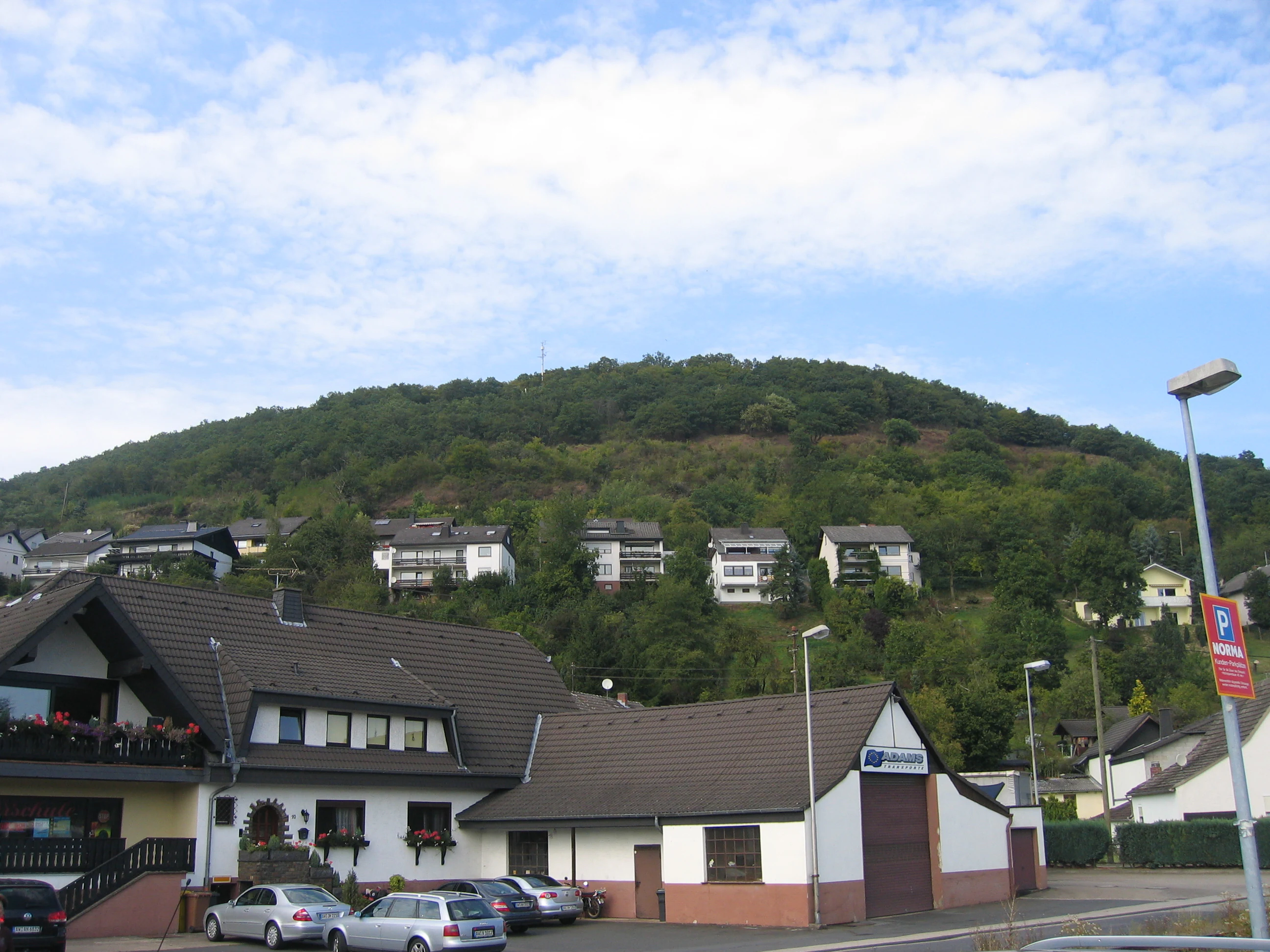
Bausenberg forms a clearly shaped scoria cone (Schlackenkegel) rising to about 339.8 meters above sea level, with a typical crater depression at or near the summit. The cone is part of the eastern Eifel volcanic field, where rounded volcanic hills and lava remnants interrupt broader valley landscapes shaped by agriculture and settlement. The cone is flanked by the villages of Niederzissen to the south and Waldorf to the north-northeast, giving it a distinctive silhouette against the surrounding lowlands.
A northeast-directed lava stream (Lavastrom) flows away from the cone and is included within the protected area. The overall landform has been described as a Hufeisenkrater, or horseshoe-shaped crater, a profile that reflects the geometry of the eruption which built the cone. Overlaying the volcanic terrain is a well-preserved Ringwall, a roughly circular rampart on the summit region, which combines with the underlying volcanic relief to give the mountain a layered topographic identity.
Bausenberg ecosystems, habitats, and plant life
The nature reserve around Bausenberg is shaped first and foremost by its volcanic substrate, which determines the soils, drainage, and microhabitats found on and around the cone. Scoria cones and their attached lava flows in the Eifel typically support distinct plant communities adapted to mineral-rich, often dry, and well-drained volcanic substrates, contrasting with the surrounding agricultural and forest habitats.
The 1981 protection ordinance explicitly cites the area's importance as a location for rare plant species and plant communities, and as a habitat for rare animal species. These references indicate that the combination of volcanic geology, slope exposure, and relatively undisturbed ground has created ecological niches that retain unusual species in a regional context. The protected area of approximately 127 hectares across parts of the Niederzissen and Waldorf municipal areas preserves this mosaic of volcanic habitats.
Bausenberg wildlife and species highlights
The 1981 legal ordinance establishing the Bausenberg nature reserve names the site as a habitat for rare animal species (seltener Tierarten) and justifies protection on scientific grounds partly because of this fauna. The source material does not provide a detailed species list or identification of particular animals, so specific wildlife claims cannot be supported beyond this general designation.
Bausenberg conservation status and protection priorities
Bausenberg has been a designated nature reserve (Naturschutzgebiet) since its formal legal establishment on April 14, 1981, following provisional protection from August 27, 1968. The reserve covers approximately 127 hectares, spanning parts of the Gemarkungen of Niederzissen and Waldorf in Kreis Ahrweiler, Rhineland-Palatinate.
The conservation purpose defined in the 1981 ordinance focuses on preserving the scoria cone itself along with the lava flow that extends toward the northeast; protecting the site's special geological significance; maintaining rare plant species and plant communities; and safeguarding the rare animal species that depend on these volcanic habitats, all on scientific grounds. The well-formed Ringwall on the summit region is likewise included within the protected area, so that archaeological and ecological values are managed together. Bausenberg thus belongs to a broader network of Naturschutzgebiete within the Landkreis Ahrweiler that collectively protect Eifel volcanic and landscape heritage.
Bausenberg cultural meaning and human context
The principal cultural feature associated with Bausenberg is the well-preserved Ringwall on the summit region, an ancient circular earthwork that overlies the volcanic cone. Although the source material does not give a detailed archaeological interpretation, the inclusion of the Ringwall within the nature reserve highlights its recognized local heritage value on top of the site's geological interest.
Top sights and standout views in Bausenberg
Bausenberg offers a compact showcase of eastern Eifel volcanism, with a clearly defined scoria cone, a horseshoe-shaped crater profile, and an attached lava flow oriented toward the northeast. Its protected status since 1981 reflects a deliberate effort to preserve both the geological form and the rare plant and animal communities it supports.
A distinguishing surface feature is the well-formed Ringwall on the summit, which gives the mountain both natural and archaeological character. Combined with its position between Niederzissen and Waldorf near the A61 autobahn, Bausenberg functions as one of the more accessible small-scale volcanic landmarks in the Landkreis Ahrweiler nature reserve network.