Mori Atlas logo
National parkBayanaul National Park

Discover its distinctive granite mountains, erosion-shaped rock formations, and unique lakes within the Kazakh Uplands.

Bayanaul National Park: Kazakhstan's First National Park Protected Landscape

(Bayanaul State National Nature Park)

Bayanaul National Park, established in 1985, stands as Kazakhstan's inaugural national park, safeguarding the remarkable Bayanaul Range. This protected landscape spans 68,453 hectares, featuring dramatic granite mountains sculpted by erosion, verdant valleys, and four pristine freshwater lakes set within the vast Kazakh Uplands. It offers a unique opportunity to explore ancient mountain terrain, unusual rock formations resembling mythical figures, and rare botanical species thriving in a semi-desert steppe environment.

National ParkKazakhstanMountain RangeLakesGranite LandscapeRock Formations

Bayanaul National Park

National park

Park overview

Structured park overview, official facts, and landscape profile for Bayanaul National Park

Bayanaul National Park park facts, protected area profile, and essential visitor context

Review the core facts for Bayanaul National Park, including designation, size, terrain, visitor scale, habitats, and operating context in one park-focused overview.

About Bayanaul National Park

Bayanaul State National Nature Park represents a unique ecological and landscape sanctuary in Kazakhstan's northeastern steppe region. Created in 1985 as the country's first national park, it was established to conserve the natural flora and fauna of the Bayanaul Range—a mountainous outlier within the vast Kazakh Steppe. The park's location on the outskirts of the Kazakh Uplands places it in a transition zone between forest environments and semi-desert conditions, creating unusual ecological diversity. The landscape features ancient Paleozoic granite mountains that have been carved by natural forces into dramatic shapes, with the highest point being Akbet Mountain at 1,027 meters. The park contains four notable freshwater lakes—Sabyndykol, Jasybay, Toraygir, and Byrzhankol—surrounded by forests and fed by mountain springs. The area has long been a destination for recreation and cultural significance, with visitors drawn to both the natural scenery and the distinctive rock formations that dominate the landscape.

Quick facts and research context for Bayanaul National Park

Bayanaul National Park is located in Pavlodar Province, approximately 140 kilometers from Ekibastuz. Established on August 12, 1985, it was Kazakhstan's inaugural national park. The park protects a portion of the Bayanaul Range within the Kazakh Uplands, featuring four main lakes: Sabyndykol (the largest, literally meaning 'soapy lake'), Jasybay (named after a Kazakh mythic hero), Toraygir (the highest and third-largest, honoring poet Sultanmahmut Toraygirov), and Byrzhankol. The park's climate is humid continental with warm summers and cold winters, with an average annual temperature of 3.2°C and annual precipitation of 340 mm. It lies within the Kazakh Steppe ecoregion but is notable for its forest and forest-steppe vegetation communities that thrive in this otherwise semi-desert landscape.

Protection and recognition

Mapping the official conservation boundaries and terrestrial framework established in 1985.

Bayanaul National Park Protection Status and Terrestrial Designation History

Bayanaul National Park features a dedicated terrestrial protection status established in 1985 to preserve the regional geography of the Kazakh Uplands. Reviewing documented designation records and historical protection profiles provides vital geographical context for understanding the conservation status of regional landscapes.

Protection details

Protection scope
Terrestrial
Designated year
1985
Transboundary protection
No
Park context

Deeper park guide and search-rich context for Bayanaul National Park

Bayanaul National Park history, landscape, wildlife, and travel context

Explore Bayanaul National Park through its history, landscape character, ecosystems, wildlife, conservation priorities, cultural context, and seasonal travel timing in a structured park guide built for atlas discovery and search intent.

Why Bayanaul National Park stands out

Bayanaul National Park is best known for its extraordinary granite rock formations that have been shaped by centuries of wind and water erosion into bizarre shapes resembling animals, people, and objects, including a rock resembling Baba-Yaga from Slavic folklore and the famous 'masculine dignity' rock formation. The park is also renowned for its unique Bayanaul pine, which grows directly on rocks, a botanical rarity in Kazakhstan. The four freshwater lakes, particularly Lake Jasybay with its beach and recreational facilities, form another major draw. The 'holy cave' at high altitude, where visitors traditionally make wishes, adds a cultural dimension to the park's appeal. The combination of mountainous terrain, forest oases in a steppe setting, and unusual rock formations makes Bayanaul distinctive among Central Asian protected areas.

Bayanaul National Park history and protected-area timeline

Bayanaul National Park was established on August 12, 1985, through a decree of the Soviet government, becoming Kazakhstan's first national park. The creation of the park was motivated by the need to conserve the unique natural ecosystems of the Bayanaul Range, which represents a significant mountainous area within the predominantly flat steppe landscape of northeastern Kazakhstan. The park was initially established with an area of approximately 50,688 hectares, and in 2007, through a government decree dated December 27, the park's territory was expanded to its current size of 68,452.8 hectares. The park is managed by the Forestry and Wildlife Committee of the Ministry of Agriculture of Kazakhstan. In addition to the original protected area, the 'Kyzyltau' forest tract, covering 60,000 hectares, was incorporated into the park's protective zone. The park's territory is divided into three forestry units: Bayanaul Forestry (19,188 hectares), Zhasybai Forestry (22,904 hectares), and Dalba Forestry (8,596 hectares). The region has a long human history, with more than 20 archaeological sites within the park including Bronze Age burial mounds (kurgans), rock inscriptions, and caves with historical significance.

Bayanaul National Park landscape and geographic character

The landscape of Bayanaul National Park is defined by its granite mountain range rising abruptly from the surrounding steppe. The mountains formed during the Paleozoic Era and have since undergone significant erosion, resulting in relatively low but visually dramatic peaks and ridges with elevations between 400 and 1,027 meters. The highest point, Akbet Mountain, dominates the park and is associated with local legend. The terrain is characterized by bare rock outcrops interspersed with pine vegetation—an unusual sight in this semi-desert region. The park contains four significant freshwater lakes: Sabyndykol (the largest), Jasybay (second largest, lying in a vale between two mountain ridges), Toraygir (the highest altitude lake, named after poet Sultanmahmut Toraygirov), and Byrzhankol (the smallest). Numerous smaller lakes also exist, some shrinking significantly during the dry season. Six of these smaller lakes lie near the top of Nayzatas Mountain, whose name means 'stone spear' in Kazakh. The area is renowned for its bizarre rock formations created by centuries of environmental erosion—rocks take on shapes resembling animals, mythical creatures, and human forms. The largest lake, Sabyndykol, has a village of the same name on its shores and is named for its 'soft water' and soap-like surface appearance.

Bayanaul National Park ecosystems, habitats, and plant life

Bayanaul National Park supports remarkable biodiversity within its semi-desert steppe setting, featuring four distinct vegetation types: forest, forest-steppe, steppe, and meadow. The park is botanically diverse with approximately 460 plant species, including the unique Bayanaul pine that grows primarily on rocks—a botanical phenomenon that creates striking scenes of pine vegetation juxtaposed with bare granite. The park supports black alder and up to 50 relict plant species, including species listed in Kazakhstan's Red Book such as sticky alder and spring anemone. Common tree species include birches, pines, aspens, and alders, while the understory features numerous shrubs and bushes, including berry-bearing varieties such as raspberries, rose hips, currants, and hawthorns. Wild strawberries grow in the meadows, and mushrooms populate the forests. The variety of vegetation is particularly surprising given the park's location in a semi-desert steppe zone. The forest and forest-steppe communities represent significant ecological islands within the surrounding grassland, providing habitat for diverse wildlife and contributing to the park's conservation significance.

Bayanaul National Park wildlife and species highlights

Bayanaul National Park supports approximately 50 bird species and 40 mammal species within its diverse habitats. Mammalian inhabitants include argali (the largest wild sheep, listed in Kazakhstan's Red Book), Siberian roe deer, European badger, squirrel, wolves, foxes, and other species. The park provides important habitat for these species in the mountainous and forested environments that contrast sharply with the surrounding steppe. Avian diversity includes cranes, swans, herons, and bustards among waterbirds and ground birds, while birds of prey such as eagles, kestrels, and kites soar above the mountains and forests. The golden eagle and whooper swan are among the protected species listed in Kazakhstan's Red Book. The aquatic environments provided by the four major lakes and numerous smaller water bodies support waterfowl and other bird species, while the forests and rocky areas provide diverse breeding and foraging habitats.

Bayanaul National Park conservation status and protection priorities

Bayanaul National Park holds significant conservation value as Kazakhstan's first national park and as a protected area preserving a unique mountainous ecosystem within the vast Kazakh Steppe. The park conserves the Bayanaul Range with its distinctive granite landscape, the four major lakes with their associated wetlands, and the forest oases that support diverse flora and fauna. The park is categorized as IUCN Category II (National Park), reflecting its primary purpose of protecting natural ecosystems while allowing for sustainable recreation and environmental education. The area includes zones designated for strict protection (zapovednik), limited use (zakaznik), and recreation, with different regulations applying to each zone. Species of conservation concern include argali, golden eagle, and whooper swan, which are listed in Kazakhstan's Red Book. The park also conserves relict plant species including black alder and rock currant, representing ancient lineages that have survived in this isolated mountain environment.

Bayanaul National Park cultural meaning and human context

Bayanaul National Park contains significant cultural heritage with more than 20 archaeological sites within its boundaries. These include Bronze Age burial mounds (kurgans), ancient rock inscriptions and symbols, and several caves with historical and cultural significance. The 'holy cave' (Қасиетті үңгір) is a notable cultural site where local tradition holds that visitors can make a wish by placing their palm on the cave wall and leaving without turning around. The cave is also associated with fertility rituals and requires a kilometer-long walk to reach, with a wooden staircase recently installed for the final section. The park is associated with Kazakh cultural figures, including poet Sultanmahmut Toraygirov, for whom Lake Toraygir is named, and the mythic hero Jasybay, for whom Lake Jasybay is named. The landscape features numerous rock formations with names reflecting cultural associations, such as the Baba-Yaga rock connected to Slavic mythology. In summer 1993, the park hosted the first National Jamboree of the Organization of the Scout Movement of Kazakhstan, dubbed 'Jasybay's Arrow'.

Top sights and standout views in Bayanaul National Park

The distinctive granite rock formations of Bayanaul National Park, shaped by erosion into shapes resembling Baba-Yaga, a camel, mammoth, gorilla, dinosaur, and the famous 'masculine dignity' rock, represent one of the park's most remarkable features. The four freshwater lakes—Sabyndykol, Jasybay, Toraygir, and Byrzhankol—provide scenic beauty and recreational opportunities, with Lake Jasybay offering beach access and boat rentals. The unique Bayanaul pine, growing directly on rocks, creates an unusual botanical landscape. Akbet Mountain, the highest peak at 1,027 meters, offers hiking opportunities and is associated with a tragic local legend. The holy cave at high altitude provides a cultural experience tied to traditional wishes and fertility rituals. The combination of forest and steppe environments in this mountainous setting creates exceptional ecological diversity within a semi-desert region, making Bayanaul a distinctive destination in Central Asia.

Best time to visit Bayanaul National Park

The best time to visit Bayanaul National Park is during the summer months when warm weather allows for full access to hiking trails, rock climbing, swimming in the lakes, and other outdoor activities. The average July temperature reaches 14.6°C with maximums around 32.6°C, providing comfortable conditions for exploration. The park's approximately 140 frost-free days make summer the primary visitor season. However, the park also offers distinct winter beauty with snowy mountain panoramas, though infrastructure limitations and the harsh continental climate—with January averages of -13.7°C—restrict winter access. Spring and autumn provide transitional seasons with milder conditions, though visitors should be prepared for the large seasonal temperature variations characteristic of this continental climate region. The park generally avoids the strong winds and dust storms common in surrounding steppe regions, making it a relatively sheltered destination year-round.
Monthly climate preview

Tracing thirty-year temperature fluctuations and monthly precipitation trends

Bayanaul National Park Average Temperature and Weather by Month Patterns

Long-term observations at 344 meters elevation indicate a climate pattern of severe freezing winter temperatures contrasted with warm summer averages peaking in July. Detailed monthly climatology records trace these seasonal precipitation and temperature shifts to provide a complete historic overview of the park region.
Annual mean4 °C
-16 °C21 °C
Jan-16°
Feb-13°
Mar-5°
Apr
May14°
Jun20°
Jul21°
Aug19°
Sep12°
Oct
Nov-5°
Dec-12°
Warmest month
July

21.4 °C

Coolest month
January

-15.5 °C

Wettest month
July

1.9 mm/day

Driest month
January

0.5 mm/day

Park location guide

Geography guide, regional context, and park location map for Bayanaul National Park

Bayanaul National Park park geography, regions, and map view in Kazakhstan

Understand where Bayanaul National Park sits in Kazakhstan through a broader geographic reading of the surrounding landscape, nearby location context, and its mapped position within the national park landscape.

How Bayanaul National Park fits into Kazakhstan

Kazakhstan is a Central Asian country spanning vast steppes and plains, bordered by Russia, China, Kyrgyzstan, Uzbekistan, and Turkmenistan, with a coastline along the Caspian Sea. It gained independence from the Soviet Union in 1991 and has a population of approximately 20.5 million people. The country is officially secular but predominantly Muslim, with Kazakh and Russian as official languages.

Wider geography shaping Bayanaul National Park in Kazakhstan

Kazakhstan occupies a vast territory in Central Asia, extending into Eastern Europe. Its terrain consists largely of hilly plateaus and plains, with lowlands covering about a third of the area. The southern and eastern regions are mountainous. The country borders Russia to the north and west, China to the east, Kyrgyzstan to the southeast, Uzbekistan to the south, and Turkmenistan to the southwest. It has a coastline along the Caspian Sea.

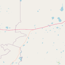
Map view of Bayanaul National Park

Use this park location map to pinpoint Bayanaul National Park in Kazakhstan, understand its exact geographic position, and read its mapped placement within the surrounding landscape more clearly.

Pigeon | © OpenStreetMap contributors

Location context for Bayanaul National Park

Pavlodar Province
Natural feature types

Browse the Detailed Natural Feature Index for Bayanaul National Park

Continue your geographic exploration by navigating the specific natural landforms found across Bayanaul National Park. This MoriAtlas index serves as a reference for the mountain peaks, granite structures, and lake basins that define the park topography, offering a localized perspective on its rugged wilderness.
Park atlas

Map the regional spread of protected areas, comparing national parks and unique landscapes across Kazakhstan.

Explore Nearby National Parks and Protected Areas Around Bayanaul National Park, Kazakhstan

Browse other national parks and protected areas in Kazakhstan, extending your exploration beyond Bayanaul National Park's granite formations and forest oases. Compare mapped geography and regional park context to understand how diverse terrain and ecological zones are protected throughout the wider Central Asian steppe.
Watercolor illustration of a mountainous landscape with green hills, trees, and a river in the foreground
National parkKazakhstan
135 km away#1 closest

South

Karkaraly State National Nature Park: Kazakhstan's Mountain-Forest Protected Area

Discover unique geology, archaeology, and regional landscape context.

Delve into the distinctive protected landscape of Karkaraly State National Nature Park, situated in Kazakhstan's Karaganda Region. This park preserves a rare mountain-forest ecosystem with dramatic granite formations, ancient archaeological sites, and lakes, presenting a rich geographic contrast to the surrounding Kazakh Steppe. MoriAtlas provides structured insights into Karkaraly State National Nature Park's unique terrain, its conservation value, and its position within the broader regional geography of Central Asia.

Area
1,121.2 km²
Established
1998
IUCN
II
Relief
Mountain
Watercolor illustration of a landscape with green forests, rolling hills, and distant mountains under a soft sky
National parkAkmola Region
About 146 km away#2 closest

West

Buiratau State National Nature Park: Kazakhstan National Park within Akmola Region

Explore unique steppe-forest transition ecosystems and geography.

Buiratau State National Nature Park in Kazakhstan's Akmola Region protects a significant transitional zone between dry steppe and semi-arid forest. This national park showcases a diverse landscape of low ridges, plains, and salt lakes, contributing to its rich biodiversity. Discover the mapped boundaries and the unique ecological character of this protected area within the context of the Kazakh Uplands atlas and its regional geography.

Area
890 km²
Established
2011
IUCN
II
Relief
Upland
Natural monumentPavlodar Region
About 177 km away#3 closest

Northeast

Gusiny Perelet Natural Monument: Geological Geography and Fossil Site Mapping in Pavlodar Region

An iconic Irtysh River protected area and Neogene research locality

Situated along the Irtysh River bank, Gusiny Perelet functions as a vital reference point for Neogene mammal evolution in Central Asia. The protected site showcases an exposed geological face, providing scientific insight into ancient ecosystems once dominated by Hipparion fauna. Its preserved fossil assemblage and riverside location offer a tangible connection to the region's deep natural history.

Established
1971
Relief
Lowland
Climate
Temperate
Access
Easy access
A horizontal watercolor painting depicting a sparse forest in the midground and low hills in the background with a pale, misty sky.
Nature reservePavlodar Region
About 237 km away#4 closest

Northeast

Ertis Ormany Nature Reserve: A Geographical Overview of Kazakhstan's Pine Belts

Protected forested corridors within the Kulunda Plain steppe.

Covering over 278,000 hectares, Ertis Ormany is a premier protected area in Kazakhstan's Pavlodar Region. The reserve manages unique ribbons of pine forest growing on sandy soils, forming an essential forest-steppe ecosystem that supports biodiversity and provides a natural barrier against desertification in the southwestern Kulunda Plain.

Area
2,779.61 km²
Established
2003
IUCN
VI
Relief
Lowland
A pale, minimalist watercolor illustration of a soft, rolling landscape with light green and pink washes against a white background.
Wildlife reserveKaraganda Region
About 252 km away#5 closest

Southwest

Bugyly Sanctuary Wildlife Reserve and Protected Mountain Terrain in Karaganda Region

A protected zoological landscape in the heart of central Kazakhstan

Bugyly Sanctuary is a specialized wildlife reserve defined by its low mountain topography, rocky outcrops, and narrow stream-side groves. Situated in the Karaganda Region, the protected area functions as a vital refuge for argali sheep, roe deer, and various ground-nesting birds, standing as a testament to the diverse interior uplands of the Sarysu River basin.

Area
85 km²
Relief
Lowland
Water
Minor water
A pale, soft-toned watercolor illustration of a winding stream moving through a grassy meadow with scattered trees and distant hills.
Nature reserveAbai Region
About 293 km away#6 closest

East

Semey Ormany Nature Reserve: Protected Ribbon Pine Forests in Abai Region

Mapped forest corridors and steppe ecological boundaries.

Semey Ormany protects extensive ribbon pine forests that stretch through the sandy plains of the Abai Region. This reserve serves as a vital ecological buffer, bridging the gap between desert-like semi-steppes and dense woodland strips, home to diverse wildlife and rare plant communities across the Irtysh river basin.

Area
6,541.8 km²
Established
2003
IUCN
VI
Relief
Mixed relief
Nature reserveKaraganda Region
About 372 km away#7 closest

Southwest

Karaagash Nature Reserve: Granite Ridge Landscapes in Central Kazakhstan

Protected forest-steppe habitat in the Karaganda region

Karaagash Nature Reserve stands as a sentinel of central Kazakhstan's geography, protecting a rugged area where granite uplands meet ridge-and-valley plains. This reserve supports a diverse array of flora and fauna, offering a representative look at the forest-steppe transition zone and its role in regional conservation.

Area
68 km²
Established
1986
IUCN
IV
Relief
Mountain
Watercolor painting of a landscape with green forests, hills, and a body of water
National parkAqmola Region
388 km away#8 closest

Northwest

Burabay State National Nature Park: Mapped Granite Hills and Forested Terrain Atlas

Explore protected landscapes in Kazakhstan's Aqmola Region.

Burabay State National Nature Park presents a unique protected landscape within the Kokshetau Massif of Kazakhstan's Aqmola Region. This atlas-focused entry details the park's distinctive terrain, featuring ancient granite outcrops and rolling hills draped in pine and birch forests. Understand the mapped boundaries and geographic setting of this national park, renowned for its scenic lakes and significant geological formations, offering rich context for protected-area discovery.

Area
1,299.35 km²
Established
2000
IUCN
II
Relief
Mixed relief

Common questions about visiting, size, designation, and location context for Bayanaul National Park

Bayanaul National Park FAQs for park facts, access, geography, and protected area context

Find quick answers about Bayanaul National Park, including protected-area facts, park geography, trail and visitor context, and how the park fits into its surrounding country and regional landscape.
MoriAtlas Explorer

Continue Your Protected Areas Search Across the Global Atlas

Deepen your exploration by continuing the structured search for national parks and protected areas worldwide. Utilize the comprehensive filtering capabilities to compare different conservation landscapes and refine your understanding of global park geography. Discover more about the distribution and characteristics of protected natural areas.

Global natural geography