
Mori Atlas logo
Protected areaNatura 2000-område nr. 51 Begtrup Vig og kystområder ved Helgenæs

A comprehensive map of coastal grasslands, steep cliffs, and marine ecosystems on the Helgenæs peninsula

Natura 2000-område nr. 51 Begtrup Vig og kystområder ved Helgenæs: Coastal Habitat Atlas

Natura 2000-område nr. 51 Begtrup Vig og kystområder ved Helgenæs encompasses a unique geological landscape where the sheltered waters of Begtrup Vig meet the dramatic Kattegat coastline of eastern Jutland. This protected area features an extensive mosaic of raised seabeds, recurved spit systems, and steep coastal cliffs that highlight the region's post-glacial history. By analyzing the interplay between marine shallows and terrestrial grasslands, observers gain insight into one of the most continuous coastal habitats in Denmark, situated within the administrative landscape of Syddjurs Kommune.

Natura 2000coastal habitatKattegatHelgenæsBegtrup Vigcoastal grassland
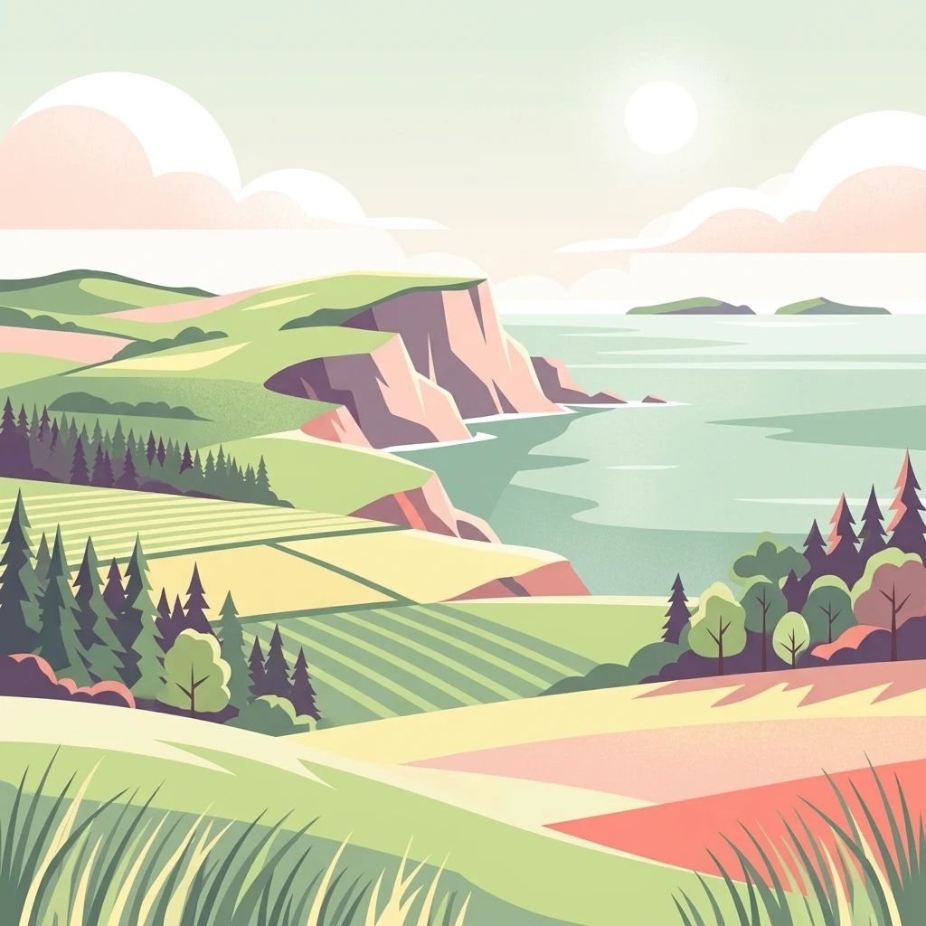
A stylized vector illustration of a coastal landscape with green rolling hills, layered farmland, a rugged cliff edge meeting the water, and a bright sun in the sky.

Natura 2000-område nr. 51 Begtrup Vig og kystområder ved Helgenæs

Protected area

Park overview

Structured park overview, official facts, and landscape profile for Natura 2000 Area No. 51 Begtrup Vig and Coastal Areas at Helgenæs

Natura 2000 Area No. 51 Begtrup Vig and Coastal Areas at Helgenæs park facts, protected area profile, and essential visitor context

Review the core facts for Natura 2000 Area No. 51 Begtrup Vig and Coastal Areas at Helgenæs, including designation, size, terrain, visitor scale, habitats, and operating context in one park-focused overview.

About Natura 2000 Area No. 51 Begtrup Vig and Coastal Areas at Helgenæs

Natura 2000 Area No. 51 sits at the meeting point between the rolling glacial landscape of Mols and the marine influence of the Kattegat along the Djursland coast. Geographically, it is defined by Helgenæs, a hooked peninsula jutting south and east toward Ebeltoft Vig, and the broad, shallow bay of Begtrup Vig that lies between the peninsula and the Mols mainland. The site thus combines a varied marine coastline with several distinctly different terrestrial coastal zones.

The western coast of Helgenæs, running roughly from Fejrup south to Ørby, is marked by steep coastal cliffs that expose the geological stratification of the landscape. By contrast, the eastern side opens into a flatter marine foreland beneath ancient Stone Age sea cliffs, supporting coastal heath and dry grassland systems. Large areas of raised seabed and curving recurved spits are found both south of Strands and at Stavsøre on the northern coast of Helgenæs, illustrating the dynamic relationship between sea level change and sediment movement that has shaped this coast over millennia.

The southern tip of the peninsula, around Sletterhage lighthouse, is one of the site highlights. Here the coastal slopes and sandy grasslands form one of the most extensive areas of coastal dry grassland in Denmark. The land connection between Helgenæs and Mols, the so-called Draget, also forms part of the area and supports a protected zone around the historic earthworks of Dragsmur and Ryes Skanser. Together, these elements make the site an unusually complete cross-section of Danish eastern coastal nature.

The administrative and planning framework ties this area into Denmark's wider Natura 2000 network. The Natura 2000 plan for the site was adopted in 2011, with the municipalities and the Danish Nature Agency preparing binding action plans to implement its objectives and continuing the plan in subsequent planning periods. The northern portion of the territory also overlaps with Nationalpark Mols Bjerge, linking habitat conservation here with the broader landscape protection of the Mols region.

Quick facts and research context for Natura 2000 Area No. 51 Begtrup Vig and Coastal Areas at Helgenæs

Natura 2000 Area No. 51 covers roughly 1,771 hectares, about three quarters of which is marine water associated with Begtrup Vig and the coastal sea out to a depth of ten meters. The area lies in Syddjurs Kommune within Region Midtjylland, on the eastern coast of Jutland in Denmark.

The designated site stretches approximately sixteen kilometers along the coast from Strands in the north to Lushage on the eastern side of Helgenæs. Around 295 hectares of land area, representing about two thirds of the site's terrestrial zone, fall under Section 3 of the Danish Nature Protection Act, including dry grassland, freshwater meadow, raised bog, heath, and coastal meadow. The site also includes species designations for the great crested newt and a priority-rich mix of coastal and calcareous habitat types.

Protection and recognition

Examine documented protection scope, management assignments, and official designation records.

Protection Status and International Recognition for Natura 2000-område nr. 51 Begtrup Vig og kystområder ved Helgenæs

Natura 2000-område nr. 51 Begtrup Vig og kystområder ved Helgenæs holds a mixed protection scope governed by structured conservation frameworks. Protected area records outline the established management scope and verified international recognition details.

Protection details

Protection scope
Mixed
Transboundary protection
No
Park context

Deeper park guide and search-rich context for Natura 2000 Area No. 51 Begtrup Vig and Coastal Areas at Helgenæs

Natura 2000 Area No. 51 Begtrup Vig and Coastal Areas at Helgenæs history, landscape, wildlife, and travel context

Explore Natura 2000 Area No. 51 Begtrup Vig and Coastal Areas at Helgenæs through its history, landscape character, ecosystems, wildlife, conservation priorities, cultural context, and seasonal travel timing in a structured park guide built for atlas discovery and search intent.

Why Natura 2000 Area No. 51 Begtrup Vig and Coastal Areas at Helgenæs stands out

The area is best known for hosting some of the largest connected stretches of coastal dry grassland in Denmark, particularly the sandy and calcareous coastal slopes between Sletterhage on the southern tip of Helgenæs and the northeast of the peninsula. These open grasslands, set against the backdrop of the Kattegat, sit alongside impressive recurved spit systems and raised seabed formations that document the slow rise of the Danish landscape since the last ice age. Equally central to the site's identity is the combination of cliff, dune, and marine shallow-water habitats along Begtrup Vig. The contrast between the steep coastal cliffs on the west side of Helgenæs and the flat, heath-clad marine foreland on the east side gives the site a strong sense of physical and ecological variety, while the narrow land connection to Mols adds a distinctive geographic framing.
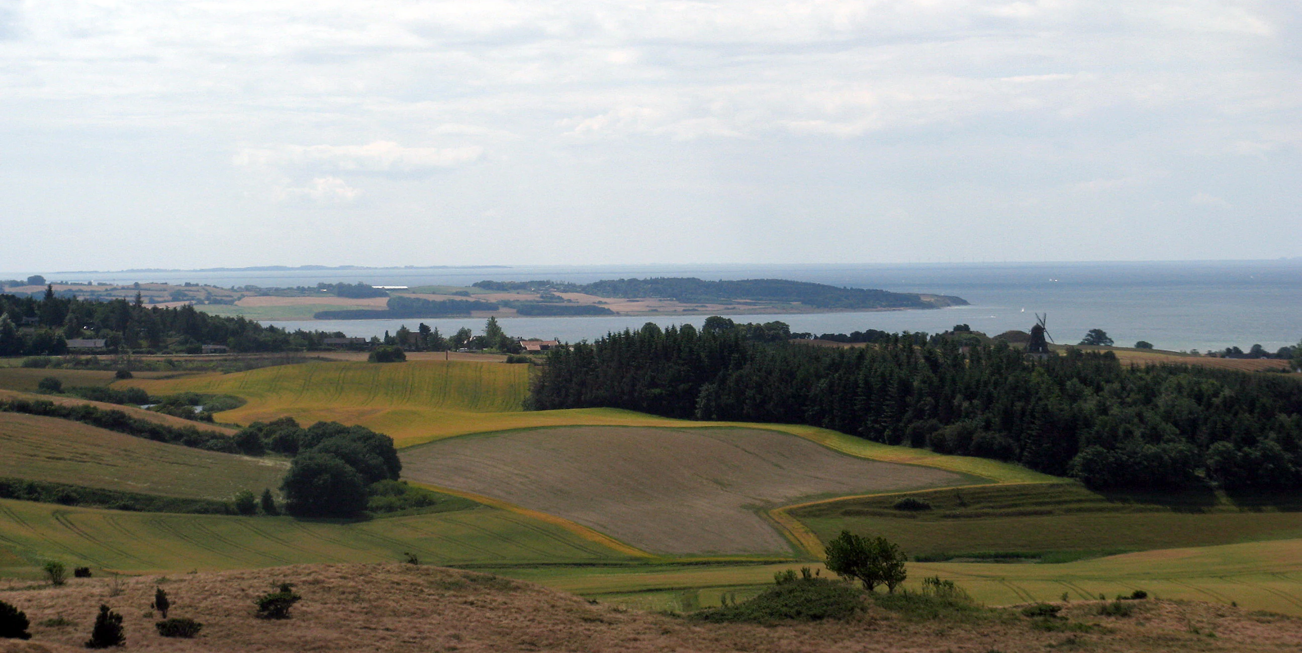
A wide, elevated view of the Danish coast, featuring rolling fields, patches of forest, and the waters of Begtrup Vig under a cloudy sky.
View of the coastal landscape of Helgenaes overlooking Begtrup Vig.

Natura 2000 Area No. 51 Begtrup Vig and Coastal Areas at Helgenæs landscape and geographic character

The physical landscape of the site is shaped almost entirely by the interaction of glacial inheritance, land uplift, and ongoing marine processes. Helgenæs itself represents a peninsula carved out of the broader Mols moraine landscape, with its axis bending southward toward the Kattegat. About three quarters of the protected area is marine, covering Begtrup Vig and surrounding shallow waters out to a depth of ten meters, where light penetration allows submerged sandbanks, lagoons, and reefs to develop.

On land, the western coast of Helgenæs rises into steep coastal cliffs between Fejrup and Ørby, exposing geological sequences tied to the Pleistocene history of eastern Jutland. Below these cliffs, narrow boulder and shingle formations meet the sea, often lined by rows of beach ridges that mark former shorelines. In the north, the coast near Strands and at Stavsøre shows extensive raised seabed with curving recurved spit systems, where former seabeds have been lifted into dry land and shaped into large coastal arcs.

The eastern side of the peninsula tells a quieter morphological story. Here, the older Stone Age sea cliff forms a backdrop to a flatter marine foreland where wind, grazing, and time have produced dry heath and grassland mosaics. South of Sletterhage, sandy slopes open into broad coastal dry grasslands that extend toward the lighthouse area, forming some of the largest connected grassland surfaces in Denmark. The narrow land bridge of Draget between Helgenæs and the Mols mainland adds a final defining element to the landscape, with shallow marine waters and tidal flats on either side.
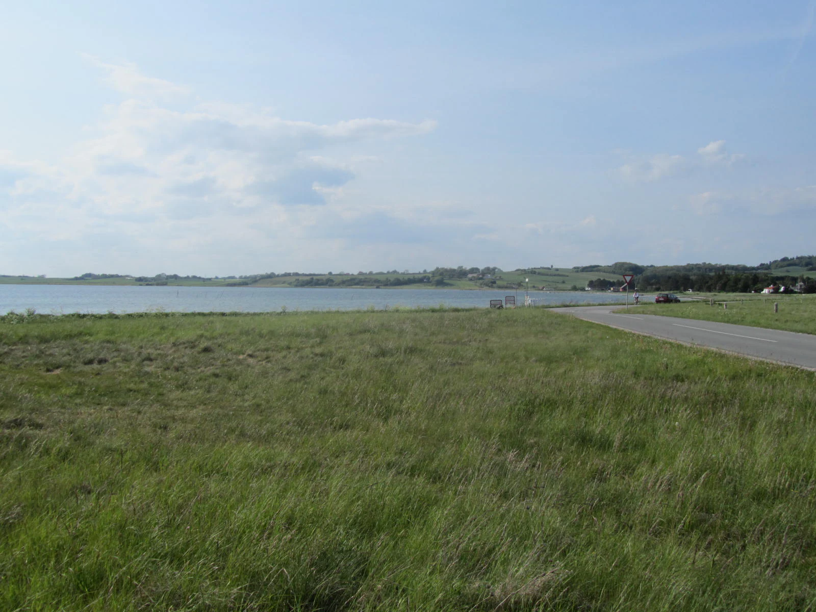
A grassy coastal landscape with a narrow paved road leading toward the horizon along the shore of Begtrup Vig bay.
The Draget isthmus connecting Mols to the Helgenæs peninsula, bordering the calm waters of Begtrup Vig.

Natura 2000 Area No. 51 Begtrup Vig and Coastal Areas at Helgenæs ecosystems, habitats, and plant life

Ecologically, the area is defined by an unusually rich meeting zone between marine, littoral, and terrestrial habitats. The marine side includes sandbanks, coastal lagoons, bays, and reefs supporting diverse submerged and semi-submerged communities, while the shoreline transitions into beach-ridge formations, shifting dunes, dune heath, grey and green dune vegetation, and dry heath further inland.

The grasslands of south and east Helgenæs are particularly significant at the national scale. Dry calcareous grassland and dry calcareous sand grassland are present alongside more acidic dry grassland communities, while inland the habitat network also includes nutrient-rich lakes, flushed springs, and rich fen vegetation. These habitats support specialized flora adapted to the dry, sun-exposed coastal environment, and they form the backdrop for the area's strong invertebrate and bird populations.

Wetland habitats are present in lower but ecologically important amounts, including freshwater meadows, raised bog patches, and coastal meadows along the bay edges. Together with mires and source springs around the cliffs, these humid pockets add microhabitat diversity to an otherwise open coastal landscape. Roughly 295 hectares of land habitats across the site are protected under Section 3 of the Danish Nature Protection Act, which underlines the integrated mosaic approach to habitat conservation here.
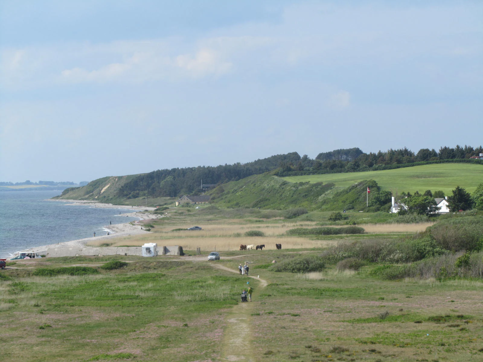
A wide view of a coastal landscape with a dirt path in the foreground leading toward a beach and bay. In the midground, there is a grassy area with sparse trees and buildings, and in the background, a low cliff line topped with dense green vegetation.
Coastal landscape at Sletterhage, featuring a path leading toward the shore with marshland and rolling hills in the background.

Natura 2000 Area No. 51 Begtrup Vig and Coastal Areas at Helgenæs wildlife and species highlights

Although the area is primarily described through its habitats rather than its fauna, the mosaic landscape supports several characteristic coastal species groups. The freshwater and wetland components, including ponds and springs, provide suitable breeding habitat for the great crested newt, which is the species explicitly listed in the site designation. Coastal meadows and reed belts around Begtrup Vig also offer feeding and resting areas for waterbirds and waders.

The dry coastal grasslands and heath zones around Sletterhage and eastern Helgenæs are typically rich in insects, including butterflies and other pollinators that depend on the open, sun-exposed structure of these habitats. Gulls, seabirds, and migrating waterbirds make regular use of the marine shallows and bay edges, while the varied cliff and beach-ridge landscape creates nesting and shelter opportunities for several coastal bird species across the seasons.

Natura 2000 Area No. 51 Begtrup Vig and Coastal Areas at Helgenæs conservation status and protection priorities

Conservation significance here is rooted in the size and connectivity of habitat patches that are rare at the Danish national level. The site contains priority habitat types including coastal dunes, calcareous grasslands, calcareous sand grasslands, acidic dry grasslands, and source-spring communities, marking it as a national-level stronghold for these ecosystems. The combination of marine, coastal, and inland calcareous habitats in a single designation creates a conservation area that responds to changes in sea level, land use, and grazing management in an integrated way.

The Natura 2000 plan adopted in 2011 and continued in later planning cycles has structured ongoing management through binding action plans prepared by the municipality and the Danish Nature Agency. The site is also coordinated with the relevant water plan for Aarhus Bay, recognizing the strong hydrological coupling between Begtrup Vig and the surrounding land. The northern part of the designation overlaps with Nationalpark Mols Bjerge, expanding the conservation context from a strictly habitat-area setting into a broader landscape-scale approach.

Top sights and standout views in Natura 2000 Area No. 51 Begtrup Vig and Coastal Areas at Helgenæs

The site's strongest distinguishing features include the large, nationally significant coastal dry grasslands around Sletterhage, the dramatic cliff coast between Fejrup and Ørby on western Helgenæs, and the extensive raised seabed and recurved spit systems around Strands and Stavsøre. The marine belt of Begtrup Vig adds shallow sandbanks, lagoons, and reefs that anchor the area ecologically.

Cultural-geographic features also play a role, particularly the narrow land bridge of Draget between Helgenæs and Mols with its protected historic earthwork Dragsmur, and the Ørby Klint area, where a long stretch of cliff coastline is under formal protection. The connection to Nationalpark Mols Bjerge in the northern portion of the area adds an additional layer of landscape-level recognition.


Monthly climate preview

Long-term temperature and precipitation records across twelve months

Natura 2000-område nr. 51 Begtrup Vig og kystområder ved Helgenæs Climate Normals

Natura 2000-område nr. 51 Begtrup Vig og kystområder ved Helgenæs records long-term temperature and precipitation patterns derived from representative coordinate measurements between 1991 and 2020. Examining the complete monthly climate profile reveals detailed thermal ranges and moisture distribution across the entire protected landscape.
Annual mean9 °C
2 °C17 °C
Jan
Feb
Mar
Apr
May11°
Jun15°
Jul17°
Aug17°
Sep14°
Oct10°
Nov
Dec
Warmest month
August

17.5 °C

Coolest month
February

1.5 °C

Wettest month
August

2.5 mm/day

Driest month
April

1.3 mm/day

Park location guide

Geography guide, regional context, and park location map for Natura 2000 Area No. 51 Begtrup Vig and Coastal Areas at Helgenæs

Natura 2000 Area No. 51 Begtrup Vig and Coastal Areas at Helgenæs park geography, regions, and map view in Denmark

Understand where Natura 2000 Area No. 51 Begtrup Vig and Coastal Areas at Helgenæs sits in Denmark through a broader geographic reading of the surrounding landscape, nearby location context, and its mapped position within the national park landscape.

How Natura 2000 Area No. 51 Begtrup Vig and Coastal Areas at Helgenæs fits into Denmark

Denmark is a constitutional monarchy and Nordic country in Northern Europe. It is the southernmost of the Scandinavian countries, bordering Germany to the south, Norway to the north, and Sweden to the southwest. The country consists of the Jutland peninsula and an archipelago of islands, with Copenhagen as its capital and largest city. Denmark has a population of over 6 million and is characterized by flat, arable land, sandy coasts, and a temperate climate.

Wider geography shaping Natura 2000 Area No. 51 Begtrup Vig and Coastal Areas at Helgenæs in Denmark

Denmark occupies the Jutland peninsula and roughly 406 islands in Northern Europe. It is situated between the North Sea to the west and the Baltic Sea to the east. The country borders Germany to the south and is connected to Sweden via the Øresund Bridge. Denmark is predominantly flat terrain with low elevation, the highest point being Møllehøj at 170.86 meters.

Map view of Natura 2000 Area No. 51 Begtrup Vig and Coastal Areas at Helgenæs

Use this park location map to pinpoint Natura 2000 Area No. 51 Begtrup Vig and Coastal Areas at Helgenæs in Denmark, understand its exact geographic position, and read its mapped placement within the surrounding landscape more clearly.

Pigeon | © OpenStreetMap contributors

Location context for Natura 2000 Area No. 51 Begtrup Vig and Coastal Areas at Helgenæs

Region Midtjylland

Visualizing coastal cliffs, marine shallows, and protected grasslands across the Helgenæs peninsula

Natura 2000-område nr. 51 Begtrup Vig og kystområder ved Helgenæs Photos and Landscape Scenery

Visual documentation of Natura 2000-område nr. 51 Begtrup Vig og kystområder ved Helgenæs reveals the complex topography of steep coastal cliffs, marine shallows, and extensive dry grasslands. Examining these protected landscapes provides direct insight into the post-glacial land formations and coastal habitats characterizing eastern Jutland.

A wide, elevated view of the Danish coast, featuring rolling fields, patches of forest, and the waters of Begtrup Vig under a cloudy sky.

A grassy coastal landscape with a narrow paved road leading toward the horizon along the shore of Begtrup Vig bay.

A wide view of a coastal landscape with a dirt path in the foreground leading toward a beach and bay. In the midground, there is a grassy area with sparse trees and buildings, and in the background, a low cliff line topped with dense green vegetation.

Park atlas

Compare adjacent coastal landscapes and regional nature reserves across eastern Jutland

Explore Protected Areas Near Natura 2000-område nr. 51 Begtrup Vig og kystområder ved Helgenæs

Browsing nearby protected areas allows visitors to compare marine shallows, cliff formations, and coastal grasslands across the wider Djursland shore. Continuing the geographic exploration reveals how surrounding regional nature reserves share similar post-glacial terrain and coastal habitats.
Watercolor illustration showing rolling hills, a lake, pink flowering trees, and distant mountains
National parkDenmark
Mapped location lies within the park boundary#1 closest

North

Mols Bjerge National Park: Glacial Geography and Protected Terrain in Central Jutland

Mapping the coastal cliffs and rolling heathland of Denmark

Mols Bjerge National Park protects a sweeping mosaic of glacial hills, woodlands, and coastal zones on the Djursland peninsula. With a landscape shaped by ancient ice sheets, the park offers a detailed view into Denmark's geological history, preserved ancient barrows, and rich botanical diversity along the Kattegat sea.

Area
180 km²
Established
2009
IUCN
II
Relief
Upland
Watercolor painting of a calm coastal bay with soft, layered green hills in the distance and a pale shoreline in the foreground.
Protected areaDenmark
About 2.4 km away#2 closest

West

Begtrup Vig Protected Area: Glacial Terrain and Coastal Geography in Denmark

Coastal landscape and regional protected area mapping

Begtrup Vig is a distinct coastal bay defined by its glacial history, stretching across the southern Djursland peninsula in Denmark. Within the broader Mols Bjerge national park framework, the area features varied topography including stony shores, sandy coves, and pastoral meadows. This record provides a focused look at the environmental boundaries and geographic significance of this protected habitat, bridging natural terrain with the regional landscape context.

Relief
Upland
Scope
Mixed
Water
Water-dominated
Season
Year-round
Nature reserveRegion Midtjylland
About 6.8 km away#3 closest

Northwest

Tved Kær Nature Reserve: Protected Coastal Habitat Geography in Region Midtjylland

Exploring lime-rich fens and coastal cliff terrain.

Tved Kær represents a compact but ecologically dense protected area in Denmark, known for its rare calcareous fen and seepage vegetation. Situated near the village of Tved, this nature reserve integrates coastal cliffs and raised seabed to form a distinct habitat mosaic within the Mols peninsula, serving as a vital site for rare orchid species and lime-rich soil preservation.

Area
0.06 km²
Established
1981
Relief
Lowland
Climate
Temperate
Watercolor painting of a panoramic landscape featuring green rolling hills, light foliage, and patches of pink wildflowers in the foreground.
National parkCentral Jutland
About 9.6 km away#4 closest

North

Nationalpark Mols Bjerge: A Geographic Overview of Central Jutland's Glacial Landscape

Mapped terrain, dead-ice hills, and prehistoric monuments

Nationalpark Mols Bjerge offers a deep look into the glacial heritage of Central Jutland. The area features steep, sun-exposed slopes, heathland, and coastal fringes that provide a unique perspective on the Danish landscape. By examining the park's mapped boundaries, one can identify the convergence of geological landforms and ancient cultural history preserved within this protected environment.

Relief
Mountain
Access
Easy access
Water
Major water bodies
Nature reserveRegion Midtjylland
About 14 km away#5 closest

Northeast

Stubbe Sø Nature Reserve: A Geographic Exploration of Djursland Protected Landscapes

Mapping the wetlands, forest fringes, and mire systems of eastern Jutland.

Stubbe Sø is a central protected feature within the landscape of eastern Jutland, comprising a large shallow lake surrounded by alder-birch shorelines and coniferous plantations. This nature reserve offers deep insight into the glaciated terrain and wetland mosaic of the Djursland peninsula, providing an essential geographic reference for understanding local conservation habitats and regional waterbird migration corridors.

Area
7.78 km²
Established
1963
Relief
Lowland
Climate
Temperate
Watercolor painting depicting a gentle, rolling green landscape leading to a distant blue sea under a pale sky.
Protected areaRegion Midtjylland
About 17 km away#6 closest

South

Nordby Bakker Protected Area: Glacial Moraine and Grasslands in Region Midtjylland

Coastal cliffs, dunes, and rare calcareous ecosystems

Nordby Bakker preserves one of the largest continuous dry grassland complexes in Denmark, set upon a prominent glacial terminal moraine. Located at the northern tip of Samsø, this protected area features a unique synthesis of coastal dunes, beach ridges, and inland lakes that support a distinct array of rare plant and insect species within the central Kattegat region.

Area
6.28 km²
Relief
Upland
Climate
Temperate
Scope
Mixed
Protected areaRegion Midtjylland
About 22 km away#7 closest

Southwest

Kysing Fjord Protected Area: Coastal Lagoon and Saltmarsh Geography in Region Midtjylland

Mapped coastal lagoon and wetland protected area

Kysing Fjord serves as a significant coastal lagoon system on the eastern Jutland coast. This protected area in Region Midtjylland integrates shallow lagoon waters, saltmarsh meadows, and riverine terrain, offering a precise look at managed coastal landscapes and their ecological importance for wintering bird populations.

Area
3.7 km²
Established
1942
Relief
Lowland
Climate
Temperate
A minimalist watercolor painting showing a horizontal landscape of green islands and shoreline against a white background.
Protected areaDenmark
About 23 km away#8 closest

South

Stavns Fjord Protected Area: An Atlas of Danish Coastal Landscapes

Mapping the islands and tidal flats of Samsø

Stavns Fjord offers a rare glimpse into a sheltered coastal landscape set entirely within the island of Samsø. Characterized by its calm waters, shallow tidal flats, and the curving spit of Besser Rev, this protected site is a critical Ramsar wetland habitat for coastal bird populations. Explore the unique geography and layered history, from Viking canals to medieval fortifications, that define this essential Danish protected area.

Area
20 km²
Established
1926
Relief
Lowland
Access
Moderate access

Common questions about visiting, size, designation, and location context for Natura 2000 Area No. 51 Begtrup Vig and Coastal Areas at Helgenæs

Natura 2000 Area No. 51 Begtrup Vig and Coastal Areas at Helgenæs FAQs for park facts, access, geography, and protected area context

Find quick answers about Natura 2000 Area No. 51 Begtrup Vig and Coastal Areas at Helgenæs, including protected-area facts, park geography, trail and visitor context, and how the park fits into its surrounding country and regional landscape.
MoriAtlas Explorer

Continue Your Protected Areas Search Across the Global Atlas

Deepen your exploration by continuing the structured search for national parks and protected areas worldwide. Utilize the comprehensive filtering capabilities to compare different conservation landscapes and refine your understanding of global park geography. Discover more about the distribution and characteristics of protected natural areas.

Global natural geography