
Mori Atlas logo
Nature reserveBingenheimer Ried

Analyzing the floodplain topography, seasonal wetland dynamics, and conservation boundaries

Bingenheimer Ried Nature Reserve: Mapped Protected Landscapes in the Wetterau Region of Hesse

(Naturschutzgebiet Bingenheimer Ried)

Bingenheimer Ried serves as a critical wetland mosaic within the Horloff river valley of central Germany. This protected nature reserve integrates diverse habitats including Niedermoor, wet meadows, and managed flood pools into the broader landscape of the Wetterau. By examining the geographic boundaries and seasonal water management systems, researchers and visitors can understand its significance within the Natura 2000 network and the Auenverbund Wetterau conservation framework.

wetlandlowland mireNiedermoorfloodplainwet meadowsbird reserve
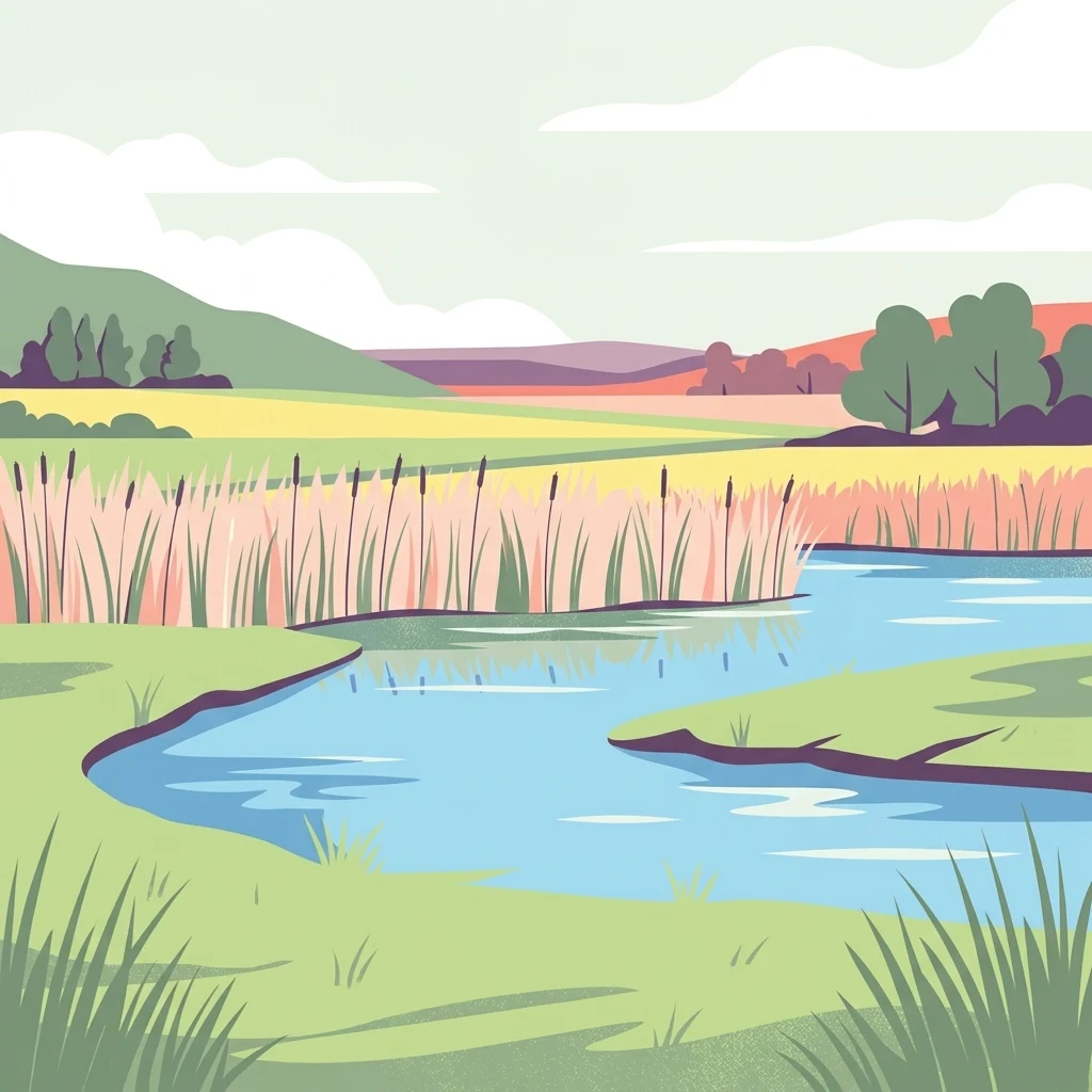
A flat vector illustration of a wetland scene showing a calm blue stream winding through grassy banks and tall reeds under a cloudy sky.

Bingenheimer Ried

Nature reserve

Park overview

Structured park overview, official facts, and landscape profile for Bingenheimer Ried

Bingenheimer Ried park facts, protected area profile, and essential visitor context

Review the core facts for Bingenheimer Ried, including designation, size, terrain, visitor scale, habitats, and operating context in one park-focused overview.

About Bingenheimer Ried

Bingenheimer Ried sits in the gentle lowlands of the Wetterau, one of the most fertile and historically cultivated valleys in Hesse. Despite this agricultural setting, the Horloff floodplain around Bingenheim retains a fragment of the original wetland character of the region, preserved as a state-designated nature reserve in 1985 under the official identifier 1440019. The reserve is small, roughly 85 hectares, but its ecological density is unusually high because it combines permanent wet ground, seasonally flooded meadows, and open water.

The site forms the centerpiece of the Auenverbund Wetterau, a connected landscape protection network that links scattered wetland fragments across the district. Within the wider European framework, Bingenheimer Ried contributes to the Natura 2000 network through the Fauna-Flora-Habitat site Grünlandgebiete in der Wetterau, which recognizes the area's value as species-rich grassland and wetland habitat of EU importance.

The reserve's identity is shaped by water management. A controllable weir installed in 1991 allows managers to retain autumn, winter, and spring floodwaters across the meadows, creating temporary wetland surfaces that attract both breeding and migrating birds. After the breeding season, the water is gradually released, returning the meadows to a more terrestrial state. A 1996 observation tower allows visitors and researchers to view wildlife without disturbing it, reflecting the site's role not only in conservation but also in public engagement with wetland ecology.

More recently, the hydrology of the broader area has been influenced by nearby former mining pits, now filled with water. One of these, the Pfaffensee, completed its filling in 2013 and now occasionally releases excess water into the Bingenheimer Ried, with downstream effects such as reed dieback documented in 2015 during the European heatwave. These changes underline the reserve's sensitivity to both regional water management decisions and shifting climate conditions, and they reinforce the importance of careful monitoring of this small but ecologically rich wetland.

Quick facts and research context for Bingenheimer Ried

Bingenheimer Ried is a designated nature reserve (Naturschutzgebiet) in the Wetteraukreis district of Hesse, Germany, established in 1985. It is located in the Horloff river floodplain west of Bingenheim, a district of Echzell. The reserve covers about 85 hectares of lowland peat-forming wetland, known in German as a Niedermoor or Ried, surrounded by wet grassland. It is part of the Auenverbund Wetterau landscape protection area and lies within the Natura 2000 network as part of the FFH site Grünlandgebiete in der Wetterau.

Protection and recognition

Examine the formal protected area designation and global database identifiers

Bingenheimer Ried Protection Status And International Recognition Records

Bingenheimer Ried maintains documented conservation status within international database records for protected landscapes. Structured administrative metrics outline the official designation framework and registry details for this natural area.

Protection details

WDPA ID
162418
Park context

Deeper park guide and search-rich context for Bingenheimer Ried

Bingenheimer Ried history, landscape, wildlife, and travel context

Explore Bingenheimer Ried through its history, landscape character, ecosystems, wildlife, conservation priorities, cultural context, and seasonal travel timing in a structured park guide built for atlas discovery and search intent.

Why Bingenheimer Ried stands out

Bingenheimer Ried is best known as one of the most important wetland bird reserves in Hesse, particularly for rare breeding marsh bird species such as the little crake, Baillon's crake, garganey, and shoveler, together with white storks. Its other defining trait is its intensive dragonfly fauna, with around forty recorded species supported by the network of flooded meadows and shallow pools. The reserve is also notable for demonstrating how traditional grazing with cattle and Exmoor ponies, combined with controlled flooding, can sustain a lowland Ried landscape. This management model, together with the long-term observation tower built in 1996, has made the site a key reference point for floodplain conservation in central Germany.
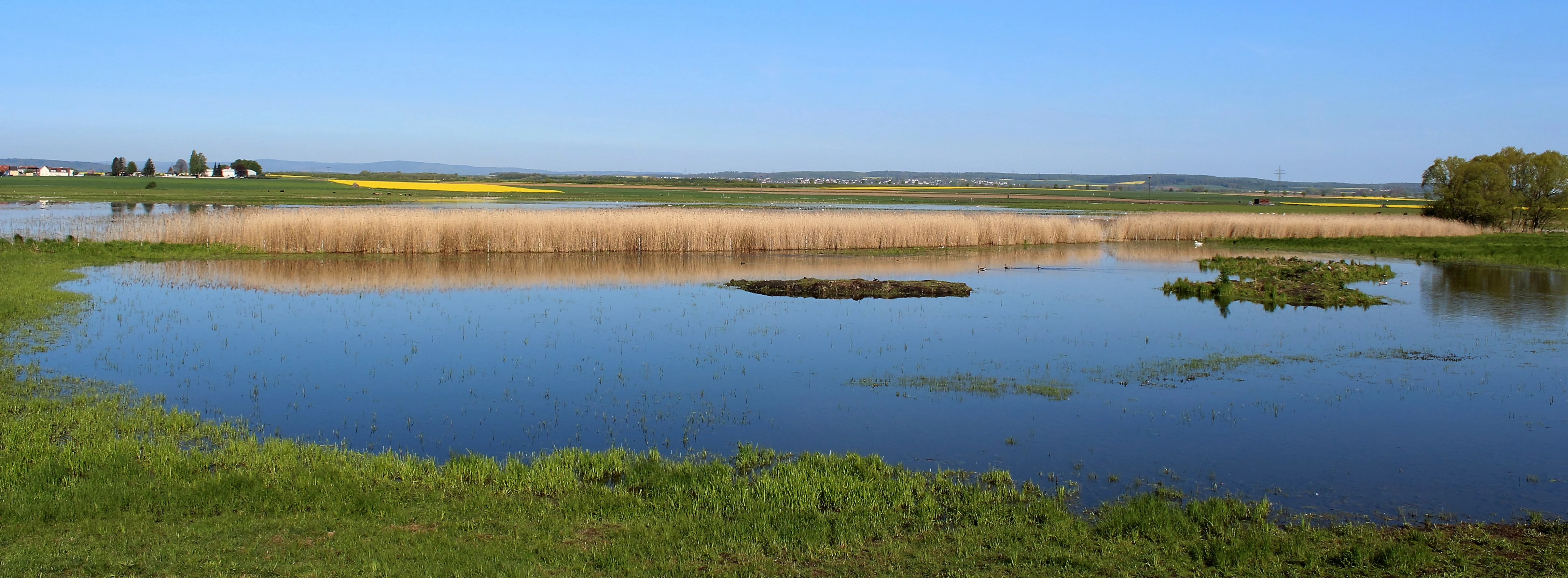
A horizontal landscape view of a marshy wetland area with a large pond in the foreground, surrounded by reeds, green grass, and yellow flowering fields under a clear blue sky.
A wide view of the Bingenheimer Ried nature reserve, highlighting its wetland habitat.

Bingenheimer Ried history and protected-area timeline

Bingenheimer Ried was officially designated as a nature reserve in 1985, referenced in the Hessian state gazette StAnz 1985(3): 204. Its protection was driven by the recognition that even within the heavily farmed Wetterau lowlands, fragments of the original Ried wetland still survived along the Horloff and held exceptional value for birds, amphibians, and dragonflies.

In the years that followed, the reserve's identity was consolidated through physical management interventions. A controllable weir was built in 1991 to allow water levels across the meadows to be raised during the cooler months and lowered after the breeding season, recreating a more natural flood pulse. An observation tower was added in 1996, making the area accessible for non-intrusive wildlife viewing.

A more recent layer of the reserve's history is tied to regional landscape change. The nearby Pfaffensee, created from former open-pit mining pits, finished filling with water in 2013 and has since influenced the hydrology of the Ried. During the extreme European heatwave of 2015, virtually all ponds and temporary waters within the reserve dried up except one, and reed stands at the Pfaffensee inflow point collapsed. These episodes have shaped modern management thinking about the reserve's resilience to climate stress and external water flows.

Bingenheimer Ried landscape and geographic character

The landscape of Bingenheimer Ried is shaped by the flat floor of the Wetterau valley. The reserve is essentially a low-lying wetland mosaic embedded in otherwise cultivated lowland terrain. Its defining feature is the Niedermoor, a shallow peat-forming mire that retains moisture throughout much of the year. Around this central wet zone, wet meadows stretch outward, interspersed with ditches, shallow pools, and temporary flood surfaces.

During autumn, winter, and early spring, large portions of the meadows are deliberately flooded by the weir system installed in 1991, turning the area into an open wetland landscape with reflective water surfaces standing only centimeters above the underlying peat. As spring advances and breeding activity peaks, water is gradually drawn down, and the meadows re-emerge as grassy fields grazed by cattle and Exmoor ponies.

The surrounding topography is gentle and low, with the wider landscape dominated by arable fields, small villages such as Bingenheim, and the broader Horloff floodplain. The Ried itself, however, reads visually as an unexpectedly open, quiet, and water-dominated space, a clear contrast to the intensively used agricultural land around it.

Bingenheimer Ried ecosystems, habitats, and plant life

Ecologically, Bingenheimer Ried is defined by the interplay between fluctuating water levels, traditional grazing, and the persistence of peat-forming conditions. This combination produces a habitat mosaic that includes wet meadows, reed stands, shallow temporary pools, and patches of more permanent open water. The result is a small but highly structured wetland ecosystem with strong zonation between terrestrial, semi-aquatic, and aquatic habitats.

Vegetation in the reserve is dominated by moisture-loving grassland species, reeds, sedges, and other typical Ried wetland plants that thrive where the peat base retains water. Grazing by cattle and Exmoor ponies helps prevent succession toward scrub and woodland, maintaining the open structure that many of the reserve's specialist species depend on.

The site is also notable for its integration into broader ecological networks. Through the Auenverbund Wetterau, Bingenheimer Ried is connected with other fragments of floodplain grassland across the district, allowing species to move between habitat patches. Its inclusion in the Natura 2000 FFH site Grünlandgebiete in der Wetterau reflects the broader European recognition of its grassland and wetland habitat value.

Bingenheimer Ried wildlife and species highlights

Bingenheimer Ried is primarily known as a bird area. The reserve supports a notable breeding community that includes rare marsh-nesting species such as the little crake, Baillon's crake, garganey, and shoveler, along with white storks. During migration, the seasonal flooding draws in wading birds including ruff, common redshank, and greenshank, which use the shallow waters as stopover habitat on broader flyways.

The amphibian fauna of the reserve is also significant. The natterjack toad and the crested newt are among the species documented in the wet meadows and pools. These populations are closely tied to the seasonal water regime and to the persistence of suitable breeding ponds through spring.

A third pillar of the reserve's wildlife identity is its dragonfly community. Around forty species of dragonflies and damselflies have been recorded here, reflecting the diversity of still-water, temporary-pool, and vegetated aquatic edge habitats. This high odonate diversity has made the reserve a recognized reference site for dragonfly conservation in the Wetterau region.

Bingenheimer Ried conservation status and protection priorities

Conservations-wise, Bingenheimer Ried is a textbook example of how a small, intensively managed lowland wetland can deliver disproportionate ecological value. Its designation as a Naturschutzgebiet in 1985 was an explicit recognition that the fragment of Ried along the Horloff was irreplaceable for the survival of several threatened species in Hesse.

The reserve is embedded in layered protection. On the regional level, it is part of the Auenverbund Wetterau, a landscape protection framework that links scattered wetland fragments. On the European level, it is integrated into the Natura 2000 network through the Fauna-Flora-Habitat area Grünlandgebiete in der Wetterau, which recognizes the site's value as species-rich grassland and wetland habitat of EU importance.

Active management is central to the reserve's conservation strategy. Cattle and Exmoor ponies are used to maintain the open meadow structure, preventing succession to scrub and preserving habitats for ground-nesting birds and amphibians. Controlled flooding through the 1991 weir reproduces a natural seasonal water cycle that supports both breeding and migrating species. Climate stress and altered water inputs from the nearby Pfaffensee have introduced new conservation challenges, particularly around drought events and reed dieback, highlighting the reserve's ongoing vulnerability and the importance of continued hydrological monitoring and adaptive management.

Bingenheimer Ried cultural meaning and human context

Bingenheimer Ried reflects the broader Wetterau tradition of coexisting with wet lowland landscapes. The name Ried itself refers to a wetland or reed area, a landscape element that has long shaped local land use, grazing patterns, and settlement in this fertile valley. The reserve's continued use of cattle and Exmoor ponies for grazing preserves a pattern of interaction between humans and seasonal wet meadows that has deep regional roots.

The surrounding village of Bingenheim, part of the municipality of Echzell, sits in a landscape where agriculture has historically been dominant, and the protected status of the Ried represents a deliberate decision to maintain a fragment of the original wetland character within a working agricultural matrix. Local conservation groups, including NABU Bingenheim, have been active in supporting and communicating about the site, reinforcing its role as both a natural and a community-centered heritage feature of the Wetterau.

Top sights and standout views in Bingenheimer Ried

The standout features of Bingenheimer Ried are the unusually rich bird life packed into a small area and the effectiveness of traditional, low-tech management in sustaining it. The reserve is widely recognized as one of Hesse's premier sites for rare marsh-nesting birds and as an important stopover for migratory waders during the seasonal flooding phase.

Its second highlight is the dragonfly fauna, with around forty recorded species, which gives the site a special significance beyond its ornithological value. Combined with the Natura 2000 integration, the Auenverbund Wetterau network role, and the long-standing observation tower that has supported monitoring since 1996, these features make Bingenheimer Ried a small but emblematic example of lowland floodplain conservation in central Germany.

Best time to visit Bingenheimer Ried

The character of a visit to Bingenheimer Ried shifts sharply with the seasons. In spring, as water levels are gradually drawn down after the winter flood pulse, the meadows come alive with breeding marsh birds, displaying dragonflies, and active amphibians. This period tends to offer the densest wildlife experience and is when many of the reserve's rarest breeding species are most observable from the observation tower.

In autumn and winter, the deliberate flooding of the meadows transforms the landscape into open shallow wetland, attracting migratory waders and waterfowl. This quieter, more atmospheric phase offers a different kind of experience, focused less on breeding spectacle and more on wide open skies, water surfaces, and gatherings of passing birds. Summer, when grazing dominates and water levels are low, tends to be the least dynamic period for casual visitors and is also when the reserve can be most vulnerable to drought, as illustrated by the 2015 heatwave event.

Monthly climate preview

Long term temperature and precipitation records for regional conservation geography

Bingenheimer Ried Climate Normals and Measured Monthly Weather Patterns

Representative coordinate sampling records long term monthly temperature ranges and precipitation rates for Bingenheimer Ried in Hesse. Examining twelve month climate normals reveals complete annual weather variations across the protected landscape.
Annual mean9 °C
-1 °C19 °C
Jan-1°
Feb
Mar
Apr
May13°
Jun16°
Jul19°
Aug19°
Sep14°
Oct
Nov
Dec
Warmest month
July

18.8 °C

Coolest month
January

-0.6 °C

Wettest month
July

2.5 mm/day

Driest month
April

1.6 mm/day

Park location guide

Geography guide, regional context, and park location map for Bingenheimer Ried

Bingenheimer Ried park geography, regions, and map view in Germany

Understand where Bingenheimer Ried sits in Germany through a broader geographic reading of the surrounding landscape, nearby location context, and its mapped position within the national park landscape.

How Bingenheimer Ried fits into Germany

Germany is a federal republic in Western and Central Europe with a population of over 83 million across sixteen constituent states. It is Europe's largest economy by nominal GDP and a major global exporter and importer. The capital is Berlin, and the country borders Denmark, Poland, Czech Republic, Austria, Switzerland, France, Luxembourg, Belgium, and the Netherlands.

Wider geography shaping Bingenheimer Ried in Germany

Germany is located in Western and Central Europe, spanning 357,022 km². It borders Denmark to the north, Poland and the Czech Republic to the east, Austria and Switzerland to the south, and France, Luxembourg, Belgium, and the Netherlands to the west. The country has coastlines on the Baltic Sea and North Sea to the north, with the Alps located in the southern region.

Map view of Bingenheimer Ried

Use this park location map to pinpoint Bingenheimer Ried in Germany, understand its exact geographic position, and read its mapped placement within the surrounding landscape more clearly.

Pigeon | © OpenStreetMap contributors

Location context for Bingenheimer Ried

Hesse

Visual reference of lowland mire habitats, flood meadows, and protected terrain

Bingenheimer Ried Photos, Scenery, and Protected Wetland Landscapes

Photographic records capture the open wetland mosaic, seasonal floodwaters, and wet meadow terrain defining Bingenheimer Ried. Visual exploration reveals the lowland mire character and floodplain conservation environment of the reserve.

A horizontal landscape view of a marshy wetland area with a large pond in the foreground, surrounded by reeds, green grass, and yellow flowering fields under a clear blue sky.

Park atlas

Compare regional wetland reserves and connected lowland floodplains across the Wetterau valley.

Parks Near Bingenheimer Ried and Surrounding Protected Areas in Hesse

Visitors exploring Bingenheimer Ried can continue comparing nearby nature reserves and regional wetland habitats across the surrounding landscape. Expanding the geographic scope reveals connected protected areas and similar lowland floodplains throughout central Germany.
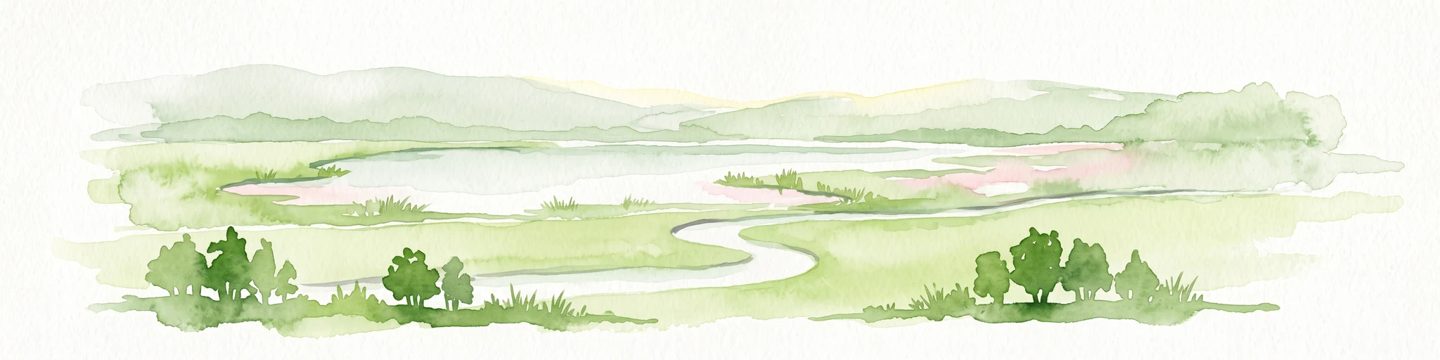
A horizontal watercolor illustration showing a meandering stream flowing through open green grasslands with scattered trees and low hills in the background.
Nature reserveHessen
About 4.7 km away#1 closest

Southeast

Nachtweid von Dauernheim Nature Reserve: Geographic Overview and Wetland Conservation

Saline meadows and floodplain habitats in Hessen

Nachtweid von Dauernheim is a specialized nature reserve in the Wetterau district, defined by its rare saline-influenced grassland flora and extensive sedge marshes. As a core rail bird biotope, the site anchors a wider wetland network alongside the Nidda river floodplain. This protected area offers a deep look into central Germany's unique hydrologic conditions and sensitive open-terrain conservation.

Area
0.789 km²
Established
1978
A wide watercolor painting showing a green river valley with marshy foreground, a line of trees, and rolling hills in purple and green in the background.
Nature reserveWetteraukreis
About 8.8 km away#2 closest

West

Salzwiesen von Wisselsheim Nature Reserve: Atlas and Regional Geography of Wetteraukreis

Protected inland salt meadows and floodplain geography in Hesse, Germany.

Salzwiesen von Wisselsheim stands as a significant protected area in the Wetteraukreis region, distinguished by rare inland salt meadows fed by natural saline springs. This reserve presents a compelling landscape defined by the River Wetter, offering deep insights into how unique hydrogeology and historical salt production have formed a specialized lowland habitat that is largely absent from other inland regions.

Area
0.23 km²
Established
1982
Relief
Lowland
Climate
Temperate
A watercolor painting of a green, rolling meadow landscape with distant hills under a soft, light sky.
Nature reserveWetteraukreis
About 10 km away#3 closest

East

Nidderauen von Stockheim Nature Reserve: A Detailed Geographic and Protected Landscape Map

Wetland floodplain geography in the Wetteraukreis region

This protected nature reserve spans 51 hectares of the Nidder river valley, forming a critical segment of the Auenverbund Wetterau. The landscape is defined by its mosaic of wet meadows, ponds, and tall herb vegetation, maintained by targeted conservation management and river restoration. Access the map-driven context of this European FFH site to understand its role in regional wetland preservation and habitat connectivity.

Area
0.512 km²
Established
1981
Relief
Lowland
Climate
Temperate
A watercolor painting showing a soft, peaceful landscape with green rolling hills, a small body of water in the foreground, and faint, distant mountains under a pale sky.
Nature reserveHesse
About 10 km away#4 closest

West

Kiesgrube Laukertsberg bei Nieder-Mörlen Protected Area in Hesse, Germany

A reclaimed post-industrial nature reserve and habitat

Located in the Wetterau district of Hesse, Kiesgrube Laukertsberg bei Nieder-Mörlen represents a significant shift from industrial gravel extraction to protected ecological sanctuary. The terrain features open-ground habitats and seasonal wetlands that support sensitive species, illustrating how landscape management can prioritize biodiversity. Analyze the site boundaries and its role within the broader regional geography of central Germany.

Area
0.157 km²
Established
2019
IUCN
IV
Relief
Lowland
Protected areaGermany
About 10 km away#5 closest

Southeast

Bruch von Heegheim Protected Area: A Wetland Landscape in the Nidder River Valley

Mapped wetland habitats and ecological site geography

Bruch von Heegheim is a specialized nature reserve that protects a delicate mosaic of shallow water bodies and reed-dominated marshes in the German district of Wetteraukreis. The site serves as a vital refuge for European tree frogs and breeding marshland birds, demonstrating how compact protected lands contribute to broader biodiversity conservation within agricultural floodplains.

Area
0.108 km²
Established
1976
Relief
Lowland
Climate
Temperate
A wide watercolor illustration showing a purple mountain in the distance, a line of green trees, a body of water, and pinkish plants in the foreground on a white background.
Nature reserveWetteraukreis
About 11 km away#6 closest

West

Breitwiese bei Steinfurth und Oppershofen: A Wetteraukreis Nature Reserve Profile

Examining floodplain ecology and protected wetland boundaries

This protected area in the Wetteraukreis highlights the importance of small-scale floodplain management for biodiversity. The site preserves essential wet meadow habitats, riparian edges, and river-adjacent ecosystems that provide sanctuary for specialized amphibian and bird species. It serves as an informative case study for understanding how conservation grazing and corridor protection interact within an intensive agricultural landscape.

Area
0.164 km²
Established
1990
IUCN
IV
Relief
Lowland
Nature reserveHesse
About 12 km away#7 closest

Southeast

Im Rußland und in der Kuhweide bei Lindheim: Nature Reserve and Floodplain Geography

Protected grassland landscapes in the Wetterau, Hesse.

Located in the Wetteraukreis district of Hesse, this nature reserve protects extensive floodplain meadows along the Nidder river. The area is defined by its open grassland mosaic, providing critical refuge for meadowbirds and diverse amphibian populations. Access detailed map data and landscape context for this significant German conservation site.

Area
2.495 km²
Established
1984
Relief
Lowland
Climate
Temperate
Watercolor painting of a green landscape with rolling hills, small clusters of trees, and soft pinkish tones in the background.
Nature reserveHesse
About 13 km away#8 closest

South

Krebsbachtal bei Kaichen: Protected Stream Valley Geography and Landscape Map in Hesse

Nature reserve featuring diverse meadow and forest habitat mosaics

Spanning 34 hectares in the Main-Kinzig-Kreis, the Krebsbachtal bei Kaichen reserve protects a unique concentration of riparian stream life, dry grasslands, and traditional orchard meadows. This valley landscape, framed by the Hainwald forest, provides a protected corridor that remains a significant representative of the historic natural terrain found in central Hesse.

Area
0.34 km²
Established
1988
Relief
Lowland
Climate
Temperate

Common questions about visiting, size, designation, and location context for Bingenheimer Ried

Bingenheimer Ried FAQs for park facts, access, geography, and protected area context

Find quick answers about Bingenheimer Ried, including protected-area facts, park geography, trail and visitor context, and how the park fits into its surrounding country and regional landscape.
MoriAtlas Explorer

Continue Your Protected Areas Search Across the Global Atlas

Deepen your exploration by continuing the structured search for national parks and protected areas worldwide. Utilize the comprehensive filtering capabilities to compare different conservation landscapes and refine your understanding of global park geography. Discover more about the distribution and characteristics of protected natural areas.

Global natural geography