
Mori Atlas logo
Biosphere reserveBiosphere Reserve Großes Walsertal

Examining the geological divide between flysch ridges and limestone peaks in this Austrian biosphere reserve

Biosphere Reserve Großes Walsertal: A Mapped Exploration of Alpine Protected Landscapes in Vorarlberg

(Biosphärenpark Großes Walsertal)

Biosphere Reserve Großes Walsertal represents a complex integration of conservation and traditional land use within the Vorarlberg region of Austria. This protected area spans a striking topographical gradient, ranging from the gentle, forested flysch mountains of the Walserkamm to the rugged, high-altitude limestone summits of the Kalkhochalpen. The reserve provides a model for managing a living cultural landscape, where active organic farming and human heritage exist alongside strictly protected core zones. Mapping these environmental zones offers a window into the ecological and structural diversity of this high-alpine valley.

UNESCO biosphere reserveAlpine valleyVorarlbergsustainable tourismorganic farmingalpine pastures
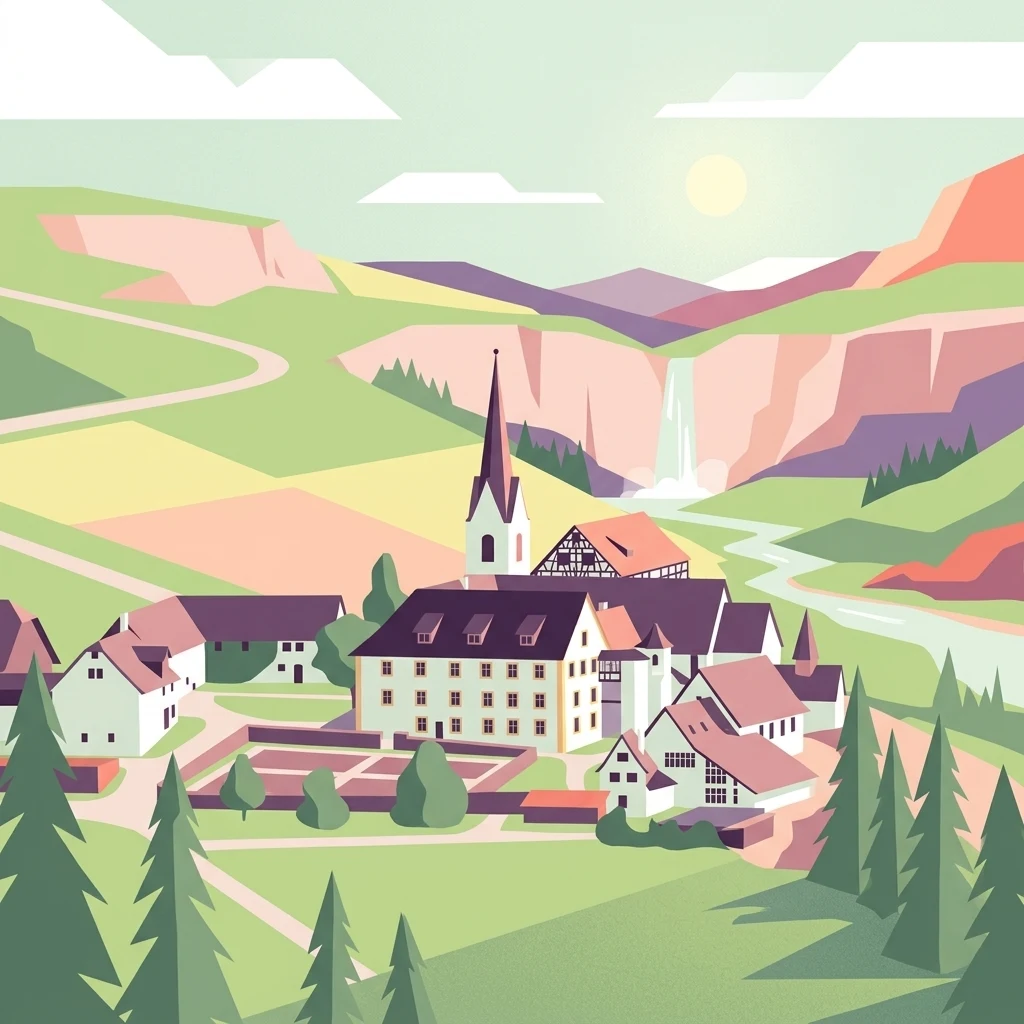
Flat-style vector illustration of a village with a tall church steeple, surrounded by pine trees, with rolling green hills, a waterfall, winding road, and mountains under a pale sky with clouds.

Biosphere Reserve Großes Walsertal

Biosphere reserve

Park overview

Structured park overview, official facts, and landscape profile for Biosphere Reserve Großes Walsertal

Biosphere Reserve Großes Walsertal park facts, protected area profile, and essential visitor context

Review the core facts for Biosphere Reserve Großes Walsertal, including designation, size, terrain, visitor scale, habitats, and operating context in one park-focused overview.

About Biosphere Reserve Großes Walsertal

The Biosphere Reserve Großes Walsertal occupies the namesake valley in Vorarlberg, Austria's westernmost state. Sheltered between the green flysch slopes of the Walserkamm and the rugged limestone massifs of the Kalkhochalpen, the valley reads like a textbook example of an inhabited Alpine landscape that has retained both its natural character and its rural way of life.

At around 19,231 hectares, the reserve is not a large national park-scale wilderness, but rather a working valley composed of small villages, organic farms, alpine pastures, forests, and high-mountain terrain. Roughly 3,420 people live within its boundaries across six municipalities: Blons, Fontanella, Raggal, Sonntag, St. Gerold, and Thüringerberg. About 180 farms still operate here, and around 42 percent of them are managed organically, giving the reserve one of the highest concentrations of organic agriculture among Austrian biosphere reserves.

Since November 2000 the area has been a UNESCO biosphere reserve. The designation reflects a deliberate philosophy: to protect biodiversity, support sustainable regional development, and encourage research and education, all within a valley where people still live and work. The reserve actively promotes sustainable tourism and serves as a forum connecting society, politics, and science around questions of mountainous rural futures.

The valley's role as a cultural bridge between alpine traditions and modern conservation practice is one of the things that distinguishes it. Sites such as the long-running Benedictine abbey at St. Gerold, the Walserherbst festival, and the visitor-oriented biosphärenpark.haus anchor this identity, while the surrounding slopes serve both as a working agricultural landscape and as a protected ecological mosaic.

Quick facts and research context for Biosphere Reserve Großes Walsertal

The Biosphere Reserve Großes Walsertal covers roughly 19,231 hectares in the Vorarlberg Alps of western Austria. It spans six small alpine municipalities and contains about 3,420 residents and around 180 farms, nearly half of which operate organically.

Designated a UNESCO biosphere reserve in November 2000, the area rises from about 580 meters to peaks over 2,700 meters. It is divided into core, maintenance, development, and regeneration zones, with core and maintenance zones together covering roughly 85 percent of the valley and emphasizing ecological protection, traditional land use, and sustainable settlement patterns.

Protection and recognition

Explore documented protection frameworks and formal international recognition records.

Protection Status and International Recognition for Biosphere Reserve Großes Walsertal

Examine the verified protection status and administrative designation records established for Biosphere Reserve Großes Walsertal. Access structured management data and official registry details compiled within the global protected area network.

Protection details

WDPA ID
555545145
Park context

Deeper park guide and search-rich context for Biosphere Reserve Großes Walsertal

Biosphere Reserve Großes Walsertal history, landscape, wildlife, and travel context

Explore Biosphere Reserve Großes Walsertal through its history, landscape character, ecosystems, wildlife, conservation priorities, cultural context, and seasonal travel timing in a structured park guide built for atlas discovery and search intent.

Why Biosphere Reserve Großes Walsertal stands out

The reserve is especially known for showing how a traditional Alpine farming valley can function as a modern UNESCO biosphere reserve. Its zonation model places almost a fifth of the valley into core zones reserved for nature conservation, while still allowing traditional alpine pasture use, organic farming, and sustainable tourism in surrounding areas. Equally distinctive is the blend of cultural and ecological heritage: the Walserkamm flysch mountains and dramatic Kalkhochalpen limestone peaks frame a living cultural landscape where the Walser heritage, Benedictine monastery at St. Gerold, organic mountain agriculture, and pioneering Austrian Alpine biosphere management coexist.
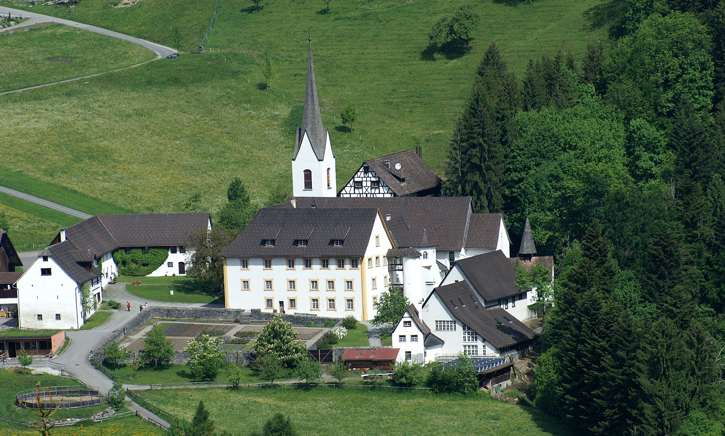
High-angle view of a white priory complex with a tall church spire, surrounded by green meadows and coniferous forests.
Aerial view of the Sankt Gerold Priory complex nestled in the green valley of the Großes Walsertal biosphere reserve.

Biosphere Reserve Großes Walsertal history and protected-area timeline

The reserve's formal history begins with its UNESCO recognition in November 2000, when the Großes Walsertal was accepted into the global network of biosphere reserves. This designation acknowledged both the ecological value of the valley and the long continuity of human settlement and land use within it.

Cultural roots in the valley run much deeper than the modern designation. The Benedictine presence at St. Gerold reaches back to the tenth century, giving the valley more than a millennium of documented institutional and agricultural history. Walser heritage, traditional mountain farming, and alpine pastoralism have shaped the landscape for centuries, contributing to the mosaic of meadows, pastures, forests, and high-mountain habitats that the reserve now manages.

After recognition, the reserve gradually built the institutional structure seen today, including the biosphärenpark.haus visitor center, the Walserherbst festival, educational trails such as the Walderlebnispfad Marul, and a clearly defined system of core, maintenance, development, and regeneration zones. A key milestone was the formal categorization of nearly 20 percent of the valley as core zones, significantly exceeding Austria's minimum requirement and underscoring the region's conservation ambitions.

Biosphere Reserve Großes Walsertal landscape and geographic character

The valley's physical setting is defined by a clear geological contrast. The northern flank is shaped by the relatively soft, green flysch mountains of the Walserkamm, with rounded ridges, mature forest cover, and gentler terrain. These slopes present the more inviting face of the valley, dotted with hamlets, meadows, and traditional pastures.

The southern flank is markedly different. Here the landscape rises into the Kalkhochalpen, part of the Northern Limestone Alps, forming sharp peaks, rocky crests, and extensive scree slopes. Notable summits visible from the valley include the Zitterklapfen above 2,400 meters, along with peaks like Glatthorn, Türtschhorn, and Zafernhorn, all reaching well above 2,000 meters. Together these two flanks create an enclosed valley with strong environmental gradients over a relatively short horizontal distance.

The elevation range stretches from roughly 580 meters at the valley floor to peaks above 2,700 meters. The river Lutz, whose upper reaches are protected within the reserve, runs through the valley, while elevation and exposure create distinct vegetation zones from valley-bottom farmland to subalpine and alpine habitats higher up. This compact topographic diversity is a major reason the valley supports such a wide range of habitats in a small area.
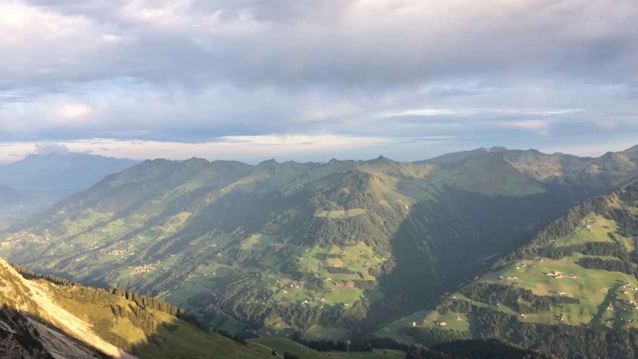
Wide landscape photograph showing a mountain valley with green slopes, scattered buildings, and forested areas under a cloudy sky.
A panoramic view of the Großes Walsertal valley from Alpe Steris, showing green mountain slopes and scattered alpine settlements under a cloudy sky.

Biosphere Reserve Großes Walsertal ecosystems, habitats, and plant life

Ecologically, the reserve functions as a gradient-rich Alpine landscape compressed into a single valley system. Habitat types range from valley-bottom meadows and settlement areas through montane and submontane forests, extensive alpine pastures, mountain hay meadows, and high-moor vegetation up to rocky alpine zones with sparse vegetation and scree communities.

The high-moor at Tiefenwald is one of the ecologically sensitive habitats protected within the core zones, alongside extensive forests such as Kirschwald-Ischkarnei and the Gadental. The Gadental area is both a nature reserve and part of the Natura 2000 network, highlighting its importance for European habitat conservation. The upper reaches of the Lutz are protected for the integrity of the river ecosystem itself.

Roughly a fifth of the valley is set aside as core zones where ecosystems can develop with minimal human interference, well above the national minimum. Together with the maintenance zones covering about 65 percent of the area, most of the reserve is dedicated to either strict protection or near-natural traditional land use, ensuring that ecological processes, traditional agricultural practices, and biodiversity conservation reinforce one another.
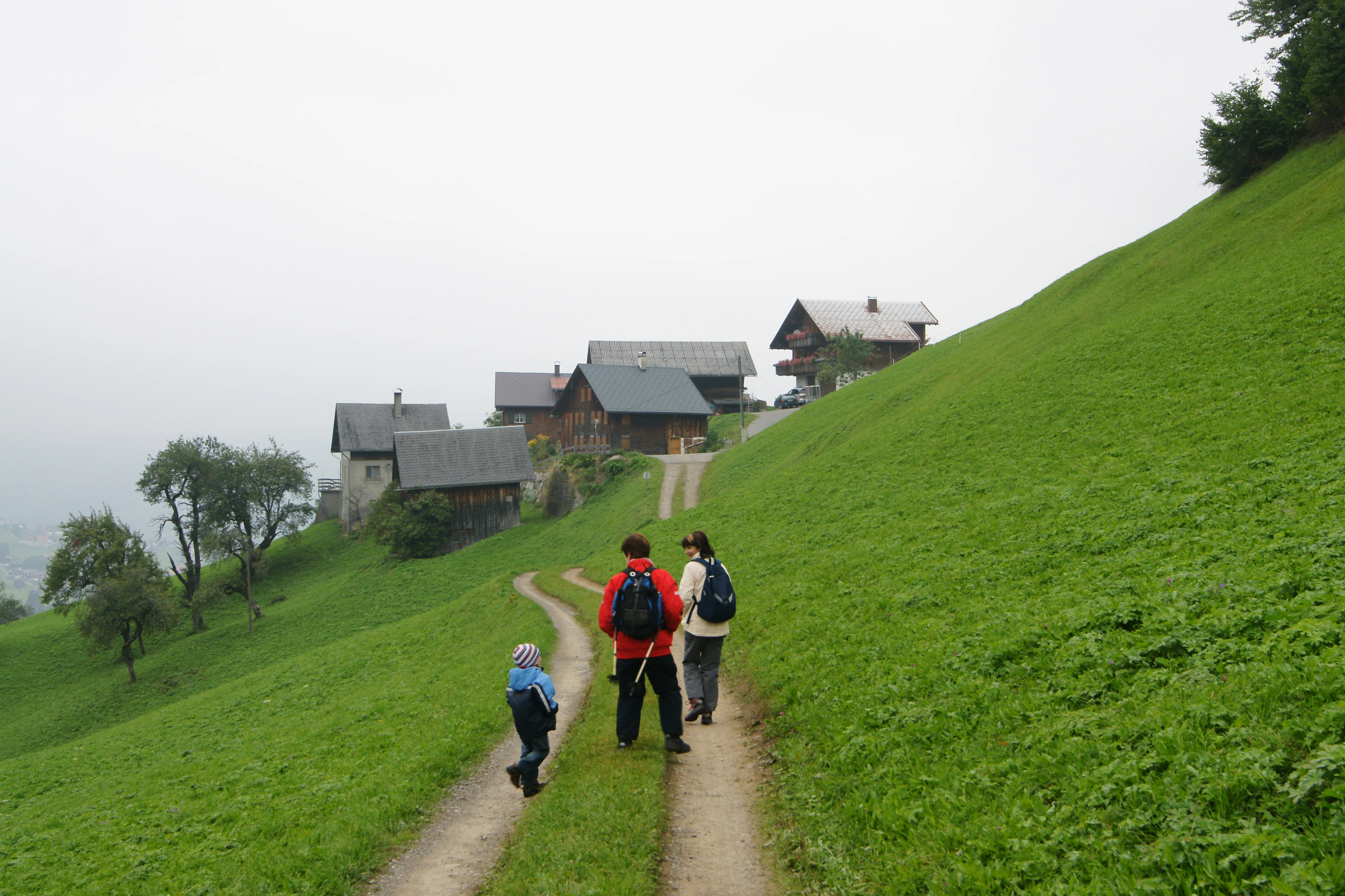
Three hikers walking away from the camera on a dirt trail leading up a green hillside toward a cluster of wooden farmhouses under an overcast sky.
Hikers walking along a dirt path toward traditional farmhouses on a grassy hillside in Marul.

Biosphere Reserve Großes Walsertal wildlife and species highlights

The reserve's wildlife profile reflects its variety of habitats. Continuous forest cover on the northern Walserkamm slopes and the steep rocky terrain of the southern Kalkhochalpen together provide habitat for typical Alpine forest fauna as well as species adapted to cliffs, alpine pastures, and high-mountain environments.

The protected upper Lutz river corridor and the high-moor at Tiefenwald are ecologically important for invertebrates, amphibians, and birdlife that depend on intact wetland and riverine conditions. The extensive alpine pasture zone, with its mosaic of meadows, shrubs, and forest remnants, supports a relatively rich suite of farmland-associated Alpine species, while the cliff and scree areas of the southern limestone ranges host typical rock-dwelling fauna.

Because the reserve is structured to keep large tracts under near-natural conditions, it functions as a refugium within a wider region where intensified land use and tourism pressure have grown. This makes the area important not only for resident wildlife but also as part of broader Alpine conservation networks.
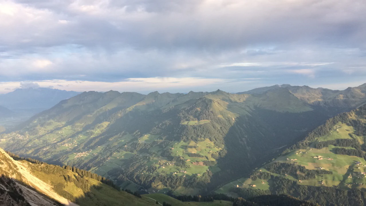
Wide landscape view of a green mountain valley with rolling hills, scattered farmhouses, and forested slopes under an overcast sky.
Panoramic view of the Großes Walsertal valley from Alpe Steris, showing rolling green mountains and scattered settlements under a cloudy sky.

Biosphere Reserve Großes Walsertal conservation status and protection priorities

The Biosphere Reserve Großes Walsertal demonstrates a model of conservation rooted in long-term inhabitation rather than strict exclusion. Roughly 20 percent of the valley is classified as core zones, including the Gadental Natura 2000 site, the Faludriga-Nova nature reserve, the Tiefenwald high moor, the upper Lutz river, the Kirschwald-Ischkarnei forest, and the alpine region around the Rote Wand. This is far above Austria's national minimum of 5 percent, signaling a strong commitment to ecological protection.

Around 65 percent of the reserve falls within the maintenance zone, which permits near-natural land uses such as traditional meadow management, alpine pasture grazing, selective forestry, and low-impact tourism. This approach recognizes that many of the valley's habitats, including species-rich mountain meadows and culturally shaped forests, depend on continued traditional use.

The reserve also addresses ecological restoration through a regeneration zone along the diverted section of the Lutz below the reservoir, where the aim is to restore sufficient natural flow. Organic farming, sustainable tourism initiatives, and educational programs reinforce the conservation strategy, positioning the valley as an experimental landscape for combining biodiversity protection, rural livelihoods, and environmental learning.

Biosphere Reserve Großes Walsertal cultural meaning and human context

The valley's cultural identity is tightly bound to its geography. The name Großes Walsertal refers to the Walser heritage, a community whose historical migrations shaped settlement patterns across parts of the Alps. Walser traditions, language influences, and mountain customs continue to inform the valley's sense of place.

The Propstei St. Gerold anchors the cultural landscape. Held by Benedictine monks since the tenth century, the abbey represents one of the longest continuous institutional presences in the valley and has long been linked to its agricultural and spiritual rhythms. A footpath leads along small lakes through forest below the abbey, blending spiritual heritage with the surrounding nature.

Modern cultural life is woven into the reserve's broader identity through institutions such as the biosphärenpark.haus visitor center, with its exhibitions, films, and herbarium, and the Walserherbst festival. Held every two years in August and September and lasting roughly three weeks, Walserherbst combines music, literature, and regional cuisine, turning the valley itself into a stage for its living heritage.

Top sights and standout views in Biosphere Reserve Großes Walsertal

The reserve's standout qualities include its UNESCO biosphere status, a near twenty percent core-zone share well beyond national requirements, and a uniquely compact geological contrast between the gentle flysch Walserkamm and the dramatic Kalkhochalpen limestone peaks. Equally distinctive is the integration of a working, organically farmed Alpine valley into a serious conservation framework.

Cultural anchors such as the tenth-century Benedictine Propstei St. Gerold, the Walserherbst festival, the biosphärenpark.haus, and the Walderlebnispfad Marul forest trail provide memorable entry points into the landscape, while protected sites like the Gadental Natura 2000 area, the Tiefenwald high moor, and the upper Lutz river showcase the valley's ecological depth.

Best time to visit Biosphere Reserve Großes Walsertal

The valley's character shifts strongly with season. Late spring and early summer bring fresh green meadows and flowering alpine pastures, with pleasant conditions for hiking the Walderlebnispfad Marul and other valley trails. Midsummer offers the warmest conditions and the broadest range of outdoor activities, although it is also the busiest period.

Early autumn is particularly atmospheric in the valley, when the foliage shifts color and the biennial Walserherbst festival fills the villages with music, literature, and regional cuisine. Winter brings a quieter, snow-covered Alpine landscape, well suited to those seeking low-season tranquility, although higher-elevation areas become more demanding in terms of weather and access. Visitors interested in peak alpine scenery will find midsummer clearest, while those drawn to cultural events should target Walserherbst years in late summer.

Monthly climate preview

Long-term average temperature and precipitation patterns sampled at a representative coordinate

Biosphere Reserve Großes Walsertal Climate Normals and Monthly Temperature Rhythm

Measured monthly data records long-term average temperature and precipitation variations across the representative coordinate for Biosphere Reserve Großes Walsertal. Reviewing the complete twelve-month profile provides deeper context for evaluating regional climate rhythms and seasonal ranges.
Annual mean4 °C
-6 °C14 °C
Jan-6°
Feb-5°
Mar-1°
Apr
May
Jun12°
Jul14°
Aug14°
Sep10°
Oct
Nov
Dec-4°
Warmest month
July

14 °C

Coolest month
January

-5.7 °C

Wettest month
June

5.5 mm/day

Driest month
February

2.5 mm/day

Park location guide

Geography guide, regional context, and park location map for Biosphere Reserve Großes Walsertal

Biosphere Reserve Großes Walsertal park geography, regions, and map view in Austria

Understand where Biosphere Reserve Großes Walsertal sits in Austria through a broader geographic reading of the surrounding landscape, nearby location context, and its mapped position within the national park landscape.

How Biosphere Reserve Großes Walsertal fits into Austria

Austria is a landlocked country in Central Europe, bordered by Germany, Czech Republic, Slovakia, Hungary, Slovenia, Italy, Switzerland, and Liechtenstein. The country is a federal semi-presessional republic composed of nine states, with Vienna as its capital and largest city. It has a population of approximately 9.1 million people.

Wider geography shaping Biosphere Reserve Großes Walsertal in Austria

Austria is located in Central Europe, lying in the Eastern Alps. It is bordered by Germany and Czech Republic to the north, Slovakia to the northeast, Hungary to the east, Slovenia and Italy to the south, and Switzerland and Liechtenstein to the west.

Map view of Biosphere Reserve Großes Walsertal

Use this park location map to pinpoint Biosphere Reserve Großes Walsertal in Austria, understand its exact geographic position, and read its mapped placement within the surrounding landscape more clearly.

Pigeon | © OpenStreetMap contributors

Location context for Biosphere Reserve Großes Walsertal

Vorarlberg

Visualizing limestone peaks, forested flysch ridges, and protected valley habitats.

Biosphere Reserve Großes Walsertal Photos and Alpine Landscapes

Visual records illustrate the rugged terrain and distinct elevation zones defining Biosphere Reserve Großes Walsertal. Photography captures the physical contrast between green northern slopes and high alpine limestone crests.

High-angle view of a white priory complex with a tall church spire, surrounded by green meadows and coniferous forests.

High-angle view of a white building complex with a tall church steeple and dark roofs, situated in a green valley with coniferous trees.

Wide landscape photograph showing a mountain valley with green slopes, scattered buildings, and forested areas under a cloudy sky.

Three hikers walking away from the camera on a dirt trail leading up a green hillside toward a cluster of wooden farmhouses under an overcast sky.

Wide landscape view of a green mountain valley with rolling hills, scattered farmhouses, and forested slopes under an overcast sky.

Three people hiking on a winding dirt path up a steep green grassy hill towards a cluster of wooden houses under an overcast sky.

Park atlas

Compare regional Alpine terrain, limestone peaks, and connected conservation areas.

Other Parks Near Biosphere Reserve Großes Walsertal and Surrounding Protected Landscapes

Browse protected areas and alpine nature reserves situated close to Biosphere Reserve Großes Walsertal. Comparing adjacent mountain terrain and valley ecosystems deepens geographic context across the region.
Light watercolor illustration of a winding river or lake curving through green trees and vegetation with pale mountains in the distant background
Nature reserveLiechtenstein
About 11 km away#1 closest

North

Gampriner Seelein Nature Reserve: Geographical Context and Mapped Protected Boundaries

A rare natural lake within the Rhine Valley lowlands

Gampriner Seelein serves as a vital nature reserve and the sole naturally formed lake in Liechtenstein. Formed by historic Rhine flood events, this site preserves a rare floodplain forest ecosystem and managed wetland, providing essential habitat for diverse aquatic species and birds within a densely developed regional geography.

Area
0.015 km²
Established
1961
Relief
Lowland
Climate
Temperate
A watercolor illustration of a landscape with green meadows, trees, and soft mountains in the background, set against a white background.
Nature reserveLiechtenstein
About 13 km away#2 closest

North

Ruggeller Riet Nature Reserve: Geographic Context and Mapped Wetland Boundaries in Liechtenstein

A vital lowland moorland and wetland ecosystem in the Rhine valley.

Ruggeller Riet serves as the primary lowland nature reserve in Liechtenstein, featuring an expansive 88-hectare wetland landscape. Positioned in the Alpine Rhine valley near the tripoint with Austria and Switzerland, this protected area preserves the post-glacial history of the region through its distinctive peat meadows, bogs, and grassland habitats.

Area
0.88 km²
Established
1978
IUCN
Ia
Relief
Lowland
A soft watercolor painting depicting a wide river flowing through a green floodplain with distant mountains in the background.
Nature reserveGraubünden
About 39 km away#3 closest

South

Naturschutzgebiet Rhäzünser Rheinauen: Protected River Landscape and Floodplain Geography

Graubünden Alpine floodplain and alluvial river system

Located in the Swiss canton of Graubünden, Naturschutzgebiet Rhäzünser Rheinauen encompasses 157 hectares of rare, free-flowing river landscape. This protected area supports a diverse succession of plant communities, ranging from pioneer species on shifting gravel bars to mature softwood and hardwood floodplain forests, framed by the dramatic mountain terrain of the Hinterrhein valley.

Area
1.569 km²
Established
1992
IUCN
IV
Relief
Mountain
Regional parkGraubünden
About 40 km away#4 closest

South

Naturpark Beverin: Exploring Alpine Gorges and Cultural Landscapes in Graubünden

A regional nature park shaped by high alpine ridges and ancient settlement traditions.

Naturpark Beverin encompasses a vast, multi-layered environment in the Swiss Alps. The area is defined by the sharp vertical contrast between carved river gorges like the Viamala and high-elevation ridges. Beyond the rugged mountain terrain, this protected landscape preserves centuries of pastoral history through the distinct settlement traditions of its Romanesque and Walser valleys.

Area
515 km²
Established
2013
Relief
Mountain
Climate
Alpine
A watercolor painting showing a panoramic view of a wetland with water, grasses in the foreground, green hills, and purple-toned mountains in the distance.
Nature reserveVorarlberg
About 42 km away#5 closest

North

Rhine Delta Nature Reserve: Mapped Wetlands and Alpine Foothills Geography in Vorarlberg

A dynamic freshwater delta and critical bird habitat in Austria

The Rhine Delta constitutes the largest wetland biotope on Lake Constance, characterized by ongoing sediment deposits and an evolving shoreline. Its geography includes dense riparian forests, alluvial plains, and shallow bays that provide refuge for diverse amphibians and birds. This nature reserve serves as a prime example of large-scale wetland conservation nestled between the Alpine foothills and the open waters of the lake.

Area
20.65 km²
Established
1982
Relief
Lowland
Climate
Temperate
A soft watercolor painting of a wetland landscape with rolling hills, grassy plains, and gentle water channels in muted green and pink tones.
Nature reserveSt. Gallen
About 43 km away#6 closest

West

Kaltbrunner Riet Nature Reserve and Wetland Landscape in the Canton of St. Gallen

Mapping the protected fen habitats and agricultural wetland remnants of the Linthebene.

Kaltbrunner Riet serves as a primary nature reserve in the canton of St. Gallen, encompassing critical lowland fen and amphibian spawning habitats. As a protected Ramsar wetland, the reserve offers an essential window into the historic Linthebene landscape, showcasing how traditional meadow management sustains biodiversity across the Swiss plateau.

Area
0.5 km²
Established
1914
Relief
Lowland
Climate
Temperate
Protected landscapeBaden-Württemberg
About 53 km away#7 closest

North

Steilrand und Schotterfeld des Argentals südlich der Kochermühle Protected Landscape Atlas

Glacial geomorphology and river terrace geography in Baden-Württemberg

This protected area provides a diagrammatic view of the Argen valley's ice-age origins. By preserving a Late Glacial terrace complete with its characteristic steep edge and gravel-strewn surfaces, it offers an essential geographic reference for understanding the retreat of the Würm ice within the wider Bodenseebecken region.

Area
0.081 km²
Established
1954
Relief
Lowland
Climate
Temperate
A flat, stylized illustration showing a waterfall cascading from a cliff into a river that flows alongside a forest towards a large body of water under a soft-toned sky.
Protected landscapeBaden-Württemberg
About 54 km away#8 closest

North

Württembergisches Bodenseeufer: Protected Shoreline Landscapes of Lake Constance

A regional atlas of riparian habitats in Baden-Württemberg

Württembergisches Bodenseeufer preserves over 180 hectares of natural shoreline across Friedrichshafen, Langenargen, and Kressbronn am Bodensee. This protected landscape highlights essential riparian ecology, featuring diverse river mouth environments and largely unaltered forest edges that define the southern borders of the Bodenseekreis district.

Area
1.88 km²
Established
1940
Relief
Lowland
Climate
Temperate

Common questions about visiting, size, designation, and location context for Biosphere Reserve Großes Walsertal

Biosphere Reserve Großes Walsertal FAQs for park facts, access, geography, and protected area context

Find quick answers about Biosphere Reserve Großes Walsertal, including protected-area facts, park geography, trail and visitor context, and how the park fits into its surrounding country and regional landscape.
MoriAtlas Explorer

Continue Your Protected Areas Search Across the Global Atlas

Deepen your exploration by continuing the structured search for national parks and protected areas worldwide. Utilize the comprehensive filtering capabilities to compare different conservation landscapes and refine your understanding of global park geography. Discover more about the distribution and characteristics of protected natural areas.

Global natural geography