
Mori Atlas logo
Nature reserveBird Island Nature Reserve

A rugged offshore sedimentary reserve within the Tasman Sea off the New South Wales coastline.

Bird Island Nature Reserve: Mapped Geographic Boundaries and Coastal Protected Landscape Context

Bird Island Nature Reserve exists as a distinct protected landform located roughly 1.4 kilometers off the coast of New South Wales. This roughly circular island, shaped by sedimentary rock of the Munmorah Conglomerate, features steep cliffs rising 20 meters above the Tasman Sea. As a strictly managed offshore refuge, it provides an undisturbed habitat for large seabird breeding colonies and coastal heathland, serving as a critical piece of the regional geography within the Sydney Basin context.

seabird islandshearwater breeding colonycoastal heathlandtasman seaoffshore island reservenew south wales
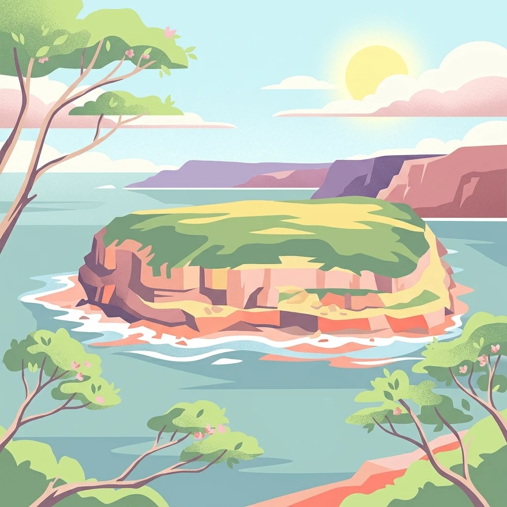
An illustration of a small island with green vegetation and rocky cliffs surrounded by the ocean, viewed from a slightly elevated perspective with foreground trees and a warm sun in the sky.

Bird Island Nature Reserve

Nature reserve

Park overview

Structured park overview, official facts, and landscape profile for Bird Island Nature Reserve

Bird Island Nature Reserve park facts, protected area profile, and essential visitor context

Review the core facts for Bird Island Nature Reserve, including designation, size, terrain, visitor scale, habitats, and operating context in one park-focused overview.

About Bird Island Nature Reserve

Bird Island Nature Reserve is a small but ecologically distinctive protected area situated about 1.4 kilometers off the east coast of New South Wales, near the Central Coast town of Budgewoi and close to Lake Munmorah. Although tiny in size and rarely visited, it represents an unusually intact example of an offshore seabird island in the Tasman Sea, with rocky cliffs, coastal heathland, and rich adjacent marine waters all packed into a roughly circular landmass that does not exceed 260 meters at any point.

The island's geological foundations lie in the Munmorah Conglomerate, a sedimentary unit within the broader Sydney Basin. Several thousand years ago, when post-glacial sea levels were lower, Bird Island was still attached to the Australian mainland; rising seas over the past four to six thousand years subsequently cut it off, producing the steep cliffs and isolation that today make the reserve both difficult to access and ecologically important.

Ecologically, Bird Island Nature Reserve is defined less by dramatic scenery than by its prolific birdlife. Tens of thousands of shearwaters breed on the island, alongside smaller numbers of sooty oystercatchers, terns, storm petrels, egrets, cormorants, and visiting shorebirds such as ruddy turnstone and eastern curlew. Peregrine falcons nest on the island and prey heavily on white-faced storm petrels, creating a natural predator-prey balance. Surrounding waters host reef fish, blue groper, Port Jackson sharks, stingrays, cuttlefish, dolphins, seals, turtles, and migrating humpback whales.

Being classified as a strict nature reserve (IUCN Category Ia) and receiving fewer than ten visitors, the area is managed primarily for conservation and ecological monitoring rather than public access. Together, its isolation, large seabird colonies, predator-prey relationships, and lack of introduced mammals give Bird Island Nature Reserve a strong, focused ecological identity that complements the broader network of NSW national parks and reserves along the Central Coast.

Quick facts and research context for Bird Island Nature Reserve

Bird Island Nature Reserve is a strict nature reserve (IUCN Category Ia) located off the Central Coast of New South Wales, Australia, in the Tasman Sea. It was gazetted in June 1960 and is administered by the NSW National Parks and Wildlife Service.

Geologically, the island is composed of sedimentary rocks of the Munmorah Conglomerate within the Sydney Basin. The reserve is small, roughly circular, not much more than 260 meters at its longest axis, and rises to about 20 meters in height, with steep rocky cliffs making access difficult.

The reserve is significant primarily for its breeding seabird populations, especially wedge-tailed and short-tailed shearwaters, and for the absence of introduced mammals. The waters around the island regularly host dolphins, seals, turtles, and humpback whales on their seasonal migration.

Protection and recognition

Examine the documented conservation scope and administrative management records for Bird Island Nature Reserve.

Bird Island Nature Reserve Protection Status and International Recognition

Bird Island Nature Reserve maintains a documented mixed protection status within regional conservation frameworks. Review official designation records, management scope details, and international recognition facts for this protected natural area.

Protection details

Protection scope
Mixed
Transboundary protection
No
Park context

Deeper park guide and search-rich context for Bird Island Nature Reserve

Bird Island Nature Reserve history, landscape, wildlife, and travel context

Explore Bird Island Nature Reserve through its history, landscape character, ecosystems, wildlife, conservation priorities, cultural context, and seasonal travel timing in a structured park guide built for atlas discovery and search intent.

Why Bird Island Nature Reserve stands out

Bird Island Nature Reserve is most recognized for its huge breeding colonies of seabirds on a tiny, isolated offshore island. Up to 7,000 pairs of wedge-tailed shearwaters and short-tailed shearwaters nest on the island each year, making it one of the significant shearwater breeding sites on the New South Wales coast. The reserve also stands out for the diversity of shorebirds and seabirds that use the island, including threatened species such as the sooty oystercatcher and migratory visitors such as eastern curlew, bar-tailed godwit, whimbrel, red-necked stint, and little tern. The presence of breeding peregrine falcons that prey on white-faced storm petrels adds a notable predator-prey dynamic that draws particular attention from ornithologists. Its combination of difficult-to-access cliffs, the absence of introduced mammals, and the surrounding productive Tasman Sea waters has kept the island in a relatively undisturbed state, giving the reserve an outsized ecological value for such a small area.
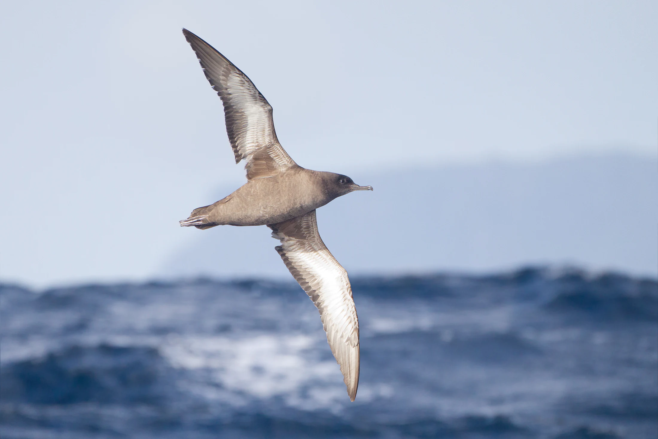
A Sooty Shearwater with brown feathers flying over deep blue ocean waters.
A Sooty Shearwater in flight over the ocean.

Bird Island Nature Reserve history and protected-area timeline

Bird Island Nature Reserve was formally gazetted in June 1960, establishing legal protection over the small offshore island and its associated ecological values. The reserve was created under the New South Wales state reserves system and is now administered by the NSW National Parks and Wildlife Service as a strict nature reserve, a designation that prioritizes conservation over public use.

Although the protected-area status of the island is relatively modern, the island itself is geologically ancient in landscape terms. It was part of the Australian mainland before post-glacial sea-level rise, with rising seas between roughly four and six thousand years ago isolating it as a low, rocky island in the Tasman Sea. This geological separation underpins the ecological character the reserve was later established to protect.

The island also carries a layered human history. It once served as an RAAF bombing range during the Second World War, reflecting its strategic coastal position during that era. Prior to and after its military use, a number of shipwrecks occurred at or near the island, including vessels such as the Adelaide and the Allenwood, leaving the surrounding waters a recognized maritime heritage zone in addition to their ecological importance.

Bird Island Nature Reserve landscape and geographic character

Bird Island Nature Reserve is shaped by its small size, its rocky geology, and its position in the Tasman Sea. The island is roughly circular, with no dimension exceeding about 260 meters, and is built from sedimentary rocks of the Munmorah Conglomerate within the Sydney Basin. These rocks form the island's defining topography: a steep, rugged landform with prominent cliffs that rise approximately 20 meters above sea level.

Because of these cliffs and the surrounding ocean conditions, landing on the island by boat is difficult. This natural inaccessibility has been a major factor in preserving the reserve's ecological values. From the mainland, the island can be viewed from elevated coastal vantage points such as the lighthouse at Norah Head, where it sits offshore as a low, dark profile against the sea.

The surrounding seascape is equally important to the reserve's character. Shallow waters around the island support reef fish and mobile marine species, while the broader Tasman Sea provides a migratory corridor for humpback whales traveling between Antarctica and tropical breeding grounds. The combination of rocky island cliffs, coastal heathland on top, and productive nearshore waters gives the reserve a layered physical setting that is more varied than its tiny footprint suggests.

An aerial view of a small, rocky island covered in green vegetation, surrounded by blue ocean water with white surf breaking against its shoreline.
An aerial perspective of Bird Island, showcasing its isolated coastal geography and surrounding surf.

Bird Island Nature Reserve ecosystems, habitats, and plant life

The ecological character of Bird Island Nature Reserve is defined by its isolation and by the extreme marine influence on every part of the island. Vegetation is restricted to low-growing communities adapted to salt spray, wind exposure, and thin, rocky soils, producing a relatively open plant cover rather than closed forest.

Two main vegetation types are recognized on the island. The first is a low open heathland that includes tree broom heath, a distinctive local form of the Sydney golden wattle, tuckeroo, and coastal tea tree, giving the interior of the island a shrubby, heath-like profile. In more exposed positions, the flora shifts to a salt-tolerant community dominated by pigface, a tussock grass, and a long-stalked form of Lomandra, plants well adapted to the harshest edge environments.

In addition to native vegetation, several weed species have managed to reach the island despite its isolation, including bitou bush, prickly pear, inkweed, and trad. Their presence illustrates how vulnerable even remote islands are to introduced plants, partly because seabird nutrients and nesting activity continually rework the soil. The reserve's ecology is therefore a dynamic balance between well-adapted native coastal flora, opportunistic weeds, and the seasonal rhythms of the surrounding ocean.

Bird Island Nature Reserve wildlife and species highlights

Wildlife is the most prominent ecological feature of Bird Island Nature Reserve. The island hosts no introduced animals and no terrestrial mammals or amphibians, a situation that helps preserve the integrity of its native fauna and concentrates ecological attention on birds and reptiles.

The reserve's most outstanding wildlife values are its seabird colonies. Up to 7,000 pairs of wedge-tailed shearwaters and short-tailed shearwaters breed on the island each season, producing one of the more significant shearwater breeding aggregations on the New South Wales coast. The island also supports the threatened sooty oystercatcher, along with a wide roster of shorebirds and seabirds that includes ruddy turnstone, eastern curlew, whimbrel, bar-tailed godwit, red-necked stint, Arctic jaeger, Caspian tern, common tern, white-fronted tern, white-faced storm petrel, eastern reef egret, little penguin, black cormorant, little black cormorant, white-breasted sea eagle, whistling kite, and little tern.

A pair of peregrine falcons breeds on the island and preys heavily on young white-faced storm petrels, creating a documented top-down effect on one of the petrel colonies. On land, the only recorded reptiles are two lizard types: an unidentified skink and the jacky lizard, an agamid notable locally for an unusual pink mouth. Together, these birds and reptiles form a compact but ecologically meaningful native fauna for an island of this size.

Bird Island Nature Reserve conservation status and protection priorities

Bird Island Nature Reserve is managed as a strict nature reserve under IUCN Category Ia, a classification that gives ecological preservation priority over most other uses and strongly limits human access, infrastructure, and intervention. Fewer than ten visitors are recorded at the reserve, and its difficult-to-access cliffs reinforce this low-impact profile.

The reserve's conservation value rests heavily on its seabird populations. With thousands of breeding pairs of wedge-tailed and short-tailed shearwaters, supported by species such as the threatened sooty oystercatcher, the island represents an important offshore breeding refuge in the New South Wales protected-area system. The presence of breeding peregrine falcons further strengthens its ecological credibility, demonstrating that predator-prey relationships continue to function naturally here.

Conservation management also extends to dealing with invasive plants that have reached the island despite its isolation. Species such as bitou bush, prickly pear, inkweed, and trad are monitored and controlled where possible, including biological control of prickly pear using cochineal insects. The reserve's marine surroundings, used by humpback whales, dolphins, seals, and turtles on migration, add a further conservation dimension, tying the small terrestrial protected area into broader Tasman Sea ecological systems.

Bird Island Nature Reserve cultural meaning and human context

Bird Island Nature Reserve does not have a deeply documented indigenous cultural layer in the available sources, but its setting places it within the traditional Country of Aboriginal peoples of the New South Wales Central Coast. The wider region around Lake Munmorah, Norah Head, and the Central Coast carries Aboriginal heritage significance, though specific cultural associations with the island itself are not detailed in the reference material.

In more recent times, the island has a layered non-indigenous history. It was used as an RAAF bombing range during the Second World War, reflecting its visibility from the mainland and its strategic coastal position. Earlier and later maritime activity in the surrounding waters also left a cultural footprint: a number of shipwrecks occurred at or near Bird Island, including vessels such as the Adelaide and HMAS Allenwood, giving the surrounding sea a recognized shipwreck heritage in addition to its ecological importance. These layered uses illustrate how a small offshore island can accumulate a richer human story than its size alone would suggest.

Top sights and standout views in Bird Island Nature Reserve

The standout features of Bird Island Nature Reserve are its sheer concentration of seabird life on a tiny offshore island, with up to 7,000 pairs of wedge-tailed and short-tailed shearwaters breeding each season alongside a long list of other shorebirds, terns, petrels, and migratory species. The island's status as a strict nature reserve with virtually no visitors keeps this birdlife largely undisturbed.

Equally distinctive is the island's combination of steep sedimentary cliffs, low coastal heathland, and productive Tasman Sea waters that host reef fish, sharks, dolphins, seals, turtles, and migrating humpback whales. The presence of breeding peregrine falcons preying on white-faced storm petrels adds a working predator-prey relationship rarely documented at such a small reserve, while the island's separation from the mainland only four to six thousand years ago gives it both a young geological history and an unusually intact ecological profile.

Best time to visit Bird Island Nature Reserve

Because Bird Island Nature Reserve is a strict nature reserve with very limited access and typically fewer than ten visitors, practical public visitation is restricted, and any visit would be primarily for research, monitoring, or supervised conservation purposes rather than casual tourism. The reserve can usually be observed from the mainland, particularly from the lighthouse area at Norah Head, where elevated views allow clear sightlines to the island offshore.

For ecological interest, late spring through autumn is generally the most dynamic period for seabird activity on the New South Wales coast, when shearwaters are actively breeding and shorebirds are most numerous. Migrating humpback whales typically move along this section of the Tasman Sea during the cooler months, often visible from the mainland as they pass between Antarctic feeding grounds and tropical breeding waters. The reserve's experience, whether visited in person or viewed from the coast, is therefore strongly seasonal, with bird breeding, whale migration, and milder weather each shaping different possibilities for observers.

Monthly climate preview

Long-term representative monthly temperature and precipitation data for New South Wales

Bird Island Nature Reserve Climate Normals and Annual Temperature Rhythm

Bird Island Nature Reserve records measured long-term temperature swings and precipitation baselines across twelve distinct monthly intervals from NASA power archives. Reviewing the comprehensive monthly climate profile provides deep analytical insight into the environmental rhythms shaping this protected landscape.
Annual mean19 °C
14 °C23 °C
Jan23°
Feb23°
Mar22°
Apr20°
May17°
Jun15°
Jul14°
Aug15°
Sep17°
Oct19°
Nov20°
Dec22°
Warmest month
January

23.5 °C

Coolest month
July

14.2 °C

Wettest month
February

4.3 mm/day

Driest month
August

1.8 mm/day

Park location guide

Geography guide, regional context, and park location map for Bird Island Nature Reserve

Bird Island Nature Reserve park geography, regions, and map view in Australia

Understand where Bird Island Nature Reserve sits in Australia through a broader geographic reading of the surrounding landscape, nearby location context, and its mapped position within the national park landscape.

How Bird Island Nature Reserve fits into Australia

Australia is a constitutional monarchy and federal parliamentary democracy comprising six states and ten territories. With a population of nearly 28 million, it is one of the world's most urbanised countries, with most people concentrated on the eastern seaboard. The country has a high Human Development Index and is known for its cultural diversity, ancient Aboriginal heritage, and unique wildlife.

Wider geography shaping Bird Island Nature Reserve in Australia

Australia occupies the entire Australian continent, the island of Tasmania, and numerous smaller islands. It is the world's flattest and driest inhabited continent, featuring vast deserts in the interior (the Outback), tropical rainforests along the eastern coast, and a coastline bordering the Indian and Pacific Oceans.

Map view of Bird Island Nature Reserve

Use this park location map to pinpoint Bird Island Nature Reserve in Australia, understand its exact geographic position, and read its mapped placement within the surrounding landscape more clearly.

Pigeon | © OpenStreetMap contributors

Location context for Bird Island Nature Reserve

New South Wales

Visual exploration of coastal cliffs, marine habitats, and offshore topography

Bird Island Nature Reserve Photos and Landscape Scenery

Visual records capture the rugged topography, steep sedimentary cliffs, and coastal heathland defining Bird Island Nature Reserve. Photographic documentation reveals the isolated marine environment and protected seabird habitats supporting large breeding colonies across the Tasman Sea.

A Sooty Shearwater with brown feathers flying over deep blue ocean waters.

A side-profile shot of a Sooty Oystercatcher with black feathers, a bright red bill, and red eye rings, standing on a rocky surface against a blurred blue background.

An aerial view of a small, rocky island covered in green vegetation, surrounded by blue ocean water with white surf breaking against its shoreline.

Park atlas

Compare nearby coastal reserves and regional protected habitats across the New South Wales coast.

Parks Near Bird Island Nature Reserve and Surrounding Protected Landscapes

Browsing other protected areas near Bird Island Nature Reserve reveals connected coastal ecosystems and regional marine habitats along the Tasman Sea. Comparing these nearby national parks and coastal reserves provides a broader geographic understanding of New South Wales wildlife sanctuaries.
Watercolor painting of a coastal scene with sandy dunes, low green coastal vegetation, and distant hills overlooking a bay.
State or regional parkNew South Wales
About 1.5 km away#1 closest

North

Munmorah State Conservation Area: Coastal Geography and Protected Landscape Atlas

Exploring the dune systems and habitat corridors of the NSW Central Coast

Munmorah State Conservation Area is a protected coastal reserve featuring a complex mosaic of perched sand dunes, beach fronts, and wetland systems. This overview examines the park's structural role within the Tuggerah Important Bird Area, mapping its diverse vegetation zones and significant topographic features that anchor this regional refuge against the urbanized Central Coast of New South Wales.

Area
15.3 km²
Established
1977
IUCN
IV
Relief
Lowland
Protected areaNew South Wales
About 6.2 km away#2 closest

North

Lake Macquarie State Conservation Area: Geography and Protected Landscape Map Details

Coastal lagoon bushland across six protected foreshore sections

Situated along the saltwater shores of a major coastal lagoon in New South Wales, this protected area features a distinctive fragmented design. The reserve safeguards rare coastal forest and wetland vegetation, providing a vital snapshot of the region's original shoreline ecosystem. Through its unique distribution of six shoreline blocks, the park offers significant insight into the interplay between protected bushland and the surrounding developed landscape.

Area
7.6 km²
Established
1996
IUCN
II
Scope
Terrestrial
National parkNew South Wales
About 7.4 km away#3 closest

Southwest

Wyrrabalong National Park National Park: Protected Littoral Rainforest and Coastal Geography

Explore mapped terrain and vital bird habitats in New South Wales.

Wyrrabalong National Park on New South Wales' Central Coast is an essential protected landscape, noted for safeguarding the last significant coastal littoral rainforest of its kind. This park entry details the mapped geography across its peninsula, island, and beachfront sections, revealing a compact yet ecologically rich environment. It highlights the park's importance as part of an Important Bird Area, supporting significant waterbird and woodland bird populations within its protected boundaries, offering a unique glimpse into a vanishing coastal ecosystem.

Area
6.2 km²
Established
1991
IUCN
II
Relief
Lowland
State or regional parkNew South Wales
About 21 km away#4 closest

Northwest

Jilliby State Conservation Area: Geographic Boundaries and Regional Protected Landscapes

Forested hinterland and protected bushland in New South Wales

Jilliby State Conservation Area encompasses a rich bushland environment behind the New South Wales Central Coast. The protected territory features a contrast between ridge-top forests and deep, moisture-rich rainforest gullies. Beyond its natural terrain, the area holds cultural significance and provides a vital habitat for diverse birdlife within the broader regional landscape.

Area
121.59 km²
Scope
Terrestrial
National parkNew South Wales
About 27 km away#5 closest

Northwest

Watagans National Park: National Park Protected Landscape in New South Wales

Explore its mapped boundaries and regional geography.

Watagans National Park stands as a key protected area within New South Wales, Australia. This detail page focuses on its specific role as a national park, offering insights into its mapped geographic boundaries and its place within the regional landscape. Understand the protected natural identity of Watagans National Park through a structured, atlas-informed lens.

Area
77.51 km²
Established
1999
IUCN
II
Climate
Temperate
Watercolor painting of rolling green hills, grassy foreground, and soft, hazy mountains in the background, set against a plain white background.
State or regional parkNew South Wales
About 29 km away#6 closest

North

Glenrock State Conservation Area: Coastal Reserve and Geological Atlas Exploration

Protected coastal landscapes and rare remnant vegetation near Newcastle

Glenrock State Conservation Area encompasses 534 hectares of protected coastline, ranging from steep cliffs and exposed headlands to sheltered forested gullies and lagoon systems. This reserve functions as a critical ecological refuge, housing nationally significant plant communities and unique Permian-aged soil substrates. Its terrain documents both deep geological history and the cultural heritage of the Awabakal people, balanced with early industrial relics that reflect the colonial history of the lower Hunter region.

Area
5.34 km²
Established
1974
Relief
Upland
Climate
Temperate
National parkNew South Wales
About 33 km away#7 closest

Southwest

Brisbane Water National Park: A Protected Landscape in New South Wales' Sydney Basin Bioregion

Explore mapped terrain, endangered ecosystems, and coastal waterway geography.

Brisbane Water National Park, located in New South Wales, Australia, is a vital protected area safeguarding critical ecosystems within the Sydney Basin bioregion. This national park features a diverse landscape encompassing rugged escarpments, fertile valleys, and important coastal waterways. Its protected status makes it a crucial conservation refuge, offering insights into unique natural terrain and regional geography for those seeking detailed, map-centric exploration.

Area
115.06 km²
Established
1959
IUCN
II
Relief
Mixed relief
Nature reserveNew South Wales
About 34 km away#8 closest

North

Blackbutt Reserve: Protected Eucalyptus Woodland and Urban Nature Reserve in Newcastle

Geography and landscape mapping of a New South Wales nature reserve

Blackbutt Reserve stands as a notable 182-hectare nature reserve within Newcastle, New South Wales, protecting a diverse stretch of undulating eucalyptus forest. This protected area serves as an essential green space, offering a unique look at local topography and regenerating woodland ecosystems preserved through decades of community effort.

Area
1.82 km²
Established
1938
Relief
Upland
Climate
Temperate

Common questions about visiting, size, designation, and location context for Bird Island Nature Reserve

Bird Island Nature Reserve FAQs for park facts, access, geography, and protected area context

Find quick answers about Bird Island Nature Reserve, including protected-area facts, park geography, trail and visitor context, and how the park fits into its surrounding country and regional landscape.
MoriAtlas Explorer

Continue Your Protected Areas Search Across the Global Atlas

Deepen your exploration by continuing the structured search for national parks and protected areas worldwide. Utilize the comprehensive filtering capabilities to compare different conservation landscapes and refine your understanding of global park geography. Discover more about the distribution and characteristics of protected natural areas.

Global natural geography