Mori Atlas logo
Marine protected areaBlackwater, Crouch, Roach and Colne Estuaries Marine Conservation Zone

Examining the tidal estuaries, coastal boundaries, and marine habitats of this expansive Essex coastline.

Blackwater, Crouch, Roach and Colne Estuaries Marine Conservation Zone Protected Landscape Atlas

Spanning 284 square kilometers, the Blackwater, Crouch, Roach and Colne Estuaries Marine Conservation Zone represents the largest inshore marine protected area in England. This geographic entity encompasses a complex network of four tidal estuaries, extensive intertidal mudflats, and saltmarshes that are critical for native oyster beds and migrating waterfowl. By mapping the confluence of these tidal rivers with the North Sea coast, this dataset provides a detailed view of the layered conservation landscape across the Essex shoreline.

Marine Conservation ZoneestuariesNorth Sea coastnative oyster bedsintertidal mudflatssaltmarsh

Blackwater, Crouch, Roach and Colne Estuaries Marine Conservation Zone

Marine protected area

Park overview

Structured park overview, official facts, and landscape profile for Blackwater, Crouch, Roach and Colne Estuaries Marine Conservation Zone

Blackwater, Crouch, Roach and Colne Estuaries Marine Conservation Zone park facts, protected area profile, and essential visitor context

Review the core facts for Blackwater, Crouch, Roach and Colne Estuaries Marine Conservation Zone, including designation, size, terrain, visitor scale, habitats, and operating context in one park-focused overview.

About Blackwater, Crouch, Roach and Colne Estuaries Marine Conservation Zone

The Blackwater, Crouch, Roach and Colne Estuaries Marine Conservation Zone is a marine protected area on the coast of Essex in eastern England, covering the tidal waters of four major Essex estuaries and the open coast that links them. At 284 square kilometres, it is the largest inshore Marine Conservation Zone in England, extending from the mean high water mark along the shoreline out towards where the estuary mouths meet the North Sea.

Marine Conservation Zones are a national network of marine areas designated to safeguard particular species and habitats that are nationally important, rare or threatened. They sit within a wider UK effort to create a network of marine protected areas, often described as contributing to the 'UK Blue Belt'. Around 50 such zones have been established in English waters, with designations occurring in several phases beginning in 2013. Within this network, the Blackwater, Crouch, Roach and Colne Estuaries zone stands out both for its size and for the specific features it was created to protect.

The zone was designated for four named features: native oyster (Ostrea edulis) beds to be recovered to favourable condition, native oysters themselves also to be recovered to favourable condition, intertidal mixed sediments to be maintained in favourable condition, and Clacton Cliffs and Foreshore, likewise to be maintained in favourable condition. Its selection reflects years of research by organisations including the Zoological Society of London, Essex Wildlife Trust, the University of Essex and the Blackwater Oysterman's Association, who between 2011 and 2013 compiled the evidence needed to justify the native oyster and oyster bed listings.

The Blackwater is described within the site documentation as the largest tidal river in Essex and one of the largest estuaries in the East of England. The area's ecological value extends well beyond oysters: it encompasses extensive intertidal mudflats and saltmarshes that are important for waterfowl populations, including internationally and nationally significant numbers of species such as Brent Goose and Curlew. The Marine Conservation Zone therefore both adds a new layer of protection and ties together an existing patchwork of overlapping designations across the Essex coast.

Quick facts and research context for Blackwater, Crouch, Roach and Colne Estuaries Marine Conservation Zone

Marine Conservation Zone covering 284 square kilometres along the Essex coast of eastern England, including the Blackwater, Colne, Crouch and Roach estuaries. It is the largest inshore MCZ in England and the only UK MCZ designated specifically for the protection of native oyster beds as a habitat. The zone overlaps with Sites of Special Scientific Interest, the Essex Estuaries Special Area of Conservation and the Mid Essex Coast Special Protection Area.

Protection and recognition

Marine conservation scope and official protected area recognition details

Blackwater, Crouch, Roach and Colne Estuaries Marine Conservation Zone Protection Status

Blackwater, Crouch, Roach and Colne Estuaries Marine Conservation Zone holds a documented marine protection status within regional waters. Official administrative records outline the governance framework and formal conservation designation scope for the protected area.

Protection details

Protection scope
Marine
Transboundary protection
No
Park context

Deeper park guide and search-rich context for Blackwater, Crouch, Roach and Colne Estuaries Marine Conservation Zone

Blackwater, Crouch, Roach and Colne Estuaries Marine Conservation Zone history, landscape, wildlife, and travel context

Explore Blackwater, Crouch, Roach and Colne Estuaries Marine Conservation Zone through its history, landscape character, ecosystems, wildlife, conservation priorities, cultural context, and seasonal travel timing in a structured park guide built for atlas discovery and search intent.

Why Blackwater, Crouch, Roach and Colne Estuaries Marine Conservation Zone stands out

The zone is best known for being England's largest inshore Marine Conservation Zone and for its unique status as the only UK Marine Conservation Zone designated to protect native oyster beds, both the species and the bed habitat itself. It is also recognised for the sheer scale of its estuarine landscape, with tidal mudflats and saltmarshes supporting major waterfowl populations along the North Sea coast. Equally central to its identity is the way the Marine Conservation Zone designation builds on a layered set of existing protections. By overlaying new measures onto Sites of Special Scientific Interest, Special Areas of Conservation and Special Protection Areas, the zone expands the conservation toolkit across an already heavily protected Essex coastal system.

Blackwater, Crouch, Roach and Colne Estuaries Marine Conservation Zone history and protected-area timeline

The Marine Conservation Zone network in English waters grew out of a recommendation process that began in 2011, when 127 potential sites for marine protection were put forward to the UK government. The first 27 Marine Conservation Zones were formally designated in November 2013, with a second tranche of 23 zones added in January 2016, expanding the total sea area protected by the network to 7,886 square miles. Additional phases were expected to continue the expansion of the 'UK Blue Belt' and to build a more comprehensive marine protected area network around the UK.

For the Blackwater, Crouch, Roach and Colne Estuaries zone specifically, the immediate history is tied to the broader Essex conservation work that preceded its designation. Between 2011 and 2013, multiple organisations including the Zoological Society of London, Essex Wildlife Trust, the University of Essex and the Blackwater Oysterman's Association conducted research on the native oyster and its bed habitat in these estuaries. That evidence base supported the inclusion of native oysters and native oyster beds among the features that justified the site's Marine Conservation Zone status, and it continues to inform restoration work under the Essex Native Oyster Restoration Initiative, or ENORI, which operates under the UK's Biodiversity Action Plan framework.

The Marine Conservation Zone itself sits on top of a much older history of estuarine protection in Essex. Sites of Special Scientific Interest, the Essex Estuaries Special Area of Conservation and the Mid Essex Coast Special Protection Area had already classified much of the same estuarine and coastal habitat, and the MCZ designation was intended in part to build upon those existing protections rather than replace them.

Blackwater, Crouch, Roach and Colne Estuaries Marine Conservation Zone landscape and geographic character

The landscape of the Marine Conservation Zone is defined by its estuarine geography. Four distinct tidal estuaries converge along the Essex coast: the Blackwater, often described as the largest tidal river in Essex and one of the largest estuaries in the East of England; the Colne; and the closely linked Crouch and Roach estuaries. These tidal river systems shape broad expanses of intertidal mudflat and saltmarsh that are alternately covered and exposed by the tides, creating wide open coastal flats fringed by vegetated marsh habitats.

Between and beyond the estuaries, the zone includes a stretch of open North Sea coast that links the estuary mouths together. The northern extent of the coastal section is anchored by Clacton Cliffs and Foreshore, a designated feature of the zone that combines eroding coastal cliffs with the foreshore environment at their base. Together with the soft-sediment intertidal areas, this coastline gives the zone a varied physical setting, moving from low-energy sheltered tidal flats within the estuaries to more exposed beach and cliff scenery along the outer coast.

Viewed at the scale of the zone, the result is a continuous interconnected seascape of channels, mudflats, saltmarshes and coastal frontage, bounded on the seaward side by the North Sea and on the landward side by the mean high water mark that forms the inner limit of the designation.

Blackwater, Crouch, Roach and Colne Estuaries Marine Conservation Zone ecosystems, habitats, and plant life

Ecologically, the zone functions as a major estuarine and coastal habitat complex, bringing together intertidal mudflat, saltmarsh, estuarine channel, soft coastline and cliff-and-foreshore environments within a single marine designation. The intertidal mixed sediments that the zone was specifically designated to maintain in favourable condition form one of the defining substrate types, providing important habitat for a range of invertebrates and the fish and birdlife that depend on them.

Saltmarshes and mudflats of this scale play a central role in estuarine ecology, supporting dense populations of marine invertebrates that in turn underpin the food webs of both fish and overwintering waterfowl. Within this wider habitat mosaic, the native oyster and its associated bed habitat occupy a particularly distinctive ecological role, creating complex three-dimensional reef-like structures that other estuarine species can associate with.

Blackwater, Crouch, Roach and Colne Estuaries Marine Conservation Zone wildlife and species highlights

The marine and estuarine zone supports a rich waterfowl community, with populations of Brent Goose and Curlew highlighted as being of international and national importance within the site's existing overlapping designations. These birds rely on the wide intertidal mudflats and saltmarshes for feeding, particularly during the winter months when estuaries of this kind across eastern England host very large aggregations of migratory and resident waterfowl.

Native oysters (Ostrea edulis) form the headline marine species interest for the Marine Conservation Zone, both through the species itself and through the reef-like habitat created by oyster beds. The site is the only Marine Conservation Zone in the United Kingdom selected specifically for the protection of native oyster beds as a habitat. A wide range of other estuarine species, including the broader invertebrate fauna of the intertidal mixed sediments, contributes to the overall wildlife character of the zone.

Blackwater, Crouch, Roach and Colne Estuaries Marine Conservation Zone conservation status and protection priorities

The conservation significance of the Blackwater, Crouch, Roach and Colne Estuaries Marine Conservation Zone lies in both its scale and the rare combination of features it protects. It is England's largest inshore Marine Conservation Zone and the only MCZ in the United Kingdom specifically designated for native oyster bed habitat, making it uniquely important within the national marine conservation network for that feature alone. Native oyster beds, both as habitat and as the living species they support, are listed as features to be recovered to favourable condition.

In addition, the zone protects intertidal mixed sediment habitats and the Clacton Cliffs and Foreshore, both of which are intended to be maintained in favourable condition. The site overlays a dense cluster of existing conservation designations, including multiple Sites of Special Scientific Interest, the Essex Estuaries Special Area of Conservation and the Mid Essex Coast Special Protection Area. Together, these overlapping layers protect extensive mudflats and saltmarshes that support internationally and nationally important waterfowl numbers.

Active conservation work continues within and around the zone. The Essex Native Oyster Restoration Initiative (ENORI), operating within the framework of the UK's Biodiversity Action Plan, is working to restore native oysters and the oyster bed habitat that the zone was created to protect. The Marine Conservation Zone designation itself adds an additional layer of protection to these existing efforts and aims to ensure that the native oyster, its bed habitat, the intertidal sediments and the Clacton coastal feature are managed to favourable condition over time.

Blackwater, Crouch, Roach and Colne Estuaries Marine Conservation Zone cultural meaning and human context

Human use of the Blackwater, Crouch and Roach estuaries has long centred on traditional shellfish harvesting, an economic and cultural activity that continues to give the estuary communities a distinct coastal identity. The presence of the Blackwater Oysterman's Association among the organisations that contributed to the scientific evidence base for the zone reflects how closely the area's working maritime traditions are tied to its conservation story.

Along the outer coast, the Clacton foreshore carries its own heritage associations through the seaside towns and beaches that developed along this part of Essex in the nineteenth and twentieth centuries. Communities around these estuaries have historically combined fishing, shellfishing and tourism with the management of a heavily protected coastal environment, and the Marine Conservation Zone adds a contemporary layer to that long-standing relationship between people and the Essex shore.

Top sights and standout views in Blackwater, Crouch, Roach and Colne Estuaries Marine Conservation Zone

England's largest inshore Marine Conservation Zone at 284 square kilometres, spanning four major Essex estuaries and the open North Sea coast between them. The only UK Marine Conservation Zone designated for the protection of native oyster beds as a habitat, making it uniquely important within the national marine conservation network. Overlaps with Sites of Special Scientific Interest, the Essex Estuaries Special Area of Conservation and the Mid Essex Coast Special Protection Area, combining multiple layers of protection across the same estuarine landscape. Supports internationally and nationally important populations of waterfowl, including Brent Goose and Curlew, on extensive mudflats and saltmarshes.

Best time to visit Blackwater, Crouch, Roach and Colne Estuaries Marine Conservation Zone

The character of the Essex coast within this zone shifts with the seasons in ways that are typical of large temperate estuaries. Winter is generally the most significant period for wildlife interest, when large numbers of migratory and overwintering waterfowl, including Brent Geese and Curlew, gather on the exposed mudflats and saltmarshes as the tides uncover rich feeding grounds. Spring and autumn can offer transition periods, while summer tends to bring more vegetated saltmarsh and active coastal towns along the outer coast. Tide state also strongly shapes any shoreline experience, with low water revealing the full extent of the mudflats and high water reducing them to narrow fringes along the channels.
Monthly climate preview

Long-term monthly temperature and precipitation rhythm from representative coordinates

Blackwater, Crouch, Roach and Colne Estuaries Marine Conservation Zone Climate Normals

Representative measurements reveal the annual temperature variation and monthly precipitation patterns recorded across a thirty-year climatology period. Detailed twelve-month records provide complete context for long-term averages without relying on live forecasts.
Annual mean11 °C
6 °C18 °C
Jan
Feb
Mar
Apr
May12°
Jun15°
Jul17°
Aug18°
Sep16°
Oct13°
Nov10°
Dec
Warmest month
August

17.7 °C

Coolest month
February

5.5 °C

Wettest month
November

2.6 mm/day

Driest month
April

1.4 mm/day

Park location guide

Geography guide, regional context, and park location map for Blackwater, Crouch, Roach and Colne Estuaries Marine Conservation Zone

Blackwater, Crouch, Roach and Colne Estuaries Marine Conservation Zone park geography, regions, and map view in United Kingdom

Understand where Blackwater, Crouch, Roach and Colne Estuaries Marine Conservation Zone sits in United Kingdom through a broader geographic reading of the surrounding landscape, nearby location context, and its mapped position within the national park landscape.

How Blackwater, Crouch, Roach and Colne Estuaries Marine Conservation Zone fits into United Kingdom

The United Kingdom is a parliamentary constitutional monarchy located in northwestern Europe, consisting of four constituent countries: England, Scotland, Wales, and Northern Ireland. As a major global power with over 69 million residents, it maintains significant international influence in politics, economics, and culture.

Wider geography shaping Blackwater, Crouch, Roach and Colne Estuaries Marine Conservation Zone in United Kingdom

The United Kingdom is an island nation located in northwestern Europe, surrounded by the Atlantic Ocean, North Sea, English Channel, Celtic Sea, and Irish Sea. It shares a land border with the Republic of Ireland to the west. The territory includes the island of Great Britain, the northeastern portion of Ireland, and most of the smaller British Isles islands.

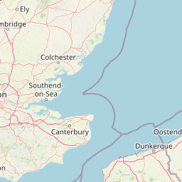
Map view of Blackwater, Crouch, Roach and Colne Estuaries Marine Conservation Zone

Use this park location map to pinpoint Blackwater, Crouch, Roach and Colne Estuaries Marine Conservation Zone in United Kingdom, understand its exact geographic position, and read its mapped placement within the surrounding landscape more clearly.

Pigeon | © OpenStreetMap contributors

Location context for Blackwater, Crouch, Roach and Colne Estuaries Marine Conservation Zone

Essex
Park atlas

Compare adjacent coastal protected areas and regional estuarine landscapes

Parks Near Blackwater, Crouch, Roach and Colne Estuaries Marine Conservation Zone

Browse protected areas and coastal landscapes situated near Blackwater, Crouch, Roach and Colne Estuaries Marine Conservation Zone. Comparing adjacent estuarine reserves reveals broader patterns in regional marine conservation and tidal geography.
Nature reserveEssex
About 6.2 km away#1 closest

North

Colne Estuary Nature Reserve: Geography and Protected Landscapes of the Essex Coast

Coastal wetlands, saltmarsh zones, and geological formations

Colne Estuary represents a massive tidal landscape in Essex characterized by the interaction between fluvial and marine systems. Covering over 2,900 hectares, this site protects diverse habitats including intertidal mudflats, active saltmarshes, and transitional zones that support wintering waterbirds. The area remains a key reference for studying coastal accretion and Quaternary geology in the East of England.

Area
29.152 km²
Established
1989
Relief
Lowland
Climate
Temperate
A soft watercolor illustration showing rolling green hills and wetlands against a light, pale sky.
Nature reserveEssex
About 13 km away#2 closest

Northwest

Abberton Reservoir: Mapped Landscape and Protected Area Context in Essex, England

Freshwater reservoir, wetland, and historic site

Abberton Reservoir stands as a landmark of regional geography in Essex. This entry maps the site's transition from an engineered water-supply facility to a mosaic of reedbeds, marshes, and open water, providing essential habitat for migratory wildfowl and wintering bird populations.

Area
7 km²
Established
1939
Relief
Lowland
Climate
Temperate
Nature reserveSuffolk
About 46 km away#3 closest

Northeast

Martlesham Wilds Nature Reserve: Suffolk Wetland and Protected Landscape Geography

Examining the ecological corridor along the River Deben estuary

Martlesham Wilds represents a significant lowland rewilding effort in eastern England. The 117 hectare reserve, managed by the Suffolk Wildlife Trust, creates a vital connection between ancient woodlands, tidal marshes, and freshwater wetland scrapes. Explore the geographic layout and protected boundaries of this developing sanctuary on the Deben Estuary.

Area
1.17 km²
Established
2023
Relief
Lowland
Climate
Temperate
Watercolor painting showing grassy wetlands and distant hills with a sunset sky
National parkUnited Kingdom
About 87 km away#4 closest

Northeast

The Broads National Park: Wetland Landscape, Rivers, and Regional Geography Atlas

Explore mapped waterways and protected reedbed ecosystems.

The Broads National Park offers a singular protected wetland landscape with over 200 kilometers of navigable waterways across its numerous shallow lakes, or 'broads.' Shaped by medieval peat excavations and natural processes, this area presents a unique geography of reedbeds and grazing marshes, punctuated by historic windmills. Discover the mapped extent of this protected landscape, its river systems, and its vital role in regional geography through structured atlas data.

Area
303 km²
Established
1989
IUCN
V
Relief
Lowland
A horizontal watercolor painting showing a soft landscape with green vegetation, pink accents, and a winding body of water leading towards distant hills.
Nature reserveFrance
About 107 km away#5 closest

Southeast

Réserve naturelle régionale du mont de Couple: Protected Chalk Escarpment and Coastal Viewpoint

A limestone ridge sanctuary in the northern French Boulonnais region

Spanning a rare chalk cuesta in northern France, this protected area balances ecological conservation with distinct geological features. The reserve provides critical habitat for orchids and protected flora while serving as a strategic viewpoint across the Straits of Dover and the surrounding Opal Coast terrain.

Area
0.136 km²
Established
1997
Relief
Upland
Climate
Temperate
Nature reserveSurrey
About 108 km away#6 closest

West

Wraysbury Reservoir: An Engineered Nature Reserve and Vital Wetland Habitat in Surrey

Examining infrastructure, ecology, and sonar testing geography.

Wraysbury Reservoir stands as a unique example of late-twentieth-century industrial landscape design, serving as both a primary London water resource and a protected Ramsar wetland. Its earthen embankments enclose a specialized environment where sonar research and ecological conservation coexist within the wider context of the Thames Valley. This record details the site's boundaries, its function as a wintering bird refuge, and its specialized role in UK marine testing.

Area
2.05 km²
Established
1970
Relief
Lowland
Climate
Temperate
A horizontal watercolor painting showing a soft coastal scene with rolling dunes, sparse grasses, and a calm shoreline under a light sky.
Nature reservePas-de-Calais
About 108 km away#7 closest

Southeast

Réserve naturelle nationale du Platier d'Oye: Protected Coastal Landscape and Wetland Geography

Coastal dunes and migratory bird habitats in Pas-de-Calais

Located along the Opal Coast, the Réserve naturelle nationale du Platier d'Oye represents a complex mosaic of tidal flats, mobile sand dunes, and humid polder meadows. This protected area offers unique insight into the ecological intersection of maritime forces and terrestrial environments, functioning as a primary staging ground for diverse migratory species within the Hauts-de-France coastal region.

Area
3.91 km²
Established
1987
IUCN
IV
Relief
Lowland
Nature reserveHauts-de-France
About 110 km away#8 closest

Southeast

Réserve naturelle régionale de la forteresse de Mimoyecques: Regional Nature Reserve Geography

Protected subterranean habitat and wartime heritage in Hauts-de-France.

Located in the rolling lowlands of the Pas-de-Calais, the Réserve naturelle régionale de la forteresse de Mimoyecques is a uniquely managed protected area. Its landscape integrates historical military architecture with modern biodiversity conservation, focusing on the protection of rare underground roosting environments for diverse bat species within the regional Hauts-de-France terrain.

Area
0.016 km²
Established
2012
Relief
Lowland
Climate
Temperate

Common questions about visiting, size, designation, and location context for Blackwater, Crouch, Roach and Colne Estuaries Marine Conservation Zone

Blackwater, Crouch, Roach and Colne Estuaries Marine Conservation Zone FAQs for park facts, access, geography, and protected area context

Find quick answers about Blackwater, Crouch, Roach and Colne Estuaries Marine Conservation Zone, including protected-area facts, park geography, trail and visitor context, and how the park fits into its surrounding country and regional landscape.
MoriAtlas Explorer

Continue Your Protected Areas Search Across the Global Atlas

Deepen your exploration by continuing the structured search for national parks and protected areas worldwide. Utilize the comprehensive filtering capabilities to compare different conservation landscapes and refine your understanding of global park geography. Discover more about the distribution and characteristics of protected natural areas.

Global natural geography