

Mori Atlas logo
Wildlife reserveBosques Nublados de Udima Wildlife Refuge

Explore the dramatic mountain escarpment and ecological transitions of this protected Peruvian wildlife reserve.

Bosques Nublados de Udima Wildlife Refuge: Protected Andean Cloud Forest and River Headwaters

(Refugio de Vida Silvestre Bosques Nublados de Udima)

Bosques Nublados de Udima Wildlife Refuge spans over 12,000 hectares across the western Andean slopes of Peru, acting as a critical bridge between coastal desert and Amazonian ecosystems. This protected landscape preserves the headwaters of the Zaña River and includes significant pre-Columbian archaeological sites, such as the Poro Poro ruins and ancient irrigation canals. Its steep topography and vertical gradient create a unique environment where Amazonian species thrive on the Pacific side of the Andes.

cloud forestAndean cloud forestwestern Andesmountain escarpmentriver headwatersZaña River basin

Bosques Nublados de Udima Wildlife Refuge

Wildlife reserve

Park overview

Structured park overview, official facts, and landscape profile for Bosques Nublados de Udima Wildlife Refuge

Bosques Nublados de Udima Wildlife Refuge park facts, protected area profile, and essential visitor context

Review the core facts for Bosques Nublados de Udima Wildlife Refuge, including designation, size, terrain, visitor scale, habitats, and operating context in one park-focused overview.

About Bosques Nublados de Udima Wildlife Refuge

Bosques Nublados de Udima Wildlife Refuge occupies one of the most ecologically unusual positions in Peru: a steep Andean escarpment where cloud forests cling to slopes between roughly 2,000 and 3,000 metres in elevation, overlooking the dry Pacific lowlands and the cultivated Zaña valley. The refuge was created in 2011 within a larger Reserved Zone first recognized in 2010, reflecting the Peruvian government's growing recognition of how distinctive these forests are.

Geographically, the refuge is mostly concentrated in the headwaters of the Zaña River, with smaller non-contiguous parcels along the Chancay River and around the archaeological site of Poro Poro. The main section sits on a dramatic escarpment that drops more than 1,000 metres from a dissected plateau down to the Zaña River, creating the rough terrain in which the protected cloud forest has persisted.

Ecologically, the refuge holds a transitional ecosystem that is neither purely coastal desert nor Amazon rainforest, nor typical high Andes. Because the Andes are relatively low in this part of northern Peru, species more commonly associated with the Amazon basin reach the western, Pacific-facing slopes, giving the area its semi-tropical character and its special conservation significance.

The refuge also carries a strong cultural and hydrological dimension. The Zaña River, which begins in these forests, flows west to the Pacific and irrigates farmland in the valley below, notably sugar cane cultivation centered on the town of Zaña. Nearby, the Zaña valley contains numerous pre-Columbian ruins and the oldest known irrigation canals in the Americas, making the refuge a meeting point of natural heritage and ancient agricultural ingenuity.

Quick facts and research context for Bosques Nublados de Udima Wildlife Refuge

Bosques Nublados de Udima Wildlife Refuge is a Peruvian protected area of about 12,183 hectares administered by SERNANP under IUCN Category IV. It spans the Cajamarca and Lambayeque regions on the western Andean slopes, with most of its territory inside the Catache District of Santa Cruz Province in Cajamarca.

Its defining feature is a band of semi-tropical cloud forest perched between roughly 2,000 and 3,000 metres in elevation, an unusual ecological zone where Amazonian species reach the Pacific side of the Andes. The refuge also encompasses the upper Zaña River basin and protects the pre-Columbian archaeological site of Poro Poro and surrounding canal systems.

Protection and recognition

Examining documented terrestrial protection parameters and official designation records

Bosques Nublados de Udima Wildlife Refuge Protection Status and Designation History

Terrestrial protection status for Bosques Nublados de Udima Wildlife Refuge highlights formal designation history established in 2011. Structured conservation records outline the documented management scope and territorial framework without international recognition overlays.

Protection details

Protection scope
Terrestrial
Designated year
2011
Transboundary protection
No
Park context

Deeper park guide and search-rich context for Bosques Nublados de Udima Wildlife Refuge

Bosques Nublados de Udima Wildlife Refuge history, landscape, wildlife, and travel context

Explore Bosques Nublados de Udima Wildlife Refuge through its history, landscape character, ecosystems, wildlife, conservation priorities, cultural context, and seasonal travel timing in a structured park guide built for atlas discovery and search intent.

Why Bosques Nublados de Udima Wildlife Refuge stands out

The refuge is best known for protecting a rare Andean cloud forest belt that brings Amazonian plant and animal species to the western slopes of the Peruvian Andes. It is also recognized for sheltering the headwaters of the Zaña River and for preserving ancient pre-Columbian irrigation canals in the valley below.

Bosques Nublados de Udima Wildlife Refuge history and protected-area timeline

The history of Bosques Nublados de Udima Wildlife Refuge is closely tied to a growing recognition of how unusual these cloud forests are within Peru's broader ecological mosaic. In 2010, the Peruvian government created the larger Reserved Zone of Udima, covering roughly 30,503 hectares, as a way to formally acknowledge the ecological importance of the forests straddling the Cajamarca and Lambayeque regions.

The following year, on 21 July 2011, the reserved zone was reorganized and a core area of more than 12,000 hectares was carved out and formally designated as the Bosques Nublados de Udima Wildlife Refuge. It is now administered by SERNANP, Peru's national service of natural areas protected by the state, under an IUCN Category IV framework focused on habitat and species management.

While the formal protected area is relatively recent, the cultural landscape around it is far older. The Zaña River valley below the refuge hosts some of the earliest known irrigation canals in the Americas, dated to around 3400 BCE and possibly as old as 4700 BCE, marking this region as one of the cradles of organized agriculture in South America.

Bosques Nublados de Udima Wildlife Refuge landscape and geographic character

The landscape of Bosques Nublados de Udima Wildlife Refuge is defined by a steep and dramatic escarpment on the western slopes of the Andes. The main section sits on slopes descending from a dissected plateau, dropping more than 1,000 metres down to the Zaña River. Elevations across the refuge range roughly from 2,000 metres to a high point of 3,367 metres, producing a varied terrain of ridges, ravines, and forested gullies.

Outside the main block, the refuge includes smaller non-contiguous sections along the Chancay River and around the archaeological site of Poro Poro, extending the protected footprint into adjacent valleys. The village of Udima, formerly Hacienda Udima at about 2,365 metres, lies near the refuge's edge, with the cultivated and irrigated Zaña valley stretching out below toward the Pacific coast.

Where the escarpment meets the valley, the topography transitions sharply from wet, forested highlands into the drier agricultural lowlands, giving the refuge a striking vertical gradient that compresses several climate zones into a relatively short horizontal distance.

Bosques Nublados de Udima Wildlife Refuge ecosystems, habitats, and plant life

The ecosystem at the heart of Udima is an Andean cloud forest, a semi-tropical forest type found above about 2,000 metres in elevation that depends on persistent cloud cover and high humidity. Within the refuge, these forests flourish on steep slopes where moisture from the Pacific-facing slopes condenses into mists that feed both vegetation and the rivers below.

Ecologically, the refuge sits at a major transition zone. To the west lie the arid and semi-arid landscapes of coastal Peru, while to the east stretch the rainforests of the Amazon basin. Because the Andes in this stretch of northern Peru are relatively low, the ecological barrier between the two regions is permeable, allowing plant and animal species more typical of Amazonian forests to appear on the western slopes. This overlap produces a distinctive mixed flora and fauna that gives the refuge its semi-tropical character.

The forests also serve as a hydrological anchor for the surrounding region. The cloud-covered slopes capture and slowly release moisture, feeding the headwaters of the Zaña River, which flows westward toward the Pacific and supports irrigation in the valley below.

Bosques Nublados de Udima Wildlife Refuge wildlife and species highlights

Bosques Nublados de Udima Wildlife Refuge supports the wildlife communities of Andean cloud forest, an ecosystem where east-and-west Andean faunas overlap. Because the Andes are relatively low here, species that are more typically associated with the Amazon basin reach the western, Pacific-facing slopes of northern Peru, giving the refuge an unusual mix of forest-dwelling birds, mammals, and smaller fauna more characteristic of eastern Peru's rainforest.

The combination of rugged terrain, persistent moisture from cloud cover, and a broad elevation gradient provides varied habitats for cloud-forest birds and mammals, as well as for the plant communities on which they depend. While the refuge is relatively new and detailed species inventories are still developing, its geographic position makes it a significant zone for understanding how Amazonian and Pacific-slope wildlife interact across the northern Andes.

Bosques Nublados de Udima Wildlife Refuge conservation status and protection priorities

The conservation significance of Bosques Nublados de Udima Wildlife Refuge lies in its protection of a rare transitional ecosystem between the dry Pacific coast and the Amazon basin. By designating the area under IUCN Category IV, Peru has placed it in a framework specifically intended for managing habitats and species rather than for strict wilderness preservation, making it a working conservation landscape that also provides ecosystem services to surrounding communities.

The refuge's forests are the headwaters of the Zaña River, which supplies irrigation water to agricultural lands downstream, especially sugar cane cultivation centered on the town of Zaña. Protecting these forested slopes is therefore directly tied to securing long-term water supply for one of the region's key farming valleys, elevating the refuge's importance beyond biodiversity alone.

The refuge's creation in 2011 within the prior Reserved Zone of Udima reflects an effort to lock in protection for forests that were already recognized as ecologically distinctive in 2010. By carving out a more compact core area, SERNANP has prioritized the escarpment and river headwaters that contain the most concentrated cloud forest habitat and the most critical hydrological functions.

Bosques Nublados de Udima Wildlife Refuge cultural meaning and human context

Although the refuge itself focuses on natural ecosystems, its surroundings carry deep cultural layers. The Zaña River valley, which the refuge overlooks, is one of the most archaeologically significant landscapes in Peru. It contains numerous pre-Columbian sites and, notably, irrigation canals dated to around 3400 BCE that are considered among the oldest known in the Americas, with some evidence pushing their origins back toward 4700 BCE.

Within the refuge, the small non-contiguous section around Poro Poro specifically preserves an archaeological site, integrating cultural heritage protection into the ecological reserve. Nearby, the village of Udima, formerly Hacienda Udima, reflects the longer history of human settlement and agricultural land use on the lower forested slopes. Together, these features frame the refuge as a landscape where pre-Columbian ingenuity and modern conservation overlap.

Top sights and standout views in Bosques Nublados de Udima Wildlife Refuge

Bosques Nublados de Udima Wildlife Refuge stands out for combining three rare qualities in a single protected area: an Andean cloud forest belt that hosts Amazonian species on the Pacific side of the Andes, the headwaters of the Zaña River that sustain an important agricultural valley, and pre-Columbian archaeological sites including the Poro Poro ruins and some of the oldest irrigation canals in the Americas.

Its dramatic escarpment, dropping more than 1,000 metres from plateau to river, and its position between coastal desert and Amazon rainforest, make it a particularly vivid example of ecological compression in northern Peru.

Best time to visit Bosques Nublados de Udima Wildlife Refuge

The cloud forests of Udima depend on persistent humidity and mist, conditions that fluctuate seasonally across the western Peruvian Andes. Periods of stronger moisture tend to bring richer moss and epiphyte growth, lusher stream flow, and more active vocalization from forest birds, while drier intervals yield clearer views across the escarpment and toward the Zaña valley below.

Because the refuge spans elevations from roughly 2,000 metres to over 3,300 metres, temperatures and atmospheric conditions vary across the protected area. Visitors generally experience cooler, mistier conditions higher on the escarpment, and warmer, drier conditions near the agricultural lowlands and the village of Udima. Any visit should be planned with attention to the moisture-dependent character of the cloud forest itself, which is most atmospheric when the forest is regularly wrapped in fog rather than on the clearest, driest days.

Monthly climate preview

Long-term monthly temperature and precipitation data sampled at a representative coordinate

Bosques Nublados de Udima Wildlife Refuge Annual Climate Normals And Temperature Patterns

Representative coordinates at 2,749 meters elevation record stable monthly mean temperatures between 13.7 °C and 15.1 °C alongside distinct precipitation rhythms across the year. Reviewing the complete twelve-month climatology profile provides deeper insight into measured baseline temperature ranges and precipitation variations.
Annual mean14 °C
14 °C15 °C
Jan14°
Feb14°
Mar14°
Apr14°
May14°
Jun14°
Jul14°
Aug15°
Sep15°
Oct15°
Nov14°
Dec14°
Warmest month
September

15.1 °C

Coolest month
July

13.8 °C

Wettest month
March

2.7 mm/day

Driest month
August

0.1 mm/day

Park location guide

Geography guide, regional context, and park location map for Bosques Nublados de Udima Wildlife Refuge

Bosques Nublados de Udima Wildlife Refuge park geography, regions, and map view in Peru

Understand where Bosques Nublados de Udima Wildlife Refuge sits in Peru through a broader geographic reading of the surrounding landscape, nearby location context, and its mapped position within the national park landscape.

How Bosques Nublados de Udima Wildlife Refuge fits into Peru

Peru is a megadiverse country in western South America with a population of over 34 million. It spans three distinct geographic regions: the Pacific coastal desert in the west, the Andes mountains running north to south, and the Amazon rainforest in the east. The country has one of the longest histories of civilization in the world, tracing back to the Caral-Supe civilization of the 10th millennium BCE, and was home to the Inca Empire before Spanish colonization in the 16th century.

Wider geography shaping Bosques Nublados de Udima Wildlife Refuge in Peru

Peru is located in western South America along the Pacific coast. The country encompasses three major geographic regions: the coastal desert plains along the Pacific, the Andes mountain range extending from north to southeast, and the Amazon basin rainforest in the eastern interior. It shares borders with Ecuador and Colombia to the north, Brazil to the east, Bolivia to the southeast, and Chile to the south.

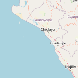
Map view of Bosques Nublados de Udima Wildlife Refuge

Use this park location map to pinpoint Bosques Nublados de Udima Wildlife Refuge in Peru, understand its exact geographic position, and read its mapped placement within the surrounding landscape more clearly.

Pigeon | © OpenStreetMap contributors

Location context for Bosques Nublados de Udima Wildlife Refuge

CajamarcaLambayeque
Recorded earthquake history

View Recorded Seismic Activity Near Bosques Nublados de Udima Wildlife Refuge

Browse the documented seismic history for the Bosques Nublados de Udima Wildlife Refuge. This MoriAtlas collection offers a clear, data-focused look at recorded earthquakes in the region, providing historical context for the landscape's geographic position within the northern Peruvian Andes.

Bosques Nublados de Udima Wildlife Refuge Earthquake History

Catalogued events

6 events

Strongest magnitude

Magnitude 4.9

Most recent event

Jun 22, 2023

This history includes earthquakes recorded inside the park or within 50 km of its borders

Park atlas

Compare surrounding Andean terrain and regional protected areas in northern Peru

Parks Near Bosques Nublados de Udima Wildlife Refuge and Related Protected Landscapes

Browse nearby national parks and protected areas sharing the complex mountain escarpments of northern Peru. Regional park comparison reveals broader ecological patterns across the western slopes of the Andes.
Protected areaCajamarca Region
23 km away#1 closest

North

Pagaibamba Protection Forest: Geography and Protected Area Landscape Analysis

Highland Watershed Protection in the Cajamarca Andes

Pagaibamba Protection Forest represents a key protected land entity in northern Peru. Focused on maintaining the local water cycle, the area showcases dense cloud forest vegetation and steep Andean terrain. Use this mapping data to analyze its ecological boundaries, watershed significance, and regional landscape context in the Cajamarca department.

Area
20.784 km²
Established
1987
IUCN
VI
Relief
Mountain
Wildlife reserveLambayeque Region
38 km away#2 closest

Northwest

Laquipampa Wildlife Refuge: Geography and Protected Area Map of Northern Peru

Tracing the tropical dry forest boundaries of the Lambayeque Region

Laquipampa Wildlife Refuge stands as a critical protected landscape within the Lambayeque Region, preserving rare tropical dry forest ecosystems along the western Andean foothills. The refuge features a unique vertical gradient, ranging from exposed dry-forest slopes to moist highland ravines. Use this atlas resource to understand the park's mapped boundaries, diverse terrain, and central role in regional conservation.

Area
113.47 km²
Established
2006
IUCN
IV
Visitors
2K annual
National parkCajamarca Region
53 km away#3 closest

North

Cutervo National Park: Peru's Oldest National Park Atlas and Protected Landscape

Andean Montane Forests and Mapped Geography of a Pioneering Protected Area

As Peru's oldest national park, established in 1961, Cutervo National Park offers a unique glimpse into the protected geography of the northern Peruvian Andes. Located in the Cajamarca Region, it preserves diverse Andean montane forests and páramo grasslands across a significant elevation gradient from 1,550 to 3,500 meters. This page details the park's landscape, including its role as a headwater conservation area and its position within a critical South American ecoregion, providing rich context for geographic and protected-area exploration.

Area
82.14 km²
Established
1961
IUCN
II
Relief
Mountain
Wildlife reserveCajamarca Region
71 km away#4 closest

Southeast

Sunchubamba Game Reserve: Geographic Overview of Protected Andean Landscapes in Northern Peru

Examining dry forest ecosystems and managed habitat in the Cajamarca Region

Explore the unique environmental footprint of Sunchubamba Game Reserve, a protected area in northern Peru characterized by its blend of native dry forests and non-native tree plantations. This record details the reserve as a historical hacienda site that now serves as an important study in land-use, wildlife management, and the evolution of Andean highland conservation practices.

Area
597.35 km²
Established
1977
IUCN
VI
Relief
Mountain
Wildlife reserveAmazonas Region
156 km away#5 closest

Northeast

Chayu Nain Communal Reserve: Mapped Protected Landscapes and Regional Geography in Peru

Andes to Amazon ecological transition zone in the Amazonas region

Chayu Nain Communal Reserve functions as a critical stronghold for endemic wildlife and represents a major achievement in communal conservation. Its sandstone geology and elevational gradients create a distinct terrain that sustains rare primate populations, lowland tapirs, and complex forest mosaic habitats in northern Peru.

Area
235.98 km²
Established
2009
IUCN
VI
Relief
Upland
A watercolor illustration of layered green hills and distant mountain ridgelines, depicted in soft pastel tones against a white background.
Nature reserveSan Martin
172 km away#6 closest

Northeast

Alto Mayo Protection Forest: Geographic Boundaries and Andean Slope Landscape Mapping

Protected watershed and cloud forest in San Martin, Peru

Spanning the eastern Andes, Alto Mayo Protection Forest functions as a foundational watershed for the Mayo River basin. This reserve preserves significant cloud forest habitats and high-gradient terrain, serving as an important link between Andean highlands and the Amazonian lowlands. Study the topographic features, hydrological network, and protected boundaries that define this crucial Peruvian wilderness.

Area
1,820 km²
Established
1987
IUCN
VI
Relief
Mountain
National parkSan Martín Region
180 km away#7 closest

Southeast

Rio Abiseo National Park: Peru's Protected Landscape Identity and Geographic Context

Discover the mapped boundaries and regional atlas information.

Investigate Rio Abiseo National Park, a designated national park situated within the San Martín Region of Peru. This detailed entry focuses on its protected landscape characteristics and its specific geographic placement. Understand the park's mapped boundaries and its role in the broader atlas of protected areas, offering a structured approach to geographic discovery.

Area
2,745.2 km²
Established
1983
IUCN
II
Relief
Mountain
National parkZamora Chinchipe
199 km away#8 closest

North

Yacurí National Park: Protected Andean Lakes and Volcanic Landscape in Zamora Chinchipe

Discover highland geography and the ancient Inca Trail.

Yacurí National Park is a key protected landscape in Ecuador's southern Andes, celebrated for its remarkable collection of over 46 high-altitude lakes set within dramatic volcanic terrain. Situated in Zamora Chinchipe province, the park preserves a vital stretch of the Inca Trail, complete with archaeological sites. This national park offers a rich exploration of Andean geography, páramo ecosystems, and significant cultural heritage, making it a cornerstone of the region's protected areas.

Area
431 km²
Established
2009
IUCN
II
Relief
Mountain

Common questions about visiting, size, designation, and location context for Bosques Nublados de Udima Wildlife Refuge

Bosques Nublados de Udima Wildlife Refuge FAQs for park facts, access, geography, and protected area context

Find quick answers about Bosques Nublados de Udima Wildlife Refuge, including protected-area facts, park geography, trail and visitor context, and how the park fits into its surrounding country and regional landscape.
MoriAtlas Explorer

Continue Your Protected Areas Search Across the Global Atlas

Deepen your exploration by continuing the structured search for national parks and protected areas worldwide. Utilize the comprehensive filtering capabilities to compare different conservation landscapes and refine your understanding of global park geography. Discover more about the distribution and characteristics of protected natural areas.

Global natural geography
