
Mori Atlas logo
Park earthquake history

A historical overview of seismic events documented in the proximity of this Thuringian landscape.

Recorded Earthquake History and Seismic Records for the Bottendorfer Hügel Nature Reserve

Explore a chronologically organized catalogue of historical seismic events recorded near the Bottendorfer Hügel. Each record includes event dates, measured magnitudes, recorded depths, and calculated epicentre distances relative to the ridge. This database provides geographic context for seismic activity surrounding the gypsum-rich cuesta landscape in the Kyffhäuserkreis district without indicating present conditions.

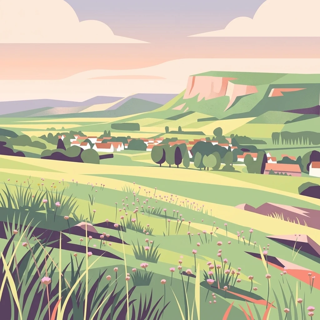
A flat-style digital illustration showing a rolling grassy landscape with wildflowers in the foreground, looking toward a small village and a large hill ridge under a soft sunset sky.

A small gypsum hill range in Thuringia protecting rare subcontinental steppe grasslands and a globally unique heavy-metal wildflower.

Bottendorfer Hügel

The Bottendorfer Hügel are a small hill range and nature reserve (Naturschutzgebiet) in the Kyffhäuserkreis district of northeastern Thuringia, Germany. They form a compact ridge roughly 2.5 kilometers long and 1 kilometer wide, oriented northwest to southeast, with their highest point reaching 206.5 meters above sea level on the Galgenberg. From a distance the hills stand out for their extensive open steppe grasslands and their almost complete lack of trees, giving them an unusually dry, exposed character for central Germany. Geologically, the Bottendorfer Hügel are a faulted cuesta-like ridge made up of gypsum and copper-bearing shale (Kupferschiefer) from the Permian Zechstein period. They rise roughly 82 meters above the floor of the nearby Unstrut valley, between the Ziegelrodaer Buntsandsteinplatte to the north and the Buntsandstein ridge of the Hohe Schrecke to the south. Their combination of gypsum-rich, metal-contaminated soils and dry microclimate has produced specialized plant communities including subcontinental brome swards and heavy-metal grasslands, the latter being the only place on Earth where the Bottendorf thrift (Armeria maritima var. bottendorfensis) occurs.

Location
Germany
Park type
Nature reserve
Area
1.3 km²
Highest point
207 m
Bottendorfer Hügel Nature Reserve Geography

Measure reported epicentre distance from 1.316 km² of upland grassland and steppe

Search earthquake observations near Bottendorfer Hügel

Review source-linked earthquake records around Bottendorfer Hügel, a 1.316 km² terrestrial upland protected area with mountains, grassland and steppe and no recorded water presence; compare date, magnitude, depth, locality and boundary separation. Proximity does not prove occurrence inside the site, landscape effects, current risk, seismic causation or future events.

Sort by
Magnitude
Location

This page describes catalogued earthquakes associated with the park by epicentre location and distance. It does not establish causation, assess current danger, or predict future earthquakes.

No earthquake records match the current filters

Park atlas

Expand park discovery beyond the Bottendorfer Hügel earthquake catalogue

Continue from Bottendorfer Hügel to other protected parks

The atlas follows the Bottendorfer Hügel earthquake entries with an independent selection of protected park pages. These destinations are not presented as sharing German hill landscapes, conservation status, earthquake data, geological traits, geographic closeness, seismic relevance, hazards, or risk.
A soft watercolor painting of layered green hills and forest under a pale sky, with a faded white background.
Protected landscapeThuringia
About 7.4 km away#1 closest

Southwest

Hohe Schrecke: Protected Landscape Map and Geographic Overview of Thuringian Woodlands

Mapped beech forest ridges and central German terrain.

Hohe Schrecke is a low mountain ridge in central Germany defined by expansive, unfragmented beech forests and sandstone-based topography. The area features a coherent mosaic of mature woodland, stream-cut valleys, and dry grasslands. This overview provides a structured look at the park boundaries and regional geographic context that define this protected landscape in Thuringia.

Area
42.5 km²
Established
2004
Relief
Mountain
Climate
Temperate
Nature reserveThuringia
About 24 km away#2 closest

West

Wipperdurchbruch Nature Reserve: Geographic Map and Protected Landscape Overview

Examining the Muschelkalk gorge and Hainleite ridge in Thuringia

Understand the protected geography of Wipperdurchbruch, a narrow breakthrough valley in the northern Thuringian hill country. This detailed entry maps the interplay between the meandering river, steep calcareous slopes, and ancient archaeological hilltops, defining its role within the wider regional conservation network of the Hainleite ridge.

Area
6.316 km²
Relief
Mountain
Climate
Temperate
Access
Access unknown
Watercolor painting of a green, rolling landscape with forested hills and a misty atmosphere.
Protected landscapeThuringia
About 26 km away#3 closest

West

Naturpark Kyffhäuser: Protected Landscape and Regional Geography in Thuringia

Explore ridges, gypsum karst, and wetland migration sites.

Naturpark Kyffhäuser stands as a unique protected landscape in Thuringia, bridging the gap between dramatic gypsum massifs and expansive agricultural lowlands. Its geography includes the notable Hainleite and Windleite ridges, alongside diverse habitats ranging from dry steppe slopes to the internationally recognized Kelbra reservoir. This detailed view examines the topographical and ecological features that define the park within the Unstrut catchment area.

Area
305 km²
Relief
Upland
Climate
Temperate
Access
Access unknown
A watercolor landscape painting showing a winding river flowing through a valley surrounded by gentle hills, trees, and fields.
Protected landscapeSachsen-Anhalt
About 32 km away#4 closest

Southeast

Naturpark Saale-Unstrut-Triasland Protected Landscape Geography and Regional Atlas

Mapping the geology and cultural terrain of Sachsen-Anhalt.

The Naturpark Saale-Unstrut-Triasland serves as a critical study in how river systems like the Saale and Unstrut shape central German terrain. Its status as a Geo-Naturpark reflects the area's visible Triassic rock layers, which anchor a landscape of vineyards, floodplain meadows, and historic medieval landmarks that stretch across the region.

Area
1,037 km²
Established
1991
Relief
Upland
Climate
Temperate
Nature reserveThuringia
About 34 km away#5 closest

South

Südhang Ettersberg Nature Reserve: Geographic Overview and Protected Area Boundaries

A prominent protected ridge landscape in central Thuringia

Südhang Ettersberg encompasses 408 hectares of south-facing slopes, creating a unique microclimate in the Weimarer Land district. This nature reserve serves as a benchmark for dry grassland and thermophilic woodland conservation in central Germany, offering a distinct mapped landscape that stands out from the surrounding agricultural lowlands.

Area
4.083 km²
Established
1997
IUCN
IV
Relief
Upland
Nature reserveThuringia
About 35 km away#6 closest

Southeast

Lohholz Nature Reserve: Protected Forest and Meadow Mosaic in Thuringia

Mapped deciduous woodlands and river valley meadow geography

Lohholz constitutes an isolated nature reserve in Thuringia, showcasing a distinct mosaic of broadleaf forest and traditional orchard meadows. The terrain slopes toward the Saale river valley, featuring varied grassland communities and a vital spring-fed brook. This protected area offers a look at forest preservation within a landscape predominantly utilized for agricultural purposes.

Area
0.304 km²
Established
1995
IUCN
IV
Relief
Upland
Nature reserveThuringia
About 41 km away#7 closest

South

Windknollen Nature Reserve: Mapping Protected Limestone Landscapes in Thuringia

Examining the plateau geography and former training site boundaries

The Windknollen nature reserve occupies a distinct position on the Muschelkalk limestone plateau near Jena. Its protected status reflects an evolution from historical battlefield use to a formal conservation area within the National Natural Heritage framework. The terrain is defined by exposed; dry-adapted vegetation across 185 hectares of highland geography.

Area
1.851 km²
Established
1997
IUCN
IV
A soft watercolor painting of a green landscape with trees, rolling hills, and a body of water under a light sky.
Nature reserveThuringia
42 km away#8 closest

South

Jenaer Forst Nature Reserve: Mapping the Protected Limestone Plateau and Forest Terrain

Protected nature reserve in Thuringia, Germany

Jenaer Forst is a 540 hectare nature reserve in Thuringia, characterized by dry calcareous woodland and active restoration work. The site is a study in landscape recovery, balancing forest management with the protection of orchid-rich habitats on its limestone plateau. This detailed atlas entry provides insights into the park boundaries, geological features, and ecological significance of this peri-urban forest zone.

Area
5.411 km²
Established
2008
IUCN
IV
MoriAtlas Explorer

Continue Exploring the Bottendorfer Hügel Nature Reserve Landscape

Examine the mapped terrain and unique botanical characteristics of the Bottendorfer Hügel nature reserve. MoriAtlas provides a focused look at this protected ridge, allowing for deeper engagement with its geological significance, regional setting in Kyffhäuserkreis, and specialized steppe ecosystems.