
Mori Atlas logo
Nature reserveBoyneburg und Schickeberg bei Breitau

Examine the geological formations, limestone cliffs, and diverse forest habitats within this significant German nature reserve.

Boyneburg und Schickeberg bei Breitau: A Protected Muschelkalk Rockfall Landscape in Northern Hesse

(Naturschutzgebiet Boyneburg und Schickeberg bei Breitau)

Boyneburg und Schickeberg bei Breitau stands as a prominent nature reserve in the Werra-Meißner-Kreis region of northern Hesse, defined by its active Muschelkalk rockfall zones and steep plateau edges. This protected area captures the dramatic interplay between shifting limestone cliffs, crevice cave systems, and near-natural deciduous forests. Beyond the geological significance, the summit plateaus preserve the historic Boyneburg castle ruins, anchoring the ecological landscape within a rich cultural and historical context.

nature reserveFFH siteNatura 2000Muschelkalk cliffslimestone beech forestrockfall landscape
A minimalist vector-style illustration of a mountain peak rising above a valley with forest and geometric field patterns, framed by trees in the foreground.

Boyneburg und Schickeberg bei Breitau

Nature reserve

Park overview

Structured park overview, official facts, and landscape profile for Boyneburg und Schickeberg bei Breitau

Boyneburg und Schickeberg bei Breitau park facts, protected area profile, and essential visitor context

Review the core facts for Boyneburg und Schickeberg bei Breitau, including designation, size, terrain, visitor scale, habitats, and operating context in one park-focused overview.

About Boyneburg und Schickeberg bei Breitau

Boyneburg und Schickeberg bei Breitau protects one of the most geologically dynamic and ecologically rich hill landscapes in northern Hesse. It sits at the northwestern edge of the Ringgau plateau, where the underlying geology of Lower Muschelkalk capped by softer Röt clays produces a landscape that is constantly being reshaped by landslides. The reserve encompasses the forested peaks of Boyneburg, Schickeberg, and Erbberg, and includes sections of cliff, slope forest, plateau, and valley.

The area is layered into three nested protection regimes. The original Naturschutzgebiet, in force since December 1988, covers 211.51 hectares and comprises two unequal parts divided by a district road: a larger northern area around Schickeberg and Boyneburg, and a much smaller southern patch around the Erbberg. In 2008, a 292.62 hectare Natura 2000 FFH site (DE-4926-350) was designated, extending the protection to include an additional oval-shaped forest area east of the Boyneburg and south of Gut Harmuthshausen, reaching toward Röhrda. The southern cliffs of the Schickeberg also fall within the EU Bird Sanctuary 'Felsklippen im Werra-Meißner-Kreis' (DE-4726-401), designated primarily for eagle owl and peregrine falcon.

Ecologically, the reserve is dominated by four habitat types: Waldmeister beech forest, orchid-rich limestone beech forest, Galium oak-hornbeam forest, and ravine-slope mixed forest. Surveys conducted in 2004 for the EU Habitats Directive concluded that all four forest types are highly natural and structurally rich, with the inaccessible slopes showing an almost primeval character. Highlights include substantial natural yew populations, a remarkable concentration of orchids (including the legally strictly protected yellow lady's slipper), and nineteen recorded orchid species in total.

The reserve also harbours numerous caves formed by the same Muschelkalk slip processes that built the cliffs. Of these, the Wendeltreppenkluft cave reaches about 120 metres in length and provides winter roosts for bats, while smaller fissure caves shelter cave-dwelling invertebrates such as the large cave spider.

Culturally, the area carries traces of settlement stretching from the late Neolithic through the Iron Age. The medieval Boyneburg castle, a high medieval fortified site first mentioned among the holdings of the Counts of Northeim and later a Reichsburg visited by Emperor Frederick Barbarossa, dominates the highest point of the reserve and lends the area its name. By the fifteenth century the castle had been abandoned and was reduced to a ruin during the Thirty Years' War. Several medieval villages below the hills, including Schickenberg, Gangesthal, and Beierod, are recorded as deserted settlements (Wüstungen).

Quick facts and research context for Boyneburg und Schickeberg bei Breitau

Boyneburg und Schickeberg bei Breitau lies in the Werra-Meißner-Kreis, northern Hesse, at the boundary between the municipalities of Sontra and Ringgau, north of the village of Breitau.

The site is layered under three overlapping designations: a 211.51 hectare nature reserve (Naturschutzgebiet, established 1988, with earlier protections from 1965); a 291 to 292 hectare European FFH site (designated 2008, code DE-4926-350); and the southern Boyneburg and Schickeberg cliffs lie within the larger EU Bird Sanctuary 'Felsklippen im Werra-Meißner-Kreis' (DE-4726-401). Elevations range from about 300 metres at the base up to 513 metres at the Boyneburg summit, with an average of around 400 metres.

Protection and recognition

Documented terrestrial protection history, management scope, and Natura 2000 listings

Boyneburg und Schickeberg bei Breitau Protection Status and Recognition Data

Boyneburg und Schickeberg bei Breitau maintains formal terrestrial protection status established in 2008 alongside verified Natura 2000 recognition records. Structured administrative facts track designation history and official boundaries without implying broader conservation outcomes.

International recognition

Protection details

Protection scope
Terrestrial
Designated year
2008
Transboundary protection
No
WDPA ID
81445
Park context

Deeper park guide and search-rich context for Boyneburg und Schickeberg bei Breitau

Boyneburg und Schickeberg bei Breitau history, landscape, wildlife, and travel context

Explore Boyneburg und Schickeberg bei Breitau through its history, landscape character, ecosystems, wildlife, conservation priorities, cultural context, and seasonal travel timing in a structured park guide built for atlas discovery and search intent.

Why Boyneburg und Schickeberg bei Breitau stands out

The area is best known for its Muschelkalk rockfall cliffs and the rare combination of geological instability with near-natural deciduous forest. Active landsliding along the Unterer Muschelkalk-and-Röt boundary has produced the largest active mass-movement zone in Hesse, generating tall cliff faces and a network of crevice caves. These cliffs and the forests surrounding them host exceptionally rich flora and fauna: orchid-rich beech and oak-hornbeam forests, an unusually large population of wild yew on natural sites, populations of yellow lady's slipper orchid, several rare bat species, and breeding pairs of eagle owl and peregrine falcon on the exposed rock faces. The medieval Boyneburg castle ruins on the summit plateau give the area a distinctive cultural signature atop a fundamentally ecological reserve.
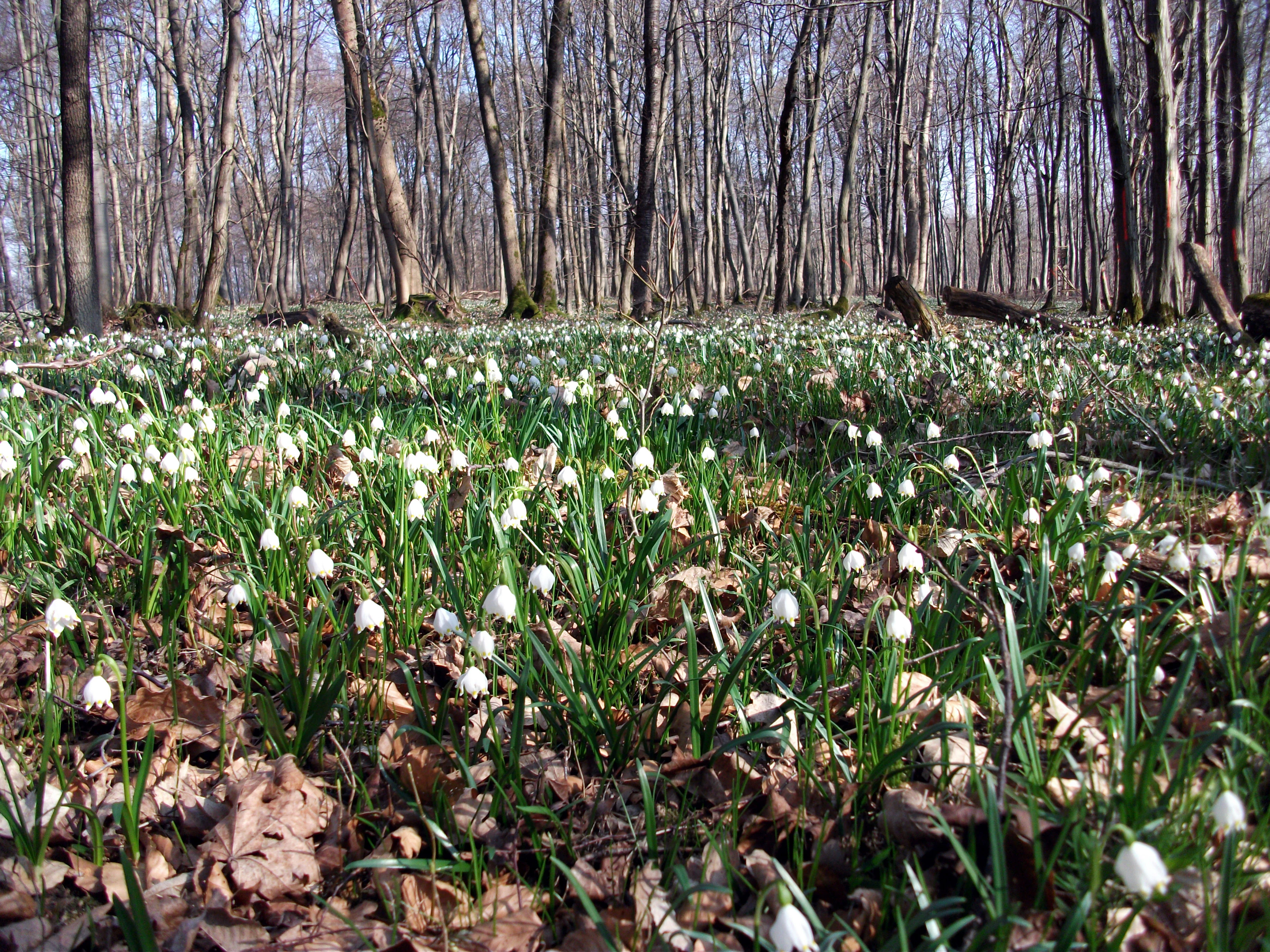
A vast carpet of white bell-shaped spring snowflake flowers covering a forest floor with a backdrop of tall bare deciduous trees.
A carpet of spring snowflakes, Leucojum vernum, blooming on the forest floor in Boyneburg und Schickeberg bei Breitau.

Boyneburg und Schickeberg bei Breitau history and protected-area timeline

The geological history of the site is ongoing: landslides along the boundary between Lower Muschelkalk and the underlying Röt clays have shaped the landscape for millennia, with a notable rockfall event recorded as recently as 1956. The current reserve is part of what geologists identify as Hesse's largest active mass-movement zone.

Humans have occupied the plateau for thousands of years. Archaeological finds on the Boyneburg hilltop indicate settlement from the late Neolithic through the Iron Age, with a Celtic refuge castle (Fliehburg) on the plateau. In the early Middle Ages the Counts of Northeim held the site; the line ended with Siegfried IV of Boyneburg. By the twelfth century the castle served as a central place for controlling royal estates between the Harz mountains and the Wetterau, and it was occasionally used as a royal court and Imperial Diet location, visited several times by Emperor Frederick Barbarossa.

The fortress later became a contested object between Hesse and Thuringia before passing definitively into Hessian ownership, and it gave its name to the imperial ministerial family of Boyneburg. It lost its permanent inhabitants in the fifteenth century and was reduced to a ruin during the Thirty Years' War. The lower medieval castle was protected by a neck ditch and stands at the northern edge of the older refuge castle plateau, which remains unforested today.

Formal nature protection arrived in stages. Earlier protective measures for parts of the present-day area date to 1965. The complete nature reserve designation (Naturschutzgebiet) was enacted in December 1988 under the number 1636004. In January 2008, the larger FFH site DE-4926-350 was gazetted in the Hessian law and ordinance gazette, adding about 42 hectares of additional forest to the protected footprint. In 2016, the area joined the Naturpark Meißner-Kaufunger Wald, which was renamed the Geo-Naturpark Frau-Holle-Land in 2017.

Boyneburg und Schickeberg bei Breitau landscape and geographic character

The landscape of Boyneburg und Schickeberg is shaped by the interplay of hard Lower Muschelkalk limestone and the soft clay-rich Röt layer beneath it. As the underlying Röt weathers and gives way, slabs of Muschelkalk slide downhill along fault lines, leaving behind near-vertical cliff faces, scree slopes, fissure caves, and unstable plateau fragments. The resulting topography is steep, broken, and visibly in motion; the most recent recorded rockfall occurred in 1956.

The reserve spans three named summits: the Boyneburg at 513 metres, the Schickeberg at 500.2 metres, and the Erbberg at 427.6 metres. These peaks mark the northwestern edge of the Ringgau plateau, with the broader terrain descending westward into the Fulda-Werra-Bergland and especially the Hosbach-Sontra-Bergland sub-unit. Elevations across the protected area range from about 300 metres in the valley floors up to the 513 metre summit. The north-to-south extent is close to four kilometres, while the longest southwest-to-northeast span approaches five kilometres.

Open rock faces, particularly the Zehn-Uhr-Klippen on the Schickeberg, create dramatic cliff scenery that contrasts with dense forest cover on the more stable slopes. Small forest clearings, including the historically important Boyneburg plateau clearing, interrupt the otherwise continuous woodland.
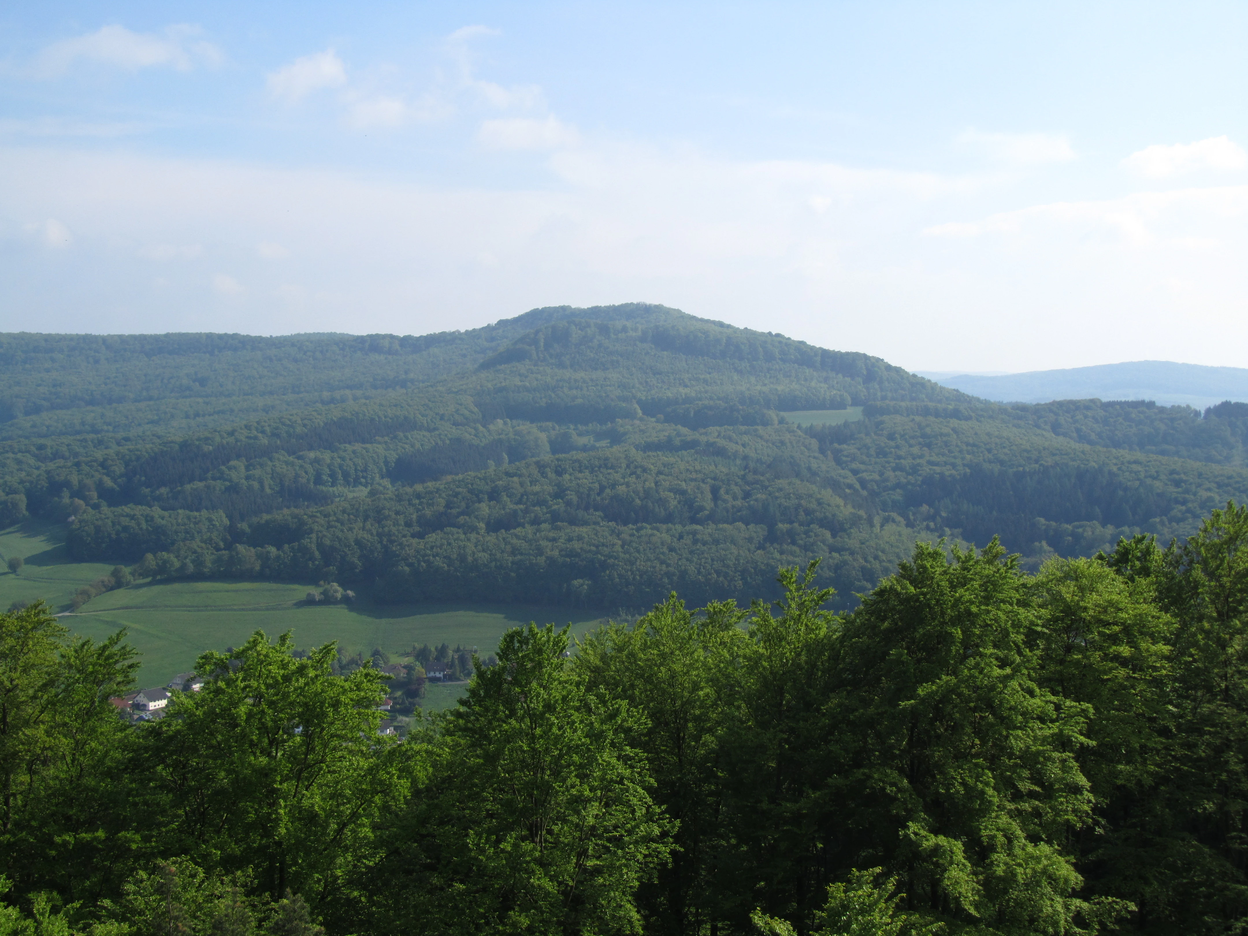
A wide, eye-level landscape view of a green, forested hill called Boyneburg, with a foreground of deciduous tree canopies and open green fields at the base of the mountain under a light blue sky.
A view of the Boyneburg mountain from the north.

Boyneburg und Schickeberg bei Breitau ecosystems, habitats, and plant life

Ecologically, the reserve is overwhelmingly a forested landscape, with beech-dominated woodland occupying roughly two-thirds of the FFH area. Four officially assessed habitat types define the core of its ecological value: the Waldmeister-Buchenwald (Galio odorati-Fagetum), the orchid-rich Orchideen-Kalk-Buchenwald, the Labkraut-Eichen-Hainbuchenwald (Galium oak-hornbeam forest), and Schlucht- und Hangmischwälder (ravine and slope mixed forests). Surveys conducted in 2004 by the higher nature conservation authority found all four to be highly natural, structurally diverse, and in places of primeval character because of the steep, unworkable terrain.

A particularly distinctive feature is a substantial population of European yew growing on natural sites, considered one of the most important in Hesse. The forests are also exceptionally rich in orchids, with nineteen recorded orchid species including the strictly protected yellow lady's slipper (Cypripedium calceolus). Other notable plants include common hepatica, spring snowflake, broad-leaved helleborine, pale and purple orchis, wolf's bane, woodland goatsbeard, and alpine thistle in the open limestone grasslands above the cliffs.

Beyond the forests, the open limestone cliffs and associated habitats add a contrasting ecological layer. These include calcareous and semi-dry grasslands in various stages of shrub encroachment, base-rich pioneer swards of the Alysso-Sedion albi type, limestone scree communities from the colline to the montane belt, and fissure vegetation on the cliff faces that supports rare mosses and lichens. Below the cliffs, lean flatland hay meadows with orchard strips host species such as meadow foxtail and great burnet. Several non-tourist caves in the northern and northeastern parts of the reserve provide winter roosting habitat for bats.
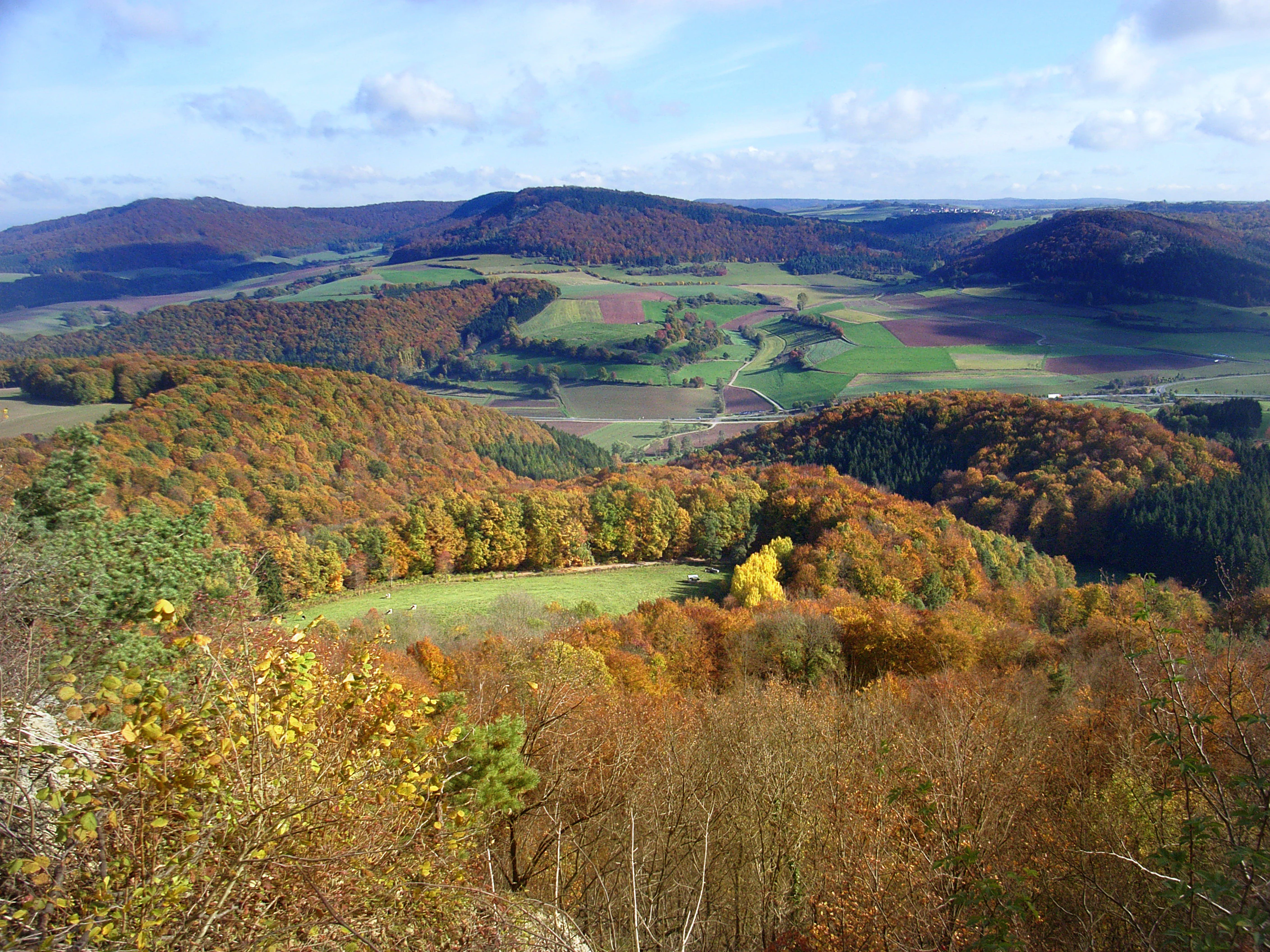
A wide-angle landscape view looking out over forested rolling hills and small farm fields during the autumn season.
Autumn view looking toward the forested hills of the Boyneburg und Schickeberg nature reserve.

Boyneburg und Schickeberg bei Breitau wildlife and species highlights

The cliffs of the Schickeberg, particularly the prominent Zehn-Uhr-Klippen, are the most important wildlife feature for birds of prey. Both eagle owl and peregrine falcon maintain nesting sites here, and the eagle owl and Tengmalm's owl are among the more characteristic species of the broader area.

The forests support a wide community of bats that use the system's fissure caves as winter roosts. Surveys have documented hibernation use in several caves, including the longer Wendeltreppenkluft cave. Lynx presence in the broader region is recorded, and the area is highlighted as potential retreat habitat for midwife toads associated with nearby historic estates, although confirmed records inside the protected boundary are still lacking.

Among invertebrates, the reserve is notable for butterflies including the lesser purple emperor, the large tortoiseshell relative known as the Großer Schillerfalter, and the large fritillary Großer Perlmuttfalter. The large cave spider, recognized as Germany's Spider of the Year in 2012, has been recorded in the larger caves. Reptile records include the sand lizard in three sub-areas, while the thyme blue butterfly, a Hesse-rare species listed in Annex IV of the EU Habitats Directive, has been documented in the calcareous grasslands although its population status is considered poor.
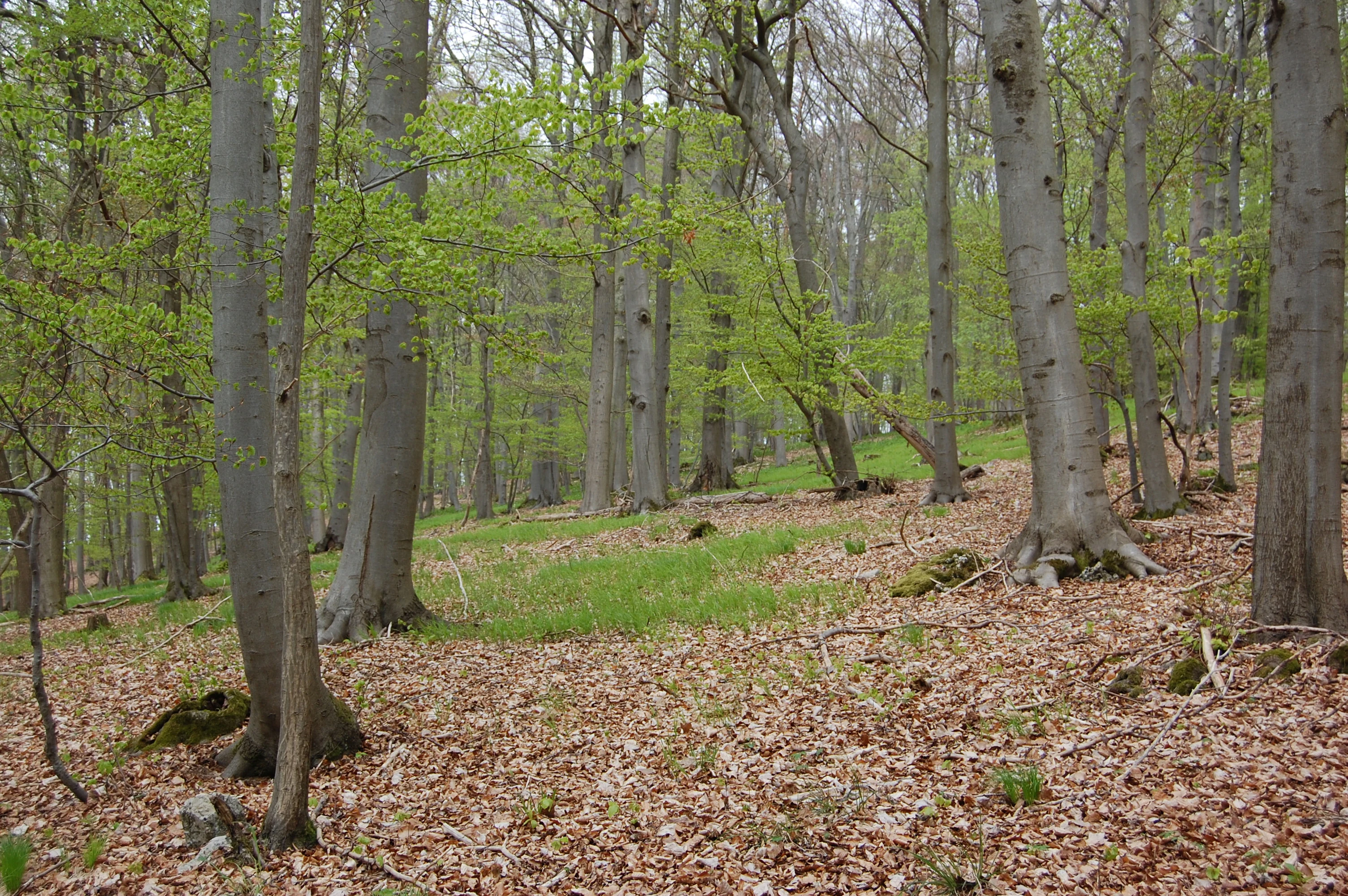
A woodland scene in spring featuring mature beech trees with smooth grey trunks, light green budding leaves, and a forest floor carpeted in brown fallen leaves and small patches of green grass.
A limestone beech forest located on the Erbberg hill within the Boyneburg und Schickeberg bei Breitau nature reserve.

Boyneburg und Schickeberg bei Breitau conservation status and protection priorities

Boyneburg und Schickeberg bei Breitau is protected at three nested levels, reflecting both national and European conservation priorities. As a Naturschutzgebiet under Hessian law it has been formally protected since 1988; as a European FFH site (DE-4926-350) it forms part of the EU's Natura 2000 ecological network since 2008; and as a component of the EU Bird Sanctuary 'Felsklippen im Werra-Meißner-Kreis' (DE-4726-401) it is also part of the Birds Directive network. Since 2016 it has been integrated into the larger Geo-Naturpark Frau-Holle-Land framework.

Its conservation significance rests on several rare combinations. Geologically, it lies within Hesse's largest active landslide zone, and the Muschelkalk rockfall cliffs are described as a geological rarity of national interest, comparable exposures being rare elsewhere in Germany. Ecologically, it preserves a near-natural mosaic of beech, oak-hornbeam, and slope-mixed forest types, with the steepest, least accessible parts showing primeval forest character and harbouring one of Hesse's most important natural yew populations.

The site also carries specific protection responsibilities for individual species. Yellow lady's slipper orchid populations, in poor overall condition at the Hessian scale, are under strict protection under Annex II of the EU Habitats Directive. Several bat species depend on the protected cave systems, and Annex IV species such as the thyme blue butterfly are monitored, with current population status rated poor and shrub encroachment identified as a key threat.

Boyneburg und Schickeberg bei Breitau cultural meaning and human context

The reserve carries a dense layer of medieval and early-modern cultural history beneath its ecological importance. The Boyneburg plateau, the highest point of the protected area, hosts the ruins of a high medieval castle that originated as an Iron Age and Celtic refuge site. From the early Middle Ages the castle belonged to the Counts of Northeim; after their line ended with Siegfried IV of Boyneburg, it became a royal castle that hosted visits by Emperor Frederick Barbarossa and served as a control point over royal estates between the Harz and the Wetterau. Later contested between Hesse and Thuringia, it eventually passed into Hessian hands and gave its name to a noble line of imperial ministerials before falling into ruin during the Thirty Years' War.

Below the protected hills, three deserted medieval villages, Schickenberg, Gangesthal, and Beierod, are documented in historical records and in surviving field traces such as church foundations and pot shards. Schickenberg is recorded in 1345 and was already classified as a Wüstung by the middle of the fifteenth century, with unusually high levels of Thuringian pottery suggesting eastward cultural ties. Gangesthal was documented as early as 993 through a donation by King Otto III but was abandoned around 1330.

Today the area intersects the long-distance Barbarossaweg hiking trail and the premium circular P13 Boyneburg hiking route, the latter used as the main public pathway through the protected landscape.

Top sights and standout views in Boyneburg und Schickeberg bei Breitau

Among the strongest features of Boyneburg und Schickeberg are its Muschelkalk rockfall cliffs, considered a geological rarity at the national scale and forming part of Hesse's largest active mass-movement zone. The Zehn-Uhr-Klippen on the Schickeberg host breeding eagle owl and peregrine falcon and give the area one of its sharpest visual signatures.

Ecologically, the reserve stands out for its highly natural beech and oak-hornbeam forests, the unusual natural occurrence of European yew, and one of Hesse's most important yellow lady's slipper orchid populations, plus a recorded total of nineteen orchid species. The cave systems formed by ancient rockfall processes provide critical bat roosts and shelter cave invertebrates such as the large cave spider.

Culturally, the highlight is the medieval Boyneburg castle ruin, an Iron Age refuge site, royal castle, and Barbarossa-era residence that crowns the highest point of the reserve and continues to define the area's identity.

Best time to visit Boyneburg und Schickeberg bei Breitau

The protected area is most atmospheric in spring, when the beech forests of the lower and middle slopes come alive with the flowering of common hepatica, spring snowflake, and a wide range of orchids in the limestone beech forests and calcareous grasslands. Late spring and early summer are also the best windows for observing cliff-nesting raptors and for enjoying the open plateau clearing around the Boyneburg.

Late summer and autumn bring drier conditions that make the steeper paths easier to traverse and emphasize the contrast between the vegetated slopes and the exposed limestone cliff faces above. Winter generally offers quieter conditions, but access via the steep terrain can be limited and the dynamic geological character of the area, including occasional rock movement, is best appreciated in fair weather.

Monthly climate preview

Measured long term temperature ranges and precipitation statistics across the park coordinate

Boyneburg und Schickeberg bei Breitau Climate Normals and Annual Weather Patterns

Historical monitoring records establish the long term temperature and precipitation rhythm across representative elevations in Boyneburg und Schickeberg bei Breitau. Detailed monthly climate normals provide broader context for analyzing regional weather variations throughout the year.
Annual mean8 °C
-1 °C18 °C
Jan-1°
Feb
Mar
Apr
May12°
Jun16°
Jul18°
Aug18°
Sep14°
Oct
Nov
Dec
Warmest month
July

18.3 °C

Coolest month
January

-1.1 °C

Wettest month
July

2.6 mm/day

Driest month
April

1.4 mm/day

Park location guide

Geography guide, regional context, and park location map for Boyneburg und Schickeberg bei Breitau

Boyneburg und Schickeberg bei Breitau park geography, regions, and map view in Germany

Understand where Boyneburg und Schickeberg bei Breitau sits in Germany through a broader geographic reading of the surrounding landscape, nearby location context, and its mapped position within the national park landscape.

How Boyneburg und Schickeberg bei Breitau fits into Germany

Germany is a federal republic in Western and Central Europe with a population of over 83 million across sixteen constituent states. It is Europe's largest economy by nominal GDP and a major global exporter and importer. The capital is Berlin, and the country borders Denmark, Poland, Czech Republic, Austria, Switzerland, France, Luxembourg, Belgium, and the Netherlands.

Wider geography shaping Boyneburg und Schickeberg bei Breitau in Germany

Germany is located in Western and Central Europe, spanning 357,022 km². It borders Denmark to the north, Poland and the Czech Republic to the east, Austria and Switzerland to the south, and France, Luxembourg, Belgium, and the Netherlands to the west. The country has coastlines on the Baltic Sea and North Sea to the north, with the Alps located in the southern region.

Map view of Boyneburg und Schickeberg bei Breitau

Use this park location map to pinpoint Boyneburg und Schickeberg bei Breitau in Germany, understand its exact geographic position, and read its mapped placement within the surrounding landscape more clearly.

Pigeon | © OpenStreetMap contributors

Location context for Boyneburg und Schickeberg bei Breitau

HessenWerra-Meißner-Kreis
Recorded earthquake history

Examine Recorded Earthquake History at Boyneburg und Schickeberg bei Breitau

Investigate the historical record of seismic activity linked to this protected landscape. Our data catalogue provides mapped event details and distance references, allowing for a structured review of seismic occurrences near the nature reserve through the MoriAtlas platform.

Boyneburg und Schickeberg bei Breitau Earthquake History

Catalogued events

4 events

Strongest magnitude

Magnitude 3.6

Most recent event

Oct 25, 2006

This history includes earthquakes recorded inside the park or within 50 km of its borders

Visualizing the dramatic limestone cliffs and beech forests of northern Hesse

Boyneburg und Schickeberg bei Breitau Landscape and Scenery Photography

Photographic documentation reveals the rugged Muschelkalk rockfall cliffs and dense deciduous woodlands that characterize the reserve. Visual examination of the terrain highlights active geological formations and protected habitats across the summit plateau.

A vast carpet of white bell-shaped spring snowflake flowers covering a forest floor with a backdrop of tall bare deciduous trees.

A wide view of the village of Breitau, Germany, with traditional houses featuring red tiled roofs in the foreground and a dense, forested hill rising behind the village under a clear blue sky.

A wide, eye-level landscape view of a green, forested hill called Boyneburg, with a foreground of deciduous tree canopies and open green fields at the base of the mountain under a light blue sky.

A wide-angle landscape view looking out over forested rolling hills and small farm fields during the autumn season.

A woodland scene in spring featuring mature beech trees with smooth grey trunks, light green budding leaves, and a forest floor carpeted in brown fallen leaves and small patches of green grass.

Park atlas

Compare nearby regional reserves, limestone formations, and connected forest habitats.

Parks Near Boyneburg und Schickeberg bei Breitau and Surrounding Protected Landscapes

Browse other protected areas and nature reserves located close to Boyneburg und Schickeberg bei Breitau in northern Hesse. Comparing adjacent regional terrain helps place local geological formations and woodland ecosystems into a broader geographic perspective.
Watercolor illustration showing a wide landscape with green trees, rolling hills, and distant mountains under a pale sky.
Nature reserveHessen
About 5.2 km away#1 closest

Northeast

Graburg Nature Reserve and Protected Shell-Limestone Massif in Northern Hessen

Mapped protected areas and botanical landscape geography

Graburg is a compact shell-limestone plateau located in the Ringgau range of northern Hessen. This nature reserve is characterized by its high conservation value, featuring ancient calcareous beech forests, dramatic rock faces, and extensive historic landslide zones that support one of the most botanically diverse habitats in central Germany.

Area
3.41 km²
Established
1965
IUCN
IV
A pale, panoramic watercolor painting depicting a series of rocky outcroppings surrounded by sparse green vegetation against a light, hazy background.
Nature reserveWerra-Meißner-Kreis
About 5.6 km away#2 closest

North

Blaue Kuppe Nature Reserve: Volcanic Basalt Landscapes in Werra-Meißner-Kreis, Germany

Protected geological monument and habitat zone

Blaue Kuppe is a notable basalt hill near Eschwege, preserved for its rare mineralogical record and exposed contact zones between volcanic lava and sedimentary sandstone. The site serves as a vital geological archive and protected nature reserve in the Werra-Meißner-Kreis, showcasing historical volcanic intrusions that shaped the local terrain.

Area
0.068 km²
Established
1939
IUCN
IV
Relief
Upland
A watercolor painting depicting a soft, green meadow landscape with gentle rolling hills in the background and scattered trees.
Nature reserveGermany
About 7 km away#3 closest

East

Feuchtwiesen bei Lüderbach Nature Reserve: Regional Geography and Protected Landscape Atlas

A diverse wetland and grassland reserve in northern Hesse, Germany

Spanning 40 hectares in the Werra-Meißner-Kreis district, Feuchtwiesen bei Lüderbach protects a complex mosaic of reedbeds, eutrophic ponds, and floodplain forests. This nature reserve serves as an important ecological link in the Netra-Ifta valley, bridging valley-bottom wetlands with the limestone-rich slopes of the Weinberg hill to create a distinct and valuable natural terrain in the German landscape.

Area
0.41 km²
Established
1995
Relief
Upland
Climate
Temperate
Watercolor painting of a green landscape featuring rolling hills and sparse trees.
Nature reserveWerra-Meißner-Kreis
About 7.7 km away#4 closest

East

Dreiherrenstein-Eschenberg-Kreutzerberg Nature Reserve and Border Landscape Geography

Protected calcareous forests and limestone ridges in Werra-Meißner-Kreis

Spanning 206 hectares of the Ringgau escarpment, this reserve features ancient beech forests, steep limestone cliffs, and rare steppe-heath grasslands. It sits at a cultural and ecological intersection, preserving Cold War-era boundary markers alongside post-glacial biological relicts within the broader Hessian protected-area network.

Area
2.063 km²
Established
1998
IUCN
IV
Relief
Mountain
A minimalist watercolor illustration depicting a soft, rolling landscape with gentle hills, a winding path, and sparse trees in light green, yellow, and muted tones.
Nature reserveHesse
About 8.4 km away#5 closest

Southeast

Iberg bei Markershausen: Nature Reserve and Geological Landmark in Hesse, Germany

Calcareous forests and limestone cliff landscapes within the Ringgau plateau

Iberg bei Markershausen is a protected nature reserve in northern Hesse recognized for its complex Muschelkalk terrain. The reserve encompasses a 180-meter limestone cliff, rare relict yew populations, and a dense forest floor featuring spring geophytes and diverse orchid species. This site serves as a vital anchor for regional biodiversity, linking steep rockfall remnants with open dry grassland habitats.

Area
0.32 km²
Established
1988
IUCN
IV
Relief
Upland
Watercolor painting of a rolling green landscape with a winding trail leading toward purple mountains under a soft light.
Nature reserveWartburgkreis
9.2 km away#6 closest

South

Mertelstal - Heldrastein: Protected Nature Reserve and Forested Limestone Geography in Wartburgkreis

Mapping the natural relief and ecological boundaries of a central German nature reserve.

Mertelstal - Heldrastein stands as a protected natural landmark in the Wartburgkreis district, defined by its dramatic limestone cliffs and ancient beech forest canopy. The reserve features a unique vertical relief above the Werra river valley, housing rare orchid communities and specialized bryophytes. This entry maps the structural geography and conservation value of the site, highlighting its dual identity as both a Natura 2000 protected habitat and a place of deep historical resonance across the former inner-German border landscape.

Area
2.525 km²
Established
1997
IUCN
IV
Relief
Mountain
Nature reserveThuringia
9.7 km away#7 closest

East

Werra bis Treffurt mit Zuflüssen: Protected River and Floodplain Network in Thuringia

Mapping an extensive 191 kilometer Natura 2000 river corridor.

The Werra bis Treffurt mit Zuflüssen protected area serves as a vital ecological corridor in Thuringia. This site encompasses a complex mosaic of fast-flowing highland brooks, expansive floodplain meadows, inland salt sites, and rare dissolution lakes. Its geography bridges high-altitude source regions with lower river valleys, creating a distinctive landscape transect that supports essential freshwater habitats and rare aquatic species across the state.

Area
22.6 km²
Established
2008
IUCN
IV
Relief
Mixed relief
Nature reserveThuringia
11 km away#8 closest

East

Werra-Aue zwischen Breitungen und Creuzburg: Protected Floodplain and River Geography

Nature reserve sanctuary in western Thuringia

Spanning over 33 kilometers of the Werra river, this protected floodplain is defined by its distinctive geological sinkholes, seasonal wetlands, and diverse bird habitats. Discover the layered conservation status and riparian terrain that mark this significant Thuringian nature reserve as a crucial node for European ecological connectivity.

Area
25.78 km²
Established
2007
IUCN
IV
Relief
Lowland

Common questions about visiting, size, designation, and location context for Boyneburg und Schickeberg bei Breitau

Boyneburg und Schickeberg bei Breitau FAQs for park facts, access, geography, and protected area context

Find quick answers about Boyneburg und Schickeberg bei Breitau, including protected-area facts, park geography, trail and visitor context, and how the park fits into its surrounding country and regional landscape.
MoriAtlas Explorer

Continue Your Protected Areas Search Across the Global Atlas

Deepen your exploration by continuing the structured search for national parks and protected areas worldwide. Utilize the comprehensive filtering capabilities to compare different conservation landscapes and refine your understanding of global park geography. Discover more about the distribution and characteristics of protected natural areas.

Global natural geography