
Mori Atlas logo
Nature reserveBruchwiesen bei Büttelborn

Mapping the floodplain terrain and river meander ecosystems of the Rhine Main lowlands

Bruchwiesen bei Büttelborn Nature Reserve and Protected Wetland Landscape in Hessen Germany

(NSG/LSG Bruchwiesen bei Büttelborn)

Bruchwiesen bei Büttelborn encompasses one of the most significant lowland fen complexes in the state of Hessen, Germany. This protected landscape, shaped by the legacy of an ancient Altneckar river meander, serves as a vital refuge for wetland bird populations and rare botanical communities. MoriAtlas provides a geographic breakdown of the reserve, tracing its network of wet grasslands, reedbeds, and riparian corridors across the broader Rhine Main floodplain context.

wetlandlowland fenbird sanctuarymeadowreedbedorchid habitat
A flat-style digital illustration of a nature landscape with a flowery meadow in the foreground, a river flowing toward a waterfall, a wooded area with a stork perched in a high nest, and stylized mountains under a sunrise.

Bruchwiesen bei Büttelborn

Nature reserve

Park overview

Structured park overview, official facts, and landscape profile for Bruchwiesen bei Büttelborn

Bruchwiesen bei Büttelborn park facts, protected area profile, and essential visitor context

Review the core facts for Bruchwiesen bei Büttelborn, including designation, size, terrain, visitor scale, habitats, and operating context in one park-focused overview.

About Bruchwiesen bei Büttelborn

The Bruchwiesen bei Büttelborn represents a small but ecologically dense protected area in the southwestern part of the Rhine-Main region of Hesse. Established in late 1997, it combines a German Naturschutzgebiet (strict nature reserve) with a Landschaftsschutzgebiet (landscape protection area) to create a layered protection framework around a historic river landscape. The reserve is anchored in the cadastral areas of Büttelborn and Groß-Gerau, occupying land that was once shaped by the shifting channels of the Neckar before that river took its present, more southerly course.

What makes the site exceptional for its size is the combination of hydrological legacy and ecological diversity. The abandoned Neckar meanders hold groundwater close to the surface for much of the year, sustaining a range of near-natural grassland communities. These include fragments of Calthion-type wet meadows, oat-grass meadows dominated by tall oat grass, large sedge beds, tall herb flood vegetation known as Hochstaudenfluren, and reedbeds along the ditches and channels. Bordering these open wetland habitats, a species-rich deciduous forest has developed, providing ecotone habitat that increases overall structural complexity.

The reserve's significance extends well beyond its 88 hectares because of its role in regional and European conservation networks. It is integrated into the EU Birds Directive protection area "Hessische Altneckarschlingen" and links with neighboring reserves such as the Torfkaute - Bannholz von Dornheim-Wolfskehlen to the south. Conservation management is shaped by organizations such as the Naturschutzbund Deutschland (NABU), which has acquired and leased additional surrounding land to enhance habitat quality, including hydrological restoration through excavated pools, removal of encroaching woody vegetation, and grazing with hardy cattle breeds to maintain open habitat conditions.

Quick facts and research context for Bruchwiesen bei Büttelborn

The Bruchwiesen bei Büttelborn is a combined nature and landscape protection area in the Kreis Groß-Gerau of southern Hesse, designated on 16 December 1997 under the German classification as a habitat and species management area (IUCN Category IV). Its total extent is around 88 hectares, of which roughly 60 hectares are strict nature protection area and around 28 hectares are landscape protection area.

The reserve sits within an old loop of the Neckar and contains one of Hesse's largest surviving lowland fen landscapes. It belongs to the EU Birds Directive site "Hessische Altneckarschlingen" and is documented in the World Database on Protected Areas. Its ecological profile is dominated by wet meadows, sedge beds, reedbeds, tall herb vegetation, and adjacent deciduous forest, and it is known for hosting an exceptionally rich bird community centered on White Storks and the very rare Little Crake.

Protection and recognition

Examine the official protected area designation and database records.

Bruchwiesen bei Büttelborn Protection Status and Registry Records

Bruchwiesen bei Büttelborn maintains verified database tracking through global protected area registries. Structured records aggregate official designation details and administrative tracking metrics for geographic analysis.

Protection details

WDPA ID
318246
Park context

Deeper park guide and search-rich context for Bruchwiesen bei Büttelborn

Bruchwiesen bei Büttelborn history, landscape, wildlife, and travel context

Explore Bruchwiesen bei Büttelborn through its history, landscape character, ecosystems, wildlife, conservation priorities, cultural context, and seasonal travel timing in a structured park guide built for atlas discovery and search intent.

Why Bruchwiesen bei Büttelborn stands out

The area is best known for its exceptionally rich wetland birdlife set within a former Neckar river meander. White Storks breed here in significant numbers, and the site has gained particular renown for hosting a major share of Europe's tiny remaining population of the Little Crake, Europe's smallest rail species and one considered at severe risk of extinction. It is also recognized as one of the largest preserved lowland fen complexes in Hesse, and as a textbook example of how old river meanders can evolve into ecologically valuable habitats for orchids, specialized insects, waterbirds, and wetland-dependent mammals such as beaver and coypu.
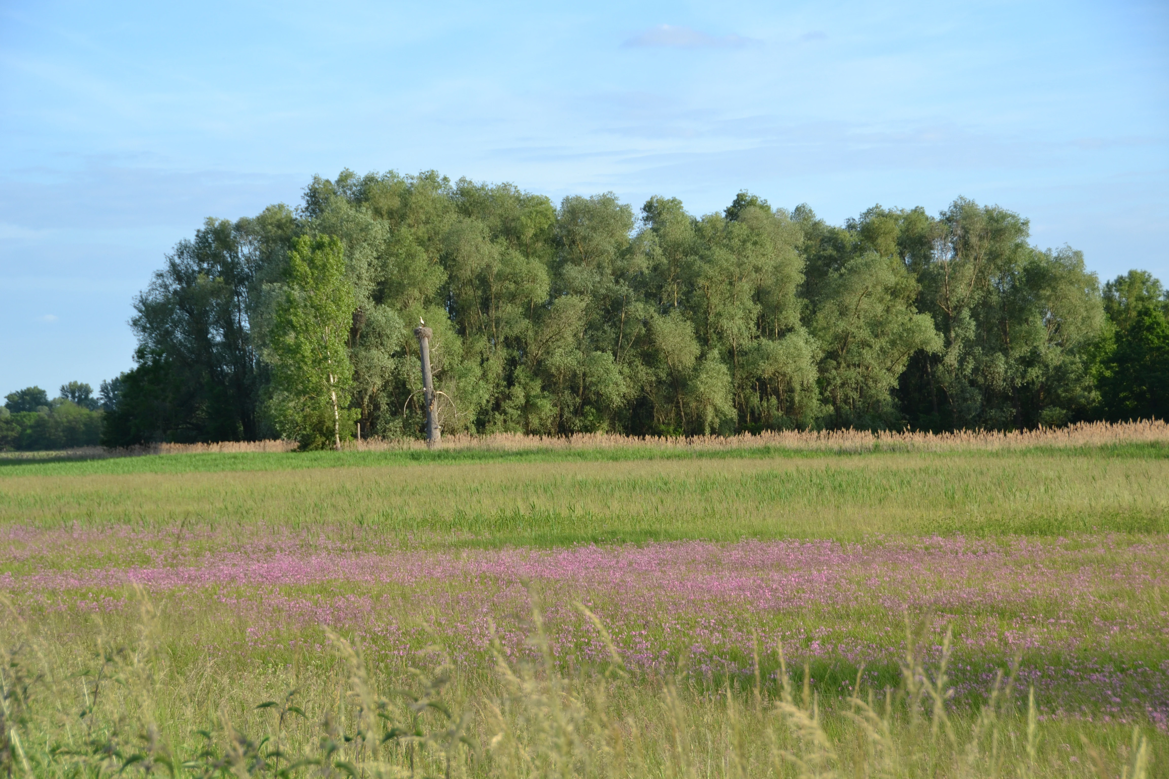
A wide landscape view of an open meadow with patches of purple wildflowers in the foreground, leading to a line of mature green trees in the background.
A wide view of the Bruchwiesen bei Büttelborn nature reserve, featuring meadows and woodland.

Bruchwiesen bei Büttelborn history and protected-area timeline

The formal protection of the Bruchwiesen bei Büttelborn dates to 16 December 1997, when the area was designated through a regulatory order combining nature reserve and landscape protection statutes. The designation reflected growing recognition that the abandoned Neckar meanders near Büttelborn retained unusually intact examples of lowland fen vegetation and associated wildlife that were largely lost elsewhere in the Hessian Rhine-Main lowlands.

The site's ecological history, however, goes back much further. The wetland complex formed along former beds of the Neckar that shifted course over centuries, leaving behind a sinuous pattern of old channels and floodplain depressions. These hydrological conditions allowed peat-forming and base-rich wet meadow communities to persist, while surrounding woodland developed on the better-drained ridges between channels.

In more recent decades, conservation organizations have actively shaped the reserve's development. Since 2018, NABU has leased or purchased additional adjacent land, expanding the area under conservation influence to roughly 38 hectares. Restoration efforts since that time have included the excavation of hollows to retain water in the landscape, the removal of trees and shrubs on neighboring fields to re-establish open habitat, and, beginning in 2019, seasonal grazing by Galloway cattle and Rotes Höhenvieh to keep vegetation short and to discourage scrub encroachment. These management measures reflect an evolving approach that pairs legal protection with active, ongoing landscape stewardship.

Bruchwiesen bei Büttelborn landscape and geographic character

The landscape of the Bruchwiesen bei Büttelborn is shaped by the legacy of the Neckar River, whose former channels still define the terrain. The reserve extends in a roughly south-to-north direction along these old meanders, between Büttelborn to the northeast and the Groß-Gerau districts of Berkach and Dornheim to the west. The result is a gentle, low-relief floodplain landscape, marked by shallow depressions, ditches, and the slow-flowing Landgraben watercourse that runs through the area.

At ground level, the scene is dominated by open wetland vegetation. Sedge communities, reedbeds, tall herb flood vegetation, and fragments of moist grassland alternate across the wetter parts of the site, while patches of taller deciduous woodland occupy slightly higher ground. The Landgraben and surrounding water-filled ditches create long, linear wetland features that break up the meadow matrix and provide important habitat corridors for both birds and aquatic mammals.

The surrounding landscape is shaped by the broader Hessian Rhine-Main lowlands, with agricultural land and settlement patches framing the reserve. This rural setting gives the wetland a notably isolated character, surrounded by open fields rather than dense development, which makes the Bruchwiesen an unusually visible and ecologically distinct feature within the regional landscape.

Bruchwiesen bei Büttelborn ecosystems, habitats, and plant life

Ecologically, the Bruchwiesen bei Büttelborn is anchored in a lowland fen system developed on an ancient Neckar floodplain. The reserve protects near-natural grassland communities that include fragments of Calthion wet meadows, Glatthafer meadows dominated by tall oat grass, extensive Großseggenried (large sedge beds), Hochstaudenfluren of tall wetland herbs, and reedbeds dominated by reeds and similar tall graminoids. Together these communities create a layered habitat mosaic that varies with hydrological conditions across the former river meanders.

An adjoining species-rich deciduous forest adds a woodland component to the reserve, offering structural contrast to the open wetlands and serving as a refuge for woodland birds and other fauna. Hydrological conditions remain a defining ecological factor, with the Landgraben and connected ditches maintaining the water levels that sustain both the wetland vegetation and the characteristic fauna.

The site is frequently described in conservation literature as one of Hesse's most important remaining Niedermoor (lowland fen) areas, and it has been identified as a hotspot of biological diversity within the regional context. Its combination of open wet grassland, reedbeds, water-filled ditches, and adjacent woodland results in overlapping plant and animal communities that are rarely found together at this scale in modern German agricultural landscapes.

Bruchwiesen bei Büttelborn wildlife and species highlights

The wildlife profile of the Bruchwiesen bei Büttelborn is dominated by an exceptionally diverse bird community, with up to approximately 120 species recorded in the area. This diversity is closely tied to the reserve's combination of open wetland, reedbed, and woodland habitats. The most emblematic species is the White Stork, which is present year-round and supports more than 30 breeding pairs within the reserve. Counts between November 2024 and January 2025 documented over 400 individuals using the area, and storks find additional foraging habitat at a nearby district landfill about two kilometers to the northeast.

Of particular conservation importance is the Little Crake, Europe's smallest rail and a species considered at severe risk of extinction across the continent. With only an estimated 10 to 15 breeding pairs remaining in all of Europe, the Bruchwiesen supports two to three breeding pairs and around ten calling males, meaning the site can host up to roughly 20 percent of the European population in a single season.

Beyond these signature species, the reserve hosts a wide range of wetland and meadow birds, including Common Snipe, Jack Snipe, Marsh Warbler, Hen Harrier, Red Kite, Bluethroat, Common Cuckoo, Grey Heron, Great Egret, and the strikingly colored Common Kingfisher along the Landgraben. The reedbeds also support a number of increasingly rare specialists such as the Spotted Crake, Corncrake, Sedge Warbler, and Savi's Warbler. Among insects, the site hosts the rare large marsh grasshopper and the Highly specialized reedbed moth Plusia festucae, while the broad-leaved marsh orchid Dactylorhiza majalis stands out as a remarkable botanical record. Mammals include both the native Eurasian beaver and the introduced South American coypu, both of which have established populations along the Landgraben and surrounding water-filled ditches.

Bruchwiesen bei Büttelborn conservation status and protection priorities

The Bruchwiesen bei Büttelborn is protected under German law as a combined Naturschutzgebiet and Landschaftsschutzgebiet, with the original designation issued on 16 December 1997. Internationally it falls within IUCN Category IV, recognizing it as a habitat and species management area, and it is also part of the EU Birds Directive site "Hessische Altneckarschlingen," giving the reserve both national and European conservation significance.

The conservation rationale centers on the preservation of near-natural wetland vegetation along an ancient Neckar meander. Specific protection targets include remaining fragments of Calthion wet meadows, oat-grass meadows, large sedge beds, tall herb flood vegetation, reedbeds, and the adjoining deciduous forest, all of which provide habitat for rare plant communities and a wide range of bird species, including some of Europe's most threatened.

Active management has become an increasingly important component of the reserve's conservation strategy. Since 2018, NABU has significantly expanded its footprint in and around the area, leasing or purchasing about 38 hectares of additional land to support habitat improvement. Conservation measures have included the excavation of water-retaining hollows, the removal of encroaching trees and shrubs on adjacent fields to restore open meadow conditions, and the introduction of robust traditional cattle breeds such as Galloway and Rotes Höhenvieh since 2019 for low-intensity grazing. These measures reflect a shift from static protection toward an integrated approach combining legal designation with ongoing landscape management.

Bruchwiesen bei Büttelborn cultural meaning and human context

The cultural context of the Bruchwiesen is closely tied to the historical relationship between the Hessian Rhine-Main lowlands and the Neckar River, whose shifting channels shaped both the landscape and human land use. The reserve is embedded in the rural surroundings of Büttelborn and Groß-Gerau, where agriculture and small communities have long coexisted with wet meadow and floodplain systems. The ongoing use of hardy traditional cattle breeds, such as Galloway and Rotes Höhenvieh, for conservation grazing connects modern habitat management with longstanding regional practices of extensive pasture use.

Top sights and standout views in Bruchwiesen bei Büttelborn

One of Hesse's largest surviving lowland fen landscapes, developed along a former Neckar river meander and offering a textbook example of how abandoned river channels can sustain diverse wetland communities. The site is distinguished by an exceptional bird fauna of up to around 120 species, with White Storks breeding here in significant numbers and the Little Crake finding refuge in numbers that can represent up to roughly one-fifth of the European population in a single season.

The reserve stands out for its layered protection framework, combining a strict German nature reserve with a broader landscape protection area, and for its integration into the EU Birds Directive site "Hessische Altneckarschlingen." Active management by NABU, including hydrological restoration, scrub control, and conservation grazing with traditional cattle breeds, makes it a strong example of modern, hands-on wetland conservation in the Rhine-Main region.

Best time to visit Bruchwiesen bei Büttelborn

Because the Bruchwiesen is a lowland wetland reserve, the character of a visit shifts substantially with the seasons. Spring and early summer are the most rewarding periods for birdwatching, when breeding activity peaks, reedbed songsters such as Sedge Warbler, Marsh Warbler, and Savi's Warbler are most vocal, and orchids including the broad-leaved marsh orchid are in flower across the meadows. White Storks are present across the breeding season and often remain visible later into the year.

Late autumn and winter can also be highly interesting, especially for stork counts and visiting wintering birds, with records of more than 400 White Storks using the area during late 2024 and early 2025. Visitors should expect damp ground conditions throughout much of the year, and a quiet, rural atmosphere suited to observational nature visits rather than active recreation.

Monthly climate preview

Long-term representative monthly temperature and precipitation patterns

Bruchwiesen bei Büttelborn Climate Normals and Annual Temperature Rhythm

Bruchwiesen bei Büttelborn tracks a measured annual temperature range from sub-zero winter minimums to warm summer maximums alongside consistent daily precipitation. Examining the complete twelve-month record reveals detailed shifts in long-term atmospheric normals across the protected area.
Annual mean10 °C
0 °C21 °C
Jan
Feb
Mar
Apr10°
May14°
Jun18°
Jul21°
Aug20°
Sep15°
Oct10°
Nov
Dec
Warmest month
July

20.6 °C

Coolest month
January

0.2 °C

Wettest month
July

2.2 mm/day

Driest month
April

1.4 mm/day

Park location guide

Geography guide, regional context, and park location map for Bruchwiesen bei Büttelborn

Bruchwiesen bei Büttelborn park geography, regions, and map view in Germany

Understand where Bruchwiesen bei Büttelborn sits in Germany through a broader geographic reading of the surrounding landscape, nearby location context, and its mapped position within the national park landscape.

How Bruchwiesen bei Büttelborn fits into Germany

Germany is a federal republic in Western and Central Europe with a population of over 83 million across sixteen constituent states. It is Europe's largest economy by nominal GDP and a major global exporter and importer. The capital is Berlin, and the country borders Denmark, Poland, Czech Republic, Austria, Switzerland, France, Luxembourg, Belgium, and the Netherlands.

Wider geography shaping Bruchwiesen bei Büttelborn in Germany

Germany is located in Western and Central Europe, spanning 357,022 km². It borders Denmark to the north, Poland and the Czech Republic to the east, Austria and Switzerland to the south, and France, Luxembourg, Belgium, and the Netherlands to the west. The country has coastlines on the Baltic Sea and North Sea to the north, with the Alps located in the southern region.

Map view of Bruchwiesen bei Büttelborn

Use this park location map to pinpoint Bruchwiesen bei Büttelborn in Germany, understand its exact geographic position, and read its mapped placement within the surrounding landscape more clearly.

Pigeon | © OpenStreetMap contributors

Location context for Bruchwiesen bei Büttelborn

Hessen

Visualizing the lowland fen habitats and ancient river meanders of Hesse

Bruchwiesen bei Büttelborn Photos and Landscape Scenery Exploration

Visual documentation reveals the distinctive terrain, wet grassland communities, and open reedbeds that characterize this protected lowland fen. Examining photographic records helps visitors understand the ecological structure of the old river meanders and the wetland bird habitats that define the protected landscape.

A wide landscape view of an open meadow with patches of purple wildflowers in the foreground, leading to a line of mature green trees in the background.

Park atlas

Compare regional wetland reserves, river meanders, and connected lowland habitats

Explore Parks Near Bruchwiesen bei Büttelborn and Surrounding Protected Landscapes

Browsing parks near Bruchwiesen bei Büttelborn reveals a wider network of lowland fen reserves, river meanders, and protected wetland habitats across southern Hesse. Extending the geographic comparison helps trace ecological corridors and regional conservation areas throughout the RhineMain lowlands.
Nature reserveHessen
About 3.6 km away#1 closest

Northeast

Am Belzberg Nature Reserve: A Detailed Atlas of Protected Sand Grassland Landscapes

Protected natural areas and regional terrain in Hessen, Germany

Explore the specialized geography of Am Belzberg, a nature reserve nestled in the Untermainebene region of Hessen. This protected area represents an essential habitat for dry-substrate plant communities and local fauna, serving as a key example of small-scale conservation management in the lower Main river plain.

Area
0.053 km²
Established
1996
IUCN
IV
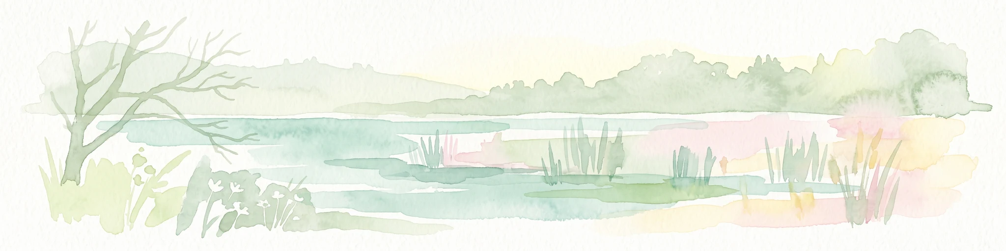
A horizontal watercolor illustration showing soft, muted green trees and shrubs against a light pink and pale yellow sky, representing a wetland landscape.
Nature reserveHessen
About 4.7 km away#2 closest

Southeast

Griesheimer Bruch Nature Reserve: Geographic Overview and Mapped Protected Landscapes

Wetland ecosystems and regional geography in southern Hesse

Griesheimer Bruch is a 35-hectare nature reserve that protects a rare mosaic of lowland bog remnants, mat-grass swards, and black alder carr forest. This mapped site is central to the Hessian Upper Rhine Plain, serving as a critical wetland refuge within the broader Natura 2000 network. Gain detailed insight into the hydrological features, field geography, and ecological boundaries of this protected landscape in southern Germany.

Area
0.35 km²
Established
2000
IUCN
IV
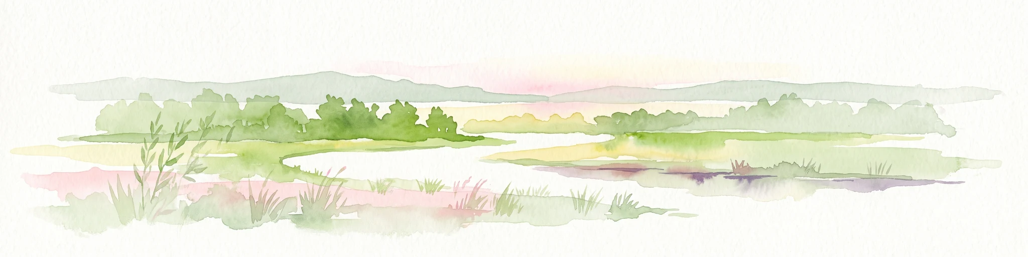
Soft watercolor illustration of a calm, marshy wetland scene with reeds, a lone bare tree on the left, and a soft forest line in the background.
Nature reserveHessen
About 4.8 km away#3 closest

East

Löserbecken von Weiterstadt Nature Reserve in Hessen: A Detailed Geographic Overview

Protected landscape within the Upper Rhine Plain

Löserbecken von Weiterstadt protects a distinct basin landscape characterized by the interaction between former sand extraction slopes and naturally forming rainwater wetlands. This reserve showcases the transformation of post-industrial ground into a high-value habitat for crested newts and other species. Explore the boundaries and topographic features of this compact, protected Hessen nature area.

Area
0.08 km²
Established
1983
IUCN
IV
Nature reserveHessen
About 5.4 km away#4 closest

North

Niederwald von Groß-Gerau Nature Reserve: Hessen Protected Woodland and Riparian Geography

A preserved lowland forest habitat in the Rhine-Main landscape

Niederwald von Groß-Gerau serves as a protected refuge for moist deciduous woodland in the Untermainebene. This nature reserve features an intricate network of streams and deadwood habitats, standing as a vital ecological link within the heavily developed region of Hessen. Explore the mapped boundaries and natural terrain of this unique, habitat-rich forest fragment.

Area
0.696 km²
Established
1995
IUCN
IV
Relief
Lowland
A soft watercolor painting of a winding river flowing through a lush green floodplain with distant hills under a pale sky.
Nature reserveHessen
About 7.5 km away#5 closest

Southwest

Kühkopf-Knoblochsaue Nature Reserve: A Detailed Look at Hessian Rhine Floodplain Geography

Protected river island terrain, alluvial forests, and floodplain dynamics

Examine the geographic characteristics of Kühkopf-Knoblochsaue, the premier nature reserve in the Hessian Ried. This site provides an in-depth atlas perspective on the Rhine floodplain, featuring the iconic inland island structure, softwood and hardwood forest transitions, and the ongoing influence of the Stockstadt-Erfelder Altrhein on the local terrain.

Area
24.4 km²
Established
1952
Relief
Lowland
Climate
Temperate
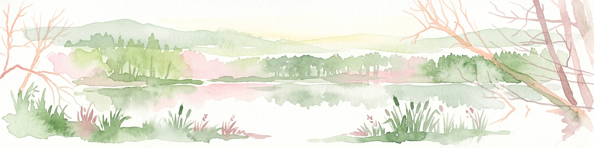
A pale, soft watercolor landscape painting of a quiet lake with shoreline reeds, trees in the background, and branches framing the scene on the sides.
Nature reserveHesse
About 9.2 km away#6 closest

East

Am Kleewoog von Gräfenhausen Nature Reserve: Geography and Protected Area Landscape Overview

A regional sanctuary of sand habitats and former gravel pits in Hesse

Examine the distinct ecological geography of Am Kleewoog von Gräfenhausen. This reserve showcases the transition between rugged, water-filled gravel excavations and stable pine-oak forest stands on acidic inland dunes. Gain insight into the regional importance of this protected mosaic as an amphibian refuge and a remnant of the unique geological substrate found across the Darmstadt sand sheet.

Area
0.209 km²
Established
1985
IUCN
IV
Relief
Lowland
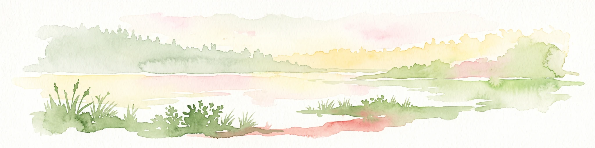
A horizontal watercolor painting depicting a calm lake with grassy banks, reeds, and a soft, hazy treeline in the background against a pale sky.
Nature reserveHessen
About 12 km away#7 closest

Southeast

Bessunger Kiesgrube Nature Reserve: A Detailed Look at the Hessen Protected Landscape

Examining post-industrial geography and forest recovery

The Bessunger Kiesgrube is a designated nature reserve located in Hessen, Germany. Once a centuries-old gravel extraction site, the area now features a groundwater-fed lake bordered by steep rocky banks and dense, naturally regenerated woodland. This site provides a clear case study of ecological recovery on the edge of urban development, offering insight into the geological and environmental legacy of the region.

Area
0.118 km²
Established
1978
Relief
Lowland
Climate
Temperate
Nature reserveHesse
About 13 km away#8 closest

Northeast

Faulbruch bei Erzhausen: Protected Wetland Landscapes and Regional Nature Reserve Atlas

Mapping rare fen woodlands and wet meadow habitats in southern Hesse

This nature reserve protects an ecologically distinct combination of black alder fen, mat grass pastures, and calcareous meadows near Erzhausen. Situated on silty, peaty soils within the southern Hessian lowlands, the site serves as a vital refuge for specialized biodiversity, maintained by its unique groundwater hydrology and surrounding anthropogenic borders.

Area
0.658 km²
Established
2001
Relief
Lowland
Climate
Temperate

Common questions about visiting, size, designation, and location context for Bruchwiesen bei Büttelborn

Bruchwiesen bei Büttelborn FAQs for park facts, access, geography, and protected area context

Find quick answers about Bruchwiesen bei Büttelborn, including protected-area facts, park geography, trail and visitor context, and how the park fits into its surrounding country and regional landscape.
MoriAtlas Explorer

Continue Your Protected Areas Search Across the Global Atlas

Deepen your exploration by continuing the structured search for national parks and protected areas worldwide. Utilize the comprehensive filtering capabilities to compare different conservation landscapes and refine your understanding of global park geography. Discover more about the distribution and characteristics of protected natural areas.

Global natural geography