
Mori Atlas logo
Nature reserveBrush Island Nature Reserve

Understanding the island terrain, rocky cliff boundaries, and offshore conservation landscape of this South Coast reserve.

Brush Island Nature Reserve: Mapped Protected Geography and Coastal Seabird Sanctuary in New South Wales

Brush Island Nature Reserve serves as a vital protected landscape sitting off the coast of New South Wales, Australia. This 47-hectare continental island in the Tasman Sea features steep rocky cliffs and erosion-carved gullies that provide essential habitat for dense seabird colonies. By tracing its geographic footprint and shoreline character, you can examine the island's role in Australian conservation and its distinct terrain within the regional seascape.

seabird sanctuaryisland reservestrict nature reserveNew South WalesSouth CoastTasman Sea
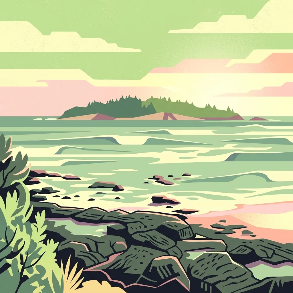
A stylized vector illustration of an island off a rocky coastline at sunrise with pastel green and pink tones.

Brush Island Nature Reserve

Nature reserve

Park overview

Structured park overview, official facts, and landscape profile for Brush Island Nature Reserve

Brush Island Nature Reserve park facts, protected area profile, and essential visitor context

Review the core facts for Brush Island Nature Reserve, including designation, size, terrain, visitor scale, habitats, and operating context in one park-focused overview.

About Brush Island Nature Reserve

Brush Island Nature Reserve is a small but ecologically rich protected island lying just offshore from the New South Wales South Coast. It sits within the Tasman Sea, about two kilometres southeast of Bawley Point, and stretches only around 880 metres in length with a maximum width of about 560 metres. Despite its compact size, it rises roughly 30 metres above sea level, giving the island a clearly defined silhouette against the surrounding ocean.

The island is administered as a strict nature reserve under the New South Wales National Parks and Wildlife Service, and is recognised for its importance to seabird breeding populations along the New South Wales coast. Its shorelines are dominated by steep, rocky cliff faces, while the northern side features erosion gullies that are both created and intensively used by little penguins. The onshore vegetation is typical of exposed South Coast headlands and islands, with low coastal scrub, herbs, and stunted trees adapted to wind, salt spray, and thin soils.

Brush Island has strong cultural and historical significance as well. The Yuin nation's Murramamrang people know the island as "Mit Island" in the Dhurga language, and the island also holds a place in early European exploration history. Captain James Cook sighted the island in April 1770 during his first Pacific voyage, intending to shelter the Endeavour between the island and the mainland but being forced to continue north. Today the reserve forms a quiet but distinctive part of New South Wales' coastal protected-area system, valued less for visitor infrastructure than for the seabird life and ecological condition it preserves.

Quick facts and research context for Brush Island Nature Reserve

Brush Island Nature Reserve is a 47-hectare protected island in the Tasman Sea off the south coast of New South Wales, Australia, lying about two kilometres southeast of Bawley Point and roughly 350 metres beyond Murramarang Point. It is classed as an IUCN Category Ia strict nature reserve, gazetted in July 1963 and administered by the NSW National Parks and Wildlife Service.

The reserve is ecologically important for breeding seabirds, including wedge-tailed and short-tailed shearwaters, little penguins, and sooty oystercatchers, and it is one of the few places on the New South Wales coast where white-faced storm petrels and sooty shearwaters have also been recorded breeding. The island also carries significant historical and cultural value, from Indigenous Yuin heritage through to its 1770 sighting by Captain James Cook.

Protection and recognition

Examining mixed protection scope and international recognition records

Brush Island Nature Reserve Protection Status and Governance Data

Brush Island Nature Reserve maintains a documented mixed protection scope alongside official administrative records. Public registry data outlines management frameworks and conservation designations without additional international listings.

Protection details

Protection scope
Mixed
Transboundary protection
No
Park context

Deeper park guide and search-rich context for Brush Island Nature Reserve

Brush Island Nature Reserve history, landscape, wildlife, and travel context

Explore Brush Island Nature Reserve through its history, landscape character, ecosystems, wildlife, conservation priorities, cultural context, and seasonal travel timing in a structured park guide built for atlas discovery and search intent.

Why Brush Island Nature Reserve stands out

Brush Island Nature Reserve is best known for its density of breeding seabirds, which use nearly every part of the small island for nesting, burrowing, and roosting. Little penguins in particular leave tracks across nearly all of the island, and their erosion gullies shape much of the northern shoreline. The reserve is also recognised as one of the South Coast's cleaner examples of an offshore seabird island. After black rats infested the island in the 1930s following a shipwreck, a successful 2005 eradication campaign restored much of the island's ecological condition, making it a small but important case study in Australian island conservation.
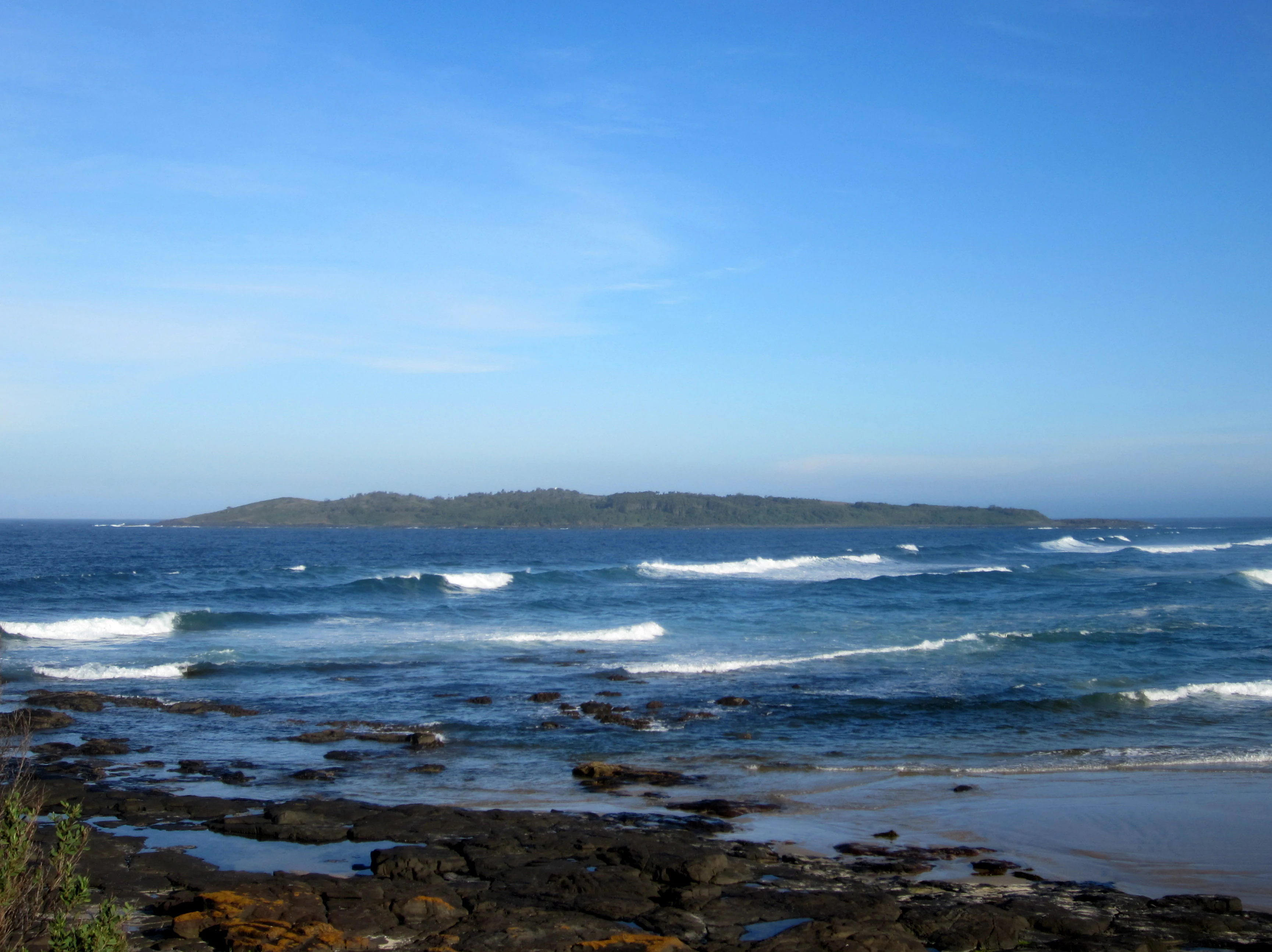
A wide angle view across the blue ocean towards a low lying green island sitting on the horizon under a clear blue sky, with dark rocky foreground and small waves breaking near the shore.
Brush Island viewed from the shore at Murramarang Beach.

Brush Island Nature Reserve history and protected-area timeline

Brush Island has a layered history spanning Indigenous heritage, European exploration, and modern conservation management. For the Yuin nation's Murramamrang people, the island is a known and named place, referred to as "Mit Island" in the Dhurga language, reflecting a longstanding cultural relationship with the South Coast seascape.

The island entered European maritime history on 22 April 1770, when Captain James Cook sighted it during his first voyage to the South Pacific. Cook had intended to shelter HMS Endeavour between the island and the mainland, but heavy seas prevented the plan, and the ship continued north, eventually making its first Australian landfall at Botany Bay a week later.

In the twentieth century, the island's ecological condition was severely disrupted when the steamer Northern Firth ran aground in 1932, introducing black rats that subsequently infested the island. The reserve was gazetted as a nature reserve in July 1963, formalising its protection status. A landmark conservation event came in 2005, when the NSW National Parks and Wildlife Service completed a poisoning campaign that successfully eradicated the black rats, allowing seabird populations and island habitats to recover. The reserve is also listed on Australia's Register of the National Estate, recognising its broader natural and historical value.

Brush Island Nature Reserve landscape and geographic character

Brush Island is a compact continental island with a strongly defined physical character. It rises to roughly 30 metres above sea level, with steep, rocky cliff faces forming much of its shoreline. The island measures about 880 metres in length and up to 560 metres wide, giving it an elongated footprint that is clearly visible from the mainland.

The northern side of the island is shaped by erosion gullies that cut down toward the sea. These gullies are not only a defining feature of the terrain but also a visible sign of the island's biological activity, as little penguin burrows and tracks extend across much of the slope. Beyond the cliffs, the Tasman Sea surrounds the island, and the adjacent mainland forms the scenic backdrop of Murramarang Point and the northern end of Murramarang Beach, from which the island is most readily seen.

Brush Island Nature Reserve ecosystems, habitats, and plant life

The island supports a hardy coastal vegetation cover adapted to salt spray, wind exposure, and thin island soils. Plant communities include low herbs, shrubs, and stunted trees, with notable species such as Carpobrotus glaucescens, Lomandra longifolia, Einadia hastata, Myoporum insulare, Enchylaena tomentosa, Acacia longifolia, Westringia fruticosa, Banksia integrifolia, and Casuarina glauca. Together, these plants create a mosaic of low scrub typical of South Coast offshore islands.

Ecologically, the reserve is primarily significant as a seabird breeding island. The combination of steep cliffs, soft burrowing soils, and limited terrestrial predator presence has allowed several species to nest in large numbers. The island's ecological recovery after the 2005 rat eradication is also a key part of its modern natural history, showing how quickly island vegetation and nesting behaviour can rebound once invasive mammals are removed.

Brush Island Nature Reserve wildlife and species highlights

Brush Island is dominated by its seabird fauna, which is its most distinctive wildlife feature. Wedge-tailed shearwaters and short-tailed shearwaters nest on the island in significant numbers, while little penguins are so widespread that their burrows and tracks cover most of the island, actively shaping the northern gullies as they move between nests and the sea. Sooty oystercatchers also breed along the island's rocky shoreline.

The reserve has gained additional wildlife significance through the discovery of new breeding records. In 2008, white-faced storm petrels and sooty shearwaters were recorded on the island for the first time, adding two further species to its known breeding fauna. The successful 2005 eradication of black rats has played a major role in supporting these populations, removing a key predator of eggs, chicks, and adult seabirds and helping the island function once again as a relatively safe offshore breeding refuge.

Brush Island Nature Reserve conservation status and protection priorities

Brush Island Nature Reserve is significant from a conservation perspective because it functions as one of the South Coast's most important seabird breeding refuges, while occupying only a very small area. Its IUCN Category Ia strict nature reserve status reflects a high level of protection, limiting human activity and prioritising ecological values over visitor use.

The reserve's inclusion on Australia's Register of the National Estate acknowledges its broader natural and cultural significance at a national level. Its conservation story is also defined by the 2005 black rat eradication, a campaign led by the NSW National Parks and Wildlife Service that removed a long-standing invasive threat introduced by the 1932 Northern Firth shipwreck. This restoration effort has become a notable example of how targeted small-island management can rapidly improve breeding conditions for seabirds, including little penguins and shearwaters, as well as supporting the recovery of native coastal vegetation.

Brush Island Nature Reserve cultural meaning and human context

The island holds meaningful cultural value for the Yuin nation, whose Murramamrang people know it as "Mit Island" in the Dhurga language, placing the reserve within a living Indigenous seascape and naming tradition. This long-standing cultural recognition underlines the island's role as more than just a modern conservation site.

The island also carries early European maritime heritage, having been sighted by Captain James Cook in 1770 during the first European charting of the eastern Australian coast. Together, these overlapping Indigenous and exploration histories give Brush Island a layered cultural context that sits alongside its ecological importance.

Top sights and standout views in Brush Island Nature Reserve

Brush Island Nature Reserve stands out for its compact scale combined with its surprising ecological density, supporting major breeding colonies of seabirds on a 47-hectare island just a short distance from the New South Wales mainland. Its cliff-and-gully terrain is visually striking and biologically productive, especially for little penguins, whose activity has shaped much of the island's surface.

Other highlights include the successful 2005 rat eradication, which restored the island's condition after decades of invasive pressure, the recent first-time records of white-faced storm petrels and sooty shearwaters breeding there, and the reserve's dual recognition as both a strict nature reserve and a place listed on Australia's Register of the National Estate. The visible link from mainland headlands like Murramarang Point to the offshore island also makes it a distinctive feature of the South Coast's seascape.

Best time to visit Brush Island Nature Reserve

Brush Island is an uninhabited nature reserve without regular public access, so any consideration of visit timing relates mainly to viewing the island from the mainland, particularly from Murramarang Point and Bawley Point. From the shore, the island is most atmospheric in the calmer, clearer months of late spring through early autumn, when ocean conditions are gentler and seabird activity along the cliffs is more visible.

Seabird breeding seasons generally give the island its richest sense of life, with shearwaters and little penguins most active around their nesting periods. Rough winter seas can obscure views from the mainland and emphasise the island's exposed, cliff-bound character, while milder shoulder seasons offer a balance of pleasant viewing conditions and active birdlife. Visitors are generally expected to view the reserve from a respectful distance, given its strict nature reserve status.


Monthly climate preview

Examine long-term representative temperature and precipitation averages across the year.

Brush Island Nature Reserve Climate Normals and Annual Temperature Patterns

Representative coordinates record mean monthly temperatures ranging from 13.8 degrees Celsius in July to 21.68 degrees Celsius in February alongside varying daily precipitation rates. Reviewing the complete twelve-month profile provides deeper analytical insight into the long-term climatic rhythm of Brush Island Nature Reserve.
Annual mean18 °C
14 °C22 °C
Jan21°
Feb22°
Mar21°
Apr19°
May17°
Jun15°
Jul14°
Aug14°
Sep15°
Oct17°
Nov18°
Dec20°
Warmest month
February

21.7 °C

Coolest month
July

13.8 °C

Wettest month
February

4.3 mm/day

Driest month
September

2 mm/day

Park location guide

Geography guide, regional context, and park location map for Brush Island Nature Reserve

Brush Island Nature Reserve park geography, regions, and map view in Australia

Understand where Brush Island Nature Reserve sits in Australia through a broader geographic reading of the surrounding landscape, nearby location context, and its mapped position within the national park landscape.

How Brush Island Nature Reserve fits into Australia

Australia is a constitutional monarchy and federal parliamentary democracy comprising six states and ten territories. With a population of nearly 28 million, it is one of the world's most urbanised countries, with most people concentrated on the eastern seaboard. The country has a high Human Development Index and is known for its cultural diversity, ancient Aboriginal heritage, and unique wildlife.

Wider geography shaping Brush Island Nature Reserve in Australia

Australia occupies the entire Australian continent, the island of Tasmania, and numerous smaller islands. It is the world's flattest and driest inhabited continent, featuring vast deserts in the interior (the Outback), tropical rainforests along the eastern coast, and a coastline bordering the Indian and Pacific Oceans.

Map view of Brush Island Nature Reserve

Use this park location map to pinpoint Brush Island Nature Reserve in Australia, understand its exact geographic position, and read its mapped placement within the surrounding landscape more clearly.

Pigeon | © OpenStreetMap contributors

Location context for Brush Island Nature Reserve

New South Wales

Visual exploration of coastal cliffs, seabird habitats, and island terrain

Brush Island Nature Reserve Photos and Landscape Scenery

Examine detailed photography capturing the rugged rocky cliffs, coastal scrub, and marine environment defining Brush Island Nature Reserve. Visual documentation reveals the distinct topography and island habitats supporting major regional seabird colonies.

A wide angle view across the blue ocean towards a low lying green island sitting on the horizon under a clear blue sky, with dark rocky foreground and small waves breaking near the shore.

Park atlas

Compare adjacent coastal reserves and regional wildlife habitats

Explore Protected Areas and Parks Near Brush Island Nature Reserve

Browse nearby protected landscapes and coastal reserves connected to Brush Island Nature Reserve through shared regional geography. Comparing surrounding coastal habitats expands your understanding of marine conservation and island ecosystems along the South Coast.
National parkNew South Wales
About 4 km away#1 closest

North

Meroo National Park: Protected National Park in New South Wales with Mapped Landscape Identity

Explore the protected landscape and geographic context of this national park.

Meroo National Park is a protected national park located in New South Wales, Australia, offering specific geographic context for atlas exploration. This page provides details on its mapped boundaries and its identity as a conservation landscape. Understanding Meroo National Park's place within the regional geography of New South Wales is key to appreciating its protected status and unique natural characteristics, all within a framework designed for structured geographic discovery.

Established
2001
IUCN
II
Relief
Lowland
Climate
Temperate
National parkNew South Wales
About 4.4 km away#2 closest

Southwest

Murramarang National Park: Discover Its Mapped Protected Area and New South Wales Geography

Explore the unique landscape and geographic features.

Murramarang National Park stands as a distinct protected area within New South Wales, offering a unique landscape to explore through its mapped boundaries and regional geographic context. This resource provides essential details for understanding its place in the atlas of Australian protected lands. Users can gain a factual appreciation of the park's physical geography and its identity as a national park, grounded in spatial data and mapped terrain.

Area
121 km²
Established
1973
IUCN
II
Relief
Mountain
Watercolor landscape illustration showing green fields, trees, hills, and pastel sky
National parkNew South Wales
About 17 km away#3 closest

Northwest

Morton National Park: A Protected Landscape of Waterfalls and Dissected Plateaus in New South Wales

Explore its mapped boundaries and regional geographic context.

Morton National Park is a nationally recognized protected area within New South Wales, Australia, celebrated for its striking natural features and geographic significance. The park's landscape is characterized by a dramatic dissected plateau, giving rise to impressive waterfall systems such as Fitzroy Falls and Belmore Falls that cascade into deep gorges. As a key component of the Southern Highlands' natural heritage, Morton National Park provides a rich subject for atlas exploration, offering insights into regional terrain, protected land distribution, and the unique interplay of natural elements within this Australian national park.

Area
1,997.45 km²
Established
1967
IUCN
II
Relief
Mixed relief
National parkNew South Wales
About 20 km away#4 closest

West

Bimberamala National Park: New South Wales National Park Protected Landscape Atlas

Mapped boundaries and regional geographic context for discovery.

Bimberamala National Park is a protected natural area within New South Wales, Australia, offering a distinct geographic profile. As a national park, its mapped boundaries and landscape characteristics are valuable for understanding regional protected areas and their distribution. This entity provides a focused point for atlas-based geographic exploration, allowing users to study its specific terrain and environmental context within the wider Australian geography.

Area
43.96 km²
Established
2001
IUCN
II
Relief
Upland
National parkAustralia
About 27 km away#5 closest

Southwest

Clyde River National Park: Australia's Protected Riverine Landscape and Swift Parrot Sanctuary

Discover its vital role in conservation and mapped geography.

Clyde River National Park is a critical protected area in Australia, safeguarding nine kilometers of river frontage along the Clyde River. Established for its ecological importance, particularly as a sanctuary for the endangered swift parrot, the park's landscape is characterized by riverine forests and eucalyptus woodlands. This designation highlights its role in preserving key habitats and contributing to the regional map of protected lands vital for biodiversity.

Area
10.91 km²
Established
2000
IUCN
II
Scope
Terrestrial
National parkNew South Wales
About 29 km away#6 closest

West

Budawang National Park: Wilderness Area and Rugged Terrain Map

Discover New South Wales protected landscape geography.

Budawang National Park is recognized for its exceptional wilderness character, defined by the steep topography of the southern Budawang Range. This protected national park features extensive cool temperate rainforests clothing its middle and upper slopes, creating a visually striking and ecologically rich mountain environment. Its rugged terrain, with deep valleys and rocky outcrops, distinguishes it as a remote natural landscape within New South Wales, offering unique habitat pockets and contributing to the region's protected area atlas.

Area
237 km²
Established
1977
IUCN
Ib
Relief
Mountain
National parkNew South Wales
About 29 km away#7 closest

North

Conjola National Park: Mapped Protected Landscape within New South Wales Geography

Explore the park's protected boundaries and regional terrain.

Conjola National Park represents a distinct protected landscape within New South Wales, offering rich opportunities for geographic discovery. As a national park, its mapped boundaries and natural terrain contribute significantly to the regional atlas. This entry provides essential context for understanding the park's protected identity and its contribution to the broader geographic landscape of Australia, facilitating detailed map exploration.

Area
10 km²
Established
1994
IUCN
II
Relief
Lowland
Nature reserveNew South Wales
About 30 km away#8 closest

North

Yatteyattah Nature Reserve: A Geographical Overview of Coastal Protected Rainforests

Mapping subtropical rainforest remnants in New South Wales

Yatteyattah Nature Reserve provides a vital case study in protected-area geography by maintaining a complex subtropical rainforest canopy near the southern limits of its climatic envelope. Located on the New South Wales coast, the reserve features a diverse assemblage of rainforest trees and epiphytic ferns thriving on fertile monzonite soils, offering a clear visual contrast to the surrounding grazing countryside within the regional landscape.

Area
0.35 km²
Established
1996
IUCN
Ia
Relief
Upland

Common questions about visiting, size, designation, and location context for Brush Island Nature Reserve

Brush Island Nature Reserve FAQs for park facts, access, geography, and protected area context

Find quick answers about Brush Island Nature Reserve, including protected-area facts, park geography, trail and visitor context, and how the park fits into its surrounding country and regional landscape.
MoriAtlas Explorer

Continue Your Protected Areas Search Across the Global Atlas

Deepen your exploration by continuing the structured search for national parks and protected areas worldwide. Utilize the comprehensive filtering capabilities to compare different conservation landscapes and refine your understanding of global park geography. Discover more about the distribution and characteristics of protected natural areas.

Global natural geography