
Mori Atlas logo
Protected landscapeBuffalo Gap National Grassland

Mapping the vast prairie terrain, eroded chalk badlands, and integrated ecological boundaries

Buffalo Gap National Grassland: An Essential Protected Landscape in Southwestern South Dakota

Buffalo Gap National Grassland represents one of the largest protected grassland systems in the United States, stretching across the heart of southwestern South Dakota. This sprawling landscape preserves a working Great Plains ecosystem characterized by the dramatic contrast between gentle, rolling mixed-grass prairie and sharply carved, fossil-rich badlands. Through its unique geography, the area acts as a vital transition zone that wraps around neighboring protected lands, providing critical habitat for wildlife and preserving a significant paleontological record within its eroded buttes and gullies.

grasslandmixed-grass prairiebadlandsGreat Plainsnational grasslandpublic land
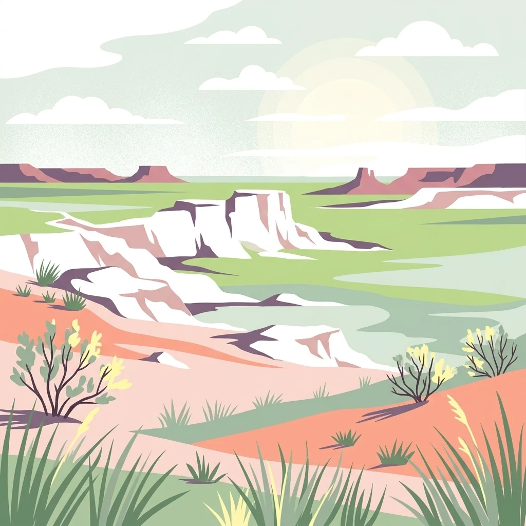
A digital illustration depicting a landscape with chalky white badland cliffs, green prairie grass, and sparse desert shrubs under a soft sky.

Buffalo Gap National Grassland

Protected landscape

Park overview

Structured park overview, official facts, and landscape profile for Buffalo Gap National Grassland

Buffalo Gap National Grassland park facts, protected area profile, and essential visitor context

Review the core facts for Buffalo Gap National Grassland, including designation, size, terrain, visitor scale, habitats, and operating context in one park-focused overview.

About Buffalo Gap National Grassland

Buffalo Gap National Grassland is one of the largest blocks of public grassland in the Great Plains and a defining landscape of southwestern South Dakota. Spanning roughly the size of a small U.S. state, it preserves a continuous stretch of mixed-grass prairie, rolling plains, and the eroded chalk badlands that lend the surrounding region its stark, layered appearance. Because the grassland physically surrounds Badlands National Park, it functions almost as a broader ecological envelope for that park, softening the boundary between formal national park protection and working rangeland.

The grassland forms part of the National Grassland system administered by the U.S. Forest Service. It is managed in coordination with other Great Plains units, including the Nebraska National Forest, Samuel R. McKelvie National Forest, Fort Pierre National Grassland, and Oglala National Grassland. Shared offices in Chadron, Nebraska oversee the combined operation, while local ranger districts in Hot Springs and Wall, South Dakota handle day-to-day management on the ground. The National Grasslands Visitor Center in Wall provides an interpretive introduction to the region's prairie ecology, grazing history, and Great Plains heritage, complete with exhibits, a theater, and educational displays about grassland wildlife and plants.

Ecologically, Buffalo Gap supports a classical Great Plains mix of warm- and cool-season grasses, prairie shrubs, and riparian corridors, while its badlands add exposures of fossil-rich sedimentary layers that connect the living landscape to the paleontological legacy of the region. The grassland's open and largely undeveloped character makes it a stronghold for native prairie species and a key site for species recovery efforts, most notably the black-footed ferret reintroduction in the Conata Basin.

Culturally and geographically, Buffalo Gap sits at the crossroads of some of America's most recognizable western landscapes. To its north rise the Black Hills with Mount Rushmore, Crazy Horse Memorial, Custer State Park, and the Black Elk Wilderness. To its east extend iconic features like Bear Butte, Wind Cave, Jewel Cave, and Spearfish Canyon, while long-distance trails such as the Centennial Trail and the George S. Mickelson Trail run nearby. The Peter Norbeck Scenic Byway and other scenic roads tie the grassland into the broader Black Hills and Badlands touring experience, making Buffalo Gap both an independent destination and a connective landscape tying South Dakota's most famous places together.

Quick facts and research context for Buffalo Gap National Grassland

Buffalo Gap National Grassland is located in southwestern South Dakota and ranks as the second largest National Grassland in the United States. It spans parts of four counties in descending order of land area: Fall River, Pennington, Jackson, and Custer counties, with the nearest city being Hot Springs.

The grassland is administered by the U.S. Forest Service and managed alongside the Nebraska and Samuel R. McKelvie National Forests and the Fort Pierre and Oglala National Grasslands from shared offices in Chadron, Nebraska. It surrounds Badlands National Park and the Minuteman Missile National Historic Site, integrating the grassland ecologically and geographically with one of South Dakota's most visited parks. The National Grasslands Visitor Center in Wall, South Dakota serves as an interpretive hub for visitors interested in prairie ecology, grazing history, and Great Plains heritage.

Protection and recognition

Examine documented protection metrics and official conservation status records.

Buffalo Gap National Grassland Protection Status and Terrestrial Area Designation

Terrestrial protection status records for Buffalo Gap National Grassland outline the official conservation framework governing this landscape. Structured management data details international recognition sources and baseline administrative definitions.

Protection details

Protection scope
Terrestrial
Transboundary protection
No
Park context

Deeper park guide and search-rich context for Buffalo Gap National Grassland

Buffalo Gap National Grassland history, landscape, wildlife, and travel context

Explore Buffalo Gap National Grassland through its history, landscape character, ecosystems, wildlife, conservation priorities, cultural context, and seasonal travel timing in a structured park guide built for atlas discovery and search intent.

Why Buffalo Gap National Grassland stands out

Buffalo Gap is best known for its sweeping mixed-grass prairie and striking chalky badlands scenery that blends directly into the adjacent Badlands National Park. Its immense size makes it a defining landscape feature of southwestern South Dakota, where it preserves a working Great Plains ecosystem of open range, eroded buttes, and prairie habitat. The grassland is also renowned for hosting the most successful black-footed ferret reintroduction program undertaken by the U.S. federal government. In the Conata Basin area, this program established a small but sustainable population of a species that had been extirpated from the wild, giving Buffalo Gap a significant conservation profile that extends well beyond its scenic value.
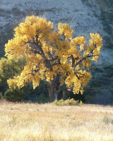
A large Plains cottonwood tree with brilliant yellow autumn leaves stands in a dry grassland with a pale badlands slope in the background.
A Plains cottonwood tree displaying vibrant autumn foliage in Buffalo Gap National Grassland.

Buffalo Gap National Grassland history and protected-area timeline

Buffalo Gap National Grassland was formally established on June 23, 1960, as part of the National Grassland system designed to conserve representative Great Plains landscapes that might otherwise have been lost to cultivation and development. The grassland draws its name from Buffalo Gap, a traditional low pass and travel route in southwestern South Dakota that historically provided a natural passage between the Black Hills and the surrounding prairie.

From its establishment, the grassland was placed under the stewardship of the U.S. Forest Service. Over time it became operationally integrated with the Nebraska National Forest system, allowing Forest Service rangers in Chadron, Nebraska and local offices in Hot Springs and Wall to manage Buffalo Gap alongside other plains units such as Fort Pierre and Oglala National Grasslands.

In the late twentieth and early twenty-first centuries, the grassland gained wider recognition for its conservation role, particularly through the successful black-footed ferret reintroduction program in the Conata Basin. This effort is regarded as the most successful such program undertaken by the federal government, establishing a small but sustainable population of an animal that had been considered extinct in the wild. In 2010, South Dakota Senator Tim Johnson introduced the Tony Dean Cheyenne River Valley Conservation Act, which proposed designating more than 48,000 acres of the grassland as protected wilderness, the first such designation within a National Grassland, while still allowing grazing and hunting to continue. The grassland also entered public discourse in 2013 when concerns were raised by activist Charmaine White Face regarding radiation exposure of South Dakota Army National Guard soldiers training on Buffalo Gap lands.

Buffalo Gap National Grassland landscape and geographic character

The landscape of Buffalo Gap National Grassland is a textbook expression of the southwestern South Dakota plains. The terrain is dominated by gently rolling mixed-grass prairie that stretches toward distant horizons, broken intermittently by the dramatic, sharply eroded chalk badlands for which the region is famous. These badlands expose pale bands of sedimentary rock and clay that shift in color from white and gray to soft pink and ochre, creating a stark visual contrast with the surrounding green and gold prairie.

The grassland sits in a transitional position between the rugged Black Hills uplift to the north and the wider High Plains to the east and south. This geography produces subtle but important variations in elevation, drainage, and soil, supporting a mosaic of upland prairie, lowland swales, and steep badland drainages. Erosion has sculptured the soft rock into classic badlands features, including buttes, pinnacles, gullies, and washes, while the broader prairie preserves a more gentle, sweeping topography.

In the Conata Basin and along the perimeter of Badlands National Park, the chalky badlands of Buffalo Gap blend almost imperceptibly into the formally protected badlands of the neighboring national park. This continuous landscape gives the region its distinctive feel, where visitors can move from open ranching country into deeply eroded, fossil-bearing scenery within a short distance. The area's setting also places it in close proximity to landmarks such as the Black Hills, Bear Butte, and the fossil-rich formations of The Mammoth Site, reinforcing Buffalo Gap's role as a gateway among southwestern South Dakota's most iconic landforms.
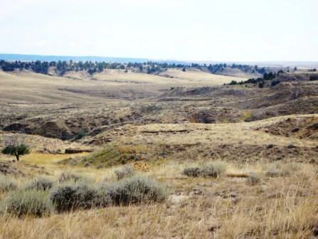
Rolling, arid grassy landscape with sparse shrubs and low hills under a bright, overcast sky in South Dakota.
A wide view of the mixed grass prairie and rolling terrain characteristic of the Buffalo Gap National Grassland.

Buffalo Gap National Grassland ecosystems, habitats, and plant life

Buffalo Gap National Grassland preserves a substantial and largely intact example of mixed-grass prairie, one of the most altered ecosystems in North America. The prairie here includes both warm- and cool-season grasses along with flowering forb species and low shrubs that together form a dynamic, fire-adapted plant community. Across the property, the prairie shifts in composition and density in response to soil type, slope, and moisture, producing a patchwork of habitat conditions across an otherwise seemingly uniform landscape.

Where the prairie meets the chalky badlands, the ecological character changes abruptly. The steep, eroding slopes support sparse, drought-tolerant vegetation and expose fast-draining soils that contrast sharply with the denser grass cover of the surrounding plains. These badland edges and breaks are important for species that rely on broken terrain, while the more level prairie lands continue to function as working rangeland for both wildlife and historic grazing use.

Riparian corridors and draws within the grassland add a third dimension to its ecology, providing moisture and cover in an otherwise semi-arid setting. Together, the prairie uplands, badland breaks, and riparian strips form an interconnected habitat mosaic that supports the grassland's broader biodiversity and gives it enduring conservation significance.
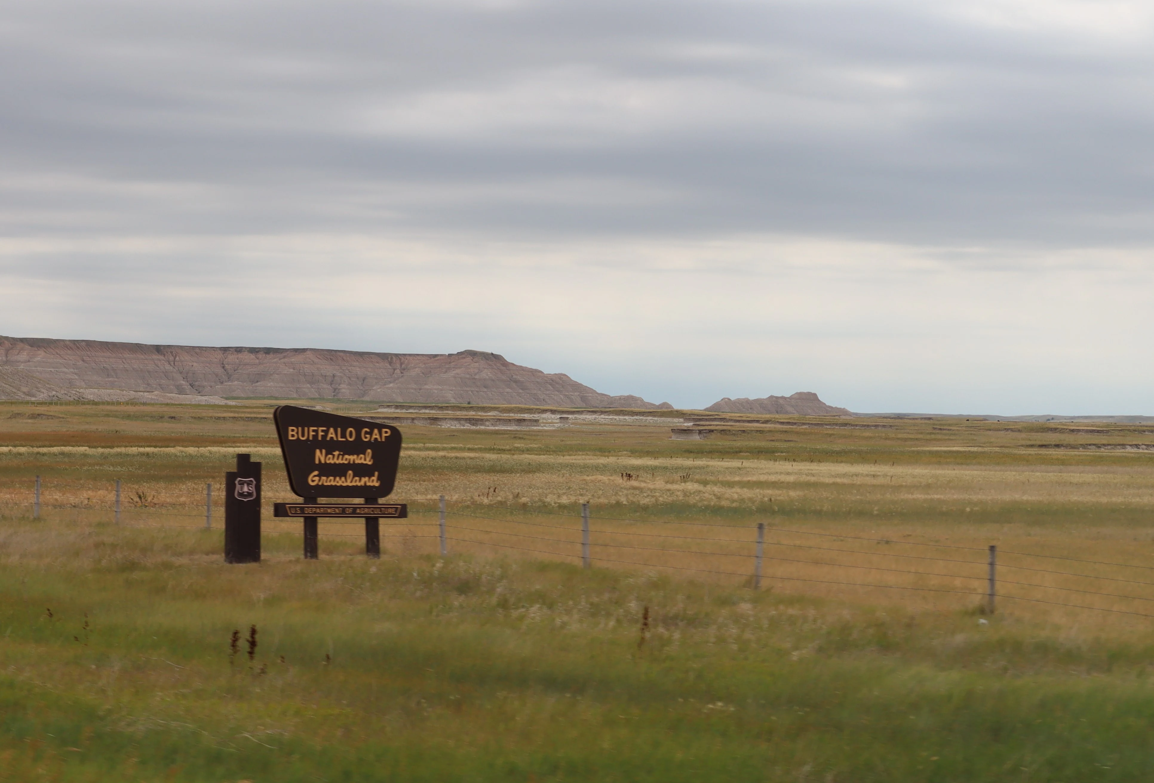
An official, dark, shield-shaped entrance sign for Buffalo Gap National Grassland stands on a grassy prairie with low-lying bluffs in the background under a cloudy sky.
The official entrance sign for Buffalo Gap National Grassland in South Dakota, set against a backdrop of open prairie and distant bluffs.

Buffalo Gap National Grassland wildlife and species highlights

Wildlife is a central element of Buffalo Gap National Grassland's identity, reflecting the broader character of the Great Plains. The open prairie and badland edges support populations of grassland songbirds, ground-nesting birds, and raptors that depend on large, unbroken expanses of native grass. Mammals typical of the northern Great Plains also inhabit the grassland, using the mix of prairie, breaks, and draws for forage and shelter.

The grassland's most famous wildlife story is the recovery of the black-footed ferret. Once considered lost from the wild, this slender, prairie-dependent predator has been returned to portions of the Buffalo Gap landscape through a deliberate reintroduction program in the Conata Basin area. That program is widely regarded as the most successful black-footed ferret reintroduction undertaken by the U.S. federal government, and the small but sustainable population it established is a defining feature of the grassland's modern conservation profile.

Beyond black-footed ferrets, the grassland continues to host a community of mammals, birds, reptiles, and invertebrates associated with mixed-grass prairie, with species composition shifting between the upland prairie, badland formations, and riparian zones. This mosaic of habitats gives the grassland a richer wildlife presence than its open, treeless appearance might suggest.

Buffalo Gap National Grassland conservation status and protection priorities

Buffalo Gap National Grassland plays an outsized role in the conservation of Great Plains ecosystems. Its sheer size makes it one of the largest remaining blocks of native mixed-grass prairie in the region, providing habitat continuity that is increasingly rare as surrounding lands are converted to other uses. By preserving a working landscape that still supports grazing alongside wildlife, the grassland demonstrates how pastoral land use and biodiversity protection can coexist.

The grassland's most prominent conservation achievement is the black-footed ferret reintroduction program in the Conata Basin. This effort transformed Buffalo Gap into a critical recovery site for a species that had vanished from the wild, and the sustainable population established there has become a model for prairie species recovery across North America.

Beyond species-specific work, Buffalo Gap has been at the center of broader policy debates about the future of the National Grassland system. Proposals such as the Tony Dean Cheyenne River Valley Conservation Act of 2010 sought to elevate parts of the grassland to formal wilderness status, an unprecedented step for any National Grassland, while still allowing grazing and hunting to continue. Whether or not such designations advance, they underscore that Buffalo Gap is viewed as a landscape of national conservation significance, not merely a backdrop for the nearby Black Hills and Badlands.

Buffalo Gap National Grassland cultural meaning and human context

Buffalo Gap National Grassland occupies a landscape deeply woven into the cultural and historical identity of the Great Plains. The name itself, Buffalo Gap, refers to a traditional natural passage in southwestern South Dakota that long served as a route of movement between the Black Hills and the open prairie. The surrounding country carries deep significance for the Lakota and other Indigenous peoples of the northern Plains, including connections to nearby landmarks such as Bear Butte, a National Historic Landmark of profound spiritual importance.

In more recent history, the grassland has been shaped by ranching and military use as well as by conservation and Indigenous advocacy. Concerns voiced in 2013 by activist Charmaine White Face regarding the radiation exposure of South Dakota Army National Guard soldiers training on Buffalo Gap lands added another chapter to the grassland's contemporary cultural history, reflecting ongoing debates about how public grasslands are used and for whose benefit.

Top sights and standout views in Buffalo Gap National Grassland

Buffalo Gap National Grassland is distinguished by its role as the second largest National Grassland in the United States, wrapping around Badlands National Park and tying that iconic park into a much larger prairie landscape. Its striking visual contrast between gentle mixed-grass prairie and sharply eroded chalk badlands gives the area a unique sense of scale and openness within the Black Hills and Badlands region.

Internationally, the grassland is also recognized for the success of its black-footed ferret reintroduction program, which stands as a landmark achievement in North American wildlife conservation. These qualities, vast working prairie, dramatic eroded geology, and globally relevant species recovery, together make Buffalo Gap one of the most ecologically significant protected landscapes in the Great Plains.

Best time to visit Buffalo Gap National Grassland

The character of Buffalo Gap National Grassland shifts noticeably with the seasons, and each part of the year offers a different perspective on its prairie and badland scenery. Spring and early summer bring fresh green growth to the mixed-grass prairie, warmer temperatures for exploration, and active periods for grassland birdlife and mammals, making this a rewarding window for those interested in the living landscape.

Late summer and early autumn typically turn the prairie golden and dry, sharpening the visual contrast between the open range and the pale, eroded chalk badlands. Light is often softer and warmer during these months, accentuating the layered textures of the badlands formations. Winter, by contrast, brings quieter conditions, occasional snow cover, and stark, sweeping views across the plains, though visitors should expect variable weather and reduced services. The National Grasslands Visitor Center in Wall, South Dakota provides a useful year-round starting point for understanding the seasonal rhythms of the grassland.
Monthly climate preview

Long-term representative temperature and monthly precipitation statistics for South Dakota

Buffalo Gap National Grassland Climate Normals and Annual Weather Patterns

Representative coordinates record long-term temperature ranges spanning sub-zero winter minimums to warm summer maximums alongside measured monthly precipitation averages. Detailed twelve-month climate normals provide a complete statistical profile of annual atmospheric patterns across the protected landscape.
Annual mean10 °C
-3 °C25 °C
Jan-3°
Feb-1°
Mar
Apr
May15°
Jun21°
Jul25°
Aug24°
Sep18°
Oct
Nov
Dec-2°
Warmest month
July

24.9 °C

Coolest month
January

-2.7 °C

Wettest month
May

2.7 mm/day

Driest month
January

0.3 mm/day

Park location guide

Geography guide, regional context, and park location map for Buffalo Gap National Grassland

Buffalo Gap National Grassland park geography, regions, and map view in United States of America

Understand where Buffalo Gap National Grassland sits in United States of America through a broader geographic reading of the surrounding landscape, nearby location context, and its mapped position within the national park landscape.

How Buffalo Gap National Grassland fits into United States of America

The United States of America is a federal presidential republic and one of the world's largest countries by area and population. It consists of 50 states across a vast territory spanning multiple time zones, with its capital in Washington, D.C. and largest city in New York City. The nation has a diverse economy, influential political system, and significant cultural and military presence globally.

Wider geography shaping Buffalo Gap National Grassland in United States of America

The United States occupies a vast territory in North America, bordered by Canada to the north and Mexico to the south. The 48 contiguous states stretch from the Atlantic to the Pacific Ocean, while Alaska occupies the northwestern region and Hawaii is an archipelago in the Pacific. The country encompasses diverse terrain including the Rocky Mountains, Appalachian Mountains, Great Plains, and extensive river systems.

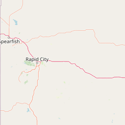
Map view of Buffalo Gap National Grassland

Use this park location map to pinpoint Buffalo Gap National Grassland in United States of America, understand its exact geographic position, and read its mapped placement within the surrounding landscape more clearly.

Pigeon | © OpenStreetMap contributors

Location context for Buffalo Gap National Grassland

South Dakota

Visual reference for mixed-grass prairie terrain, eroded badlands, and protected habitat.

Buffalo Gap National Grassland Photos and Scenery: Exploring the Great Plains Landscape

Visual documentation captures the sweeping mixed-grass prairie and eroded chalk badlands that define the protected landscape of Buffalo Gap National Grassland. Examining these field photographs reveals the unique terrain, geological formations, and Great Plains habitat patterns across southwestern South Dakota.

A large Plains cottonwood tree with brilliant yellow autumn leaves stands in a dry grassland with a pale badlands slope in the background.

A wide, flat landscape in Buffalo Gap National Grassland featuring white chalky soil, patches of dry grass, and eroded badlands formations in the distance under a blue sky with scattered clouds.

Rolling, arid grassy landscape with sparse shrubs and low hills under a bright, overcast sky in South Dakota.

An official, dark, shield-shaped entrance sign for Buffalo Gap National Grassland stands on a grassy prairie with low-lying bluffs in the background under a cloudy sky.

Park atlas

Compare adjacent Great Plains terrain, badlands formations, and regional reserves

Explore Protected Areas and Parks Near Buffalo Gap National Grassland

Discover other national parks and protected areas sharing the sweeping mixed-grass prairie and eroded badlands geography surrounding Buffalo Gap National Grassland. Broaden regional comparison across connected Great Plains landscapes and adjacent conservation zones.
National parkSouth Dakota
About 0.7 km away#1 closest

Northeast

Badlands National Park: South Dakota's Premier National Park for Atlas Exploration

Explore mapped terrain and protected landscape boundaries.

Badlands National Park stands as a key protected area within the geography of South Dakota, offering a distinct natural landscape for detailed atlas exploration. This National Park's unique terrain and mapped boundaries provide crucial context for understanding regional geography and conservation landscapes. Engage with structured information that highlights the park's geographic identity, making it an essential destination for those seeking to map and comprehend protected natural areas.

Area
982.4 km²
Established
1939
IUCN
II
Visitors
1M annual
National parkCuster County
About 38 km away#2 closest

West

Wind Cave National Park: A National Park with Distinct Protected Landscape and Geographic Identity

Explore the mapped terrain and regional context of this US protected area.

Wind Cave National Park represents a key protected area within Custer County, offering users a deep dive into its unique geography and landscape characteristics. As a designated national park in the United States, its mapped boundaries provide crucial context for understanding its ecological and geological significance. This MoriAtlas entry facilitates detailed exploration, focusing on the protected land's identity and its role within the wider regional geography and natural landscape.

Area
136.97 km²
Established
1903
IUCN
II
Visitors
489.4K annual
Watercolor painting of a wide, rolling grassy plain leading to distant low hills or badlands against a pale sky.
Protected landscapeNebraska
About 72 km away#3 closest

Southwest

Oglala National Grassland: Geological Terrain and Protected Landscape Map in Nebraska

Regional geography of prairie rangelands and eroded badlands

Situated in the northwest corner of Nebraska, Oglala National Grassland covers nearly 95,000 acres of shortgrass prairie and badlands. This protected landscape is defined by the unique exposure of Pierre Shale, creating a terrain characterized by deep gullies, banded sedimentary rock, and hoodoo formations that provide essential habitat and a deep record of natural history.

Area
382.5 km²
Relief
Upland
Climate
Arid
Access
Easy access
A watercolor painting showing a rolling landscape with green hills, patches of coniferous forest, and a soft, hazy sky.
Protected landscapeNebraska
About 84 km away#4 closest

South

Nebraska National Forest: Geographic Context and Protected Landscape Boundaries

Mapped terrain across Sandhills and Pine Ridge districts.

This protected landscape is defined by its unusual dual-district structure, encompassing both the historic tree-planting experiments in the central Sandhills and the rugged, native pine-covered canyons of the Pine Ridge. Discover how these distinct environmental zones create a unique ecological footprint within the broader Nebraska geography through detailed map-based insights.

Area
574.1 km²
Established
1908
Relief
Upland
Climate
Temperate
Protected landscapeWyoming
About 119 km away#5 closest

West

Thunder Basin National Grassland: A Protected Landscape in the Wyoming Powder River Basin

Mapping the prairie and sagebrush mosaic of northeastern Wyoming

Thunder Basin National Grassland is a sprawling, federally protected territory in northeastern Wyoming that functions as a critical ecotone between the Great Plains and the Rocky Mountain region. Its landscape is characterized by wide-open vistas, intricate sedimentary bluffs, and diverse habitats shaped by natural disturbance patterns and ongoing grassland management. This record outlines the geography, terrain features, and protected boundaries that define this essential segment of the American West.

Area
2,215.65 km²
Established
1960
Relief
Upland
Climate
Arid
National parkCherry County
About 153 km away#6 closest

Southeast

Samuel R. McKelvie National Forest: Mapping Nebraska's Sandhills Protected Landscape

An atlas view of rolling dune grasslands and forest mosaics in Cherry County.

Located in the heart of Cherry County, Samuel R. McKelvie National Forest presents a distinct landscape where prairie grasses meet planted pine islands. This overview examines the forest's placement within the Sandhills region, highlighting its role as a protected grassland unit near the shores of Merritt Reservoir and the Snake River corridor.

Area
469.76 km²
Established
1971
Relief
Upland
Climate
Temperate
Protected areaSouth Dakota
About 204 km away#7 closest

East

Fort Pierre National Grassland: An Atlas of South Dakota Mixed-Grass Prairie Ecosystems

Exploration of central Great Plains protected terrain and boundaries

Focusing on the authentic mixed-grass prairie of South Dakota, Fort Pierre National Grassland serves as a critical example of northern Plains conservation. Its landscape, marked by sweeping vistas and seasonal wetlands, provides a deep look into the spatial character and ecological heritage of the interior United States. Gain a precise understanding of its boundaries and the surrounding geographic features that define this expansive public land.

Area
469 km²
Relief
Upland
Access
Access unknown
Scope
Terrestrial
Protected landscapeSouth Dakota
About 230 km away#8 closest

North

Grand River National Grassland: Protected Landscape and Regional Geography in South Dakota

Mapped prairie, riparian corridors, and badland terrain.

Grand River National Grassland represents a complex protected landscape in South Dakota. Managed by the U.S. Forest Service, this area features diverse landforms including sand dunes, claypan playas, and green ash draws. This record provides a structured geographic overview of the grassland mosaic, spanning Perkins, Corson, and Ziebach counties with significant cultural ties to local tribal lands.

Area
626.38 km²
Established
1960
Relief
Lowland
Climate
Temperate

Common questions about visiting, size, designation, and location context for Buffalo Gap National Grassland

Buffalo Gap National Grassland FAQs for park facts, access, geography, and protected area context

Find quick answers about Buffalo Gap National Grassland, including protected-area facts, park geography, trail and visitor context, and how the park fits into its surrounding country and regional landscape.
MoriAtlas Explorer

Continue Your Protected Areas Search Across the Global Atlas

Deepen your exploration by continuing the structured search for national parks and protected areas worldwide. Utilize the comprehensive filtering capabilities to compare different conservation landscapes and refine your understanding of global park geography. Discover more about the distribution and characteristics of protected natural areas.

Global natural geography