

Mori Atlas logo
Nature reserveBullwaddy Conservation Reserve

Analyzing the dense bullwaddy and lancewood thickets of this Northern Territory nature reserve

Bullwaddy Conservation Reserve: Protected Sturt Plateau Woodlands and Geographic Boundaries

Bullwaddy Conservation Reserve acts as a vital refuge for semi-arid woodland vegetation across the vast Sturt Plateau in Australia's Northern Territory. This protected area safeguards intact bullwaddy and lancewood communities, creating a stark ecological contrast to the surrounding pastoral cattle stations. Through its strict nature reserve status, the area preserves native terrain and critical habitats that remain distinct from the surrounding grazed plains.

strict nature reserveIUCN Category IaSturt Plateaubullwaddy woodlandlateritic soilsNorthern Territory

Bullwaddy Conservation Reserve

Nature reserve

Park overview

Structured park overview, official facts, and landscape profile for Bullwaddy Conservation Reserve

Bullwaddy Conservation Reserve park facts, protected area profile, and essential visitor context

Review the core facts for Bullwaddy Conservation Reserve, including designation, size, terrain, visitor scale, habitats, and operating context in one park-focused overview.

About Bullwaddy Conservation Reserve

Bullwaddy Conservation Reserve sits deep in the semi-arid tropical north of the Northern Territory, on the broad, flat landscape of the Sturt Plateau. The plateau is one of the great erosional surfaces of northern Australia, characterised by its lateritic crust and shallow, infertile soils. Within this remote and sparsely populated region, the reserve occupies about 115 square kilometres of land that has been shielded from the more intensive land uses that dominate the surrounding country.

The vegetation of the reserve is its most distinctive feature. Extensive stands of bullwaddy, a low, gnarled tree adapted to seasonal drought and poor soils, are interspersed with dominant areas of lancewood, an Acacia species that often forms a more open, spindly canopy above and between the bullwaddy. The combination creates a dense, tangled, and visually striking woodland that is unusual in Australia and difficult to penetrate on foot.

The reserve is bounded to the north by the Carpentaria Highway and otherwise surrounded by large pastoral holdings, including Amungee Mungee Station on three sides and Tanumbirini Station to the east. This positioning isolates Bullwaddy Conservation Reserve as a patch of relatively undisturbed native vegetation in a working cattle landscape. Established in 2000 and managed by the Parks and Wildlife Commission of the Northern Territory, it represents an effort to formally protect an example of the bullwaddy lancewood woodland community, which is otherwise poorly represented in the region's conservation estate.

Quick facts and research context for Bullwaddy Conservation Reserve

Bullwaddy Conservation Reserve is a small IUCN Category Ia strict nature reserve in the Northern Territory of Australia, situated on the Sturt Plateau approximately 120 kilometres north east of Elliott. Established in 2000, it covers about 115.3 square kilometres of land with shallow lateritic soils that support dense stands of bullwaddy and lancewood. It is surrounded by large cattle stations and managed by the Parks and Wildlife Commission of the Northern Territory.

Protection and recognition

Documented terrestrial protection scope and international recognition data

Bullwaddy Conservation Reserve Protection Status and Designated Area Framework

Bullwaddy Conservation Reserve maintains a recorded terrestrial protection status without imported international recognition sources. Official conservation records outline the designated area framework and management scope for this protected landscape.

Protection details

Protection scope
Terrestrial
Transboundary protection
No
Park context

Deeper park guide and search-rich context for Bullwaddy Conservation Reserve

Bullwaddy Conservation Reserve history, landscape, wildlife, and travel context

Explore Bullwaddy Conservation Reserve through its history, landscape character, ecosystems, wildlife, conservation priorities, cultural context, and seasonal travel timing in a structured park guide built for atlas discovery and search intent.

Why Bullwaddy Conservation Reserve stands out

Bullwaddy Conservation Reserve is best known for protecting large, ecologically intact stands of bullwaddy, a sprawling, drought-tolerant tree that defines the canopy of the Sturt Plateau's lateritic woodland. The reserve preserves a representative example of this distinctive vegetation community, which is normally threatened elsewhere by clearing, grazing pressure, and frequent fire. Its combination of bullwaddy dominance, lancewood associates, and nutrient-poor plateau soils sets it apart from the surrounding pastoral grasslands.

Bullwaddy Conservation Reserve history and protected-area timeline

The area that is now Bullwaddy Conservation Reserve has a long history of indigenous stewardship. Traditional owners of the country are the Alawa and Jingili peoples, Aboriginal groups whose languages, laws and land management practices remain connected to the Sturt Plateau landscape.

European arrival in the region came with pastoralists who moved cattle onto the surrounding plains, establishing extensive cattle stations that still dominate land use around the reserve today. Amungee Mungee and Tanumbirini stations, which adjoin the reserve, are part of that pastoral legacy.

The reserve itself is comparatively young in formal terms. It was established in 2000 as a protected area under the Northern Territory's conservation framework, taking in 115.3 square kilometres of bullwaddy and lancewood country that had remained relatively intact within a heavily grazed landscape. The IUCN Category Ia strict nature reserve designation reflects its primary purpose of preserving natural ecological processes and native biodiversity rather than catering to visitor use.

Bullwaddy Conservation Reserve landscape and geographic character

The landscape of Bullwaddy Conservation Reserve is shaped by its position on the Sturt Plateau, a vast, gently undulating erosional surface that dominates much of central northern Australia. The terrain is generally flat to slightly rolling, with subtle rises and shallow drainage lines typical of lateritic terrain. The laterite cap produces shallow, nutrient-poor soils that have strongly limited the type of vegetation that can grow here.

The result is a low, dense, and somewhat impenetrable woodland. Bullwaddy trees form twisted, spreading canopies close to the ground, and lancewood, an Acacia, fills the spaces between with taller, whip-like stems. Together they create a thicket-like forest cover across much of the reserve, distinct in character from the open grass plains and pastoral paddocks of the surrounding cattle country.

The reserve's boundaries are defined by working landscape features rather than dramatic landforms. The Carpentaria Highway marks its northern edge, while the fencelines of Amungee Mungee and Tanumbirini stations run along its other sides. This makes the boundary transition sharp, often from dense bullwaddy woodland into cleared or grazed open country.

Bullwaddy Conservation Reserve ecosystems, habitats, and plant life

Bullwaddy Conservation Reserve protects a representative example of bullwaddy lancewood woodland, a distinctive vegetation community that has become increasingly rare as the Sturt Plateau has been developed for cattle grazing. Bullwaddy is the signature species, a small, tough tree capable of surviving the long dry seasons and nutrient-starved soils of the plateau. Intermixed with it, lancewood (Acacia) provides a contrasting structural element, often forming a scattered upper layer above the more compact bullwaddy canopy.

The shallow lateritic soils of the plateau are central to the reserve's ecological character. They restrict water-holding capacity and nutrient availability, which in turn shapes the fire regime, plant composition, and resilience of the woodland. Because these soils make the land unattractive for cropping or improved pasture, the bullwaddy country has remained largely intact, offering a snapshot of pre-pastoral vegetation that would otherwise be hard to find in the region.

Ecologically, the reserve functions as a refuge patch inside a much larger grazing landscape. Its dense canopy cover, low productivity, and historically low fire frequency relative to surrounding grass plains all contribute to a habitat type that supports animals dependent on persistent woody cover.

Bullwaddy Conservation Reserve wildlife and species highlights

Although the reserve is small, its dense bullwaddy and lancewood woodland supports a number of native animal species that rely on relatively undisturbed habitat. Among the more ecologically significant inhabitants are species of conservation concern, including the bush stone-curlew, the spectacled hare-wallaby, and the northern nailtail wallaby, all of which are recorded in the area as near threatened.

Reptiles also feature in the reserve's fauna, with the black-tailed goanna (Varanus tristis) noted as a species of interest. The woodland environment, with its tangled understorey and abundant fallen woody material, provides shelter and hunting grounds for goannas and similar predators adapted to thick vegetation rather than open grass.

Frogs, including the giant frog (Cyclorana australis), are part of the reserve's fauna as well, an indication that despite the dry setting, seasonal rains fill seasonally available habitats long enough to support amphibian breeding. The relative absence of introduced predators across the reserve, compared with more developed surrounding pastoral land, is likely an important factor in the persistence of these species.

Bullwaddy Conservation Reserve conservation status and protection priorities

Bullwaddy Conservation Reserve was established specifically to safeguard an example of the bullwaddy lancewood woodland community that has been widely reduced elsewhere on the Sturt Plateau. Its IUCN Category Ia strict nature reserve classification indicates a management focus on ecosystem protection rather than recreation, with conservation of natural processes and biodiversity as the primary objectives.

By covering around 115 square kilometres of largely intact bullwaddy and lancewood country surrounded by cattle stations, the reserve provides a refuge for species such as the near-threatened bush stone-curlew, spectacled hare-wallaby, and northern nailtail wallaby. It also helps maintain habitat for reptiles like the black-tailed goanna and seasonally important amphibians like the giant frog.

The reserve complements the broader network of Northern Territory conservation areas managed by the Parks and Wildlife Commission of the Northern Territory. Although modest in size, it is significant because it protects a vegetation type that has been poorly represented in formal reserves due to its earlier conversion for pastoral use.

Bullwaddy Conservation Reserve cultural meaning and human context

The country that includes Bullwaddy Conservation Reserve has been cared for by Aboriginal traditional owners for many generations. The Alawa and Jingili peoples are recognised as the traditional owners of this part of the Sturt Plateau, and their ongoing connection to the land is part of the reserve's cultural identity. Their knowledge of the landscape, its plants, animals, and seasonal cycles has shaped how this country has been used over time.

European contact with the broader area began when pastoralists brought cattle onto the surrounding plains, establishing properties such as Amungee Mungee and Tanumbirini. The development of these stations transformed the surrounding land into a working cattle landscape, but the bullwaddy country contained within the reserve escaped much of that conversion, leaving it as a place that still carries both Aboriginal cultural significance and the more recent pastoral heritage of the region.

Top sights and standout views in Bullwaddy Conservation Reserve

Bullwaddy Conservation Reserve stands out as one of the Northern Territory's formal protections for bullwaddy lancewood woodland, a vegetation community that has otherwise been heavily modified by pastoral development across the Sturt Plateau. Its IUCN Category Ia status underlines a strict protection focus on ecological integrity rather than tourism.

Other strong points of interest include its role as habitat for near-threatened species such as the bush stone-curlew, spectacled hare-wallaby, and northern nailtail wallaby, and the contrasts it offers with the surrounding cattle country, providing dense native woodland amid open grazed plains.

Best time to visit Bullwaddy Conservation Reserve

Bullwaddy Conservation Reserve sits in the monsoonal tropics of northern Australia, where the year is divided into a long dry season and a shorter, intensely wet wet season. The dry season, broadly from around May through September, is the most comfortable window for outdoor activity, with cooler temperatures, lower humidity, and mostly dry track conditions.

The wet season brings heavy rains that transform the landscape, filling seasonal pools and supporting amphibian activity, but it also makes remote plateau roads difficult or impassable for ordinary vehicles. As a strict nature reserve, the reserve is not oriented towards visitor use, so anyone considering a trip should treat seasonal timing as a way of ensuring safe, low-impact access to an area where ecological rather than recreational priorities govern management.
Monthly climate preview

Long term monthly averages for temperature and precipitation patterns

Bullwaddy Conservation Reserve Climate Normals and Annual Temperature Rhythm

Bullwaddy Conservation Reserve records sustained high maximum temperatures alongside distinct wet and dry precipitation periods across the representative coordinate. Analyzing the complete twelve month climatology profile provides precise insight into the local temperature range and monthly rainfall distribution.
Annual mean27 °C
21 °C31 °C
Jan29°
Feb28°
Mar27°
Apr26°
May23°
Jun21°
Jul21°
Aug23°
Sep27°
Oct30°
Nov31°
Dec31°
Warmest month
November

31.5 °C

Coolest month
July

21 °C

Wettest month
February

7.1 mm/day

Driest month
July

0 mm/day

Park location guide

Geography guide, regional context, and park location map for Bullwaddy Conservation Reserve

Bullwaddy Conservation Reserve park geography, regions, and map view in Australia

Understand where Bullwaddy Conservation Reserve sits in Australia through a broader geographic reading of the surrounding landscape, nearby location context, and its mapped position within the national park landscape.

How Bullwaddy Conservation Reserve fits into Australia

Australia is a constitutional monarchy and federal parliamentary democracy comprising six states and ten territories. With a population of nearly 28 million, it is one of the world's most urbanised countries, with most people concentrated on the eastern seaboard. The country has a high Human Development Index and is known for its cultural diversity, ancient Aboriginal heritage, and unique wildlife.

Wider geography shaping Bullwaddy Conservation Reserve in Australia

Australia occupies the entire Australian continent, the island of Tasmania, and numerous smaller islands. It is the world's flattest and driest inhabited continent, featuring vast deserts in the interior (the Outback), tropical rainforests along the eastern coast, and a coastline bordering the Indian and Pacific Oceans.

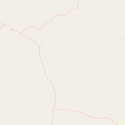
Map view of Bullwaddy Conservation Reserve

Use this park location map to pinpoint Bullwaddy Conservation Reserve in Australia, understand its exact geographic position, and read its mapped placement within the surrounding landscape more clearly.

Pigeon | © OpenStreetMap contributors

Location context for Bullwaddy Conservation Reserve

Northern Territory
Park atlas

Compare regional plateau reserves and surrounding northern Australian landscapes

Explore Protected Areas and Parks Near Bullwaddy Conservation Reserve

Browse nearby national parks and protected areas to compare regional woodland habitats beyond Bullwaddy Conservation Reserve. Examining adjacent terrain helps place remote outback conservation reserves into a broader geographic context.
National parkNorthern Territory
About 107 km away#1 closest

Northeast

Limmen National Park: Explore Australia's Northern Territory National Park & Protected Landscape

Discover mapped geography and regional context for this protected area.

Limmen National Park stands as a distinct protected area within the Northern Territory, offering valuable insights for geographic exploration. This national park serves as a focal point for understanding the mapped landscape and the broader regional context of protected lands in Northern Australia. Its identity as a national park contributes significantly to the geographic narrative of the territory, making it a crucial point for atlas-based discovery.

Area
9,369.26 km²
Established
2012
IUCN
II
Relief
Upland
Protected areaNorthern Territory
About 170 km away#2 closest

Southwest

Lake Woods Protected Area: Northern Territory Wetland Geography and Atlas Data

Ephemeral floodplain and waterbird habitat mapping

Lake Woods is a distinct freshwater system in the Northern Territory, defined by its cycle of flooding and recession. The basin hosts an important mosaic of coolibah woodland, river red gums, and lignum shrubland. As a recognized wetland for migratory and breeding waterbirds, the area offers a significant example of inland Australian floodplain geography and dynamic aquatic ecosystems.

Area
1,240 km²
Water
Water-dominated
National parkNorthern Territory
About 201 km away#3 closest

Northwest

Elsey National Park: Northern Territory National Park Atlas and Protected Landscape Context

Discover the mapped terrain and unique natural features of Elsey National Park.

Elsey National Park, located in Australia's Northern Territory, is a significant protected area known for its distinctive thermal springs and characteristic paperbark woodlands. This national park provides a valuable point of study for understanding regional geography, mapped natural landscapes, and the hydrological importance of its riverine environments, offering a concrete example of protected land within the tropical savanna biome.

Area
138.96 km²
Established
1991
IUCN
II
Visitors
207.7K annual
Nature reserveNorthern Territory
About 268 km away#4 closest

North

Wongalara Sanctuary: Protected Landscapes and Top End Geography

Nature reserve featuring sandstone escarpments and savannah woodlands

Wongalara Sanctuary acts as a vital nature reserve and ecological refuge within Australia's Northern Territory. Spanning rugged sandstone plateaus, monsoon rainforests, and seasonal wetlands, the protected area maintains a rare, feral herbivore-free environment that supports extensive biodiversity across its mapped river corridors.

Area
1,910 km²
Established
2007
Relief
Upland
Climate
Tropical
National parkNorthern Territory
About 286 km away#5 closest

Northwest

Nitmiluk National Park: Detailed Protected Landscape and Geographic Context

Explore mapped park boundaries and regional terrain.

Delve into the specifics of Nitmiluk National Park, a designated national park within the Northern Territory of Australia. This section focuses on its protected-area status and how its geography contributes to the regional landscape. Users can explore the park's mapped extent and understand its placement within the broader geographical atlas, highlighting its importance as a distinct protected natural area.

Area
2,946.64 km²
Established
1977
IUCN
II
Visitors
309.8K annual
National parkNorthern Territory
About 290 km away#6 closest

East

Barranyi (North Island) National Park: Northern Territory Island Protected Area and Landscape Context

Explore mapped geography and unique island terrain.

Barranyi (North Island) National Park is a remote national park in the Northern Territory, distinguished by its island setting in the Gulf of Carpentaria. The park's landscape features low coastal terrain, beaches, and dune formations, embodying a protected island ecosystem. Discover its mapped boundaries and geographic context within the vast northern Australian region, offering a specific example of island conservation and Indigenous land stewardship.

Area
53.81 km²
Established
1992
IUCN
II
Climate
Tropical
Nature reserveNorthern Territory
About 291 km away#7 closest

Northwest

Cutta Cutta Caves Nature Park: A Tropical Karst and Cave Reserve in Northern Territory

Protected tropical limestone karst and subterranean landscape geography.

Cutta Cutta Caves Nature Park is a specialized protected area in Australia, safeguarding a unique tropical limestone karst landscape near Katherine. This reserve manages subterranean cave systems, mineral-rich chambers, and the surrounding woodland terrain. As a significant ecological site, it provides essential habitat for rare wildlife, highlighting the complex intersection of geological formations and tropical biodiversity within the Northern Territory.

Area
14.99 km²
Established
1967
IUCN
III
Visitors
17.2K annual
National parkAustralia
About 312 km away#8 closest

Northwest

Kakadu National Park: Australia's Protected Landscape and Regional Geography

Explore Kakadu National Park's mapped boundaries and natural terrain.

Kakadu National Park stands as a significant national park entity within Australia, providing rich geographic context for atlas discovery. This page details the park's protected area identity, its mapped natural landscapes, and its place within the broader Australian continent's geography. Understand the unique regional setting and the specific topographic features that define Kakadu National Park for detailed exploration and comparative geographic analysis.

Area
19,804 km²
Established
1979
IUCN
II
Visitors
250K annual

Common questions about visiting, size, designation, and location context for Bullwaddy Conservation Reserve

Bullwaddy Conservation Reserve FAQs for park facts, access, geography, and protected area context

Find quick answers about Bullwaddy Conservation Reserve, including protected-area facts, park geography, trail and visitor context, and how the park fits into its surrounding country and regional landscape.
MoriAtlas Explorer

Continue Your Protected Areas Search Across the Global Atlas

Deepen your exploration by continuing the structured search for national parks and protected areas worldwide. Utilize the comprehensive filtering capabilities to compare different conservation landscapes and refine your understanding of global park geography. Discover more about the distribution and characteristics of protected natural areas.

Global natural geography