

Mori Atlas logo
Nature reserveCalperum Station

Geographic landscape mapping of sand dune ecosystems and critical habitat within South Australia.

Calperum Station Nature Reserve: A Detailed Atlas of Mallee Woodlands and Murray River Wetlands

Calperum Station functions as a massive conservation landscape in South Australia, protecting an expansive network of mallee woodland on the Loxton-Parilla Sands alongside vital Murray River floodplain wetlands. This nature reserve provides critical habitat for the black-eared miner and stands as an essential component of the Riverland Biosphere Reserve. Mapping these protected boundaries reveals a transition between semi-arid sand dunes and complex riverine environments.

mallee woodlandLoxton-Parilla SandsMurray River floodplainRiverland Ramsar siteRiverland Biosphere Reserveblack-eared miner habitat

Calperum Station

Nature reserve

Park overview

Structured park overview, official facts, and landscape profile for Calperum Station

Calperum Station park facts, protected area profile, and essential visitor context

Review the core facts for Calperum Station, including designation, size, terrain, visitor scale, habitats, and operating context in one park-focused overview.

About Calperum Station

Calperum Station is a privately held conservation reserve in South Australia that doubles as one of the country's most important sites for protecting mallee woodland ecosystems and Murray River floodplain habitats. Covering 2,386 square kilometers on the north side of the Murray River north-west of Renmark, it was created from a cluster of old sheep pastoral leases that were retired from grazing and redirected toward conservation, research, and education.

The reserve sits within a broader regional conservation framework. It forms part of the Riverland Biosphere Reserve, recognized under UNESCO's Man and the Biosphere programme, and contains a major portion of the Riverland Ramsar site, a 30,600-hectare wetland complex declared internationally significant under the Ramsar Convention. Four named wetlands, Merreti, Woolpolool, Clover, and Woolpolool Swamp, lie within the reserve's floodplain section.

Ecologically, Calperum Station is overwhelmingly a mallee landscape. Approximately 95% of the reserve consists of mallee vegetation communities on the east-west red-brown dunes of the Loxton-Parilla Sands, while the remaining 5% is Murray River floodplain. This combination of sand-dune mallee and riverine wetland gives the reserve exceptional environmental diversity for an inland Australian site and supports a wide range of woodland and wetland species.

The reserve was purchased in 1993 by the Chicago Zoological Society, using funds from the McCormick Foundation and the Australian Government, and the leases were subsequently transferred to the Director of National Parks to be held in trust. Management passed to the Australian Landscape Trust, and more recently to Austland Services Pty Ltd, a company owned by the trust that now manages Calperum and the neighboring Taylorville Station reserve as one operating unit.

Although it is not formally classified under the IUCN protected-area system, Calperum Station is treated as a model for implementing the UNESCO Biosphere Reserve Action Plan and is a key site for ecological monitoring. The Calperum Mallee SuperSite, established in 2011 as part of the Australian Flux Network Project, supports long-term research into ecosystem dynamics and land restoration. Partnerships with the Commonwealth Environmental Water Office and Aboriginal corporations have added active floodplain recovery and Indigenous-led land management to the reserve's conservation profile.

Quick facts and research context for Calperum Station

Calperum Station is a 2,386-square-kilometer nature reserve in South Australia, located on the north bank of the Murray River about 10 kilometers north-west of Renmark and roughly 250 kilometers east of Adelaide. It was assembled from three former pastoral leases, Calperum, Calperum Road, and Yubalia, which were purchased in 1993 by the Chicago Zoological Society with funds from the McCormick Foundation and the Australian Government.

The reserve is dominated by mallee vegetation on red-brown dunes, with a small proportion of Murray River floodplain containing four key wetlands that lie within the Riverland Ramsar site. It is part of the Riverland Biosphere Reserve, hosts the Calperum Mallee SuperSite, and is jointly managed with neighboring Taylorville Station by Austland Services Pty Ltd on behalf of the Director of National Parks.

Protection and recognition

Examine terrestrial protection scope, designation records, and conservation status for Calperum Station.

Calperum Station Protection Status and International Recognition Overview

Terrestrial protection status and administrative parameters for Calperum Station are compiled through official conservation records. Fact-based records outline management scope and international recognition standing without assuming unverified designations.

Protection details

Protection scope
Terrestrial
Transboundary protection
No
Park context

Deeper park guide and search-rich context for Calperum Station

Calperum Station history, landscape, wildlife, and travel context

Explore Calperum Station through its history, landscape character, ecosystems, wildlife, conservation priorities, cultural context, and seasonal travel timing in a structured park guide built for atlas discovery and search intent.

Why Calperum Station stands out

Calperum Station is best known for being one of the most important strongholds for the black-eared miner, a threatened Australian bird species, with roughly 95% of the reserve listed as critical habitat for this species. It is equally valued for the large block of mallee woodland it protects on the Loxton-Parilla Sands, an ecological community that has been heavily cleared elsewhere in southern Australia. The reserve is also recognized for its inclusion in the Riverland Biosphere Reserve and the Riverland Ramsar site, which bring international biosphere and wetland recognition to what is otherwise a former pastoral landscape. Together with the nearby Gluepot Reserve and Taylorville Station reserve, it forms a network of reserves that is central to mallee conservation in the region.
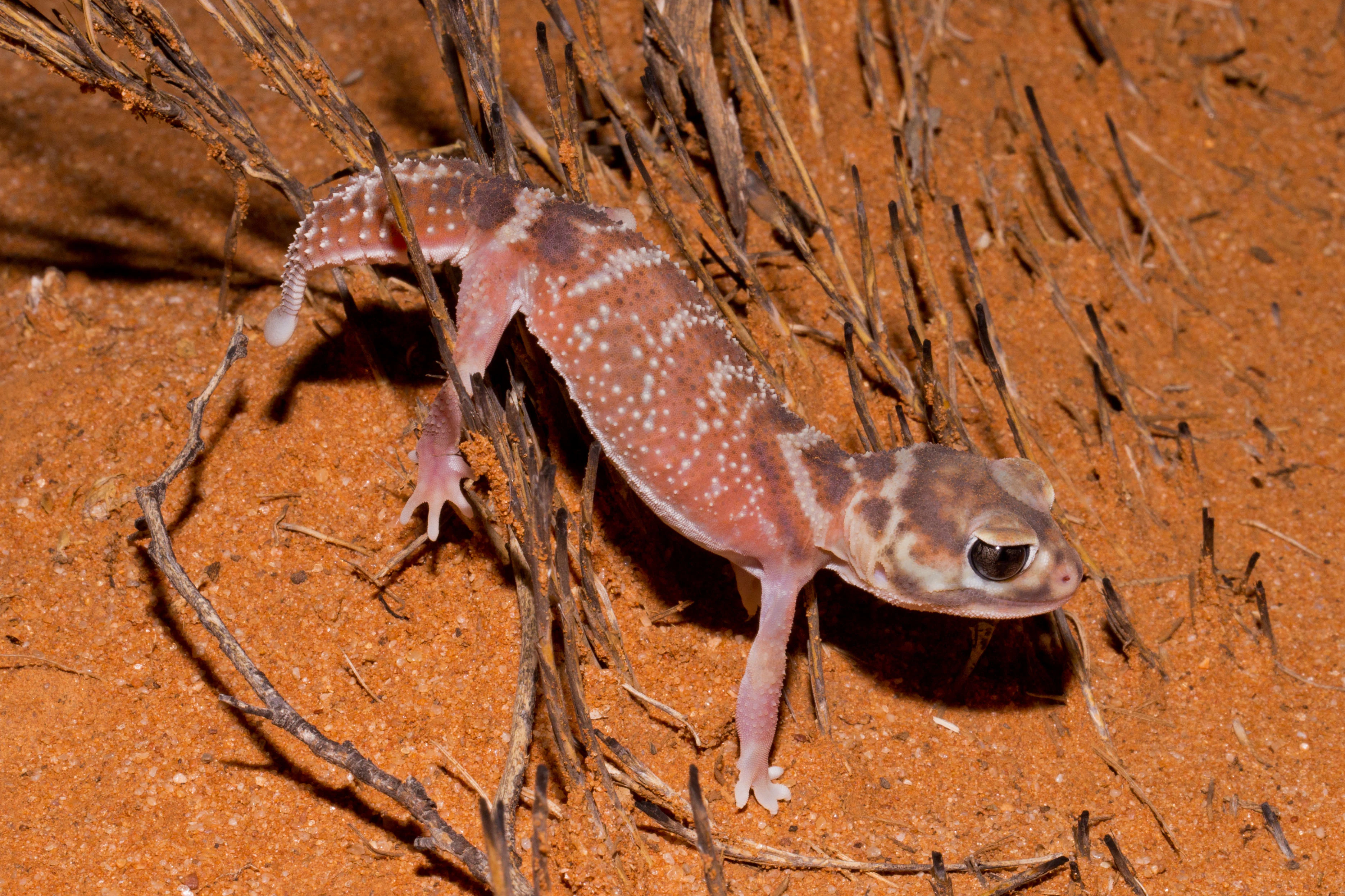
A knob-tailed gecko with a patterned reddish-brown back and large dark eyes standing on reddish desert sand near dry plant debris.
A Nephrurus levis knob-tailed gecko on arid sandy soil at Calperum Station.

Calperum Station history and protected-area timeline

The Calperum homestead sits on a site historically known as Ral Ral, a name drawn from an Aboriginal king figure associated with the area. From around 1838, during the early European settlement of South Australia, drovers used Ral Ral as a campsite and watering point for livestock being driven southward, taking advantage of Ral Ral Creek.

Formal European occupation began around 1846, when men were granted annual licences to graze sheep and cattle in the region. In 1851, fourteen pastoral leases were issued; one of these, originally known as Chowilla and later Chowilla-Bookmark, was split in 1896 into Chowilla and Calperum. The Calperum lease remained in the Robertson family from 1896, following the death of leaseholder John Holland Robertson in 1909, until 1953, then passed through several hands and was eventually divided among three brothers before being sold in 1993.

The purchase in 1993 was undertaken by the Chicago Zoological Society with funding from the McCormick Foundation and the Australian Government, bringing together three leases, Calperum, Calperum Road, and Yubalia, into a single conservation holding. The leases were then assigned by deed to the Director of National Parks, who holds them in trust. Since 2003 they have been managed with the Taylorville Station reserve, and in 2013-14 the pastoral leases were transferred to Austland Services Pty Ltd, a company owned by the Australian Landscape Trust.

More recent milestones include the 2011 establishment of the Calperum Mallee SuperSite as part of the Australian Flux Network Project, and a December 2020 partnership between the Commonwealth Environmental Water Office and the Australian Landscape Trust to deliver environmental water to the Calperum floodplain over five years, including drought-era deliveries in 2018-2019 supported by Indigenous rangers.

Calperum Station landscape and geographic character

Calperum Station's landscape is shaped by two contrasting environments: an extensive dune-field mallee system and a narrow strip of Murray River floodplain. About 95% of the reserve is occupied by mallee vegetation communities growing on the east-west oriented red-brown dunes of the Loxton-Parilla Sands, a distinctive dune system that defines much of the southern Murray-Darling region.

The dune-and-mallee landscape is semi-arid, low in stature, and ecologically distinct from the higher forests found in wetter parts of Australia. Across thousands of square kilometers of dunes, mallee eucalypts form dense multi-stemmed woodlands over an understory adapted to sandy, nutrient-poor soils. The result is a vast and relatively uniform but ecologically rich landscape, interrupted only by tracks, drainage lines, and the occasional open swale.

The remaining 5% of the reserve is occupied by the Murray River floodplain, including four named wetlands: Merreti, Woolpolool, Clover, and Woolpolool Swamp. These wetlands belong to the broader 30,600-hectare Riverland Ramsar site. Together, the dune-and-mallee country and the riverine wetlands make Calperum Station a landscape where dryland sand-ridge woodland meets one of Australia's most ecologically important river systems.

Calperum Station ecosystems, habitats, and plant life

The ecological identity of Calperum Station is fundamentally shaped by mallee vegetation on sand. Mallee communities are characterized by multi-stemmed eucalypts that resprout from underground lignotubers, an adaptation that allows them to survive frequent fire and prolonged dry conditions. On the Loxton-Parilla Sands, these communities form extensive woodlands that provide critical habitat for wildlife species that have lost much of their range to land clearing elsewhere in southern Australia.

Along the southern edge of the reserve, the Murray River floodplain introduces a very different ecological character. The floodplain contains a network of wetlands and ephemeral wet areas that support aquatic plants, waterbirds, frogs, and seasonal invertebrate bursts. The contrast between arid sand-dune mallee and periodically inundated floodplain habitats gives Calperum Station strong ecological value for species that depend on either woodland or wetland environments, or on the interface between them.

The reserve also serves as a long-term ecological monitoring platform. The Calperum Mallee SuperSite, established in 2011 as part of the Australian Flux Network Project, is a partnership between the University of Adelaide and the Australian Landscape Trust that tracks ecosystem processes and supports research on land restoration in arid and semi-arid Australia.

Calperum Station wildlife and species highlights

Calperum Station is best known in ecological circles for the black-eared miner, a threatened Australian honeyeater for which roughly 95% of the reserve is listed as critical habitat. The reserve is jointly managed with the nearby Gluepot Reserve and Taylorville Station reserve as a network of sites aimed at preventing the species' decline.

The reserve is also reported as important for the nationally vulnerable malleefowl, a ground-dwelling bird of mallee scrub, and the regionally vulnerable bush stone-curlew. The Murray River floodplain within Calperum supports additional wildlife values, including habitat for the nationally vulnerable southern bell frog, as well as the waterbird communities that contribute to the ecological character of the Riverland Ramsar site.

Together with Taylorville Station, the reserve provides habitat for a wide range of woodland and wetland-dependent animals, with particular importance for ground-nesting birds, semi-arid woodland specialists, and floodplain species. The combination of fire-adapted mallee woodland and Murray floodplain wetlands gives Calperum Station unusually broad wildlife significance for an inland reserve.

Calperum Station conservation status and protection priorities

Although Calperum Station has not been classified as an IUCN protected area, it functions as a major conservation property and is managed under trust arrangements that require its use as a model for implementing the UNESCO Biosphere Reserve Action Plan, in line with its inclusion in the Riverland Biosphere Reserve. Its principal conservation purpose is the protection of critical habitat for the black-eared miner, in conjunction with the Gluepot Reserve and the Taylorville Station reserve.

The reserve provides essential landscape-scale protection for mallee vegetation communities on the Loxton-Parilla Sands, an ecological community heavily cleared elsewhere in the Murray-Darling region. By maintaining a very large, relatively continuous block of mallee woodland, Calperum contributes to the long-term survival of species that depend on this habitat type, including the malleefowl.

The Murray River floodplain section adds an important wetland dimension. A major part of the Riverland Ramsar site, a wetland of international significance under the Ramsar Convention, falls within the reserve. Beginning in December 2020, a five-year partnership between the Commonwealth Environmental Water Office and the Australian Landscape Trust committed to delivering environmental water to support floodplain and wetland health, with earlier drought-era deliveries in 2018-2019 supported by Indigenous rangers.

Calperum Station cultural meaning and human context

The cultural landscape of Calperum Station is deeply rooted in Aboriginal history, particularly the long Aboriginal presence along the Murray River floodplain. The floodplain setting has long supported access to plant, animal, and aquatic resources, and archaeological work has begun to document this history in detail.

The reserve's homestead area, historically known as Ral Ral after an Aboriginal king of the region, marks an intersection between Aboriginal and European histories. From around 1838, the site served as a droving campsite during the early European settlement of South Australia, and from 1846 onward it became a centre of pastoral activity under annual licences and then formal pastoral leases from 1851. The eventual retirement of these leases and their transfer to conservation in 1993 represents a shift back toward Indigenous-led and ecologically focused land management.

Recent ecological research and management of Calperum Station has involved substantial Aboriginal partnerships. Indigenous rangers from the River Murray and Mallee and Ngarrindjeri Aboriginal Corporations have assisted with environmental watering during the 2018-2019 drought, and Flinders University and Griffith University archaeologists have worked in collaboration with these corporations to investigate Aboriginal heritage across the Riverland region, including Calperum Station.

Top sights and standout views in Calperum Station

Calperum Station stands out as one of the largest conservation properties in South Australia's mallee country and one of the most important protected strongholds for the threatened black-eared miner. Its size, around 2,386 square kilometers, allows it to support a near-continuous block of mallee woodland on the Loxton-Parilla Sands, an ecological community that has lost much of its extent elsewhere across the southern Murray-Darling region.

Equally notable is its integration into the Riverland Biosphere Reserve and its role in protecting the Riverland Ramsar site, one of Australia's key international wetlands. The reserve combines long-term ecological research through the Calperum Mallee SuperSite with active floodplain recovery through environmental watering partnerships, and is increasingly shaped by collaborative management with Aboriginal ranger groups.

Best time to visit Calperum Station

Calperum Station sits in the semi-arid Murray-Mallee region of South Australia, where seasonal conditions strongly affect both the natural environment and the experience of the landscape. Cooler months from late autumn through early spring generally offer milder temperatures for outdoor exploration of the mallee country, with the Murray River floodplain and associated wetlands typically holding water and supporting active waterbird and frog life.

Spring is often the most visually rewarding period, when mallee vegetation can show flowering and seasonal growth and many bird species, including woodland and ground-nesting species, are more active. Summer brings intense heat and a higher bushfire risk across the broader mallee zone, so cooler seasons are usually more comfortable for time in the dunes. Environmental watering events, such as those delivered through partnerships involving the Commonwealth Environmental Water Office, can produce dramatic wetland responses at any time of year and shape floodplain conditions.
Monthly climate preview

Long-term representative coordinate climatology for South Australia

Calperum Station Climate Normals: Measured Annual Temperature and Precipitation Rhythm

Historical data records sustained monthly temperature ranges and steady precipitation averages across the representative park coordinate. Examining the complete twelve-month climatology reveals detailed shifts in long-term weather patterns.
Annual mean18 °C
10 °C27 °C
Jan27°
Feb26°
Mar22°
Apr18°
May14°
Jun11°
Jul10°
Aug11°
Sep15°
Oct18°
Nov22°
Dec24°
Warmest month
January

26.6 °C

Coolest month
July

10.2 °C

Wettest month
September

0.9 mm/day

Driest month
March

0.4 mm/day

Park location guide

Geography guide, regional context, and park location map for Calperum Station

Calperum Station park geography, regions, and map view in Australia

Understand where Calperum Station sits in Australia through a broader geographic reading of the surrounding landscape, nearby location context, and its mapped position within the national park landscape.

How Calperum Station fits into Australia

Australia is a constitutional monarchy and federal parliamentary democracy comprising six states and ten territories. With a population of nearly 28 million, it is one of the world's most urbanised countries, with most people concentrated on the eastern seaboard. The country has a high Human Development Index and is known for its cultural diversity, ancient Aboriginal heritage, and unique wildlife.

Wider geography shaping Calperum Station in Australia

Australia occupies the entire Australian continent, the island of Tasmania, and numerous smaller islands. It is the world's flattest and driest inhabited continent, featuring vast deserts in the interior (the Outback), tropical rainforests along the eastern coast, and a coastline bordering the Indian and Pacific Oceans.

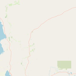
Map view of Calperum Station

Use this park location map to pinpoint Calperum Station in Australia, understand its exact geographic position, and read its mapped placement within the surrounding landscape more clearly.

Pigeon | © OpenStreetMap contributors

Location context for Calperum Station

South Australia

Explore photographic records of dune terrains, wetland systems, and protected ecosystems across the reserve

Calperum Station Photos and Landscape Scenery: Visualizing Mallee Woodland and Riverine Habitats

Visual documentation captures the vast expanse of semi-arid mallee vegetation growing across sandy dune ridges and the distinct riverine wetlands along the Murray floodplain. Photographic records help observers examine the terrain, habitat structures, and environmental character that define this southern Australian conservation landscape.

A knob-tailed gecko with a patterned reddish-brown back and large dark eyes standing on reddish desert sand near dry plant debris.

Park atlas

Compare regional mallee woodlands and riverine wetland reserves across South Australia

Explore Other Parks Near Calperum Station and Surrounding Protected Landscapes

Browse protected areas adjacent to Calperum Station to compare similar semi arid dune systems and river floodplains. Evaluating these connected reserves provides broader regional context for mallee conservation networks in southern Australia.
National parkSouth Australia
About 34 km away#1 closest

South

Murray River National Park: Protected Wetland Ecosystems in South Australia

Explore South Australia's unique river red gum floodplains.

Murray River National Park is a significant protected area in South Australia, renowned for its expansive wetland and floodplain environments situated along the Murray River. This national park preserves crucial habitats within the Murray-Darling Basin, characterized by river red gum woodlands, permanent water bodies, and dynamic seasonal floodplains. Its detailed maps and geographic context offer deep insights into one of Australia's most important riverine conservation landscapes.

Area
148.79 km²
Established
1991
IUCN
VI
Relief
Lowland
State or regional parkSouth Australia
About 35 km away#2 closest

South

Cooltong Conservation Park: Geography and Protected Mallee Woodland in South Australia

A regional conservation area defined by dune and shale flat topography

Cooltong Conservation Park is a protected state area in South Australia's Riverland. It features 37 square kilometres of mallee shrubland shaped by undulating dunes and shale flats. This conservation landscape is a recognized stronghold for birdlife, particularly the iconic Malleefowl, offering an authentic look at Australia's inland semi-arid terrain and its ecological connectivity.

Area
37.1 km²
Established
1993
IUCN
VI
Relief
Lowland
Wildlife reserveSouth Australia
About 38 km away#3 closest

West

Taylorville Station Wildlife Reserve: Mallee Woodland Map and Regional Geography

Protected mallee landscapes in the Murray-Mallee, South Australia.

Taylorville Station provides a critical refuge for mallee-dependent species within its 92 square kilometres of semi-arid woodland. As a cornerstone of the Riverland Biosphere Reserve, this protected area in South Australia offers a unique look at the ecological significance of the Murray-Mallee region's persistent eucalypt vegetation and habitat management frameworks.

Area
92.6 km²
Established
2005
IUCN
IV
Visitors
2.7K annual
National parkAustralia
About 41 km away#4 closest

Southeast

Murray-Sunset National Park: Iconic Pink Lakes and Mallee Wilderness in Victoria's Semi-Arid Interior

Explore its unique landscape, mapped boundaries, and regional geography.

Murray-Sunset National Park offers a compelling glimpse into Australia's semi-arid heart, featuring a dramatic landscape of salt lakes, gypsum plains, extensive sand dunes, and dense mallee woodlands. This vast protected area is renowned for the vibrant pink hue of its salt lakes, a phenomenon created by microscopic algae that flourishes in the hypersaline conditions during warmer months. The park's rich biodiversity and unique ecosystem make it a significant conservation asset, providing crucial habitat for numerous species adapted to this challenging yet beautiful environment.

Area
6,330 km²
Established
1991
IUCN
II
Relief
Lowland
Nature reserveSouth Australia
About 42 km away#5 closest

Northeast

Danggali Conservation Park: Semi-Arid Protected Land and Murray-Mallee Geography

Nature reserve geography and inland landscape context in South Australia.

Danggali Conservation Park preserves a substantial inland landscape north of the Riverland, characterised by open mallee scrubland, sandy dune systems, and dry eucalypt woodlands. This protected area acts as a crucial ecological bridge, showcasing the distinct shift from river-influenced environments to the arid interior of South Australia.

Area
484.16 km²
Established
1976
IUCN
Ia
Relief
Upland
Watercolor painting of a pastoral landscape with soft green hills, distant pink-hued ridges, and pine trees.
Biosphere reserveSouth Australia
About 56 km away#6 closest

North

Riverland Biosphere Reserve: Geography and Protected Landscapes in South Australia

Mapping the convergence of mallee woodland and riverine wetland ecosystems

Riverland Biosphere Reserve represents a significant landscape-scale conservation effort covering 9,000 square kilometres of South Australian terrain. The reserve encompasses an ecological mosaic, where arid, sandy mallee woodlands transition into a complex network of Murray River floodplains and riparian wetlands. This overview maps the protected area structure, highlighting the unique environmental interplay that supports essential bird populations and ecologically sustainable development.

Area
9,000 km²
Established
1977
Relief
Lowland
Climate
Arid
Nature reserveNew South Wales
About 68 km away#7 closest

Northeast

Scotia Sanctuary: Protected Nature Reserve and Mallee Landscape Geography in New South Wales

Arid zone conservation and dune-swale mapping.

Scotia Sanctuary serves as a primary example of arid-zone conservation in south-western New South Wales. This reserve protects vast tracts of intact eucalypt mallee shrubland and sheoak woodland, set across a distinctive landscape of parallel sand dunes and calcareous swales. Its geographic position within the Murray-Darling Depression makes it a critical site for understanding the intersection of land management, habitat restoration, and regional ecological patterns.

Area
650 km²
Established
1994
Relief
Lowland
Climate
Arid
Protected areaSouth Australia
About 70 km away#8 closest

South

Kapunda Island Conservation Park: Atlas and Geographic Context of a Murray River Reserve

A protected sand-bar island in the South Australian Riverland

Located in the Murray River near Loxton, Kapunda Island Conservation Park serves as an important example of a riverine island environment. This protected area provides essential habitat, featuring river red gum woodland and lignum understorey that support local waterbird populations and regional biodiversity patterns.

Area
0.01 km²
Established
1968
IUCN
III
Relief
Lowland

Common questions about visiting, size, designation, and location context for Calperum Station

Calperum Station FAQs for park facts, access, geography, and protected area context

Find quick answers about Calperum Station, including protected-area facts, park geography, trail and visitor context, and how the park fits into its surrounding country and regional landscape.
MoriAtlas Explorer

Continue Your Protected Areas Search Across the Global Atlas

Deepen your exploration by continuing the structured search for national parks and protected areas worldwide. Utilize the comprehensive filtering capabilities to compare different conservation landscapes and refine your understanding of global park geography. Discover more about the distribution and characteristics of protected natural areas.

Global natural geography