Mori Atlas logo
Nature reserveCambalache Forest Reserve

Analyzing the protected limestone mogote landscape and forest mosaic in the Northern Karst Belt

Cambalache Forest Reserve: Exploring the Karst Topography of Northern Puerto Rico

(Bosque Estatal de Cambalache)

Cambalache Forest Reserve represents a critical protected landscape within the Northern Karst Belt of Puerto Rico. This nature reserve preserves a distinct geological mosaic characterized by steep-sided limestone hills known as mogotes, which rise sharply from the coastal plain to sustain high botanical diversity. By examining the interplay between humid sheltered slopes and drier exposed ridges, researchers and visitors can trace the unique microclimates that define this lowland forest sanctuary.

karst landscapemogotestropical moist forestlimestone hillsNorthern Karst Beltstate forest

Cambalache Forest Reserve

Nature reserve

Park overview

Structured park overview, official facts, and landscape profile for Cambalache Forest Reserve

Cambalache Forest Reserve park facts, protected area profile, and essential visitor context

Review the core facts for Cambalache Forest Reserve, including designation, size, terrain, visitor scale, habitats, and operating context in one park-focused overview.

About Cambalache Forest Reserve

Cambalache Forest Reserve occupies a compact but ecologically rich zone in northern Puerto Rico, where the island's coastal plain meets the rugged edge of the Northern Karst Belt. The forest is divided into several separate land units spread across Arecibo and Barceloneta, including sites near Factor, Garrochales, Miraflores, and Sabana Hoyos, as well as farmland parcels such as La Mano, Benero, and Palenque. Together these holdings protect a portion of one of Puerto Rico's most distinctive natural regions, united by a shared karst geology rather than by a single continuous tract of trees.

The featured terrain of the reserve consists of mogotes, the steep, rounded limestone hills that rise abruptly from flatter surroundings and give the northern karst region its distinctive silhouettes. Between and around these hills, the vegetation shifts character depending on slope orientation and exposure. This small-scale variation produces humid forest patches on some sides of the mogotes and drier, more xeric conditions on their tops, with valleys often altered by past land use and now dominated by secondary growth and teak plantations.

At an elevation range of only about 5 to 50 meters above sea level, Cambalache offers a different ecological profile than Puerto Rico's high-mountain forests. Its warm temperatures and substantial rainfall, averaging over 1,400 millimeters annually, support a lush moist forest community that feels tropical and dense even though the topography remains subdued compared with the island's interior ranges.

Because of its position, character, and long research history, Cambalache is both a working conservation site and a place where ecologists have studied Northern Karst Belt dynamics for decades. The combination of unusual geology, endemic biodiversity, and accessibility from the northern coast has made it one of the more recognizable state forests in the Puerto Rican system.

Quick facts and research context for Cambalache Forest Reserve

Cambalache Forest Reserve is a public Commonwealth forest located in northern Puerto Rico across Arecibo and Barceloneta municipalities, managed by the Puerto Rico Department of Natural and Environmental Resources (DRNA). It protects mogote karst hills within the Northern Karst Belt, with elevations between roughly 5 and 50 meters. The reserve belongs ecologically to the Puerto Rican moist forests ecoregion and is part of a landscape designated as an Important Bird Area by BirdLife International.

Protection and recognition

Terrestrial protected area classification and designation records

Cambalache Forest Reserve Protection Status and Recognition Data

Cambalache Forest Reserve holds a documented terrestrial protection scope within official conservation registries. Structured records track available designation history, management parameters, and international recognition sources for the protected area.

Protection details

Protection scope
Terrestrial
Park context

Deeper park guide and search-rich context for Cambalache Forest Reserve

Cambalache Forest Reserve history, landscape, wildlife, and travel context

Explore Cambalache Forest Reserve through its history, landscape character, ecosystems, wildlife, conservation priorities, cultural context, and seasonal travel timing in a structured park guide built for atlas discovery and search intent.

Why Cambalache Forest Reserve stands out

Cambalache is best known for its mogote landscape, the dramatic limestone hills that punctuate the Puerto Rican moist forest and define the Northern Karst Belt. The reserve stands out for its combination of karst geomorphology, endemic plant diversity, and significant populations of locally rare birds, including endemic Puerto Rican species and migratory visitors. It is also recognized for its role as one of the longest-standing experimental forest units on the island.
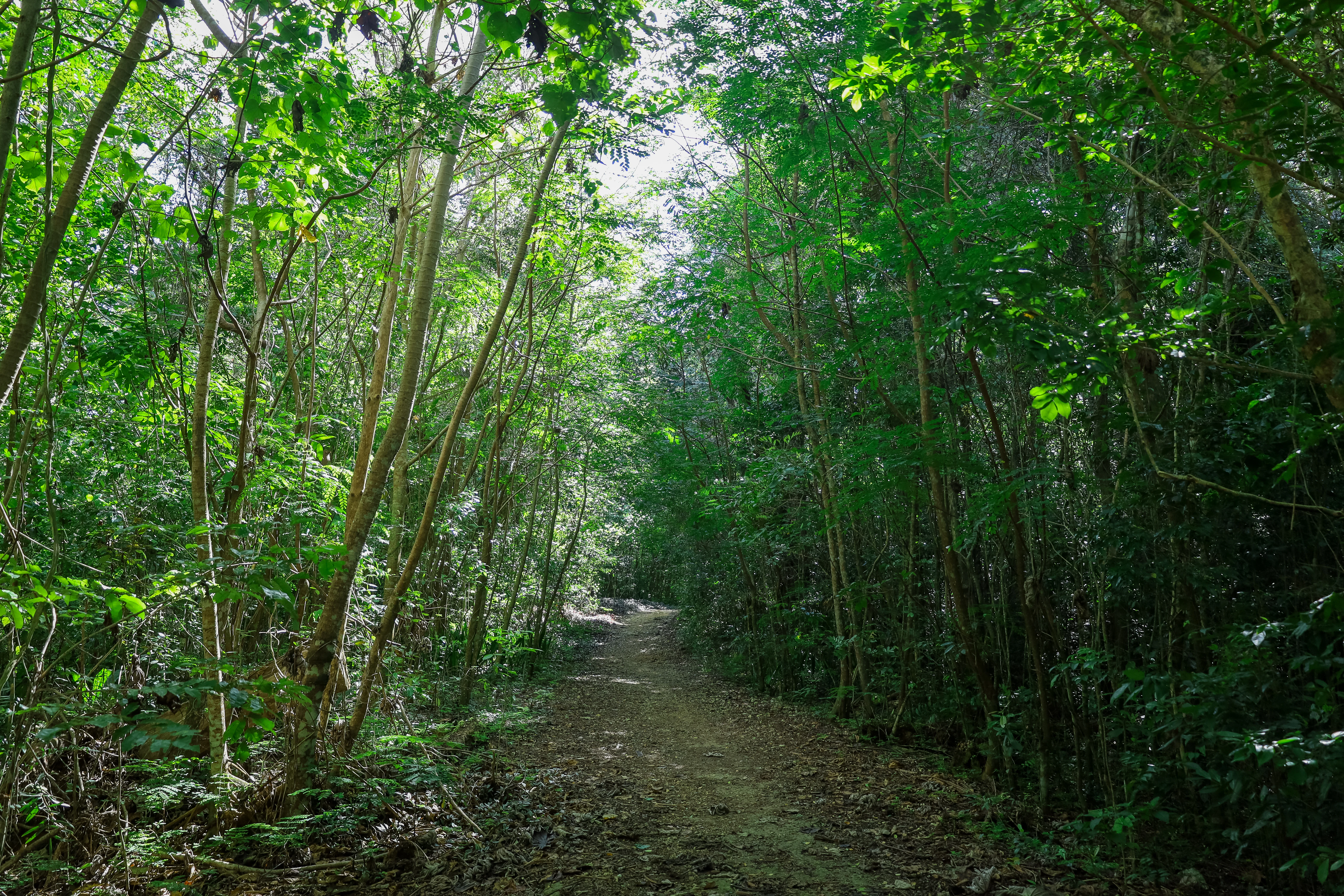
A dirt path leading through a dense, green forest with tall, thin trees on both sides.
A dirt trail winds through the dense green forest of Cambalache Forest Reserve.

Cambalache Forest Reserve history and protected-area timeline

The origins of Cambalache Forest Reserve reach back to 1943, when the area was proclaimed through an agreement between the United States Forest Service and the Land Authority of Puerto Rico (Autoridad de Tierras). The agreement was part of a broader research initiative aimed at understanding the ecology and geology of the Northern Karst Belt, a distinctive karst region across the island's north. Under this arrangement the property was first known as the Cambalache Experimental Forest, and for decades it functioned primarily as a site for applied forest research rather than as a public reserve.

The transition to a more permanent protected status came in 1973, when the experimental forest was formally proclaimed a state forest. This change aligned Cambalache with the broader network of protected state forests managed by the Puerto Rico Department of Natural and Environmental Resources. The proclamation also solidified the forest's role as a long-term conservation site rather than purely a research plot.

Since then, Cambalache has continued to serve both research and public purposes. Its protected status has helped anchor conservation efforts across the Northern Karst Belt and contributed to its recognition as part of an Important Bird Area, ensuring that its historical research function dovetails with modern biodiversity priorities.

Cambalache Forest Reserve landscape and geographic character

The defining feature of Cambalache Forest Reserve is its karst topography, expressed most visibly through mogotes: steep-sided, rounded limestone hills that rise abruptly from the surrounding lowlands. These hills form the visual and structural backbone of the Northern Karst Belt and give Cambalache a landscape character very different from the forested mountain interiors of Puerto Rico. Because the reserve sits at elevations of only about 5 to 50 meters above sea level, the mogotes appear even more prominent against the relatively flat coastal plain.

Slope orientation plays a major role in shaping the local environment. Mogotes aligned northeast to southeast tend to have humid northern and southwestern flanks, while their upper surfaces and exposed faces are noticeably drier. This small-scale variation in moisture and sun exposure creates a patchwork of habitat conditions across short distances, with denser forest on sheltered slopes and more xeric vegetation on the tops and drier sides.

Between the mogotes, the valleys have been more heavily altered by human activity. Many of these flats have lost their original forest cover and now carry secondary scrub, regrowth, and planted teak groves, contrasting sharply with the wilder, more rugged hillsides. The result is a landscape that blends natural karst drama with a visible history of land use and restoration.

Cambalache Forest Reserve ecosystems, habitats, and plant life

Cambalache lies within the Puerto Rican moist forests ecoregion, one of the most ecologically distinctive woodland types on the island. Within this broad classification, the reserve's combination of karst soils, variable slope exposure, and consistent rainfall allows it to support a remarkable variety of plant life. More than 150 tree and large shrub species have been identified in the forest, including common canopy trees such as Cecropia, Schefflera, and Tabebuia heterophylla, alongside iconic palms like the endemic Puerto Rican royal palm and the locally unusual Palma de Sierra.

The forest's vegetation is organized into recognizable zones that reflect both natural conditions and human history. Hillsides carry the most intact forest cover, especially on sheltered slopes where moisture persists. Mogote tops and exposed faces host more drought-tolerant species such as Zanthoxylum martinicense, while slopes and ravines include smaller trees and shrubs like Eugenia biflora and Eugenia ligustrina. In contrast, the valleys between mogotes have largely been converted to secondary scrub and teak plantations, reflecting a long period of agricultural and forestry activity before stricter protection took hold.

This mixture of intact karst forest, degraded but recovering valley land, and planted teak stands gives Cambalache an ecological profile that is unusually varied for its modest size, and one that makes it useful for studying how Caribbean forest communities regenerate on disturbed karst terrain.

Cambalache Forest Reserve wildlife and species highlights

Wildlife is one of Cambalache's most important assets, and the reserve is notable for the presence of at least two endangered species: the Puerto Rican boa and the red fruit bat. The boa is one of the island's signature reptiles, while the fruit bat represents a more rarely seen group whose presence indicates relatively intact forest conditions. Together with the rest of the Northern Karst Belt landscape, these species give the reserve significant conservation weight.

The forest is also rich in birdlife, with a mix of endemic Puerto Rican species and migratory visitors. Among the notable resident birds are the Puerto Rican lizard cuckoo, the Puerto Rican tody, the green mango, the Puerto Rican bullfinch, the Puerto Rican oriole, and Adelaide's warbler. Their combined presence reflects the importance of the surrounding karst region as a stronghold for species found almost exclusively in Puerto Rico.

Because of this bird diversity, the broader Northern Karst Belt area encompassing Cambalache was designated an Important Bird Area by BirdLife International in 2007. The forest also supports a wide variety of butterflies, including some rare species, adding an invertebrate dimension to its conservation value. Overall, the wildlife profile of Cambalache is shaped by a small area that nonetheless delivers a high concentration of locally significant species.

Cambalache Forest Reserve conservation status and protection priorities

Cambalache Forest Reserve plays a meaningful conservation role as a protected pocket of Puerto Rican moist forest within the Northern Karst Belt, one of the most ecologically distinctive regions on the island. Its importance comes not from sheer size but from the fact that it preserves a karst landscape where mogotes, slopes, and valleys support different vegetation communities and an unusually high concentration of endemic plants and animals.

The reserve's long history as the Cambalache Experimental Forest, and its later transition to formal state forest status in 1973, has helped anchor decades of ecological and geological research on northern Puerto Rico. That research legacy continues to shape how the forest is understood and managed today.

The recognition of the surrounding Northern Karst Belt as an Important Bird Area by BirdLife International underscores that Cambalache is part of a conservation network rather than an isolated reserve. With endangered species such as the Puerto Rican boa and the red fruit bat relying on its habitat, alongside numerous endemic birds and rare butterflies, Cambalache carries meaningful conservation weight beyond its modest footprint.

Cambalache Forest Reserve cultural meaning and human context

Cambalache Forest Reserve sits in a part of Puerto Rico where the Northern Karst Belt has long shaped local life, with mogote landscapes, scattered farms, and small communities tucked between the limestone hills. The forest's modern configuration, spread across distinct units near places such as Garrochales, Factor, Miraflores, and Sabana Hoyos, reflects a layered history of land management that includes both traditional rural land use and more recent state-led conservation efforts.

The presence of teak plantations in some of the reserve's flatter areas is itself a sign of this layered past, marking a period when timber production was part of the forest's identity before ecological priorities became central. Today, these plantations coexist with recovering secondary forest and intact karst slopes, offering a visible link between the area's working landscape history and its modern protected status.

Top sights and standout views in Cambalache Forest Reserve

Cambalache's standout qualities include its mogote karst terrain, its unusually high plant diversity for a small protected area, and the presence of endangered species such as the Puerto Rican boa and the red fruit bat within an Important Bird Area. The reserve combines a research legacy dating to 1943 with modern conservation recognition, making it one of the more ecologically distinctive state forests in northern Puerto Rico. Its accessibility from PR-22 and its mix of intact forest, recovering land, and recreational areas give it a broadly appealing identity as both a conservation site and an outdoor destination.

Best time to visit Cambalache Forest Reserve

Cambalache lies in the warm coastal climate of northern Puerto Rico, where temperatures stay relatively steady throughout the year and rainfall patterns shape the experience more than seasonal temperature swings. Conditions tend to be favorable for visiting whenever rainfall is lighter, when trails, mogote slopes, and birdwatching sites are most accessible. Birdwatchers often find rich activity from periods when migratory and endemic species are present around the Northern Karst Belt, while drier stretches offer clearer hiking conditions across the reserve's karst terrain.

Monthly climate preview

Long-term representative monthly averages for temperature and precipitation

Cambalache Forest Reserve Climate Normals and Annual Temperature Rhythm

Representative coordinate records show mean monthly temperatures ranging from 24.96 degrees Celsius to 27.92 degrees Celsius alongside distinct precipitation patterns across the year. Detailed monthly breakdowns provide complete baseline climate data for analyzing seasonal shifts in the protected forest.
Annual mean27 °C
25 °C28 °C
Jan25°
Feb25°
Mar25°
Apr26°
May27°
Jun27°
Jul28°
Aug28°
Sep28°
Oct27°
Nov26°
Dec26°
Warmest month
August

27.9 °C

Coolest month
January

25 °C

Wettest month
September

5.7 mm/day

Driest month
February

1.9 mm/day

Park location guide

Geography guide, regional context, and park location map for Cambalache Forest Reserve

Cambalache Forest Reserve park geography, regions, and map view in Puerto Rico

Understand where Cambalache Forest Reserve sits in Puerto Rico through a broader geographic reading of the surrounding landscape, nearby location context, and its mapped position within the national park landscape.

How Cambalache Forest Reserve fits into Puerto Rico

Puerto Rico is a Caribbean archipelago and island territory of the United States, classified as an unincorporated and organized territory under commonwealth status. Located in the North Atlantic Ocean east of the Dominican Republic, it serves as a significant cultural and economic hub in the region. The territory maintains its own constitution, governor, and legislative assembly while being represented in Congress by a resident commissioner.

Wider geography shaping Cambalache Forest Reserve in Puerto Rico

Puerto Rico is a Caribbean island archipelago located in the North Atlantic Ocean, approximately 1,600 kilometers southeast of Florida. The main island spans about 177 kilometers in length and 65 kilometers in width, with a total land area of approximately 8,868 km². The terrain ranges from coastal plains to mountainous interior regions, with the highest point at Cerro Punta reaching 1,338 meters. The island is bordered by the Atlantic Ocean and Caribbean Sea.

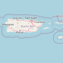
Map view of Cambalache Forest Reserve

Use this park location map to pinpoint Cambalache Forest Reserve in Puerto Rico, understand its exact geographic position, and read its mapped placement within the surrounding landscape more clearly.

Pigeon | © OpenStreetMap contributors

Location context for Cambalache Forest Reserve

Puerto Rico

Visualizing the mogotes, limestone hills, and Northern Karst Belt habitats

Cambalache Forest Reserve Photos and Landscape Scenery

Visual records capture the distinctive karst terrain and steep limestone mogotes that define the protected landscape of Cambalache Forest Reserve. Examining these field photographs reveals the intricate mosaic of moist forest microclimates and lowland vegetation spanning northern Puerto Rico.

A dirt path leading through a dense, green forest with tall, thin trees on both sides.

A narrow dirt path covered in leaves and exposed roots winds through a dense forest with lush green vegetation and a large tree trunk on the left.

Park atlas

Compare regional protected areas and connected forest reserves across Puerto Rico

Explore Parks Near Cambalache Forest Reserve and Northern Karst Landscapes

Visitors exploring Cambalache Forest Reserve can continue browsing adjacent limestone hills and protected landscapes across the northern coast. Extending the geographic review reveals connected conservation units and regional habitats that define the wider island terrain.
State or regional parkUnited States of America
About 16 km away#1 closest

Southwest

Río Abajo State Forest: Mapping the Karst Terrain and Protected Landscapes of Puerto Rico

Protected karst landscape and regional forest geography

Río Abajo State Forest serves as an essential example of Caribbean karst ecosystems, defined by its steep limestone mogotes, hidden ravines, and extensive sinkhole networks. Located in the northern karst belt of Puerto Rico, the forest provides deep insight into complex subterranean drainage patterns and serves as a primary hub for endangered species recovery within its uniquely broken, three-dimensional terrain.

Area
14.1 km²
Established
1943
Relief
Upland
Climate
Tropical
State or regional parkPuerto Rico
About 26 km away#2 closest

South

Los Tres Picachos State Forest: A Geographic Guide to Puerto Rico's Mountain Protected Areas

Cloud forests, volcanic terrain, and watershed protection

Los Tres Picachos State Forest encompasses a striking landscape in the Puerto Rican interior, marked by deep river valleys and its namesake triple peaks. This atlas feature provides insights into the forest's layered ecological zones and its role as a crucial hydrological anchor for the Toro Negro and Cialitos river systems within the Cordillera Central.

Established
1999
Relief
Mountain
Climate
Tropical
Access
Remote access
Protected areaAdjuntas
About 31 km away#3 closest

South

Bosque del Pueblo: Protected Forest Geography and Cordillera Central Landscape

A mountain watershed and ecological corridor in Adjuntas

Bosque del Pueblo represents a key protected landscape within the central mountains of Puerto Rico. As a critical forest reserve located in Adjuntas, it preserves headwaters and supports rare bird populations, serving as a permanent ecological link between several major state forest units.

Area
2.987 km²
Established
1995
Relief
Mountain
Climate
Tropical
Watercolor painting of a hilly, green landscape featuring rolling mountains in the distance and vegetation in the foreground.
State or regional parkUnited States of America
About 39 km away#4 closest

South

Cerrillos State Forest: Protected Subtropical Woodland and Reservoir Geography

Foothill landscapes and watershed features in Ponce, Puerto Rico

This protected area features a mix of tabonuco forest and water-based recreational terrain. Spanning the slopes of the Cordillera Central foothills, the forest encompasses the Cerrillos River and the man-made Lake Cerrillos reservoir, offering a distinct example of subtropical moist forest ecology within the United States commonwealth system.

Area
0.79 km²
Established
1996
Relief
Upland
Climate
Subtropical
A soft watercolor illustration of green hills and foliage against a pale background.
State or regional parkPuerto Rico
About 40 km away#5 closest

West

Guajataca State Forest: Geography and Protected Karst Landscapes in Puerto Rico

Explore the mogotes and cave systems of this regional forest

Guajataca State Forest protects a significant limestone karst landscape in northwestern Puerto Rico. The area is defined by its conical mogote hills, deep sinkhole drainage, and complex cave networks, including the notable Cueva del Viento. As a key part of the regional forest system, it offers a window into the geological and ecological makeup of the Northern Karst belt.

Area
9.26 km²
Established
1943
Relief
Upland
Climate
Tropical
State or regional parkPuerto Rico
About 40 km away#6 closest

Southwest

Guilarte State Forest: Protected Mountain Ecosystems and Cordillera Central Geography

Highland conservation and mapped mountain terrain in central Puerto Rico

Guilarte State Forest represents a essential protected area in the Cordillera Central of Puerto Rico. The reserve encompasses steep altitudinal shifts, ranging from mid-slope palm forests to summit-level cloud forests. As a headwater region for major river basins, the forest is a focal point for understanding the island's mountainous geography and conservation priorities for endemic species.

Area
19.514 km²
Established
1935
Relief
Mountain
Climate
Tropical
State or regional parkSan Juan
About 53 km away#7 closest

East

San Patricio State Forest: Protected Urban Karst and Mogote Terrain in San Juan

Mapping subtropical moist forest geography in Puerto Rico

San Patricio State Forest represents a unique conservation success as a reclaimed secondary forest within the San Juan metropolitan region. This protected area maintains the distinctive karst geology of Puerto Rico, featuring a prominent mogote landmark that provides habitat for endemic species and native plant communities amidst an urban environment.

Area
0.283 km²
Established
2000
Relief
Upland
Climate
Tropical
State or regional parkPuerto Rico
About 53 km away#8 closest

Southwest

Maricao State Forest: A Detailed Map and Geographic Overview of Puerto Rico's Mountain Wilderness

Endemic-rich mountain forests and serpentinite terrain in the Cordillera Central

Maricao State Forest represents a vital protected landscape in the western Cordillera Central of Puerto Rico. This site features distinctive serpentinite geology, complex mountainous watersheds, and diverse endemic bird habitats. The forest serves as a primary geographic anchor along the Ruta Panorámica, providing clear insight into the rugged environmental character of the central island spine.

Area
43.72 km²
Established
1919
Relief
Mountain
Climate
Tropical

Common questions about visiting, size, designation, and location context for Cambalache Forest Reserve

Cambalache Forest Reserve FAQs for park facts, access, geography, and protected area context

Find quick answers about Cambalache Forest Reserve, including protected-area facts, park geography, trail and visitor context, and how the park fits into its surrounding country and regional landscape.
MoriAtlas Explorer

Continue Your Protected Areas Search Across the Global Atlas

Deepen your exploration by continuing the structured search for national parks and protected areas worldwide. Utilize the comprehensive filtering capabilities to compare different conservation landscapes and refine your understanding of global park geography. Discover more about the distribution and characteristics of protected natural areas.

Global natural geography