
Rivers
Park geography
Analyzing the terrain, elevation ranges, and identified natural features of the Eastern Cape
Comprehensive Geographic Profile and Mapped Boundaries of Camdeboo National Park
Camdeboo National Park spans 194.05 square kilometers across the rugged landscape of South Africa's Eastern Cape. This geographic profile details the park's elevation range from 740 to 1480 meters and maps its diverse features including the Valley of Desolation, Nqweba Dam, and surrounding arid shrubland and grasslands.
Related tags
Karoo BiomeValley of DesolationEastern CapeMountain LandscapesDolerite Formations
Karoo wilderness surrounding a historic Eastern Cape town, crowned by the dramatic Valley of Desolation
Camdeboo National Park
Camdeboo National Park is a protected wilderness area in South Africa's Eastern Cape province that nearly encircles the historic town of Graaff-Reinet. The park occupies the southern foothills of the Sneeuberg Mountain ranges, encompassing a dramatic slice of the semi-arid Karoo biome. Established as South Africa's 22nd national park in 2005, the park spans approximately 194 square kilometres and includes the spectacular dolerite formations of the Valley of Desolation, where towering rock pillars and cliffs rise dramatically from the valley floor. The landscape features elevations ranging from 740 to 1,480 metres above sea level, creating a varied terrain of mountain ridges, valley bottoms, and open plains. The park also contains the Nqweba Dam, an important water source in this otherwise arid region. Camdeboo's name derives from the Khoi word !Xamdeboo, meaning 'green valley', reflecting the area's ecological significance within the broader Karoo landscape.
- Location
- South Africa
- Park type
- National park
- Established
- 2005
- Area
- 194.1 km²
Location overview
Regional administrative and location status in the Eastern Cape
Geographic Position of Camdeboo National Park in South Africa
Camdeboo National Park is situated within the Eastern Cape region of South Africa. Regional records confirm its administrative placement and status as a terrestrial, non-transboundary protected landscape.
- Countries
- South Africa
- Regions
- Eastern Cape
- Primary location
- Eastern Cape
- Geographic setting
- Inland
Boundary and coordinates
Mapping the 194.05 square kilometer footprint and coordinate limits
Camdeboo National Park Geographic Boundary Map and Spatial Limits
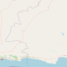
Mapped spatial geometry traces the outline of Camdeboo National Park for regional context. Structured dataset panels show the calculated area of 194.05 square kilometers, coordinate limits, and geographic spans.
- Boundary area
- 195.1 km²
- Boundary perimeter
- 107 km
- Northernmost point
- 32.1707° S
- Southernmost point
- 32.3275° S
- Easternmost point
- 24.6769° E
- Westernmost point
- 24.4106° E
- Geographic centre
- 32.2534° S, 24.5368° E
- North–south span
- 17.4 km
- East–west span
- 25.1 km
Elevation and terrain
Mountain relief features and recorded natural landmarks
Camdeboo National Park Terrain and Elevation Range Profile
Explore the recorded elevation summary ranging from 740 to 1480 meters across the mountain terrain. Linked feature cards supply names, types, and spatial relationships for recorded natural landmarks.
- Minimum elevation
- 740 m
- Maximum elevation
- 1,480 m
Selected named natural features
Valleys
Valley of Desolation
Viewpoints
Ribbokberg Lookout
Rivers
Pienaars
Viewpoints
Valley of Desolation Yellow Frame
Peaks
Hanglip
1,478.9 m
Environmental setting
Arid climate zones, mountain relief, and diverse habitat types
Camdeboo National Park Environmental Classifications and Physical Setting
Recorded landscape features and habitat types provide complementary ways to read the physical setting of Camdeboo National Park. Stored environmental categories connect directly to relevant atlas destinations across arid mountain terrain.
- Relief
- Mountain
- Climate
- Arid
- Water
- Minor water
- Forest cover
- No forest cover
Landscape features
Mountains · Valleys · Cliffs · Lakes · Desert
Habitat types
Desert habitat · Grassland · Shrubland
Park atlas
Compare the diverse protected landscapes of the Eastern Cape and broader Karoo biome
Discover More National Parks and Protected Areas Near Camdeboo National Park
Browse national parks and protected areas geographically close to Camdeboo National Park, encompassing the distinctive Karoo biome and varied Eastern Cape landscapes. Compare these diverse conservation areas to understand regional protected-area distribution, contrasting terrains, and ecological significance across South Africa's arid regions.
National parkEastern Cape
39 km away#1 closest
East

Mountain Zebra National Park: A National Park within Eastern Cape's Geography
Explore its mapped protected boundaries and regional landscape context.
Mountain Zebra National Park serves as a key protected area within South Africa's Eastern Cape region. This page offers an atlas-driven perspective, detailing the park's geographic scope and mapped boundaries. Understand its role as a national park and its contribution to the regional landscape context, providing structured data for those interested in protected land distribution and natural terrain.
- Area
- 284 km²
- Established
- 1937
- IUCN
- II
- Visitors
- 31.2K annual
National parkEastern Cape
91 km away#2 closest
Southeast
Addo Elephant National Park: South African National Park with Diverse Protected Landscapes
Explore its geographic context and unique Big Seven megafauna habitats.
Addo Elephant National Park is a crucial protected landscape within South Africa's Eastern Cape, covering approximately 1,640 square kilometers of varied terrain including karoo plains, coastal dunes, and marine protected areas. Its identity is deeply tied to the successful recovery of elephant populations and its distinction as the only African national park where all Big Seven megafauna can be observed in their natural surroundings. Discover the park's geographic spread, landscape diversity, and its role as a premier conservation area.
- Area
- 1,640 km²
- Established
- 1931
- IUCN
- II
- Visitors
- 305.5K annual
Nature reserveEastern Cape
About 172 km away#3 closest
East
Tsolwana Nature Reserve: Geographic Profile and Protected Landscape Boundaries
Eastern Cape, South Africa Mountain and Karoo Transition
Tsolwana Nature Reserve protects a 8,500 hectare landscape on the Winterberg slopes. This region serves as a vital ecological bridge, blending semi-arid Karoo vegetation with high-altitude grasslands. Explore the map to understand the intersection of river corridors, mountain ridgelines, and plains habitat that define this South African reserve.
- Area
- 85 km²
- Established
- 1979
Wildlife reserveWestern Cape
173 km away#4 closest
West
Karoo National Park Wildlife Reserve: Mapped Boundaries and Geographic Context
Explore the protected landscape of this Western Cape wildlife reserve.
Karoo National Park stands as a protected wildlife reserve, offering insights into the natural geography of South Africa's Western Cape. This detail page provides an atlas view of its protected landscape, mapping its boundaries and situating it within its regional context. Engage with the park's identity as a conservation area and understand its geographic significance for dedicated exploration.
- Area
- 767.9 km²
- Established
- 1979
- Relief
- Mountain
- Climate
- Arid
Wildlife reserveEastern Cape
About 182 km away#5 closest
Southeast
Shamwari Game Reserve: An Atlas View of Restored Bushveld and Conservation Landscapes
Examining protected terrain within South Africa's Eastern Cape
Shamwari Game Reserve occupies approximately 250 square kilometers of restored Eastern Cape terrain. As a focal point of the Indalo Protected Environment, the reserve provides a structured habitat for diverse wildlife species and represents a significant case study in regional land reclamation and conservation mapping.
- Area
- 250 km²
- Established
- 1992
- Relief
- Upland
- Scope
- Terrestrial
Nature reserveEastern Cape Province
About 184 km away#6 closest
East
Mpofu Nature Reserve: Mapping the Ecological Diversity of the Amatole Mountains
Protected escarpment terrain and South African biome transitions
Located in the Eastern Cape, Mpofu Nature Reserve is a significant protected landscape known for the meeting of Grassland, Forest, and Albany Thicket biomes. The terrain ranges from low valley floors to high escarpment plateaus, providing a complex habitat for diverse mammals and endemic flora in a malaria-free setting.
- Area
- 75 km²
- Established
- 1985
- Relief
- Mountain
- Climate
- Subtropical
National parkSouth Africa
187 km away#7 closest
Southwest
Garden Route National Park: South Africa's Protected Landscape and Forest Atlas
Explore indigenous forests, coastal cliffs, and lake systems.
Garden Route National Park is a key national park in South Africa, celebrated for its rich indigenous forests and dramatic coastline. As a protected landscape, it offers a unique geographic profile, blending ancient woodlands with rugged coastal terrain and interconnected lake systems. This page serves as an atlas entry, detailing the park's spatial extent and its significance as a conservation area within the broader geography of South Africa.
- Area
- 1,210 km²
- Established
- 2009
- IUCN
- II
- Relief
- Mixed relief
National parkSouth Africa
About 198 km away#8 closest
South
Tsitsikamma National Park: South Africa's Protected Coastal Forest and Terrain
Explore the unique mapped landscape and protected area boundaries.
Tsitsikamma National Park in South Africa is defined by its striking coastal geography, where ancient indigenous forests descend towards rugged shores. This national park is a prime example of a protected landscape that showcases the dynamic interface between land and sea, featuring dramatic cliffs and iconic river mouths. Understanding its mapped boundaries and diverse terrain provides critical context for regional geographic exploration and the study of conservation areas within South Africa.
- Established
- 2009
- IUCN
- II
- Relief
- Mixed relief
- Climate
- Mediterranean
MoriAtlas Explorer
Continue Exploring Camdeboo National Park's Geographic and Protected Landscape Identity
Deepen your understanding of Camdeboo National Park by investigating its specific geographic features and protected landscape designation. Discover how this national park contributes to the atlas of South Africa's Eastern Cape, offering valuable insights into regional protected areas and mapped natural terrain. Engage further with its unique geographic setting and conservation significance.
Browse next
Global natural geography
Explore related park routes
Explore MoriAtlas Global ParksBrowse All MoriAtlas ParksGlobal Park Map DiscoveryMoriAtlas: Browse All CountriesBrowse All MoriAtlas ContinentsNational Park Environment AtlasGrand Canyon National Park AtlasYellowstone National Park AtlasYosemite National Park Atlas and GeographySerengeti National Park AtlasGalápagos National Park Protected LandscapeBanff National Park Geography and AtlasKruger National Park Atlas EntryUluṟu-Kata Tjuṯa National Park AtlasExplore Uluru-Kata Tjuta National Park GeographyPlitvice Lakes National Park AtlasFiordland National Park Protected LandscapeGreat Smoky Mountains National Park AtlasAfghanistan National Parks and Protected AreasAlbania National Parks and Protected AreasAlgeria National Parks and Protected AreasAmerican Samoa National Parks and Protected AreasAndorra National Parks and Protected AreasAngola National Parks and Protected AreasAntarctica National Parks and Protected AreasAntigua and Barbuda Park List