
Why Canyon de Santa Elena Flora and Fauna Protection Area stands out
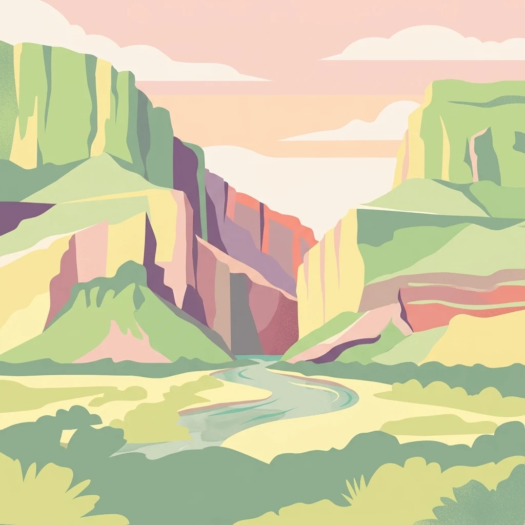
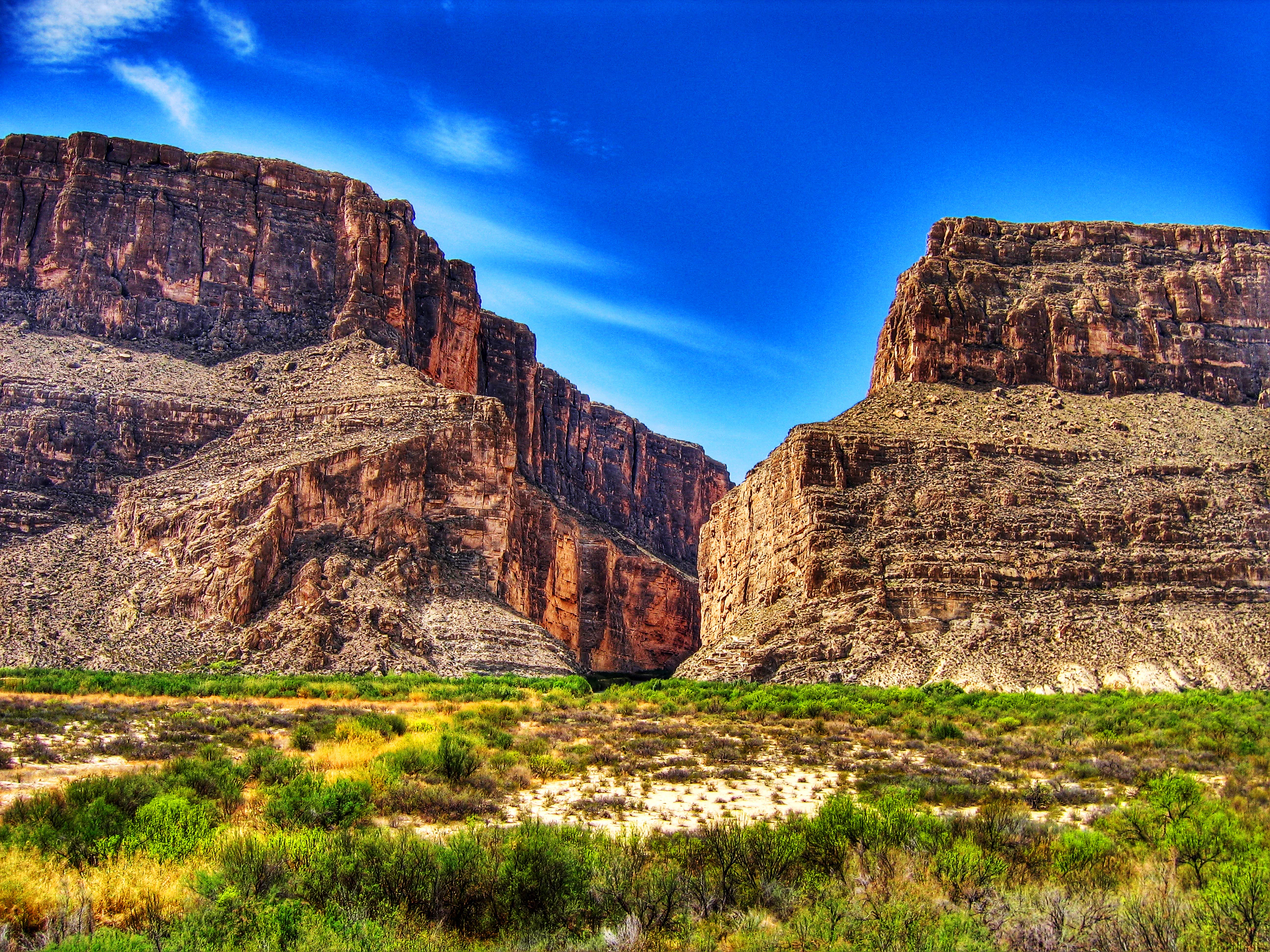
Canyon de Santa Elena is best known for protecting a major stretch of the Chihuahuan Desert along the deeply carved Rio Grande canyon that forms the Mexico, United States border. The dramatic limestone and volcanic canyons, including the namesake Santa Elena Canyon and the canyon of La Gaviota, are among the most visually striking desert landscapes in North America. The reserve is also recognized for its ecological richness, hosting a high diversity of cactus-dominated desert scrub, oak woodlands at higher elevations, and a fauna adapted to aridity, including golden eagles, peregrine falcons, black bears, bobcats, mule deer, and white-tailed deer. Its location opposite Big Bend National Park makes it a cornerstone of transboundary desert conservation.
Canyon de Santa Elena Flora and Fauna Protection Area history and protected-area timeline
The cultural history of the Canyon de Santa Elena region stretches back at least 15,000 years. Archaeological finds in the area, including projectile points, grinding stones, and rock paintings, document human presence from the Paleoindian period through the Archaic, the Late Prehistoric, and into the Cielo Complex period around 1300–1680. These early inhabitants lived as mobile hunter-gatherers, fishing, gathering, hunting, and practicing small-scale agriculture, following seasonal movements that let them exploit varied desert and river resources.
A succession of indigenous groups moved through the area, including the Conchos, Jumanos, Chisos, and various Apache bands such as the Chiricahuas, Mescaleros, and Lipan. Their presence shaped land use in the canyons and valleys for centuries. The arrival of the Spanish and the Comanche in the colonial era disrupted this world decisively; the Mescaleros and Lipan in particular were displaced, while the Rio Grande became a contested frontier line.
The Spanish colonial government built a chain of small fortifications along the river, including San Carlos in Chihuahua and Junta de los Ríos, San Vicente, Santa Rosa, and San Juan Bautista in Coahuila, each manned by garrisons to defend against raids. For many years the region was too dangerous for permanent settlement, and until around 1890 it remained largely unpopulated because of ongoing Apache and Comanche attacks. The fort of San Carlos was abandoned by 1784 and used only intermittently by travelers sheltering from bandits and raiders.
Modern municipal settlement began in the 19th century. The first town council of the Ojinaga municipality was established in 1824, with San Carlos attached as a section in 1831. The growth of mining led to the creation of the Manuel Benavides municipality, named after a general who died in 1913 during the Mexican Revolution. This layered history of indigenous, colonial, revolutionary, and modern land use still shapes the cultural landscape of the reserve today.
The conservation history of the area is more recent. Discussions about creating a Mexican counterpart to Big Bend National Park on the United States side of the border began as early as 1934, when an overlapping Forest Protection Area was declared to safeguard the watersheds feeding the La Amistad Dam in Coahuila. In 1990, at the request of the Chihuahua state government, formal proceedings began to establish a biosphere reserve in northeastern Chihuahua. After consultations with local residents and authorities, the area was officially decreed as a Flora and Fauna Protection Area on 7 November 1994.
Canyon de Santa Elena Flora and Fauna Protection Area landscape and geographic character
The landscape of Canyon de Santa Elena is a textbook expression of the Chihuahuan Desert's structural geology. Cretaceous limestones form a foundation that was later folded and fractured by mid-Tertiary volcanic activity, creating alternating block uplifts and depressions. This produces a terrain of scattered mountain ranges separated by broad valleys and gently rolling plains, with occasional outcrops of older metamorphic rocks and granitic intrusions.
The reserve's most iconic features are its two great canyons. Santa Elena Canyon, after which the protected area is named, is incised nearly 460 meters into the bedrock by the Rio Grande, forming sheer cliffs that mark the international border. The canyon of La Gaviota runs even deeper, reaching roughly 656 meters, and adds further dramatic relief to the eastern part of the reserve. Together, these river-cut gorges are among the most visually arresting desert canyon systems in North America.
Beyond the canyons, the reserve encompasses the sierras of El Ranchito, Sierra Rica, and El Mulato. Between these ranges lie the broad valleys of Álamo, Chapó, El Mulato, and Rancho Blanco, along with lower hilly zones near Manuel Benavides, Paso Lajitas, and San Antonio. Despite the rugged canyon scenery, large parts of the protected area are relatively flat, with slopes under 8 percent and only modest hill formations, creating an alternation between open desert basins and dramatic cliff-bound corridors along the river.
Canyon de Santa Elena Flora and Fauna Protection Area ecosystems, habitats, and plant life
Ecologically, Canyon de Santa Elena sits squarely within the Chihuahuan Desert, one of the three great North American deserts and the most biologically diverse of them. The reserve's relatively wide altitudinal range, from roughly 700 meters in the river corridor to more than 2,000 meters in the higher sierras, allows multiple vegetation communities to coexist within a single protected unit.
The dominant vegetation is microphyllous desert scrub, characterized by small-leaved, drought-adapted shrubs such as creosote bush, mariola, hojasén, mesquite, ocotillo, and junco. This community covers the largest share of the reserve and forms the classic Chihuahuan Desert mosaic. Above it, on rocky slopes and canyon walls, rosetophyllous scrub takes over, dominated by yuccas, agaves, lechuguilla, and sotol, often with a rich understory of cacti. Open grasslands of navajita and other native bunchgrasses occupy flatter, more fertile soils, and at the highest elevations these grasslands transition into piñon–juniper woodlands and mixed oak forests, particularly with piñon pine, juniper, and gray oak.
Along the Rio Grande and its tributaries, narrow but ecologically vital ribbons of riparian vegetation break the arid monotony. Cottonwoods, willows, and other moisture-loving species create shaded corridors that contrast sharply with the surrounding desert and provide critical habitat for wildlife. CONABIO records indicate that more than 700 species of plants and animals have been documented in the reserve, with dozens falling under Mexican official protection categories, including numerous cactus species that are among the area's most distinctive and threatened plants.
Canyon de Santa Elena Flora and Fauna Protection Area wildlife and species highlights
Wildlife in Canyon de Santa Elena is shaped by the harshness of the Chihuahuan Desert and the contrasting richness of the river canyon. The fauna is dominated by birds and mammals that have adapted to extreme aridity, supplemented by reptiles, amphibians, and freshwater species associated with the Rio Grande and its tributaries.
Among mammals, the reserve supports species typical of northern Mexican desert mountains. Bobcats, coyotes, black-tailed jackrabbits, mule deer, white-tailed deer, and collared peccaries roam the canyons and scrublands. Black bears are present in higher, more vegetated zones, and beavers are especially associated with the river, creating their own influence on the riparian forests. This mix of predators and herbivores reflects a functioning desert ecosystem with relatively intact predator–prey relationships.
The avifauna is one of the reserve's standout features. Songbirds and ornamental species fill the riparian corridors and oak woodlands, while raptors dominate the open desert and cliff faces. Golden eagles, peregrine falcons, and American kestrels are recorded among the breeding raptors, while mourning doves, various ducks, and numerous other species are present in lower country. The Rio Grande itself supports several fish species, adding an aquatic dimension to an otherwise dry-land fauna.
A substantial share of the reserve's species are of conservation concern. According to the management literature, 79 species are formally protected under the relevant Mexican norms, with 66 belonging to the fauna, including the black bear, golden eagle, peregrine falcon, and beaver, among many others. This high number of protected species underlines the area's role as an important refuge within the Chihuahuan Desert.
Canyon de Santa Elena Flora and Fauna Protection Area conservation status and protection priorities
Canyon de Santa Elena was established explicitly to protect a representative portion of the Chihuahuan Desert, one of the most biodiverse arid ecoregions in North America, and to serve as the Mexican counterpart to existing protected areas across the Rio Grande in Texas. Its creation completed a transboundary conservation complex centered on Big Bend National Park and its Mexican neighbors, allowing joint ecological management across an international border.
The reserve's conservation significance rests on several pillars. It safeguards a wide elevational gradient of Chihuahuan Desert ecosystems, from low-elevation microphyllous scrub through rosetophyllous succulent communities and grasslands up to piñon–juniper and oak woodlands. It also protects the fragile riparian corridors of the Rio Grande, which act as biological highways through an otherwise arid matrix. The high number of protected plant and fauna species, including endemic cacti and large mammals such as the black bear, gives the area national importance for desert conservation.
Conservation management is complicated by the reserve's overlap with active human land use. Much of the territory is composed of private properties and ejidos, with agriculture, livestock ranching, and mining present alongside the protected ecosystems. Overgrazing, land clearing for new crops, and unregulated tourism are recognized threats, as is the illegal extraction of cacti, fossils, and archaeological artifacts. The reserve's long-term value depends on balancing these traditional land uses with continued protection of the desert ecosystems that prompted its creation.
Canyon de Santa Elena Flora and Fauna Protection Area cultural meaning and human context
The cultural landscape of Canyon de Santa Elena reflects a layered history of human presence in a challenging desert environment. Archaeological evidence indicates occupation spanning from the Paleoindian period through the Late Prehistoric and into the relatively recent Cielo Complex period, with sites showing evidence of hunting, gathering, fishing, and small-scale agriculture.
A succession of indigenous peoples inhabited or traversed the area, including the Conchos, Jumanos, Chisos, and multiple Apache groups such as the Chiricahuas, Mescaleros, and Lipan. The Apache and Comanche presence in particular defined the colonial and 19th-century history of the region, limiting Spanish and later Mexican settlement and shaping the pattern of frontier forts along the Rio Grande.
Today, the reserve is a working landscape. Small towns such as Manuel Benavides, Loma de Juárez, El Mulato, Paso Lajitas, and Santa Elena continue the long tradition of human habitation in the desert. Roughly 2,500 people live within the protected area, distributed across private properties, ejidos, and fundos legales. Agriculture, livestock ranching, and small-scale mining are part of the local economy, and the area's identity is shaped as much by its ranching and mining heritage as by its wild desert settings.
Top sights and standout views in Canyon de Santa Elena Flora and Fauna Protection Area
Some of the most distinctive features of the Canyon de Santa Elena reserve are concentrated along the river and in its highest mountain zones. The Santa Elena Canyon itself, where the Rio Grande cuts a deep international border gorge of limestone walls, is the visual centerpiece of the area and the reason it was originally proposed for protection.
Equally memorable is the deeply incised canyon of La Gaviota, which exceeds 600 meters in depth and offers some of the most dramatic scenery within the protected area. The contrasts between low-elevation microphyllous desert scrub, mid-elevation rosetophyllous succulent communities rich in yuccas and agaves, and high-elevation piñon–juniper and oak forests create layered landscapes that change rapidly over short distances. The presence of large mammals such as the black bear, iconic raptors including the golden eagle and peregrine falcon, and a thriving riparian corridor along the Rio Grande add further depth to the experience of the reserve.
Best time to visit Canyon de Santa Elena Flora and Fauna Protection Area
Seasonal conditions in Canyon de Santa Elena are shaped by its position deep within the Chihuahuan Desert. Summers are extremely hot, with temperatures that can reach the mid-forties Celsius, while winters are milder by day but can be cold at night at higher elevations. Precipitation is scarce overall and concentrated mostly in the summer monsoon season, when short, intense storms can transform normally dry washes into active streams and briefly green up the desert.
For most visitors, the cooler months from late autumn through early spring offer the most comfortable conditions for exploring the desert landscapes, observing wildlife along the river, and appreciating the contrast between canyon walls and open basins. Spring can bring wildflower displays in years with sufficient winter rain. Summer visits are possible but require preparation for intense heat, limited shade, and the possibility of afternoon thunderstorms, which can make canyon access dangerous due to flash floods.