
Mori Atlas logo
Marine protected areaCape Rodney-Okakari Point Marine Reserve

Explore the structural complexity and diverse marine habitats of New Zealand's first designated marine reserve.

Cape Rodney-Okakari Point Marine Reserve: Coastal Geography and Protected Marine Boundaries

Cape Rodney-Okakari Point Marine Reserve represents a vital stretch of protected coastline on New Zealand's North Island, encompassing varied terrain from rocky headlands and boulder fields to expansive mudflats and mangrove forests. This geographic study details the transition from high-energy surf beaches to sheltered estuarine waters, mapping the ecological recovery of kelp forests and fish populations within the established protection zone. Beyond its scientific significance to the Leigh Marine Laboratory, the reserve provides a clear record of how long-term conservation shapes marine landscapes and invertebrate communities along the eastern seaboard.

marine reservesnorkelingscuba divingkelp forestrocky shorecoastal habitats
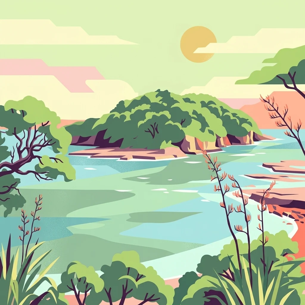
Stylized digital illustration of a coastal bay with an island, lush vegetation, and rocky shorelines under a pale sun.

Cape Rodney-Okakari Point Marine Reserve

Marine protected area

Park overview

Structured park overview, official facts, and landscape profile for Cape Rodney-Okakari Point Marine Reserve

Cape Rodney-Okakari Point Marine Reserve park facts, protected area profile, and essential visitor context

Review the core facts for Cape Rodney-Okakari Point Marine Reserve, including designation, size, terrain, visitor scale, habitats, and operating context in one park-focused overview.

About Cape Rodney-Okakari Point Marine Reserve

Cape Rodney-Okakari Point Marine Reserve sits along the eastern coastline of New Zealand's North Island, just north of the settlement of Leigh and within reach of the wider Auckland region. Established in 1975, the reserve marked a landmark moment in New Zealand environmental history as the country's first formally protected marine area. It extends along the coast between Cape Rodney and Okakari Point, covering a 547 hectare zone that combines nearshore seabed, intertidal shoreline, and offshore waters around Te Hāwere-a-Maki, the island more commonly known as Goat Island.

The reserve is shaped by an unusually wide range of coastal habitats packed into a relatively compact area. Rocky headlands and boulder fields give way to sheltered harbours with mudflats and mangrove stands, while open surf beaches of white sand face the open Pacific swell. Beneath the surface, the seafloor includes coarse sand, mudstone terraces, pebblestone rock, and greywacke, producing a layered mosaic of microhabitats. This diversity of shoreline and seabed environments is central to the reserve's identity, supporting very different communities of marine plants and animals within a single protected boundary.

What distinguishes the reserve most clearly is the contrast between its pre-protection condition and its present ecological richness. Before 1975, decades of heavy fishing pressure had unbalanced the system: populations of predatory species such as rock lobster and Australasian snapper were depleted, while New Zealand sea urchins flourished in the absence of predators, leaving large areas of seafloor grazed bare in what marine biologists call kina barrens. Once fishing and the removal of marine life were banned, the ecosystem gradually recovered. By the early 2010s, more than 35 years after protection, the reserve supported an abundance and diversity of fish that has since become emblematic of what well-managed marine protection can achieve.

Today, the reserve is equally recognised as a hub for marine research and public engagement with the sea. The Leigh Marine Laboratory, run by the University of Auckland, maintains scientific equipment throughout the reserve and uses it as a long-term field site for studying marine ecosystem function. Each year, the reserve draws around 200,000 visitors who come to snorkel, dive, kayak, walk the coastal tracks, and explore the intertidal rock pools at low tide, making it one of the most accessible places in New Zealand to experience a healthy marine ecosystem firsthand.

Quick facts and research context for Cape Rodney-Okakari Point Marine Reserve

Cape Rodney-Okakari Point Marine Reserve is a 547 hectare marine protected area on the North Island of New Zealand, situated near the small coastal community of Leigh. Established in 1975, it was the country's first marine reserve and is administered by the Department of Conservation.

The reserve extends from Cape Rodney in the north to Okakari Point in the south, reaching 800 metres out to sea, and includes the waters around Te Hāwere-a-Maki, also known as Goat Island. The Auckland University Leigh Marine Laboratory is located within the reserve, conducting ongoing research into marine ecosystems. The site is classified under IUCN Category Ia as a strict nature reserve.

Protection and recognition

Documented marine protection scope, governance metrics, and recognition records

Cape Rodney-Okakari Point Marine Reserve Protection Status and Recognition

Marine protection status and management scope provide clear baseline data for Cape Rodney-Okakari Point Marine Reserve. Recorded designation details establish the formal conservation framework governing this protected coastal marine zone.

Protection details

Protection scope
Marine
Transboundary protection
No
Park context

Deeper park guide and search-rich context for Cape Rodney-Okakari Point Marine Reserve

Cape Rodney-Okakari Point Marine Reserve history, landscape, wildlife, and travel context

Explore Cape Rodney-Okakari Point Marine Reserve through its history, landscape character, ecosystems, wildlife, conservation priorities, cultural context, and seasonal travel timing in a structured park guide built for atlas discovery and search intent.

Why Cape Rodney-Okakari Point Marine Reserve stands out

The reserve is best known for being New Zealand's first marine reserve, a pioneering step in marine conservation that has demonstrated how coastal ecosystems can recover when fishing and extraction are halted. Within its boundaries, visitors regularly encounter large numbers of fish such as Australasian snapper, particularly in the shallows around Goat Island, as well as kelp forests, sponge gardens, and dense populations of New Zealand sea urchins, known locally as kina. Beyond its role as a flagship conservation site, the reserve is renowned as a premier destination for accessible marine wildlife encounters. Snorkellers and divers can interact with strikingly tame fish in clear coastal waters, while the surrounding intertidal zone offers one of the richest rocky shore experiences in the country. The presence of the Leigh Marine Laboratory also gives the park a strong identity as a living classroom for marine science in New Zealand.
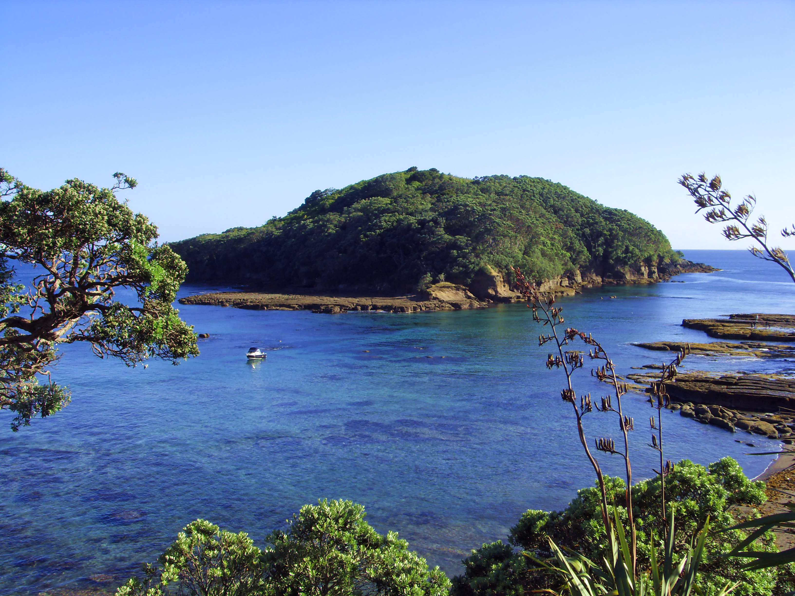
A clear, sunny view of Goat Island surrounded by deep blue ocean waters, viewed from the shore with native trees and flax plants in the foreground.
A scenic view of Goat Island within the Cape Rodney-Okakari Point Marine Reserve.

Cape Rodney-Okakari Point Marine Reserve history and protected-area timeline

The coastline within and around the present reserve has a much older human history than its 1975 protection status suggests. Te Hāwere-a-Maki, also known as Goat Island or Motu Hāwere, holds deep significance for Ngāti Manuhiri, the iwi whose ancestral connections to the area trace back to the earlier tribal group Wakatūwhenua. According to tradition, those ancestors arrived with the Moekākara waka under the captain Tahuhunuiarangi. The island's name refers to Maki, the son of the founding ancestor Manuhiri, whose campaign during the late seventeenth century brought the wider area under Māori control. Members of the iwi later maintained a fortified pā on the island itself.

Ngāti Manuhiri continued to live, farm, and harvest from the coastal area for generations, including through the early period of European settlement in the nineteenth century. In 1901, the iwi received formal title over the island, recognising in modern legal terms a relationship with the place that had long existed. This continuing Māori connection forms an important part of the reserve's identity and is reflected in the dual name Te Hāwere-a-Maki / Goat Island that the island now carries.

The marine reserve itself was established in 1975, a decision that followed growing concern about the deteriorating condition of the local marine environment. By that point, extensive recreational and commercial harvesting had stripped large predatory fish and shellfish populations from the area, leaving expansive stretches of seafloor dominated by grazing sea urchins. The creation of the reserve as New Zealand's first marine protected area represented a deliberate test of whether excluding extraction could allow a temperate coastal ecosystem to recover. Subsequent decades showed that it could: populations of predatory fish and other species gradually rebuilt, and the reserve became a benchmark case for marine protection worldwide.

Cape Rodney-Okakari Point Marine Reserve landscape and geographic character

The reserve's landscape is best understood as a compressed cross-section of New Zealand's eastern coast. At its northern end, the rocky headland of Cape Rodney forms the boundary of the protected waters, with steep cliffs that drop into the sea and create an interface between land and ocean that shapes the local wave and current patterns. From there, the coastline transitions southward into a varied sequence of beach types and sheltered inlets, including the open white sand surf beach at Pakiri and the quieter, sediment-rich environment of Whangateau Harbour, where mudflats and mangrove forests fringe the shore.

These contrasting coastal forms produce very different conditions above and below the waterline. The rocky exposures around Cape Rodney and Te Hāwere-a-Maki support rich communities of invertebrates on boulders, in crevices, and across tide pools, while the sandy Pakiri beach represents a high-energy environment shaped by surf and shifting sand. In Whangateau Harbour, the gentler slope of the seafloor, the fine sediments, and the shelter provided by mangroves create a softer, more estuarine setting that contrasts strongly with the exposed outer coast.

Below the tideline, the reserve continues this diversity through different seabed types: boulders and cobble fields in some areas, coarse sand in others, and extensive stretches of mudstone terraces, pebblestone rock, and greywacke bedrock. Together, these materials create the structural complexity that allows so many different marine organisms to find a foothold, from encrusting life on hard surfaces to burrowing communities in softer sediments.

Cape Rodney-Okakari Point Marine Reserve ecosystems, habitats, and plant life

Ecologically, the reserve is defined less by a single dominant environment than by the close juxtaposition of several very different marine habitats. The protected waters include kelp forests anchored to hard reef, dense sponge gardens on rocky surfaces, beds of coralline turf, and patches of open sand and mud where other communities develop. Creeks running across the intertidal zone create deeper channels that accumulate their own distinctive assemblages of encrusting marine life and shelter mobile species.

On the shore and in the shallow subtidal zone, the reserve's mosaic of boulder, sand, mudstone, and pebblestone rock produces overlapping ecological worlds. The boulder fields host sea anemones, boulder crabs, and bristle-tails in shaded crevices. The coarse sand supports animals such as sand-hoppers and sea lice that thrive in shifting sediments. The mudstone terraces and pebblestone areas are particularly rich in grazing invertebrates, including snails, limpets, chitons, and whelks, alongside crabs, half-crabs, shrimps, starfish, small fish, sea-squirts, barnacles, tube worms, and oysters.

The sheltered harbour environments add a further ecological dimension. Mangrove forests around Whangateau Harbour stabilise fine sediments, filter nutrients, and serve as nurseries for juvenile fish and invertebrates, linking the inner estuarine system to the broader marine ecology of the reserve. This combination of reef, soft sediment, estuarine, and beach habitats within a single protected boundary gives the reserve a disproportionately rich ecological character for its size.

Cape Rodney-Okakari Point Marine Reserve wildlife and species highlights

The most conspicuous wildlife in the reserve is fish, particularly the Australasian snapper, which has become one of the species most closely associated with the park's identity. Within the protected waters, snapper populations are notably abundant and unnaturally curious around divers and snorkellers, a behavioural pattern linked to decades without fishing pressure. Rock lobster, which was historically overexploited outside the reserve, has also returned in numbers, and the recovery of these predatory species has reshaped the broader ecosystem.

New Zealand sea urchins, known locally as kina, are a defining presence in the reserve's underwater story. They were once so dominant that they grazed the seafloor down to barren rock, but the return of their predators has begun to rebalance the system. Their continuing role, as both part of the healthy ecosystem and a reminder of what it once was, makes them an important indicator species for the reserve.

The intertidal and shallow subtidal zones support a wide variety of smaller marine animals. Sea anemones cling to boulders and walls, crabs move through crevices, and shrimps, starfish, sea-quirts, and tube worms occupy microhabitats within the rock and sediment. Above the waterline, the harbour and rocky shore areas support their own communities, including mangrove-associated species in the sheltered inlets and shorebirds that use the mudflats and surrounding coast.

Cape Rodney-Okakari Point Marine Reserve conservation status and protection priorities

The reserve holds an outsize place in New Zealand conservation history because it was the country's first marine reserve and the proving ground for the idea that temperate coastal ecosystems could recover once extraction was halted. Its establishment in 1975 set a template for the broader network of marine reserves that New Zealand has since developed along its coast. The reserve's IUCN Category Ia designation as a strict nature reserve underscores the high level of protection it receives, with all fishing and any removal or disturbance of marine life or materials prohibited within its boundaries.

Its conservation importance lies as much in the recovery evidence it provides as in its current biodiversity. The shift from a kina-dominated, predator-poor seafloor to a system rich in snapper, rock lobster, and associated species is one of the most studied examples of marine ecosystem recovery in the Southern Hemisphere. The reserve has therefore become a reference point for debates about marine protected area design, the role of predator populations, and the long timescales over which coastal recovery operates.

The presence of the University of Auckland's Leigh Marine Laboratory inside the reserve strengthens its conservation role. Scientists there use the protected waters as a long-term observatory for marine ecosystem research, with deployments of monitoring equipment around the reserve that generate continuous data about how a fully protected coastal system functions. This combination of legal protection, ecosystem recovery, and active scientific study gives the reserve a distinctive place in New Zealand's conservation landscape.

Cape Rodney-Okakari Point Marine Reserve cultural meaning and human context

The cultural context of Cape Rodney-Okakari Point Marine Reserve is inseparable from the history of Ngāti Manuhiri and the island at its heart. Te Hāwere-a-Maki, or Goat Island, is woven into the ancestral narrative of the iwi: the story of Manuhiri and his son Maki, the arrival of the Moekākara waka under Tahuhunuiarangi, and the establishment of a pā on the island in the late seventeenth century all anchor the iwi's whakapapa to this coastline. The island's name preserves the memory of these figures, and the formal dual name used today reflects the partnership between customary knowledge and contemporary conservation practice.

Ngāti Manuhiri maintained active homes and farms along this coast well into the period of European settlement, with formal title over the island eventually returned to the iwi in 1901. That recognition, alongside the protection era that began in 1975, has shaped the reserve into a place where ecological conservation and Māori cultural heritage coexist. Managed jointly in spirit by the Department of Conservation and informed by the iwi's continuing relationship with the area, the reserve sits within a broader regional landscape of Māori coastal identity on the eastern North Island.

Top sights and standout views in Cape Rodney-Okakari Point Marine Reserve

Highlights of Cape Rodney-Okakari Point Marine Reserve include the recovery story of its fish populations, its exceptionally accessible shore snorkelling and diving around Te Hāwere-a-Maki / Goat Island, and the unusual concentration of distinct coastal habitats, from rocky headlands and boulder fields to white sand beaches and mangrove-lined mudflats. The long-running research presence of the Leigh Marine Laboratory gives the reserve a depth of scientific character unmatched by most other New Zealand marine sites.

The reserve also stands out for its position in New Zealand's conservation history as the country's inaugural marine reserve, a status that gives it both symbolic and practical weight. The transformation of its seafloor from kina barrens to kelp forest, sponge garden, and snapper-rich habitat is itself one of the park's defining features, offering visitors a visible record of what long-term protection can achieve.

Best time to visit Cape Rodney-Okakari Point Marine Reserve

The reserve can be visited year round, but conditions in the water change significantly with the seasons and the weather. Calm, settled days during the warmer months of late spring through early autumn generally offer the best visibility and sea conditions for snorkelling and diving, when light penetrates further into the water and the kelp forests are most biologically active. Summer conditions also make walkways and intertidal exploration more comfortable, and low spring tides at any time of year can reveal exceptionally rich rock pool life along the boulder shores.

Windy conditions, particularly easterly or north-easterly winds above about 20 knots, and easterly or north-easterly swells above roughly one metre, can make the water less suitable for in-water activities such as snorkelling, diving, and kayaking. During such periods, visiting the coastal walkways, exploring the rock pools at low tide, or viewing the area from land still offers much of the reserve's character. Visitors planning to spend time in the water generally benefit from checking local sea conditions in advance, since the reserve's accessibility by sea depends heavily on the prevailing wind and swell.

Monthly climate preview

Long-term representative temperature and precipitation averages across the annual cycle

Cape Rodney-Okakari Point Marine Reserve Climate Normals and Weather by Month

Representative coordinate records show average monthly temperatures peaking above twenty degrees Celsius alongside measured daily precipitation patterns. Examining the complete twelve-month profile provides deeper context on long-term thermal and moisture conditions.
Annual mean16 °C
12 °C21 °C
Jan20°
Feb21°
Mar19°
Apr18°
May16°
Jun14°
Jul13°
Aug12°
Sep13°
Oct15°
Nov16°
Dec18°
Warmest month
February

20.6 °C

Coolest month
August

12.5 °C

Wettest month
July

3.5 mm/day

Driest month
January

1.7 mm/day

Park location guide

Geography guide, regional context, and park location map for Cape Rodney-Okakari Point Marine Reserve

Cape Rodney-Okakari Point Marine Reserve park geography, regions, and map view in New Zealand

Understand where Cape Rodney-Okakari Point Marine Reserve sits in New Zealand through a broader geographic reading of the surrounding landscape, nearby location context, and its mapped position within the national park landscape.

How Cape Rodney-Okakari Point Marine Reserve fits into New Zealand

New Zealand is an island nation in the southwestern Pacific Ocean comprising two main islands and numerous smaller islands. Located east of Australia across the Tasman Sea, it features varied topography with the Southern Alps running along the South Island and volcanic terrain on the North Island. The country was settled by Maori people between 1280 and 1350, followed by European exploration beginning in 1642, and became a Dominion in 1907 before gaining full independence in 1947.

Wider geography shaping Cape Rodney-Okakari Point Marine Reserve in New Zealand

New Zealand lies in the southwestern Pacific Ocean, east of Australia across the Tasman Sea. The country consists of two main islands, the North Island and South Island, plus over 600 smaller islands. The North Island features volcanic plateaus and hills while the South Island is dominated by the Southern Alps mountain range. The country has a long coastline and is surrounded by the Pacific Ocean.

Map view of Cape Rodney-Okakari Point Marine Reserve

Use this park location map to pinpoint Cape Rodney-Okakari Point Marine Reserve in New Zealand, understand its exact geographic position, and read its mapped placement within the surrounding landscape more clearly.

Pigeon | © OpenStreetMap contributors

Location context for Cape Rodney-Okakari Point Marine Reserve

North Island
Recorded earthquake history

View Historical Earthquake Records for Cape Rodney-Okakari Point Marine Reserve

Explore the documented seismic history for the region surrounding Cape Rodney-Okakari Point Marine Reserve. This catalogue tracks recorded events by epicentre distance, providing a clear reference for historical seismic activity within the context of the marine protected area. MoriAtlas maintains these records to support geographical understanding of the coastal environment.

Cape Rodney-Okakari Point Marine Reserve Earthquake History

Catalogued events

2 events

Strongest magnitude

Magnitude 4.5

Most recent event

Feb 21, 2007

This history includes earthquakes recorded inside the park or within 50 km of its borders

Visualizing coastal habitats, rocky headlands, and marine ecosystems

Cape Rodney-Okakari Point Marine Reserve Photos and Landscape Scenery

Visual records reveal the diverse coastal terrain, rocky shores, and flourishing marine habitats protected within Cape Rodney-Okakari Point Marine Reserve. Detailed imagery offers clear insight into the underwater recovery, kelp forests, and estuarine environments that define the protected landscape.

A clear, sunny view of Goat Island surrounded by deep blue ocean waters, viewed from the shore with native trees and flax plants in the foreground.

Park atlas

Compare adjacent coastal habitats and regional marine reserves across the North Island

Parks Near Cape Rodney-Okakari Point Marine Reserve And Surrounding Protected Areas

Browse nearby coastal reserves and protected marine habitats located across the surrounding regional landscape. Expanding the geographic comparison helps trace broader ecological patterns beyond Cape Rodney-Okakari Point Marine Reserve.
Regional parkAuckland Region
10 km away#1 closest

Northwest

Te Ārai Regional Park: Mapping Coastal Dune Systems and Protected Geography in Auckland

A protected coastal landscape featuring expansive dune systems and northern headlands.

Te Ārai Regional Park sits as a major protected coastal area on the northern edge of the Auckland Region. Its primary defining feature is an expansive system of sand dunes that anchor a diverse coastal environment. Extending southward toward Poutawa Stream and bordered by the Mangawhai Forest, the park represents a critical geography for endangered species breeding and provides a distinct topographic profile along the North Island coast.

Established
2008
Relief
Lowland
Climate
Subtropical
Access
Easy access
A soft watercolor illustration showing the low-lying shape of Motuora Island surrounded by calm water, with a distant hilly coastline in the background.
Nature reserveNorth Island
About 25 km away#2 closest

South

Motuora Nature Reserve: Protected Coastal Island Geography and Restoration Map

Predator-free ecological sanctuary in the Hauraki Gulf

Motuora occupies a key position in the Hauraki Gulf, offering a well-mapped look at coastal island restoration in New Zealand. This protected area features a regenerated forest interior and cliff-edged terrain, serving as an important mainland-island site for avian conservation, including kiwi and petrel colonies.

Area
0.8 km²
Established
1965
Relief
Lowland
Climate
Subtropical
Regional parkAuckland Region
28 km away#3 closest

South

Te Muri Regional Park: Mapped Coastal Peninsula and Estuarine Geography in Auckland

Protected native forest and tidal estuary landscapes

Te Muri Regional Park presents a unique peninsular landscape situated between the Puhoi River and Te Muri O Tarariki Stream in Auckland. This protected area showcases a complex interface between native coastal forest and tidal ecosystems, offering clear mapped boundaries that connect to the wider Hauraki Gulf coastal belt. Explore the topographical transition from sea level estuaries to rolling hill country.

Area
4.44 km²
Established
2010
Relief
Upland
Scope
Terrestrial
Regional parkAuckland Region
29 km away#4 closest

South

Wenderholm Regional Park: Coastal Forest and Estuary Geography in the Auckland Region

Mapped protected landscapes of a coastal New Zealand peninsula

Situated on a narrow peninsula north of Auckland, Wenderholm Regional Park offers a compact study in diverse coastal terrain. The park encompasses the forested Maungatauhoro headland, the tidal Puhoi sandspit, and riverine boundaries that create a distinct protected environment. Since its 1965 founding, the area has become a haven for native bird restoration and coastal vegetation, providing a unique vantage point across the Hauraki Gulf.

Area
1.35 km²
Established
1965
Relief
Mixed relief
Climate
Temperate
A watercolor illustration of a soft green hilly landscape with distant peaks against a white background.
Nature reserveNew Zealand
About 36 km away#5 closest

North

Hen and Chicken Islands Nature Reserve: Mapped Geography and Protected Island Terrain

Archipelago sanctuary and volcanic landscape offshore of New Zealand

Explore the geographic structure of the Hen and Chicken Islands, an uninhabited nature reserve that serves as a vital predator-free sanctuary. The archipelago displays varied volcanic terrain, from the dramatic central ridge of Hen Island to the rugged rocky reefs of the Marotiri islets, offering a clear window into the ecological conservation landscapes of the Northland region.

Area
8.44 km²
Established
1908
Relief
Highland
Climate
Subtropical
Regional parkAuckland Region
51 km away#6 closest

Southwest

Te Rau Pūriri Regional Park: Geography and Protected Land Overview for Auckland Region

Coastal harbour landscape and native forest recovery zones

Te Rau Pūriri Regional Park occupies a strategic position on the South Kaipara Head, serving as a protected corridor between agricultural land and the expansive Kaipara Harbour. The park serves as an atlas-worthy example of ecological transition, featuring sandy bays, eucalyptus stands, and native pūriri forests that provide habitat stability within the wider Auckland coastal geography.

Area
2.49 km²
Established
2006
Relief
Lowland
Climate
Temperate
A horizontal watercolor painting of a coastal island landscape with rolling green hills, pale distant mountains, and coastal greenery.
Wildlife reserveAuckland
About 60 km away#7 closest

South

Motuihe Island Wildlife Reserve: Protected Landscapes and Hauraki Gulf Geography

Ecological restoration and coastal island history near Auckland

Motuihe Island represents a significant case study in island conservation, featuring intensive native forest regeneration and successful wildlife reintroduction. The mapped landscape details an elongated island geography defined by coastal beaches, sandstone terrain, and rich archaeological layers, serving as a prominent protected reserve for the Auckland region.

Area
1.79 km²
Relief
Lowland
Climate
Subtropical
Access
Moderate access
A watercolor painting showing soft green hills rising above a light blue body of water, with a small patch of reddish-brown land visible in the foreground.
Protected areaAuckland Region
About 63 km away#8 closest

East

Rakitu Island Protected Area: Volcanic Geography and Coastal Landscapes in the Hauraki Gulf

A protected offshore sanctuary near Great Barrier Island

Rakitu Island is an uninhabited 253-hectare protected area that represents a distinct volcanic landscape off the northeast coast of New Zealand. Formed from eroded rhyolite domes, the island features high coastal cliffs and a central valley that now supports native forest regrowth. This predator-free sanctuary offers an essential map perspective on small-scale island conservation and rugged maritime terrain.

Area
2.5 km²
Established
1994
Relief
Upland
Scope
Terrestrial

Common questions about visiting, size, designation, and location context for Cape Rodney-Okakari Point Marine Reserve

Cape Rodney-Okakari Point Marine Reserve FAQs for park facts, access, geography, and protected area context

Find quick answers about Cape Rodney-Okakari Point Marine Reserve, including protected-area facts, park geography, trail and visitor context, and how the park fits into its surrounding country and regional landscape.
MoriAtlas Explorer

Continue Your Protected Areas Search Across the Global Atlas

Deepen your exploration by continuing the structured search for national parks and protected areas worldwide. Utilize the comprehensive filtering capabilities to compare different conservation landscapes and refine your understanding of global park geography. Discover more about the distribution and characteristics of protected natural areas.

Global natural geography