Why Caroona Creek Conservation Park stands out
Caroona Creek Conservation Park is most recognised for protecting a representative slice of the transitional landscape between the Mid North hills and the rocky southern Flinders Ranges. Its defining feature is the rugged northern section around Tourilie Gorge, where steep ridges and weathered hills give way to calmer alluvial country, and where Caroona Creek itself flows through the reserve. The park is also valued as a quiet, walk-in section of the Heysen Trail, providing a loop experience for long-distance hikers exploring the Mid North. Beyond its scenic character, it is appreciated for its role as a small but ecologically meaningful example of the semi-arid landscapes that link the cultivated Mid North with the arid country further inland.
Caroona Creek Conservation Park history and protected-area timeline
The land that now makes up Caroona Creek Conservation Park was assembled and protected over a relatively short but deliberate period in the early twenty-first century. The name "Caroona Creek", taken from the stream that flows through the property, was formally approved by the Surveyor General of South Australia on 14 June 2005, signalling early planning intent for a future reserve.
The park itself was proclaimed on 18 February 2010 under the National Parks and Wildlife Act 1972, drawing on a defined set of sections and allotments within the Hundred of Tomkinson. A concurrent proclamation on the same day preserved existing rights of entry, prospecting, exploration and mining under the Mining Act 1971 and the Petroleum and Geothermal Energy Act 2000, embedding a sustainable-use character into the reserve from its inception. Further land was added to the park on 16 October 2014, extending its footprint with additional sections in the Hundred of Tomkinson and Hundred of Hallett. As of 2016, the park's area stood at approximately 54.22 square kilometres.
Caroona Creek Conservation Park landscape and geographic character
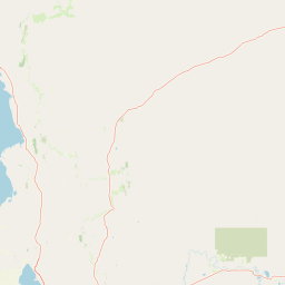
Caroona Creek Conservation Park occupies a transitional landscape on the western edge of the Olary Plain, where the rolling, rounded hills of the Mid North grade into the more rugged terrain of the southern Flinders Ranges. Its topography is varied and clearly defined, moving between several distinct landform types within a relatively compact area.
Steep rocky ridges and calcrete hills form much of the higher ground, giving the park a broken, weathered character in places, while lower-lying alluvial plains open out around the drainage lines and provide a calmer counterpoint to the rougher country. Caroona Creek itself runs through the property, shaping the alluvial flats and contributing to the localised vegetation patterns along its banks.
The most dramatic section of the park is the northern area around Tourilie Gorge, a rocky, rugged environment of steep hills and dissected terrain that visually and geologically anticipates the gorge country that dominates further north in the Flinders Ranges. Together, these landforms give Caroona Creek Conservation Park a layered scenic quality, with views shifting between open plains, ridgelines and enclosed rocky valleys as one moves through the reserve.
Caroona Creek Conservation Park ecosystems, habitats, and plant life
Caroona Creek Conservation Park conserves a representative sample of the semi-arid environments that characterise the transition between the Mid North and the western edge of the Olary Plain. Its protection reflects a desire to maintain ecological continuity across a landscape that, outside the park, has been significantly altered by pastoral use, cropping and other rural land uses typical of the surrounding Mid North.
The mix of rocky ridges, calcrete hills and alluvial plains creates a range of soil and microclimate conditions within a relatively limited area, supporting varied vegetation types associated with the break in country between the Mid North and the southern Flinders Ranges. The corridor along Caroona Creek adds a riparian element to the park's ecological profile, providing habitat that contrasts with the drier rocky and plain environments found elsewhere in the reserve.
Because of its transitional position, the park functions as a small but useful ecological link in the broader network of conservation reserves that run from the Mid North into the Flinders Ranges, helping to maintain habitat continuity across a region where natural vegetation has otherwise been heavily modified.
Caroona Creek Conservation Park wildlife and species highlights
As a representative sample of the Mid North to Olary Plain transition, Caroona Creek Conservation Park supports fauna typical of semi-arid South Australia, including species adapted to rocky ranges, open plains and riparian corridors. While individual wildlife records for the park are limited in publicly available sources, its habitat mosaic of rocky ridges, calcrete hills and alluvial flats along Caroona Creek provides the structural variety needed to sustain a range of typical regional species.
The gorge country in the north, particularly around Tourilie Gorge, offers sheltered rocky terrain that is generally valuable for reptiles and rock-dwelling species, while the more open alluvial areas and creek lines tend to support birdlife and smaller ground-dwelling fauna. The park is best understood not as a wildlife flagship in its own right, but as a contributing piece of habitat within the broader Flinders Ranges and Mid North conservation landscape.
Caroona Creek Conservation Park conservation status and protection priorities
Caroona Creek Conservation Park is classified as an IUCN Category VI protected area, a designation that recognises both its biodiversity values and its continuing allowance for sustainable use of natural resources. This dual purpose reflects the way the park was proclaimed, with a separate proclamation on the same day as its 2010 establishment preserving existing rights related to entry, prospecting, exploration and mining under South Australian mining and petroleum legislation.
From a conservation perspective, the park's principal value lies in protecting a representative portion of the landscape transition between the Mid North hills and the southern Flinders Ranges. Outside the reserve, much of this transitional zone has been modified by agriculture and pastoral activity, making protected patches like Caroona Creek important for retaining native vegetation cover and habitat structure. The 2014 expansion of the park also reflects a longer-term intent to strengthen this conservation role by consolidating additional sections into the reserve.
Through its management by the Department for Environment and Water and its integration with broader regional conservation priorities, Caroona Creek forms a small but meaningful link in the wider network of reserves that maintain ecological character across the Mid North and into the Flinders Ranges.
Caroona Creek Conservation Park cultural meaning and human context
Caroona Creek Conservation Park does not have a prominently documented cultural or Indigenous heritage profile in the available sources, and the park's identity is defined primarily in ecological and landscape terms. Its name, derived from the local watercourse Caroona Creek, reflects a long-standing local geographic tradition in the Mid North of South Australia, where many features take their names from creeks, hills, and pastoral histories of the surrounding districts.
The park also shares a cultural connection with the broader Mid North community through the Heysen Trail, the long-distance walking route that has become a cultural fixture for South Australian hikers exploring the ranges and pastoral country. Caroona Creek's role as a loop section of this trail gives it a recognised place in the outdoor recreation culture of the region, even if its broader cultural significance is modest in scale.
Top sights and standout views in Caroona Creek Conservation Park
The standout features of Caroona Creek Conservation Park include the rugged Tourilie Gorge and surrounding hills in the northern part of the reserve, the varied landscape of rocky ridges, calcrete hills and alluvial plains, and the quiet stretch of Caroona Creek that gives the park its name. Together these elements capture the essence of a transitional South Australian landscape that bridges the Mid North with the southern edge of the Flinders Ranges.
Equally important is the park's role as a loop section of the Heysen Trail, allowing walkers to experience these varied environments as part of a much longer journey through South Australia's hill country. Small as it is, the park's combination of scenic diversity, ecological transition and recreational connectivity gives it a clear and individual identity within the state's conservation reserve system.
Best time to visit Caroona Creek Conservation Park
Caroona Creek Conservation Park sits in a semi-arid part of South Australia where weather strongly shapes the experience of the landscape. Cooler months, broadly spanning autumn through to early spring, tend to offer the most comfortable conditions for walking and exploring the park's ridges, gorges and creek lines, particularly along the Heysen Trail loop that crosses the reserve.
Warmer months bring higher temperatures and more arid conditions, when the rocky ridges, calcrete hills and alluvial flats of the Olary Plain edge feel drier and more exposed, and when viewing conditions for wildlife and vegetation become more challenging for casual visitors. Regardless of season, visitors to this part of the Mid North should be prepared for variable weather typical of the transition zone between the cultivated Mid North and the more arid country to the north.