
Mori Atlas logo
State or regional parkCerrillos State Forest

Tracing subtropical moist forest boundaries and reservoir geography in south central Puerto Rico

Cerrillos State Forest: Protected Landscapes in the Cordillera Central Foothills

Cerrillos State Forest sits within the foothills of the Cordillera Central, offering a representative glimpse into the subtropical moist forests of Puerto Rico. This protected area centers on the intersection of tabonuco woodland terrain and the human-managed reservoir of Lake Cerrillos. The landscape encompasses diverse valley slopes and river corridors, providing a crucial geographic anchor for understanding the ecological and recreational character of protected lands near Ponce.

state forestPuerto Ricosubtropical moist foresttabonuco forestfoothillsCordillera Central
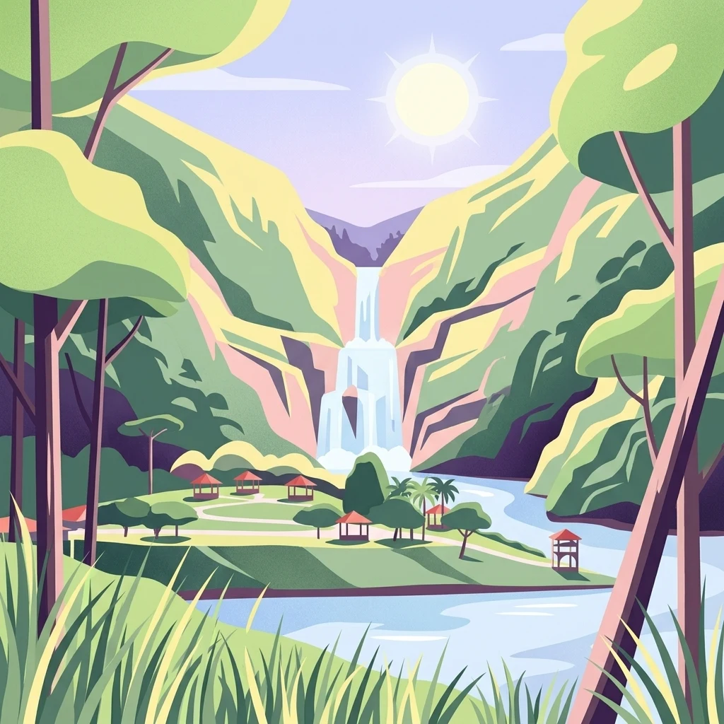
A stylized digital illustration of a cascading waterfall flowing into a lake, surrounded by green mountains, forest trees, and several small picnic pavilions in the foreground.

Cerrillos State Forest

State or regional park

Park overview

Structured park overview, official facts, and landscape profile for Cerrillos State Forest

Cerrillos State Forest park facts, protected area profile, and essential visitor context

Review the core facts for Cerrillos State Forest, including designation, size, terrain, visitor scale, habitats, and operating context in one park-focused overview.

About Cerrillos State Forest

Cerrillos State Forest occupies a modest but well-defined place within Puerto Rico's system of protected public lands. One of 21 state forests administered by the Puerto Rico Department of Natural and Environmental Resources, it sits in barrio Maragüez, just northeast of the city of Ponce in south-central Puerto Rico. The forest covers more than 200 cuerdas, roughly 194 acres, of valley and mountain terrain in the foothills of the Cordillera Central, the long mountain spine that runs through the interior of the island.

The landscape at Cerrillos is shaped as much by water as by forested ridge and valley. The state forest's centerpiece is Lake Cerrillos, a man-made reservoir held back by the Lake Cerrillos dam. The Cerrillos River runs through the area as well, and the combination of reservoir, dam, river, and adjacent forests defines how the space is experienced. Elevations within the forest range from about 400 feet up to roughly 1,000 feet above sea level, placing the area firmly in the subtropical foothills rather than in Puerto Rico's higher mountain zones.

Ecologically, Cerrillos belongs to the subtropical moist zone, and its vegetation is anchored by tabonuco forest, a wet subtropical forest type characteristic of Puerto Rico's mountain slopes and foothills. In the broader WWF classification framework, the forest falls within the Puerto Rican moist forests ecoregion. As with much of Puerto Rico, hurricane disturbance is a recurring natural pressure on these forests, shaping patterns of regrowth, canopy turnover, and habitat dynamics. Forest cover is significant within the protected area, supporting the kind of shaded, leafy environment that visitors associate with the site.

The forest was formally established on 25 September 1996 as part of Puerto Rico's expanding network of state forests. Its setting, adjacent to Lake Cerrillos, has also given it a particular sporting identity: the area around the forest and lake hosted events associated with the 1993 Central American and Caribbean Games and again in connection with the 2010 Central American and Caribbean Games. Beyond those events, Cerrillos functions primarily as a nearby outdoor space for Ponce and surrounding communities, offering trails, observation points, picnic areas with gazebos, and access to water-based activities on the lake.

Quick facts and research context for Cerrillos State Forest

Cerrillos State Forest is one of the 21 state forests of Puerto Rico and is administered by the Puerto Rico Department of Natural and Environmental Resources. It is located in barrio Maragüez, northeast of the city of Ponce, and is reached via PR-139 at kilometer 3.4. The forest covers more than 200 cuerdas (about 194 acres) of valleys and foothills in the Cordillera Central.

The landscape ranges from about 400 to 1,000 feet above sea level and is dominated by subtropical moist forest, with tabonuco as a characteristic forest type. The forest is closely tied to Lake Cerrillos, a man-made reservoir and dam, and to the Cerrillos River, both of which define much of its recreational use.

Protection and recognition

Documented terrestrial protection scope and official designation records

Cerrillos State Forest Protection Status and International Recognition

Cerrillos State Forest maintains a documented terrestrial protection scope within official conservation inventories. Archival records outline regional designation frameworks and management parameters without international recognition sources.

Protection details

Protection scope
Terrestrial
Transboundary protection
No
Park context

Deeper park guide and search-rich context for Cerrillos State Forest

Cerrillos State Forest history, landscape, wildlife, and travel context

Explore Cerrillos State Forest through its history, landscape character, ecosystems, wildlife, conservation priorities, cultural context, and seasonal travel timing in a structured park guide built for atlas discovery and search intent.

Why Cerrillos State Forest stands out

Cerrillos State Forest is best known as a compact subtropical recreation forest set around Lake Cerrillos, a man-made reservoir created by the Lake Cerrillos dam. The combination of forested Cordillera Central foothills, a sizable lake, walking trails, and picnic facilities makes it a popular local escape in the Ponce area. It is also recognized as a representative example of Puerto Rico's subtropical moist forest and tabonuco woodland, set against the broader backdrop of a commonwealth-managed protected lands network. Its accessibility from Ponce and its mix of water features and mountain-foothill forest give it a distinctive identity within Puerto Rico's state forest system.
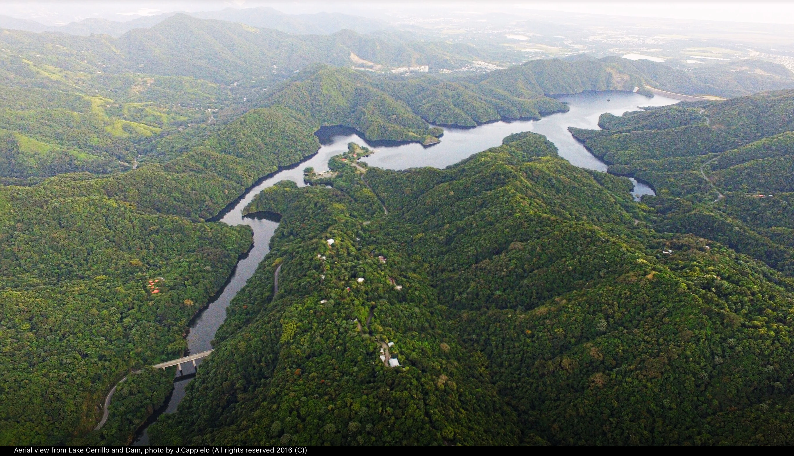
Aerial view of a winding lake surrounded by dense, green forest-covered mountains, with a dam structure visible in the lower foreground.
An aerial view of the Cerrillos Lake and dam located within the Cerrillos State Forest.

Cerrillos State Forest history and protected-area timeline

Cerrillos State Forest was formally established on 25 September 1996 as a protected public forest under the administration of the Puerto Rico Department of Natural and Environmental Resources. As one of the 21 state forests of Puerto Rico, it was created as part of the commonwealth's broader effort to manage forested lands, watersheds, and recreational landscapes under a unified state forest framework.

The forest's history is also intertwined with the development of Lake Cerrillos and its dam, the man-made reservoir that anchors the protected area. Beyond its conservation role, the forest and surrounding lake have hosted regional sporting events, including competitions associated with the Central American and Caribbean Games in both 1993 and 2010, which gave the site visibility beyond its usual local recreational use.

Cerrillos State Forest landscape and geographic character

The landscape of Cerrillos State Forest is defined by the foothills of the Cordillera Central, where forested ridges and valleys descend toward the south-central coast of Puerto Rico. Elevations in the forest range from around 400 feet to about 1,000 feet above sea level, giving it the character of a low-to-mid elevation subtropical landscape rather than a high-mountain environment.

The most distinctive single feature is Lake Cerrillos, a man-made reservoir held back by the Lake Cerrillos dam. The lake and dam introduce a broad open-water element into an otherwise heavily wooded setting and create the reflective shoreline views and lake-edge viewing points that visitors often associate with the forest. The Cerrillos River also runs through the area, adding a natural water course to a landscape otherwise shaped by valley topography.

Viewed from the surrounding hills, the forest reads as a green patchwork of continuous tree cover interrupted by the lake surface and the cleared spaces around picnic areas, gazebos, and trailheads. The wide mixture of valley floor and adjacent ridges gives the protected area both sheltered, easy terrain near the water and more elevated viewpoints looking out across the foothills toward Ponce.
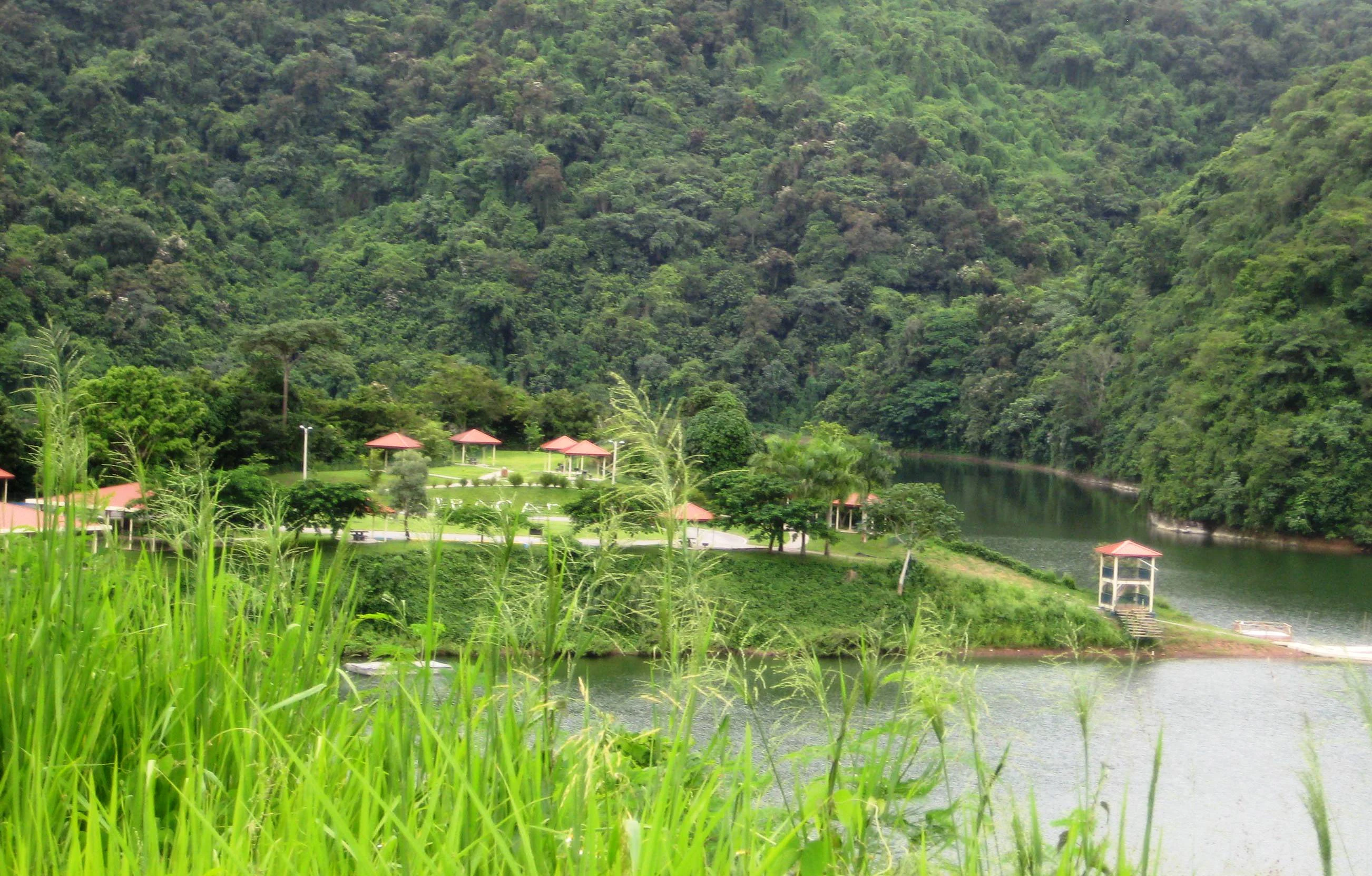
A wide view of a calm lake surrounded by lush green hills covered in dense forest. In the foreground, tall green grasses frame the scene, while the midground features a grassy recreation area with small covered pavilions and a lookout structure near the water.
A view of the shoreline and park facilities along Lake Cerrillos within Cerrillos State Forest.

Cerrillos State Forest ecosystems, habitats, and plant life

Cerrillos State Forest lies within Puerto Rico's subtropical moist ecological zone, in an area where the climate supports dense, evergreen broadleaf forest on mountain foothills and valley slopes. The vegetation is anchored by tabonuco forest, a characteristic wet subtropical forest type associated with Puerto Rico's interior mountains and sheltered valleys.

In broader ecological classification, the forest falls within the Puerto Rican moist forests ecoregion, part of the WWF framework of terrestrial ecoregions. Together with the surrounding foothills of the Cordillera Central, Cerrillos forms part of a wider forested landscape that includes other state forests, higher mountain zones, and connecting river corridors.

Forest cover within the protected area is substantial, and the canopy and understory of the tabonuco forest create the shaded, humid habitat conditions typical of Puerto Rico's subtropical moist zone. Hurricanes are a recurring natural disturbance across this ecoregion, periodically resetting portions of the canopy and shaping long-term patterns of forest composition and recovery.
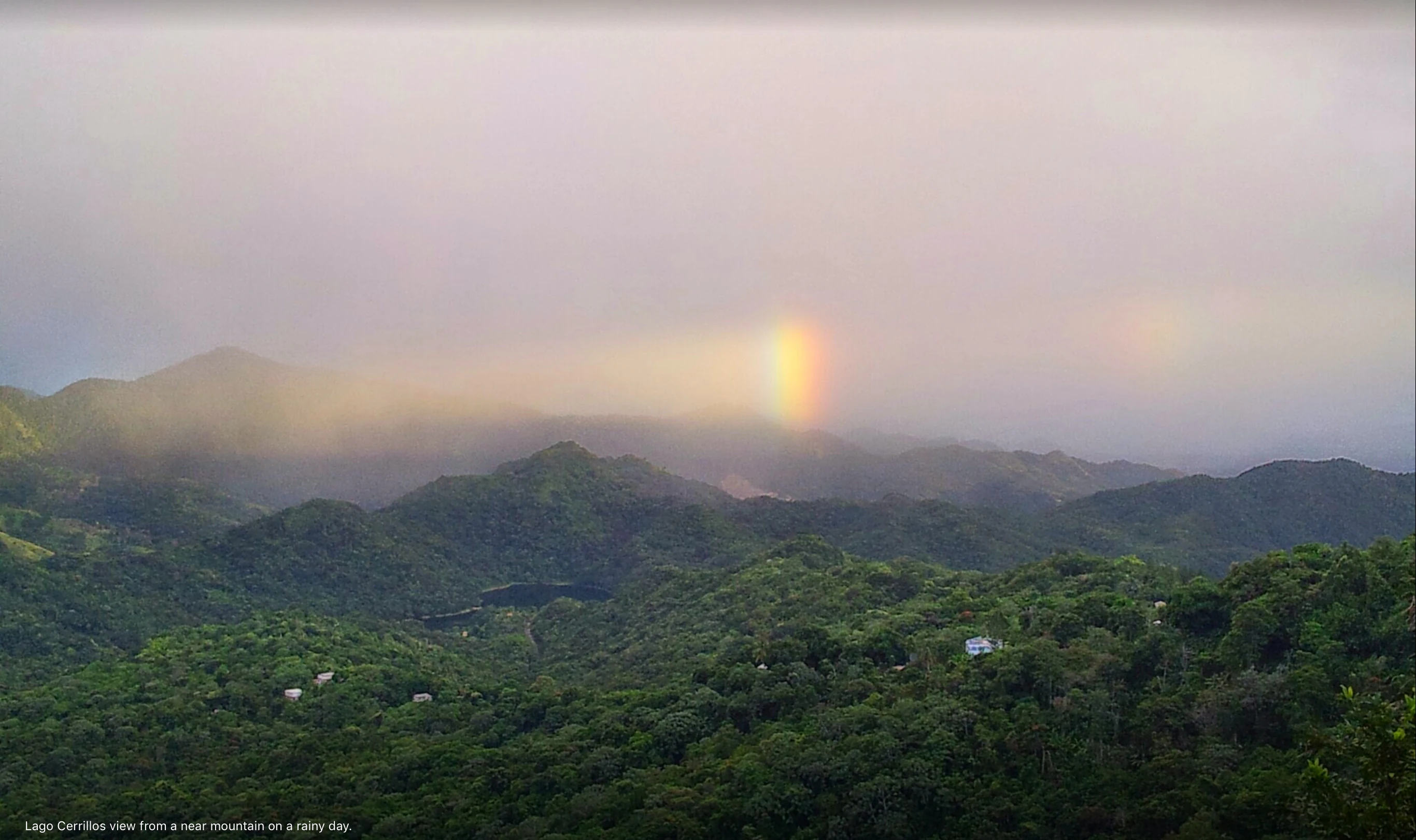
A wide, slightly hazy, eye-level landscape view of rolling, green, forested mountains under a cloudy, overcast sky with a faint rainbow segment hanging above the ridges.
A view over the forested mountains of Cerrillos State Forest during a rainy, overcast day with a partial rainbow visible.

Cerrillos State Forest wildlife and species highlights

The forested valley and foothill setting of Cerrillos State Forest provides habitat typical of Puerto Rico's subtropical moist forests, with birdlife being one of the more visible elements of the park's fauna. The combination of continuous canopy, water features like Lake Cerrillos and the Cerrillos River, and edge habitat around picnic areas and clearings supports a mix of forest interior and forest-edge species.

Because the forest is embedded in the broader Cordillera Central foothills, its wildlife communities overlap with those found across neighboring forested areas of south-central Puerto Rico, including other state forests and protected lands. Birdwatching is one of the recreational activities explicitly associated with the site, and the park's trails and observation areas are used by visitors interested in viewing birds and other forest wildlife in a relatively accessible setting near Ponce.

Cerrillos State Forest conservation status and protection priorities

Cerrillos State Forest plays a role in conserving a representative sample of Puerto Rico's subtropical moist forest in the foothills of the Cordillera Central. By protecting more than 200 cuerdas of valley and mountain terrain in a readily accessible location near Ponce, it contributes to the commonwealth's broader network of state forests, which together cover a range of ecological settings across the island.

The forested land around Lake Cerrillos and the Cerrillos River also helps protect a portion of the watershed and riparian habitat associated with these water features. Management by the Puerto Rico Department of Natural and Environmental Resources places the forest within an institutional framework focused on the conservation and stewardship of public natural resources in Puerto Rico, and the site is part of ongoing efforts to maintain forest cover and ecological function in the face of natural disturbances such as hurricanes.

Cerrillos State Forest cultural meaning and human context

Cerrillos State Forest is closely tied to the municipality of Ponce, the largest city in southern Puerto Rico and a major cultural and economic center on the island. Its location in barrio Maragüez, just northeast of the city, positions it as a nearby natural space for Ponce residents and visitors, with picnic areas, gazebos, and lake access shaped around everyday community recreation.

The forest's role in hosting regional sporting events, including the 1993 Central American and Caribbean Games and the 2010 Central American and Caribbean Games, reflects its wider use as a venue that brings people from across the Caribbean region to the Ponce area. While not a culturally defined landscape in a traditional sense, Cerrillos is part of the public recreational heritage of south-central Puerto Rico, blending local outdoor culture with the commonwealth's state forest system.

Top sights and standout views in Cerrillos State Forest

Cerrillos State Forest stands out for the way it combines a small but ecologically representative piece of Puerto Rico's subtropical moist forest with the recreational draw of Lake Cerrillos and its dam. The protected area's setting in the foothills of the Cordillera Central, accessible from Ponce via PR-139, makes it both a convenient local escape and a useful entry point into the broader forest landscapes of south-central Puerto Rico.

The mix of tabonuco forest cover, mountain foothill terrain, river and reservoir habitat, and built recreational infrastructure, with hiking, birdwatching, kayaking, fishing, photography, and picnicking all available, gives Cerrillos a clearly defined role within the island's network of 21 state forests managed by the Puerto Rico Department of Natural and Environmental Resources.

Best time to visit Cerrillos State Forest

Cerrillos State Forest sits in Puerto Rico's subtropical moist zone, where conditions remain warm and humid throughout much of the year. Visits in the drier seasons tend to be more comfortable for hiking, picnicking, and lake-based recreation, with lower rainfall and fewer of the heavy showers that can affect trails and outdoor activities during wetter months.

Hurricane season in the Atlantic and Caribbean brings the risk of severe storms that can affect forest conditions, lake access, and trail safety, and visitors planning a trip should be aware of this broader seasonal pattern. Cooler mountain-foothill mornings, particularly in the higher parts of the forest, can make early hours a particularly pleasant time to enjoy the trails, observation areas, and shoreline of Lake Cerrillos.

Monthly climate preview

Long-term temperature and monthly precipitation averages for Cerrillos State Forest

Cerrillos State Forest Climate Normals and Annual Weather Patterns

Representative coordinate records show measured monthly temperature ranges and precipitation totals spanning twelve distinct periods across the protected terrain. Analyzing complete monthly climate normals reveals detailed seasonal rhythm shifts that help interpret long-term environmental conditions.
Annual mean26 °C
24 °C28 °C
Jan24°
Feb25°
Mar25°
Apr26°
May27°
Jun27°
Jul27°
Aug28°
Sep27°
Oct27°
Nov26°
Dec25°
Warmest month
August

27.6 °C

Coolest month
January

24.4 °C

Wettest month
September

4.2 mm/day

Driest month
February

1.3 mm/day

Park location guide

Geography guide, regional context, and park location map for Cerrillos State Forest

Cerrillos State Forest park geography, regions, and map view in United States of America

Understand where Cerrillos State Forest sits in United States of America through a broader geographic reading of the surrounding landscape, nearby location context, and its mapped position within the national park landscape.

How Cerrillos State Forest fits into United States of America

The United States of America is a federal presidential republic and one of the world's largest countries by area and population. It consists of 50 states across a vast territory spanning multiple time zones, with its capital in Washington, D.C. and largest city in New York City. The nation has a diverse economy, influential political system, and significant cultural and military presence globally.

Wider geography shaping Cerrillos State Forest in United States of America

The United States occupies a vast territory in North America, bordered by Canada to the north and Mexico to the south. The 48 contiguous states stretch from the Atlantic to the Pacific Ocean, while Alaska occupies the northwestern region and Hawaii is an archipelago in the Pacific. The country encompasses diverse terrain including the Rocky Mountains, Appalachian Mountains, Great Plains, and extensive river systems.

Map view of Cerrillos State Forest

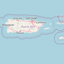
Use this park location map to pinpoint Cerrillos State Forest in United States of America, understand its exact geographic position, and read its mapped placement within the surrounding landscape more clearly.

Pigeon | © OpenStreetMap contributors

Explore protected habitats, reservoir views, and Cordillera Central foothill terrain.

Cerrillos State Forest Photos and Landscape Scenery Visual Guide

Visual documentation captures the rolling subtropical moist forest and open reservoir waters that define the protected landscape. Examining these field photographs reveals the distinctive valley topography and tabonuco woodland character found across the reserve.

Aerial view of a winding lake surrounded by dense, green forest-covered mountains, with a dam structure visible in the lower foreground.

A small river flows through a dense, green forest with trees framing the view on both sides.

A wide view of a calm lake surrounded by lush green hills covered in dense forest. In the foreground, tall green grasses frame the scene, while the midground features a grassy recreation area with small covered pavilions and a lookout structure near the water.

A wide, slightly hazy, eye-level landscape view of rolling, green, forested mountains under a cloudy, overcast sky with a faint rainbow segment hanging above the ridges.

Park atlas

Compare adjacent forest reserves, watersheds, and regional protected natural areas.

Explore Parks Near Cerrillos State Forest and Surrounding Protected Landscapes

Browsing other parks near Cerrillos State Forest reveals connected subtropical woodland habitats and foothill terrain across the Cordillera Central. Evaluating these nearby protected areas provides valuable geographic context for understanding Puerto Rico's regional conservation network.
Protected areaAdjuntas
About 14 km away#1 closest

Northwest

Bosque del Pueblo: Protected Forest Geography and Cordillera Central Landscape

A mountain watershed and ecological corridor in Adjuntas

Bosque del Pueblo represents a key protected landscape within the central mountains of Puerto Rico. As a critical forest reserve located in Adjuntas, it preserves headwaters and supports rare bird populations, serving as a permanent ecological link between several major state forest units.

Area
2.987 km²
Established
1995
Relief
Mountain
Climate
Tropical
State or regional parkPuerto Rico
About 15 km away#2 closest

North

Los Tres Picachos State Forest: A Geographic Guide to Puerto Rico's Mountain Protected Areas

Cloud forests, volcanic terrain, and watershed protection

Los Tres Picachos State Forest encompasses a striking landscape in the Puerto Rican interior, marked by deep river valleys and its namesake triple peaks. This atlas feature provides insights into the forest's layered ecological zones and its role as a crucial hydrological anchor for the Toro Negro and Cialitos river systems within the Cordillera Central.

Established
1999
Relief
Mountain
Climate
Tropical
Access
Remote access
State or regional parkPuerto Rico
About 18 km away#3 closest

West

Guilarte State Forest: Protected Mountain Ecosystems and Cordillera Central Geography

Highland conservation and mapped mountain terrain in central Puerto Rico

Guilarte State Forest represents a essential protected area in the Cordillera Central of Puerto Rico. The reserve encompasses steep altitudinal shifts, ranging from mid-slope palm forests to summit-level cloud forests. As a headwater region for major river basins, the forest is a focal point for understanding the island's mountainous geography and conservation priorities for endemic species.

Area
19.514 km²
Established
1935
Relief
Mountain
Climate
Tropical
State or regional parkUnited States of America
About 31 km away#4 closest

Northwest

Río Abajo State Forest: Mapping the Karst Terrain and Protected Landscapes of Puerto Rico

Protected karst landscape and regional forest geography

Río Abajo State Forest serves as an essential example of Caribbean karst ecosystems, defined by its steep limestone mogotes, hidden ravines, and extensive sinkhole networks. Located in the northern karst belt of Puerto Rico, the forest provides deep insight into complex subterranean drainage patterns and serves as a primary hub for endangered species recovery within its uniquely broken, three-dimensional terrain.

Area
14.1 km²
Established
1943
Relief
Upland
Climate
Tropical
Watercolor painting of a coastal dry forest scene with mangrove-like trees and hills in the background.
State or regional parkPuerto Rico
About 34 km away#5 closest

Southwest

Guánica State Forest: Mapped Geography and Protected Landscapes in Puerto Rico

A diverse Caribbean subtropical dry forest reserve spanning karst terrain and coastal habitats

Guánica State Forest serves as a primary protected natural area in southwestern Puerto Rico, defined by its arid subtropical climate and exceptional ecological diversity. This reserve incorporates a complex mosaic of ecosystems, including deciduous dry forest, mangrove channels, salt flats, and offshore keys. The landscape provides critical habitat for numerous endemic species while preserving the integrity of the Southern Karst geological zone and its surrounding maritime boundaries.

Area
39.97 km²
Established
1919
Relief
Lowland
Climate
Tropical
A wide watercolor illustration showing a forest scene with trees in the foreground, a winding path or river, and green hills in the background.
Nature reservePuerto Rico
About 39 km away#6 closest

North

Cambalache Forest Reserve: A Detailed Look at Northern Puerto Rico Karst Geography

Protected karst landscape and forest mosaic

Focusing on the rugged limestone mogotes that define the Northern Karst Belt, Cambalache Forest Reserve serves as a vital protected area for endemic flora and fauna. This record provides geographic context on its low-elevation forest structure, the ecological significance of its varied microclimates, and its role as a persistent research site since the mid-twentieth century.

Established
1943
Relief
Upland
Access
Easy access
Scope
Terrestrial
State or regional parkPuerto Rico
About 42 km away#7 closest

West

Maricao State Forest: A Detailed Map and Geographic Overview of Puerto Rico's Mountain Wilderness

Endemic-rich mountain forests and serpentinite terrain in the Cordillera Central

Maricao State Forest represents a vital protected landscape in the western Cordillera Central of Puerto Rico. This site features distinctive serpentinite geology, complex mountainous watersheds, and diverse endemic bird habitats. The forest serves as a primary geographic anchor along the Ruta Panorámica, providing clear insight into the rugged environmental character of the central island spine.

Area
43.72 km²
Established
1919
Relief
Mountain
Climate
Tropical
State or regional parkPuerto Rico
About 47 km away#8 closest

East

Aguirre State Forest: Protected Coastal and Mangrove Geography in Southern Puerto Rico

Explore the estuarine terrain and tidal salt pond boundaries.

Aguirre State Forest encompasses a protected coastal mosaic of mangrove forests and salt-tolerant vegetation across the southern coast of Puerto Rico. This record outlines the forest's role as a primary node in the Jobos Bay estuarine system, characterized by low lying tidal channels and hypersaline flats that provide habitat for diverse avian and marine species within its protected borders.

Area
9.68 km²
Established
1918
Relief
Lowland
Climate
Tropical

Common questions about visiting, size, designation, and location context for Cerrillos State Forest

Cerrillos State Forest FAQs for park facts, access, geography, and protected area context

Find quick answers about Cerrillos State Forest, including protected-area facts, park geography, trail and visitor context, and how the park fits into its surrounding country and regional landscape.
MoriAtlas Explorer

Continue Your Protected Areas Search Across the Global Atlas

Deepen your exploration by continuing the structured search for national parks and protected areas worldwide. Utilize the comprehensive filtering capabilities to compare different conservation landscapes and refine your understanding of global park geography. Discover more about the distribution and characteristics of protected natural areas.

Global natural geography