Mori Atlas logo
Nature reserveCharcoal Tank Nature Reserve

Analyzing the protected remnant vegetation and semi-arid terrain of this central western Australian landscape

Charcoal Tank Nature Reserve: Geographic Context and Mapped Boundaries in New South Wales

(The Charcoal Tank Nature Reserve)

Charcoal Tank Nature Reserve functions as a critical protected fragment within the heavily modified agricultural landscape of central western New South Wales. This atlas entry examines the reserve's rare mallee and mallee-broombush woodland, its documented bird fauna, and its role as an isolated refuge for native species. By mapping the boundary between intact remnant vegetation and the surrounding farmland, this data provides a clear perspective on the ecological value of small protected areas in semi-arid environments.

nature reservemallee woodlandbroombushremnant vegetationcritically endangered vegetationsemi-arid woodland

Charcoal Tank Nature Reserve

Nature reserve

Park overview

Structured park overview, official facts, and landscape profile for Charcoal Tank Nature Reserve

Charcoal Tank Nature Reserve park facts, protected area profile, and essential visitor context

Review the core facts for Charcoal Tank Nature Reserve, including designation, size, terrain, visitor scale, habitats, and operating context in one park-focused overview.

About Charcoal Tank Nature Reserve

The Charcoal Tank Nature Reserve sits in a predominantly agricultural stretch of central-western New South Wales, just off the Newell Highway south of West Wyalong. Although it covers less than a square kilometre, it punches well above its weight ecologically because it preserves a vegetation type that has been almost completely altered by land clearing across the surrounding districts.

The reserve's defining feature is its community of mallee and mallee-broombush woodland, a multi-stemmed eucalypt formation that is critically endangered in New South Wales and only protected in a handful of places. Mixed with this is a eucalyptus-callitris woodland that includes inland grey box, mugga ironbark, and black cypress pine, as well as smaller pockets of currawang and Dwyer's red-gum. Together these communities create a layered habitat of small trees, shrubs, and groundcover that, while reduced in extent, retains high local conservation value.

Ecologically the reserve functions as a refuge. Its isolation within a heavily cleared rural matrix means that species which have vanished from neighbouring farmland continue to survive here. Key examples include breeding populations of brown treecreeper and varied sittella, both listed as vulnerable in New South Wales, as well as important records of painted honeyeater, superb parrot, regent honeyeater, and swift parrot. Mammals such as eastern grey kangaroo, swamp wallaby, short-beaked echidna, and sugar glider also persist, alongside a modest but meaningful set of reptiles, amphibians, and butterflies.

The reserve is also an important long-term monitoring site. A bird banding program initiated in July 1986 has been running for decades, contributing data to the NSW NPWS, the Atlas of NSW Wildlife, and wider scientific literature on Australian birds. That program has documented declining numbers of species such as the grey-crowned babbler, shy heathwren, diamond firetail, and eastern yellow robin, and has even shown measurable changes in the body size of white-plumed honeyeaters in response to warming and drying conditions.

Beyond its ecological role, the reserve carries a deeper cultural and historical weight. Its setting within Wiradjuri country connects it to Aboriginal land use over tens of thousands of years, while its later history as a camp on the travelling stock route and a public watering place tells of the era of European settlement and pastoral expansion. The story of Charcoal Tank is in many ways a small-scale mirror of broader Australian conservation challenges, including habitat fragmentation, edge effects, invasive species, climate change, and the need to maintain connectivity in an extensively altered landscape.

Quick facts and research context for Charcoal Tank Nature Reserve

The Charcoal Tank Nature Reserve is a roughly 86 hectare nature reserve located in the Central West of New South Wales, Australia, about ten kilometres south of West Wyalong and accessible from the Newell Highway. Established in May 1966 under the management of what is now the NSW National Parks and Wildlife Service, it holds an IUCN Category Ia designation dedicated to conserving biodiversity with minimal human disturbance.

It is one of only three reserves in New South Wales that protect the critically endangered mallee and mallee-broombush vegetation without spinifex, and it sits within a semi-arid climate zone characterised by hot dry summers, cold winters, and highly variable annual rainfall. The reserve is best known for its long-running bird banding program and its importance as a refuge for native flora and fauna in a fragmented rural landscape.

Protection and recognition

Terrestrial protected area conservation scope and administrative frameworks

Charcoal Tank Nature Reserve Protection Status and Designation Records

Charcoal Tank Nature Reserve maintains a documented terrestrial protection status within its designated administrative framework. Official records outline the conservation scope and management parameters established for the protected area.

Protection details

Protection scope
Terrestrial
Transboundary protection
No
Park context

Deeper park guide and search-rich context for Charcoal Tank Nature Reserve

Charcoal Tank Nature Reserve history, landscape, wildlife, and travel context

Explore Charcoal Tank Nature Reserve through its history, landscape character, ecosystems, wildlife, conservation priorities, cultural context, and seasonal travel timing in a structured park guide built for atlas discovery and search intent.

Why Charcoal Tank Nature Reserve stands out

The Charcoal Tank Nature Reserve is best known for protecting a rare stand of critically endangered mallee and mallee-broombush vegetation that has been almost entirely cleared from the surrounding central-western New South Wales landscape. It is one of only three reserves in the state that conserve this vegetation type in the absence of spinifex. The reserve is also recognised for its exceptionally rich birdlife relative to its size, with more than 165 bird species recorded and an ongoing bird banding study stretching back to the mid-1980s. This combination of a rare plant community and an intensively studied bird fauna gives the reserve an outsized ecological significance for a reserve of its size.
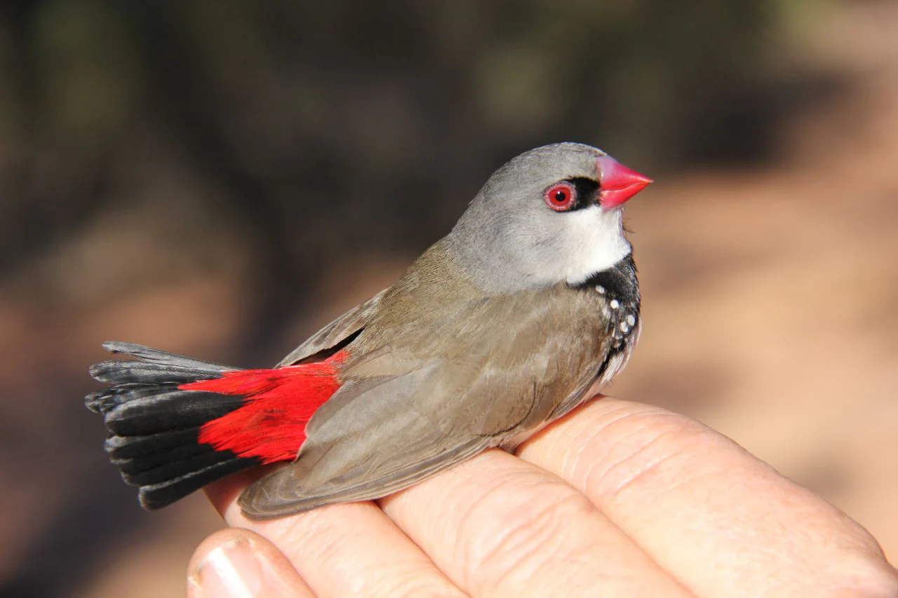
A small diamond firetail bird with a grey head, red beak, and bright red tail feathers resting on a human hand.
A diamond firetail bird held in a hand within the Charcoal Tank Nature Reserve.

Charcoal Tank Nature Reserve history and protected-area timeline

The land now protected as the Charcoal Tank Nature Reserve was used and occupied long before it gained any formal protection. The Wiradjuri people, the traditional landowners of the broader central-western New South Wales region, are believed to have inhabited the area for more than forty thousand years. While little specific documentation survives about their use of the reserve itself, the site is thought to have served as a place for gathering food.

Following European settlement, the reserve's land became part of the working pastoral landscape of the region. Before it was formally protected, the site functioned as a camp along the travelling stock route and was used as a public watering place for stock. In 1960 it was designated as NSW Wildlife Refuge No. 2, although it continued to be available for these pastoral uses during that transitional period.

In May 1966 the area was officially gazetted as The Charcoal Tank Nature Reserve, finally removing it from active pastoral exploitation and placing it under formal conservation management. Protection under reserve status brought an end to harvesting of mallee and broombush, both of which had been extensively cut in the region since European settlement, and reduced the degrading impacts associated with itinerant campers and their animals. A rest stop that had been cut into part of the reserve along the Newell Highway prior to its formal listing, however, remained in place and continues to influence the reserve's edge environment today.

Since 1966 the reserve has been managed by what is now the NSW National Parks and Wildlife Service under the New South Wales National Parks and Wildlife Act 1974, and an active scientific and community management program has grown up around it, peaking with the long-term bird banding study that began in July 1986.

Charcoal Tank Nature Reserve landscape and geographic character

Physically, the Charcoal Tank Nature Reserve is a relatively flat parcel of land in a semi-arid part of central-western New South Wales. The terrain sits at an elevation of about 257 metres above sea level and is characterised by a dry, red loamy clay topsoil that reflects both the regional geology and the long history of weathering in a low-rainfall environment.

A drainage line runs the length of the reserve, and along it a series of three man-made dams have been constructed. These dams concentrate moisture within the landscape and create localised wetter microhabitats that contrast with the otherwise dry surroundings. In the western part of the reserve, gully erosion linked to this drainage line and to runoff from cleared paddocks remains a persistent landscape feature.

Beyond the reserve's boundaries the land is dominated by farmland, roads, and other cleared country. This starkly modified surrounding landscape frames the reserve visually and ecologically: the boundary between intact remnant vegetation and the agricultural matrix is abrupt, linear, and largely artificial. A rest stop cut into the reserve from the Newell Highway, concrete road signs, and the highway corridor itself are all prominent features of this edge landscape.
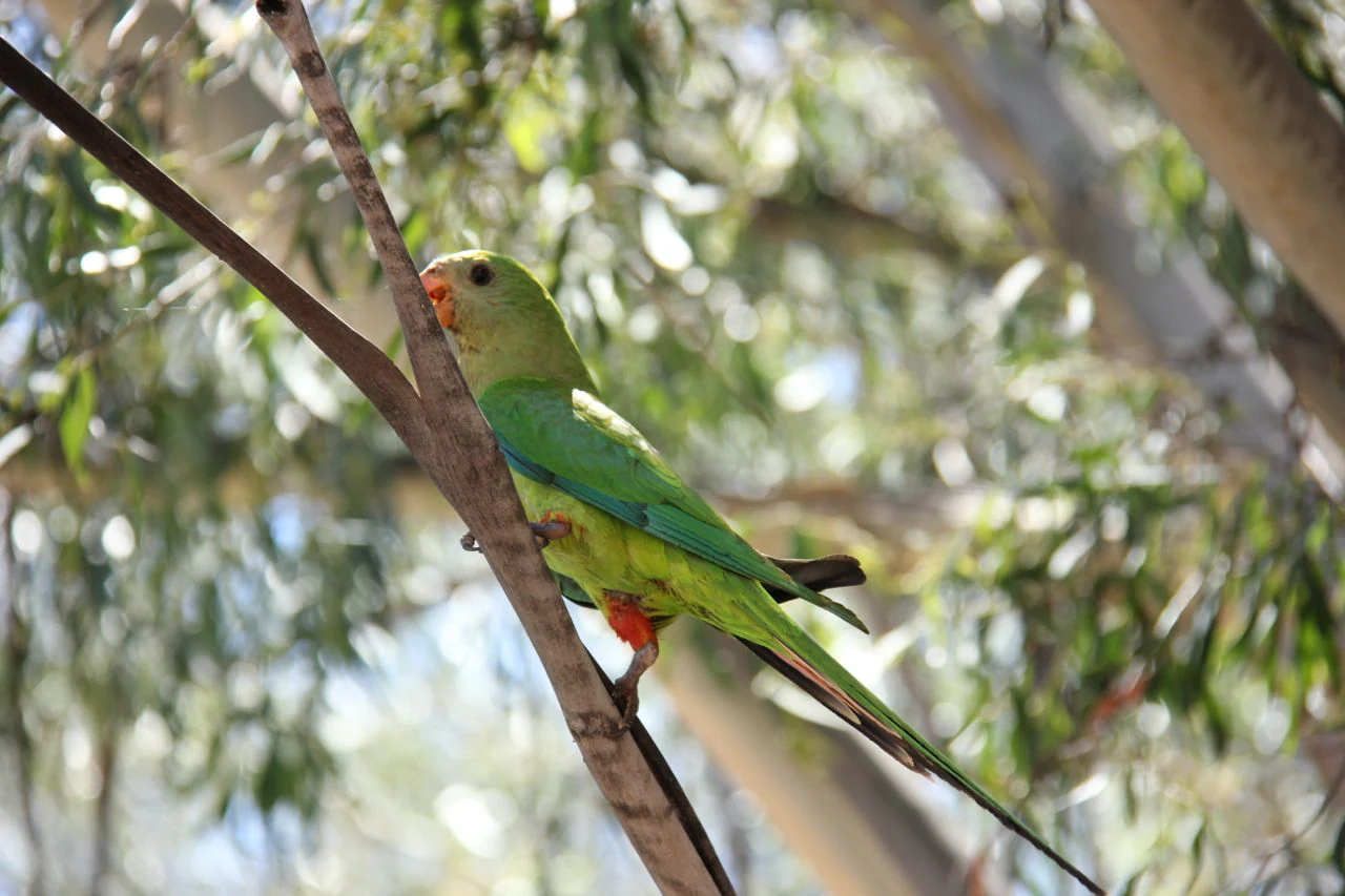
A green Superb Parrot with a bright orange beak and accents perched on a thin tree branch, surrounded by blurred eucalyptus leaves.
A Superb Parrot perched on a branch within the woodland habitat of Charcoal Tank Nature Reserve.

Charcoal Tank Nature Reserve ecosystems, habitats, and plant life

Despite its small size, the Charcoal Tank Nature Reserve supports three distinct vegetation communities. The dominant community is mallee-broombush, made up of broombush, blue mallee, green mallee, and bull mallee, often accompanied by native shrubs such as purple kunzea and dagger-leaved wattle. This formation is listed as critically endangered under the NSW Threatened Species Conservation Act, and the reserve is one of only three in the state protecting it in the absence of spinifex.

The second largest vegetation community is a mixed eucalyptus-callitris woodland featuring inland grey box, mugga ironbark, and black cypress pine. This community has a relatively well-developed understory of native shrubs including cough bush, quandong, and hakea wattle, which adds structural complexity to the woodland. The smallest community is dominated by black cypress pine with Dwyer's red-gum and currawang.

Vegetation at the edges of the reserve, particularly along the drainage line and adjoining the altered road corridor, has been lost or badly degraded, reflecting the broader pressure from edge effects and historical disturbance. Nonetheless, the intact central portions retain a meaningful mosaic of habitats that supports a wide range of native fauna, from arboreal mammals to ground-dwelling reptiles and seasonal nectar-feeding birds.
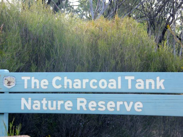
A light blue wooden sign reading The Charcoal Tank Nature Reserve in white text, situated in front of dense green scrub and trees.
The entrance sign for Charcoal Tank Nature Reserve.

Charcoal Tank Nature Reserve wildlife and species highlights

Charcoal Tank Nature Reserve has an exceptional bird fauna relative to its size, with more than 165 bird species identified, 96 of which have been banded and released through a long-term monitoring program that began in 1986. Breeding residents include vulnerable species such as the brown treecreeper and the varied sittella, both listed under the New South Wales Threatened Species Conservation Act. A further twenty species that use the reserve, including painted honeyeater, superb parrot, regent honeyeater, and swift parrot, are also listed as vulnerable at the state level, with regent honeyeater and swift parrot additionally listed as endangered under Australia's national Environment Protection and Biodiversity Conservation Act.

The reserve's bird community has been changing. Long-term banding data show declines in previously common species such as the grey-crowned babbler, shy heathwren, diamond firetail, and eastern yellow robin, and outright local extinctions of the malleefowl, Gilbert's whistler, southern scrub robin, and crested shrike-tit over the past thirty years. Long-running research on the white-plumed honeyeater has also documented a measurable increase in body size over 23 years, attributed by researchers to a warming, drying climate.

Beyond birds, the reserve supports a typical central-western New South Wales mammal assemblage including eastern grey kangaroo, swamp wallaby, short-beaked echidna, and sugar glider, along with five amphibian species and nine reptile species that range from the lace monitor to the eastern brown snake. Invertebrates are represented by the common freshwater yabby and at least nine butterfly species, including the spotted Jezebel and Australian painted lady. The locally threatened western dusky-blue butterfly, dependent on mallee habitat, has been recorded in nearby remnants and is of conservation interest here.
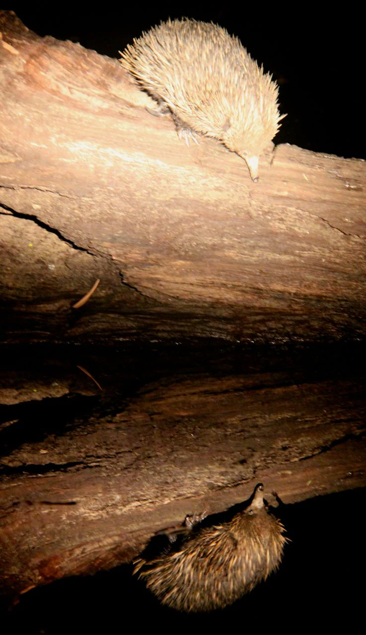
A short-beaked echidna walks along a fallen tree trunk at night, with its reflection visible in dark water below.
An echidna captured at night within the Charcoal Tank Nature Reserve.

Charcoal Tank Nature Reserve conservation status and protection priorities

The Charcoal Tank Nature Reserve is recognised as a refuge of native flora and fauna within a heavily modified and fragmented agricultural landscape. Its IUCN Category Ia designation reflects its purpose of conserving biodiversity while minimising human disturbance, and as a formally gazetted reserve it has enjoyed more than half a century of legal protection.

Conserving this reserve is significant well beyond its physical footprint. It preserves vegetation, particularly the critically endangered mallee-broombush community, that has been almost completely cleared from the surrounding region, and it retains breeding populations of several threatened bird species that have disappeared elsewhere in central-western New South Wales. Its long-term bird banding dataset, stretching back to the mid-1980s, has become a valuable long-term scientific resource in its own right, informing conservation decisions both locally and nationally.

At the same time, the reserve faces pervasive threats connected to its small size and isolation. Fragmentation limits species movement and genetic exchange, edge effects create vulnerability along the reserve's linear and artificial boundaries, and invasive animals such as red fox, feral cat, European rabbit, feral goat, and feral pig add compounding pressure. Climate change is intensifying these threats, with the region already experiencing severe drought, declines in bird abundance, and measurable physiological changes in individual species. The reserve's management plan, currently running to 2021, addresses these challenges through fire suppression policies, erosion control, fencing maintenance, and partnerships with Aboriginal land councils, fire management committees, and local brigades.

Charcoal Tank Nature Reserve cultural meaning and human context

The Charcoal Tank Nature Reserve lies on the traditional lands of the Wiradjuri people, whose connection to the broader central-western New South Wales landscape stretches back over forty thousand years. While little specific documentation survives about their precise use of the reserve, oral and material evidence suggests it was a place where they gathered food within a wider pattern of resource use across the region's woodlands and waterways.

In the era of European settlement, the reserve took on a very different cultural role. The site became a camp along the travelling stock route and a public watering place, embedding it in the pastoral life and infrastructure of inland New South Wales. Even after it was gazetted as a nature reserve in 1966, the residue of that earlier history remained on the landscape in the form of a rest stop along the Newell Highway that continues to influence the reserve's edge environment.

The reserve is also connected to ongoing Wiradjuri-led land management through the West Wyalong Aboriginal Land Council, which partners with NSW National Parks and Wildlife Service in reserve management. This contemporary partnership reflects a return to broader recognition of Aboriginal cultural connections to Country, layered onto a long history of pastoral, scientific, and conservation use.
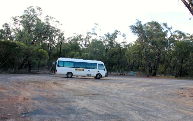
A small white bus parked in a large dirt clearing surrounded by native eucalyptus forest.
A small bus parked at the rest area within Charcoal Tank Nature Reserve.

Top sights and standout views in Charcoal Tank Nature Reserve

Three features define the Charcoal Tank Nature Reserve. First, it protects one of only three surviving occurrences in New South Wales of critically endangered mallee and mallee-broombush vegetation without spinifex, a type of woodland that has otherwise been almost entirely cleared from the central west. Second, it carries an unusually rich bird record for such a small reserve, with more than 165 species documented, including breeding populations of several threatened woodland birds and an ongoing banding study that has been running since 1986. Third, it offers a clear case study in how a small, isolated reserve functions within a heavily modified agricultural landscape, illustrating both the value of protecting remnants and the limits of doing so without broader landscape connectivity.

Best time to visit Charcoal Tank Nature Reserve

The Charcoal Tank Nature Reserve sits in a semi-arid zone with hot, dry summers and cold winters, and this climate strongly shapes what a visitor might experience. Slightly cooler months tend to make outdoor activity more comfortable, while periods following rainfall often bring fresher growth and increased bird activity across the woodland. Drought years, by contrast, can produce visibly reduced foliage and lower bird abundance, reflecting the rainfall-driven character of the local ecology.

Seasons also influence what wildlife is likely to be present. Migratory and nomadic bird species may be encountered at different times of year, and flowering events in the mallee and eucalyptus communities shift the availability of nectar and therefore the activity patterns of honeyeaters and other nectar-feeding birds. Because the reserve is small and unprotected from extreme heat, planning a visit for cooler, milder conditions typically makes for a more rewarding experience.
Monthly climate preview

Long-term monthly temperature and precipitation patterns recorded across representative coordinates

Charcoal Tank Nature Reserve Climate Normals and Annual Temperature Rhythm

Charcoal Tank Nature Reserve records measured long-term monthly temperature and precipitation variations across a representative coordinate point. Opening the complete climate profile provides full twelve-month weather normals for detailed regional comparison.
Annual mean17 °C
8 °C27 °C
Jan27°
Feb25°
Mar22°
Apr17°
May12°
Jun
Jul
Aug
Sep13°
Oct17°
Nov21°
Dec24°
Warmest month
January

26.6 °C

Coolest month
July

8.1 °C

Wettest month
February

1.5 mm/day

Driest month
April

0.8 mm/day

Park location guide

Geography guide, regional context, and park location map for Charcoal Tank Nature Reserve

Charcoal Tank Nature Reserve park geography, regions, and map view in Australia

Understand where Charcoal Tank Nature Reserve sits in Australia through a broader geographic reading of the surrounding landscape, nearby location context, and its mapped position within the national park landscape.

How Charcoal Tank Nature Reserve fits into Australia

Australia is a constitutional monarchy and federal parliamentary democracy comprising six states and ten territories. With a population of nearly 28 million, it is one of the world's most urbanised countries, with most people concentrated on the eastern seaboard. The country has a high Human Development Index and is known for its cultural diversity, ancient Aboriginal heritage, and unique wildlife.

Wider geography shaping Charcoal Tank Nature Reserve in Australia

Australia occupies the entire Australian continent, the island of Tasmania, and numerous smaller islands. It is the world's flattest and driest inhabited continent, featuring vast deserts in the interior (the Outback), tropical rainforests along the eastern coast, and a coastline bordering the Indian and Pacific Oceans.

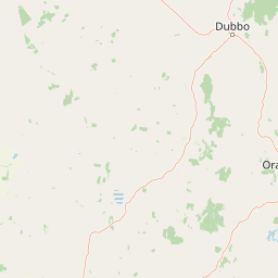
Map view of Charcoal Tank Nature Reserve

Use this park location map to pinpoint Charcoal Tank Nature Reserve in Australia, understand its exact geographic position, and read its mapped placement within the surrounding landscape more clearly.

Pigeon | © OpenStreetMap contributors

Location context for Charcoal Tank Nature Reserve

New South Wales

Visual reference guide to rare mallee woodland habitats and semi-arid terrain

Charcoal Tank Nature Reserve Photos and Mapped Landscape Scenery

Visual documentation reveals the distinct boundary between intact mallee remnants and surrounding agricultural land. Protected-area photography highlights fragile woodland habitats, red clay soils, and native bird environments.

A small diamond firetail bird with a grey head, red beak, and bright red tail feathers resting on a human hand.

A close-up view of a small, olive-yellow White-plumed Honeyeater bird resting on a human hand.

A green Superb Parrot with a bright orange beak and accents perched on a thin tree branch, surrounded by blurred eucalyptus leaves.

A light blue wooden sign reading The Charcoal Tank Nature Reserve in white text, situated in front of dense green scrub and trees.

A short-beaked echidna walks along a fallen tree trunk at night, with its reflection visible in dark water below.

A small, still pond reflects the surrounding eucalyptus forest, with orange-tinted soil banks visible along the water edge.

A small white bus parked in a large dirt clearing surrounded by native eucalyptus forest.

Park atlas

Compare regional protected landscapes, remnant vegetation, and wildlife habitats

Explore Parks Near Charcoal Tank Nature Reserve and Surrounding Protected Areas

Continue browsing other parks near Charcoal Tank Nature Reserve to examine similar semi-arid woodland remnants and regional conservation networks. Comparing adjacent protected areas reveals broader geographic patterns across the heavily modified agricultural terrain of central New South Wales.
Nature reserveNew South Wales
About 55 km away#1 closest

Southeast

Boginderra Hills Nature Reserve: Protected Granite Landscapes in New South Wales

An ecological map of the Riverina woodland refuge.

Boginderra Hills Nature Reserve protects a distinct granite ridge that remains largely intact amidst the heavily modified plains of the Riverina. This site functions as a strictly managed conservation area, preserving a mosaic of native eucalypt and cypress pine communities that provide essential habitat for regional woodland bird species and other native fauna.

Area
7.56 km²
Established
1982
IUCN
Ia
Relief
Upland
Nature reserveNew South Wales
About 65 km away#2 closest

South

Ingalba, Big Bush and Pucawan Nature Reserves: Regional Geography and Protected Woodland Map

Inland New South Wales conservation complex within the Lachlan Fold Belt

These three nature reserves function as one of the most substantial surviving remnants of mugga ironbark and western grey box woodland in southern inland New South Wales. Located west of Temora, the reserves protect forty-nine square kilometres of distinct woodland and dry heathland communities that provide essential habitat corridors across a heavily cleared agricultural region. The mapping highlights the unique topography and geological variety that sustains this protected landscape.

Area
49.27 km²
IUCN
Ia
Relief
Upland
Climate
Temperate
National parkNew South Wales
About 74 km away#3 closest

East

Weddin Mountains National Park: National Park Mapping and Geographic Context

Discover mapped protected landscape boundaries in New South Wales.

Weddin Mountains National Park represents a key protected area within New South Wales, Australia, offering a focused lens for geographic exploration. This detail page provides access to the park's specific mapped boundaries and its role as a national park. Understand the surrounding regional geography and the protected landscape's identity through a detailed atlas perspective, ideal for mapping conservation areas.

Area
83.61 km²
Established
1971
IUCN
II
Relief
Mountain
National parkRiverina
About 81 km away#4 closest

West

Cocoparra National Park: Semi-Arid Hill Country and Protected Landscape in Riverina

Explore mapped geography and key natural features of this Australian national park.

Cocoparra National Park is an essential protected natural area within Australia's Riverina region, noted for its striking semi-arid landscape. The park features a prominent range of low hills, including Bingar Mountain, rising from the predominantly flat terrain. This distinctive geography, characterized by rocky sandstone ridges and characteristic woodland communities, offers valuable insights into the region's natural heritage. As an Important Bird Area, Cocoparra National Park also holds significant conservation value for its avian populations and their unique inland habitat.

Area
83.57 km²
Established
1969
IUCN
II
Relief
Mixed relief
A horizontal watercolor illustration depicting rolling, hazy hills covered in sparse green trees and shrubs, typical of arid woodland terrain.
Nature reserveNew South Wales
About 99 km away#5 closest

West

Pulletop Nature Reserve: Mapping the Mallee Woodlands of New South Wales

Protected semi-arid landscapes and malleefowl habitat

Pulletop Nature Reserve stands as a preserved fragment of the extensive mallee woodland that once dominated inland New South Wales. Within the Cobar Peneplain, this nature reserve offers a look at dry-country ecosystems, featuring diverse eucalypt species and habitat for the malleefowl in a flat, undisturbed geographic setting.

Area
1.45 km²
Established
1963
IUCN
Ia
Relief
Lowland
Watercolor depiction of a river, trees, and rolling hills in a landscape
National parkNew South Wales
About 101 km away#6 closest

Southeast

Jindalee National Park: New South Wales National Park Protecting Cypress Pine Woodlands

Explore unique mapped terrain and regional conservation landscape.

Jindalee National Park represents a vital conservation effort in New South Wales, safeguarding remaining cypress pine woodlands and Critically Endangered grassy woodland ecosystems. Situated in the South West Slopes region, its undulating terrain and drainage lines form a distinctive natural landscape. The park's designation as a national park underscores its importance for preserving threatened species habitats and offers a focused point for atlas-driven discovery of its unique protected-area character and geographic context.

Area
10.76 km²
Established
2011
IUCN
II
Relief
Lowland
National parkNew South Wales
About 107 km away#7 closest

East

Conimbla National Park: Protected Landscape Atlas and Regional Geography

Mapped boundaries and terrain within New South Wales.

Examine the protected landscape of Conimbla National Park, a designated national park situated in New South Wales, Australia. This entry provides focused geographic context, detailing its mapped boundaries and the regional terrain. It serves as a valuable resource for understanding the park's identity within the national atlas and its specific place in the Australian landscape.

Area
84.71 km²
Established
1980
IUCN
II
Relief
Upland
Nature reserveNew South Wales
About 116 km away#8 closest

Southeast

Ulandra Nature Reserve: Atlas Overview, Mapped Terrain, and Regional Protected Landscapes

Woodland conservation in the New South Wales Riverina fringe

Ulandra Nature Reserve serves as a vital sanctuary for the Cootamundra wattle and native woodland communities within a highly modified agricultural landscape. The reserve protects the rugged slopes of the Ulandra Range and the catchment of Merrybundinah Creek, offering a clear window into the natural forest geography of southeastern Australia.

Area
39.3 km²
Established
1981
IUCN
Ia
Relief
Upland

Common questions about visiting, size, designation, and location context for Charcoal Tank Nature Reserve

Charcoal Tank Nature Reserve FAQs for park facts, access, geography, and protected area context

Find quick answers about Charcoal Tank Nature Reserve, including protected-area facts, park geography, trail and visitor context, and how the park fits into its surrounding country and regional landscape.
MoriAtlas Explorer

Continue Your Protected Areas Search Across the Global Atlas

Deepen your exploration by continuing the structured search for national parks and protected areas worldwide. Utilize the comprehensive filtering capabilities to compare different conservation landscapes and refine your understanding of global park geography. Discover more about the distribution and characteristics of protected natural areas.

Global natural geography