Mori Atlas logo
Protected landscapeChęcińsko-Kielecki Park Krajobrazowy

Mapping the geological reserves, forested ridges, and historic cultural landmarks of Central Poland

Chęcińsko-Kielecki Park Krajobrazowy: A Protected Landscape in the Świętokrzyskie Foothills

Chęcińsko-Kielecki Park Krajobrazowy occupies a distinct geographic corridor within the Świętokrzyskie Voivodeship, serving as a protected mosaic of limestone hills, karst cave systems, and traditional rural valleys. This region documents the complex geological history of the Holy Cross Mountains through its dense network of inanimate nature reserves. Spanning the foothills southwest of Kielce, the landscape preserves a transition between urban centers and the ancient mountain terrain, anchoring its identity in a unique blend of rocky outcrops, mixed forest habitats, and medieval heritage sites.

landscape parkŚwiętokrzyskie Mountainslimestone hillscaves and karstgeological reservesforest reserves

Chęcińsko-Kielecki Park Krajobrazowy

Protected landscape

Park overview

Structured park overview, official facts, and landscape profile for Chęcińsko-Kielecki Landscape Park

Chęcińsko-Kielecki Landscape Park park facts, protected area profile, and essential visitor context

Review the core facts for Chęcińsko-Kielecki Landscape Park, including designation, size, terrain, visitor scale, habitats, and operating context in one park-focused overview.

About Chęcińsko-Kielecki Landscape Park

Chęcińsko-Kielecki Landscape Park occupies a transitional zone between the urban area of Kielce and the older, more rugged terrain of the Świętokrzyskie (Holy Cross) Mountains. The protected landscape covers about 19,800 hectares and is surrounded by a buffer of roughly 8,000 hectares, extending across the southern and southwestern outskirts of Kielce and into the surrounding gminas. This geography makes the park function both as a peri-urban greenbelt and as an entry corridor into the broader natural and cultural landscape of the Holy Cross region.

The defining character of the park is geological. The Świętokrzyskie Mountains are among the oldest mountain ranges in Europe, and the Chęcińsko-Kielecki foothills expose a layered record of Paleozoic, Devonian, and Jurassic rocks, along with karst phenomena such as caves, rock shelters, and mineralized exposures. Protection of this geological heritage is one of the park's primary purposes, which is why eight of its ten interior reserves focus on inanimate natural features: caves (Raj, Chelosiowa Jama), rocky hills (Miedzianka, Rzepka, Zelejowa, Żakowa, Moczydło, Karczówka), and the forest-slope reserve of Milechowy and the landscape reserve of Biesak-Białogon extending the ecological coverage.

Culturally, the park is anchored by Chęciny, a small town with a medieval Piast-era castle that has become one of the most recognizable historical landmarks of the region. The Ethnographic Park of the Museum of the Kielce Countryside near Tokarnia adds a further cultural layer, presenting traditional rural buildings and folk architecture in an open-air setting. Together, geology, forest, rural scenery, and historical monuments give the Chęcińsko-Kielecki Landscape Park its identity as a compact, multi-layered protected area just outside a regional capital.

Quick facts and research context for Chęcińsko-Kielecki Landscape Park

Chęcińsko-Kielecki Landscape Park was created on December 2, 1996 by regulation of the then Kielce Voivode, and is part of the Świętokrzyskie complex of protected landscape areas. It lies within the Świętokrzyskie Voivodeship and spans portions of the city of Kielce along with the gminas of Chęciny, Małogoszcz, Nowiny, Piekoszów, and Sobków.

The park covers roughly 19,800 hectares and is surrounded by a buffer zone of about 8,000 hectares. Within its boundaries sit ten nature reserves, eight of which protect inanimate natural features such as caves, rocky hills, and geological exposures, together with one forest reserve and one landscape reserve, plus an additional reserve located in the surrounding buffer zone.

Protection and recognition

Examine documented terrestrial conservation frameworks and official recognition records.

Chęcińsko-Kielecki Park Krajobrazowy Protection Status and Designated Landscape Overview

Chęcińsko-Kielecki Park Krajobrazowy maintains a documented terrestrial protection status within regional conservation inventories. Public records outline the assigned management scope and regulatory framework governing this protected landscape.

Protection details

Protection scope
Terrestrial
Transboundary protection
No
Buffer area
80.03 km²
Park context

Deeper park guide and search-rich context for Chęcińsko-Kielecki Landscape Park

Chęcińsko-Kielecki Landscape Park history, landscape, wildlife, and travel context

Explore Chęcińsko-Kielecki Landscape Park through its history, landscape character, ecosystems, wildlife, conservation priorities, cultural context, and seasonal travel timing in a structured park guide built for atlas discovery and search intent.

Why Chęcińsko-Kielecki Landscape Park stands out

The park is most recognized for the extraordinary density of inanimate-nature reserves on its territory, especially its limestone caves and exposed hill summits. The reserves of Raj Cave, Chelosiowa Jama, Miedzianka, Rzepka, Zelejowa, Żakowa, and Moczydło together form one of the most compact concentrations of cave and rocky-hill protection in the Świętokrzyskie region. It is also strongly associated with the medieval Piast castle in Chęciny, which sits at the edge of the protected landscape and gives the area a defining cultural anchor, and with the ethnographic open-air museum near Tokarnia that documents traditional rural life of the Kielce countryside.
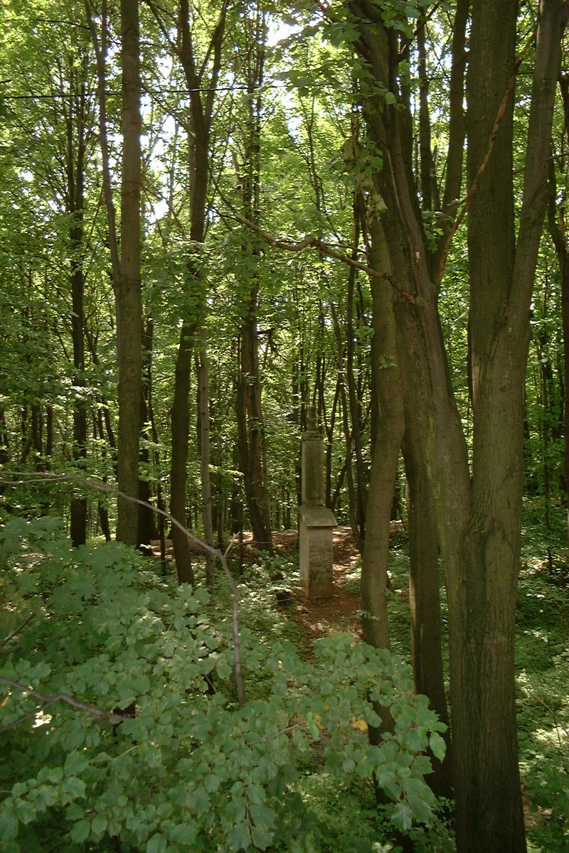
A narrow dirt path winds through a dense, green deciduous forest, passing a small stone monument or marker standing among the tree trunks.
A shaded trail passing through a deciduous forest in Chęcińsko-Kielecki Landscape Park.

Chęcińsko-Kielecki Landscape Park history and protected-area timeline

The Chęcińsko-Kielecki Landscape Park was established on December 2, 1996, by regulation number 17/96 of the Kielce Voivode, during the period in which Poland reorganized the administrative map of its voivodeships and expanded the system of landscape parks (parki krajobrazowe) as a category of protection between strict reserves and less regulated nature use.

The park was created by consolidating a number of already recognized geological and forest reserves into a single management framework. The reserves of Raj Cave, Miedzianka, Rzepka, Zelejowa, and Chelosiowa Jama, among others, were the historical core around which the larger landscape park was assembled. Its design intentionally joined the protection of inanimate natural features with the surrounding forested foothills, rural landscapes, and cultural monuments, including the prominent Chęciny Castle and the Tokarnia ethnographic museum.

Since its founding, the park has been managed as part of the complex of Świętokrzyskie and Nadnidziańskie Landscape Parks (Zespół Świętokrzyskich i Nadnidziańskich Parków Krajobrazowych), which coordinates administration across the broader Holy Cross region.

Chęcińsko-Kielecki Landscape Park landscape and geographic character

The landscape of the park is a varied mosaic of low foothills, forested ridges, river valleys, and rocky hilltops that mark the transition from the Kielce urban area into the older terrain of the Holy Cross Mountains. Elevations across the protected area are modest by mountain standards, but the local relief is rich, with limestone and dolomite hills rising above softer agricultural valleys and stream corridors.

The most distinctive landforms are the isolated rocky hills of Miedzianka, Rzepka, Zelejowa, Żakowa, Moczydło, and Karczówka. These hills are not high, but they are visually prominent, often crowned with bare rock, old quarrying scars, or chapel ruins, and they give the landscape a characteristic profile of forested slopes broken by exposed crests. Karst features are also important to the scenery: the Raj Cave near Chęciny is the best-known example, with developed dripstone formations, and Chelosiowa Jama adds a second significant underground landscape.

Between these rocky and karst features, the park encompasses extensive mixed and coniferous forest on the slopes, agricultural land in the lower valleys, and small rural settlements that preserve the traditional character of the Kielce countryside. The result is a foothill landscape that combines natural and cultural scenery across a relatively compact area.

Chęcińsko-Kielecki Landscape Park ecosystems, habitats, and plant life

In ecological terms, the park functions primarily as a refuge for the forest, rocky-hill, and karst habitats of the southern Świętokrzyskie foothills. Much of its area is covered by mixed and coniferous woodland that links the larger forest complexes of the Holy Cross Mountains with smaller woodlands near Kielce, supporting the continuity of forest habitats on a regional scale.

The reserves and the surrounding landscape protect a range of habitat types: limestone rock communities on the exposed summits and cliffs, cave and subterranean karst habitats in Raj and Chelosiowa Jama, slope forests with mature and old-growth character in Milechowy and Biesak-Białogon, and transitional agricultural-forest mosaics in the lower areas. This variety within a compact territory gives the park substantial ecological significance despite its relatively small size.

Wetland and aquatic habitats are less prominent than in some other Polish landscape parks, but streams and small valleys in the park contribute to local hydrology and add a further dimension to its habitat mosaic.

Chęcińsko-Kielecki Landscape Park wildlife and species highlights

The wildlife profile of the Chęcińsko-Kielecki Landscape Park is shaped by the forest and rocky-hill habitats that dominate its area. The mixed and coniferous forests provide cover and food for typical central European forest species, including ungulates such as roe deer and wild boar, smaller mammals such as red foxes and martens, and a range of forest birds tied to mature woodland structure.

The rocky hills, cliffs, and cave entrances support species adapted to craggy and subterranean conditions, including cave-dwelling invertebrates of conservation interest in Raj and Chelosiowa Jama and raptors and corvids that use the exposed rock faces and hilltops. Forest reserves such as Milechowy and Biesak-Białogon are the most important sites for nesting birds and species sensitive to disturbance.

The agricultural-forest mosaic in the lower areas adds further biodiversity value, supporting common farmland species and acting as a transition zone between the urban outskirts of Kielce and the more strictly protected forests and reserves within the park.

Chęcińsko-Kielecki Landscape Park conservation status and protection priorities

From a conservation perspective, the park's most distinct contribution is the protection of inanimate natural features. Eight of its ten interior reserves safeguard caves, rock formations, and geological exposures that document the ancient and complex geological history of the Świętokrzyskie Mountains, a region considered one of the geologically oldest in Europe. Raj Cave in particular is recognized as one of the most important cave reserves in Poland, and Chelosiowa Jama and the rocky-hill reserves complement it as a compact network of geological protection.

At the same time, the park safeguards woodland, slope, and rural habitats around these geological highlights, creating a landscape-level framework that connects the reserves ecologically and buffers them from the urban pressure of nearby Kielce. The buffer zone of about 8,000 hectares further reduces the impact of surrounding land use.

The park is administered as part of the Zespół Świętokrzyskich i Nadnidziańskich Parków Krajobrazowych, which allows coordinated management of landscape protection across the broader region and supports joint monitoring, education, and visitor management activities.

Chęcińsko-Kielecki Landscape Park cultural meaning and human context

The cultural context of the park is tightly bound to the historical identity of the Kielce countryside, often referred to as the Holy Cross region. The town of Chęciny, on the edge of the park, is one of the most important medieval sites in central Poland: its large Piast castle dominating the local landscape has stood for centuries as a symbol of regional power and later of romantic-era historical memory. The castle remains the single most recognizable cultural landmark associated with the park.

A second significant cultural element is the Ethnographic Park near Tokarnia, an open-air museum belonging to the Museum of the Kielce Countryside. It preserves traditional rural buildings, crafts, and lifeways from across the Świętokrzyskie region and provides a direct link between the natural landscape of the park and the historical human use of the same terrain. Together, the castle and the skansen give the park a strong cultural dimension that complements its geological and ecological identity.

Top sights and standout views in Chęcińsko-Kielecki Landscape Park

The most distinctive features of the Chęcińsko-Kielecki Landscape Park are its dense cluster of cave and rocky-hill reserves on the Świętokrzyskie foothills, the medieval Piast castle at Chęciny at the edge of the protected area, and the open-air Ethnographic Park near Tokarnia that documents regional rural heritage.

The combination of geological, forest, rural, and historical highlights within a single compact landscape just southwest of Kielce is what gives the park its particular profile, allowing visitors to move between cave exploration, hilltop viewpoints, forest walks, and cultural sites in a short distance.

Best time to visit Chęcińsko-Kielecki Landscape Park

The park is most rewarding in late spring and summer, when the forest cover is fully developed, the hilltop viewpoints are accessible, and the rural scenery around Chęciny and Tokarnia is at its most active. These seasons also tend to offer the best conditions for cave reserves such as Raj and Chelosiowa Jama, which are typically visited as guided experiences.

Autumn brings strong color across the mixed and coniferous forests of the foothills and quieter conditions on the trails, while winter offers a quieter, more austere atmosphere in which the rocky hills of Miedzianka, Rzepka, Zelejowa, and Karczówka stand out more clearly against snowy slopes. Each season gives the park a different character, but the warmer months are usually best for combining its geological, forest, and cultural highlights.
Monthly climate preview

Long-term representative point measurements tracking monthly temperature and precipitation cycles

Chęcińsko-Kielecki Park Krajobrazowy Climate Normals and Annual Temperature Rhythm

Representative baseline coordinates record average monthly temperatures spanning sub-zero winter minimums to warm summer peaks alongside steady year-round precipitation rates. Examining the complete twelve-month climatology profile reveals precise seasonal fluctuations and detailed weather patterns across the landscape.
Annual mean8 °C
-4 °C20 °C
Jan-4°
Feb-2°
Mar
Apr
May14°
Jun17°
Jul20°
Aug19°
Sep14°
Oct
Nov
Dec-2°
Warmest month
July

19.8 °C

Coolest month
January

-3.8 °C

Wettest month
July

2.9 mm/day

Driest month
January

1.3 mm/day

Park location guide

Geography guide, regional context, and park location map for Chęcińsko-Kielecki Landscape Park

Chęcińsko-Kielecki Landscape Park park geography, regions, and map view in Poland

Understand where Chęcińsko-Kielecki Landscape Park sits in Poland through a broader geographic reading of the surrounding landscape, nearby location context, and its mapped position within the national park landscape.

How Chęcińsko-Kielecki Landscape Park fits into Poland

Poland, officially the Republic of Poland, is a Central European country spanning from the Baltic Sea in the north to the Carpathian Mountains in the south. It borders Germany, Czech Republic, Slovakia, Ukraine, Belarus, Lithuania, and Kaliningrad Oblast. The country has a temperate climate, diverse landscapes, and is known for its rich history, cultural heritage, and strong economic position within the EU.

Wider geography shaping Chęcińsko-Kielecki Landscape Park in Poland

Poland occupies 312,696 km2 in Central Europe, extending from the Baltic Sea coast in the north to the Sudetes and Carpathian Mountains in the south. It borders Germany to the west, Czech Republic and Slovakia to the south, Ukraine and Belarus to the east, and Lithuania and Kaliningrad Oblast to the northeast. The landscape includes lowland plains, uplands, and mountain ranges.

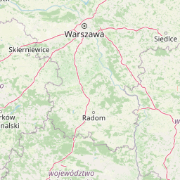
Map view of Chęcińsko-Kielecki Landscape Park

Use this park location map to pinpoint Chęcińsko-Kielecki Landscape Park in Poland, understand its exact geographic position, and read its mapped placement within the surrounding landscape more clearly.

Pigeon | © OpenStreetMap contributors

Location context for Chęcińsko-Kielecki Landscape Park

Świętokrzyskie Voivodeship
Recorded earthquake history

View Documented Seismic Events for Chęcińsko-Kielecki Park Krajobrazowy

Access the comprehensive seismic history for Chęcińsko-Kielecki Park Krajobrazowy via our structured event catalogue. MoriAtlas provides detailed records including epicentre distance, date, and magnitude for earthquakes associated with this protected landscape.

Chęcińsko-Kielecki Park Krajobrazowy Earthquake History

Catalogued events

13 events

Strongest magnitude

Magnitude 3.6

Most recent event

Aug 21, 1996

This history includes earthquakes recorded inside the park or within 50 km of its borders

Visualizing the limestone hills, forested ridges, and protected nature reserves of central Poland

Chęcińsko-Kielecki Park Krajobrazowy Photos and Landscapes

Visual records capture the distinctive terrain of Chęcińsko-Kielecki Park Krajobrazowy, including its exposed rocky hilltops, karst caves, and forested foothill slopes. Examining these protected-area photographs helps observers understand the varied geological features and regional scenery that define the landscape.

A narrow dirt path winds through a dense, green deciduous forest, passing a small stone monument or marker standing among the tree trunks.

Park atlas

Compare adjacent geological reserves and regional mountain terrain across central Poland.

Parks Near Chęcińsko-Kielecki Park Krajobrazowy and Surrounding Protected Landscapes

Browse nearby protected areas and related foothill landscapes sharing similar terrain characteristics with Chęcińsko-Kielecki Park Krajobrazowy. Expanding the search into surrounding regional geography helps place local karst formations and forest ridges into a broader conservation context.
Nature reserveŚwiętokrzyskie Voivodeship
Mapped location lies within the park boundary#1 closest

Northeast

Rezerwat przyrody Moczydło Nature Reserve: Geological and Mining Landscape in Poland

Documenting protected limestone ridges and mining heritage

This protected area safeguards a distinct 317-meter limestone hill that preserves both ancient mining remnants and rare xerothermic grasslands. Located within the Chęcińsko-Kielecki Landscape Park, the site provides a concentrated view of the regional geological identity and industrial past of the Holy Cross Mountains, documented here through its specific mapped boundaries and natural terrain features.

Area
0.164 km²
Established
1995
Relief
Mountain
Scope
Terrestrial
Nature reserveświętokrzyskie
Mapped location lies within the park boundary#2 closest

Northwest

Rezerwat przyrody Milechowy: Protected Nature Reserve and Karst Landscape Atlas

Exploration of forested ridges and rocky karst terrain in świętokrzyskie, Poland

Rezerwat przyrody Milechowy is a significant nature reserve located in the świętokrzyskie voivodeship, home to diverse ecological habitats ranging from dense woodland ridges to exposed rocky slopes. The area is defined by its karst landscape, featuring multiple caves and rock shelters, alongside rare xerothermic vegetation that flourishes in the warm, sun-exposed terrain of the Holy Cross Mountains region.

Area
1.323 km²
Established
1978
Relief
Upland
Climate
Temperate
Nature reserveświętokrzyskie
5.7 km away#3 closest

Northeast

Ostoja Wierzejska Nature Reserve: Protected Forest and Ridge Geography in Świętokrzyskie

Ecological corridors and rare fir forest habitat mapping

Uncover the landscape characteristics of Ostoja Wierzejska, a protected area in Poland featuring quartzite ridges and diverse forest ecosystems. The reserve acts as a crucial ecological link within the Masłowskie Range, sheltering mature tree stands, rare fungi, and specialized invertebrates that define the unique phytosociology of the Świętokrzyskie Mountains.

Area
2.25 km²
Established
2011
Relief
Mountain
Climate
Temperate
Protected landscapeŚwiętokrzyskie Voivodeship
8.1 km away#4 closest

East

Cisowsko-Orłowiński Park Krajobrazowy: Protected Landscape and Geological Atlas

Mapping biodiversity and Paleozoic formations in Świętokrzyskie, Poland

Cisowsko-Orłowiński Park Krajobrazowy stands as a center for biodiversity in southeastern Poland, protecting rare peat-bog forests and 200-year-old tree stands. This atlas profile highlights the park's distinct geological character, from the volcanic rock exposures at Sieraków to the fossil-rich sandstone cliffs at Zalesie, offering insight into the complex mosaic of the Góry Świętokrzyskie foothills.

Area
206.93 km²
Established
1988
Relief
Mountain
Climate
Temperate
Protected landscapeŚwiętokrzyskie Voivodeship
8.3 km away#5 closest

Northeast

Suchedniowsko-Oblęgorski Park Krajobrazowy: A Protected Landscape in Świętokrzyskie

Geographic terrain, forest ecosystems, and industrial heritage

Located in the Świętokrzyskie Voivodeship, this protected area preserves significant forest stands and historic industrial remnants. The terrain captures the intersection of plateau geology and hill country, hosting the headwaters of the Bobrza and Krasna rivers within a culturally layered, heavily forested environment.

Area
198.95 km²
Established
1988
Relief
Mountain
Climate
Temperate
Watercolor illustration of rolling hills with green forests in the foreground and purple, green, pink, and yellow mountain ranges in the background
National parkŚwiętokrzyskie Voivodeship
15 km away#6 closest

East

Świętokrzyski National Park: Protected Mountain Terrain in Świętokrzyskie Voivodeship

Geography and landscape mapping for Poland's oldest mountain range

Świętokrzyski National Park encompasses the highest ridges of the Świętokrzyskie Mountains, showcasing a landscape defined by expansive granite boulder fields and primeval fir forests. This atlas entry provides a detailed look at the park's topography, ranging from the prominent Łysica peak to the protected valley floors, highlighting the geological and biological diversity preserved within this central Polish sanctuary.

Area
76.26 km²
Established
1950
IUCN
II
Visitors
168K annual
National parkŚwiętokrzyskie Voivodeship
15 km away#7 closest

East

Świętokrzyski Park Narodowy: Protected Forests and Mountain Geography in Central Poland

A preserved landscape of ancient fir forests and rubble fields

Situated within the Świętokrzyskie Voivodeship, this protected area guards the Łysogóry range and its rare forest associations. The landscape is characterized by its dramatic gołoborza rubble fields and dense mixed-woodland terrain, providing a unique look into the natural geography of the region.

Area
76.26 km²
Established
1950
Visitors
168K annual
Relief
Mountain
Protected landscapeŚwiętokrzyskie Voivodeship
18 km away#8 closest

Southeast

Szaniecki Park Krajobrazowy: Protected Landscape Atlas and Regional Map Context

Exploring xerothermic habitats across the Ponidzie plateau

Szaniecki Park Krajobrazowy anchors conservation efforts across the Płaskowyż Szaniecki and the Garb Pińczowski ridge. This detailed profile tracks the regional geography, calcareous soil influence, and the protection of rare steppe flora within the broader Świętokrzyskie Voivodeship landscape framework.

Area
112.896 km²
Established
1986
Relief
Upland
Climate
Temperate

Common questions about visiting, size, designation, and location context for Chęcińsko-Kielecki Landscape Park

Chęcińsko-Kielecki Landscape Park FAQs for park facts, access, geography, and protected area context

Find quick answers about Chęcińsko-Kielecki Landscape Park, including protected-area facts, park geography, trail and visitor context, and how the park fits into its surrounding country and regional landscape.
MoriAtlas Explorer

Continue Your Protected Areas Search Across the Global Atlas

Deepen your exploration by continuing the structured search for national parks and protected areas worldwide. Utilize the comprehensive filtering capabilities to compare different conservation landscapes and refine your understanding of global park geography. Discover more about the distribution and characteristics of protected natural areas.

Global natural geography