
Mori Atlas logo
Protected areaChilika Lake

A detailed geographic study of estuarine ecosystems, barrier spits, and island landscapes in Odisha.

Chilika Lake Protected Area: Exploring the Geography of India's Largest Brackish Lagoon

(Chilika Lake (Ramsar Site No. 229))

Chilika Lake stands as the largest brackish-water lagoon on the east coast of India, defined by a complex interplay between the Eastern Ghats and the Bay of Bengal. This protected landscape encompasses extensive mudflats, shallow channels, and a shifting barrier beach, creating a vital wetland environment that fluctuates with the monsoons. The lagoon serves as a primary site for migratory waterbirds and sustains unique marine and freshwater biodiversity within its diverse ecological zones.

brackish lagoonestuarine wetlandRamsar sitemigratory birdsIrrawaddy dolphincoastal lagoon

Chilika Lake

Protected area

Park overview

Structured park overview, official facts, and landscape profile for Chilika Lake

Chilika Lake park facts, protected area profile, and essential visitor context

Review the core facts for Chilika Lake, including designation, size, terrain, visitor scale, habitats, and operating context in one park-focused overview.

About Chilika Lake

Chilika Lake is a vast brackish lagoon set along the eastern shore of India, where the Mahanadi river system meets the Bay of Bengal in Odisha. It is an ephemeral, shallow waterbody whose salinity changes with the seasons, ranging from freshwater in the river-fed north to near-oceanic levels near the tidal mouth in the south. The result is a transitional ecosystem that supports a unique mix of marine, brackish, and freshwater species within a single system.

The lagoon is bordered by the Eastern Ghats on its western and southern sides and enclosed on the east by a long barrier beach that has slowly grown through littoral drift over thousands of years. Inside its pear-shaped basin are numerous islands, channels, and mudflats that change shape with the monsoons. The waters of Chilika are crossed by 52 rivers and tributaries, including the Bhargavi, Daya, Malaguni, and Luna, which together supply most of the freshwater inflow that drives its productivity.

Ecologically, Chilika is one of Asia's most important coastal wetlands. It has been recognized under the Ramsar Convention since 1981, qualifies as a tentative UNESCO World Heritage site, and is widely regarded as one of the best-managed Ramsar sites in the region. The lake's combination of rich biodiversity, scenic islands, and cultural significance makes it both a globally important conservation site and a defining landscape of coastal Odisha, supporting traditional fisheries, pilgrimage sites, and a deep-rooted maritime heritage that stretches back to ancient trade with Southeast Asia.

Quick facts and research context for Chilika Lake

Chilika Lake is a shallow, bar-built brackish lagoon on India's east coast, located in Odisha across the districts of Puri, Khordha, and Ganjam. Designated as a Ramsar Wetland in 1981, it became one of India's first two internationally recognized wetlands and is recognized as one of the largest brackish-water lagoons in Asia.

The lake is shaped by the Eastern Ghats to the west, a long barrier spit on the east, and a tidal connection to the Bay of Bengal. It supports both freshwater and saline habitats and is host to more than 800 recorded animal species and a substantial migrant waterbird population. The Chilika Development Authority, established in 1992, manages the lagoon and led its restoration after a period of marked ecological decline in the 1990s.

Protection and recognition

Documented protection history, management scope, and official Ramsar site designation records.

Chilika Lake Protection Status and International Recognition Records

Chilika Lake brings together documented protection status, designation history, and management scope established since 1981. Official international recognition records outline the designated Ramsar site status associated with the protected area.

International recognition

Protection details

Protection scope
Mixed
Designated year
1981
Transboundary protection
No
Core area
15.53 km²
Park context

Deeper park guide and search-rich context for Chilika Lake

Chilika Lake history, landscape, wildlife, and travel context

Explore Chilika Lake through its history, landscape character, ecosystems, wildlife, conservation priorities, cultural context, and seasonal travel timing in a structured park guide built for atlas discovery and search intent.

Why Chilika Lake stands out

Chilika Lake is best known as the single largest wintering ground for migratory birds on the Indian subcontinent, drawing flocks from as far away as the Caspian Sea, Lake Baikal, Central Asia, and the Himalayas. The shallow brackish waters and extensive mudflats that emerge each winter create ideal feeding conditions for hundreds of thousands of waterfowl, waders, and shorebirds. Equally distinctive is its role as the only known habitat of the endangered Irrawaddy dolphin in India. The lagoon is considered one of the few in the world where these dolphins still survive close inshore, and the Irrawaddy dolphin has become the symbolic flagship species of the entire Chilika ecosystem.
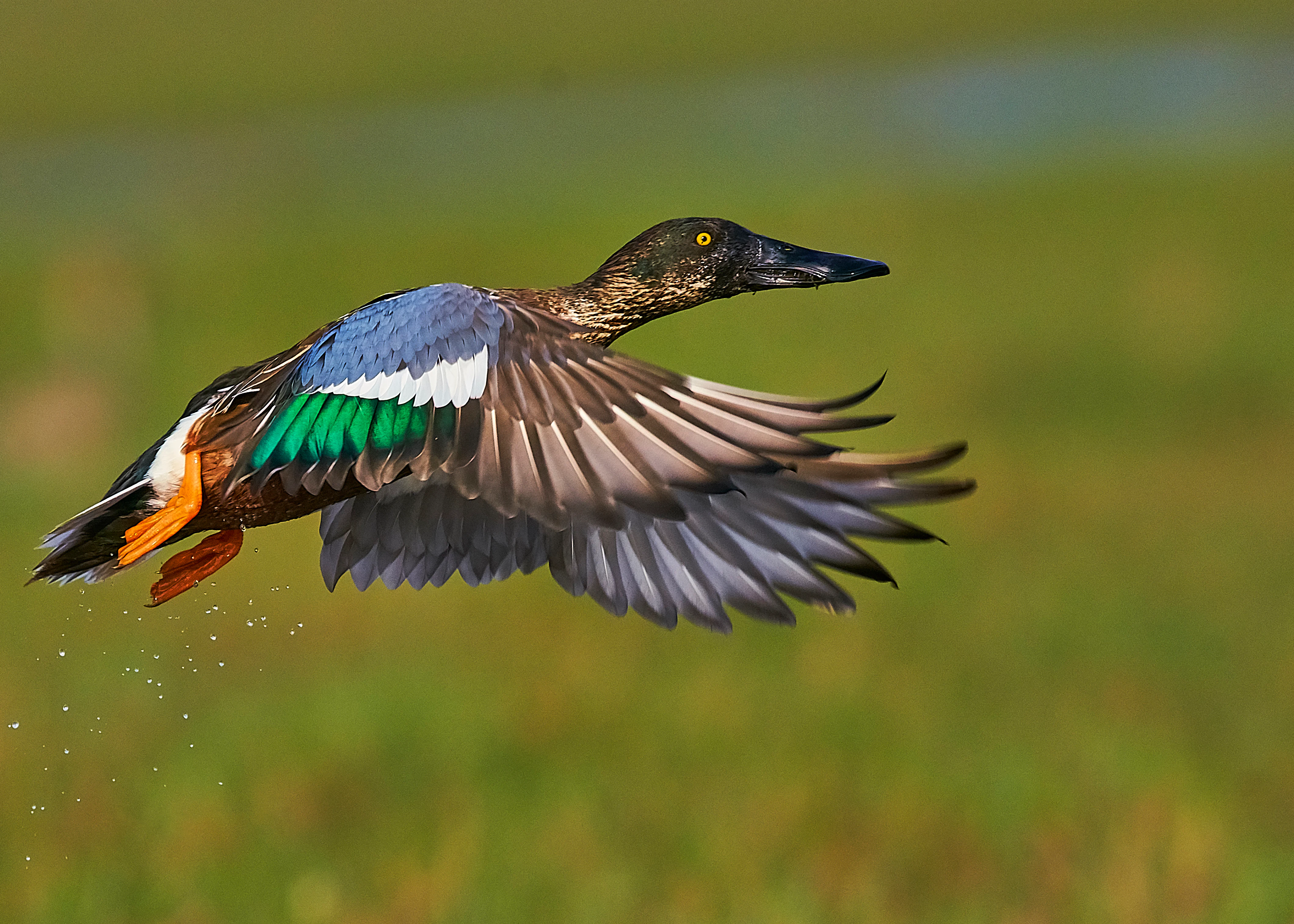
Northern shoveler at Mangalajodi
A migratory northern shoveler in flight at Mangalajodi, Chilika Lake, Odisha, India.

Chilika Lake history and protected-area timeline

Chilika Lake was once part of the Bay of Bengal during the later stages of the Pleistocene, and a slow process of sedimentation, sea-level change, and sand-bar growth gradually separated its waters from the open sea. A fossil from the southwestern edge of the barrier spit suggests that the present-day lagoon took shape only about three to four thousand years ago.

Archaeological work at Golabai Sasan, on a river that flows into Chilika, has revealed Neolithic, Chalcolithic, and Iron Age occupation layers, with the earliest radiocarbon dates around 2300 BCE. The site shows traces of ancient boat-building and maritime activity, suggesting that the lake has long linked inland Odisha to seafaring trade routes. Classical and medieval accounts describe the southern part of Chilika as a major harbour: Ptolemy referred to the port of Paloura near its shores; Chinese pilgrims mentioned a famous port of Che-li-ta-lo Ching on its banks; and the Brahmanda Purana of the 10th century names the lagoon as an important embarkation point for ships sailing to Java, Malaya, and China.

In the early 19th century, the British reached the lake in 1803 en route to occupying Odisha, and the area subsequently came under colonial administration. Over the 20th century, siltation, shrinkage of the water surface, choking of the inlet channel, proliferation of invasive freshwater plants, and declining fisheries placed Chilika under severe ecological stress. By 1993 the lagoon had been placed on the Montreux Record of threatened Ramsar sites. Following major hydrological intervention, including the opening of a new lake mouth at Satapada in 2000, the lake recovered significantly and became the first Ramsar site in Asia to be removed from the Montreux Record; it was also recognized with the Ramsar Wetland Conservation Award in 2002.

Chilika Lake landscape and geographic character

Chilika Lake is a shallow, bar-built estuary whose physical shape is dominated by the interplay between the Eastern Ghats hills, a long sandy barrier beach on the coast, and the tidal influence of the Bay of Bengal. The eastern shoreline follows a roughly 60-kilometre barrier spit formed by northerly longshore drift, while the western and southern margins rise into the forested ridges of the Eastern Ghats. The lake itself is pear-shaped, narrow in the south and broader in the central and northern sectors, and divided into four broad ecological zones by its salinity and hydrology.

The water surface fluctuates dramatically with the seasons, expanding during the southwest monsoon and contracting during the dry months, exposing extensive mudflats. Across the lagoon lie numerous islands separated by shallow channels, including the larger landmasses of Parikud, Phulbari, Berahpura, Nuapara, Nalbana, and Tampara, together with smaller features such as Honeymoon Island, Birds Island, Somolo, and Sanakuda. A roughly 32-kilometre outer channel links the inner lagoon to the sea near the village of Motto, with a newer mouth opened near Satapada, and the older, silt-choked channel known as Magarmukha still traces the historical connection to the coast.
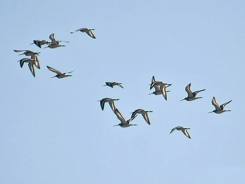
Black-tailed Godwit at Chilika Lake
A Black-tailed Godwit observed at Chilika Lake, Odisha, India.

Chilika Lake ecosystems, habitats, and plant life

Chilika supports a unique assembly of freshwater, brackish, and marine habitats within a single basin. In the northern and central sectors, large volumes of river-derived freshwater create nutrient-rich conditions and turbid waters, while the southern sector remains more saline and clearer. The lake's bottom is largely silt, supplied by rivers carrying sediment from the Mahanadi catchment, and the wide salinity gradient supports a wide variety of vegetation types from submerged aquatic plants and seagrasses to mangrove associates at the brackish margins.

Surveys have identified more than 700 species of flowering plants around the lagoon, dominated by aquatic and sub-aquatic species in families such as Fabaceae, Poaceae, and Cyperaceae, along with mangrove associates and an endemic species of Cassipourea ceylanica. The recovery of seagrass beds in recent years has been considered an encouraging sign, potentially offering habitat for threatened marine species. Across the catchment, land use pressures include siltation, nutrient inflow from rivers, and historical encroachment by invasive freshwater plants such as water hyacinth, which have shaped the lake's ecological condition since the late 20th century.
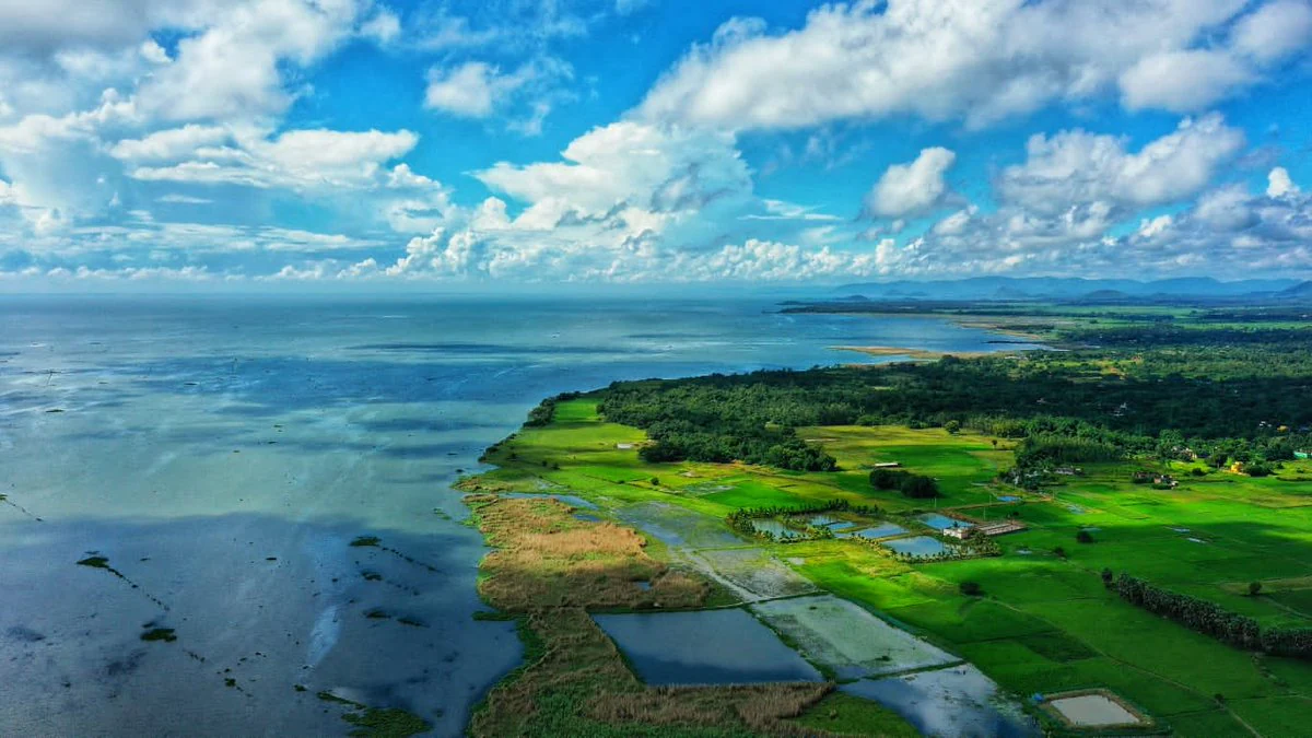
Aerial view of Chilika Lake

Chilika Lake wildlife and species highlights

Chilika Lake is one of the most important bird habitats in South Asia. In peak migratory season, the lagoon hosts large numbers of waterfowl, waders, shorebirds, and raptors that travel vast distances from breeding grounds in the Caspian basin, Lake Baikal, the Kazakh steppes, Mongolia, Siberia, Ladakh, and the Himalayas. Tens of thousands of flamingos, geese, pelicans, herons, storks, ibises, spoonbills, and kingfishers can be observed feeding on the exposed mudflats, particularly around Nalbana Island once the monsoon recedes.

Below the surface, the lake's brackish waters host an exceptional diversity of fish, prawn, and crab species, several hundred fish species being recorded in modern surveys, alongside economically important prawns and the mangrove crab. Among mammals, the Irrawaddy dolphin is the most famous inhabitant and the lagoon's flagship species; small numbers of bottlenose dolphins also enter from the sea. Reptiles include the endangered green sea turtle, and the lagoon is also associated with threatened species such as the spoon-billed sandpiper, fishing cat, and the Chilika limbless skink.
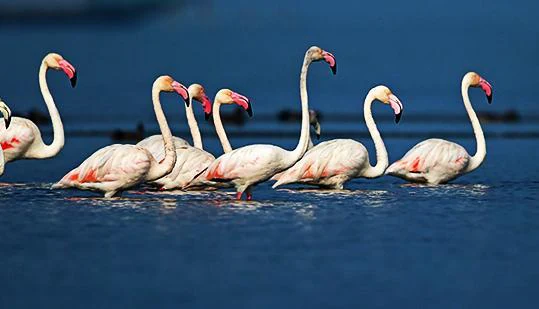
Migratory flamingos at Chilika Lake
Migratory flamingos in the Chilika Lake wetland area, which supports a popular eco-tourism initiative providing employment for local communities.

Chilika Lake conservation status and protection priorities

Chilika's conservation story is one of the most closely studied wetland recoveries in Asia. The lake was recognized under the Ramsar Convention in 1981 as one of the first wetlands of international importance in India, but by the early 1990s mounting siltation, shrinkage of the water surface, choking of the inlet channel, declining salinity, proliferation of invasive freshwater plants, and falling fish catches had pushed the lagoon onto the Montreux Record of threatened Ramsar sites.

The establishment of the Chilika Development Authority in 1992 marked a shift toward organized, integrated management. A major hydrological intervention, the opening of a new lake mouth at Satapada in 2000, restored tidal flushing and improved salinity balance across the lagoon. The recovery that followed increased fish landings dramatically and enabled the removal of invasive aquatic weeds. In 2002 Chilika became the first Ramsar site in Asia to be taken off the Montreux Record, and the Chilika Development Authority received the Ramsar Wetland Conservation Award the same year. Ongoing concerns include managing dolphin-watching tourism, gill-net bycatch, and maintaining salinity and water-quality regimes under pressure from catchment development.

Chilika Lake cultural meaning and human context

Chilika is deeply embedded in the cultural, spiritual, and literary life of coastal Odisha. The lake was historically a gateway to maritime trade, and ancient ports such as Palur and Manikapatna, both lying along the lagoon's shores, served as embarkation points for voyages to Southeast Asia and China. Villagers still mark this deep trading past with the annual Bali Yatra festival.

The lagoon also holds strong religious significance. Kalijai Temple on an island within the lake is revered as the abode of the presiding goddess of Chilika, while smaller shrines such as Chourbar Shiva Temple, the Bhabakundeswar temple at Manikapatna, and the Varuna temple on Barunkuda reflect the spiritual geography of the waterbody. Odia poets and saints, including Purshottam Das, Radhanath Ray, and Godavarish Mishra, have long drawn on the lake's imagery, and freedom-fighter Gopabandhu Das wrote movingly of Chilika's colorful beauty. The lagoon remains a defining feature of Odia regional identity, woven into folklore, festivals, and everyday coastal life.
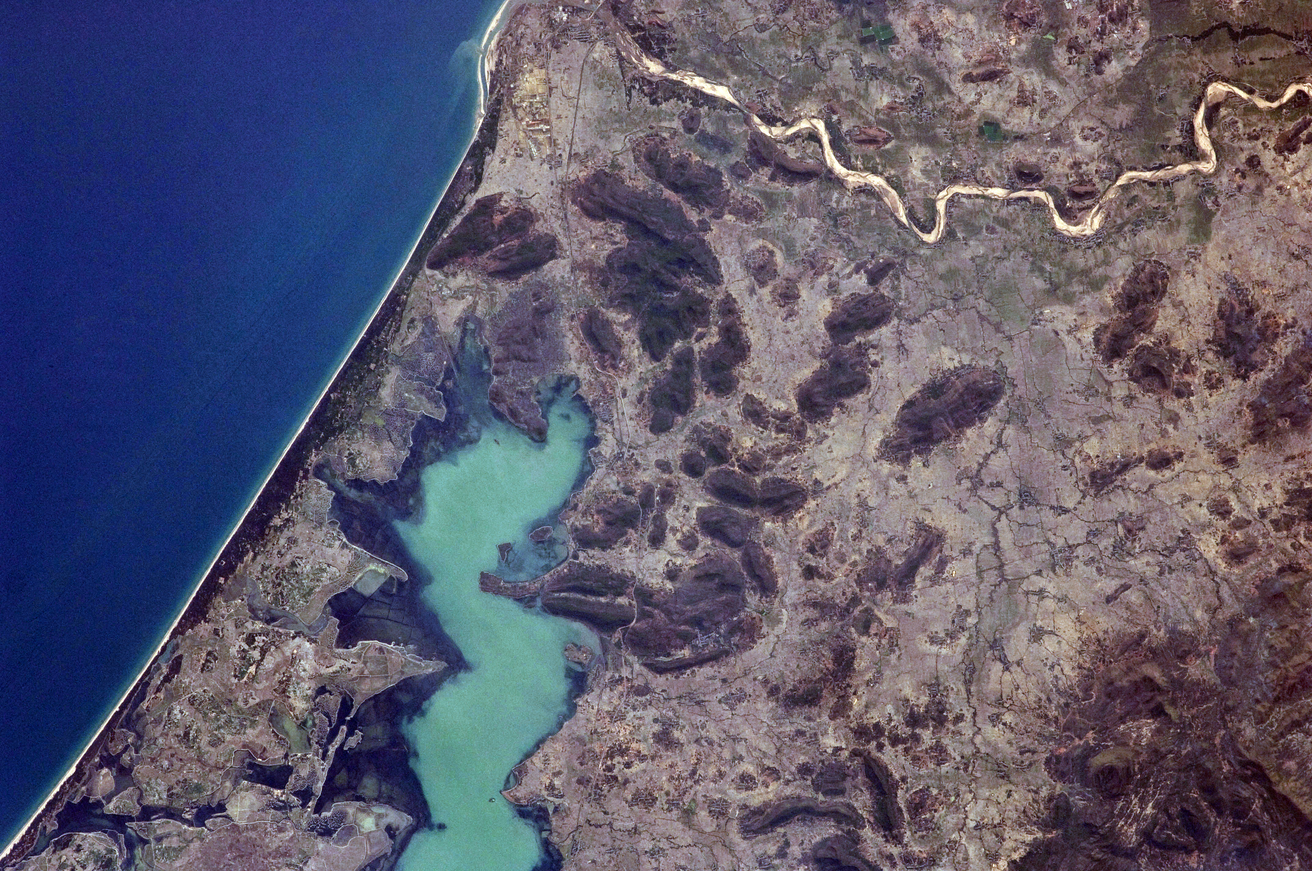
Aerial satellite view of Chilika Lake
Satellite imagery showing the geography of Chilika Lake, Odisha.

Top sights and standout views in Chilika Lake

Chilika is exceptional in combining three distinct identities in a single protected area: a Ramsar-recognized wetland of global biodiversity significance, a living cultural landscape tied to centuries of maritime trade, religious tradition, and Odia literature, and a working estuary that sustains the livelihoods of tens of thousands of fisherfolk.

Its greatest distinctions include hosting the only known population of Irrawaddy dolphins in India, supporting the largest wintering congregation of migratory waterbirds on the Indian subcontinent, and standing as a successful case of large-scale wetland restoration after being removed from the Montreux Record. The combination of scenic islands, ancient temples, dolphin-watching at Satapada, and spectacular bird flocks, particularly around Nalbana, makes Chilika one of the most recognizable natural landmarks of coastal India.
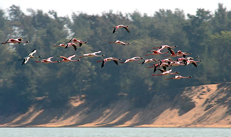
Lesser Flamingos in Chilika Lake
Lesser Flamingos observed at Chilika Lake in Odisha, India.

Best time to visit Chilika Lake

The character of Chilika Lake shifts noticeably between seasons. Winter, roughly from November through February, is widely regarded as the most rewarding time, when the lake's water surface recedes, mudflats and islands such as Nalbana are exposed, migratory waterbirds arrive in large numbers, and salinity-driven ecological balance is restored. Clearer skies and milder temperatures also make boat travel around the lagoon more comfortable.

The southwest monsoon months bring heavy rain, raised water levels, and submerged islands, reducing access to many bird-rich sites and obscuring wildlife viewing, although the surrounding hills and river-fed areas remain scenically lush. The months around October to January, and to a lesser extent May to June, are typically associated with peak visitor activity linked to wildlife and dolphin viewing, while the quieter monsoon and early post-monsoon periods offer a calmer atmosphere with fewer crowds.
Park guides

Explore targeted topics for planning wetland exploration and wildlife study.

Chilika Lake Focused Guides and Protected Area Answers

Selected reference materials provide structured answers to specific lagoon questions regarding seasonal timing and regional access. Published briefings examine visit timing requirements and environmental patterns across the protected ecosystem.
Monthly climate preview

Track representative annual temperature ranges and monthly precipitation patterns for Chilika Lake.

Chilika Lake Climate Normals and Long-Term Weather by Month Preview

Representative coordinate measurements reveal sustained annual temperature rhythms alongside distinct monthly precipitation shifts across Chilika Lake. Exploring the complete twelve-month climatology dataset clarifies long-term averages for detailed regional research.
Annual mean27 °C
23 °C30 °C
Jan23°
Feb25°
Mar28°
Apr29°
May30°
Jun29°
Jul29°
Aug28°
Sep29°
Oct28°
Nov26°
Dec23°
Warmest month
May

29.8 °C

Coolest month
January

23.2 °C

Wettest month
August

10.3 mm/day

Driest month
December

0.4 mm/day

Park location guide

Geography guide, regional context, and park location map for Chilika Lake

Chilika Lake park geography, regions, and map view in India

Understand where Chilika Lake sits in India through a broader geographic reading of the surrounding landscape, nearby location context, and its mapped position within the national park landscape.

How Chilika Lake fits into India

India is a South Asian country bordered by the Indian Ocean, Arabian Sea, and Bay of Bengal. It shares land borders with Pakistan, China, Nepal, Bhutan, Bangladesh, and Myanmar. The country has a population of over 1.4 billion people and operates as a federal parliamentary republic with its capital in New Delhi.

Wider geography shaping Chilika Lake in India

India occupies the Indian subcontinent in South Asia, bordered by the Arabian Sea to the southwest, the Bay of Bengal to the southeast, and the Indian Ocean to the south. It shares land borders with Pakistan to the west, China, Nepal, and Bhutan to the north, and Bangladesh and Myanmar to the east. The territory also includes the Andaman and Nicobar Islands in the Indian Ocean.

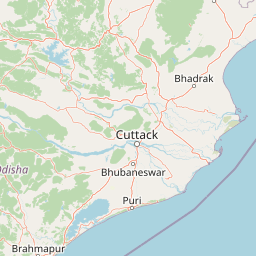
Map view of Chilika Lake

Use this park location map to pinpoint Chilika Lake in India, understand its exact geographic position, and read its mapped placement within the surrounding landscape more clearly.

Pigeon | © OpenStreetMap contributors

Location context for Chilika Lake

Odisha

Examine brackish waters, barrier beaches, and diverse wetland habitats.

Chilika Lake Photos and Landscapes, Visual Exploration of India

Visual documentation captures the shifting estuarine terrain, expansive mudflats, and intricate island channels of the reserve. Detailed photography illustrates the unique environmental character and vast ecological scope of the protected wetland landscape.

Northern shoveler at Mangalajodi

Brown-headed Gull at Chilika

Black-tailed Godwit at Chilika Lake

Aerial view of Chilika Lake

Migratory flamingos at Chilika Lake

Migratory birds at Chilika Lake

Aerial satellite view of Chilika Lake

Lesser Flamingos in Chilika Lake

Balugaon from Chilika Lake

Satapada Jetty

Red crab at Chilika Lake

Pied Kingfisher at Chilika Lake

Irrawaddy dolphin in Chilika Lake

Terek Sandpiper

Kentish Plover at Chilika Lake

Sanderling at Chilika Lake

Park atlas

Compare regional protected areas and surrounding coastal wetland geography

Explore Parks Near Chilika Lake And Related Protected Landscapes

Browsing other parks near Chilika Lake reveals broader ecological patterns across the surrounding coastal terrain and the Eastern Ghats. Continuing the comparison connects individual estuarine habitats to regional protected landscapes and wider biodiversity networks.
Wildlife reserveOdisha
About 197 km away#1 closest

Northeast

Bhitarkanika Mangroves Wildlife Reserve: Coastal Geography and Protected Land Atlas

A vast estuarine wetland in the coastal state of Odisha

Bhitarkanika Mangroves represents one of the most significant estuarine systems in South Asia. This protected wildlife reserve covers a sprawling deltaic landscape characterized by tidal channels, mudflats, and intricate mangrove forests that buffer the coastline of Odisha against the Bay of Bengal.

Area
650 km²
Established
1975
Relief
Lowland
Scope
Mixed
National parkKendrapara district
About 210 km away#2 closest

Northeast

Bhitarkanika National Park: Protected National Park in Kendrapara District

Explore its mapped boundaries and regional landscape.

Bhitarkanika National Park, a designated national park in India's Kendrapara district, offers a unique opportunity for geographic discovery. This page details the park's protected area status, its specific landscape characteristics, and its position within the regional geography. Engage with structured data about its mapped boundaries and understand its environmental context for comprehensive atlas exploration.

Area
145 km²
Established
1998
IUCN
II
Relief
Lowland
Watercolor illustration showing a landscape with trees, water, and mountains
National parkMayurbhanj district
About 233 km away#3 closest

Northeast

Simlipal National Park: National Park Protected Area in Mayurbhanj District

Mapped boundaries and regional geography of Simlipal National Park.

Simlipal National Park stands as a prominent national park, offering a rich protected area landscape within Mayurbhanj district, India. This entry provides detailed atlas-style information, focusing on the park's geographic footprint and mapped terrain. Explore the structured data that defines Simlipal National Park's identity as a protected natural landscape, ideal for understanding its place within regional geography and conservation efforts.

Area
2,750 km²
Established
1980
IUCN
II
Relief
Mountain
Wildlife reserveAndhra Pradesh
About 298 km away#4 closest

Southwest

Kambalakonda Wildlife Sanctuary: Mapped Geography and Protected Forest Landscapes

A diverse wildlife reserve in the Eastern Ghats foothills of Andhra Pradesh.

Kambalakonda Wildlife Sanctuary protects an essential patch of East Deccan dry evergreen forest near Visakhapatnam. The hilly topography and varied scrub-meadow ecosystems offer a distinct look at the region's biodiversity within the Eastern Ghats, serving as a primary site for conservation education and ecological study in southern India.

Area
70.7 km²
Established
1970
IUCN
IV
Relief
Upland
National parkIndia
About 366 km away#5 closest

West

Kanger Ghati National Park: National Park Atlas and Mapped Landscape Identity

Explore Kanger Ghati National Park's protected boundaries and regional geography.

Kanger Ghati National Park stands as a key protected national park entity within India, offering insights into its specific geographic setting and conservation landscape. This page details the park's mapped outlines and its role within the broader atlas of South Asia. Understand the natural terrain and regional context that define this protected area, providing a factual foundation for geographic discovery and landscape appreciation.

Area
200 km²
Established
1982
Relief
Mountain
Climate
Tropical
Watercolor painting showing mangrove trees, water channels, and hills in the background
National parkWest Bengal
About 408 km away#6 closest

Northeast

Sundarbans National Park: UNESCO World Heritage Mangrove National Park in West Bengal

Explore its tidal geography and mapped protected boundaries.

Sundarbans National Park is a vital protected area on the Ganges Delta, recognized globally as the world's largest mangrove forest and a UNESCO World Heritage Site. Located in West Bengal, this national park features a unique estuarine geography characterized by intricate tidal channels and distributaries that define its landscape. Its protected boundaries safeguard a complex ecosystem, offering rich opportunities for atlas-driven exploration of its distinctive natural terrain and coastal wetland significance.

Area
1,330.1 km²
Established
1984
IUCN
II
Relief
Lowland
Wildlife reserveAndhra Pradesh
About 449 km away#7 closest

Southwest

Coringa Wildlife Sanctuary: Mapping Protected Mangrove Wetlands in Andhra Pradesh

Coastal delta geography and estuarine tidal landscape exploration

Coringa Wildlife Sanctuary represents one of the largest continuous stretches of mangrove forests in India. This protected area along the Godavari Estuary offers a rich study in coastal geography, where complex tidal channels, backwater systems, and deltaic landforms create a unique, sediment-rich wetland environment essential for local avian and aquatic life.

Area
235.7 km²
Established
1978
IUCN
IV
Relief
Lowland
Protected areaWest Bengal
About 452 km away#8 closest

Northeast

East Kolkata Wetlands: A Comprehensive Geographic View of the Protected Area

Regional landscape, urban wetlands, and aquaculture mapping

Discover the physical layout of the East Kolkata Wetlands, a transformative protected area bordering Kolkata, West Bengal. This atlas entry provides a detailed look at the site's function as a massive, naturally integrated sewage-fed aquaculture and agricultural system, showcasing how water, land, and human labor interweave across the Ganges-Brahmaputra deltaic terrain.

Area
125 km²
Established
2002
Relief
Lowland
Climate
Subtropical

Common questions about visiting, size, designation, and location context for Chilika Lake

Chilika Lake FAQs for park facts, access, geography, and protected area context

Find quick answers about Chilika Lake, including protected-area facts, park geography, trail and visitor context, and how the park fits into its surrounding country and regional landscape.
MoriAtlas Explorer

Continue Your Protected Areas Search Across the Global Atlas

Deepen your exploration by continuing the structured search for national parks and protected areas worldwide. Utilize the comprehensive filtering capabilities to compare different conservation landscapes and refine your understanding of global park geography. Discover more about the distribution and characteristics of protected natural areas.

Global natural geography