
Mori Atlas logo
Wildlife reserveReserva de Producción de Fauna Chimborazo

A high-altitude wildlife reserve defined by volcanic terrain, glacial valleys, and páramo grasslands.

Reserva de Producción de Fauna Chimborazo: Mapped Geography of the Ecuadorian Andean Highlands

The Reserva de Producción de Fauna Chimborazo sits as a defining conservation landscape in the central Ecuadorian Andes. This protected area encompasses the glaciated volcanic peaks of Mount Chimborazo and Carihuairazo, spanning a diverse topographic range from wet eastern slopes to the arid El Arenal puna. It serves as a critical hydrological hub, feeding major river basins while providing a sanctuary for reintroduced vicuña populations and endemic high-Andean flora.

páramovolcanic landscapeAndeshigh-altitude reservevicuña reintroductionSouth American camelids
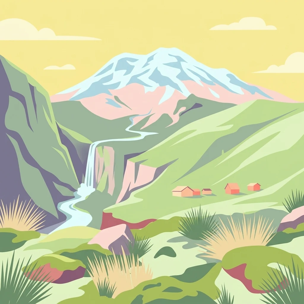
An artistic vector illustration of a snow-capped mountain peak rising above green slopes, a waterfall flowing into a river, and small huts in a valley.

Reserva de Producción de Fauna Chimborazo

Wildlife reserve

Park overview

Structured park overview, official facts, and landscape profile for Chimborazo Fauna Production Reserve

Chimborazo Fauna Production Reserve park facts, protected area profile, and essential visitor context

Review the core facts for Chimborazo Fauna Production Reserve, including designation, size, terrain, visitor scale, habitats, and operating context in one park-focused overview.

About Chimborazo Fauna Production Reserve

The Chimborazo Fauna Production Reserve is one of the most significant high-altitude protected areas in Ecuador, set in the central Andes around the country's highest peak. The reserve protects the páramo landscapes that climb the flanks of Mount Chimborazo and the adjacent Carihuairazo volcano, encompassing a wide elevation band that stretches from deep glacial valleys to the barren, icy zones above 6,000 meters. This vertical range creates an exceptionally varied environment in a relatively compact area, and it is the defining reason the reserve matters both ecologically and hydrologically.

The reserve is notable for combining a formal conservation designation with active communal land use. Roughly 80 percent of its area is held by around 38 peasant organizations, communities, cooperatives, and associations, alongside a small number of private owners. Subsistence agriculture, limited sheep grazing, and small-scale cattle and guinea pig husbandry continue in the lower parts of the reserve, while the higher páramos serve as a buffer for the watershed and a habitat for wildlife. The reserve's establishment in 1987 was closely tied to the broader idea that protecting páramo ecosystems requires working with the rural communities that depend on them.

Ecologically, the reserve stands out for its range of páramo habitats: permanently humid grasslands, periodically dry temperate zones, superhumid glacial areas, and the unique El Arenal dry páramo. Its flora includes a high number of endemic species in families such as Asteraceae, Bromeliaceae, and Geraniaceae, and its fauna is anchored by reintroduced camelids, especially vicuñas, alongside llamas and alpacas. The reserve is also a critical water source for Andean communities and downstream ecosystems, making its role both ecological and socioeconomic at a regional scale.

Quick facts and research context for Chimborazo Fauna Production Reserve

The Chimborazo Fauna Production Reserve sits in the central Ecuadorian Andes across the provinces of Bolívar, Chimborazo, and Tungurahua. Created on October 26, 1987, it is administered by Ecuador's Ministry of the Environment as a fauna production reserve under IUCN Category IV. Its elevation ranges from roughly 3,800 meters in the lower páramos to 6,310 meters at the summit of Chimborazo.

The reserve was established to support a South American camelid reintroduction program, and its lands are predominantly held by peasant communities, cooperatives, and associations, with smaller areas in private hands. Hydrologically, it is one of the most important high-Andean reserves in Ecuador, feeding both the Pacific-side Guayas basin and the Amazonian Pastaza basin.

Protection and recognition

Documented terrestrial protection metrics and international recognition data

Reserva de Producción de Fauna Chimborazo Protection Status and Scope

Reserva de Producción de Fauna Chimborazo maintains a documented terrestrial protection scope within the protected area framework. Official records outline management classifications and designation details for thorough geographical evaluation.

Protection details

Protection scope
Terrestrial
Transboundary protection
No
Park context

Deeper park guide and search-rich context for Chimborazo Fauna Production Reserve

Chimborazo Fauna Production Reserve history, landscape, wildlife, and travel context

Explore Chimborazo Fauna Production Reserve through its history, landscape character, ecosystems, wildlife, conservation priorities, cultural context, and seasonal travel timing in a structured park guide built for atlas discovery and search intent.

Why Chimborazo Fauna Production Reserve stands out

The reserve is best known for Mount Chimborazo itself, Ecuador's highest volcano and a landmark of the central Andes, and for the high-altitude páramo landscapes that surround it. It is also widely recognized for its role as the site of Ecuador's vicuña reintroduction program, which has restored populations of wild South American camelids to the country's páramo. Another defining feature is the unusual páramo diversity of the area, ranging from the wet, humid páramos of the western Bolívar slopes to the semidesertic El Arenal, considered the only dry páramo of its kind in Ecuador, often compared to a puna ecosystem of the southern Andes. Together, these characteristics make the reserve a focal point for Andean conservation, watershed protection, and the management of communal highland landscapes.
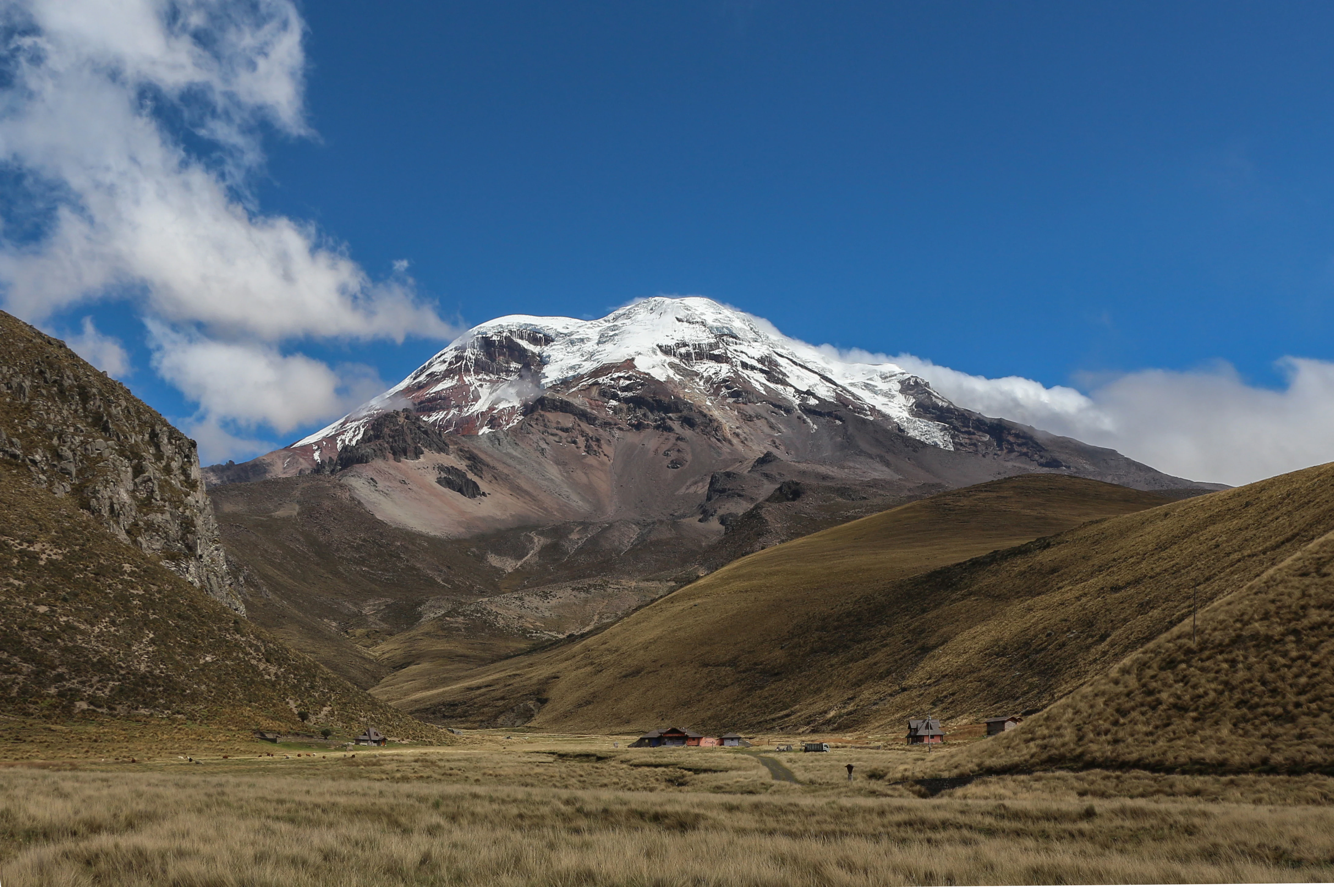
A wide view of the snow-covered, multi-peaked Chimborazo volcano towering over a vast, dry grass-covered valley in the Andes.
The snow capped peak of Chimborazo volcano rising above the high Andean paramo landscape.

Chimborazo Fauna Production Reserve history and protected-area timeline

The Chimborazo Fauna Production Reserve was officially created on October 26, 1987, through an interministerial agreement recorded in Ecuador's official registry. From its inception, the reserve was designed with a dual purpose: protecting the high-Andean ecosystems around Mount Chimborazo and Carihuairazo while supporting a structured program for the reintroduction and management of South American camelids, which had largely disappeared from the Ecuadorian Andes.

A key milestone in the reserve's history came in 1988, when Ecuador received 200 vicuñas donated by Chile and Peru as part of a regional effort to restore wild populations of the species in the northern Andes. A second contribution followed in 1993, with 77 additional vicuñas arriving from Bolivia. These founding populations formed the basis of a reintroduction program that has since become one of the defining conservation stories of the reserve.

Parallel to the wildlife efforts, the reserve has functioned as a framework for managing communal páramo lands. Rather than displacing rural communities, the protected designation has historically been used to coordinate grazing, subsistence farming, and conservation among the dozens of peasant organizations and cooperatives that collectively hold most of the reserve's territory. This integration of community land use with conservation policy has shaped the reserve's identity as a working landscape rather than a strictly exclusionary protected area.

Chimborazo Fauna Production Reserve landscape and geographic character

The landscape of the reserve is dominated by the massive, glaciated cone of Mount Chimborazo, Ecuador's highest peak, and by the neighboring Carihuairazo volcano. Together these two volcanic structures create a dramatic highland setting of concave and convex hillslopes, glacial valleys, and tectonic depressions that contrast sharply across short distances. The terrain rises from roughly 3,800 meters in the lower foothills to 6,310 meters at Chimborazo's summit, with extensive areas of permanent ice and snow near the top.

The reserve sits at the hydrological divide of the Ecuadorian Andes. Its eastern slopes drain toward the Pastaza basin and ultimately the Amazon, while the western slopes feed rivers of the Guayas basin flowing to the Pacific. The Chimborazo glacier is the second largest in Ecuador, and its meltwater supports an extensive downstream irrigation system, including the Las Abras canal, which takes water from the Mocha River born within the reserve. This combination of peak, glacier, páramo, and watershed creates a landscape that is simultaneously scenic, ecologically rich, and economically important to surrounding communities.

Vegetation patterns shift noticeably with this topographic range. The upper elevations host the barren, mineral landscapes typical of gelidofitia and ice-covered zones, while middle elevations transition into wet and humid páramos with continuous herbaceous cover. Lower elevations harbor Andean forest patches, matorrales, and reforestation zones with species such as Polylepis and Buddleja. The western flank, particularly in Bolívar province, receives significantly more precipitation than the eastern side, giving the reserve strikingly different micro-landscapes within a single protected perimeter.
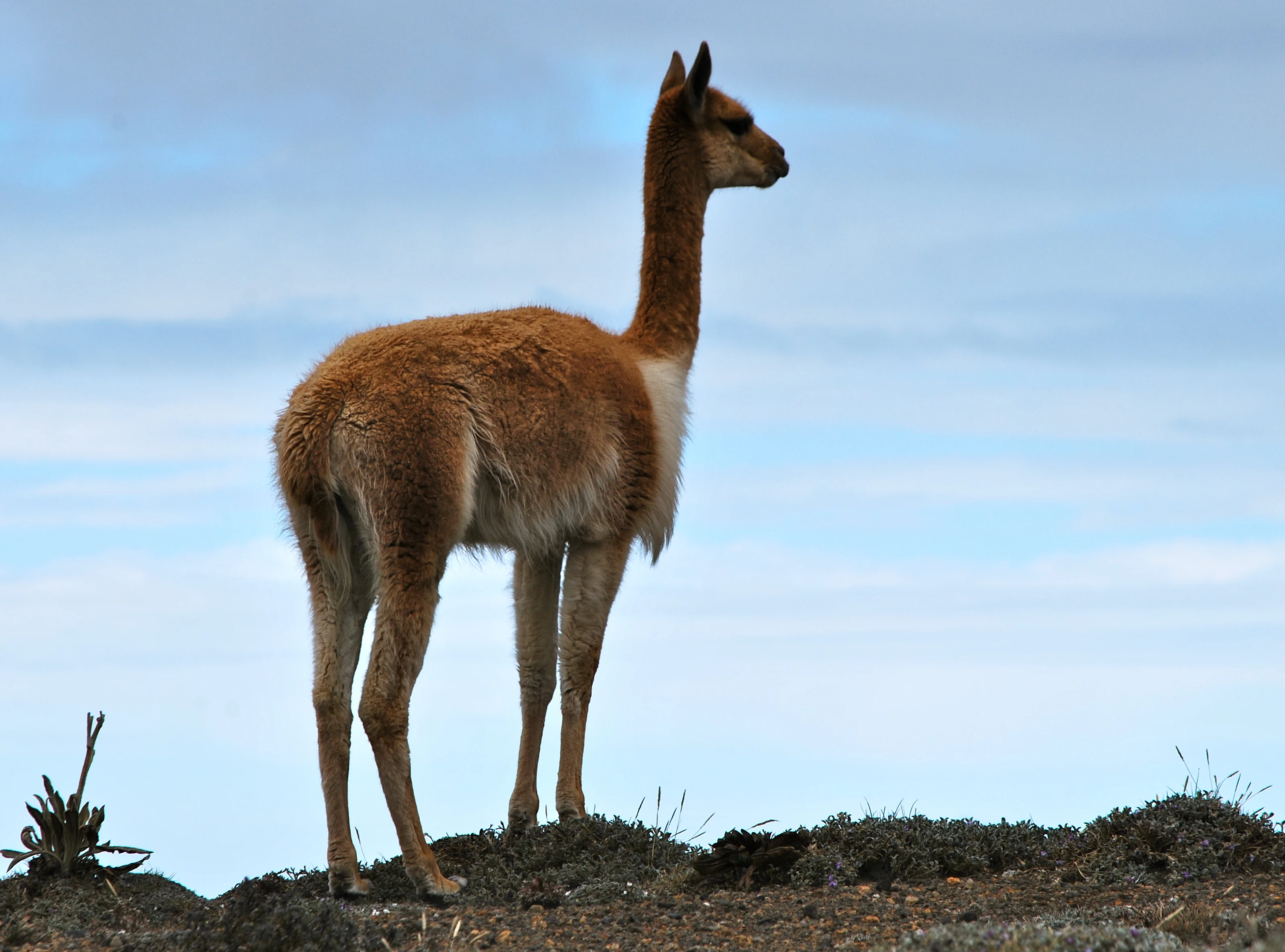
A vicuna stands on a rocky, sparse terrain against a cloudy sky.
A vicuna standing in the high-altitude landscape of the Chimborazo Fauna Production Reserve.

Chimborazo Fauna Production Reserve ecosystems, habitats, and plant life

The reserve protects a sequence of high-Andean ecosystems that together represent one of the more diverse páramo complexes in Ecuador. Four main vegetation formations are recognized within its territory: high montane evergreen forest, herbaceous páramo, dry páramo, and gelidofitia, the sparse vegetation found in glacial and periglacial zones. Between the forest and the open páramo lies the Ceja Andina, a transitional band of flora bridging the montane cloud forests and the high grasslands.

Among the most distinctive ecological features of the reserve is El Arenal, a dry páramo located within its boundaries. Considered the only páramo of this type in Ecuador, it behaves ecologically like a puna or semidesertic highland system, dominated by xerophytic vegetation adapted to unusually arid conditions for an equatorial Andean setting. This makes the reserve exceptional, since most Ecuadorian páramos tend to be cool and humid rather than dry.

The reserve's flora includes a large number of endemic species, with notable diversity in Asteraceae, Bromeliaceae, and Geraniaceae. Characteristic plants include the furry-leaved Culcitium, blue- and violet-flowered gentians of the Gentiana and Gentianella genera, the romerillo shrub Hypericum laricifolium, and various valerians. In more sheltered ravines and humid pockets, small populations of trees like Polylepis reticulata and Buddleja incana survive and are used in local reforestation efforts, providing one of the few woody plant refuges in an otherwise open landscape.
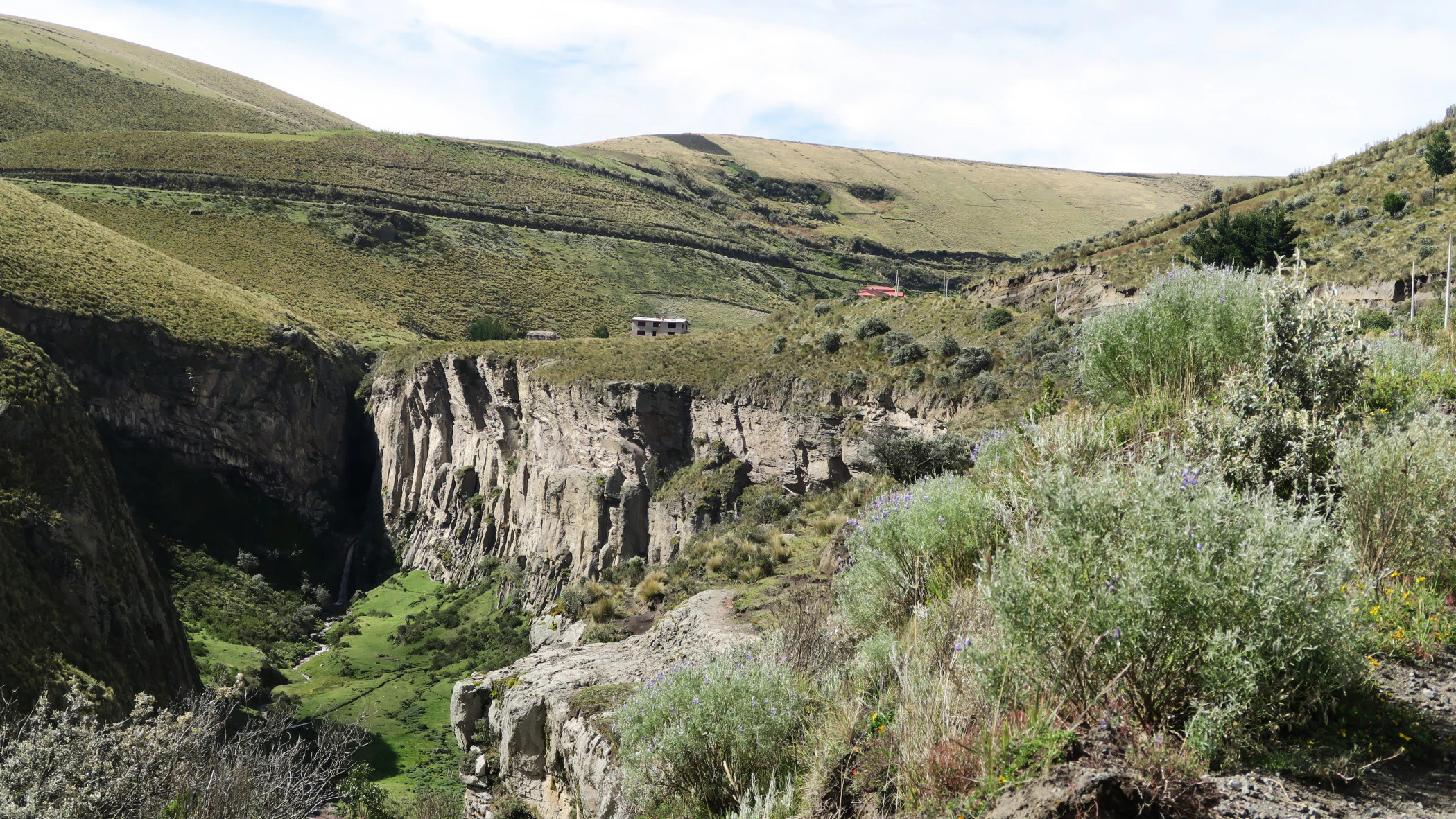
A deep rocky canyon with steep walls cuts through rolling, grass covered hills, with small structures visible on the distant horizon under a cloudy sky.
A rocky canyon landscape within the high altitude paramos of the Chimborazo Fauna Production Reserve.

Chimborazo Fauna Production Reserve wildlife and species highlights

Wildlife in the Chimborazo Fauna Production Reserve is shaped by camelid conservation more than by any other single factor. The reserve's founding purpose was to support the reintroduction of South American camelids, and the llama, alpaca, and especially the vicuña remain its most iconic animals. Vicuñas were brought back to Ecuador beginning in 1988 through donations from Chile, Peru, and later Bolivia, and today wild and managed vicuña populations are a defining presence in the upper páramos.

Beyond the camelids, the reserve supports several other mammals characteristic of high-Andean environments. These include the Andean fox, the long-tailed weasel, the white-tailed deer, the striped skunk, the tapeti rabbit, and a variety of small rodents associated with the pajonal grasslands and Gynoxys shrublands. Predators such as the Andean fox play an important ecological role in regulating small mammal populations across the páramo.

Birdlife is rich for an ecosystem of such elevation, with at least 31 identified species typical of Andean environments. Notable species include the carunculated caracara, the black-chested buzzard-eagle, the Andean swift, the Andean condor, and the Ecuadorian star hummingbird, a high-altitude hummingbird endemic to the Chimborazo massif. The highland wetlands and lakes around Cocha Negra and Abraspungo host additional species such as the Andean duck, Andean lapwing, Andean gull, and the Strickland's snipe, making lacustrine páramo zones important for both resident and migratory birdlife.
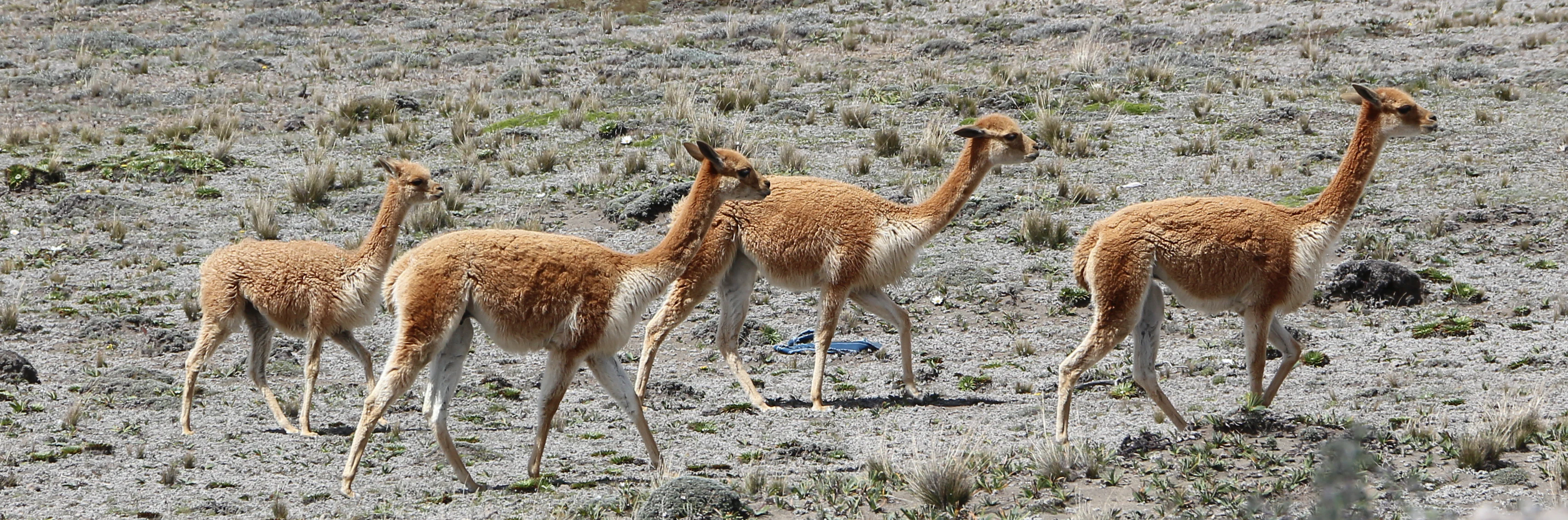
A group of four slender, light-brown vicuñas walking across a dry, rocky paramo landscape.
A small group of vicuñas traversing the arid high-altitude landscape of the Chimborazo Fauna Production Reserve.

Chimborazo Fauna Production Reserve conservation status and protection priorities

Conservation in the Chimborazo Fauna Production Reserve centers on protecting páramo ecosystems and the hydrological services they provide while supporting the recovery of South American camelids. The reserve's category as a fauna production reserve acknowledges that its purpose is not only ecological but also productive, aiming to manage wildlife populations and rural land use together rather than treating conservation and local livelihoods as opposites.

The reintroduction of vicuñas is the reserve's most prominent conservation achievement, returning a wild camelid species to Ecuador for the first time in modern memory and turning the area into a regional reference for Andean camelid recovery. Beyond that, the reserve plays a quietly critical role in watershed conservation. Glacial melt and páramo wetlands from Chimborazo and Carihuairazo feed major river systems that supply rural communities across Bolívar, Chimborazo, and Tungurahua, including the Las Abras irrigation canal anchored on the Mocha River. Because its vegetation cover depends on community land management, the reserve's conservation effectiveness is closely tied to how grazing, fire, and subsistence farming are handled in collaboration with local organizations.

Climate-related pressures on the reserve, including the gradual retreat of the Chimborazo glacier linked to broader climate patterns, give the conservation stakes an additional urgency. Reduced glacial extent will alter downstream water availability, making the protection of páramo vegetation and soils an increasingly important buffer for the surrounding human populations.

Chimborazo Fauna Production Reserve cultural meaning and human context

Although the reserve is defined by its ecological role, its cultural dimension is central to how it actually operates on the ground. The vast majority of its territory is held collectively by around 38 peasant organizations, communities, cooperatives, and associations, many of which have long histories of páramo land use for grazing, fuelwood collection, and subsistence agriculture. Crops such as potatoes, broad beans, barley, melloco, and oca remain part of the local economy in the lower elevations.

Traditional land use includes limited sheep grazing on communal páramo areas and the keeping of guinea pigs and cattle on small artificially established plots near settlements. The reintroduction of vicuñas is itself a cultural act as much as a biological one: the repatriation of camelids from Chile, Peru, and Bolivia reconnected Andean communities with an animal that has deep symbolic and historical resonance across the highland cultures of South America.

The reserve also sits within a region rich in heritage, near indigenous communities and historical sites such as the San Juan parish and Inca-era features like Cuartel Inca and Yanarumi. Archaeological traces and traditional highland settlements place the reserve in a wider Andean cultural landscape shaped by centuries of mountain-adapted human life.
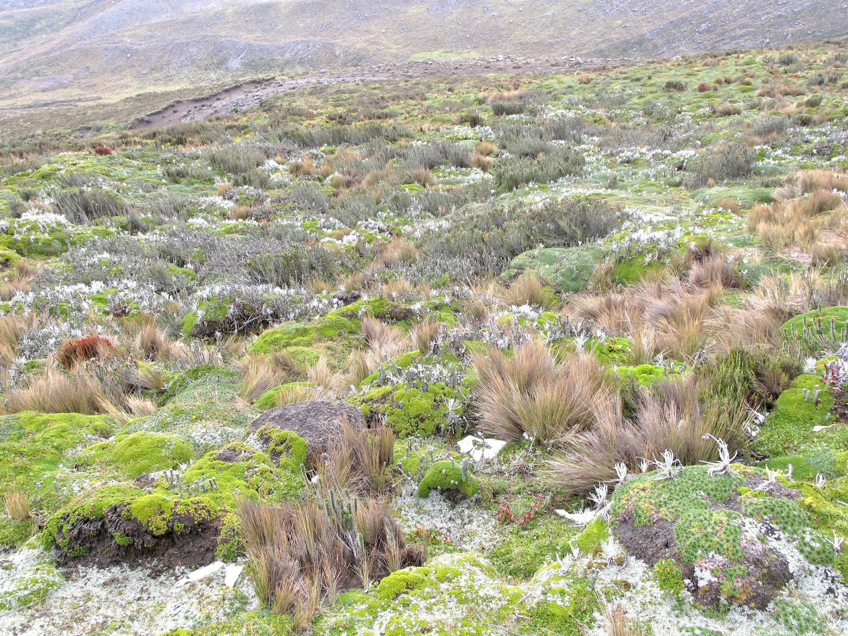
A wide view of the rugged, grassy, and mossy mountain landscape of the high Andes, featuring patches of tough bunchgrass and low-lying vegetation typical of the paramo ecosystem.
High-altitude paramo vegetation on the slopes of Mount Carihuairazo.

Top sights and standout views in Chimborazo Fauna Production Reserve

The reserve's strongest highlights cluster around three pillars: Mount Chimborazo and Carihuairazo as defining volcanic landmarks; the páramo ecosystems that range from wet grasslands to the unique dry páramo of El Arenal; and the reintroduced vicuña herds that anchor one of Ecuador's most important wild camelid programs.

The reserve's hydrological importance is itself a standout feature, since its glaciers and páramos feed major rivers on both sides of the Andean divide, ultimately reaching both the Pacific and the Amazon basin. For visitors and researchers alike, highlights include the high-altitude birdlife, the glacial scenery of Chimborazo, the diverse páramo vegetation formations, and the working cultural landscape of communal high-Andean land use.
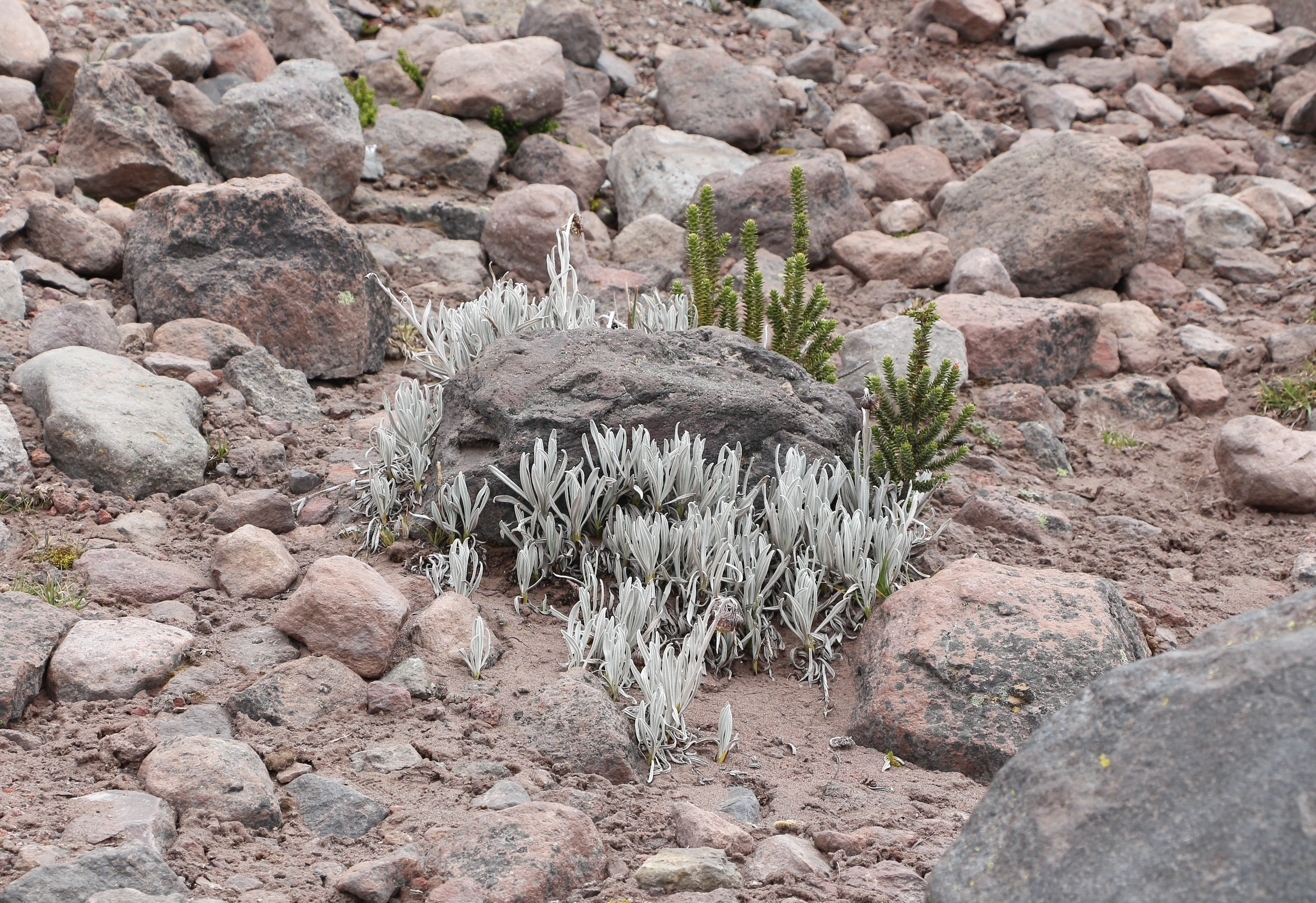
A close up view of low lying plants with silvery foliage and small green needle like shrubs growing in rocky Andean terrain.
High altitude paramo vegetation, including Culcitium and Chuquiraga, growing among rocky terrain in the Chimborazo Fauna Production Reserve.

Best time to visit Chimborazo Fauna Production Reserve

Given its high-elevation setting, the reserve is best experienced during the drier and clearer months of the central Ecuadorian Andes, generally corresponding to the regional dry season. Conditions during this period tend to offer clearer views of Chimborazo's glaciated summit and easier access to páramo trails, while wetter periods increase rainfall, mist, and snow or frost at the highest elevations.

Temperatures across the reserve remain cool year-round, typically ranging from near freezing at the highest zones to single-digit or low double-digit Celsius values lower down. Visitors should expect strong Andean weather variability regardless of season, with rapid changes between sunshine, wind, rain, and even snow at altitude. For wildlife viewing, especially of vicuñas and high-Andean birds, the calmer conditions of the dry season generally make observation easier, though páramo wildlife can be encountered throughout much of the year.
Monthly climate preview

Long term monthly temperature and precipitation data for representative park coordinates

Reserva de Producción de Fauna Chimborazo Climate Normals and Temperature Rhythms

Recorded measurements across the coordinates outline a steady annual temperature cycle alongside shifting monthly precipitation rates. Detailed analysis of these multi year climate normals provides complete insight into temperature ranges and precipitation patterns across twelve months.
Annual mean11 °C
10 °C11 °C
Jan11°
Feb11°
Mar11°
Apr11°
May11°
Jun10°
Jul10°
Aug10°
Sep11°
Oct11°
Nov11°
Dec11°
Warmest month
April

11.5 °C

Coolest month
July

9.9 °C

Wettest month
April

5.7 mm/day

Driest month
August

2.4 mm/day

Park location guide

Geography guide, regional context, and park location map for Chimborazo Fauna Production Reserve

Chimborazo Fauna Production Reserve park geography, regions, and map view in Ecuador

Understand where Chimborazo Fauna Production Reserve sits in Ecuador through a broader geographic reading of the surrounding landscape, nearby location context, and its mapped position within the national park landscape.

How Chimborazo Fauna Production Reserve fits into Ecuador

Ecuador is a presidential republic located in northwestern South America, with Quito as its capital and Guayaquil as its largest city. The country spans 283,561 km² and encompasses the Galápagos Islands, a volcanic archipelago famous for unique wildlife that helped shape Darwin's theory of evolution. Ecuador is a plurinational state with Spanish as the official language, though Kichwa and Shuar are recognized for indigenous peoples.

Wider geography shaping Chimborazo Fauna Production Reserve in Ecuador

Ecuador is located in northwestern South America along the Pacific coast. It shares borders with Colombia to the north and Peru to the east and south. The country includes the Galápagos Islands, a volcanic archipelago in the Pacific Ocean approximately 1,000 km west of the mainland. The territory encompasses diverse terrain including the Amazon rainforest in the east, the Andean highlands in the center, and coastal plains along the Pacific.

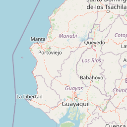
Map view of Chimborazo Fauna Production Reserve

Use this park location map to pinpoint Chimborazo Fauna Production Reserve in Ecuador, understand its exact geographic position, and read its mapped placement within the surrounding landscape more clearly.

Pigeon | © OpenStreetMap contributors

Location context for Chimborazo Fauna Production Reserve

Chimborazo
Recorded earthquake history

View the Historical Earthquake Catalogue for Reserva de Producción de Fauna Chimborazo

Examine the recorded seismic history associated with the vicinity of the Reserva de Producción de Fauna Chimborazo. This structured database provides verified event details to support a comprehensive geographic overview of the region's seismic record. Discover patterns in documented activity through MoriAtlas mapping.

Reserva de Producción de Fauna Chimborazo Earthquake History

Catalogued events

38 events

Strongest magnitude

Magnitude 6

Most recent event

Jan 3, 2026

This history includes earthquakes recorded inside the park or within 50 km of its borders

Visualizing volcanic terrain, glacial valleys, and páramo habitats across Ecuador

Reserva de Producción de Fauna Chimborazo Photos and High Altitude Landscapes

Photographic collections reveal the rugged topography, glaciated volcanic peaks, and expansive high-altitude grasslands defining the protected perimeter. Visual inspection of these conservation zones helps observers understand regional habitat variations and watershed geography without traveling on-site.

A wide view of the snow-covered, multi-peaked Chimborazo volcano towering over a vast, dry grass-covered valley in the Andes.

A wooden sign with text in Spanish and English reading Bienvenidos / Welcome, Reserva de Produccion de Fauna Chimborazo, mounted on a stone wall exterior.

A vicuna stands on a rocky, sparse terrain against a cloudy sky.

A deep rocky canyon with steep walls cuts through rolling, grass covered hills, with small structures visible on the distant horizon under a cloudy sky.

A group of four slender, light-brown vicuñas walking across a dry, rocky paramo landscape.

A snowy mountain peak with a rocky, high-altitude landscape in the foreground, including a small pond that reflects the mountain.

A wide view of the rugged, grassy, and mossy mountain landscape of the high Andes, featuring patches of tough bunchgrass and low-lying vegetation typical of the paramo ecosystem.

A close up view of low lying plants with silvery foliage and small green needle like shrubs growing in rocky Andean terrain.

Park atlas

Compare high altitude reserves, volcanic landscapes, and connected Andean wildlife habitats.

Parks Near Reserva de Producción de Fauna Chimborazo and Surrounding Andean Protected Areas

Browse protected areas and high altitude nature reserves located near Reserva de Producción de Fauna Chimborazo in the central Andes. Comparing adjacent highland terrain reveals broader regional patterns in glacial hydrology, native páramo grasslands, and volcanic geography.
Watercolor illustration showing a mountain landscape with a snow-capped peak, a lake, and green hills.
National parkEcuador
26 km away#1 closest

Southeast

Sangay National Park: Ecuador's National Park for Mapped Landscape and Geographic Discovery

Explore Ecuador's protected area boundaries and regional terrain.

Sangay National Park serves as a crucial protected landscape within Ecuador, offering rich opportunities for atlas and geography exploration. This page details the park's specific mapped boundaries and its natural terrain, providing essential context for understanding its place within South America's broader geographic tapestry. Investigate Sangay National Park's identity as a protected national park and its value for focused landscape and regional discovery.

Area
5,177.65 km²
Established
1979
IUCN
II
National parkEcuador
28 km away#2 closest

Northeast

Llanganates National Park: Detailed Atlas Entry for Ecuador's Protected Landscape

Explore the mapped geography and regional context of this Ecuadorian national park.

Llanganates National Park is a designated national park offering rich opportunities for geographic and landscape exploration. As a significant protected area in Ecuador, it provides crucial context for understanding the country's natural terrain and the distribution of its conservation landscapes. This entry is designed to facilitate an atlas-style discovery of the park's location, boundaries, and its role within the broader geography of the region.

Area
2,197.07 km²
Established
1996
IUCN
II
Relief
Mountain
A wide watercolor illustration showing a misty landscape with green trees in the midground and faint mountain peaks in the background.
Nature reserveEcuador
30 km away#3 closest

North

Reserva Ecológica Los Illinizas: Geographic Atlas and Andean Protected Nature Reserve

Volcanic terrain and cloud forest ecosystems in central Ecuador

Spanning across the provinces of Cotopaxi, Pichincha, and Santo Domingo de los Tsáchilas, Reserva Ecológica Los Illinizas preserves a significant vertical gradient of Andean ecosystems. The reserve protects the western flanks of the Illiniza volcanoes, Quilotoa, and El Corazón, offering a detailed look at high-altitude biodiversity and the transition from rugged mountain peaks to lush western cloud forests.

Area
1,342.33 km²
Established
1996
IUCN
Ia
Relief
Mountain
Wildlife reserveLos Rios
About 46 km away#4 closest

West

Refugio de Vida Silvestre Samama Mumbes: Foothill Forest and Protected Area Map

Mapping the western Andean slopes and Chocó forest fragments

Refugio de Vida Silvestre Samama Mumbes protects one of the final remnants of the Chocó Ecuatorial forest in the Ecuadorian Andes. This reserve encompasses steep, dissected ridges and vital river catchments, supporting endemic orchids, birds, and amphibians within a highly modified regional landscape. Gain deeper insight into its forest boundaries and watershed contribution.

Area
21.456 km²
Established
2016
IUCN
IV
Relief
Mountain
National parkCotopaxi Province
69 km away#5 closest

Northeast

Cotopaxi National Park: Ecuador's Mapped Protected Landscape and Regional Geography

Explore the geographic context of this national park.

Cotopaxi National Park represents a key protected landscape within Ecuador, located in Cotopaxi Province. This page facilitates detailed exploration of the park's mapped boundaries and its contribution to the regional geography. Understand the specific characteristics of this national park as part of a broader atlas of protected areas and natural terrains.

Area
333.93 km²
Established
1975
IUCN
II
Relief
Mountain
Biosphere reserveNapo
About 89 km away#6 closest

Northeast

Reserva Biológica Colonso-Chalupas: Protected Landscapes of the Upper Napo Basin

A critical vertical corridor of the Ecuadorian Andes and Amazon.

Reserva Biológica Colonso-Chalupas represents a unique bioclimatic transition, stretching nearly 4,000 meters in elevation. This biosphere reserve serves as a functional corridor connecting high-altitude páramo and cloud forests to warm, humid Amazonian lowlands, forming a key structural element of the eastern Andean conservation landscape.

Area
931.63 km²
Established
2014
Relief
Mountain
Climate
Alpine
Watercolor illustration of a winding path through a green landscape with snow capped mountains in the distance against a pink sky.
National parkNapo
93 km away#7 closest

Northeast

Parque nacional Antisana: Volcanic Terrain and Andean Protected Area Geography

High-altitude ecosystems spanning Napo and the Andean corridor

Spanning the rugged Cordillera Real, Parque nacional Antisana protects a vast sweep of volcanic terrain dominated by its central stratovolcano. From glacial fields to the water-retention capacity of its páramo wetlands, the area represents a crucial node in Ecuador's conservation network, providing a sanctuary for Andean condors and diverse montane species.

Area
1,205.81 km²
Established
1993
IUCN
Ia
Relief
Mountain
A pale, minimalist watercolor painting showing a wide, grassy field leading to distant, low mountain hills under a bright, light sky.
Wildlife reservePichincha
About 101 km away#8 closest

North

Refugio de Vida Silvestre Pasochoa: Volcanic Crater and Andean Forest Protected Area

Geographic atlas of the Pichincha volcanic highlands

Located in the Pichincha province, Refugio de Vida Silvestre Pasochoa protects an essential highland habitat defined by its steep volcanic crater walls and dense bamboo stands. This area provides a scientific reference for inter-Andean vegetation, featuring a sharp contrast between forested inner slopes and surrounding agricultural landscapes. Map the ecological gradient of this protected refuge and explore its role within the broader northern Andean geographic context.

Area
9.799 km²
Established
1996
IUCN
Ib
Relief
Mountain

Common questions about visiting, size, designation, and location context for Chimborazo Fauna Production Reserve

Chimborazo Fauna Production Reserve FAQs for park facts, access, geography, and protected area context

Find quick answers about Chimborazo Fauna Production Reserve, including protected-area facts, park geography, trail and visitor context, and how the park fits into its surrounding country and regional landscape.
MoriAtlas Explorer

Continue Your Protected Areas Search Across the Global Atlas

Deepen your exploration by continuing the structured search for national parks and protected areas worldwide. Utilize the comprehensive filtering capabilities to compare different conservation landscapes and refine your understanding of global park geography. Discover more about the distribution and characteristics of protected natural areas.

Global natural geography