
Mori Atlas logo
Marine protected areaChumash Heritage National Marine Sanctuary

A significant marine protected area defined by indigenous heritage and Pacific ecosystems

Chumash Heritage National Marine Sanctuary: Mapped Boundaries and Coastal Geography of California

The Chumash Heritage National Marine Sanctuary encompasses a vast stretch of the Pacific Ocean off the Central Coast of California, spanning from San Luis Obispo to the Gaviota Coast. This protected maritime zone preserves ecologically dynamic habitats, including submarine canyons, kelp forests, and deep sea coral gardens. By mapping these underwater features and submerged paleoshorelines, this record highlights the sanctuary's role as a major transition zone for marine life and a repository of centuries of maritime history.

marine sanctuarykelp forestcoastal cliffspacific oceanindigenous heritageseabirds
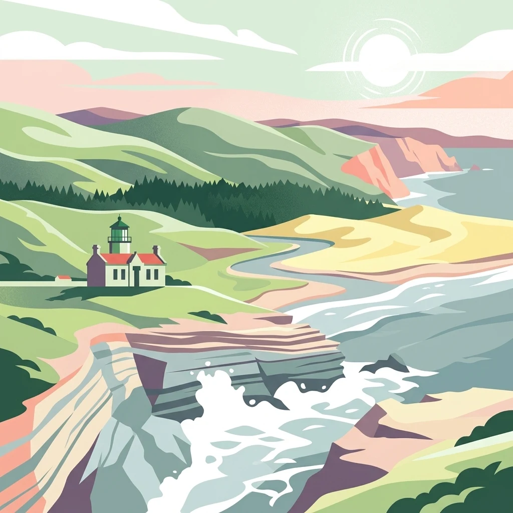
A stylized digital illustration of a white coastal lighthouse with a red roof, situated on a grassy cliff overlooking a crashing surf, with rolling green hills and a sandy beach in the background.

Chumash Heritage National Marine Sanctuary

Marine protected area

Park overview

Structured park overview, official facts, and landscape profile for Chumash Heritage National Marine Sanctuary

Chumash Heritage National Marine Sanctuary park facts, protected area profile, and essential visitor context

Review the core facts for Chumash Heritage National Marine Sanctuary, including designation, size, terrain, visitor scale, habitats, and operating context in one park-focused overview.

About Chumash Heritage National Marine Sanctuary

The Chumash Heritage National Marine Sanctuary protects a 116-mile stretch of California coastline and an expansive ocean area reaching nearly 60 miles offshore, with waters descending to depths greater than 11,000 feet. Its territory runs along the Central Coast from south of the Diablo Canyon Power Plant in San Luis Obispo County southward to Naples Reef on the Gaviota Coast in Santa Barbara County, facing coastal communities including Avila Beach, Pismo Beach, Grover Beach, and Goleta, with Santa Barbara just south of the sanctuary boundary.

Oceanographically, the sanctuary sits at one of the most important transition points along the western seaboard of North America. The convergence of cold northern waters with warmer southern currents, combined with wind-driven upwelling from the California Current, creates unusually productive ecosystems throughout the region. Submarine features such as Arguello Canyon, Rodriguez Seamount, and the Santa Lucia Bank add structural complexity to the seafloor, supporting deep-water coral gardens and ecologically rich habitats that range from sandy beaches and coastal wetlands in shallow zones to cold, dark depths offshore.

On shore, the sanctuary encompasses coastal dunes, estuaries, rocky intertidal zones, and one of the most celebrated kelp forest systems in North America. The kelp forests along Point Conception, including those near Cojo Anchorage, are particularly iconic. The sanctuary is bordered by the Monterey Bay National Marine Sanctuary to the north and the Channel Islands National Marine Sanctuary to the south, placing it at a pivotal stretch of the West Coast's network of federally protected marine areas. Its establishment adds an Indigenous-led cultural and ecological dimension to a coastal conservation landscape that has historically been defined by research-and-resource management driven from outside the region.

Protection and recognition

Examine the official marine protection scope and 2024 designation history for this conserved sanctuary.

Chumash Heritage National Marine Sanctuary Protection Status and Designation Records

Chumash Heritage National Marine Sanctuary maintains a documented marine protection scope established in the year 2024. Review structured records detailing the official protected area designation history and management framework.

Protection details

Protection scope
Marine
Designated year
2024
Transboundary protection
No
Park context

Deeper park guide and search-rich context for Chumash Heritage National Marine Sanctuary

Chumash Heritage National Marine Sanctuary history, landscape, wildlife, and travel context

Explore Chumash Heritage National Marine Sanctuary through its history, landscape character, ecosystems, wildlife, conservation priorities, cultural context, and seasonal travel timing in a structured park guide built for atlas discovery and search intent.

Why Chumash Heritage National Marine Sanctuary stands out

The sanctuary is best known for being the first U.S. national marine sanctuary proposed by an Indigenous tribe, the Northern Chumash Tribal Council. It is also recognized for the meeting of warm and cold ocean currents along the Central California coast, which fuels exceptional biological productivity in waters that include kelp forests, deep-water coral gardens, rocky reefs, coastal dunes, and wetlands. Submerged paleoshorelines within its boundaries preserve traces of human settlement dating back at least 10,000 years, while its seabed holds more than 200 shipwrecks spanning Spanish, Mexican, and American eras.
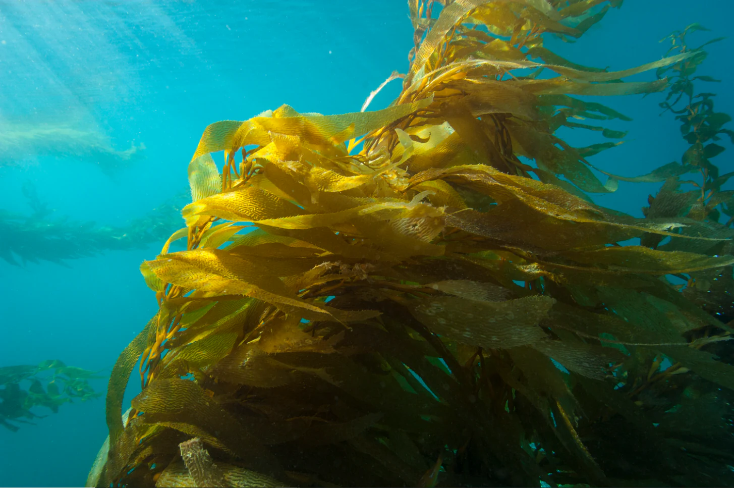
Underwater view of giant kelp fronds swaying in the Pacific Ocean, illuminated by dappled sunlight filtering from the surface.
A view of the vibrant kelp forest at Cojo Anchorage, near Point Conception.

Chumash Heritage National Marine Sanctuary history and protected-area timeline

Efforts to protect the coastal and ocean waters off Central California began in the 1980s through representatives of the Chumash people. By the mid-2010s, a broader coalition of Indigenous peoples, tribal governments, community leaders, businesses, state and local officials, and members of the U.S. Congress had joined the effort. In July 2015, the Northern Chumash Tribal Council submitted a formal sanctuary nomination on behalf of a wide consortium of stakeholders, marking the first time an Indigenous tribe in the United States had nominated a national marine sanctuary for designation.

NOAA's Office of National Marine Sanctuaries issued a notice of intent to begin the designation process in November 2021, proposing an area of roughly 7,600 square miles and a shoreline extending 156 miles. Following an 83-day public scoping period, NOAA released its official proposal on August 25, 2023, calling for protection of 5,617 square miles. After receiving 110,000 public comments, the proposed boundaries were reduced to 4,543 square miles to avoid conflict with planned offshore wind energy infrastructure, with NOAA indicating that future expansion would be considered once final transmission cable routes were determined.

The final environmental impact statement was released on September 6, 2024. After a 30-day waiting period required by the National Environmental Policy Act, NOAA published the final rule, final management plan, and record of decision on October 11, 2024, formally designating the sanctuary. The sanctuary is now managed by NOAA's Office of National Marine Sanctuaries under a co-stewardship framework in which the Santa Ynez Band of Chumash Mission Indians plays a central role.

Chumash Heritage National Marine Sanctuary landscape and geographic character

The sanctuary's coastline traces one of the most scenically varied portions of the California coast, combining long sandy beaches, rocky headlands, sheltered coves, and broad dune systems. Point Conception and the adjacent Gaviota Coast mark the southern end of the protected area and are widely regarded as a transitional landmark between the colder northern Pacific and the warmer southern California ocean environment. Coastal features such as Government Point and Cape Cojo Anchorage illustrate the rugged, wind-swept character of the shoreline.

Offshore, the seafloor topography is equally dramatic. The sanctuary stretches nearly 60 miles from the coast and reaches depths exceeding 11,000 feet. Submarine canyons, including Arguello Canyon, cut deeply into the continental shelf, while offshore features such as Rodriguez Seamount and the Santa Lucia Bank rise from the deeper ocean. These geological structures shape the way ocean currents flow through the region and create the conditions that make the area so ecologically productive. Estuaries such as the Santa Maria River estuary add fresher-water transitions to the coastal landscape and provide important habitat interfaces between land and sea.
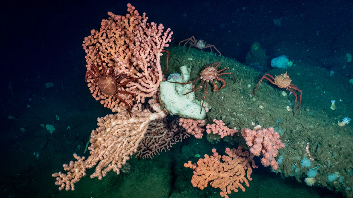
A cluster of pink bubblegum coral attached to a rocky reef on the ocean floor, with several small crabs crawling on the coral and adjacent rock, set against a dark background.
Deep-sea bubblegum coral and associated crabs on the Santa Lucia Bank floor.

Chumash Heritage National Marine Sanctuary ecosystems, habitats, and plant life

The ecosystems within the sanctuary reflect the unusual productivity created by the meeting of distinct ocean climate zones. Nearshore kelp forests are among the most extensive along the U.S. West Coast, and they form the backbone of the sanctuary's shallow-water ecology. These forests provide shelter and hunting grounds for fish, marine invertebrates, and marine mammals while also buffering coastlines and supporting nutrient cycling. Rocky reefs interspersed among the kelp add additional structural complexity and biodiversity.

Deeper in the sanctuary, cold-water coral gardens thrive on the rocky outcrops and seamounts of features such as the Santa Lucia Bank. Coastal wetlands and estuaries line portions of the shore and serve as nursery grounds for numerous fish species while also providing stopover habitat for migratory birds. Sandy beaches, coastal dunes, and intertidal zones complete the habitat mosaic, supporting seabird nesting, sea turtle foraging, and the seasonal movements of marine mammals along one of the most biologically rich stretches of the Pacific Coast.
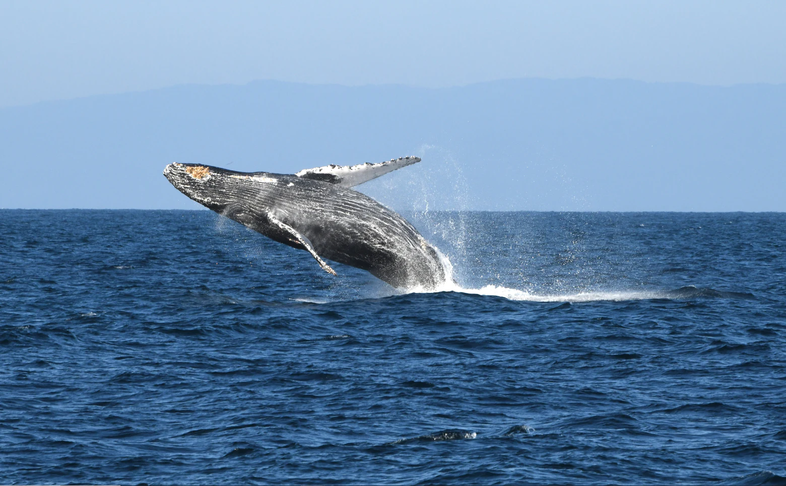
A humpback whale leaping out of the dark blue ocean water, creating a splash with its body against a clear horizon.
A humpback whale breaching in the Pacific Ocean off the Central Coast of California.

Chumash Heritage National Marine Sanctuary wildlife and species highlights

The sanctuary's waters support an exceptionally diverse range of marine and coastal species, including more than 400 species of fish, four species of sea turtle, six species of pinniped, and 33 species of cetacean. Among the most charismatic inhabitants are blue whales, humpback whales, sea otters, and harbor seals, which use the productive waters as feeding and breeding habitat. The sanctuary is also home to populations of black abalone, a threatened species, along with other invertebrates that depend on the rocky reef and kelp forest systems.

Coastal wildlife is similarly rich. The shoreline and estuaries, including the Santa Maria River estuary, host numerous seabirds and shorebirds, such as the threatened snowy plover, which nests on sandy beaches. Leatherback sea turtles, which are endangered, occasionally forage in the sanctuary's waters, drawn by the availability of prey species that thrive where warm and cold currents converge. Together, the variety of wildlife found here reflects the sanctuary's position at a major ecological crossroads of the eastern Pacific.
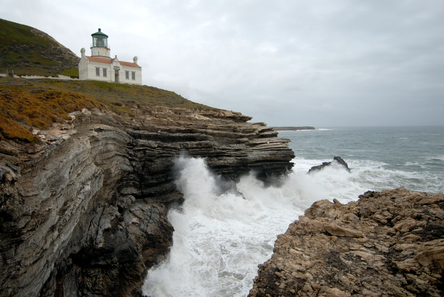
A white lighthouse stands on a rugged cliff overlooking a rocky coastline where ocean waves crash against the shore under an overcast sky.
Point Conception Lighthouse perched on the coastal bluffs, overlooking the Pacific Ocean.

Chumash Heritage National Marine Sanctuary conservation status and protection priorities

The sanctuary's conservation significance lies in its protection of a biodiversity hotspot situated at the meeting point of two major marine climate zones. By preserving kelp forests, rocky reefs, deep coral gardens, coastal dunes, and wetland nurseries within a single management framework, the sanctuary safeguards ecological processes that sustain fisheries, seabird populations, and populations of threatened and endangered species. Its establishment is also notable for advancing a model of Indigenous-led conservation, in which the Santa Ynez Band of Chumash Mission Indians serves as co-steward alongside NOAA.

This collaborative stewardship framework is designed to integrate Indigenous knowledge, cultural priorities, and ecological expertise into sanctuary management. The sanctuary also reflects national and state-level commitments to balancing conservation with renewable energy development; in shaping the final boundaries, NOAA carved out areas associated with offshore wind energy infrastructure while protecting the most ecologically and culturally significant waters. The sanctuary thus stands as both an ecological refuge and a working example of how conservation objectives can be negotiated alongside other coastal policy interests.

Chumash Heritage National Marine Sanctuary cultural meaning and human context

The coast and ocean within the sanctuary are foundational to the identity and heritage of the Chumash people and the Salinan people to the north. Coastal Indigenous communities have lived along this stretch of California for at least 10,000 years, relying on the rich marine resources of the nearshore environment. As sea levels rose at the end of the Last Glacial Period, ancient settlements and shorelines were submerged, and these paleoshorelines now lie beneath sanctuary waters.

The sanctuary's boundaries preserve the context for those ancestral places, including submerged village locations and landscapes of cultural memory. Landmarks such as Point Conception hold deep spiritual significance to the Chumash people, who view such coastal promontories as points of cultural and cosmological importance. The co-stewardship role granted to the Santa Ynez Band of Chumash Mission Indians reflects an explicit effort to recognize these cultural ties in the formal governance of the sanctuary, making it the first U.S. national marine sanctuary in which Indigenous heritage is integrated as a primary management priority.
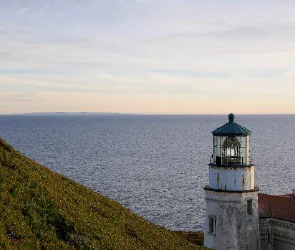
A white lighthouse standing on a grassy coastal bluff next to the open Pacific Ocean at twilight.
The historic Point Conception Lighthouse overlooking the Pacific Ocean.
Monthly climate preview

Measured annual temperature progression and monthly precipitation patterns from representative coordinates

Chumash Heritage National Marine Sanctuary Climate Normals and Weather by Month

Representative coordinate records show sustained thermal ranges and distinct monthly precipitation shifts across the protected marine area. Opening the complete climate profile reveals full twelve-month temperature averages and detailed precipitation distributions.
Annual mean14 °C
13 °C16 °C
Jan13°
Feb13°
Mar13°
Apr13°
May13°
Jun14°
Jul15°
Aug16°
Sep16°
Oct16°
Nov15°
Dec14°
Warmest month
September

16.2 °C

Coolest month
April

12.8 °C

Wettest month
February

3.3 mm/day

Driest month
August

0.1 mm/day

Park location guide

Geography guide, regional context, and park location map for Chumash Heritage National Marine Sanctuary

Chumash Heritage National Marine Sanctuary park geography, regions, and map view in United States of America

Understand where Chumash Heritage National Marine Sanctuary sits in United States of America through a broader geographic reading of the surrounding landscape, nearby location context, and its mapped position within the national park landscape.

How Chumash Heritage National Marine Sanctuary fits into United States of America

The United States of America is a federal presidential republic and one of the world's largest countries by area and population. It consists of 50 states across a vast territory spanning multiple time zones, with its capital in Washington, D.C. and largest city in New York City. The nation has a diverse economy, influential political system, and significant cultural and military presence globally.

Wider geography shaping Chumash Heritage National Marine Sanctuary in United States of America

The United States occupies a vast territory in North America, bordered by Canada to the north and Mexico to the south. The 48 contiguous states stretch from the Atlantic to the Pacific Ocean, while Alaska occupies the northwestern region and Hawaii is an archipelago in the Pacific. The country encompasses diverse terrain including the Rocky Mountains, Appalachian Mountains, Great Plains, and extensive river systems.

Map view of Chumash Heritage National Marine Sanctuary

Use this park location map to pinpoint Chumash Heritage National Marine Sanctuary in United States of America, understand its exact geographic position, and read its mapped placement within the surrounding landscape more clearly.

Pigeon | © OpenStreetMap contributors

Location context for Chumash Heritage National Marine Sanctuary

California
Recorded earthquake history

Review Recorded Seismic Activity near Chumash Heritage National Marine Sanctuary

Examine the history of recorded seismic events associated with the Chumash Heritage National Marine Sanctuary. This catalogue provides organized data on past earthquakes, supporting a deeper understanding of the regional seismic context within this protected marine area and its surrounding Pacific waters.

Chumash Heritage National Marine Sanctuary Earthquakes

Catalogued events

427 events

Strongest magnitude

Magnitude 5.1

Most recent event

Dec 12, 2025

This history includes earthquakes recorded inside the park or within 50 km of its borders

Visualizing ocean habitats, rocky headlands, and protected marine terrain

Chumash Heritage National Marine Sanctuary Photos and Coastal Scenery

Photographs capture the diverse coastal landscapes, kelp forests, and offshore marine environments protected within the sanctuary. Visual records reveal the rugged shorelines, submarine canyons, and dynamic ocean habitats that define this protected area.

Underwater view of giant kelp fronds swaying in the Pacific Ocean, illuminated by dappled sunlight filtering from the surface.

A sea otter floats on its back in calm water, surrounded by floating kelp fronds.

A cluster of pink bubblegum coral attached to a rocky reef on the ocean floor, with several small crabs crawling on the coral and adjacent rock, set against a dark background.

A humpback whale leaping out of the dark blue ocean water, creating a splash with its body against a clear horizon.

A white lighthouse stands on a rugged cliff overlooking a rocky coastline where ocean waves crash against the shore under an overcast sky.

An aerial view of the California coastline showing the prominent point of Point Conception curving into the Pacific Ocean, backed by the rolling terrain of the Santa Ynez Mountains.

A white lighthouse standing on a grassy coastal bluff next to the open Pacific Ocean at twilight.

A wide angle view of a narrow river estuary winding through sandy dunes and marshy vegetation under an overcast sky.

Underwater view showing two fish swimming among dark, weathered ship wreckage covered in marine growth in a kelp forest setting.

A wide view of the California coast featuring breaking ocean waves in the foreground, a rocky shoreline, and a distant headland under a clear blue sky.

The dark, wide fluke of a humpback whale emerging from choppy, dark blue ocean water, with water droplets streaming from its trailing edge.

Aerial view looking down at a rocky coastline with a dirt road winding across the headland into the Pacific Ocean.

Park atlas

Compare regional marine reserves, coastal ecosystems, and adjacent protected landscapes.

Explore Protected Areas and Parks Near Chumash Heritage National Marine Sanctuary

Browse other parks and protected areas situated along the dynamic Central Coast of California to compare regional marine and coastal habitats. Expanding the geographic scope reveals connected conservation landscapes and similar coastal environments beyond the sanctuary boundaries.
Marine protected areaCalifornia
Park boundaries overlap#1 closest

Southeast

Channel Islands National Marine Sanctuary Marine Protected Area Map and Atlas

Southern California marine habitat and island topography

Channel Islands National Marine Sanctuary protects 1,470 square miles of diverse marine environment near the California coast. This sanctuary guards vital kelp forests and deep seafloor ecosystems while preserving deep water archaeological sites and the biological legacy of the Northern Channel Islands.

Area
3,807 km²
Established
1980
IUCN
V
Relief
Lowland
Watercolor painting of a mountain landscape with forested foothills and a valley in the foreground.
Protected landscapeCalifornia
2.3 km away#2 closest

East

Los Padres National Forest: Geography and Protected Landscape Map of Central California

Extensive wilderness corridors and high mountain ridges

Spanning from the Big Sur coastline to the interior ranges of the Santa Lucia and San Rafael mountains, Los Padres National Forest represents a significant protected area in California. The region contains deep gorges, forest-covered canyons, and high-altitude pine ridges that provide essential habitat and support major river headwaters.

Area
7,700 km²
Established
1936
Relief
Mountain
Climate
Mediterranean
National parkCalifornia
17 km away#3 closest

East

Channel Islands National Park: A Protected Landscape within California's Geography

Explore its unique mapped terrain and protected area context.

Channel Islands National Park stands as a key protected area, providing critical insight into California's unique geographic features and natural landscapes. This entry focuses on the park's identity as a protected entity, detailing its mapped boundaries and the surrounding regional geography. It offers an atlas-level view, essential for understanding the park's contribution to the broader landscape context of the United States and its conservation importance.

Area
1,009.94 km²
Established
1980
IUCN
II
Visitors
323.2K annual
Wildlife reserveSan Luis Obispo County
27 km away#4 closest

Northeast

Garcia Wilderness: Mapped Boundaries and Geographic Identity in San Luis Obispo County

Studying the Santa Lucia Range ridge and forest ecosystems

Located in San Luis Obispo County, Garcia Wilderness encompasses 14,100 acres of protected coastal mountains. Its topography features a prominent east-west ridge system that dictates local drainage patterns and vegetative shifts, ranging from lower-slope chaparral to dense oak forests. This area represents a vital segment of the federal conservation efforts established to protect the central California landscape.

Area
57 km²
Established
1992
IUCN
Ib
Relief
Mountain
A soft watercolor painting of a shoreline with gentle green hills and pale purple water against a white background.
Marine protected areaCalifornia
48 km away#5 closest

Northwest

Monterey Bay National Marine Sanctuary: California Marine Protected Area and Coastal Atlas

Mapping deep submarine canyons and expansive Pacific coastal ecosystems.

Monterey Bay National Marine Sanctuary represents one of the most biologically significant marine protected areas in the United States. Spanning 276 miles of California shoreline, the sanctuary encompasses varied aquatic terrain including towering kelp forests, rocky reefs, and the massive Monterey Submarine Canyon. This protected marine landscape serves as a crucial region for oceanic research and environmental conservation.

Area
15,780 km²
Established
1992
Relief
Mixed relief
Climate
Mediterranean
Watercolor painting of a mountain range with a winding stream, small trees, and grassy foreground on a white background.
Wildlife reserveCalifornia
About 82 km away#6 closest

East

Matilija Wilderness: A High Elevation Protected Landscape in the Santa Ynez Mountains

Rugged canyon geography and critical California condor habitat

Spanning from deep canyon bottoms to the high rocky ridges of Monte Arido, Matilija Wilderness represents a significant protected unit within California. The area encompasses a dense network of riparian habitats along Matilija Creek, forming a vital ecological corridor for wildlife and preserving the rugged terrain of the southern Santa Ynez Mountains.

Area
118.2 km²
Established
1992
IUCN
Ib
Relief
Mountain
A watercolor illustration of rolling green hills, a small shoreline, and patches of grass against a white background.
Protected landscapeCalifornia
83 km away#7 closest

East

Santa Monica Mountains National Recreation Area: Protected Landscape and Regional Geography

Exploring the ecological and cultural tapestry of Southern California's coastal mountains.

Santa Monica Mountains National Recreation Area comprises a complex array of parks and preserves that protect the unique Mediterranean climate of Southern California. The terrain showcases rugged ridgelines, deeply carved canyons, and vital coastal habitats. As a significant urban protected area, it offers an essential look at how biodiversity, human history, and regional geography coexist within one of the most populated zones in the United States.

Area
638 km²
Established
1978
IUCN
V
Visitors
795.2K annual
A soft, painterly watercolor illustration depicting layered green mountain ridges and rolling foothills under a bright, open sky.
Protected landscapeCalifornia
105 km away#8 closest

East

Angeles National Forest: Mapped Protected Landscapes and Geographic Terrain in California

Mountain wilderness and Mediterranean watershed geography

Spanning the San Gabriel and Sierra Pelona ranges, Angeles National Forest serves as a dramatic ecological transition zone. This analysis of its protected landscape focuses on the interaction between steep canyons, high peaks, and the distinct chaparral and conifer zones that shape California geography.

Area
2,652.26 km²
Established
1908
Relief
Mountain
Climate
Mediterranean

Common questions about visiting, size, designation, and location context for Chumash Heritage National Marine Sanctuary

Chumash Heritage National Marine Sanctuary FAQs for park facts, access, geography, and protected area context

Find quick answers about Chumash Heritage National Marine Sanctuary, including protected-area facts, park geography, trail and visitor context, and how the park fits into its surrounding country and regional landscape.
MoriAtlas Explorer

Continue Your Protected Areas Search Across the Global Atlas

Deepen your exploration by continuing the structured search for national parks and protected areas worldwide. Utilize the comprehensive filtering capabilities to compare different conservation landscapes and refine your understanding of global park geography. Discover more about the distribution and characteristics of protected natural areas.

Global natural geography