
Mori Atlas logo
Protected areaCimarron National Grassland

Examining the expansive shortgrass prairie and riparian corridors defining this unique Great Plains protected area

Cimarron National Grassland: An In-Depth Geographic Analysis of Kansas Protected Landscapes

Cimarron National Grassland represents the largest expanse of public land in Kansas, offering a critical look at the geography of the Great Plains. Stretching across more than 100,000 acres, this protected area preserves a complex mosaic of sand sagebrush, cottonwood-lined river bottoms, and native shortgrass prairie. The terrain features gentle bluffs and the historic Cimarron River valley, where ongoing ecological management supports wildlife populations and maintains the integrity of this semi-arid prairie landscape.

national grasslandshortgrass prairieGreat Plainssand sagebrushprairie wildlifeSanta Fe Trail
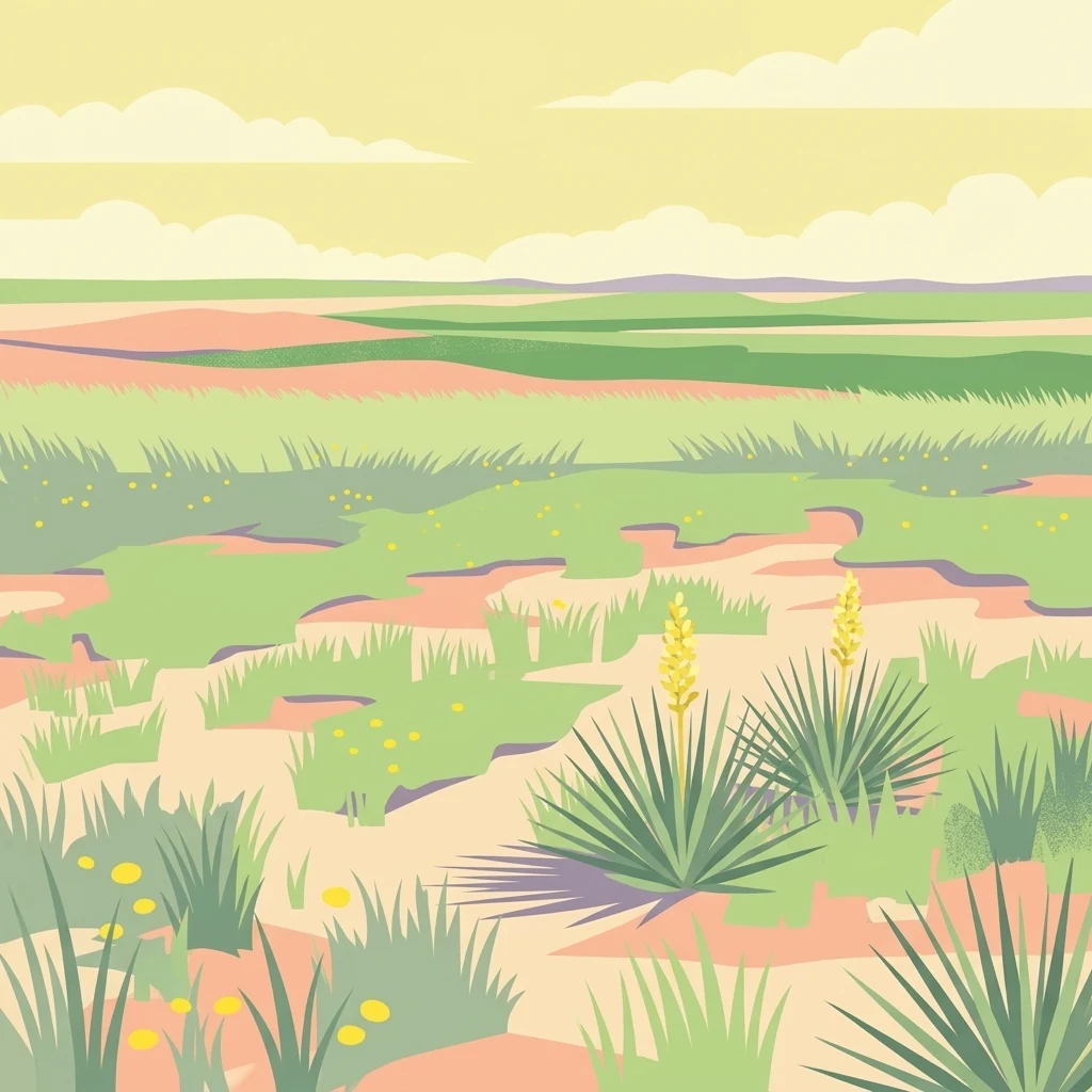
A flat-style digital illustration of a prairie landscape with clumps of spiky yucca plants, grasses, and low hills under a soft-colored sky.

Cimarron National Grassland

Protected area

Park overview

Structured park overview, official facts, and landscape profile for Cimarron National Grassland

Cimarron National Grassland park facts, protected area profile, and essential visitor context

Review the core facts for Cimarron National Grassland, including designation, size, terrain, visitor scale, habitats, and operating context in one park-focused overview.

About Cimarron National Grassland

Cimarron National Grassland occupies a distinctive position among American protected grasslands. It is part of the National Grassland system administered by the U.S. Forest Service, but stands out for being the only National Grassland in Kansas and for hosting an unusually layered intersection of prairie ecology, western expansion history, and modern working-land management. Its setting in the far southwestern corner of the state places it near the Oklahoma panhandle and the Colorado border, where it continues ecologically into Comanche National Grassland across the state line.

The terrain is shaped by the Cimarron River, which cuts a shallow, often-dry valley through the grassland. Most of the surface is gently sloping plain, but bluffs rise roughly 100 feet above the river, and notable features such as Point of Rocks provide elevated viewpoints and historically reliable springs. Sandy soils support a mosaic of shortgrass prairie and sand sagebrush, while cottonwoods and other trees cluster along the riverbanks and around perennial springs such as Middle Spring.

The grassland serves multiple designated purposes: water conservation, wildlife management, recreation, cattle grazing, and mineral production. This working-land character sets it apart from purely wilderness-oriented reserves, and reflects its origin as land assembled from Dust Bowl-era farm failures and restored to native cover. Today it combines habitat preservation, public recreation opportunities such as hiking, horseback riding, hunting, fishing, and a self-guided car tour with continuing grazing and oil and gas activity.

Quick facts and research context for Cimarron National Grassland

Cimarron National Grassland covers approximately 108,175 acres of Great Plains habitat in Morton County, Kansas, making it the largest block of public land in the state. It is managed by the U.S. Forest Service from shared headquarters with Pike and San Isabel National Forests and the Comanche National Grassland in Pueblo, Colorado, with local ranger district offices in Elkhart, Kansas.

Elevations across the grassland range from roughly 3,100 to 3,700 feet, with Point of Rocks rising to about 3,540 feet above the Cimarron River valley. The climate is semi-arid, receiving around 18 inches of precipitation per year, with hot summers, cold winters, and persistent high winds that once contributed to severe Dust Bowl-era erosion. The grassland protects both a 23-mile segment of the Santa Fe National Historic Trail and habitat for lesser prairie chickens, pronghorn, elk, deer, and a variety of native prairie species.

Protection and recognition

Explore documented terrestrial protection scope and administrative recognition records

Cimarron National Grassland Protection Status and Terrestrial Area Designation Facts

Cimarron National Grassland maintains a documented terrestrial protection scope within the national protected area registry. Official records detail the established conservation framework and administrative designation history without international recognition overlays.

Protection details

Protection scope
Terrestrial
Transboundary protection
No
Park context

Deeper park guide and search-rich context for Cimarron National Grassland

Cimarron National Grassland history, landscape, wildlife, and travel context

Explore Cimarron National Grassland through its history, landscape character, ecosystems, wildlife, conservation priorities, cultural context, and seasonal travel timing in a structured park guide built for atlas discovery and search intent.

Why Cimarron National Grassland stands out

Cimarron National Grassland is best known for being the largest expanse of public land in Kansas and for protecting a vivid remnant of shortgrass prairie in an otherwise heavily cultivated region of the Great Plains. Its combination of native sand sagebrush grasslands, bluffs above the Cimarron River valley, and cottonwood-lined riparian corridors gives it an unusually varied character within the surrounding agricultural landscape. The grassland is also recognized for preserving a major stretch of the Santa Fe Trail, including the ruts of the Cimarron Cutoff where wagon trains once crossed the plains. Wildlife viewing, especially for the rare lesser prairie chicken and the reintroduced elk herd, draws visitors interested in species that have largely vanished from the rest of the central plains.
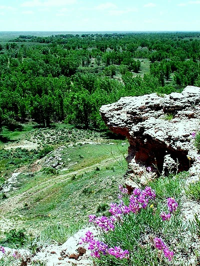
A high vantage point looking down from a rocky outcrop at Point of Rocks, with vibrant purple wildflowers in the immediate foreground and a dense green forest and open plains stretching to the horizon.
A scenic view from Point of Rocks looking out over the plains and cottonwood groves of Cimarron National Grassland.

Cimarron National Grassland history and protected-area timeline

The lands that make up Cimarron National Grassland were originally territory of the Comanche and allied Indigenous peoples. In 1822, William Becknell became the first person to traverse the Santa Fe Trail by wagon, pioneering the alternate route known as the Cimarron Cutoff, which passed directly through what is now the grassland. Middle Spring, located on or near the present-day grassland, was one of only three reliable sources of good water along more than 150 miles of the Cutoff, making it a critical waypoint for westward travelers. In or near the area, the mountain man Jedediah Smith was killed by Comanches in 1831, lending the landscape a weighty place in the history of the American frontier.

Settlement arrived in 1879 when the Beaty Brothers established Point of Rocks Ranch, the first in the area. Wheat farming soon followed, and during wet years farmers prospered, but the prolonged drought of the 1930s turned the region into ground zero for the Dust Bowl. Morton County became the most devastated county in the entire United States, and the federal government began purchasing land from bankrupt farmers with the aim of restoring the original prairie. In 1960, the Cimarron National Grassland was formally created from this restored landscape.

More recently, a substantial wildfire known as the Tunner Fire burned through about half of the park and surrounding private prairie in May 2011, along with the campground. Rains in the spring of 2012 allowed the land to green up again, and many sections were reopened to the public. The grassland continues to operate as a working landscape where restoration, grazing, and active management remain central to its identity.

Cimarron National Grassland landscape and geographic character

Cimarron National Grassland sits within the broader Great Plains physiographic region, where its terrain is mostly flat to gently undulating, with a general west-to-east slope shaped by the course of the Cimarron River. Elevations across the protected area range from roughly 3,100 to 3,700 feet, with the prominent Point of Rocks outcrop reaching about 3,540 feet and standing roughly 100 feet above the surrounding river valley.

The river itself defines much of the visual character of the grassland. The Cimarron is typically dry above ground from late summer through winter, yet it sustains surprisingly lush vegetation along its banks. Where perennial water sources persist, such as at Middle Spring, beaver dams create small pools and riparian thickets. Bluffs and isolated escarpments along the valley create small but striking relief in an otherwise horizontal landscape, and the combination of open plain, sage-dominated uplands, and wooded bottomlands gives the grassland a layered scenic character.

Sandy soils dominate much of the surface, supporting sand sagebrush and shortgrass species that are well adapted to wind and drought. High winds are a constant presence, and the semi-arid climate, with roughly 18 inches of annual precipitation falling mostly in summer, reinforces an open, sun-exposed character that reads clearly as classic plains country.

Cimarron National Grassland ecosystems, habitats, and plant life

Ecologically, Cimarron National Grassland is a textbook example of southwestern Great Plains shortgrass prairie. Sand sagebrush is widespread in the salty, sandy soils, mixed with typical shortgrass species adapted to the region's low rainfall and persistent winds. The vegetation reflects centuries of adaptation to a semi-arid climate where moisture, soil texture, and grazing pressure interact to shape plant communities.

The riparian zones along the Cimarron River and around perennial springs form small but ecologically important pockets of woodland in an otherwise open landscape. Cottonwoods and other trees cluster along these watercourses, providing habitat structure, shade, and nesting resources that contrast sharply with the surrounding plains. Middle Spring supports year-round flow and beaver-influenced pools, making it a particularly valuable ecological node within the grassland.

As a whole, the grassland preserves a significant fragment of prairie habitat in a region where most of the surrounding land has been converted to cropland. This makes it ecologically disproportionate to its size, offering a refuge for plant communities and animal species that depend on unbroken or restored native cover in the central plains.

Cimarron National Grassland wildlife and species highlights

The grassland supports a varied community of Great Plains wildlife, ranging from grassland birds to large mammals. The most conservation-significant species is the lesser prairie chicken, a rare bird whose males perform elaborate courting rituals from mid-March through early June at two designated viewing areas on the grassland. The presence of a stable population here is significant given the species' broader decline across its range.

Elk were reintroduced to Cimarron National Grassland in 1981, and a managed herd of around 50 animals has been maintained since. Under special permit, hunting is sometimes used to help control herd size. Other hunted species include whitetail deer, pronghorn, quail, common pheasant, prairie dog, and jack rabbit, reflecting the mix of grassland, brush, and riparian habitats that the protected area sustains.

Even where water is scarce, the riverbanks and spring areas support beaver and a variety of smaller wildlife, while the surrounding prairie serves as habitat for typical shortgrass species. Fishing ponds, including several at the Cimarron Recreation Area, are stocked seasonally with rainbow trout in winter and channel catfish in summer, and also support crappie, sunfish, and largemouth bass, adding an aquatic dimension to the grassland's wildlife profile.

Cimarron National Grassland conservation status and protection priorities

Cimarron National Grassland is conserved primarily for water conservation, wildlife management, recreation, cattle grazing, and mineral production, a combination that situates it within the working-landscape tradition of the National Grassland system. Its origin story is itself a conservation narrative: the land was acquired by the federal government from Dust Bowl-era bankrupt farmers and then restored to native prairie cover, making the grassland a textbook example of large-scale 20th-century soil and habitat restoration.

The protected area matters disproportionately because it is the largest tract of public land in Kansas, surrounded by a region where almost all of the original prairie has been converted to agriculture. By preserving sand sagebrush grasslands, shortgrass prairie, and cottonwood riparian corridors along the Cimarron River, the grassland maintains ecological functions and habitat connectivity that have largely disappeared from the surrounding landscape. The reintroduction of elk in 1981 and the ongoing stewardship of lesser prairie chicken habitat are concrete examples of active conservation management rather than passive protection.

Fires, such as the substantial Tunner Fire in May 2011, have shaped the grassland and tested its resilience. Recovery in the spring of 2012 demonstrated the capacity of the restored prairie to regenerate, underscoring the importance of the grassland as a resilient native ecosystem in a drought- and wind-prone region.

Cimarron National Grassland cultural meaning and human context

The grassland is deeply layered with cultural and historical significance tied to westward expansion across the Great Plains. Before Euro-American settlement, the land belonged to the Comanche and allied Indigenous peoples, and the area saw violent encounters between these groups and Euro-American explorers, including the 1831 killing of the mountain man Jedediah Smith by Comanches in or near the present-day grassland.

The Santa Fe Trail and its Cimarron Cutoff variant, first traversed by wagon in 1822 by William Becknell, passed directly through the grassland, making the landscape a tangible artifact of 19th-century overland commerce and migration. Wagon ruts from these historic routes remain visible in places, and a 23-mile segment of the Santa Fe National Historic Trail is preserved within the protected area. The 1879 establishment of Point of Rocks Ranch by the Beaty Brothers marked the beginning of sustained Euro-American ranching in the area, and ranching culture continues as part of the grassland's working identity today.

Top sights and standout views in Cimarron National Grassland

Cimarron National Grassland is the single largest block of public land in Kansas, anchoring a landscape where shortgrass prairie, sand sagebrush, and riparian cottonwood groves coexist along the Cimarron River. Its roughly 108,175 acres preserve an unusual breadth of native habitat in a region where most of the surrounding plains have been converted to farmland.

The grassland combines three distinct kinds of value in one place: ecological, as a refuge for lesser prairie chickens, reintroduced elk, pronghorn, and other prairie wildlife; historical, as a landscape crossed by William Becknell, Jedediah Smith, and generations of Santa Fe Trail travelers; and recreational, with a self-guided car tour, hiking and horseback trails, hunting, fishing ponds, and a campground at the Cimarron Recreation Area.

Best time to visit Cimarron National Grassland

The character of a visit to Cimarron National Grassland shifts notably with the seasons, given the region's semi-arid climate and dramatic temperature swings. Spring is one of the most rewarding periods for wildlife viewing because male lesser prairie chickens perform their striking courtship displays from mid-March through early June at two designated viewing areas, and the landscape greens up after winter and early rains. Cooler temperatures also make spring a comfortable time for hiking the Santa Fe, Companion, and Turkey Trails or exploring the car tour route.

Summer brings hot conditions, with July daytime highs averaging around 93 degrees Fahrenheit, though summer is also when most of the year's precipitation falls, greasing the prairie and supporting the broadest range of active wildlife. Winter is cold but visually distinctive, with sparse vegetation, big skies, and stocked rainbow trout fishing at the recreation ponds, while the summer catfish stockings are available in warmer months. High winds are a near-constant companion year-round and shape the open, expansive feel of the landscape in every season.
Monthly climate preview

Long-term temperature and precipitation records measured across representative coordinate points

Cimarron National Grassland Climate and Monthly Temperature Normals

Cimarron National Grassland records long-term monthly temperature averages spanning sub-zero winter minimums to warm summer maximums alongside measured precipitation rates. Reviewing the complete twelve-month climate profile provides detailed context on annual environmental patterns across this protected landscape.
Annual mean14 °C
2 °C28 °C
Jan
Feb
Mar
Apr13°
May19°
Jun25°
Jul28°
Aug26°
Sep21°
Oct14°
Nov
Dec
Warmest month
July

27.5 °C

Coolest month
January

1.7 °C

Wettest month
June

2.4 mm/day

Driest month
January

0.4 mm/day

Park location guide

Geography guide, regional context, and park location map for Cimarron National Grassland

Cimarron National Grassland park geography, regions, and map view in United States of America

Understand where Cimarron National Grassland sits in United States of America through a broader geographic reading of the surrounding landscape, nearby location context, and its mapped position within the national park landscape.

How Cimarron National Grassland fits into United States of America

The United States of America is a federal presidential republic and one of the world's largest countries by area and population. It consists of 50 states across a vast territory spanning multiple time zones, with its capital in Washington, D.C. and largest city in New York City. The nation has a diverse economy, influential political system, and significant cultural and military presence globally.

Wider geography shaping Cimarron National Grassland in United States of America

The United States occupies a vast territory in North America, bordered by Canada to the north and Mexico to the south. The 48 contiguous states stretch from the Atlantic to the Pacific Ocean, while Alaska occupies the northwestern region and Hawaii is an archipelago in the Pacific. The country encompasses diverse terrain including the Rocky Mountains, Appalachian Mountains, Great Plains, and extensive river systems.

Map view of Cimarron National Grassland

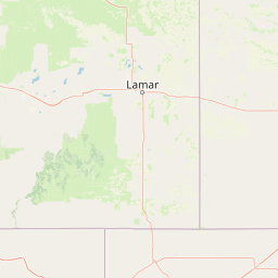
Use this park location map to pinpoint Cimarron National Grassland in United States of America, understand its exact geographic position, and read its mapped placement within the surrounding landscape more clearly.

Pigeon | © OpenStreetMap contributors

Location context for Cimarron National Grassland

Kansas

Visualizing the shortgrass prairie terrain, river bluffs, and cottonwood riparian habitats of Kansas

Cimarron National Grassland Photos, Scenery, and Protected Prairie Landscapes

Photographic collections reveal the expansive Great Plains terrain, sand sagebrush uplands, and river valley contours that define the protected landscape. Visual documentation provides deep insight into the native plant communities, river corridors, and open topography characteristic of the public land expanse.

A high vantage point looking down from a rocky outcrop at Point of Rocks, with vibrant purple wildflowers in the immediate foreground and a dense green forest and open plains stretching to the horizon.

A wide view of a flat prairie landscape with sparse patches of grass, sandy ground, and yucca plants under a blue sky with light clouds.

Park atlas

Compare regional Great Plains reserves and connected conservation areas

Explore Parks Near Cimarron National Grassland and Surrounding Protected Landscapes

Discover other parks near Cimarron National Grassland to examine shared shortgrass prairie ecosystems across the surrounding plains. Expanding into adjacent protected areas provides valuable geographic context for regional wildlife habitats and grassland conservation.
A wide watercolor painting showing a green grassy plain with distant hills and a row of purple circular shapes in the foreground.
Protected areaColorado
24 km away#1 closest

West

Comanche National Grassland: Geographic Atlas of Southeastern Colorado Protected Plains

Exploring canyon systems and prairie landscape boundaries

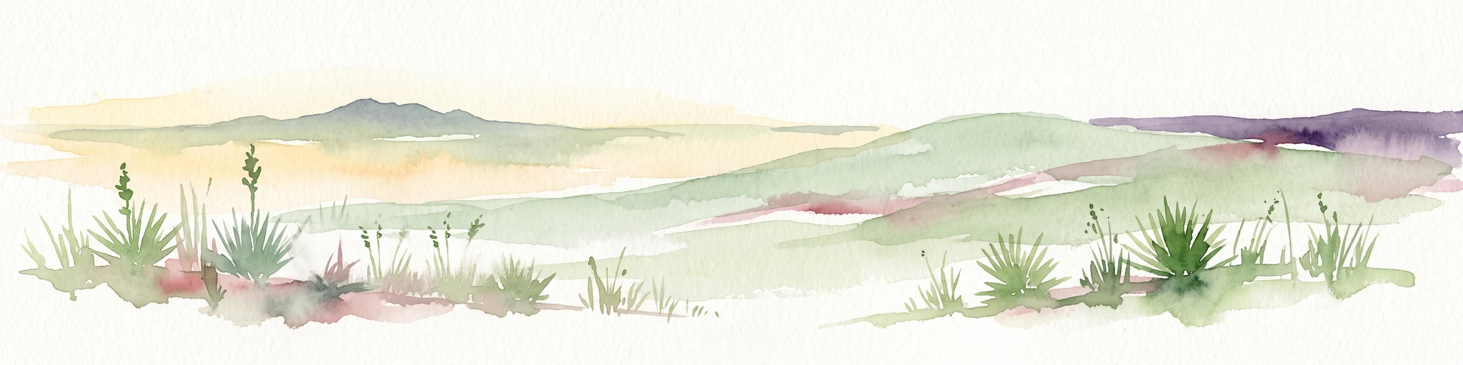
Spanning across Baca, Otero, and Las Animas counties, Comanche National Grassland represents a distinctive protected landscape of shortgrass prairie and deep canyon networks. The region is marked by the dramatic Purgatoire River and Carrizo Creek systems, offering a rich study in semi-arid topography, riparian corridors, and fossil-rich geological formations within the Colorado plains.

Area
1,793.09 km²
Established
1960
Relief
Upland
Climate
Temperate
A horizontal watercolor painting showing a soft, stylized view of open, rolling grassland under a hazy sky, with yucca-like plants in the foreground.
Wildlife reserveTexas
61 km away#2 closest

Southwest

Rita Blanca National Grassland: Protected Shortgrass Prairie Geography and Map

Mapping the mosaic of federal lands in the Texas Panhandle

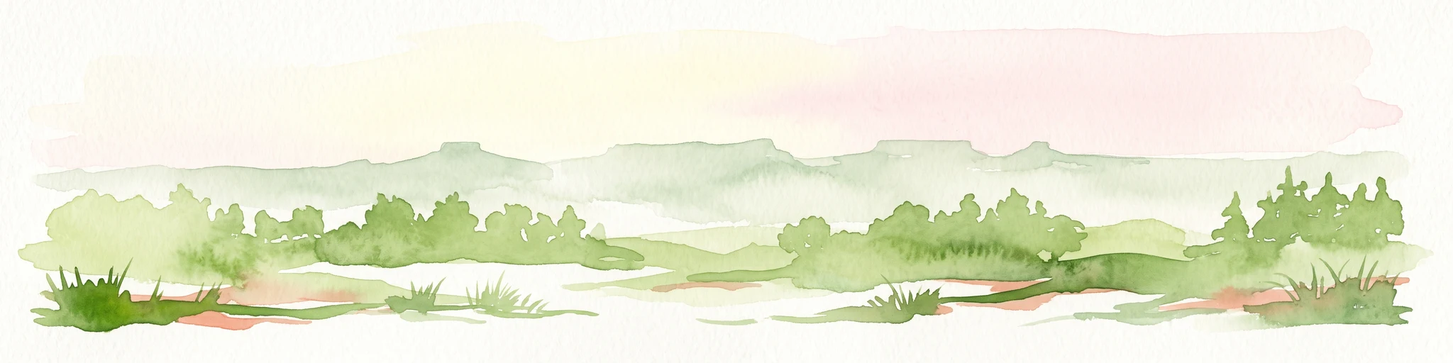
Rita Blanca National Grassland offers a detailed look at restored shortgrass prairie ecosystems within the southern Great Plains. The area consists of intermixed federal and private land parcels that define the regional geography of the Texas and Oklahoma borderlands. This protected landscape provides habitat for pronghorn, prairie dogs, and raptors across a semi-arid, gently sloping terrain.

Area
376.31 km²
Established
1960
Relief
Upland
Climate
Arid
A horizontal watercolor illustration of a wide, open prairie landscape featuring soft green hills, sparse shrubs, and grasses against a pale background.
Protected landscapeNew Mexico
94 km away#3 closest

Southwest

Kiowa National Grassland: Protected Landscapes, Canyon Terrain, and Prairie Geography

Northeastern New Mexico shortgrass prairie and river canyon systems.

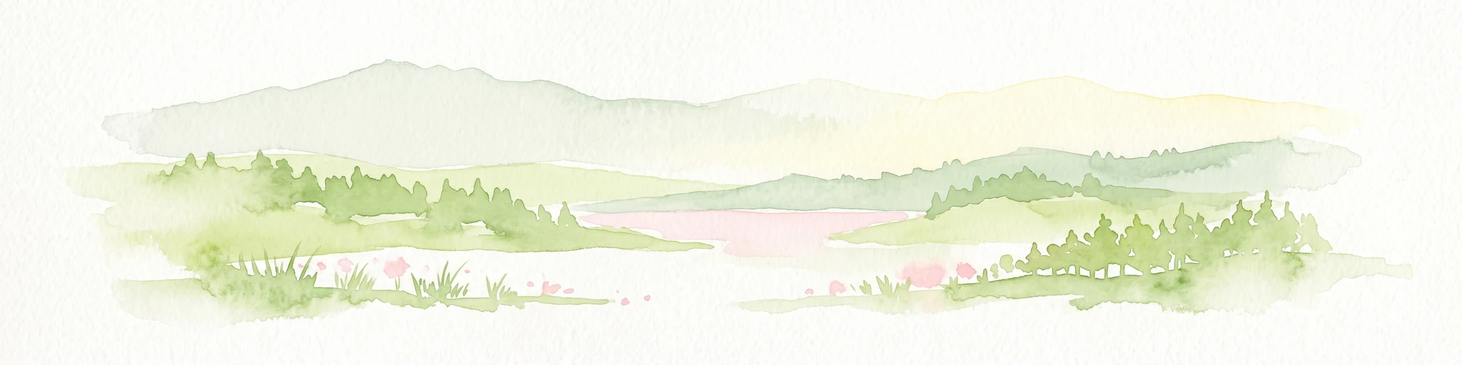
Kiowa National Grassland represents a distinctive protected landscape within the southwestern Great Plains, featuring a mix of rolling steppe, pinyon-juniper woodland, and the deep gorges of the Canadian River Canyon. This area offers significant insight into the regional geography of New Mexico, where historic Santa Fe Trail corridors and seasonal playa lakes define the local terrain and ecosystem.

Area
554.95 km²
Established
1960
Relief
Upland
Climate
Temperate
A watercolor illustration of a landscape with a central lake reflecting soft pink hues, surrounded by green rolling hills and pine forests under a hazy sky.
Protected areaTexas
142 km away#4 closest

South

Lake Meredith National Recreation Area: An Atlas Guide to Texas Panhandle Canyon Landscapes

Geography of the Canadian River reservoir and High Plains terrain

Analyze the topography of Lake Meredith National Recreation Area, where the Canadian River has sculpted deep canyons through the flat Texas High Plains. The site serves as a vital protected area for both water-based recreation and the preservation of arid, canyon-rim habitats near the Alibates Flint Quarries.

Area
182.02 km²
Established
1990
Visitors
1.3M annual
Relief
Upland
A horizontal watercolor painting depicting a soft-toned, misty prairie landscape with rolling green hills, patches of tall grass, and distant hazy ridgelines under a pale sky.
Wildlife reserveUnited States of America
179 km away#5 closest

Southeast

Black Kettle National Grassland: Protected Prairie Geography and Regional Map Context

A restored mixed-grass ecosystem in the southern Great Plains

Spanning scattered parcels in Oklahoma and Texas, Black Kettle National Grassland functions as a representative sample of restored southern plains prairie. The terrain consists of sandy soils, rocky red hills, and leafy draws along the Washita River headwaters. This protected area preserves a complex ecological and historical landscape that defines the character of the southern Great Plains, now managed for habitat restoration and natural resource protection.

Area
126.61 km²
Established
1960
Relief
Upland
Climate
Temperate
Protected landscapeTexas
213 km away#6 closest

South

McClellan Creek National Grassland: Protected Landscape and Texas Geography Atlas

Restored shortgrass prairie and riparian reservoir geography

Located in the Texas Panhandle, McClellan Creek National Grassland serves as a critical example of soil conservation and shortgrass prairie restoration. The protected area features open, rolling plains surrounding the impounded McClellan Lake, providing a focused look at the environmental history and geographic character of the southern Great Plains.

Area
5.86 km²
Water
Minor water
Watercolor painting of a serene mountain landscape featuring rolling hills, coniferous trees, and a lake in the foreground, rendered in light pastel tones.
Protected landscapeColorado
253 km away#7 closest

West

San Isabel National Forest: Geographic Overview and Protected Mountain Landscape Atlas

Central Colorado alpine terrain and designated wilderness areas

Spanning eleven counties in central Colorado, San Isabel National Forest serves as a cornerstone of the Southern Rocky Mountains. The forest landscape is dominated by the Sawatch and Sangre de Cristo ranges, offering a unique atlas of alpine tundra, dense coniferous forests, and high-altitude peaks that define the character of the region. This protected area provides a vital habitat and a vast, rugged environment characterized by volcanic formations like the Spanish Peaks and glacial geological features.

Area
4,533.42 km²
Established
1902
Relief
Mountain
Climate
Alpine
A soft watercolor illustration depicting a simplified, layered landscape of rolling hills and distant mountains in shades of light green, pale yellow, and soft pink.
Protected areaColorado
295 km away#8 closest

Northwest

Pike National Forest: Protected Mountain Landscapes and Regional Geography in Central Colorado

Granite peaks, montane forests, and diverse alpine terrain

Spanning from the rolling foothills of the Front Range to the high alpine summits of the Rocky Mountains, Pike National Forest is a significant protected area defined by its unique Pikes Peak granite bedrock and deep river-carved canyons. This analysis provides a structured look at its expansive wilderness boundaries, drainage basins, and the vertical transitions that characterize this vital central Colorado highland.

Area
4,478.27 km²
Established
1892
Relief
Mountain
Climate
Alpine

Common questions about visiting, size, designation, and location context for Cimarron National Grassland

Cimarron National Grassland FAQs for park facts, access, geography, and protected area context

Find quick answers about Cimarron National Grassland, including protected-area facts, park geography, trail and visitor context, and how the park fits into its surrounding country and regional landscape.
MoriAtlas Explorer

Continue Your Protected Areas Search Across the Global Atlas

Deepen your exploration by continuing the structured search for national parks and protected areas worldwide. Utilize the comprehensive filtering capabilities to compare different conservation landscapes and refine your understanding of global park geography. Discover more about the distribution and characteristics of protected natural areas.

Global natural geography