Mori Atlas logo
Natural monumentClements Gap Conservation Park

Discover the unique intersection of native bushland and historic township remnants near the Barunga Range.

Clements Gap Conservation Park: Exploring the Geography and Heritage of a South Australian Natural Monument

Located in the Mid North region of South Australia, Clements Gap Conservation Park serves as a critical refuge for native vegetation within a predominantly agricultural landscape. This protected natural monument spans nearly 8 square kilometres, offering a distinct blend of bushland habitat and the physical foundations of a 19th-century rural settlement. By situating the park near the Barunga Range and the upper Spencer Gulf, the landscape context reveals its role as a transitional corridor between inland farming plains and the coast.

conservation parkMid North South Australianative bushlandrural landscapehistoric townshipBarunga Range

Clements Gap Conservation Park

Natural monument

Park overview

Structured park overview, official facts, and landscape profile for Clements Gap Conservation Park

Clements Gap Conservation Park park facts, protected area profile, and essential visitor context

Review the core facts for Clements Gap Conservation Park, including designation, size, terrain, visitor scale, habitats, and operating context in one park-focused overview.

About Clements Gap Conservation Park

Clements Gap Conservation Park sits in the agricultural Mid North of South Australia, a region characterised by rolling farmland, scattered low ranges, and proximity to the upper Spencer Gulf. The park itself is a relatively compact reserve, covering just under 8 square kilometres, but it plays an important local role because much of the surrounding landscape has been converted to broad-acre farming. Within this context, the park functions as a refuge for native bushland that retains the character of the region's pre-European vegetation cover.

The reserve lies close to the Barunga Range and takes its name from a pass through that range used historically to cross between the inland farming lands and the coastal plain of the Spencer Gulf. The locality of Clements Gap takes its name from this pass, which local historical research suggests was associated with a shepherd active in the area before 1880. The pass itself remains a defining geographical feature of the district, shaping both settlement patterns and the road network in the area.

What distinguishes Clements Gap from many other small South Australian conservation parks is the presence of the remains of a small historic township within its boundaries. This town once served the surrounding agricultural community, and its surviving built structures provide a physical record of early rural life in the Mid North. The park is therefore not only a natural-area reserve but also a place where the history of European settlement in the region is anchored in the landscape itself.

The park is administered by the South Australian Department for Environment and Water and carries an IUCN Category III designation, which recognises it as a natural monument or feature. While its size is modest, its combination of ecological retention, cultural heritage, and association with a notable regional landscape feature gives it a clear place in the network of protected areas across the Mid North.

Quick facts and research context for Clements Gap Conservation Park

Clements Gap Conservation Park covers approximately 7.9 square kilometres in the Mid North of South Australia, situated about 15 kilometres west of Redhill and 20 kilometres north-east of Port Broughton, at an elevation of around 42 metres above sea level. It lies roughly 12 kilometres east of the Spencer Gulf coast and is associated with a pass through the Barunga Range that gives the locality its name. The land is held and managed as a conservation park by the South Australian Department for Environment and Water, and it is officially classified under IUCN Category III as a natural monument or feature.

Protection and recognition

Documented terrestrial protection scope and 1981 designation records

Clements Gap Conservation Park Protection Status and Designation History

Clements Gap Conservation Park maintains a documented terrestrial protection status established in the year 1981. Structured data brings together verified designation history, management scope, and international recognition details.

Protection details

Protection scope
Terrestrial
Designated year
1981
Transboundary protection
No
Park context

Deeper park guide and search-rich context for Clements Gap Conservation Park

Clements Gap Conservation Park history, landscape, wildlife, and travel context

Explore Clements Gap Conservation Park through its history, landscape character, ecosystems, wildlife, conservation priorities, cultural context, and seasonal travel timing in a structured park guide built for atlas discovery and search intent.

Why Clements Gap Conservation Park stands out

Clements Gap Conservation Park is best known for the unusual pairing of preserved native bushland with the surviving built remnants of the historic Clements Gap township. The park protects an area of natural vegetation in a region that has otherwise been heavily cleared for agriculture, while also retaining physical traces of a small rural settlement that once existed along a livestock route through the Barunga Range. The surrounding pass through the Barunga Range, after which the locality and park are named, is itself a defining feature of the local landscape. Together, the bushland setting, the historic settlement fabric, and the nearby range crossing give the park a character that blends ecological and cultural-heritage value within a relatively small footprint.

Clements Gap Conservation Park history and protected-area timeline

The land that now makes up Clements Gap Conservation Park was originally set aside as a protected area in 1963. In that year, eight land sections in the north-east corner of the Hundred of Mundoora (sections 439 to 442 and 565 to 568) were designated as Mundoora Conservation Park, establishing an early formal recognition of the area's natural values within a landscape that was already largely dominated by agriculture.

In 1981, the reserve was renamed to its present designation, Clements Gap Conservation Park, taking on the name of the surrounding locality and the historic pass through the Barunga Range. This renaming aligned the park's official identity with the broader cultural and geographical character of the area, rather than only with the broader Hundred of Mundoora subdivision. The park's history is also tied to the history of the small Clements Gap township within its boundaries, a former agricultural settlement that once served the surrounding farming community. The surviving built elements of that township remain part of what the park preserves today.

Clements Gap Conservation Park landscape and geographic character

Clements Gap Conservation Park lies within the gently undulating rural landscape of South Australia's Mid North, a region shaped by low ranges, broad farming plains, and proximity to the upper Spencer Gulf coast. The park itself sits at around 42 metres above sea level, placing it within a transitional zone between the inland agricultural country and the more coastal country to the west.

The most prominent landscape feature associated with the park is the Barunga Range, and more specifically the Clements Gap pass through that range. This pass has long served as a route linking inland farming areas with the coastal plain of the Spencer Gulf, and it has shaped the historical settlement pattern of the surrounding district. The range itself adds visual relief to an otherwise subdued rural landscape, creating a natural corridor that frames the park's setting.

Within the park, the landscape is dominated by remnant native bushland on a relatively small footprint of about 7.9 square kilometres. The vegetation occupies land that retains much of its original character relative to the cleared farmland around it. Interspersed within this bushland are the built remnants of the historic Clements Gap township, which provide a distinctly human element within an otherwise natural landscape setting.

Clements Gap Conservation Park ecosystems, habitats, and plant life

The park protects an area of natural bushland in a region where most of the surrounding land has been cleared for cropping and grazing. Within a landscape dominated by open agricultural fields, the park functions as a self-contained pocket of native vegetation, maintaining habitat continuity for the flora and fauna that historically occupied this part of the Mid North.

The vegetation type found within the park is typical of the bushland that once extended across the upper Spencer Gulf hinterland, where low ranges and undulating plains supported a mix of sclerophyllous woodland and shrubland communities. The park's location, both at the edge of the Barunga Range and inland from the Spencer Gulf coast, places it within an ecological transition zone between coastal and inland vegetation influences.

By retaining native vegetation in an otherwise heavily modified rural matrix, the park contributes to broader habitat connectivity in the northern Mid North, even at a relatively modest size. Its protected status as an IUCN Category III natural monument or feature underscores the value of the site's natural character within the regional landscape.

Clements Gap Conservation Park wildlife and species highlights

Because Clements Gap Conservation Park preserves a patch of native bushland within a predominantly agricultural landscape, it provides habitat refuge for the animal species associated with the Mid North's remaining woodland and shrubland environments. The park's vegetation cover offers shelter, foraging resources, and nesting sites for typical South Australian bushland fauna, including small marsupials, reptiles, and a range of woodland bird species.

The park's position, between the inland farming country around Redhill and Port Broughton and the coastal influence of the upper Spencer Gulf, places it within a transition zone that supports species adapted to both inland and coastal-edge habitats. While the park is small in extent, the contrast it creates with surrounding cleared land makes its habitat disproportionately valuable for wildlife in the local context.

Clements Gap Conservation Park conservation status and protection priorities

Clements Gap Conservation Park's conservation significance lies primarily in its role as one of the few remaining areas of natural bushland in a Mid North region that has been substantially cleared for agriculture. The park protects native vegetation on a footprint of roughly 7.9 square kilometres, an area that, while not large, represents a notable ecological refuge within an otherwise managed rural landscape.

The park's IUCN Category III classification, recognising it as a natural monument or feature, formally acknowledges its environmental value at a regional level. Beyond ecological protection, the reserve also serves a conservation-adjacent role by preserving the built remnants of the former Clements Gap township, maintaining a tangible link between the area's natural and cultural heritage under a single protected-area designation managed by the South Australian Department for Environment and Water.

Clements Gap Conservation Park cultural meaning and human context

The cultural dimension of Clements Gap Conservation Park is tied closely to the history of European settlement in the Mid North of South Australia. The park contains the built remains of the small agricultural township of Clements Gap, which once served as a local centre for the surrounding farming community. The preservation of these remnants within a conservation park reflects a broader pattern in South Australia of merging natural-area protection with the retention of small, abandoned settlement sites.

The name Clements Gap itself carries cultural and historical weight. The pass through the Barunga Range, after which the locality is named, is thought to derive its name from a shepherd active in the area prior to 1880, according to research by local historian Rodney Cockburn. This connection to early pastoral activity gives the park's name and identity a distinct link to the early phases of European land use in the region.

Top sights and standout views in Clements Gap Conservation Park

Clements Gap Conservation Park combines two standout qualities within a single small reserve: a pocket of preserved native bushland in an otherwise heavily cleared agricultural region, and the surviving built remnants of the historic Clements Gap township. The park's location near the Barunga Range, and its association with the Clements Gap pass through that range, gives it a clear geographical and historical anchor in the landscape of South Australia's Mid North.

Its IUCN Category III natural-monument status reflects the regional value placed on its features, even at a modest overall size of about 7.9 square kilometres. Together, the bushland habitat, the historic township fabric, and the proximity to the Spencer Gulf coast form a layered identity that distinguishes the park from purely ecological reserves in the region.

Best time to visit Clements Gap Conservation Park

Clements Gap Conservation Park sits in the Mid North of South Australia, a region with a Mediterranean-influenced climate of warm, dry summers and cool, wetter winters. Spring, when temperatures are mild and the bushland vegetation is most active, is generally the most rewarding period for experiencing both the natural and historic character of the park, as native plants are in growth and animal activity tends to increase. Autumn can also offer pleasant conditions and softer light across the rural landscape, while summers tend to be hotter and drier, and winter days are cooler but still generally accessible in this part of South Australia.
Monthly climate preview

Long-term monthly temperature and precipitation data for Clements Gap Conservation Park in South Australia

Clements Gap Conservation Park Climate Normals and Annual Temperature Patterns

Representative coordinate measurements record monthly mean temperatures ranging from 10.5 °C to 25.47 °C alongside consistent precipitation patterns across the year. Reviewing the complete twelve-month climatology profile provides deeper insight into long-term thermal extremes and precipitation variations.
Annual mean18 °C
11 °C25 °C
Jan25°
Feb25°
Mar22°
Apr18°
May14°
Jun11°
Jul11°
Aug11°
Sep14°
Oct17°
Nov20°
Dec23°
Warmest month
January

25.5 °C

Coolest month
July

10.5 °C

Wettest month
June

1.6 mm/day

Driest month
March

0.5 mm/day

Park location guide

Geography guide, regional context, and park location map for Clements Gap Conservation Park

Clements Gap Conservation Park park geography, regions, and map view in Australia

Understand where Clements Gap Conservation Park sits in Australia through a broader geographic reading of the surrounding landscape, nearby location context, and its mapped position within the national park landscape.

How Clements Gap Conservation Park fits into Australia

Australia is a constitutional monarchy and federal parliamentary democracy comprising six states and ten territories. With a population of nearly 28 million, it is one of the world's most urbanised countries, with most people concentrated on the eastern seaboard. The country has a high Human Development Index and is known for its cultural diversity, ancient Aboriginal heritage, and unique wildlife.

Wider geography shaping Clements Gap Conservation Park in Australia

Australia occupies the entire Australian continent, the island of Tasmania, and numerous smaller islands. It is the world's flattest and driest inhabited continent, featuring vast deserts in the interior (the Outback), tropical rainforests along the eastern coast, and a coastline bordering the Indian and Pacific Oceans.

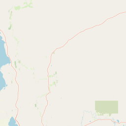
Map view of Clements Gap Conservation Park

Use this park location map to pinpoint Clements Gap Conservation Park in Australia, understand its exact geographic position, and read its mapped placement within the surrounding landscape more clearly.

Pigeon | © OpenStreetMap contributors

Location context for Clements Gap Conservation Park

South Australia
Park atlas

Compare nearby protected landscapes and regional conservation zones across South Australia

Explore Other Parks Near Clements Gap Conservation Park and Surrounding Regional Protected Areas

Browse other parks near Clements Gap Conservation Park to examine related bushland reserves and regional protected landscapes across South Australia. Continuing into adjacent conservation areas reveals broader geographic patterns and environmental context within the surrounding rural district.
National parkSouth Australia
About 50 km away#1 closest

North

Wapma Thura, Southern Flinders Ranges National Park: South Australia's Protected Natural Landscape

Explore mapped boundaries and regional geography.

Wapma Thura, Southern Flinders Ranges National Park offers a distinct protected landscape within South Australia. This page serves as a portal for understanding its geographic setting, its role as a national park, and its place within the state's atlas of natural areas. Examine the mapped terrain and protected boundaries to grasp the park's unique geographic characteristics.

Established
2021
IUCN
II
Relief
Mountain
Scope
Terrestrial
National parkSouth Australia
About 70 km away#2 closest

North

Mount Remarkable National Park: Protected Landscape Atlas and South Australia Geography

Explore mapped boundaries and natural terrain.

Mount Remarkable National Park serves as a vital protected area within South Australia's unique geographic setting. This MoriAtlas entry details the park's mapped boundaries and surrounding natural terrain, providing structured insight into its landscape character and regional geographic importance. Understand the park as a key element of Australia's protected lands atlas.

Area
166.18 km²
Established
1972
IUCN
VI
Visitors
50K annual
A wide watercolor illustration showing a coastal scene with green trees, a pinkish shoreline, and pale blue water against a white background.
State or regional parkSouth Australia
About 71 km away#3 closest

South

Clinton Conservation Park: A Protected Coastal Wetland Reserve in South Australia

Mapping mangrove forests, tidal flats, and estuarine habitats.

Clinton Conservation Park protects a significant coastal corridor at the head of Gulf St Vincent, where mangroves, samphire flats, and low backing dunes create a rare, continuous sequence of undisturbed wetland environments. This park serves as a key nursery for regional aquatic species and a habitat node for migratory bird populations in South Australia.

Area
19.15 km²
Established
1970
IUCN
III
Relief
Lowland
Wildlife reserveSouth Australia
About 74 km away#4 closest

Southwest

Bird Islands Conservation Park: A Protected Coastal Landscape in South Australia

Key wildlife reserve on the Spencer Gulf coastline

Bird Islands Conservation Park represents a vital coastal habitat within South Australia. Covering islands and mainland sections near Wallaroo, the area integrates sand dunes, intertidal flats, and mangrove woodlands. This conservation site provides essential refuge for migratory shorebirds while maintaining a complex link between marine and terrestrial ecosystems on the Yorke Peninsula.

Area
3.69 km²
Established
1968
IUCN
VI
Relief
Lowland
Protected areaSouth Australia
About 96 km away#5 closest

East

Caroona Creek Conservation Park: Geographic Overview and Protected Landscape Analysis

Exploring the transitional terrain and gorge country of South Australia

Caroona Creek Conservation Park sits as a distinctive protected area between the Mid North and the Flinders Ranges. The reserve is defined by its dramatic northern Tourilie Gorge, varied calcrete ridgelines, and riparian habitat along the creek. This location serves as an essential example of the semi-arid environmental transition, offering a focused look at the intersection of rocky geological formations and alluvial drainage plains in South Australia.

Area
54.22 km²
Established
2010
IUCN
VI
Relief
Upland
Protected landscapeSouth Australia
About 100 km away#6 closest

West

Ironstone Hill Conservation Park: Geography and Protected Land Map Overview

An essential protected landscape in the Eyre Peninsula of South Australia.

Ironstone Hill Conservation Park protects fragile sandy dune systems and dense mallee vegetation within an arid zone. This conservation area acts as a vital link in the regional natural network, neighboring both private reserves and active mineral-bearing ranges. The park provides an essential study of semi-arid terrain and rare species habitat in the heart of the Eyre Peninsula.

Area
196.5 km²
Established
2010
IUCN
VI
Relief
Upland
A horizontal watercolor illustration of a coastal landscape with pale pink water, green marshy shorelines, and distant soft blue hills against a white background.
Nature reserveSouth Australia
About 105 km away#7 closest

West

Franklin Harbor Conservation Park: Coastal Nature Reserve and Eyre Peninsula Protected Geography

Coastal conservation park and island habitat system in South Australia

This nature reserve protects rare mangrove and samphire flat associations along the eastern coast of the Eyre Peninsula. The geography encompasses a sheltered peninsula and four islands within the harbor, forming an essential maritime habitat for seabirds and reptiles in the South Australian coastal landscape.

Area
13.56 km²
Established
1976
IUCN
Ia
Relief
Lowland
Nature reserveSouth Australia
About 112 km away#8 closest

Northeast

Black Rock Conservation Park: Protected Woodlands and Regional Geography in South Australia

Mapping ecological boundaries and outwash plain terrain

Black Rock Conservation Park provides a protected glimpse into the mid-north South Australian environment. This 119 hectare nature reserve preserves low woodland and chenopod understorey, serving as a significant bird habitat characterized by steep creek banks and outwash slopes originating from the surrounding rocky high points.

Area
1.19 km²
Established
1972
IUCN
III
Relief
Lowland

Common questions about visiting, size, designation, and location context for Clements Gap Conservation Park

Clements Gap Conservation Park FAQs for park facts, access, geography, and protected area context

Find quick answers about Clements Gap Conservation Park, including protected-area facts, park geography, trail and visitor context, and how the park fits into its surrounding country and regional landscape.
MoriAtlas Explorer

Continue Your Protected Areas Search Across the Global Atlas

Deepen your exploration by continuing the structured search for national parks and protected areas worldwide. Utilize the comprehensive filtering capabilities to compare different conservation landscapes and refine your understanding of global park geography. Discover more about the distribution and characteristics of protected natural areas.

Global natural geography