
Mori Atlas logo
Nature reserveCombe Grède

Investigate the limestone half-cluse and alpine forest mosaic within the Chasseral mountain massif.

Combe Grède Nature Reserve: A Folded Jura Geological Gorge and Protected Mountain Landscape

(Naturschutzgebiet Combe Grède)

Combe Grède serves as a foundational geological site for the Folded Jura of Switzerland, featuring a deep limestone gorge and a complex mosaic of relict conifer stands and dry alpine meadows. Located on the northern slopes of the Chasseral range, this protected area exhibits dramatic cliff faces and high-value habitats for raptors and rare plants. The site offers deep insight into the regional karst topography and the structural evolution of Jura rock sequences.

gorgelimestone landscapejura mountainsjurassic geologyfold and thrusthalf-cluse
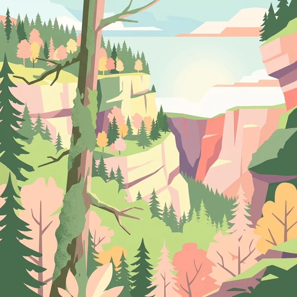
A stylized vector illustration of a steep gorge with towering limestone cliffs, dense evergreen forests, and deciduous trees in autumnal colors.

Combe Grède

Nature reserve

Park overview

Structured park overview, official facts, and landscape profile for Combe Grède

Combe Grède park facts, protected area profile, and essential visitor context

Review the core facts for Combe Grède, including designation, size, terrain, visitor scale, habitats, and operating context in one park-focused overview.

About Combe Grède

Combe Grède is a deep gorge incised into the steep northern flank of the Chasseral range in the Bernese Jura. From the mountain side, the cut begins near the small clearing of Pré aux Auges, around 1270 m above sea level and about two kilometers west of the Chasseral summit, and runs in a northwesterly direction down to the forest area of Les Covets and the Forêt des Loumonts at roughly 810 m above sea level, close to the village of Villeret. In the broader geomorphology of the massif, the gorge corresponds to a weakly developed half-cluse (Halbklus), and its significance is amplified by the fact that erosion has sliced through the saddles of low anticlines that are thrust against the main Chasseral fold from the south.

The Chasseral is a limestone massif with partially karstified strata, where most surface water disappears into dolines; rivers on the open surface are rare, and Le Bez, which drains Combe Grède, is the most important of them. The stream rises in the alpine pastures around the Métairie de Saint-Jean, is fed by karst springs near Pré aux Auges, then tumbles through the wide upper rock amphitheater between cliffs up to two hundred meters high. Lower down, it threads a narrow rocky passage through the Villeret anticline before spreading across a debris cone and pastureland down to Villeret, where it meets the Schüss. Flows in the gorge can dry up during low-rainfall periods and can become destructive during heavy precipitation, when debris flows and rockfall block paths; in winter the cascades freeze in the shade of the rock walls.

The gorge has been recognized for both its geological and ecological value. A section was designated an early geotope and nature reserve because of its importance for plant and animal species, while the broader landscape around it sits within the Parc régional Chasseral and the Chasseral area of national significance listed in the Swiss Federal Inventory of Landscapes and Natural Monuments. The Combe Grède reserve is today one of the key protected sites of the Bernese Jura, integrating geological, botanical, and wildlife values within a single dramatic landscape feature.

Quick facts and research context for Combe Grède

Combe Grède is a north-facing gorge in the Bernese Jura, within the municipality of Villeret in the Vallon de Saint-Imier. It cuts into the Chasseral anticline, exposing Cretaceous limestones down to the Hauptrogenstein formation. The gorge runs from about 1270 m above sea level at Pré aux Auges down to roughly 810 m above sea level at the forest of Les Covets/Forêt des Loumonts near Villeret, and is drained by the wild stream Le Bez.

The upper section of the gorge and surrounding slopes, totaling around 700 hectares of protected land, have been protected since 1932, making Combe Grède the earliest nature and hunting reserve of the Canton of Bern. The reserve has since been expanded, including a 96-hectare strict forest reserve established in 1982, and lies within the Parc régional Chasseral and the BLN Chasseral landscape of national importance.

Protection and recognition

Review the established terrestrial protection scope and 1932 designation timeline.

Combe Grède Protection Status and Documented Designation History

Combe Grède maintains documented terrestrial protection status with an established designation history originating in 1932. Official records outline the formal management scope and conservation framework associated with the protected area.

Protection details

Protection scope
Terrestrial
Designated year
1932
Transboundary protection
No
WDPA ID
31030
Park context

Deeper park guide and search-rich context for Combe Grède

Combe Grède history, landscape, wildlife, and travel context

Explore Combe Grède through its history, landscape character, ecosystems, wildlife, conservation priorities, cultural context, and seasonal travel timing in a structured park guide built for atlas discovery and search intent.

Why Combe Grède stands out

Combe Grède is known above all as a Jurassic geological showcase and a biodiversity island within an otherwise heavily used mountain landscape. Erosion has sliced through low anticlines running into the Chasseral thrust, exposing an instructive sequence of limestone and marl layers typical of the Folded Jura, while leaving a deep half-cluse with rock faces that rise up to roughly two hundred meters. The gorge is equally valued for its concentration of rare and relict vegetation, from Sesleria beech woods and the unusual Coronillo-Pinetum pine stands to dry alpine meadows with glacial relict species. Combined with habitats for chamois, marmots, capercaillie, peregrine falcons, golden eagles, and lynx, this mix of geology, morphology, and species richness gives Combe Grède a strong identity within Swiss protected-area networks.
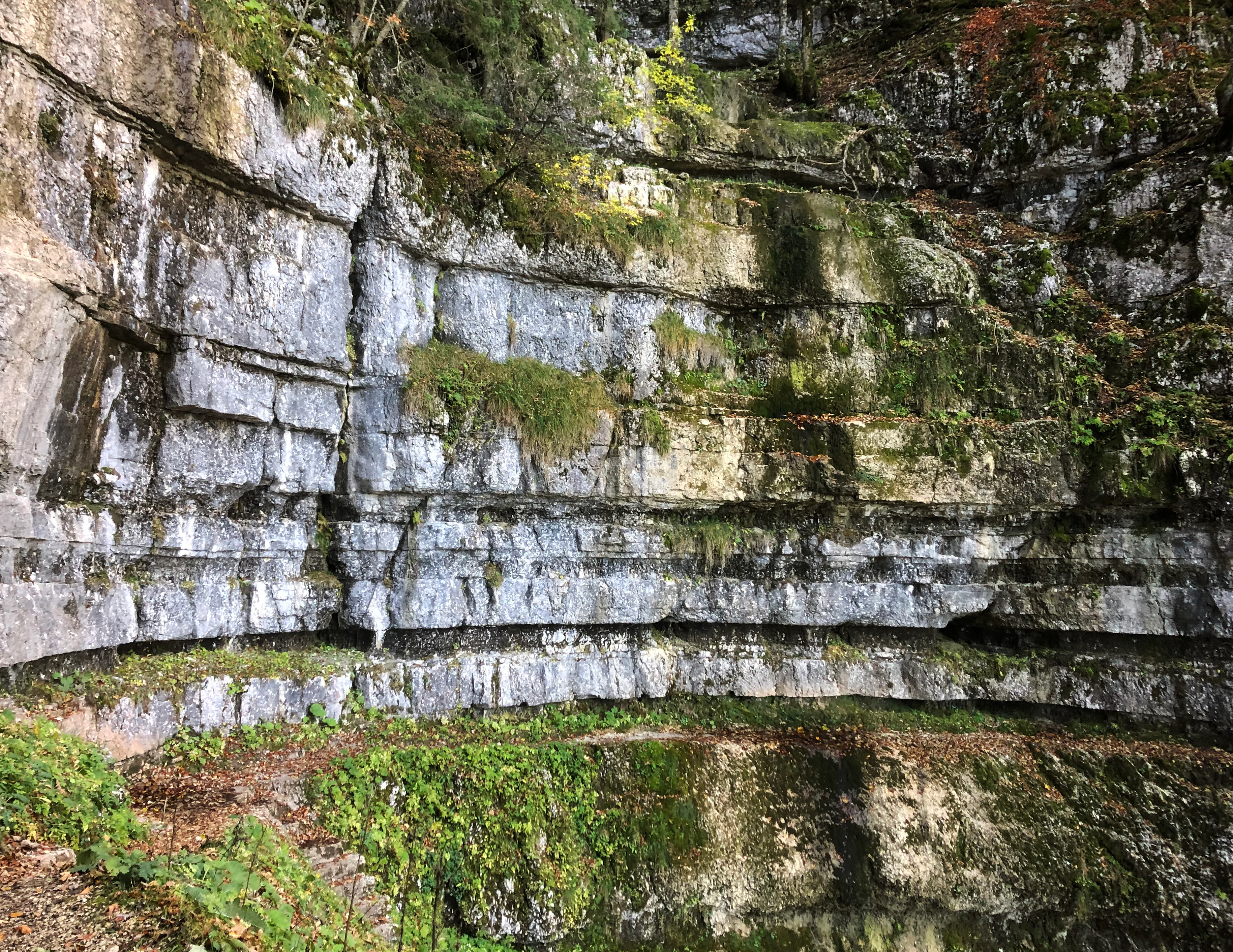
A close-up view of horizontally stratified limestone rock walls in a gorge, with moss and green vegetation growing in the crevices.
Layered limestone cliffs characterize the Combe Grède gorge in the Swiss Jura.

Combe Grède history and protected-area timeline

The first recorded descent through the steep rocky passage in the upper part of the gorge dates to 1887. In 1904, the Chasseral subgroup of the Swiss Alpine Club's La Chaux-de-Fonds section built a demanding hiking trail from Villeret through the gorge up to the Chasseral, laying the foundations for long-distance use of the route. Today the Chemin de la Combe Grède remains a popular access from Villeret station onto the Chasseral and onto the Jura high trail, and forms part of the ViaBerna long-distance path; secondary trails cross the landscapes on either side of the gorge and lead to the 300-meter-high viewpoint of La Corne.

Conservation history began in 1931 with the founding of the association Parc jurassien de la Combe-Grède, which acted together with the Swiss League for the Protection of Nature (later Pro Natura) to defend the landscape and rare species against pressure from plant collectors. The following year, 1932, the upper gorge and surrounding area of around 700 hectares became the oldest nature reserve and hunting ban area of the Canton of Bern. In 1948 the protected zone was expanded southwestward to the cantonal border with Neuchâtel, adjoining the Neuchâtel reserve of Combe Biosse. A new cantonal protection order for the Combe Grède landscape was issued on 27 September 1957, and in 1972 the Forest Directorate of Bern placed the adjacent Pâturage de la Côte under protection as well. The Cantonal Forest Directorate established a 96-hectare strict forest reserve (Réserve forestière intégrale de la Combe-Grède/St-Jean) in 1982, including scientific monitoring of forest and biodiversity development; further possible extensions through additional forest areas were explored around 2003. The gorge trail itself is maintained by the local Groupement du sentier de la Combe-Grède in Villeret, which in 2000 received the 'Goldener Wegweiser' (Golden Signpost) award from Berner Wanderwege for exemplary path maintenance.

Combe Grède landscape and geographic character

The Combe Grède landscape is defined by the dramatic contrast between the high, partially shaded cliffs of the Chasseral north face and the gentler pastureland and forest belt that lies below. Within the massif the gorge forms a weakly developed half-cluse, a deep cut shaped by water rather than by the full opening of an anticline. The upper part opens into a broad rock amphitheater between cliff faces that in places rise roughly two hundred meters above the streambed, while the lower section narrows into a steep rocky passage where the stream threads through the Villeret anticline.

On the surface the Chasseral is a karst massif, with much of its precipitation sinking into dolines rather than feeding visible streams. Combe Grède is unusual in retaining one of the few open watercourses, Le Bez, which tumbles through the gorge in cascades before spreading out over a debris cone and pastureland toward Villeret and the Schüss. The combination of exposed rock walls, talus, narrow gorge floor, wet cliff bases, and the surrounding forest belt creates a compact mosaic of microhabitats stacked into a relatively small area, with strong contrasts between sunny south-facing slopes, deeply shaded cliffs, wet streamside environments, and open alpine pastures higher up.
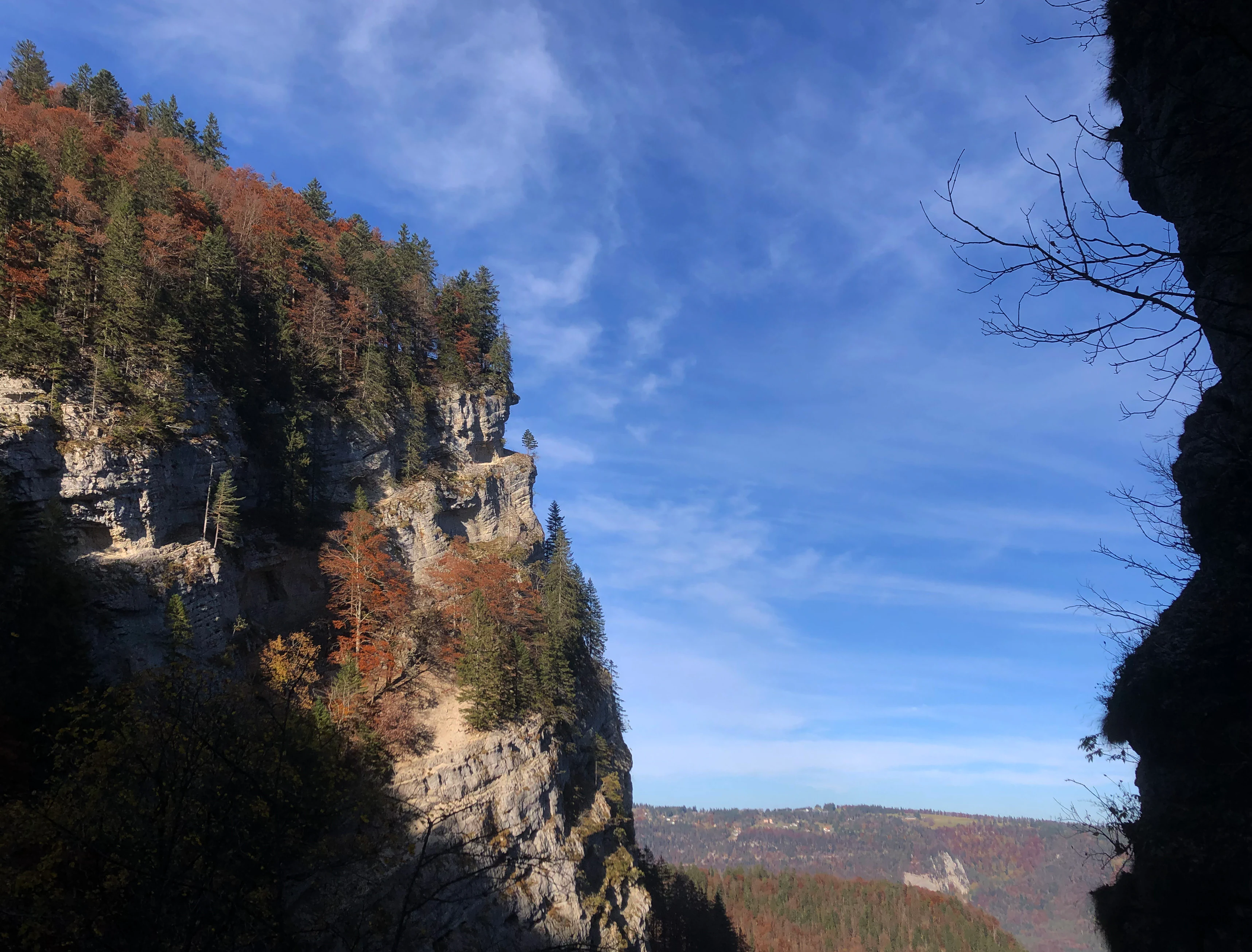
A steep, rocky limestone cliff face with autumn forest vegetation on the left, viewed through a natural gap in the gorge, against a clear blue sky.
Limestone cliffs and forested slopes in the Combe Grède gorge.

Combe Grède ecosystems, habitats, and plant life

The Combe Grède reserve is widely described as a biodiversity island within the Bernese Jura. Its ecological richness stems largely from the steep topographic relief and the resulting range of exposures: dry, sunlit south-facing rocks and slopes; cool, shaded north-facing cliffs; wet, humid zones along the stream; forest communities on the slopes; and alpine pastures above the gorge, each harboring different plant communities.

In the upper part of the reserve, the drier vegetation supports Sesleria beech woods (Seslerio-Fagetum), the rare pine association Coronillo-Pinetum, and a limestone-rock pioneer community in the Drabo-Seslerion alliance. The Pâturage de la Côte is one of the few sites in the Vallon de Saint-Imier where Scots pine (Föhre) survives as a glacial relict. Higher-quality dry meadows in the Petit Chasseral and Métairie de Saint-Jean area are listed in the Swiss Federal Inventory of Dry Meadows and Pastures of National Importance.

Along the stream in the lower part of the gorge, a moist ravine forest (Aceri-Fraxinetum) of beech, ash, and maple develops, with ferns including the mountain bladder fern, wild garlic, and round-leaved saxifrage; in some places a hart's-tongue maple woodland appears. The forest in and around the lower gorge was exploited with clear-cutting for charcoal production to supply the Jura ironworks, including the Von Roll ironworks, into the 19th century, and the present composition of spruce, maple, and elm stands partly reflects deliberate replanting. Forest use in the lower gorge continued until 1969, when a severe flood destroyed the access road near Villeret. Above the gorge, the Saint-Jean beech forest has been incorporated as a reference site in the ETH Zurich Swiss forest-monitoring program, used to track long-term changes in tree populations and biodiversity in strict forest reserves.
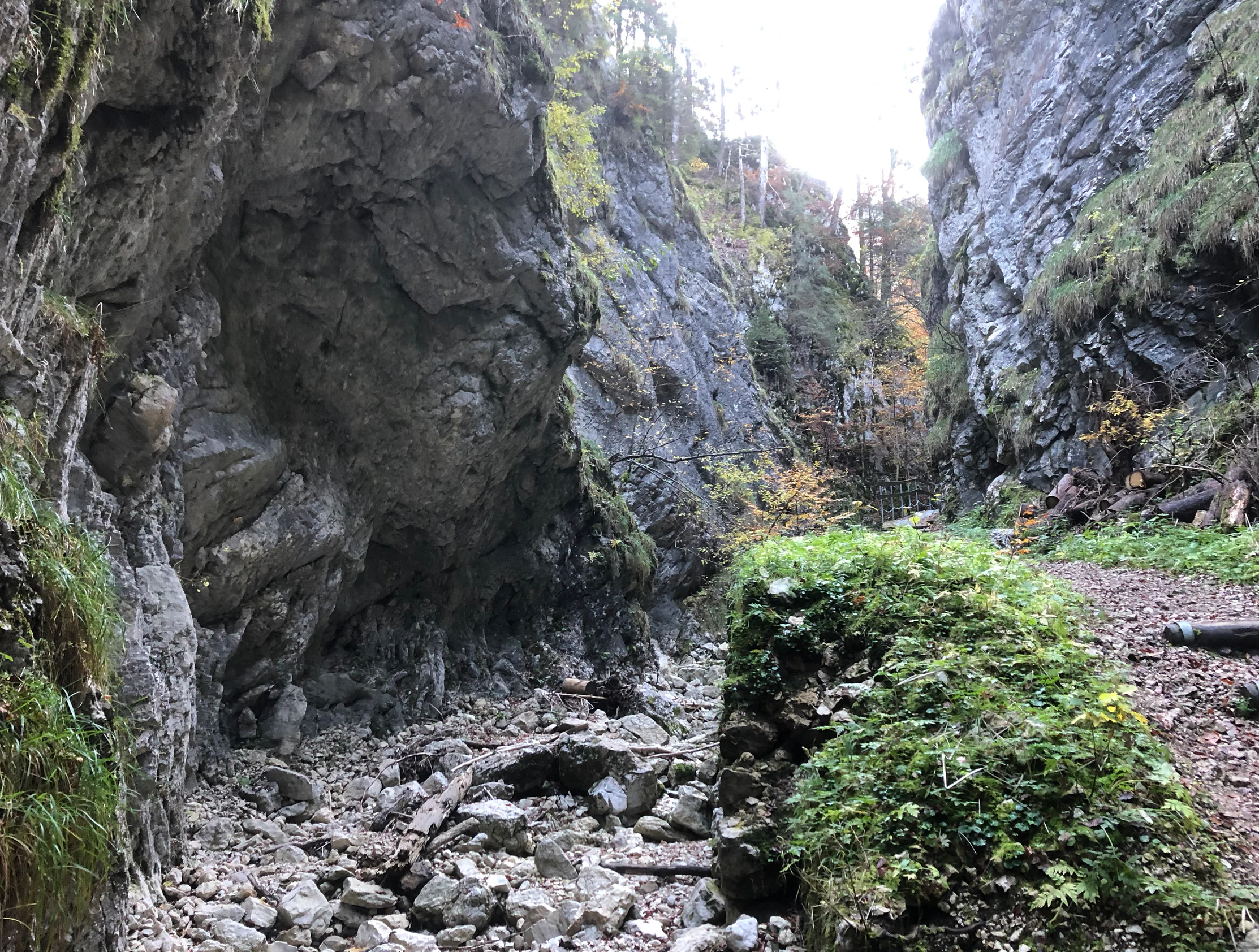
A hiking path runs through a deep, rocky limestone gorge in the Swiss Jura mountains, with steep walls and green vegetation.
A narrow, rocky trail leading through the Combe Grède gorge.

Combe Grède wildlife and species highlights

The mosaic of cliffs, forest, and pasture in and around Combe Grède supports a diverse range of fauna. The gorge and surrounding slopes are habitats for roe deer, chamois, marmots, capercaillie, peregrine falcons, and alpine foxes or hares, while the wider area lies within the territories of golden eagles and Eurasian lynx, species that have been focal to conservation attention in the Jura. From 1987 onward, bird surveys in the strict forest reserve documented 28 breeding bird species, with rock-nesting species such as the black redstart and the wallcreeper recorded in the high rock formations.

The combination of nesting cliffs, old-growth forest, and alpine pasture means that Combe Grède functions both as a breeding area and as a stepping stone in the larger Jura wildlife network. The presence of large predators and sensitive ground-nesting species such as capercaillie underlines the reserve's role beyond purely botanical protection, providing refuge for fauna strongly affected by disturbance and habitat fragmentation elsewhere in the region.
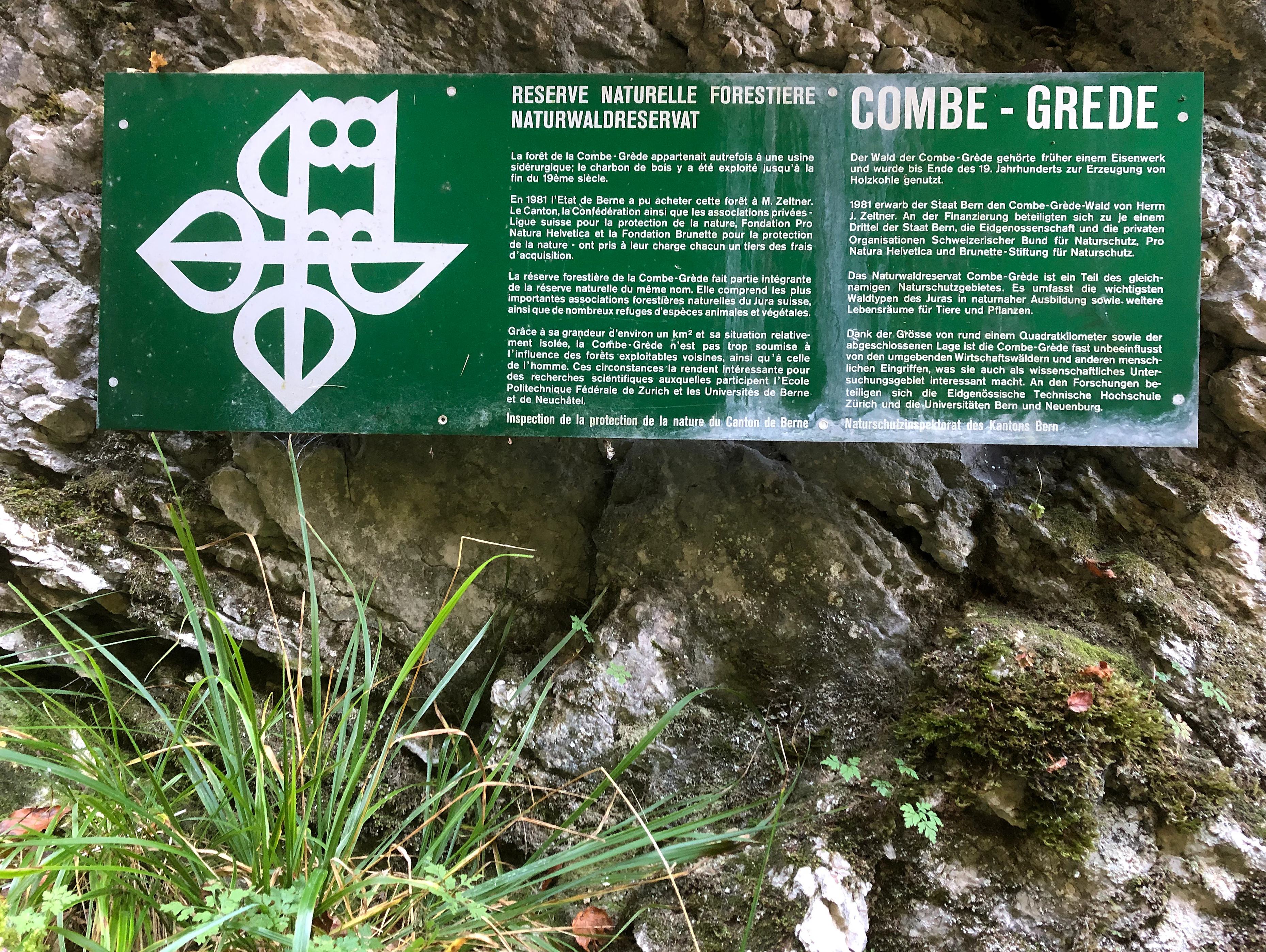
A rectangular green information sign mounted on a rocky cliff face, featuring the text Combe Grède and an owl logo.
An information sign identifying the Combe Grède nature reserve.

Combe Grède conservation status and protection priorities

Combe Grède holds a foundational place in conservation history in the Canton of Bern. Designated in 1932, it is the oldest cantonal nature reserve and hunting ban area, established initially to defend the landscape and rare plants from the pressure of plant collectors organized under the Swiss League for the Protection of Nature. Successive enlargements in 1948 and 1957, followed by the 1972 protection of the adjoining Pâturage de la Côte, built the reserve into a multi-layered protection zone spanning parts of the municipalities of Villeret, Cormoret, and Saint-Imier, covering close to twelve square kilometers in total.

The reserve is recognized in the World Database on Protected Areas and sits within multiple national and regional protection frameworks: the Parc régional Chasseral, the BLN-listed Chasseral landscape (BLN object 1002), Pro Natura protection, and the strict 96-hectare Réserve forestière intégrale de la Combe-Grède/St-Jean established in 1982. The strict forest reserve has been the subject of long-term scientific monitoring of vegetation, avifauna, and forest dynamics, beginning with Bruno Kägi's 1985 vegetation mapping and Urs Schaffner's 1990 ornithological study, and continues to inform forest and biodiversity monitoring in Switzerland through the ETH-based program.

Combe Grède cultural meaning and human context

The name Combe Grède combines the French word 'combe', meaning valley, with the surname Grède, documented since the 16th century in Villeret and associated with families that held forest-use rights in the gorge. The site sits in a historical linguistic borderland between Swiss German and French-speaking regions, which is reflected in the now mostly superseded older German place name 'Combeloch' recorded for the same gorge into the early 20th century.

Industrial use for charcoal production tied the gorge economically to the Jura iron industry in the 19th century, and forest exploitation in the lower gorge continued, by some accounts, into the late 1960s. This working landscape was gradually transformed into one of Switzerland's earliest large nature reserves, with conservation associations, the Swiss Alpine Club, and local volunteer groups collectively shaping both the protection framework and the famous footpath that still runs from Villeret up through the gorge onto the Chasseral.

Top sights and standout views in Combe Grède

Combe Grède stands out for the combination of a deeply cut half-cluse gorge with continuous cliff faces up to roughly two hundred meters, exposed Cretaceous-to-Hauptrogenstein rock sequences that make it a teaching site for the geology of the Folded Jura, and a tightly packed mosaic of contrasting habitats including Sesleria beech woods, rare Coronillo-Pinetum pine stands, moist ravine forest with maples and ashes, and species-rich dry alpine meadows.

From a conservation perspective, the gorge's importance lies in being the oldest cantonal nature and hunting reserve of Bern, layered into a larger network that includes a strict forest reserve, Pro Natura protection, the Parc régional Chasseral, and the BLN-listed Chasseral landscape. Its built heritage, the historic mountaineering path from Villeret through the gorge to the Chasseral, adds a human dimension that connects the natural values of the reserve with the long tradition of Jura hiking and regional identity.

Best time to visit Combe Grède

The exploratory footpath through the gorge is open only in summer and is maintained by a local volunteer group, making the warm months the natural season for experiencing the full vertical sequence of the gorge. Late spring and early summer are typically favorable for the surrounding alpine meadows and forest reserves, when relic species in the dry meadows at Petit Chasseral and the pastures near Pré aux Auges are most evident, while summer high season offers the most reliable conditions for the climbing-assisted sections that use fixed ladders, chains, and steps along the rock walls.

Winter transforms Combe Grède into a colder, quieter environment: the shaded rock faces receive little sunlight, the cascades of Le Bez freeze into ice formations, and streamflow can drop sharply or cease altogether during dry spells. Heavy rainfall in any season can trigger debris flows that block paths in the narrows, so visitors should expect conditions in the gorge to reflect the volatility typical of steep karst terrain in the Jura.

Monthly climate preview

Long-term representative monthly averages for temperature and precipitation patterns in the Canton of Bern

Combe Grède Climate Normals and Measured Annual Temperature Rhythm

Combe Grède records measured monthly temperatures ranging from sub-zero winter lows to warm summer maximums alongside consistent daily precipitation normals. Reviewing the complete twelve-month climate profile reveals detailed temperature curves and precipitation shifts across the protected area.
Annual mean8 °C
-1 °C17 °C
Jan-1°
Feb
Mar
Apr
May12°
Jun15°
Jul17°
Aug17°
Sep13°
Oct
Nov
Dec
Warmest month
July

17.4 °C

Coolest month
January

-1.2 °C

Wettest month
May

3.9 mm/day

Driest month
February

2.5 mm/day

Park location guide

Geography guide, regional context, and park location map for Combe Grède

Combe Grède park geography, regions, and map view in Switzerland

Understand where Combe Grède sits in Switzerland through a broader geographic reading of the surrounding landscape, nearby location context, and its mapped position within the national park landscape.

How Combe Grède fits into Switzerland

Switzerland is a landlocked federal republic in Central Europe comprising 26 cantons, with Bern as the federal city and Zurich as the largest city. The country features the Swiss Alps, Swiss Plateau, and Jura Mountains, with German, French, Italian, and Romansh as official languages. It is noted for its political neutrality, direct democracy traditions, and strong economy.

Wider geography shaping Combe Grède in Switzerland

Switzerland is located in Central Europe at the intersection of Western and Southern Europe. It is bordered by Germany to the north, France to the west, Austria and Liechtenstein to the east, and Italy to the south. The country is geographically divided among the Swiss Alps (covering most of the territory), the Swiss Plateau (where most of the population resides), and the Jura Mountains. Switzerland is landlocked.

Map view of Combe Grède

Use this park location map to pinpoint Combe Grède in Switzerland, understand its exact geographic position, and read its mapped placement within the surrounding landscape more clearly.

Pigeon | © OpenStreetMap contributors

Location context for Combe Grède

Canton of Bern

Visualizing limestone cliffs, mountain forests, and protected habitats

Combe Grède Photos and Landscape Scenery in the Swiss Jura

Visual documentation of Combe Grède reveals the dramatic topography of the limestone gorge, sheer rock faces, and surrounding alpine pastures. Examining these detailed landscape photographs provides a clearer understanding of the terrain, native vegetation mosaics, and protected habitat characteristics unique to the Bernese Jura.

A close-up view of horizontally stratified limestone rock walls in a gorge, with moss and green vegetation growing in the crevices.

A close-up view of a thick tree trunk heavily covered in vibrant green moss, standing in a forest during autumn with orange and yellow foliage in the background.

A steep, rocky limestone cliff face with autumn forest vegetation on the left, viewed through a natural gap in the gorge, against a clear blue sky.

A hiking path runs through a deep, rocky limestone gorge in the Swiss Jura mountains, with steep walls and green vegetation.

A rectangular green information sign mounted on a rocky cliff face, featuring the text Combe Grède and an owl logo.

Park atlas

Compare regional geology, mountain forests, and connected nature reserves

Explore Parks Near Combe Grède and Surrounding Protected Landscapes

Continue exploring regional geography by comparing Combe Grède with other protected areas across the surrounding mountain terrain. Broaden your wildlife and habitat research by evaluating adjacent nature reserves within the same limestone ecosystem.
A horizontal watercolor illustration depicting rolling green hills, a winding lake shore, and distant mountains in a soft, muted palette.
Protected landscapeCanton of Bern
About 10 km away#1 closest

Southeast

Linkes Bielerseeufer Protected Landscape: Map and Regional Geography in Canton of Bern

Protected Jura lakeshore and vineyard terrain

Investigate the precise boundaries and varied micro-landscape of Linkes Bielerseeufer. This protected area showcases a dramatic rise from Lake Biel into the Jura range, encompassing karst topography, historic dry-stone terraces, and diverse forest ecosystems within the Canton of Bern.

Area
7.079 km²
Relief
Mountain
Climate
Temperate
Access
Easy access
Watercolor painting of a green forested landscape with rolling hills under a soft pink and yellow sunrise sky.
Nature reserveJura
About 13 km away#2 closest

North

Franches-Montagnes Nature Reserve: A Detailed Atlas of Jura Plateau and Peat Bog Geography

Protected karst limestone landscapes and highland pasture geography.

The Franches-Montagnes nature reserve spans a unique high plateau in the Swiss Jura, characterized by its complex karst substrate and iconic raised bog systems like the Etang de la Gruère. This protected area supports a mosaic of traditional wooded pastures and wetlands, serving as a primary site for understanding the intersection of human pastoral heritage and sensitive highland ecology.

Area
39.57 km²
Established
1977
Relief
Upland
Climate
Temperate
A watercolor illustration of a river landscape with a gentle bend, shoreline greenery, and distant low hills, rendered with soft, faded edges.
Protected landscapeCanton of Bern
About 22 km away#3 closest

Southeast

Stausee Niederried Protected Landscape: A Geographic Map and Atlas of Swiss Floodplains

Mapped alluvial terrain and sandstone cliffs in the Canton of Bern.

Stausee Niederried functions as a vital protected landscape, blending a historic hydroelectric reservoir with a four-kilometer riverine floodplain. The area is characterized by high geomorphic contrast, ranging from the vast Runtigenfluh molasse cliff to critical riparian marshes and orchid-rich pine forests. This entry provides a structured look at the park boundaries, geological features, and the wider fluvial mosaic found near the confluence of the Aare and the Saane.

Area
2.97 km²
Established
1991
IUCN
V
Relief
Mixed relief
A pale, minimalist watercolor painting depicting rolling hills and mountains in shades of soft green, purple, and yellow against a white background.
Natural monumentNeuchâtel
About 30 km away#4 closest

Southwest

Creux du Van et Gorges de l’Areuse Natural Monument and Regional Protected Landscape

Geological exploration of the Folded Jura and Areuse river valley

Spanning the Cantons of Neuchâtel and Vaud, this protected area unites the dramatic rock bowl of the Creux du Van with the narrow, cascading passages of the Gorges de l’Areuse. The site provides a comprehensive view of Jura mountain landforms, highlighting millions of years of river erosion, glacial activity, and karst weathering in a singular, well-defined geographic corridor.

Area
21.21 km²
Established
1876
Relief
Mountain
Climate
Temperate
A soft watercolor painting depicting a calm river winding through a green, hazy floodplain environment.
Nature reserveSolothurn
About 31 km away#5 closest

East

Naturschutzgebiet Aare bei Altreu: Protecting Aare Valley Floodplains and Alluvial Forest

Riverine meander habitat in the Solothurn canton landscape.

Naturschutzgebiet Aare bei Altreu serves as a vital refuge for floodplain flora and fauna, standing out for its intact meander loops and silver willow gallery forests. Located in the Solothurn region, this protected area preserves a rare stretch of the Aare river ecosystem that contrasts sharply with adjacent canalized banks. Studying its terrain reveals the importance of alluvial corridors in maintaining wetland connectivity within the Swiss Mittelland.

Area
0.205 km²
Established
1992
IUCN
IV
Relief
Lowland
A pale, soft-focus watercolor illustration depicting a limestone cliff landscape with gentle rolling hills and light vegetation.
Nature reserveBourgogne-Franche-Comté
About 32 km away#6 closest

Northwest

Réserve naturelle régionale du Crêt des Roches: Protected Landscape and Geography Atlas

Lomont range limestone corniche and regional nature reserve map

Situated southeast of Pont-de-Roide-Vermondans, this regional nature reserve preserves a compact forty-three hectare area of Jurassic limestone cliffs and mesophilic forests. The site provides a critical reference point for studying Mediterranean-margin flora, including rare relict plant populations, and stands as a major topographical observation corridor for autumn bird migrations in eastern France.

Area
0.434 km²
Established
2009
IUCN
IV
Relief
Upland
A wide watercolor painting depicting a calm river or lake flanked by green and purple vegetation, with distant mountains under a soft pink and yellow sky.
Nature reserveDoubs
About 45 km away#7 closest

North

Réserve naturelle régionale de la basse vallée de la Savoureuse: Regional Nature Reserve

Protected alluvial floodplain geography in Doubs, France.

This nature reserve safeguards a significant fragment of the Savoureuse river floodplain. The protected area offers a complete alluvial sequence within 42 hectares, including active gravel bars and mature ash-alder woodlands, providing a high-density ecological core amidst an industrial landscape in the Doubs department.

Area
0.419 km²
Established
2008
IUCN
IV
Relief
Lowland
A soft watercolor painting of a mountain landscape with rolling hills, pine forests, and a meadow in light green and muted earth tones.
Regional parkCanton of Bern
About 47 km away#8 closest

Southeast

Regionaler Naturpark Gantrisch: Protected Terrain and Map Exploration in Canton of Bern

A diverse transition zone from glacial moraines to high mountain ridges.

Spanning over 400 square kilometers, Regionaler Naturpark Gantrisch offers a unique look at the Swiss landscape. Its boundaries encompass everything from low-lying agricultural valleys and historic castles to the steep, forested gorges of the Sense and Schwarzwasser rivers and the high-altitude vistas of the southern Gantrisch mountain range.

Area
414 km²
Established
2012
Relief
Mountain
Climate
Alpine

Common questions about visiting, size, designation, and location context for Combe Grède

Combe Grède FAQs for park facts, access, geography, and protected area context

Find quick answers about Combe Grède, including protected-area facts, park geography, trail and visitor context, and how the park fits into its surrounding country and regional landscape.
MoriAtlas Explorer

Continue Your Protected Areas Search Across the Global Atlas

Deepen your exploration by continuing the structured search for national parks and protected areas worldwide. Utilize the comprehensive filtering capabilities to compare different conservation landscapes and refine your understanding of global park geography. Discover more about the distribution and characteristics of protected natural areas.

Global natural geography