
Mori Atlas logo
Nature reserveComino

A detailed geographic study of limestone cliffs, coastal bird habitats, and the Blue Lagoon

Comino Nature Reserve: Exploring the Karst Landscapes and Protected Marine Boundaries near Gozo

Comino is a primary Mediterranean nature reserve located within the channels of the Maltese archipelago near Gozo. This protected landscape is defined by its rugged karst limestone plateau, sheer sea cliffs, and the luminous shallow waters of the Blue Lagoon. The area functions as a vital bird sanctuary and marine protected zone, offering a unique perspective on the intersection of island ecology, historic fortification, and sparse human habitation.

MaltaMaltese IslandsMediterranean islandkarst landscapelimestone cliffsbird sanctuary
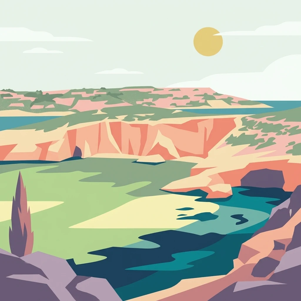
A minimalist flat illustration showing a rocky coastline with rugged cliffs and a calm, turquoise bay under a clear sun.

Comino

Nature reserve

Park overview

Structured park overview, official facts, and landscape profile for Comino

Comino park facts, protected area profile, and essential visitor context

Review the core facts for Comino, including designation, size, terrain, visitor scale, habitats, and operating context in one park-focused overview.

About Comino

Comino is the smallest of the three main islands of the Maltese archipelago and sits at the very heart of the channel system that separates Malta from Gozo, two short stretches of sea that the island effectively splits. Although only about 3.5 square kilometres in area, the island forms a distinct ecological and cultural unit, with its own chapel, historic fortifications, and protected coastline, and is treated as a self-contained protected territory within the Maltese Islands.

The physical setting of Comino is defined by Maltese limestone. The interior is a low karst plateau that rarely rises above roughly 35 metres, while the edges of the island fall to sea in steep, broken limestone cliffs and are punctured by deep sea caves. Vegetation is sparse and adapted to dry Mediterranean conditions, with sclerophyllous shrubland, low garrigue, scattered planted pine stands, and pockets of sand-dune vegetation around Santa Maria Bay that still support native species such as Vitex and Tamarix. The combination of thin soils, exposed rock, and strongly salty sea air gives the island a raw, almost lunar quality that contrasts sharply with the more developed landscapes of Malta and Gozo.

Comino's identity is also shaped by its near-absence of permanent settlement. For long stretches of its history the island was sparsely inhabited, privately owned, or abandoned entirely, and even at its twentieth-century peak the resident community numbered only around 80 people. Today, just two residents remain, served by a single priest who commutes from Gozo. This low human footprint, combined with formal protection, has helped preserve both the island's terrestrial habitats and its marine environment, and has made Comino a focal point for marine Natura 2000 designation, Important Bird Area recognition, and seabird conservation in the central Mediterranean.

At the same time, Comino is one of the most heavily visited day-trip destinations in the Maltese Islands, drawing large numbers of tourists and tour boats to its beaches and especially to the Blue Lagoon. This tension between ecological fragility and intense seasonal tourism, combined with debates over hotel redevelopment and informal commercial encroachment on the shoreline, defines much of the contemporary discussion around the island.

Quick facts and research context for Comino

Comino (Maltese: Kemmuna) is the third-largest island in the Maltese archipelago, with an area of around 3.5 square kilometres, roughly 2.6 kilometres long and just over 2 kilometres wide. It lies between the islands of Malta and Gozo, south of Sicily, in the Mediterranean Sea. Administratively it falls within the Gozo Region and the local council of Għajnsielem, even though it is geographically separated from Gozo by the narrow South Comino Channel.

The island has only two permanent residents and is widely recognised as a bird sanctuary and nature reserve, including a Natura 2000 marine protected area. BirdLife International has identified Comino as an Important Bird Area, primarily because of its breeding population of yelkouan shearwaters. The island's highest point reaches only about 35 metres above sea level, and its landscape is dominated by exposed karst limestone, low garrigue vegetation, and a handful of planted pine stands.

Protection and recognition

Explore documented conservation measures and management frameworks for Comino.

Comino Protection Status and International Recognition Details

Comino features a mixed protection scope governed by established conservation frameworks and management guidelines. Structured records track available designation history, administrative parameters, and recognized protected-area boundaries.

Protection details

Protection scope
Mixed
Transboundary protection
No
Park context

Deeper park guide and search-rich context for Comino

Comino history, landscape, wildlife, and travel context

Explore Comino through its history, landscape character, ecosystems, wildlife, conservation priorities, cultural context, and seasonal travel timing in a structured park guide built for atlas discovery and search intent.

Why Comino stands out

Comino is best known for the startlingly clear, turquoise waters of the Blue Lagoon, a sheltered sandy bay lying in the channel between Comino and the tiny islet of Cominotto. The combination of shallow sandy bottom, bright water, and surrounding limestone cliffs has made the lagoon one of the most photographed seascapes in the Maltese Islands and a focal point for swimmers, snorkelers, and divers. Beyond the Blue Lagoon, the island is distinguished by its overall sense of quiet, almost deserted natural character, shaped by very low permanent population, karst limestone terrain, and protection as a bird sanctuary and nature reserve. The island's importance for breeding seabirds, particularly the yelkouan shearwater, gives it significant ecological standing in the central Mediterranean, even though its size is modest.
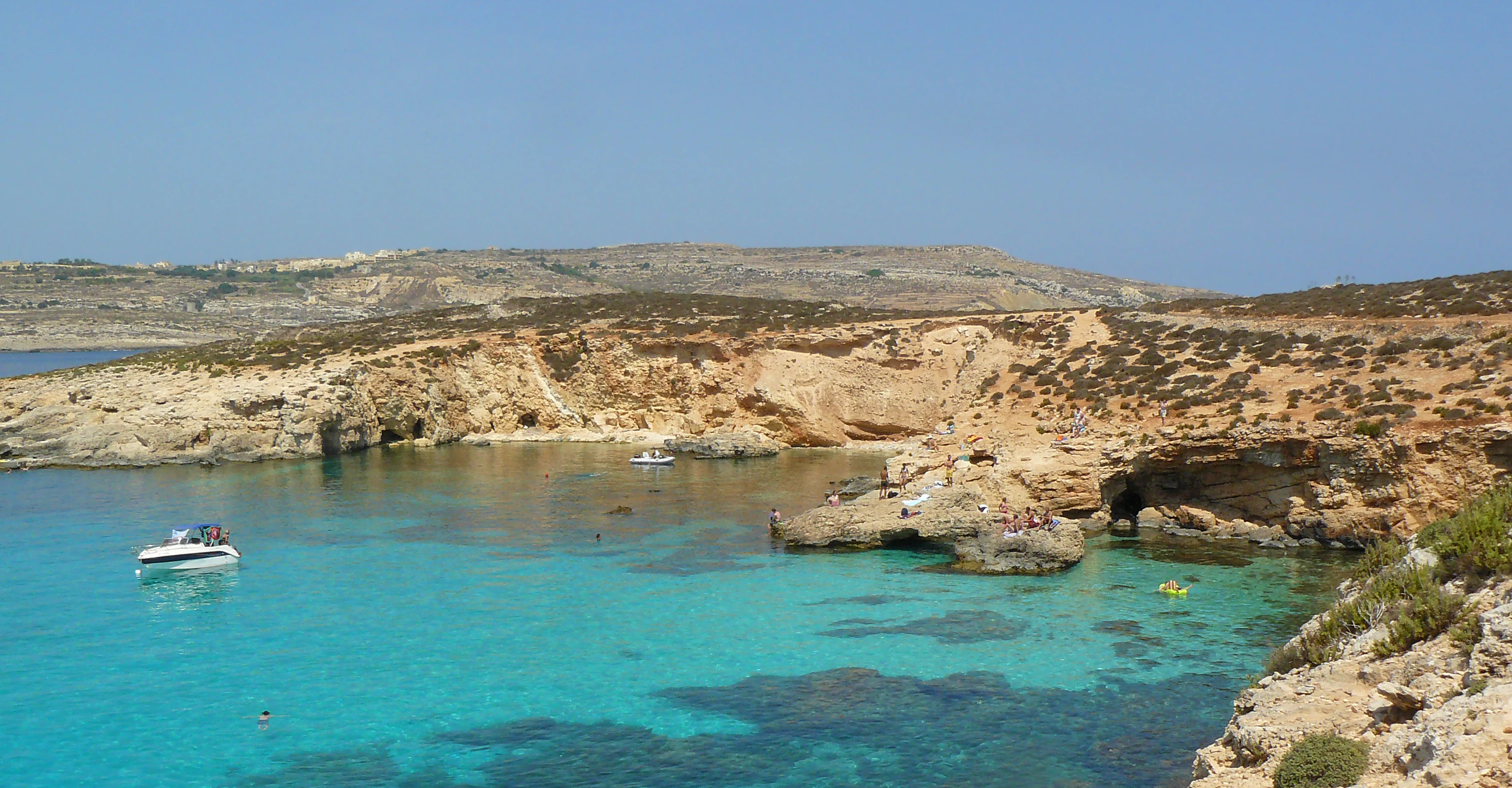
A clear blue lagoon with a small white boat, framed by rocky, arid cliffs and low-lying Mediterranean shrubland on a sunny day.
The turquoise waters of the Blue Lagoon at Comino, surrounded by rugged limestone terrain.

Comino history and protected-area timeline

The recorded history of Comino stretches back well over two thousand years. The island, anciently known as Ephaestia, was inhabited during Roman times, though for long stretches it has been sparsely populated, privately held, or quietly abandoned. Its rugged limestone coastline and deep sea caves made it a natural staging ground for pirates and raiders in the Middle Ages, and accounts from this period describe Comino being used as a launching point for attacks on boats crossing between Malta and Gozo.

Around the late thirteenth century, the exiled Jewish Kabbalist Abraham Abulafia lived on Comino between about 1285 and 1290. During his years of isolation on the island he composed major works including Sefer ha-Ot (The Book of the Sign) and his final text Imre Shefer (Words of Beauty), giving the island an important if little-known place in the history of Jewish mysticism.

From the sixteenth century onward, the Knights Hospitaller used Comino as a hunting ground and recreational retreat, fiercely protecting local game such as wild boar and hares and punishing poachers harshly. The Knights also built the island's most enduring monument, Saint Mary's Tower, on the southern coast in 1618, as part of a wider chain of coastal watchtowers across the Maltese Islands. Errant knights were sometimes sentenced to man the tower as a form of honourable exile. Saint Mary's Battery and Saint Mary's Redoubt were added to the island's defences in 1716, the battery surviving today with its cannons largely intact.

During the French occupation of Malta in the late eighteenth century, Comino's barracks buildings were repurposed as a quarantine station and isolation hospital. In the nineteenth century, the waters around the island saw a dramatic maritime incident when the British battleship HMS Sultan struck an uncharted rock in the Comino Channel in 1889 and later sank, before being raised and towed into Malta. In the 1920s the British colonial government leased the island to a private farming company, which brought a substantial part of the land under cultivation and briefly supported a settled community of farming families of up to around 80 people, sustained by terraced crops, livestock, rainwater wells, and an annual chapel feast. As of the early twenty-first century the lease history has shifted toward tourism, with a controversial long-term lease once granted to a British developer and more recent proposals for hotel redevelopment that have drawn environmental scrutiny.

Comino landscape and geographic character

Comino's landscape is a compact exercise in Maltese karst geology. The island's interior is a low, undulating limestone plateau, with its highest point only around 35 metres above sea level, and ridges and terraced fields falling outward in every direction toward the sea. The plateau surface is broken by shallow solution hollows, exposed rock, and thin, stony soils that support only a sparse cover of shrubs and grasses. Visually, the interior feels open, dry, and lightly vegetated, with wide horizons across the rock-strewn ground.

The defining scenery, however, belongs to the coast. Much of the shoreline is made up of sheer limestone cliffs where the karst meets the sea, often rising vertically from deep water and deeply fretted by wave action. These cliffs are pierced by sea caves that have historically provided shelter to passing mariners, smugglers, and raiders, and that today form part of the appeal of small-boat tours around the island. The most photographed scene on Comino and arguably in the Maltese Islands is the Blue Lagoon, the luminous body of shallow water that occupies the channel between Comino and its tiny islet neighbour Cominotto. Here the karst terrain drops into a sandy white bottom, producing famously clear turquoise water. Other notable coastal settings include Santa Maria Bay, with its dune-fringed sandy beach, and San Niklaw Bay, both of which have played central roles in the island's history of settlement and tourism.

Along the southern coast, the terrain rises to the dramatic perch of Saint Mary's Tower, which dominates views across the channel from its elevated platform roughly 80 metres above the sea. Together, the low plateau, the cliffed perimeter, the bay-lagoon systems, and the scattered knap of small fortifications give Comino a landscape that is both visually striking and unusually varied for such a small island.
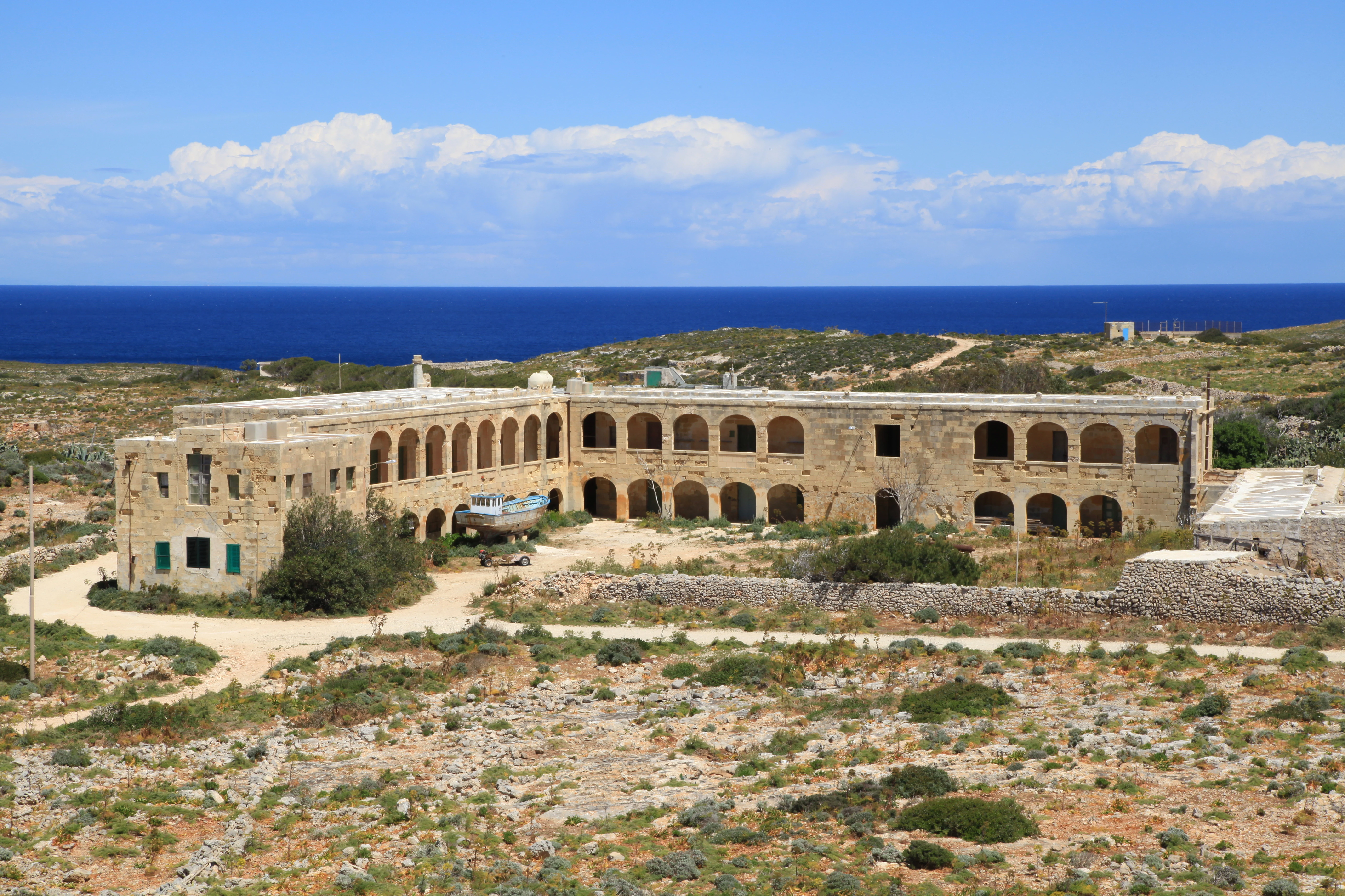
A wide view of a long, two-story stone building with a series of arched windows and doors on a rocky, arid island landscape with the sea in the background.
The historic quarantine station on the island of Comino.

Comino ecosystems, habitats, and plant life

The natural character of Comino is shaped by its position as an exposed, low-lying limestone island in the central Mediterranean. The terrestrial habitats are dominated by sclerophyllous shrubland, low garrigue formations, and thin calcareous soils that support drought-adapted Mediterranean vegetation. Limited afforestation with pine trees has been carried out in places, but much of the island retains its open shrubland character, with characteristic species typical of Maltese coastal habitats.

Along Santa Maria Bay, more specialised dune vegetation survives, including Vitex and Tamarix trees, which represent one of the more distinct pockets of native plant habitat on the island. These dune communities are ecologically important not only for their rarity within the Maltese Islands but also for their role in stabilising the sandy shoreline and providing habitat for insects and small vertebrates accustomed to a transitional land-and-sea environment.

The marine environment around Comino is central to the island's ecological identity. The sheltered, shallow waters of the Blue Lagoon and surrounding bays support rich marine life and have long made the area a focus for snorkelling and diving. The island's waters are part of a designated Natura 2000 marine protected area, providing formal recognition of their value for marine biodiversity, and offering a baseline for ongoing discussions about balancing recreational use with ecological protection.
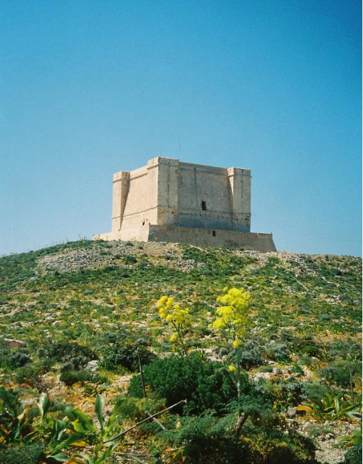
A square stone fortification, St. Mary's Tower, sits atop a grassy, rocky hill under a clear blue sky, with yellow wildflowers in the foreground.
St. Mary's Tower, a historic defensive structure on the island of Comino.

Comino wildlife and species highlights

Although Comino is small, its wildlife significance is disproportionately large in the Maltese context. The island is recognised as an Important Bird Area by BirdLife International, with its designation resting primarily on the presence of a breeding population of yelkouan shearwaters estimated at fifty to eighty pairs. These seabirds nest in burrows and rock crevices across the island and are sensitive to disturbance from both coastal development and unregulated human presence, giving the island a key role in the conservation of this species in the central Mediterranean.

Migratory birds more broadly also feature prominently in Comino's wildlife profile, and the island's lookout function, including the use of Saint Mary's Tower by enforcement agencies, has historically included protection against illegal hunting at sea. The combination of small resident seabird colonies and seasonal migratory movements, set against a backdrop of largely undeveloped terrain and protected waters, makes the island a significant coastal bird area despite its modest size.

Marine wildlife is equally central to the island's ecological identity. The waters around Comino, especially within the Blue Lagoon and along the rocky coastal stretches, support diverse fish populations and other marine life typical of shallow Mediterranean reef and seagrass habitats. Snorkelers and divers regularly report sightings of small reef fish and other coastal species, contributing to the Blue Lagoon's reputation as a rich, if fragile, marine environment.
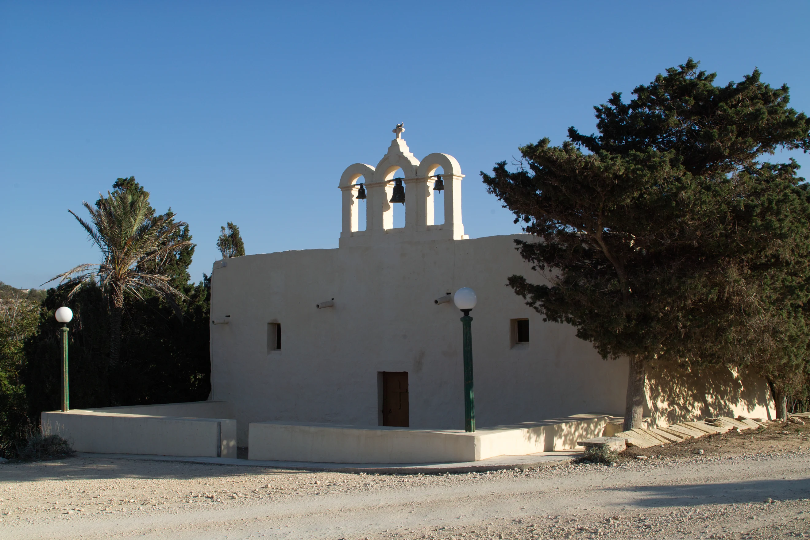
A small light-colored stone chapel with a three-arched bell gable, situated near a palm tree and a larger evergreen tree under a clear sky.
The small chapel on the island of Comino.

Comino conservation status and protection priorities

Conservation is one of the defining realities of Comino. The island is formally designated as a bird sanctuary and nature reserve, and its surrounding waters are included in a Natura 2000 marine protected area, placing it within the European Union's framework of high-level habitat protection. BirdLife International's recognition of Comino as an Important Bird Area provides a further international layer of conservation standing, primarily because of the island's breeding yelkouan shearwaters.

These protections sit alongside an unusual demographic reality: only two permanent residents live on the island, supported by a single commuting priest and a small police station. This extremely low resident population reduces the steady-state human footprint on Comino and provides a baseline for both habitat quality and conservation management, distinguishing the island from many other protected areas that must contend with substantial resident communities.

At the same time, Comino is one of the most intensively visited small islands in the Mediterranean, and conservation issues on the island extend well beyond formal designations. Concerns have included overcrowding at the Blue Lagoon, illegal kiosks and uncontrolled beach furniture, infrastructure works near sensitive habitats, and the environmental implications of hotel redevelopment projects. Environmental groups and national authorities have together undertaken habitat restoration, invasive species work, and replanting of indigenous vegetation, while conservation organisations continue to argue for an overarching management plan that limits activity and protects the island's fragile ecosystems.

Comino cultural meaning and human context

Despite its tiny resident population, Comino carries a layered cultural identity. Religious life has long centred on Saint Mary's Chapel above Santa Maria Bay, which has origins stretching back to at least the late thirteenth century. The chapel's annual Feast of Santa Marija has historically been the focal celebration of the farming community that lived on the island in the twentieth century and has recently been revived as a way of honouring Comino's heritage.

The island also embodies the military and administrative culture of the wider Maltese Islands, particularly through the legacy of the Knights Hospitaller. Saint Mary's Tower, Saint Mary's Battery, and the island's barracks reflect the Knights' strategic vision of defended coastline, while later French and British administrations reused many of the same buildings for quarantine, hospital, and policing roles. This succession of uses has left Comino with a built heritage that, in addition to its natural value, constitutes an important part of Malta's broader coastal heritage landscape.

Equally distinctive is the memory of the small twentieth-century farming community, made up of interconnected Maltese and Gozitan families who cultivated terraced fields, raised livestock, harvested rainwater, and maintained the chapel. Although this way of life effectively ended as the farming lease was revoked and the population dwindled, it remains central to how Comino is understood locally, both as a place of hard subsistence living and as a quiet community whose annual feast and chapel traditions continue to be celebrated.
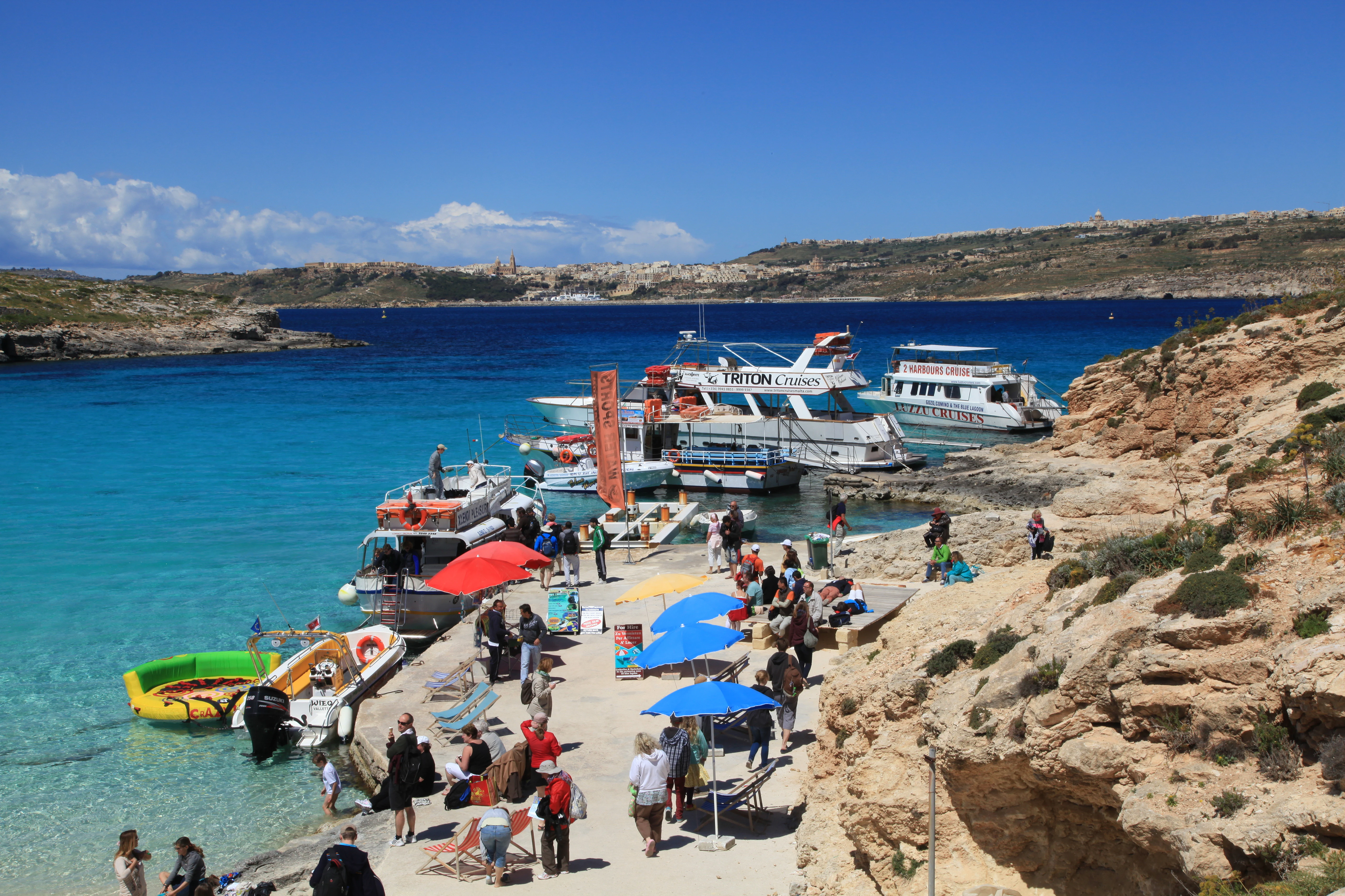
A wide angle view of the Blue Lagoon on Comino island, showing tour boats docked at a small concrete pier, colorful sun umbrellas, and tourists congregating near the rocky shoreline with clear turquoise water.
The bustling harbour area at the Blue Lagoon on the island of Comino.

Top sights and standout views in Comino

Comino's most striking feature is the Blue Lagoon, the luminous shallow bay between Comino and Cominotto, widely regarded as one of the most iconic swimming and snorkelling spots in the Maltese Islands.

Equally notable are the island's protected natural values, including its status as a bird sanctuary and nature reserve, its role as a Natura 2000 marine protected area, and its recognition by BirdLife International as an Important Bird Area for breeding yelkouan shearwaters, set against an exceptional human geography of just two permanent residents. The seventeenth-century Saint Mary's Tower, the surviving Saint Mary's Battery with its historic cannons, and the layered history of Knights Hospitaller exile, Kabbalist retreat, and twentieth-century farming community collectively give the island a heritage and ecological profile that far outweigh its modest size.
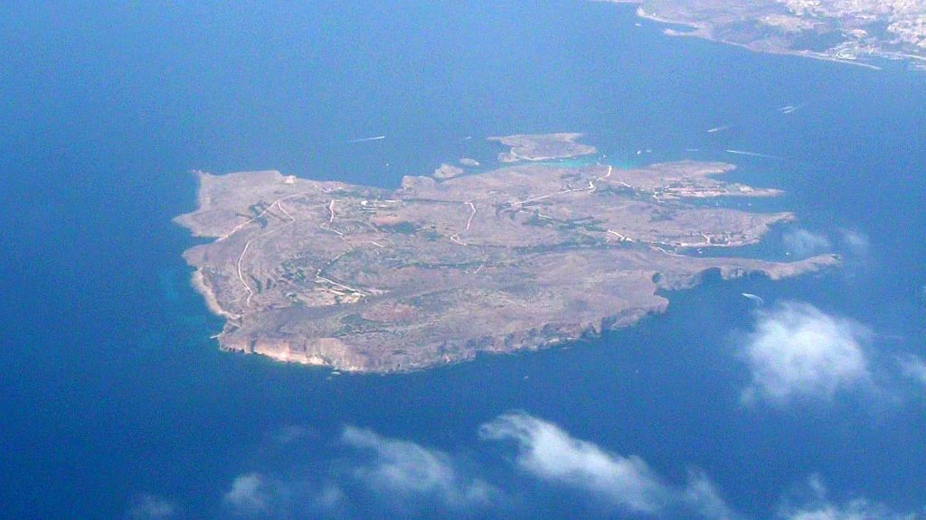
An aerial bird's eye view of the small island of Comino in Malta, surrounded by the deep blue Mediterranean Sea.
Aerial view of Comino, Malta, showcasing its karst landscape and rugged coastline surrounded by the Mediterranean Sea.

Best time to visit Comino

The broadest experience of Comino comes during the warmer months of late spring through early autumn, when the famously clear Blue Lagoon is most inviting for swimming and snorkelling and the lighter limestone terrain is at its most visually striking. In this season the island comes alive with day-trippers and boat tours, and ferry and excursion services operate at their fullest, while sea conditions are generally calm enough to make the most of the bays and exposed swimming spots.

In the cooler, quieter months the island takes on a markedly different character. Visitor numbers fall sharply, the ferry and boat schedules thin out, and the focus shifts from the lagoon to the broader landscape of cliffs, caves, and chapel. This low season also corresponds with much of the bird activity that gives Comino its conservation significance, with breeding seabirds and migratory species more easily observed away from the seasonal crowds. Visitors seeking a quieter, more contemplative experience of the island's natural and built heritage often favour these months, while those prioritising beach and water conditions generally plan for the warmer window.

Monthly climate preview

Examining recorded monthly temperature ranges and precipitation averages across the representative coordinate

Comino Climate Normals and Long Term Temperature and Precipitation Patterns

Representative point records outline annual temperature swings and monthly precipitation totals for Comino based on multi-year climatology data. Exploring the complete twelve-month climate profile reveals granular monthly averages for deeper geographic comparison.
Annual mean20 °C
14 °C27 °C
Jan15°
Feb14°
Mar15°
Apr16°
May19°
Jun22°
Jul25°
Aug27°
Sep25°
Oct23°
Nov19°
Dec16°
Warmest month
August

26.6 °C

Coolest month
February

13.9 °C

Wettest month
November

3 mm/day

Driest month
July

0.1 mm/day

Park location guide

Geography guide, regional context, and park location map for Comino

Comino park geography, regions, and map view in Malta

Understand where Comino sits in Malta through a broader geographic reading of the surrounding landscape, nearby location context, and its mapped position within the national park landscape.

How Comino fits into Malta

Malta is a small island nation in the Mediterranean, located between Italy, Tunisia, and Libya. With a population of about 520,000 spread over 316 km², it is one of the world's most densely populated countries. The country has a long history of foreign rule and is known for its strategic position, historic sites, and membership in the EU, Commonwealth, and UN.

Wider geography shaping Comino in Malta

Malta is located in the Mediterranean Sea between Sicily and North Africa, approximately 80 km south of Italy, 284 km east of Tunisia, and 333 km north of Libya. The archipelago sits at coordinates 35°54′N 14°31′E.

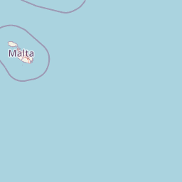
Map view of Comino

Use this park location map to pinpoint Comino in Malta, understand its exact geographic position, and read its mapped placement within the surrounding landscape more clearly.

Pigeon | © OpenStreetMap contributors

Location context for Comino

Gozo

Visualizing the rugged limestone cliffs, karst plateau, and turquoise protected waters of the Maltese archipelago

Comino Photos and Visual Landscape Guide: Exploring Terrain and Scenery

Visual records capture the distinct karst terrain, sheer limestone cliffs, and luminous turquoise waters defining the protected coastal environment of Comino. Examining these landscape views helps researchers and visitors understand the geological and ecological character of the Maltese sanctuary beyond maps alone.

A clear blue lagoon with a small white boat, framed by rocky, arid cliffs and low-lying Mediterranean shrubland on a sunny day.

Two rusted historical cannons mounted on carriages sit behind a low stone wall overlooking the blue sea.

A wide view of a long, two-story stone building with a series of arched windows and doors on a rocky, arid island landscape with the sea in the background.

A square stone fortification, St. Mary's Tower, sits atop a grassy, rocky hill under a clear blue sky, with yellow wildflowers in the foreground.

A small light-colored stone chapel with a three-arched bell gable, situated near a palm tree and a larger evergreen tree under a clear sky.

A group of people walking across a small metal footbridge connecting two rocky cliffs over a narrow inlet of water at the Blue Lagoon on Comino.

A wide angle view of the Blue Lagoon on Comino island, showing tour boats docked at a small concrete pier, colorful sun umbrellas, and tourists congregating near the rocky shoreline with clear turquoise water.

An aerial bird's eye view of the small island of Comino in Malta, surrounded by the deep blue Mediterranean Sea.

A horizontal view from the water looking toward the Comino Hotel, a low, pinkish-beige building structure set against a rocky hillside on Comino island, Malta.

Park atlas

Compare surrounding marine reserves, karst coastlines, and regional sanctuaries

Explore Protected Areas and Parks Near Comino in the Maltese Archipelago

Browse nearby national parks, protected landscapes, and marine reserves connected to the surrounding Mediterranean region. Continued geographic comparison reveals broader ecological patterns and coastal topography beyond the limestone cliffs of Comino.
A flat-style vector illustration depicting a coastal beach scene with reddish sand, rolling green hills in the background, a blue ocean with gentle waves, and a few beach umbrellas in the foreground.
Protected areaGozo
About 7.4 km away#1 closest

Northwest

Ramla Bay: Geographic Mapping and Protected Landscape Analysis of the Gozo Coast

Coastal terrain, red-sand geology, and Mediterranean rural landscapes.

Ramla Bay represents a significant protected coastal pocket on the island of Gozo. Beyond its well-known red-sand beach, the area encompasses a wider valley landscape defined by limestone headlands and agricultural plateaus. Use this mapped overview to understand the interaction between the Mediterranean coastline and the rugged rural hinterland of the Maltese islands.

Relief
Lowland
Climate
Mediterranean
Access
Easy access
Scope
Terrestrial
A pale, minimalist watercolor painting depicting St Paul's Island in Malta, showing green rolling landforms and a hint of a structure against a light background.
Protected areaMalta
About 7.7 km away#2 closest

Southeast

St Paul's Island Protected Landscape and Maltese Coastal Geography Overview

Uninhabited Mediterranean island and heritage landmark

St Paul's Island represents a unique Mediterranean limestone islet featuring maritime garigue habitat and historic ruins. Located near the Mellieħa coastline, this protected area provides a compact example of Maltese coastal geography, defined by exposed cliffs and an enduring connection to local maritime history.

Area
0.101 km²
Relief
Lowland
Scope
Mixed
Water
Water-dominated
A horizontal watercolor painting depicting a soft-toned, abstract coastal landscape with gentle green hills, grassy foreground patches, and a calm, pale pool of water against a white background.
Marine protected areaMalta
About 12 km away#3 closest

South

Ras ir-Raħeb Marine Protected Area: Geographic Profile and Mapped Coastal Landscape

Coastal cliffs and protected marine zones in north western Malta.

Ras ir-Raħeb serves as a pivotal marine protected area along the Malta coastline, where high limestone cliffs meet complex underwater habitats. This site links historical archaeological remnants with modern ecological conservation, offering a unique geographic snapshot of the Rabat plateau edge. Its mapped boundaries encompass both the terrestrial promontory and the essential seagrass meadows beneath the surface, providing a critical reference point for Mediterranean coastal geography and protected land status.

Established
2005
Relief
Upland
Climate
Mediterranean
Access
Moderate access
Watercolor painting of a reddish limestone sea arch or islet surrounded by water and faint coastal hills.
Nature reserveGozo
About 14 km away#4 closest

West

Fungus Rock: A Protected Limestone Nature Reserve on the Western Coast of Gozo

Geographic landmark and protected coastal terrain

Fungus Rock represents a critical protected landscape at the entrance to Dwejra bay, offering a unique look at Mediterranean limestone geology. Known for its vertical cliff faces and historical botanical significance, this nature reserve remains a defining feature of the Gozitan coastline and the surrounding marine environment.

Area
0.007 km²
Relief
Upland
Climate
Mediterranean
Access
Easy access
National parkMalta
About 15 km away#5 closest

Southeast

Ta' Qali National Park: Malta's Largest Urban Protected Landscape and Recreation Hub

Mapped Gardens, Event Venues, and Recreational Zones

Ta' Qali National Park serves as a vital green lung in central Malta, showcasing a landscape transformed from a wartime airfield into a modern urban protected area. This national park is recognized for its extensive recreational zones, meticulously designed formal gardens, and a prominent open-air concert venue that hosts major cultural events. Its relatively flat terrain and planned infrastructure offer a distinct map-based perspective on urban parkland, highlighting its significance as a major public amenity and a key feature of Malta's landscape.

Area
0.35 km²
IUCN
V
Relief
Lowland
Climate
Mediterranean
A soft, pastel-toned watercolor painting of a rolling green landscape with a small body of water in the foreground and a silhouette of a building on a hill in the distance.
Wildlife reserveMalta
About 18 km away#6 closest

South

Buskett Gardens Wildlife Reserve: Geography and Protected Landscape Map of Malta

A rare sheltered woodland valley in the central Mediterranean

Buskett Gardens serves as a critical protected woodland in the heart of the Maltese islands. Nestled in the fertile Wied il-Luq valley, the site offers an unusually green, shaded environment of broadleaved trees and conifers. This reserve functions as an Important Bird Area and a historic cultural landscape, providing a lush contrast to the exposed limestone plateau of rural Malta.

Area
0.47 km²
Relief
Upland
Scope
Terrestrial
Water
Minor water
A pale, minimalist watercolor illustration showing soft, rolling green and yellow hills against a white background.
Nature reserveMalta
About 26 km away#7 closest

South

Filfla Nature Reserve: The Protected Limestone Plateau and Geography of Malta

Tracing the limestone cliffs and seabird sanctuary of the Maltese archipelago

Filfla is a small, uninhabited limestone islet lying 4.5 kilometres south of the main island of Malta. Defined by its 60-metre sea cliffs and flat plateau, this protected nature reserve functions as a crucial Important Bird Area and a landmark for regional Mediterranean biodiversity. Examine the mapped boundaries and geological profile of this site to understand its status as the southernmost extremity of the Maltese archipelago.

Area
0.06 km²
Established
1980
Relief
Upland
Climate
Mediterranean
A horizontal watercolor illustration showing soft, blended washes of green, yellow, and pale pink depicting an abstract rolling landscape or horizon line against a white background.
Natural monumentMalta
About 26 km away#8 closest

Southeast

Għar Dalam Natural Monument: A Protected Maltese Cave and Paleontological Landmark

Geological and prehistoric landscape context in southeastern Malta

Għar Dalam is a protected natural monument in Malta that preserves a complex phreatic cave passage and essential fossil records of extinct dwarf species. This cave site acts as a major cornerstone for understanding the prehistoric Mediterranean, documenting the arrival of early Neolithic cultures and the long-term evolution of island-bound animal life through stratified sediment analysis.

Established
1933
Relief
Lowland
Climate
Mediterranean
Access
Easy access

Common questions about visiting, size, designation, and location context for Comino

Comino FAQs for park facts, access, geography, and protected area context

Find quick answers about Comino, including protected-area facts, park geography, trail and visitor context, and how the park fits into its surrounding country and regional landscape.
MoriAtlas Explorer

Continue Your Protected Areas Search Across the Global Atlas

Deepen your exploration by continuing the structured search for national parks and protected areas worldwide. Utilize the comprehensive filtering capabilities to compare different conservation landscapes and refine your understanding of global park geography. Discover more about the distribution and characteristics of protected natural areas.

Global natural geography