
Mori Atlas logo
Protected areaCoron Island Protected Area

Examine the geographic boundaries, karst geology, and sheltered island terrain of this unique Philippine territory.

Coron Island Protected Area: A Deep Dive into Palawan Limestone Karst and Marine Landscapes

Coron Island Protected Area stands as a landmark of karst topography and marine conservation in the Calamian Islands of Palawan. The landscape features dramatic Jurassic limestone cliffs that tower over sheltered inland lakes and expansive coastal mangrove environments. This geography encompasses both terrestrial rock formations and critical marine waters, reflecting a complex system managed within the ancestral domain of the Tagbanuwa people.

karst landscapelimestone islandinland lakesmangrovescoral reefscoastal cliffs
A flat, vector-style illustration of steep, light green mountains and rocky cliffs with dark green coniferous trees and a white waterfall cascading into a stream at the center, set against a soft, pastel-colored sky.

Coron Island Protected Area

Protected area

Park overview

Structured park overview, official facts, and landscape profile for Coron Island Protected Area

Coron Island Protected Area park facts, protected area profile, and essential visitor context

Review the core facts for Coron Island Protected Area, including designation, size, terrain, visitor scale, habitats, and operating context in one park-focused overview.

About Coron Island Protected Area

Coron Island Protected Area is one of the signature protected landscapes of northern Palawan, situated within the Calamian Islands in the western Philippines. The territory centers on Coron Island, a rugged karst landmass rising from the waters of Coron Bay, and extends outward to include portions of the surrounding sea that have long served as traditional fishing grounds for local communities.

The protected area is defined above all by its geology. Built on limestone laid down during the Jurassic period, the island has been shaped by long-term erosion into a landscape of jagged ridges, sheer cliffs, narrow canyons, and deeply recessed basins. Inland lakes occupy some of these basins, while the coastline alternates between mangrove-fringed tidal flats, white sand and pebble beaches, and cliff faces that in places reach roughly 300 meters in height. This karst scenery gives the area its highly recognizable profile, both from the sea and from elevated viewpoints inland.

Equally important to the area's identity is its human and cultural dimension. The territory is the ancestral domain of the Tagbanuwa, an indigenous people whose presence on and around Coron long predates modern conservation designations. Republic Act 7611, which formally established the protected area in 1998, recognized this relationship by placing management in the hands of the Tagbanuwa through the Palawan Council for Sustainable Development. This gives the protected area a distinctive semi-autonomous character, where conservation, indigenous land tenure, and traditional resource use are formally linked.

As a whole, Coron Island Protected Area represents a layered convergence of natural and cultural heritage: a karst island landscape, a productive marine environment, and an indigenous community with continuing stewardship responsibilities. It is frequently counted among the most scenically striking protected areas in the Philippines and is widely visited for its lakes, cliffs, reefs, and surrounding bays.

Quick facts and research context for Coron Island Protected Area

Coron Island Protected Area is located in the Calamian Islands of Palawan Province in the western Philippines, with the nearest mainland reference being the town of Coron on neighboring Busuanga Island. It was formally designated under Republic Act 7611 on 5 June 1998, consolidating earlier protections that had begun with a national reserve proclamation in 1967.

The protected area covers approximately 222 square kilometers and includes Coron Island together with parts of Coron Bay and surrounding marine waters. The territory is recognized as the ancestral domain of the Tagbanuwa people, who hold a semi-autonomous role in its management. Geologically, the island is built on Jurassic limestone that has been heavily karstified, producing the cliffs, ridges, and inland lakes that define its scenery.

Protection and recognition

Examine documented protection scope and management records for Coron Island Protected Area.

Coron Island Protected Area Protection Status and Conservation Recognition

Coron Island Protected Area maintains a mixed protection scope within its documented conservation framework. Official records compile management parameters and administrative designations for ongoing environmental research.

Protection details

Protection scope
Mixed
Transboundary protection
No
Park context

Deeper park guide and search-rich context for Coron Island Protected Area

Coron Island Protected Area history, landscape, wildlife, and travel context

Explore Coron Island Protected Area through its history, landscape character, ecosystems, wildlife, conservation priorities, cultural context, and seasonal travel timing in a structured park guide built for atlas discovery and search intent.

Why Coron Island Protected Area stands out

Coron Island Protected Area is best known for its towering limestone karst landscape, which rises in steep cliffs above Coron Bay and frames a series of inland lakes. The most celebrated feature is Kayangan Lake, often described as one of the clearest and most scenically enclosed lakes in the Philippines, surrounded on all sides by high karst walls. Beyond its freshwater lakes, the area is also recognized for its coastal environment, including mangrove forests, small tidal areas, and white sand and pebble beaches tucked between cliffs. The combination of dramatic karst topography, inland lakes, marine waters, and indigenous Tagbanuwa stewardship forms the protected area's most distinctive identity.
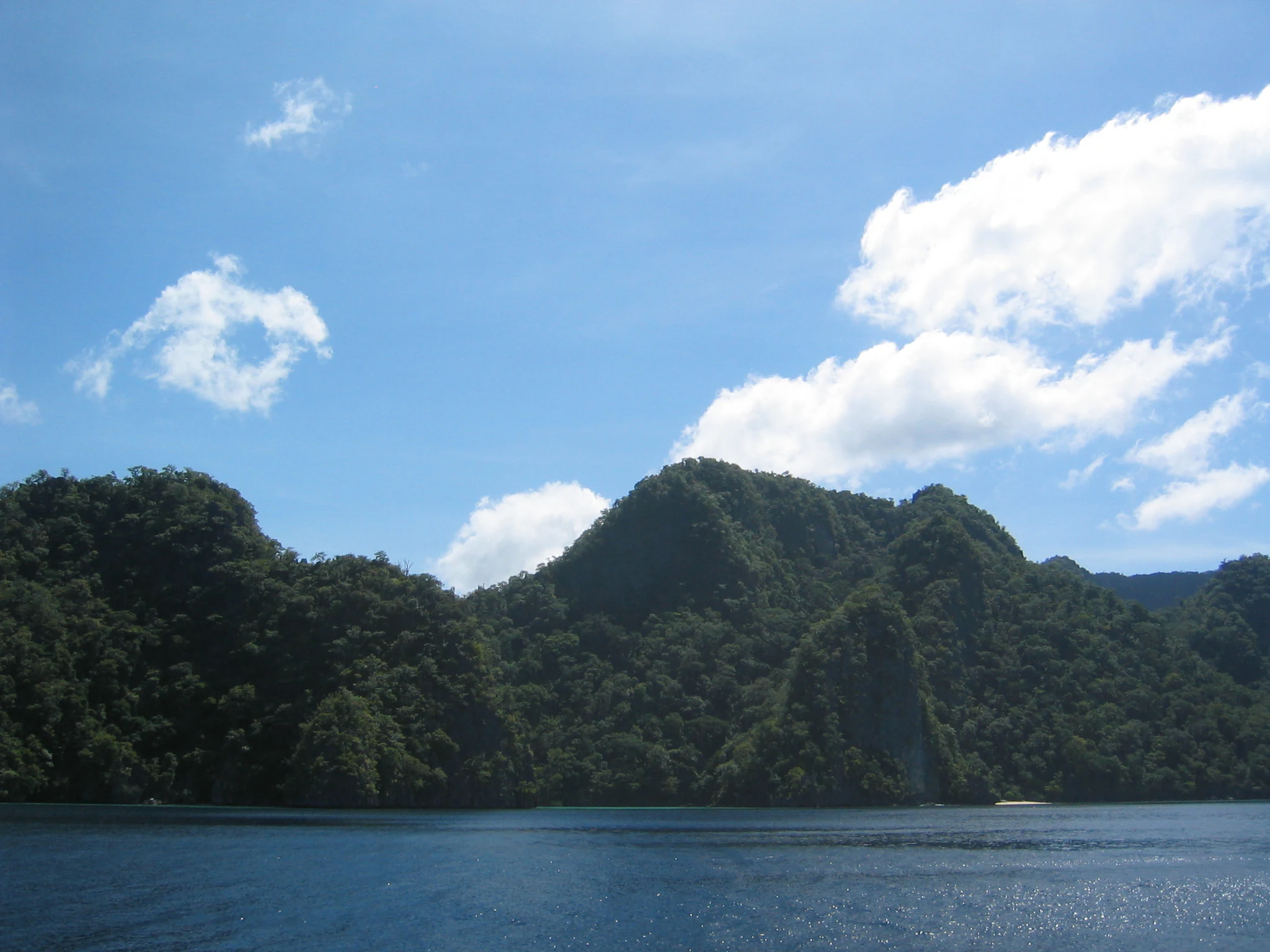
A wide view of tropical karst limestone islands covered in dense green forest rising directly out of dark blue water under a bright blue sky with scattered clouds.
A scenic view of the rugged, vegetated limestone karst cliffs rising from the sea on Coron Island.

Coron Island Protected Area history and protected-area timeline

The history of Coron Island Protected Area is one of gradually expanding protection that was ultimately consolidated into a single legal framework. In 1967, a national reserve designation was issued through Proclamation 219, establishing an initial level of protection over parts of the island. This was followed in 1978 by the designation of a tourist zone and marine protected area, and later by a mangrove protection designation under Proclamation 2152.

A first formal recognition of indigenous land rights came in 1990, when a portion of the territory was set aside as ancestral domain land for the Tagbanuwa, covering roughly 77 square kilometers. These overlapping protection measures were then brought together on 5 June 1998, when Republic Act 7611 came into effect, establishing the Coron Island Protected Area as a unified territory of about 222 square kilometers.

Republic Act 7611 was issued through the Palawan Council for Sustainable Development and explicitly framed the protected area as the ancestral domain of the Tagbanuwa, granting the community a central role in its management. This gave the area a semi-autonomous status that reflected both its ecological importance and its cultural significance, integrating earlier conservation efforts with indigenous stewardship into a single institutional framework.

Coron Island Protected Area landscape and geographic character

The landscape of Coron Island Protected Area is dominated by karst topography. The island's foundation consists of limestone formed during the Jurassic period, and prolonged erosion has carved this bedrock into the area's most distinctive features. High, steep ridges and isolated rock spires rise above the surrounding sea, while interior gorges and chasms cut deep into the terrain.

In the heart of the island, these karst basins hold freshwater lakes, with Kayangan Lake being the most prominent and several smaller lakes scattered across the interior. The lakes are typically enclosed by towering limestone walls, giving them a sheltered, almost enclosed character.

Along the coast, the landscape softens into a narrow band of mangroves, small tidal flats, and beaches of white sand and pebbles. Above these beaches, the cliffs rise abruptly, in places reaching heights of up to roughly 300 meters. The result is a setting where dramatic vertical rock faces, sheltered coves, and quiet inland lakes are all part of a single continuous landscape system shaped by limestone and time.

Coron Island Protected Area ecosystems, habitats, and plant life

Ecologically, Coron Island Protected Area reflects its isolation as an island system within the Calamian archipelago. The terrestrial environment is shaped heavily by its karst geology, which supports distinctive plant communities adapted to thin soils, exposed rock surfaces, and steep terrain. The island's interior is largely forested, while coastal vegetation transitions into mangrove stands and shoreline plant communities along the quieter bays and tidal areas.

The protected area also encompasses an important marine component, including portions of Coron Bay and surrounding waters. These marine environments support coral reef ecosystems, seagrass beds, and a range of coastal habitats that interact with the terrestrial karst landscape through rivers, springs, and the inland saltwater-influenced lakes.

Together, the karst forests, mangrove systems, inland lakes, and marine waters form an interconnected ecological network characteristic of the Calamian Islands, where terrestrial and marine habitats are tightly linked by the island's geology and hydrology.

Coron Island Protected Area wildlife and species highlights

The wildlife profile of Coron Island Protected Area is closely tied to its mosaic of karst forest, inland lakes, mangroves, and surrounding marine waters. The island's forested interior and cliff environments support birdlife and small vertebrates typical of Calamian island ecosystems, while the mangrove fringes and tidal flats provide habitat for shorebirds, crustaceans, and other coastal species.

The marine component of the protected area is rich in reef-associated fauna, including reef fish and invertebrates that depend on the coral habitats around Coron Bay and adjacent waters. The inland lakes, including Kayangan Lake, support distinct aquatic communities that have evolved within enclosed karst basins, while the surrounding cliffs and forested slopes provide nesting and shelter sites for a variety of island bird species.

Although detailed species inventories for the protected area are limited in the available source material, the combination of forest, lake, mangrove, and marine habitats gives the area notable ecological breadth across a relatively small island territory.

Coron Island Protected Area conservation status and protection priorities

The conservation significance of Coron Island Protected Area lies in its combination of karst ecosystem protection, marine habitat preservation, and indigenous co-management. The area safeguards a representative example of Jurassic limestone karst within the Calamian archipelago, including fragile features such as inland lakes, cliff habitats, and associated forest cover that are easily disturbed by unregulated development.

By incorporating large portions of Coron Bay and surrounding waters, the protected area also extends conservation beyond the terrestrial realm, addressing coral reef, mangrove, and coastal ecosystems that are vital to regional marine biodiversity. The integration of these marine and terrestrial systems into a single protected territory reflects an ecosystem-scale approach rather than a narrower habitat-by-habitat focus.

A defining element of the area's conservation framework is its indigenous dimension. Republic Act 7611 ties protection directly to the ancestral domain of the Tagbanuwa, with the Palawan Council for Sustainable Development and the Tagbanuwa themselves playing a central role in management. This gives the protected area a distinctive model where biodiversity protection and indigenous land tenure are formally linked, rather than treated as separate policy concerns.

Coron Island Protected Area cultural meaning and human context

The cultural identity of Coron Island Protected Area is inseparable from the Tagbanuwa, the indigenous people who consider the island and surrounding waters their ancestral domain. Long before modern conservation designations, the Tagbanuwa relied on Coron's forests, inland lakes, and coastal fishing grounds for subsistence, ritual, and community life.

Republic Act 7611 formalized this relationship by recognizing the protected area explicitly as Tagbanuwa ancestral domain, administered in cooperation with the Palawan Council for Sustainable Development. This arrangement gives the community a semi-autonomous role in decisions affecting land and resource use, including traditional fishing in parts of Coron Bay.

The result is a cultural landscape in which indigenous stewardship, traditional ecological knowledge, and contemporary conservation policy operate together, with the Tagbanuwa acting as both custodians and rights-holders within the protected area.

Top sights and standout views in Coron Island Protected Area

Coron Island Protected Area combines some of the most dramatic karst scenery in the Philippines with a marine environment that has supported indigenous fishing traditions for generations. Its cliffs, inland lakes, mangrove coasts, and reef-rich bays together form a compact but highly varied natural system within the Calamian Islands.

The area's most distinctive quality is the way karst geology, freshwater lake systems, and coastal marine habitats come together on a single island, all under a management framework that places indigenous Tagbanuwa stewardship at the center of conservation.

Best time to visit Coron Island Protected Area

The character of a visit to Coron Island Protected Area varies with seasonal conditions in the Calamian Islands. The dry season generally brings calmer seas, clearer skies, and better visibility for both lake visits and marine activities around the bays and reefs, making it the most favorable period for exploring the area's cliffs, inland lakes, and surrounding coast.

Wet-season months can bring heavier rain, rougher sea conditions, and reduced visibility in some marine areas, though they also keep the karst forest and waterfalls lush. Visitors interested primarily in the scenery of Kayangan Lake, the surrounding cliffs, and coastal bays will generally find the dry season most rewarding, while those drawn to greener landscapes may appreciate the wetter months.
Monthly climate preview

Long-term representative temperature and monthly precipitation averages for Palawan terrain

Coron Island Protected Area Climate Normals and Annual Temperature Patterns

Representative point measurements indicate persistent high temperatures alongside distinct shifts in monthly precipitation across the protected coordinate. Examining the complete twelve-month climatology profile reveals comprehensive variations in baseline temperature and rainfall rhythms.
Annual mean28 °C
27 °C30 °C
Jan27°
Feb27°
Mar28°
Apr30°
May29°
Jun28°
Jul28°
Aug28°
Sep27°
Oct28°
Nov28°
Dec27°
Warmest month
April

29.5 °C

Coolest month
January

26.9 °C

Wettest month
July

16.4 mm/day

Driest month
March

0.6 mm/day

Park location guide

Geography guide, regional context, and park location map for Coron Island Protected Area

Coron Island Protected Area park geography, regions, and map view in Philippines

Understand where Coron Island Protected Area sits in Philippines through a broader geographic reading of the surrounding landscape, nearby location context, and its mapped position within the national park landscape.

How Coron Island Protected Area fits into Philippines

The Philippines, officially the Republic of the Philippines, is an archipelagic nation in Southeast Asia comprising approximately 7,641 islands categorized into three main geographical divisions: Luzon, Visayas, and Mindanao. Located in the western Pacific Ocean, it shares maritime borders with Taiwan, Japan, Palau, Indonesia, Malaysia, Vietnam, and China. Manila serves as the capital city, while Quezon City is the most populated city, both within Metro Manila.

Wider geography shaping Coron Island Protected Area in Philippines

The Philippines is an archipelagic nation in Southeast Asia, positioned in the western Pacific Ocean. Its islands are bounded by the South China Sea to the west, Philippine Sea to the east, and Celebes Sea to the south. The country shares maritime borders with Taiwan to the north, Japan to the northeast, Palau to the east and southeast, Indonesia to the south, Malaysia to the southwest, Vietnam to the west, and China to the northwest.

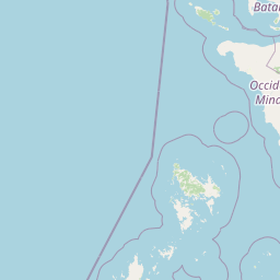
Map view of Coron Island Protected Area

Use this park location map to pinpoint Coron Island Protected Area in Philippines, understand its exact geographic position, and read its mapped placement within the surrounding landscape more clearly.

Pigeon | © OpenStreetMap contributors

Location context for Coron Island Protected Area

Palawan

Visual reference for limestone cliffs, inland lakes, and coastal marine habitats

Coron Island Protected Area Photos and Landscape Scenery

Visual records reveal the dramatic limestone karst topography and sheltered inland lakes that define the protected landscape. Examining aerial views and coastal imagery provides clear insight into the complex island ecosystem and marine environment.

A wide view of tropical karst limestone islands covered in dense green forest rising directly out of dark blue water under a bright blue sky with scattered clouds.

A first person perspective of someone holding a bright orange life vest, looking out over a calm, turquoise lake surrounded by steep, jungle-covered limestone cliffs.

Park atlas

Compare adjacent protected areas, coastal formations, and island ecosystems across the region

Explore Other Parks Near Coron Island Protected Area and Regional Landscapes

Browsing nearby national parks and protected areas reveals the broader regional spread of limestone terrain and coastal habitats. Evaluating adjacent conservation zones provides deeper geographic context for island ecosystems and marine reserves.
Wildlife reserveMimaropa
About 54 km away#1 closest

Northwest

Calauit Safari Park: Wildlife Reserve Geography and Protected Island Terrain

A conservation sanctuary within the Mimaropa region, Philippines.

Calauit Safari Park stands out as a unique wildlife reserve in the Calamian Islands, featuring a rare combination of African savanna animals and native Philippine wildlife. Its 3,700 hectares encompass a diverse array of tropical forests, grasslands, and mangrove-lined shores, reflecting a complex history of conservation and land management. This protected island ecosystem provides critical habitat for endangered species and serves as an important site for ecological recovery in the western Philippines.

Area
37 km²
Established
1976
Relief
Lowland
Climate
Tropical
A wide panoramic watercolor painting showing a body of water in the foreground, a green tree-lined shore in the midground, and faint mountains under a pink and yellow sky in the background.
Marine protected areaPhilippines
About 90 km away#2 closest

North

Apo Reef Marine Natural Park: Protected Coral Reef Atlas and Marine Geography

Marine protected area in the Mindoro Strait, Philippines

Apo Reef Marine Natural Park serves as a high-priority conservation landscape featuring two massive triangular coral banks and steep underwater drop-offs. This site provides a critical case study in marine geomorphology, characterized by its deep submarine trenches and unique atoll-like structure within the broader Philippine archipelagic geography.

Area
274.69 km²
Established
1996
Scope
Marine
Water
Water-dominated
A soft, panoramic watercolor painting depicting a coastal landscape with green rolling hills, distant mountains, and a pale shoreline.
Protected landscapePalawan
About 124 km away#3 closest

Southwest

El Nido-Taytay Managed Resource Protected Area: A Coastal Karst and Marine Landscape Atlas

Mapping the terrestrial and marine boundaries of northern Palawan.

An authoritative overview of the El Nido-Taytay Managed Resource Protected Area, detailing its extensive karst limestone islands, hidden lagoons, and diverse coastal ecosystems. This record maps the intersection of terrestrial forests and marine habitats that span the municipalities of El Nido and Taytay, providing a clear geographic context for this significant Philippine protected landscape.

Area
923.34 km²
Established
1998
National parkMindoro
About 150 km away#4 closest

Northeast

Mounts Iglit, Baco National Park: Philippines Protected Landscape and Geographic Identity

Explore Mindoro's significant national park and its mapped natural terrain.

Delve into Mounts Iglit, Baco National Park, a protected national park located on the island of Mindoro. This entry offers a detailed geographic perspective, focusing on its mapped boundaries and its role within the archipelago's conservation landscape. Understand the park's specific regional geography and its identity as a distinct protected area.

Relief
Mountain
Scope
Terrestrial
Protected landscapePalawan
About 157 km away#5 closest

Southwest

Malampaya Sound Protected Landscape/Seascape: Geographic Atlas and Coastal Park Boundaries

A combined marine and terrestrial protected area in Palawan, Philippines

Gain insights into the geographic composition of Malampaya Sound Protected Landscape/Seascape. This expansive site on Palawan island encompasses sheltered bays, island chains, and mangrove-fringed shorelines. Examine the structural balance between brackish-water ecosystems, essential tidal flats, and local fishing barangays within a single managed maritime reserve.

Area
2,015.66 km²
Established
2000
Relief
Lowland
Scope
Mixed
A watercolor painting showing a winding stream flowing through grassy wetlands toward distant low mountain ranges.
National parkPhilippines
About 169 km away#6 closest

Northeast

Lake Naujan National Park: An Atlas of Volcanic Lakes and Wetland Geography

Mapped protected landscapes in the Philippines

Lake Naujan National Park occupies a unique geographic position on Mindoro Island, centering on a vast volcanic freshwater lake. The protected area integrates diverse terrain ranging from aquatic wetland zones and thermal springs to lowland forests and managed agricultural buffers, providing an essential study in human-modified conservation landscapes.

Wildlife reserveOccidental Mindoro
About 171 km away#7 closest

North

Mount Calavite Wildlife Sanctuary: Regional Geography and Protected Habitat Mapping

A historic wildlife reserve in Occidental Mindoro

Located in northwestern Occidental Mindoro, Mount Calavite Wildlife Sanctuary preserves a distinct vertical sequence of habitats, from remnant rainforest to high-elevation grasslands. The area is defined by ancient metamorphic geology and serves as a vital stronghold for range-restricted birds and the endangered Tamaraw. This atlas entry provides structured insight into the sanctuary's boundaries, terrain, and its enduring role in Philippine conservation geography.

Area
181.5 km²
Established
1920
Relief
Mountain
Scope
Terrestrial
National parkPhilippines
About 180 km away#8 closest

Northeast

Naujan Lake National Park: Philippines National Park Atlas and Protected Landscape

Explore its mapped boundaries and regional geographic context.

Naujan Lake National Park offers a focused exploration of a distinct protected landscape within the Philippines. This page details the park's specific geographic footprint and its characteristics as a national park. Understand its place within the archipelago's broader geography, providing a valuable entry point for atlas-based discovery of protected natural areas and their mapped extents across Southeast Asia.

Scope
Terrestrial
Water
Water-dominated

Common questions about visiting, size, designation, and location context for Coron Island Protected Area

Coron Island Protected Area FAQs for park facts, access, geography, and protected area context

Find quick answers about Coron Island Protected Area, including protected-area facts, park geography, trail and visitor context, and how the park fits into its surrounding country and regional landscape.
MoriAtlas Explorer

Continue Your Protected Areas Search Across the Global Atlas

Deepen your exploration by continuing the structured search for national parks and protected areas worldwide. Utilize the comprehensive filtering capabilities to compare different conservation landscapes and refine your understanding of global park geography. Discover more about the distribution and characteristics of protected natural areas.

Global natural geography