Mori Atlas logo
Nature reserveCosigüina Peninsula

Discover the complex protected area boundaries and coastal geography of northwestern Nicaragua.

Cosigüina Peninsula Nature Reserve: Mapping the Volcanic Terrain and Estuarine Landscapes

The Cosigüina Peninsula Nature Reserve forms a vital protected landmass extending into the Gulf of Fonseca within the Chinandega Department. This expansive volcanic landscape features a central massif defined by the Cosigüina Volcano, transitioning into extensive mangrove forests, tidal flats, and estuarine channels. By analyzing the intersection of its volcanic highlands, coastal wetlands, and offshore islets, users can examine the regional geography and conservation status of this distinctive Pacific coastal environment.

peninsulavolcanic landscapemangrovesestuarine ecosystemsGulf of FonsecaPacific coast

Cosigüina Peninsula

Nature reserve

Park overview

Structured park overview, official facts, and landscape profile for Cosigüina Peninsula

Cosigüina Peninsula park facts, protected area profile, and essential visitor context

Review the core facts for Cosigüina Peninsula, including designation, size, terrain, visitor scale, habitats, and operating context in one park-focused overview.

About Cosigüina Peninsula

The Cosigüina Peninsula is one of the most environmentally significant coastal landforms on Nicaragua's Pacific coast. Extending westward from the volcanic plain of the Buena Vista valley toward the Gulf of Fonseca, it combines a dramatic volcanic interior with extensive mangrove-lined coastlines and a complex system of estuaries and tidal channels.

The peninsula's modern identity is shaped by two overlapping layers of protection. In 1958, the Nicaraguan government declared the entire peninsula a refuge for the protection of wild animals, giving it one of the country's earliest formal wildlife protection designations. Decades later, in 1983, a second decree established the Cosigüina Volcano Natural Reserve (RNVC) over the volcano itself, with a buffer zone reaching from the El Congo community outward to the Punta Ñata sector on the southwest coast and the Potosí sector on the northeast side.

Environmentally, the Cosigüina Peninsula sits at a meeting point of marine, estuarine, and terrestrial ecosystems. The Gulf of Fonseca and the Estero Real to the north, and the Pacific Ocean to the south and west, support extensive mangrove systems and seasonal wetlands that are critical for migratory waterbirds and coastal fisheries. The offshore Farallones de Cosiguina, lying at the tip of the peninsula in the Gulf of Fonseca, add rocky islet habitat that complements the broader protected area. Inland, the slopes of Cosigüina Volcano support dry tropical forest and provide a terrestrial counterpart to the surrounding marine systems.

Together, these features have made the peninsula both a refuge for wildlife and a focal point for conservation management on Nicaragua's northwestern coast, administered through MARENA's natural reserve and wildlife refuge framework.

Quick facts and research context for Cosigüina Peninsula

The Cosigüina Peninsula lies in the extreme northwest of Nicaragua, in the Chinandega Department, within the municipality of El Viejo. Its northern edge faces the Gulf of Fonseca and the Estero Real, while its western and southern sides open to the Pacific Ocean. To the east, the peninsula transitions into the volcanic plain of the Buena Vista valley.

At roughly 93,085 hectares, the peninsula forms a major share of the department's surface. A 1958 government decree established the territory as a refuge for the protection of wild animals, and a subsequent 1983 decree created the Cosigüina Volcano Natural Reserve (RNVC) over the volcanic core. The protected designation is administered by MARENA, Nicaragua's environmental authority.

Protection and recognition

Analysis of mixed protection scope, establishment year, and international recognition

Cosigüina Peninsula Protection Status and Designated History

Cosigüina Peninsula carries a mixed protection scope established in the year 1983. Documentation tracks the designated status and management history without relying on external recognition sources.

Protection details

Protection scope
Mixed
Designated year
1983
Transboundary protection
No
Park context

Deeper park guide and search-rich context for Cosigüina Peninsula

Cosigüina Peninsula history, landscape, wildlife, and travel context

Explore Cosigüina Peninsula through its history, landscape character, ecosystems, wildlife, conservation priorities, cultural context, and seasonal travel timing in a structured park guide built for atlas discovery and search intent.

Why Cosigüina Peninsula stands out

The Cosigüina Peninsula is best known for the convergence of an active volcanic landscape with one of the most ecologically rich estuarine systems in Central America. The Cosigüina Volcano dominates the peninsula's interior and defines the buffer zone of the RNVC, which extends from the community of El Congo through to the Punta Ñata and Potosí sectors around the volcano's flanks. Equally defining is the peninsula's position at the junction of the Gulf of Fonseca, the Estero Real, and the open Pacific. This setting creates extensive mangrove forests, tidal flats, and pelagic habitat that have made the area a recognized wildlife refuge, complemented by the offshore Farallones de Cosiguina islets which extend the protected environment into the marine realm.

Cosigüina Peninsula history and protected-area timeline

The Cosigüina Peninsula entered Nicaragua's formal conservation history relatively early. On 2 September 1958, a government decree designated the territory of the peninsula as a refuge or asylum area for the protection of wild animals. This made the area one of Nicaragua's earlier wildlife protection designations and laid the groundwork for its later recognition as a natural reserve.

Nearly a quarter century later, on 19 September 1983, a further government decree established the Cosigüina Volcano Natural Reserve, known as the RNVC, focused specifically on the volcanic core of the peninsula. This decree defined a buffer zone that begins at the El Congo community, roughly 39 kilometers from the city of El Viejo, and extends around the volcano to Punta Ñata on the southwest coast and Potosí on the northeast, reflecting an intent to integrate the volcanic landscape with the surrounding coastal and estuarine systems.

The present-day protected status reflects the combined framework of these decrees and ongoing administration by MARENA, Nicaragua's Ministry of the Environment and Natural Resources. The earlier name 'Lacoalguina' recorded in the sources indicates older forms of regional reference to the peninsula that predate the modern designation.

Cosigüina Peninsula landscape and geographic character

The Cosigüina Peninsula is defined by the contrast between its elevated volcanic core and its surrounding low-lying coastline. The Cosigüina Volcano rises at the heart of the peninsula, shaping a central massif of volcanic slopes that descend toward the sea in multiple directions. To the east, the volcanic terrain gives way to the Buena Vista valley, while to the north, west, and south, the land meets the waters of the Gulf of Fonseca, the Estero Real, and the Pacific Ocean.

The coastal fringe of the peninsula is shaped by extensive tidal flats, mangrove systems, and estuarine channels, particularly along the northern shore facing the Gulf of Fonseca and the Estero Real. These wetlands form a broad transitional band between the volcanic interior and the open sea and constitute a major portion of the peninsula's overall area.

Offshore, the Farallones de Cosiguina islets lie at the tip of the peninsula in the Gulf of Fonseca, adding vertical rocky outcrops to the otherwise low coastal setting. The combination of volcanic upland, mangrove plain, and offshore islets gives the Cosigüina Peninsula one of the most varied coastal landscapes on Nicaragua's Pacific side.

Cosigüina Peninsula ecosystems, habitats, and plant life

Ecologically, the Cosigüina Peninsula unites three strongly contrasting habitat systems within a single protected framework. The volcanic slopes of Cosigüina support dry tropical forest and transitional woodland, where vegetation adapts to a combination of volcanic substrates, seasonal rainfall patterns, and exposure to Pacific-influenced climatic conditions.

The coastal fringe is dominated by extensive mangrove systems and estuarine habitat associated with the Gulf of Fonseca and the Estero Real. These mangroves and tidal flats are among the most productive ecosystems in Central America, functioning as nursery areas for commercially and ecologically important fish and shellfish species, as well as critical habitat for migratory and resident waterbirds.

The offshore Farallones de Cosiguina contribute a third habitat layer, with rocky marine islet environments that support seabirds and marine life distinct from those of the mangrove-lined coast. Together, the peninsula's forest, mangrove, and marine islet habitats form an ecological mosaic of unusually high diversity for a single protected area on Nicaragua's Pacific coast.

Cosigüina Peninsula wildlife and species highlights

The combination of forest, mangrove, and marine habitats has made the Cosigüina Peninsula an important refuge for wildlife, which is reflected in its formal designation as a wildlife refuge under the 1958 decree. The area is widely recognized for its birdlife, particularly the waterbirds, shorebirds, and seabirds that depend on the mangrove estuaries of the Gulf of Fonseca and the Estero Real, as well as the rocky islets of the Farallones de Cosiguina.

The mangrove systems themselves support rich populations of crustaceans, mollusks, and juvenile fish, forming the base of a food web that extends into the broader Pacific coastal ecosystem. Inland, the volcanic forests provide habitat for a range of dry tropical forest species typical of northwestern Nicaragua.

The peninsula's wildlife significance, combined with its protection under both the 1958 wildlife refuge decree and the 1983 Natural Reserve decree, has made it one of the most important wildlife conservation areas on Nicaragua's Pacific coast.

Cosigüina Peninsula conservation status and protection priorities

Conservation importance on the Cosigüina Peninsula rests on its layered legal protection and its ecological role at the junction of marine, estuarine, and terrestrial systems. The 1958 decree establishing the peninsula as a refuge for the protection of wild animals provided an early national framework for safeguarding wildlife in the area, while the 1983 decree establishing the Cosigüina Volcano Natural Reserve added a formal natural reserve designation centered on the volcano and its buffer zone.

Administration falls under MARENA, Nicaragua's Ministry of the Environment and Natural Resources, which oversees both the wildlife refuge status of the broader peninsula and the Natural Reserve designation centered on the volcano. The buffer zone of the RNVC explicitly links inland volcanic habitats with surrounding coastal areas, reaching from El Congo to Punta Ñata on the southwest and Potosí on the northeast, recognizing that the volcano's ecological value depends on the surrounding landscape.

Beyond legal designation, the peninsula's conservation importance is reinforced by the ecological productivity of the Gulf of Fonseca and Estero Real, which rank among the most biodiverse estuarine systems in the region, and by the presence of the Farallones de Cosiguina as a complementary marine islet refuge.

Cosigüina Peninsula cultural meaning and human context

The older regional name 'Lacoalguina' for the peninsula, recorded in the sources, suggests a long pre-modern history of local reference to the landform. The municipality of El Viejo, from which administratively the peninsula is governed, gives the area a clear connection to the broader cultural landscape of the Chinandega Department in northwestern Nicaragua, where Pacific coastal livelihoods, fishing communities, and agricultural traditions shape the regional identity.

The peninsula's intertwined relationship with fishing, mangrove resource use, and the rural communities around El Congo and surrounding areas contributes to its cultural context, even where detailed ethnographic information is not central to the protected area definition.

Top sights and standout views in Cosigüina Peninsula

The standout features of the Cosigüina Peninsula include the Cosigüina Volcano at its core, the extensive mangrove and estuarine systems of the Gulf of Fonseca and Estero Real along its northern shore, and the Farallones de Cosiguina offshore islets. The peninsula's protection under both a long-standing wildlife refuge designation and a Natural Reserve decree gives it unusually strong conservation standing for a coastal protected area in Nicaragua.

Equally distinctive is the peninsula's scale. At roughly 93,085 hectares, it accounts for around 19.3 percent of the Chinandega Department's surface, forming a major share of northwestern Nicaragua's protected natural estate.

Best time to visit Cosigüina Peninsula

Information in the source pages does not provide concrete seasonal guidance for visiting the Cosigüina Peninsula, so detailed month-by-month timing cannot be supported here.

Monthly climate preview

Monthly temperature ranges and rainfall distribution for Chinandega Department

Cosigüina Peninsula Climate Normals, Long-Term Temperature and Precipitation

Cosigüina Peninsula exhibits a measured annual thermal rhythm with long-term average temperatures peaking above thirty degrees Celsius alongside distinct monthly precipitation shifts. Detailed monthly climate normals clarify the broader seasonal distribution of temperature and rainfall across the protected landscape.
Annual mean29 °C
28 °C30 °C
Jan29°
Feb29°
Mar30°
Apr30°
May29°
Jun29°
Jul29°
Aug29°
Sep28°
Oct28°
Nov28°
Dec28°
Warmest month
April

30.2 °C

Coolest month
October

27.6 °C

Wettest month
September

8.5 mm/day

Driest month
January

0.1 mm/day

Park location guide

Geography guide, regional context, and park location map for Cosigüina Peninsula

Cosigüina Peninsula park geography, regions, and map view in Nicaragua

Understand where Cosigüina Peninsula sits in Nicaragua through a broader geographic reading of the surrounding landscape, nearby location context, and its mapped position within the national park landscape.

How Cosigüina Peninsula fits into Nicaragua

Nicaragua is a Central American country spanning 130,375 km² with a population of approximately 6.7 million. It borders Honduras, Costa Rica, the Caribbean Sea, and the Pacific Ocean. The official language is Spanish, and the currency is the Córdoba. Known for its agricultural productivity and cultural diversity, Nicaragua has a history dating back to indigenous civilizations before Spanish conquest in the 16th century.

Wider geography shaping Cosigüina Peninsula in Nicaragua

Nicaragua occupies a strategic position in Central America, bordered by Honduras to the north, the Caribbean Sea to the east, Costa Rica to the south, and the Pacific Ocean to the west. The country also shares maritime borders with El Salvador and Colombia. The terrain includes coastal plains, volcanic highlands, and interior valleys. Lake Managua and Lake Nicaragua are major freshwater bodies.

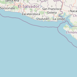
Map view of Cosigüina Peninsula

Use this park location map to pinpoint Cosigüina Peninsula in Nicaragua, understand its exact geographic position, and read its mapped placement within the surrounding landscape more clearly.

Pigeon | © OpenStreetMap contributors

Location context for Cosigüina Peninsula

Chinandega Department
Park atlas

Compare adjacent volcanic landscapes and coastal wetlands across the region

Explore Other Parks Near Cosigüina Peninsula and Surrounding Protected Areas

Continue browsing national parks and protected areas located near Cosigüina Peninsula to compare regional volcanic terrain. Expanding the geographic scope helps trace connected wildlife refuges and coastal ecosystems across the surrounding territory.
Nature reserveChinandega Department
About 3.8 km away#1 closest

Southeast

Estero Padre Ramos Natural Reserve: Protected Coastal Estuary and Turtle Habitat in Nicaragua

Mangrove forests and tidal landscapes of the Pacific coast

Gain insights into the geography and protected status of Estero Padre Ramos Natural Reserve. This coastal sanctuary in the Chinandega Department features pristine estuarine channels, mudflats, and rocky reefs that define the local terrain and support international marine turtle conservation efforts.

Area
91.57 km²
Established
1983
IUCN
IV
Relief
Lowland
National parkFrancisco Morazán Department
About 152 km away#2 closest

North

La Tigra National Park: Mapped Protected Landscape in Francisco Morazán Department, Honduras

Explore its geography and protected area context.

La Tigra National Park serves as a key protected area within the Francisco Morazán Department, offering rich opportunities for geographic and landscape discovery. This national park's specific mapped boundaries and regional context are vital for understanding its role within Honduras's protected lands. Engage with its geography to appreciate the unique characteristics of this important natural landscape.

Area
238.21 km²
Established
1980
IUCN
II
Relief
Mountain
Nature reserveManagua Department
About 174 km away#3 closest

Southeast

Chocoyero-El Brujo Natural Reserve: Geographic Overview and Protected Landscape Mapping

Tropical ravine forest and critical watershed in Managua Department.

This nature reserve protects a vital intersection of tropical forest and steep ravine terrain. Centered on the iconic El Brujo and Chocoyero waterfalls, the area acts as a crucial watershed and nesting ground for green parakeet colonies. The compact, vertical landscape provides a unique look at how small protected areas maintain biodiversity and regional water security near the capital of Nicaragua.

Area
1.8 km²
Established
1993
Visitors
10K annual
Relief
Upland
National parkHonduras
About 176 km away#4 closest

North

Montaña de Comayagua National Park: Honduras National Park and Protected Area Geography

Explore mapped boundaries and natural terrain within Central America.

Montaña de Comayagua National Park stands as a vital protected area, contributing significantly to the geographic tapestry of Honduras. This national park offers a focused perspective for atlas exploration, allowing users to trace its mapped boundaries and comprehend its role within the regional landscape. Delve into the park's protected identity and its unique position in the mapped geography of Central America.

Area
184.8 km²
Established
1987
IUCN
II
Relief
Mountain
National parkNicaragua
About 180 km away#5 closest

Southeast

Masaya Volcano National Park: Nicaragua National Park Atlas & Landscape Context

Explore the mapped boundaries of this unique volcanic terrain.

Masaya Volcano National Park offers a distinct focus for atlas exploration within Nicaragua's broader geographic framework. This page details the park's identity as a protected landscape, highlighting its volcanic terrain and mapped features. Understand its significance within the national park system and its contribution to the mapped natural heritage of Central America.

IUCN
II
Relief
Mountain
Access
Access unknown
A soft watercolor painting of a calm lake surrounded by rolling hills and distant mountains, with light vegetation in the foreground.
Nature reserveNicaragua
About 191 km away#6 closest

Southeast

Laguna de Apoyo Nature Reserve: Geographic Profile and Protected Volcanic Caldera

A study of volcanic lake hydrology and tropical dry forest terrain.

Laguna de Apoyo Nature Reserve is a prominent protected landscape in Nicaragua, centered on a deep crater lake of volcanic origin. This nature reserve protects a circular caldera filled by an endorheic lake, ringed by diverse tropical dry forest. The area serves as a significant site for understanding geological landforms and the specialized freshwater biodiversity found within its sheltered basin.

Area
35 km²
Established
1991
IUCN
IV
Relief
Mixed relief
National parkHonduras
About 207 km away#7 closest

North

Cerro Azul Meámbar National Park: Protected Area and Mapped Landscape Context

Explore its geography and national park boundaries in Honduras.

Cerro Azul Meámbar National Park offers a unique perspective on Honduras's protected lands and national park geography. This entry provides an atlas-style overview of its mapped boundaries and its regional landscape context, crucial for understanding the distribution of conservation areas within Central America. Gain insight into its protected area status and geographic identity for focused landscape discovery.

Area
300 km²
Established
1987
IUCN
II
Relief
Mountain
Nature reserveNicaragua
About 210 km away#8 closest

East

Cerro Pancasan Natural Reserve: Geographic Overview of a Nicaraguan Protected Forest Hill

Exploring mountain-slope terrain and regional watershed conservation

As a significant hill reserve in western Nicaragua, Cerro Pancasan Natural Reserve protects essential tropical forest cover against agricultural encroachment. This entry provides a detailed look at the reserve's topography, its role in maintaining regional stream flow, and its place within the country-wide SINAP network of protected land.

Scope
Terrestrial

Common questions about visiting, size, designation, and location context for Cosigüina Peninsula

Cosigüina Peninsula FAQs for park facts, access, geography, and protected area context

Find quick answers about Cosigüina Peninsula, including protected-area facts, park geography, trail and visitor context, and how the park fits into its surrounding country and regional landscape.
MoriAtlas Explorer

Continue Your Protected Areas Search Across the Global Atlas

Deepen your exploration by continuing the structured search for national parks and protected areas worldwide. Utilize the comprehensive filtering capabilities to compare different conservation landscapes and refine your understanding of global park geography. Discover more about the distribution and characteristics of protected natural areas.

Global natural geography