
Mori Atlas logo
Wildlife reserveÁrea de Protección de Flora y Fauna Cuatrociénegas

Mapping the endemic aquatic ecosystems and gypsum dune landscapes of Coahuila, Mexico.

Área de Protección de Flora y Fauna Cuatrociénegas: Geography of a Desert Wetland Reserve

The Área de Protección de Flora y Fauna Cuatrociénegas comprises a vast, flat valley floor in Coahuila, characterized by a complex network of spring-fed pools and gypsum formations within the Chihuahuan Desert. This protected landscape provides essential context for studying rare aquatic endemism and ancient stromatolite structures. Spanning over 80,000 hectares, the reserve serves as a critical geographic reference point for understanding how specialized life persists in extreme arid environments.

desert wetlandendemic speciesgypsum dunesstromatolitesChihuahuan Desertspring-fed pools
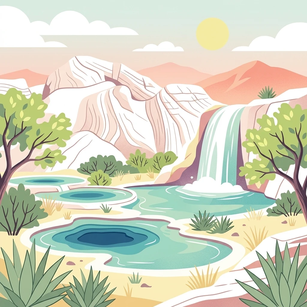
A stylized, flat-design illustration of a desert landscape featuring tiered turquoise pools, a small waterfall, desert shrubs, cacti, and layered mountains under a pale sun.

Área de Protección de Flora y Fauna Cuatrociénegas

Wildlife reserve

Park overview

Structured park overview, official facts, and landscape profile for Cuatrociénegas Flora and Fauna Protection Area

Cuatrociénegas Flora and Fauna Protection Area park facts, protected area profile, and essential visitor context

Review the core facts for Cuatrociénegas Flora and Fauna Protection Area, including designation, size, terrain, visitor scale, habitats, and operating context in one park-focused overview.

About Cuatrociénegas Flora and Fauna Protection Area

The Cuatrociénegas Flora and Fauna Protection Area is one of the most ecologically distinctive protected landscapes in northern Mexico. It is situated in the central portion of the state of Coahuila, occupying the floor of a broad intermontane valley within the Sierra Madre Oriental physiographic province. The valley is essentially flat, sits at an elevation near 700 meters, and is encircled by limestone ranges such as the Sierra de San Marcos y Pinos and the Sierra La Fragua, which act as a watershed divide between the Sabinas Gulf and the Coahuila Platform geological provinces.

What makes the area exceptional is the contrast between its arid surroundings and its extraordinarily rich aquatic system. The valley floor hosts an endemic-rich spring complex comprising hundreds of small to very large pools known locally as pozas, together with permanent streams and shallow flooded areas called lagunas. These water bodies emerge from a deep karst aquifer that is recharged through fractures in Cretaceous limestone formations. Historically the valley functioned as a closed basin, but in the late twentieth century it was artificially connected by canals to neighboring municipalities for agricultural water use, altering its hydrology.

Beyond its water features, the reserve includes dramatic landscape elements such as the gypsum dunes known locally as arenales, which extend across roughly 800 hectares and are notable for their purity and scale. Surrounding gypsum-rich flats support halophytic grasslands and xerophytic scrub vegetation, while the bajadas and slopes host rosetophilous desert scrub, microphyllous desert scrub, transitional scrub, halophyte communities, gypsophile plant communities, cacti, and isolated riparian vegetation along watercourses. The mosaic of aquatic, saline, gypsic, and desert habitats within a single compact valley gives Cuatrociénegas its unique environmental identity.

Ecologically, the protected area is recognized as one of the most important wetlands in Mexico and is registered as a RAMSAR site for its global conservation value. It encompasses more than a thousand recorded species of plants and animals, including many endemics and species listed under Mexico's NOM-059 risk categories, alongside both endemic and exotic elements. The reserve is supported by a Technical Advisory Council that coordinates federal, state, municipal, academic, NGO, and local ejido participation in management decisions.

Quick facts and research context for Cuatrociénegas Flora and Fauna Protection Area

The Cuatrociénegas Flora and Fauna Protection Area lies in central Coahuila, Mexico, within the municipality of Cuatrociénegas de Carranza, and covers more than 84,000 hectares of an endorheic valley at roughly 700 meters above sea level.

Established as a federal Flora and Fauna Protection Area on 7 November 1994, it is administered by Mexico's environmental authorities and benefits from a Technical Advisory Council involving federal, state, municipal, academic, and local ejido representatives. It is classified as a RAMSAR wetland of international importance, recognized as a priority conservation site by CONABIO, and identified as a key area within the Chihuahuan Desert ecoregion by the World Wildlife Fund.

The reserve protects a concentration of endemic and relict species including fish, crustaceans, mollusks, amphibians, reptiles, and plants, as well as freshwater stromatolites, gypsum dune fields, halophytic grasslands, and xerophytic scrub communities characteristic of the northern Mexican desert.

Protection and recognition

Terrestrial protected area designation and international Ramsar recognition data

Área de Protección de Flora y Fauna Cuatrociénegas Protection Status and Recognition

Documented protection status and international Ramsar recognition outline the official conservation framework governing Área de Protección de Flora y Fauna Cuatrociénegas. Structured geographic records assemble verified management scope and designation sources for terrestrial landscape analysis.

International recognition

Protection details

Protection scope
Terrestrial
Transboundary protection
No
Park context

Deeper park guide and search-rich context for Cuatrociénegas Flora and Fauna Protection Area

Cuatrociénegas Flora and Fauna Protection Area history, landscape, wildlife, and travel context

Explore Cuatrociénegas Flora and Fauna Protection Area through its history, landscape character, ecosystems, wildlife, conservation priorities, cultural context, and seasonal travel timing in a structured park guide built for atlas discovery and search intent.

Why Cuatrociénegas Flora and Fauna Protection Area stands out

Cuatrociénegas is best known for its extraordinary concentration of endemic aquatic life sustained by hundreds of spring-fed pools in the middle of the Chihuahuan Desert. The valley harbors relict species and evolutionary lineages that survive nowhere else, supported by an unusually stable spring system. The reserve is also distinguished by its freshwater stromatolites, living microbial structures in Poza Azul that resemble ancient formations thought to resemble conditions of early life on Earth, as well as by the expansive gypsum dune field that ranks among the largest in the Americas. Together, these features make the area a globally significant reference site for desert wetland conservation, evolutionary biology, and astrobiology-related research.
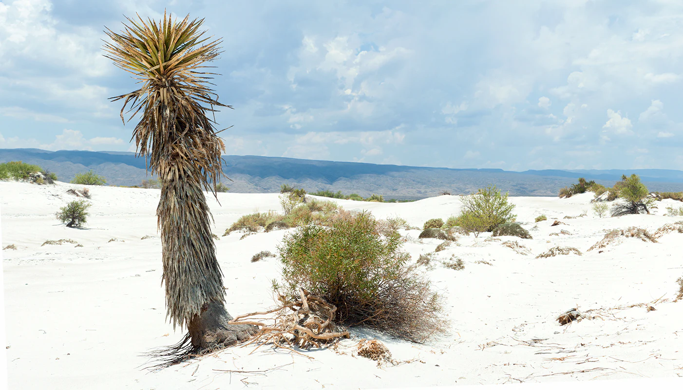
A desert landscape featuring white gypsum sand dunes with a single tall, fibrous yucca plant in the foreground and distant blue mountain ridges under a partly cloudy sky.
A lone yucca plant stands amidst the stark white gypsum dunes of Cuatrocienegas.

Cuatrociénegas Flora and Fauna Protection Area history and protected-area timeline

The Cuatrociénegas valley has been inhabited for thousands of years. Anthropologically it is considered an oasis that was visited repeatedly by nomadic groups long before the arrival of the Spanish, with evidence including arrowheads, spear points, burial remains in caves, and numerous petroglyphs and rock paintings scattered across the valley floor and surrounding mountains.

Following the Spanish conquest of northern Mexico, several attempts were made from 1598 onward to colonize the area, including the establishment of ranches and missions. These early settlements struggled against raids by indigenous groups, and only in 1800 was the town of Villa de Cuatrociénegas formally founded. The valley then developed around agriculture on the better-watered lands near the town and at the haciendas of San Juan, La Vega, and San Pablo, eventually becoming an important regional trading center linking Monclova, Saltillo, and Torreón for livestock, minerals, candelilla wax, and guayule.

After the Mexican land reforms, several ejidos were created, eleven of which lie within the present protected area, producing a complex mosaic of ejido and private land tenure. Traditional activities expanded to include extensive livestock ranching, fuelwood harvesting, salt extraction, and gypsum mining. The ecological fragility of the valley attracted scientific attention beginning with E. E. Marsh's 1939 surveys, and a succession of research expeditions through the twentieth century revealed the area's extraordinary endemism.

In response to more than three decades of advocacy by NGOs, research institutions, protected-area managers, and international bodies, the Mexican federal government established the Cuatrociénegas Flora and Fauna Protection Area by decree published in the Diario Oficial de la Federación on 7 November 1994. Subsequent management efforts have included assigning a baseline staff of director, coordinator, two project leaders, and administrative support, the creation of a permanent field presence, and the formation of a Technical Advisory Council coordinating conservation planning across governmental, academic, NGO, and local stakeholders.

Cuatrociénegas Flora and Fauna Protection Area landscape and geographic character

The landscape of the Cuatrociénegas protected area is dominated by a broad, flat valley floor encircled by steep limestone mountain ranges. The surrounding sierras were uplifted through tectonic stresses on Mesozoic marine sedimentary rocks, producing abrupt ridges and intermontane basins aligned roughly northwest to southeast. Within the valley, elevation remains close to 700 meters across the entire protected area, creating an unusually uniform topography that concentrates and retains spring discharge.

The reserve's most distinctive non-aquatic landforms are its gypsum dunes, the arenales, which spread across roughly 800 hectares of the valley and represent the second-largest gypsum dune field in the Americas. Formed by the weathering and erosion of gypsum-rich outcrops and deposited across an area of around 200 hectares of active dune surface, these white dunes migrate slowly under wind action, locally burying plants. Their purity and scale are remarkable both regionally and continentally.

Gypsum outcrops and extremely saline soils are widespread across the valley, producing stark, sparsely vegetated flats in some areas and supporting specialized halophyte and gypsophile plant communities in others. Toward the slopes and bajadas the terrain transitions into typical Chihuahuan Desert physiography, with rocky limestone foothills giving way to xerophytic scrub and rosetophilous desert vegetation as elevation increases. Although the elevation range within the protected area is limited, the contrast between flat valley floor and the encircling sierras creates a visually strong landscape mosaic.
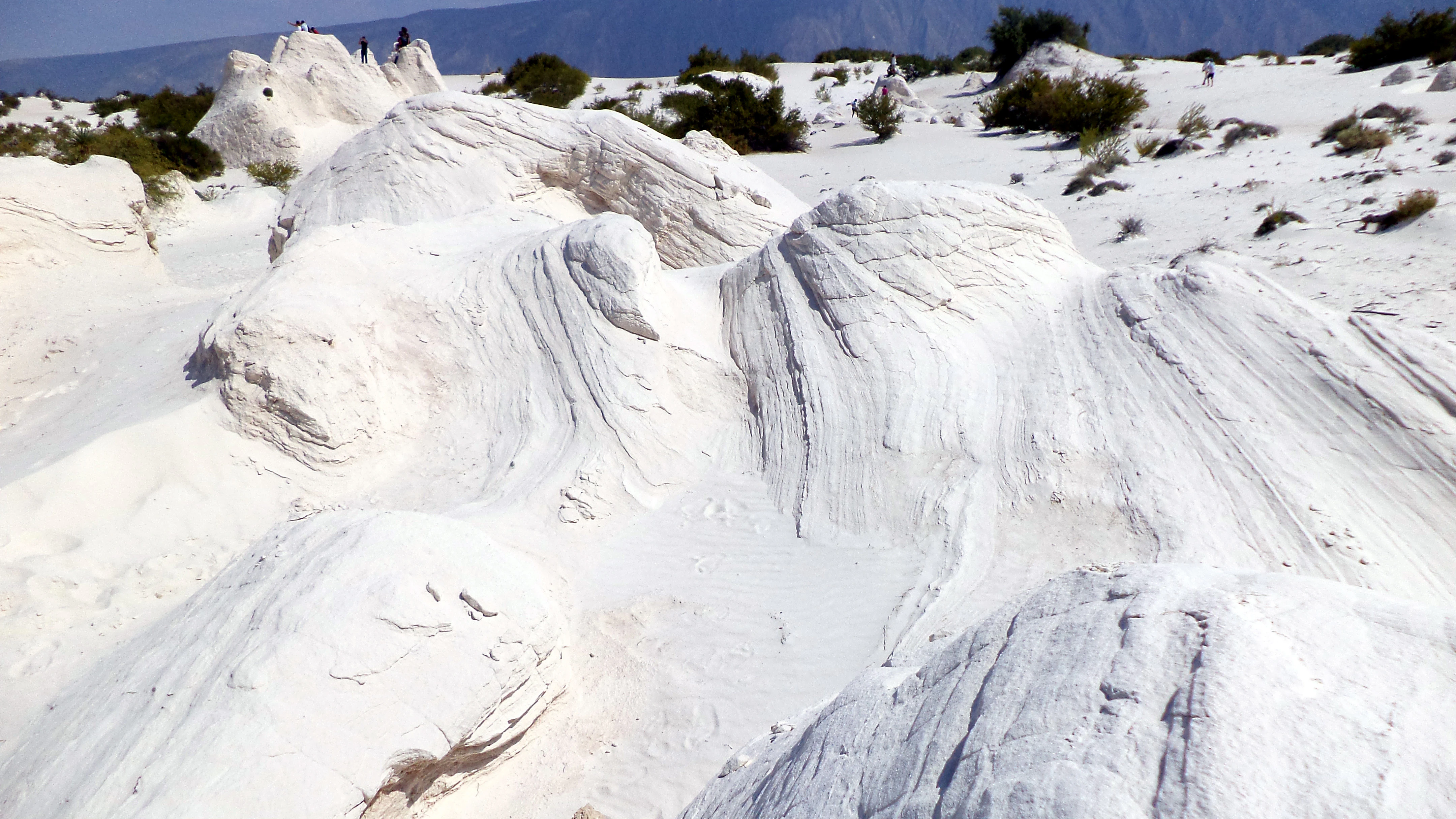
Bright white, wind-sculpted gypsum dunes with sparse desert vegetation under a clear sky.
The distinctive white gypsum dunes of Cuatrociénegas, Mexico.

Cuatrociénegas Flora and Fauna Protection Area ecosystems, habitats, and plant life

Ecologically, the Cuatrociénegas valley combines an arid, mineral-rich terrain with an exceptionally stable spring-fed aquatic system. The interplay of isolation, endorheic basin conditions, varying salinity, gypsum-rich substrates, and persistent humidity has produced a mosaic of microhabitats that supports a remarkable diversity of relict and endemic forms.

Vegetation in the protected area is zoned according to substrate and hydrology. The valley floor and active flood zones are characterized by halophytic grasslands and aquatic and semi-aquatic vegetation, while the gypsum dunes support gypsophile plant endemics. Surrounding bajadas and slopes support rosetophilous desert scrub, microphyllous desert scrub, transitional desert scrub, halophyte vegetation, scattered cacti, and patches of submontane scrub at higher elevations. More than 837 species of vascular plants have been recorded, including around 23 endemic taxa.

The valley's flora is closely tied to the broader Chihuahuan Desert flora but is enriched by local endemics adapted to gypsum, salinity, and seasonal drought. The combination of aquatic vegetation around the pozas and lagunas, arid scrub across the bajadas, and highly specialized gypsophile communities on the dunes makes Cuatrociénegas unusually rich in ecological transitions within a compact geographical footprint.

Cuatrociénegas Flora and Fauna Protection Area wildlife and species highlights

Cuatrociénegas is renowned as one of the most studied fauna-rich areas in Mexico's arid regions, primarily because of its exceptional level of endemism. Research has focused heavily on the aquatic fauna, where isolation and habitat heterogeneity have driven the evolution of distinct lineages.

The reserve's ichthyofauna is its most conspicuous wildlife feature, with sixteen recorded fish species, nine of which are endemic. These include the Cuatrociénegas cichlid (cichlids of the Cuatrociénegas basin), pupfish (Cyprinodon bifasciatus), and other highly localized species inhabiting individual pools or pool complexes. The valley's crustacean fauna includes twelve recorded species, of which six are endemic, while malacological studies have documented seven families of aquatic mollusks, with the family Hydrobiidae represented by ten endemic species.

The herpetofauna is also notable, with 67 recorded species, including two endemics tied to aquatic habitats (including the Aquatic box turtle, Terrapene coahuila), two semiaquatic endemics, and additional desert-dwelling endemics among lizards and other reptiles. The avifauna comprises about 61 recorded taxa, although their residency and migratory status are not yet fully characterized. Mammal populations in the valley remain comparatively understudied, with detailed field inventories still lacking.

Stromatolite communities represent another distinctive form of wildlife at Cuatrociénegas: Poza Azul harbors freshwater stromatolites whose microbial communities offer living analogs to ancient microbial systems, lending the reserve added significance for evolutionary, microbiological, and astrobiological research.

Cuatrociénegas Flora and Fauna Protection Area conservation status and protection priorities

Cuatrociénegas is recognized as the most important wetland within the Chihuahuan portion of Coahuila and as one of the most important wetlands in Mexico. Its international recognition includes designation as a RAMSAR site, prioritization by Mexico's National Commission for the Knowledge and Use of Biodiversity (CONABIO), and identification as a priority conservation area within the Chihuahuan Desert ecoregion by the World Wildlife Fund.

The federal protection decree of 1994 was the culmination of more than thirty years of advocacy by NGOs, research centers, protected-area managers, and international bodies that had documented the valley's unique biodiversity and its growing vulnerability. Subsequent management has established a baseline staff, a permanent on-site presence, and a Technical Advisory Council that coordinates conservation planning across federal, state, municipal, academic, NGO, and ejido stakeholders.

Conservation concerns at Cuatrociénegas center on water. Beginning in 1987, water from the valley's aquifer was exported for agriculture, and the artificial connection of springs through canals has reduced flooded surface area, altered pool hydrology, and modified flood patterns. Declining discharges and shrinking surface flows have been documented by both residents and researchers, and the Laguna de Churince, the valley's largest water body, has reportedly dried completely, taking with it microbial communities that resembled Precambrian ecological conditions. Genetic studies published in the Proceedings of the National Academy of Sciences by researchers including Valeria Souza and Brad Wolaver have shown that the Cuatrociénegas aquifer extends far beyond the valley, meaning that groundwater extraction in surrounding valleys has direct consequences for the protected area, intensifying the importance of coordinated regional water management for its long-term conservation.

Cuatrociénegas Flora and Fauna Protection Area cultural meaning and human context

The Cuatrociénegas valley has long been understood as a desert oasis, a place of refuge and resources within an otherwise harsh northern Mexican landscape. Nomadic groups are documented to have visited the valley repeatedly before the Spanish conquest, and traces of their presence survive in the form of lithic artifacts, burial remains in caves, petroglyphs, and rock paintings scattered across the valley floor and adjacent sierras.

Following colonization, settlement around the valley was slow and fragmented, withstanding both the encroachment of nomadic groups and the difficulties of arid-land agriculture. The formal founding of the Villa de Cuatrociénegas in 1800 gave the valley its enduring settlement nucleus, and the town became a regional commercial hub linking Monclova, Saltillo, and Torreón for livestock, minerals, and plant products such as candelilla wax and guayule.

Today the cultural landscape of the protected area reflects the legacy of the Mexican land reform era through a mosaic of ejido and private lands, with eleven ejidos holding territory within the reserve. Local livelihoods have historically drawn on agriculture, cattle ranching, fuelwood, salt extraction, and limited gypsum harvesting, linking the contemporary social fabric of the valley to the same natural resources that define its ecological importance.

Top sights and standout views in Cuatrociénegas Flora and Fauna Protection Area

Cuatrociénegas stands out for the depth of its aquatic endemism within an arid setting, particularly its sixteen recorded fish species of which nine are endemic, and its distinctive community of freshwater stromatolites in Poza Azul.

The reserve's gypsum dune field is also exceptional: at roughly 800 hectares it ranks among the most extensive and purest gypsum dune systems in the Americas, supporting gypsophile plant endemics and creating stark visual landscapes.

As a designated RAMSAR wetland, a CONABIO priority conservation site, and a key area within the WWF-identified Chihuahuan Desert ecoregion, Cuatrociénegas combines strong international recognition with an unusually high concentration of relict and endemic species, making it both a globally significant conservation reference site and a striking example of how life can persist in extreme desert conditions.

Best time to visit Cuatrociénegas Flora and Fauna Protection Area

The climate of Cuatrociénegas is very dry and warm, with summer-dominated rainfall and cool winters. Temperatures commonly rise above 30 degrees Celsius in the warmest months and can drop below 12 degrees Celsius in the cooler months, while annual precipitation varies widely between roughly 100 and 440 millimeters, with frequent drought years.

Visiting in the cooler months offers more comfortable conditions for exploring the valley, observing wildlife, and walking among the gypsum dunes, while the summer rainy season, though brief, can revive aquatic habitats, raise pool levels, and bring increased bird activity. Because the reserve lies in a stable climatic setting where year-to-year rainfall is unpredictable, visitors should generally expect dry, sunny conditions with strong temperature variation between day and night regardless of season.
Monthly climate preview

Long-term temperature ranges and precipitation rhythm recorded at representative coordinates in Coahuila

Área de Protección de Flora y Fauna Cuatrociénegas Climate Normals And Annual Weather Patterns

Representative coordinates record measured multi-year temperature shifts alongside seasonal precipitation totals across the protected landscape. Examining twelve-month averages reveals long-term climatic rhythms without relying on live forecasts.
Annual mean21 °C
12 °C28 °C
Jan12°
Feb15°
Mar18°
Apr23°
May26°
Jun28°
Jul27°
Aug27°
Sep24°
Oct21°
Nov16°
Dec12°
Warmest month
June

27.7 °C

Coolest month
January

11.7 °C

Wettest month
September

2.5 mm/day

Driest month
February

0.4 mm/day

Park location guide

Geography guide, regional context, and park location map for Cuatrociénegas Flora and Fauna Protection Area

Cuatrociénegas Flora and Fauna Protection Area park geography, regions, and map view in Mexico

Understand where Cuatrociénegas Flora and Fauna Protection Area sits in Mexico through a broader geographic reading of the surrounding landscape, nearby location context, and its mapped position within the national park landscape.

How Cuatrociénegas Flora and Fauna Protection Area fits into Mexico

Mexico, officially the United Mexican States, is a country in North America spanning the Sierra Madre mountain ranges, coastal plains, and tropical regions. It borders the United States to the north, Guatemala and Belize to the southeast, and has coastlines along the Pacific Ocean, Gulf of Mexico, and Caribbean Sea. With a population exceeding 130 million, Mexico is home to one of the world's most significant concentrations of Indigenous languages alongside Spanish.

Wider geography shaping Cuatrociénegas Flora and Fauna Protection Area in Mexico

Mexico occupies a land area of 1,972,550 km2, making it the thirteenth-largest country in the world. The terrain is highly diverse, featuring the Sierra Madre Occidental and Sierra Madre Oriental mountain ranges, the Mexican Plateau, coastal lowlands along the Pacific and Gulf/Caribbean margins, and the Yucatan Peninsula. The country spans multiple climate zones from desert in the north to tropical rainforest in the south.

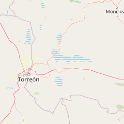
Map view of Cuatrociénegas Flora and Fauna Protection Area

Use this park location map to pinpoint Cuatrociénegas Flora and Fauna Protection Area in Mexico, understand its exact geographic position, and read its mapped placement within the surrounding landscape more clearly.

Pigeon | © OpenStreetMap contributors

Location context for Cuatrociénegas Flora and Fauna Protection Area

Coahuila

Visual exploration of spring-fed pozas, gypsum dunes, and desert wetland habitats

Área de Protección de Flora y Fauna Cuatrociénegas Landscape Photos and Scenery

Protected area photography reveals the stark limestone sierras, extensive gypsum dune fields, and crystal-clear aquatic springs defining the valley. Detailed visual records help observers examine the unique desert wetland mosaic, rare stromatolite habitats, and specialized vegetation communities across the reserve.

A desert landscape featuring white gypsum sand dunes with a single tall, fibrous yucca plant in the foreground and distant blue mountain ridges under a partly cloudy sky.

A high-angle view of a natural spring pool called Poza Azul with vibrant turquoise and deep indigo water, surrounded by desert grasses.

Bright white, wind-sculpted gypsum dunes with sparse desert vegetation under a clear sky.

Park atlas

Compare surrounding desert wetlands and regional protected landscapes

Exploring Parks Near Área de Protección de Flora y Fauna Cuatrociénegas

Visitors exploring Área de Protección de Flora y Fauna Cuatrociénegas can continue browsing adjacent desert reserves and regional protected landscapes. Comparing nearby protected areas reveals wider patterns in arid terrain, gypsum landforms, and aquatic ecosystems across the surrounding region.
Protected areaCoahuila
About 139 km away#1 closest

Northeast

Cuenca Alimentadora del Distrito Nacional de Riego 004 Don Martín Protected Area Geography

A vast watershed and mountain corridor in central Coahuila

This expansive protected area in northern Mexico functions as the primary catchment for the Don Martín irrigation district. The terrain ranges from dry shrubland and grasslands in the Coahuila interior to the rugged, forested heights of the Sierra Madre Oriental. It remains a key case study in river conservation and the complex interplay between arid ecosystems and mountainous watershed systems.

Area
15,193.8 km²
Established
1949
IUCN
VI
Relief
Mountain
Watercolor painting of a mountain range featuring gentle slopes and low-lying shrubs against a white background.
Protected areaCoahuila
About 209 km away#2 closest

Southeast

Serranía de Zapalinamé: Protected Mountain Geography and Watershed in Coahuila

Ecological transition zone within the Sierra Madre Oriental

The Serranía de Zapalinamé forms a dramatic mountain corridor rising over Saltillo, Coahuila. This state natural reserve protects a vital watershed and biodiversity hotspot where Chihuahuan Desert scrub meets pine and oak montane forests. Its steep canyons and high ridges offer a significant case study in regional landscape conservation and natural water security.

Area
253.74 km²
Established
1996
Relief
Mountain
Climate
Arid
Wildlife reserveCoahuila
About 228 km away#3 closest

Northwest

Ocampo Flora and Fauna Protection Area: Mapping Desert and Riverine Geography in Coahuila

A vital transboundary wildlife reserve in northern Mexico

Ocampo Flora and Fauna Protection Area provides a massive, contiguous block of protected wilderness characterized by rugged mountain foothills and desert flats. As a cornerstone of the El Carmen Big Bend Complex, the reserve offers a unique look at how river-cut canyons and arid scrublands support diverse life forms in the northern Chihuahuan Desert of Coahuila.

Area
3,442.38 km²
Established
2009
IUCN
VI
Relief
Mixed relief
State or regional parkDurango
About 231 km away#4 closest

Southwest

Cañon de Fernández State Park: A Protected Wetland and Canyon Landscape in Durango

Geography and riparian forest mapping in northern Mexico

Cañon de Fernández State Park is an ecologically vital protected area in Durango, defined by the Nazas River corridor. Spanning desert canyons and ancient riparian forests, this site serves as a crucial Ramsar wetland in the Chihuahuan Desert. Learn about its unique geographic boundaries and the centuries-old cypress trees that define this rare northern Mexican landscape.

Area
170.19 km²
Established
2004
Relief
Mixed relief
Climate
Arid
Watercolor illustration of layered mountain ranges with purple peaks fading into a green and yellow foreground.
Natural monumentNuevo León
About 232 km away#5 closest

Southeast

Cerro de la Silla: Protected Natural Monument Geography and Regional Map Context

A rugged mountain landscape in Nuevo León, Mexico

Cerro de la Silla is defined by its unmistakable saddle-shaped silhouette and its status as a vital protected area within the urban matrix of Monterrey. The mountain features complex folded limestone geology and a diverse habitat mosaic that transition from arid scrubland to forested peaks. Use this atlas resource to understand its topographical boundaries, summit formations, and regional environmental significance within the Sierra Madre Oriental fold belt.

Area
60 km²
Established
1991
Relief
Mountain
Climate
Subtropical
Protected areaCoahuila
About 232 km away#6 closest

Southeast

Cuenca Alimentadora del Distrito Nacional de Riego 026 Bajo Rio San Juan Protected Landscape

Mountain watershed and forest habitat in Coahuila

An expansive protected area encompassing the upper catchments of the San Juan River. The terrain features a significant altitudinal gradient, ranging from semi-arid matorral shrublands to rare high-altitude conifer groves including Mexican Douglas-fir, defining the regional water supply landscape.

Area
1,971.57 km²
Established
1949
IUCN
VI
Relief
Mountain
National parkMexico
About 240 km away#7 closest

Southeast

Cumbres de Monterrey National Park: National Park Protected Landscape Discovery

Explore Mexico's Mapped Terrain and Regional Geography

Understand Cumbres de Monterrey National Park as a distinct protected landscape within Mexico. This page provides detailed atlas-oriented information focused on its geographic boundaries, mapped terrain, and its role in regional conservation. It serves as a valuable entry point for exploring the park's natural context and understanding its place in the national geography.

Area
1,773.96 km²
Established
1939
IUCN
II
Relief
Mountain
National parkBrewster County
About 251 km away#8 closest

Northwest

Big Bend National Park: National Park, Mapped Protected Landscape, and Regional Geography

Explore Brewster County's protected natural terrain.

Big Bend National Park is a prominent national park defined by its protected landscape and geographic features within Brewster County. This destination provides users with detailed atlas-style information, focusing on the park's mapped boundaries and its contribution to the understanding of regional natural geography. Delve into the specific context of this protected area to enhance your geographic discovery.

Area
3,242.19 km²
Established
1944
IUCN
II
Visitors
568.1K annual

Common questions about visiting, size, designation, and location context for Cuatrociénegas Flora and Fauna Protection Area

Cuatrociénegas Flora and Fauna Protection Area FAQs for park facts, access, geography, and protected area context

Find quick answers about Cuatrociénegas Flora and Fauna Protection Area, including protected-area facts, park geography, trail and visitor context, and how the park fits into its surrounding country and regional landscape.
MoriAtlas Explorer

Continue Your Protected Areas Search Across the Global Atlas

Deepen your exploration by continuing the structured search for national parks and protected areas worldwide. Utilize the comprehensive filtering capabilities to compare different conservation landscapes and refine your understanding of global park geography. Discover more about the distribution and characteristics of protected natural areas.

Global natural geography