Mori Atlas logo
Protected areaCumberland Island National Seashore

A comprehensive look at the diverse maritime forests, shifting coastal dunes, and historic landscape remnants of Georgia

Cumberland Island National Seashore: Mapping the Atlantic Coast's Largest Protected Barrier Island

Cumberland Island National Seashore encompasses the largest and most ecologically diverse barrier island along the Georgia coastline. This protected area preserves a dynamic mosaic of Atlantic beaches, tidal salt marshes, freshwater lakes, and expansive maritime forests. By examining the geographic boundaries and terrain of this vehicle-free landscape, visitors can better understand the unique zonation of a southeastern coastal wilderness.

barrier islandAtlantic coast beachesmaritime forestsalt marshwilderness areahistoric estates

Cumberland Island National Seashore

Protected area

Park overview

Structured park overview, official facts, and landscape profile for Cumberland Island National Seashore

Cumberland Island National Seashore park facts, protected area profile, and essential visitor context

Review the core facts for Cumberland Island National Seashore, including designation, size, terrain, visitor scale, habitats, and operating context in one park-focused overview.

About Cumberland Island National Seashore

Cumberland Island National Seashore is one of the most distinctive protected coastal landscapes in the southeastern United States. Located off the coast of Camden County, Georgia, it encompasses the majority of Cumberland Island, the largest barrier island in the chain known as the Golden Isles of Georgia. The park protects a continuous sweep of Atlantic-facing beaches and dunes on the east, backed by a complex mosaic of live oak maritime forest, pine-dominated woodlands, freshwater lakes and ponds, and extensive salt marshes along the western shore.

The seashore was established in 1972 under the administration of the National Park Service and includes a federal wilderness area designated in 1982. Together, these protections safeguard an unusually varied barrier-island environment. The park has been identified as containing at least 23 distinct ecological communities, giving it, in the assessment of ecologists and the National Park Service, the highest ecological diversity of any of Georgia's barrier islands. Migratory waterfowl and shorebirds are prominent components of the island's birdlife, and the park sustains ongoing wildlife research and monitoring by NPS staff and visiting scientists.

Equally important to the seashore is its cultural landscape. The island carries traces of more than four thousand years of human presence, beginning with the Timucua and continuing through later colonial plantation owners, Revolutionary War-era figures such as General Nathanael Greene and cotton gin inventor Eli Whitney, and ultimately the Carnegie family, whose Gilded Age estates define much of the island's architectural legacy. The ruins of the Carnegie Dungeness mansion and the better-preserved Plum Orchard mansion anchor two separate National Historic Districts within the park.

Access to the island is deliberately limited. Visitors reach the seashore by passenger ferry from St. Marys, with cap on daily numbers and a prohibition on private vehicles. There are no paved roads on the island, and most exploration is on foot or by bicycle. This combination of ecological protection, historic preservation, and access restrictions is central to the seashore's character as a place where natural processes and a layered human history can both remain largely intact.

Quick facts and research context for Cumberland Island National Seashore

Cumberland Island National Seashore is a federally administered protected area on Cumberland Island in Camden County, Georgia, managed by the National Park Service. It is the largest of the Golden Isles of Georgia and one of the most ecologically diverse barrier islands in the state. The park encompasses extensive Atlantic beach and dune systems on its eastern shore, interior maritime forests, freshwater lakes, and significant salt marsh habitat along its western edge.

Beyond its natural systems, the seashore preserves an unusually rich cultural landscape, including Timucua archaeological sites, antebellum plantation ruins, Greene-Miller era buildings, and Carnegie family estates such as Dungeness and Plum Orchard, both of which are designated National Historic Districts. A portion of the island is protected as the Cumberland Island Wilderness, and the High Point-Half Moon Bluff area is listed on the National Register of Historic Places. Visitor access is by ferry from St. Marys, with daily limits on the number of people allowed on the island.

Protection and recognition

Documented terrestrial protection scope, designation year, and management framework

Cumberland Island National Seashore Protection Status and Designation History

Cumberland Island National Seashore maintains a documented terrestrial protection scope established in 1982. Official records outline the formal designation history and management framework associated with the protected area.

Protection details

Protection scope
Terrestrial
Designated year
1982
Transboundary protection
No
Park context

Deeper park guide and search-rich context for Cumberland Island National Seashore

Cumberland Island National Seashore history, landscape, wildlife, and travel context

Explore Cumberland Island National Seashore through its history, landscape character, ecosystems, wildlife, conservation priorities, cultural context, and seasonal travel timing in a structured park guide built for atlas discovery and search intent.

Why Cumberland Island National Seashore stands out

Cumberland Island National Seashore is best known for being the largest and most ecologically diverse barrier island in Georgia, combining long stretches of undeveloped Atlantic beach with interior maritime forests, marshes, and freshwater lakes. Within this wild coastal setting, it preserves the evocative ruins of the Carnegie Dungeness mansion and the intact Plum Orchard mansion, alongside remnants of earlier Timucua, colonial, and antebellum-era activity. The seashore is also recognized for its stringent visitor access system: the island is reachable only by ferry from St. Marys, and private vehicles are prohibited, leaving the landscape largely free of roads and cars. Combined with a designated wilderness area that spans much of the interior, this gives Cumberland a rare combination of ecological richness and historical depth in a single Atlantic coastal protected landscape.
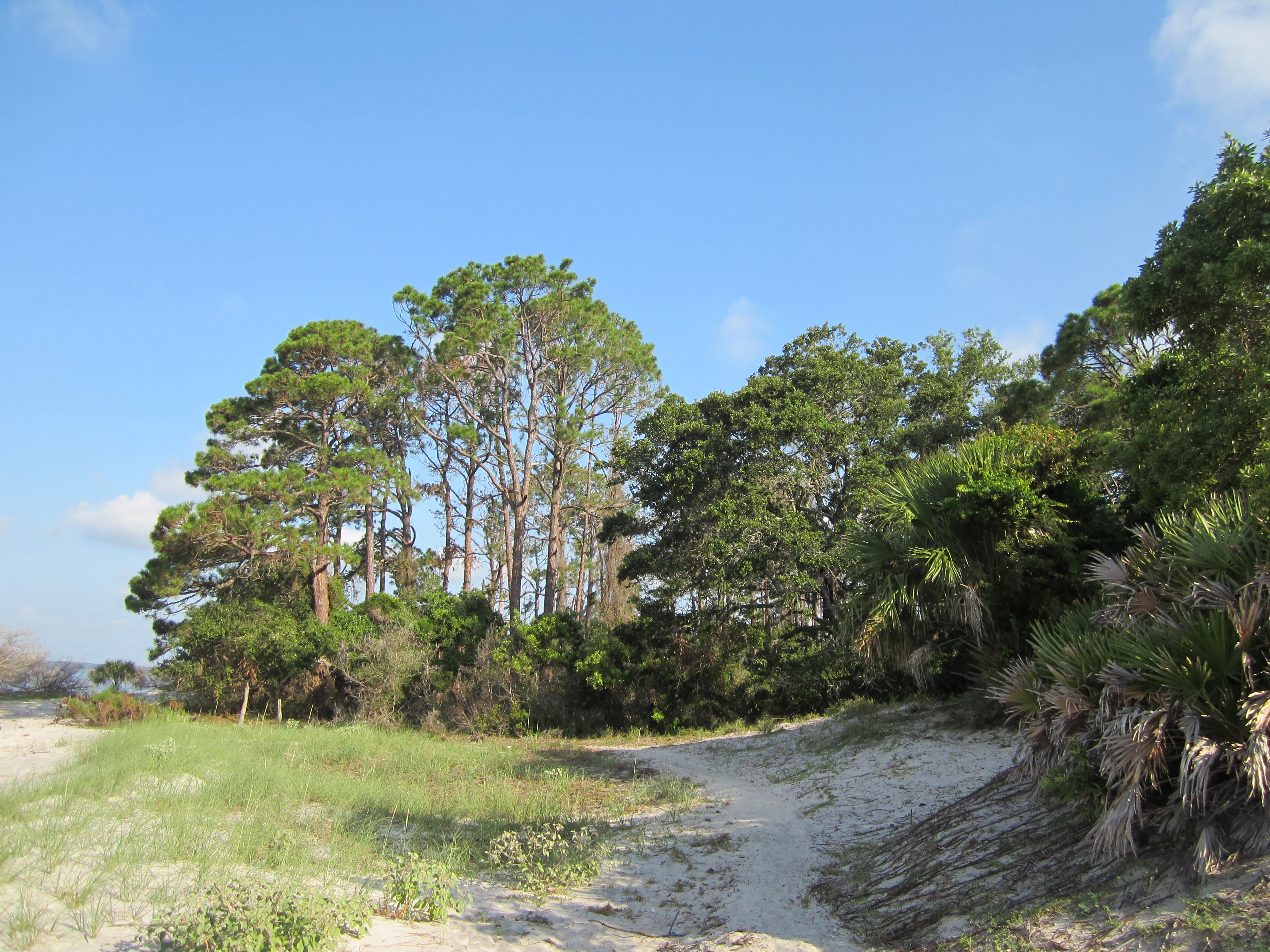
A narrow, sandy trail leads through a forest edge with tall pine trees and palmetto plants on a sunny day.
A sandy hiking trail winding through a coastal forest on Cumberland Island.

Cumberland Island National Seashore history and protected-area timeline

Cumberland Island National Seashore was authorized by the United States Congress on October 23, 1972, and has since been administered by the National Park Service. Its establishment was supported by conservation organizations including the Sierra Club and the Georgia Conservancy, both of which played a notable role in the effort to keep the island from being overdeveloped. The Cumberland Island Wilderness, a federal wilderness area within the seashore, was designated on September 8, 1982, reinforcing protections over a substantial portion of the interior landscape.

The island's recorded human history stretches back thousands of years. Archaeological sites associated with the Timucua people are documented on the island, and a shell midden near Plum Orchard dates back more than four thousand years. During the colonial and antebellum periods, Cumberland became the site of plantations, including structures connected to National Revolutionary War hero General Nathanael Greene and to Eli Whitney, whose association with the cotton gin transformed the regional agricultural economy.

In the late nineteenth century, the Carnegie family acquired large portions of Cumberland Island, transforming it into a Gilded Age retreat. They constructed the Dungeness mansion and later Plum Orchard, along with extensive supporting infrastructure. Today the two estates anchor two National Historic Districts: Dungeness was designated in 1982 and Plum Orchard in 1984. The High Point-Half Moon Bluff Historic District, also within the seashore, was placed on the National Register of Historic Places in 1978. Additional structures, including an early twentieth-century ice house originally used to store ice shipped from New England, have been restored and repurposed as interpretive spaces, including for exhibits on the War of 1812 occupation of Cumberland Island and Camden County.

Cumberland Island National Seashore landscape and geographic character

Cumberland Island's landscape is a textbook example of a southeastern Atlantic barrier island, exhibiting the full zonation typical of these dynamic systems. The eastern shoreline faces the open Atlantic and is characterized by long, undeveloped sandy beaches backed by low dunes and dune scrub. Behind the dunes, the interior of the island transitions into maritime forest dominated by live oak and pine, interspersed with freshwater lakes, ponds, and wet depressions.

On the western side, sheltered from ocean waves, the island gives way to expansive salt marshes and tidal creek systems. These marshes provide critical habitat for fish, shellfish, and waterbirds and form part of a broader estuarine network along the Georgia coast. The combination of active beach, dune, forest, freshwater, and estuarine environments within a single protected area gives Cumberland Island National Seashore a layered and visually varied landscape.

The topography is generally low-lying, with subtle elevations shaping the distribution of plant communities. The South End Trail, for example, crosses a sequence of habitats including live oak maritime forest, open beach, and pine-dominated forest over a relatively short distance, illustrating the compressed ecological transitions that characterize the island. Across the seashore, the absence of paved roads and the presence of a designated wilderness area preserve the visual openness of these landscapes.

A front view of the two-story, white Plum Orchard Mansion with a large portico and classic columns.
The Plum Orchard Mansion, a historic 1898 residence located on Cumberland Island.

Cumberland Island National Seashore ecosystems, habitats, and plant life

The seashore protects an unusually rich collection of coastal habitats for a single protected site. Ecologists and the National Park Service have identified at least 23 distinct ecological communities on Cumberland Island, more than on any other Georgia barrier island. This diversity arises from the proximity of beach, dune, maritime forest, freshwater wetland, and estuarine marsh habitats, each with its own plant and animal associations.

Live oak maritime forest is one of the signature vegetation communities on the island, often draped with Spanish moss and forming a shaded canopy over interior trails. Pine-dominated woodlands occupy higher and drier sites, while freshwater lakes and ponds support aquatic and emergent vegetation. The western salt marshes connect the island to the estuarine food web of the southeastern coast, and seasonal wetlands provide habitat for amphibians and invertebrates.

The National Park Service supports ongoing biological research on the island, employing a full-time wildlife manager and hosting periodic field studies. Migratory waterfowl in particular have been a focus of long-term observation, reflecting the importance of the island within broader Atlantic Flyway migration patterns.

Cumberland Island National Seashore wildlife and species highlights

Cumberland Island's wildlife is closely tied to its mosaic of beach, marsh, forest, and freshwater habitats. Birds are among the most visible and studied groups, with migratory waterfowl and shorebirds using the island's marshes, beaches, and interior wetlands as key stopover and wintering habitat along the Atlantic Flyway. Songbirds, wading birds, and raptors are also present across the island's varied vegetation.

The salt marshes along the western side of the island support a rich community of fish, crabs, shrimp, and other estuarine species that in turn support wading birds and larger predators. Freshwater ponds and lakes add amphibians and reptiles to the wildlife mix, while the maritime forest provides habitat for a range of small mammals and insects. White-tailed deer are commonly observed on the island, contributing to its reputation as a place where visitors can encounter wildlife in relatively open, road-free settings.

Because the park maintains access restrictions that keep the island largely free of cars and heavy infrastructure, wildlife observation is typically quiet and low-disturbance. Ongoing NPS wildlife management and visiting researchers continue to build knowledge of the island's fauna, particularly its migratory bird populations.

Cumberland Island National Seashore conservation status and protection priorities

Cumberland Island National Seashore holds an unusually strong conservation profile for a southeastern coastal unit. Its establishment in 1972 protected the largest barrier island in Georgia's Golden Isles from private development pressures that had affected other islands in the chain. Since then, the addition of the Cumberland Island Wilderness in 1982 has locked in a higher level of protection for a roughly 9,886-acre interior portion of the seashore, limiting intrusion and preserving large tracts of maritime forest, freshwater habitat, and dune systems in essentially undeveloped condition.

Conservation advocacy played a direct role in the park's creation. Organizations such as the Sierra Club and the Georgia Conservancy were instrumental in pushing for federal protection, and their involvement helped shape the access framework that continues to define the park today. Visitor caps, the prohibition on private vehicles, the absence of paved roads, and limits on camping durations all reflect a conservation-oriented management approach designed to keep the island's ecological systems functioning with minimal human pressure.

Ecologically, the seashore's value is amplified by its biodiversity. With at least 23 documented ecological communities, it is recognized as the most ecologically diverse of Georgia's barrier islands. The habitat mosaic supports migratory birds, estuarine species, and a wide range of coastal flora, while protection of archaeological and historic sites adds a cultural-conservation layer to the park's mission.

Cumberland Island National Seashore cultural meaning and human context

Cultural context sits unusually close to the surface at Cumberland Island National Seashore. The island's Timucua-era archaeological record, including a shell midden dating back more than four thousand years, places indigenous presence among the deepest layers of its story. Later colonial and antebellum periods left plantation infrastructure, including tabby concrete foundations from the early 1800s and structures connected to Greene and Whitney families, reflecting the island's entanglement with the plantation economy and early American political and industrial history.

The Carnegie family's late nineteenth and early twentieth-century presence gives Cumberland its most visible architectural identity. The Carnegie Dungeness mansion and the Plum Orchard mansion, along with their supporting structures and gardens, are preserved within separate National Historic Districts. Restored buildings such as the Ice House Museum and the Cumberland Island National Seashore Museum in St. Marys interpret this layered history for visitors, including a newer exhibit on the War of 1812.

The island's contemporary cultural identity is shaped by the deliberate preservation of its wild and historic character. The absence of private vehicles, the limits on visitor numbers, and the wilderness designation all reflect a community and management stance that frames Cumberland less as a developed tourist site and more as a protected landscape where multiple eras of coastal life remain visible.

Top sights and standout views in Cumberland Island National Seashore

The national seashore's most compelling features sit in the contrast between its wild barrier-island ecosystems and its layered human history. Long, vehicle-free Atlantic beaches and sweeping dunes make up the eastern edge, while salt marshes, interior maritime forests, and freshwater lakes define the interior and western shore. Trails such as the South End Trail pass through multiple distinct plant communities in a short distance, underscoring the island's ecological richness.

Equally striking are the historic estates that anchor the cultural landscape. The ruined Carnegie Dungeness mansion and the intact Plum Orchard mansion, together with the Dungeness cemetery, tabby house, and associated outbuildings, form two separate National Historic Districts. Supporting sites such as the restored Ice House Museum and the mainland Cumberland Island National Seashore Museum extend that story with exhibits on the Timucua, antebellum life, and the Carnegie era.

Management features are themselves part of the highlights: a ferry-only access system, a daily visitor cap, no private vehicles or paved roads on the island, and a federally designated wilderness area all ensure that the seashore retains the qualities that made it worth protecting in the first place.

Best time to visit Cumberland Island National Seashore

Cumberland Island's mild southeastern coastal climate means the park can be visited across much of the year, with timing shaped more by personal priorities than by hard seasonal closures. Spring tends to bring warming temperatures, active vegetation in the maritime forests, and increased bird activity as migrants move through the region. Summer is the warmest and most humid period, with the longest ferry schedule and vibrant marsh and beach life, though it is also when visitor demand is highest under the park's daily cap.

Fall offers gradually cooling temperatures along with continued opportunities for observing migratory waterfowl and shorebirds. Winters are mild by national standards, with cooler air and quieter conditions on the island. Because access is by ferry, with schedules varying by season and capacity capped at 300 visitors at a time, planning around ferry timing and reservations matters as much as weather in shaping the character of a visit.
Monthly climate preview

Long term temperature and precipitation patterns sampled at a representative park coordinate

Cumberland Island National Seashore Climate Normals and Monthly Weather Data

Cumberland Island National Seashore exhibits a recorded annual temperature rhythm ranging from mean lows near 3 degrees Celsius to warm summer peaks exceeding 32 degrees Celsius alongside monthly precipitation variations. Examining the complete twelve month climatology profile provides deeper insight into long term averages across the protected area.
Annual mean21 °C
14 °C28 °C
Jan14°
Feb14°
Mar17°
Apr20°
May24°
Jun27°
Jul28°
Aug28°
Sep27°
Oct23°
Nov19°
Dec15°
Warmest month
July

27.9 °C

Coolest month
January

13.6 °C

Wettest month
June

5.3 mm/day

Driest month
November

2 mm/day

Park location guide

Geography guide, regional context, and park location map for Cumberland Island National Seashore

Cumberland Island National Seashore park geography, regions, and map view in United States of America

Understand where Cumberland Island National Seashore sits in United States of America through a broader geographic reading of the surrounding landscape, nearby location context, and its mapped position within the national park landscape.

How Cumberland Island National Seashore fits into United States of America

The United States of America is a federal presidential republic and one of the world's largest countries by area and population. It consists of 50 states across a vast territory spanning multiple time zones, with its capital in Washington, D.C. and largest city in New York City. The nation has a diverse economy, influential political system, and significant cultural and military presence globally.

Wider geography shaping Cumberland Island National Seashore in United States of America

The United States occupies a vast territory in North America, bordered by Canada to the north and Mexico to the south. The 48 contiguous states stretch from the Atlantic to the Pacific Ocean, while Alaska occupies the northwestern region and Hawaii is an archipelago in the Pacific. The country encompasses diverse terrain including the Rocky Mountains, Appalachian Mountains, Great Plains, and extensive river systems.

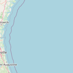
Map view of Cumberland Island National Seashore

Use this park location map to pinpoint Cumberland Island National Seashore in United States of America, understand its exact geographic position, and read its mapped placement within the surrounding landscape more clearly.

Pigeon | © OpenStreetMap contributors

Location context for Cumberland Island National Seashore

Georgia

Visualizing barrier island terrain, maritime forests, and protected coastal habitats

Cumberland Island National Seashore Photos and Landscape Scenery

Cumberland Island National Seashore photos reveal a dynamic coastal landscape featuring undeveloped Atlantic beaches, shifting dunes, and expansive salt marshes. Examining protected-area imagery helps visitors understand the ecological zonation and remote wilderness character preserved along the Georgia coast.

A narrow, sandy trail leads through a forest edge with tall pine trees and palmetto plants on a sunny day.

A peaceful, reflective tidal marsh on Cumberland Island, flanked by silhouetted trees under a cloudy sky.

A front view of the two-story, white Plum Orchard Mansion with a large portico and classic columns.

Park atlas

Compare regional coastal geography and connected wildlife reserves across the Atlantic seaboard

Parks Near Cumberland Island National Seashore and Surrounding Protected Landscapes

Browsing other protected areas near Cumberland Island National Seashore reveals adjacent coastal ecosystems and regional wildlife habitats. Comparing similar coastal reserves provides broader geographic context for the surrounding southeastern landscape.
Marine protected areaGeorgia
63 km away#1 closest

Northeast

Gray's Reef National Marine Sanctuary: Continental Shelf Geography and Reef Mapping

Submerged sandstone ridges and Atlantic marine habitat

Gray's Reef National Marine Sanctuary protects one of the largest near-shore live-bottom reefs in the southeastern United States. This submerged landscape consists of sandstone ledges rising above the sandy seafloor, fostering a unique three-dimensional habitat that supports a diverse range of marine invertebrates and fish species across its 22-square-mile protected boundary.

Area
57 km²
Established
1981
IUCN
IV
Relief
Lowland
A watercolor painting showing a soft, stylized landscape with rolling green hills, a small river or stream, and a hazy sky at sunrise or sunset.
Protected landscapeFlorida
75 km away#2 closest

Southwest

Osceola National Forest: Mapping the Protected Landscapes and Geography of Northeast Florida

Pine flatwoods, cypress swamps, and historic wilderness terrain

Osceola National Forest serves as a protected landscape in northeast Florida, defined by its extensive pine flatwoods and cypress-hardwood swamp mosaics. The forest provides vital habitat for wildlife like the Florida black bear and red-cockaded woodpecker, while preserving significant historical narratives. Its geography, marked by low elevations and slow-moving water, creates an expansive natural environment for ecological observation and regional exploration.

Area
772.67 km²
Established
1931
Relief
Lowland
Climate
Subtropical
Nature reserveFlorida
About 81 km away#3 closest

South

Guana Tolomato Matanzas National Estuarine Research Reserve: Florida Nature Reserve Atlas

Protected estuarine geography and coastal river convergence

Discover the geographic complexity of this research-driven protected area, where freshwater and saltwater environments converge along the Florida coastline. The reserve features an intricate network of tidal creeks, pine flatwoods, and coastal dunes, providing a unique look into the regional ecology of the Carolinian marine bioregion and its significant role in maritime conservation science.

Area
296.46 km²
Established
1999
IUCN
IV
Relief
Lowland
A horizontal watercolor painting depicting a soft-toned, light-filled forest landscape with a calm body of water in the foreground and rolling treed hills in the background.
Protected landscapeFlorida
136 km away#4 closest

South

Ocala National Forest: A Comprehensive Look at Florida's Largest National Forest Landscape

Protected scrub ecosystems and hydric river networks

Explore the geographic expanse of Ocala National Forest, the oldest national forest east of the Mississippi. This protected area features the vast Big Scrub, a unique sand pine ecosystem that anchors a diverse terrain of longleaf pine, blackwater rivers, and crystal-clear springs across multiple Florida counties.

Area
1,741.96 km²
Established
1908
Relief
Lowland
Climate
Subtropical
A pale watercolor landscape painting featuring silhouetted dead trees against a soft, light-colored prairie background.
Wildlife reserveMarion County
162 km away#5 closest

South

Juniper Prairie Wilderness: Wildlife Reserve Geography and Mapped Protected Landscapes

Central Florida ecological preserve in Marion County

Covering over 13,000 acres, Juniper Prairie Wilderness preserves a transition of ecosystems from dry pine scrub to wet sawgrass flats. This wildlife reserve in Marion County provides essential protection for the Juniper River drainage basin and its first-magnitude springs, offering a dense study of central Florida natural history and terrain.

Area
54 km²
Established
1984
IUCN
Ib
Relief
Lowland
A minimalist watercolor painting showing a vast coastal marshland with meandering tidal creeks and green islands under a bright, open sky.
Nature reserveSouth Carolina
About 190 km away#6 closest

Northeast

Ashepoo Combahee Edisto Basin National Estuarine Research Reserve: Mapped Protected Area

Coastal river convergence and tidal marsh geography

Spanning 140,000 acres of the South Carolina Lowcountry, this estuarine reserve protects a unique intersection of blackwater river systems and Atlantic coastal marshlands. The area provides a vital habitat for various species, where historic plantation lands, cypress swamps, and productive salt marshes form one of the largest undeveloped estuarine complexes on the United States eastern seaboard.

Area
570 km²
Relief
Lowland
Climate
Subtropical
Access
Access unknown
A minimalist watercolor illustration showing green rolling hills and a shoreline against a pale background, representing the natural coastal landscape.
Protected landscapeFlorida
About 225 km away#7 closest

South

Canaveral National Seashore Protected Landscape and Barrier Island Geography

Coastal ecosystems of the Florida Atlantic shore

Canaveral National Seashore stands as a significant protected landscape on the Florida coast, offering a cross section of barrier island geography. This protected area connects the dynamic Atlantic oceanfront with the calm, biodiverse waters of the Mosquito Lagoon, forming a vital refuge of dunes, maritime hammocks, and estuarine wetlands.

Area
233.35 km²
Established
1975
IUCN
V
Visitors
2.5M annual
Protected landscapeSouth Carolina
293 km away#8 closest

North

Sumter National Forest: Mapping Protected Landscapes and Terrain in South Carolina

Bridging Piedmont forests and Appalachian mountain foothills

Sumter National Forest offers a study in geographic contrast, as its three districts span the transition from South Carolina Piedmont ridges to the rugged spurs of the Blue Ridge Mountains. This protected area features the Chattooga Wild and Scenic River corridor, expansive hardwood-conifer mosaics, and complex mountain watersheds. The forest provides a window into regional land restoration, where reclaimed farmland and mountain ridges now form a continuous network of protected natural terrain.

Area
1,500.98 km²
Established
1936
Relief
Mixed relief
Climate
Temperate

Common questions about visiting, size, designation, and location context for Cumberland Island National Seashore

Cumberland Island National Seashore FAQs for park facts, access, geography, and protected area context

Find quick answers about Cumberland Island National Seashore, including protected-area facts, park geography, trail and visitor context, and how the park fits into its surrounding country and regional landscape.
MoriAtlas Explorer

Continue Your Protected Areas Search Across the Global Atlas

Deepen your exploration by continuing the structured search for national parks and protected areas worldwide. Utilize the comprehensive filtering capabilities to compare different conservation landscapes and refine your understanding of global park geography. Discover more about the distribution and characteristics of protected natural areas.

Global natural geography