
Mori Atlas logo
Nature reserveAshepoo Combahee Edisto Basin National Estuarine Research Reserve

Tracing the tidal marshes, cypress swamps, and river systems of the South Carolina Atlantic coast

Ashepoo Combahee Edisto Basin National Estuarine Research Reserve: Protected Coastal Landscape and Regional Geography

The Ashepoo Combahee Edisto Basin National Estuarine Research Reserve encompasses a vast protected area where three major rivers converge at St. Helena Sound. This estuarine complex stretches across 140,000 acres, featuring a mosaic of blackwater rivers, tidal salt marshes, and barrier islands that define the ecological character of the South Carolina Lowcountry. The reserve serves as a critical geography for studying estuarine health, supporting diverse habitat while maintaining historic cultural landscapes of former rice fields and plantation sites.

estuarine reservetidal marshsalt marshcypress swampblackwater riverbarrier island
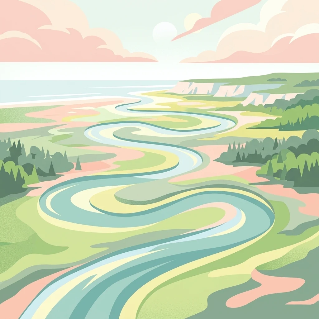
A flat-style digital illustration showing a winding river flowing through a lush coastal estuary under a pastel-colored sky.

Ashepoo Combahee Edisto Basin National Estuarine Research Reserve

Nature reserve

Park overview

Structured park overview, official facts, and landscape profile for Ashepoo Combahee Edisto Basin National Estuarine Research Reserve

Ashepoo Combahee Edisto Basin National Estuarine Research Reserve park facts, protected area profile, and essential visitor context

Review the core facts for Ashepoo Combahee Edisto Basin National Estuarine Research Reserve, including designation, size, terrain, visitor scale, habitats, and operating context in one park-focused overview.

About Ashepoo Combahee Edisto Basin National Estuarine Research Reserve

The Ashepoo Combahee Edisto Basin National Estuarine Research Reserve sits at the heart of one of the largest and least-developed estuarine landscapes on the eastern seaboard of the United States. Covering roughly 140,000 acres in the Lowcountry of South Carolina, the reserve is anchored by the convergence of three major rivers, the Ashepoo, Combahee, and Edisto, as they empty into St. Helena Sound. Together these waterways define the ACE Basin, an enormous coastal system where freshwater, saltwater, and human history overlap in a complex and biologically rich mosaic.

Estuarine reserves are unique protected areas that focus on the transitional zones where rivers meet the sea. The ACE Basin NERR belongs to the National Estuarine Research Reserve System, a network of sites across the United States dedicated to long-term research, monitoring, education, and stewardship of these critical coastal environments. Within this network, the ACE Basin stands out for its exceptional size, the relatively intact condition of its landscape, and the depth of its cultural history.

The reserve's landscape encompasses tidal salt marshes, oyster reefs, mudflats, cypress and hardwood swamps, barrier islands, and former rice fields. Cypress trees rising from the dark, tannin-stained waters of the rivers are among the most recognizable features of the region, alongside the open vistas of salt marsh and the sandy shoreline of Otter Island and other sea islands. Beyond ecological value, the basin preserves the imprint of the Lowcountry's plantation era, where centuries of rice cultivation reshaped the tidal marsh landscape.

The reserve exists in part to safeguard habitat for a range of species that depend on a healthy estuarine system. It also represents a working landscape, where commercial fishing for shrimp, crab, oyster, clam, and finfish continues to support local livelihoods, and where recreational anglers and paddlers explore the marsh creeks and blackwater rivers. By combining long-term research, education, and habitat protection with continued human use, the ACE Basin NERR reflects a model of coastal conservation that respects both ecological function and regional heritage.

Quick facts and research context for Ashepoo Combahee Edisto Basin National Estuarine Research Reserve

The Ashepoo Combahee Edisto Basin National Estuarine Research Reserve is a federally supported estuarine research reserve covering roughly 140,000 acres in coastal South Carolina. It lies within the ACE Basin, one of the largest remaining undeveloped estuaries on the United States Atlantic coast, where the Ashepoo, Combahee, and Edisto Rivers converge at St. Helena Sound.

Its landscape combines tidal salt marshes, cypress swamps, mudflats, barrier islands, and former rice plantation lands. The reserve is part of the National Estuarine Research Reserve System and combines habitat protection, scientific monitoring, and public education with the continued presence of working commercial fisheries.

Protection and recognition

Examining documented protection scope, management frameworks, and international recognition details

Ashepoo Combahee Edisto Basin National Estuarine Research Reserve Protection Status

Ashepoo Combahee Edisto Basin National Estuarine Research Reserve maintains a mixed protection scope governed by established management frameworks. Official records aggregate available designation data, administrative scope, and recognized conservation parameters.

Protection details

Protection scope
Mixed
Transboundary protection
No
Park context

Deeper park guide and search-rich context for Ashepoo Combahee Edisto Basin National Estuarine Research Reserve

Ashepoo Combahee Edisto Basin National Estuarine Research Reserve history, landscape, wildlife, and travel context

Explore Ashepoo Combahee Edisto Basin National Estuarine Research Reserve through its history, landscape character, ecosystems, wildlife, conservation priorities, cultural context, and seasonal travel timing in a structured park guide built for atlas discovery and search intent.

Why Ashepoo Combahee Edisto Basin National Estuarine Research Reserve stands out

The reserve is best known for protecting one of the largest intact estuarine systems left on the United States Atlantic coast. The ACE Basin is defined by its extensive tidal marshes, cypress-lined blackwater rivers, barrier islands, and the convergence of three major river systems at St. Helena Sound. It is also recognized for blending active conservation with continued traditional uses, including commercial fishing, recreational angling, and paddling through the salt marsh creeks. Its combination of ecological research, endangered species habitat, and preserved Lowcountry cultural landscapes makes it a defining example of the South Carolina coastal plain.
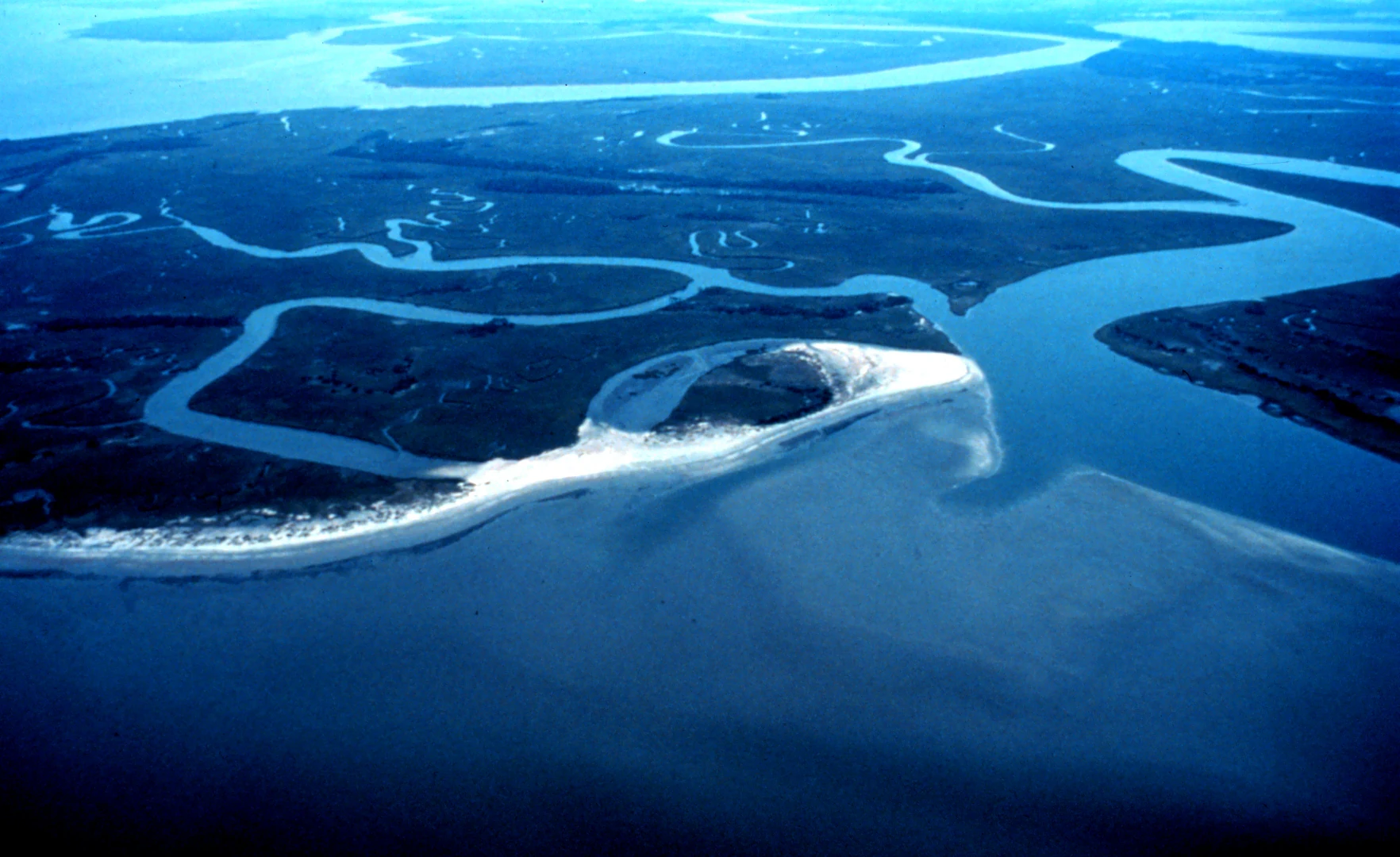
An aerial view of Otter Island showing a sandy shoreline and complex network of winding tidal creeks flowing into the dark blue water.
Aerial view of the winding tidal creeks and coastal shoreline of Otter Island within the ACE Basin National Estuarine Research Reserve.

Ashepoo Combahee Edisto Basin National Estuarine Research Reserve history and protected-area timeline

The Ashepoo Combahee Edisto Basin National Estuarine Research Reserve was established as part of the National Estuarine Research Reserve System to protect one of the most ecologically significant and least-developed estuarine systems on the United States Atlantic coast. Its creation recognized that the convergence of the Ashepoo, Combahee, and Edisto Rivers at St. Helena Sound formed a coastal landscape of exceptional ecological and cultural value that warranted long-term protection, research, and stewardship.

The basin itself carries a deep human history. Long before the reserve was designated, the landscape was shaped by the Lowcountry plantation era, particularly by centuries of rice cultivation that converted vast areas of tidal freshwater marsh into highly productive agricultural fields. Today those former rice lands and the surviving plantation houses and ruins form an important cultural layer over the natural environment, and the reserve's mission explicitly includes preserving that heritage alongside its ecological function.

Ashepoo Combahee Edisto Basin National Estuarine Research Reserve landscape and geographic character

The reserve's landscape is defined by the meeting of three river systems with the Atlantic Ocean. The Ashepoo, Combahee, and Edisto Rivers flow through cypress swamps and broad floodplains before joining the brackish waters of St. Helena Sound, a biologically rich tidal inlet that serves as the basin's outlet to the sea.

Throughout the reserve, vast expanses of tidal salt marsh dominate the view, fringed by oyster reefs, mudflats, and a network of tidal creeks. Cypress trees grow directly from the dark, tannin-rich blackwater of the rivers, giving the inland waterways a distinctive, almost primeval character. Offshore, the system includes barrier and sea islands, with Otter Island providing one of the most photographed examples of the basin's remote coastal scenery.

Between the rivers and the marshes lie traces of the region's plantation-era history, including historic rice fields, dikes, and plantation houses. These features together give the ACE Basin a landscape that is simultaneously wild, working, and culturally storied.

Ashepoo Combahee Edisto Basin National Estuarine Research Reserve ecosystems, habitats, and plant life

The natural environment of the ACE Basin NERR centers on a high-functioning estuarine ecosystem. Tidal salt marsh, cypress-dominated blackwater swamps, freshwater wetland forests, oyster reefs, and barrier island habitats combine to create a transition zone where freshwater species, marine life, and estuarine organisms all coexist.

Vegetation patterns follow the salinity gradient from the rivers inland to the open sound. Cypress and bottomland hardwood forests line the upper reaches of the river systems, giving way downstream to expansive cordgrass-dominated salt marshes that filter nutrients, stabilize sediments, and form the foundation of the food web. Oyster reefs and submerged aquatic vegetation beds further shape habitat availability in the tidal creeks and around St. Helena Sound.

These habitats support a remarkably diverse estuarine food web, linking microscopic plankton and marsh grasses to shellfish, finfish, birds, and large marine predators. The reserve's ecological value lies as much in this functional connectivity as in any single habitat type.

Ashepoo Combahee Edisto Basin National Estuarine Research Reserve wildlife and species highlights

The reserve provides habitat for a wide range of fish, shellfish, birds, reptiles, and mammals that depend on estuarine systems. Tidal marshes and oyster reefs support important populations of shrimp, blue crab, oyster, clam, and various finfish, which form both a commercial fishery and a foundation for the food web.

Several species of conservation concern rely on the basin's habitats. Shortnose sturgeon inhabit the river systems, wood storks forage in the marshes and cypress swamps, loggerhead sea turtles nest along the barrier island beaches, and bald eagles nest in the larger trees of the estuarine landscape. Seasonal migrations bring additional waterfowl and shorebirds into the marsh and mudflat habitats.

Humans are also a visible part of the basin's wildlife-related activity, with commercial and recreational fishermen working the mudflats, creeks, and nearshore waters. The reserve's research and monitoring programs help track the health of these species and the broader ecosystem that supports them.

Ashepoo Combahee Edisto Basin National Estuarine Research Reserve conservation status and protection priorities

The Ashepoo Combahee Edisto Basin NERR was established because the ACE Basin represents one of the very few large estuarine systems on the United States Atlantic coast that remains largely undeveloped. Its protected status is intended to maintain water quality, intact marsh and forest habitat, and viable populations of estuarine species in the face of mounting coastal development pressure elsewhere on the eastern seaboard.

Conservation work at the reserve combines long-term ecological monitoring with applied research on estuarine health, including water-quality monitoring, biological inventory, and ecosystem-scale evaluation. This scientific foundation informs regional coastal management and supports policies affecting habitat, fisheries, and land use. The reserve also uses education and outreach to extend its conservation impact, running lecture series, teacher curriculum development, hands-on touch tank programs, and on-the-water educational cruises.

By integrating research, habitat protection, public education, and engagement with local communities, the reserve functions as both a refuge for coastal wildlife and a regional center for understanding how estuaries can be conserved while still supporting traditional uses such as commercial fishing.

Ashepoo Combahee Edisto Basin National Estuarine Research Reserve cultural meaning and human context

The cultural landscape of the ACE Basin NERR is inseparable from the broader story of the South Carolina Lowcountry. For generations, communities living around the Ashepoo, Combahee, and Edisto Rivers have made their living from the tidal marshes, oyster beds, and river fisheries, and that working relationship with the estuary continues today in the form of commercial and recreational fishing.

The reserve also preserves the legacy of the region's plantation era, when large-scale rice cultivation transformed the upper tidal marshes over multiple centuries. Today the abandoned rice fields, dikes, and historic plantation houses scattered across the basin serve as reminders of the area's complex social and agricultural history. By formally including cultural heritage within its mission, the reserve acknowledges that the ACE Basin is not only an ecological system but also a layered cultural landscape shaped by centuries of human interaction with the coast.

Top sights and standout views in Ashepoo Combahee Edisto Basin National Estuarine Research Reserve

The reserve's strongest qualities include its extraordinary size, the relatively undeveloped condition of its marshes, swamps, and barrier islands, and the rare convergence of three major river systems at St. Helena Sound. Few other estuarine reserves in the United States combine this scale of intact habitat with such a long and layered human history.

It also stands out for pairing active research and monitoring with a real working landscape, where commercial fishing traditions and recreational use continue alongside habitat protection. The mix of cypress blackwater, broad tidal marsh, historic plantation rice fields, and open Atlantic-facing barrier islands gives the reserve an unusually varied coastal identity within a single protected system.

Best time to visit Ashepoo Combahee Edisto Basin National Estuarine Research Reserve

Because the ACE Basin NERR is a tidal estuarine system, conditions change notably with the seasons. Spring and fall generally offer mild temperatures and active migratory bird and fish movement, making these periods especially rewarding for wildlife observation, paddling, and photography across the marshes and blackwater rivers. Cooler months can also bring concentrations of wintering waterfowl to the mudflats and impoundments.

Summer brings warmer water, lush marsh growth, sea turtle nesting activity on the barrier islands, and the reserve's own summer lecture and education programming. Tide cycles, river flow, and weather always shape conditions on the water, so any visit is best planned with awareness of tides and seasonal weather patterns in the South Carolina Lowcountry.
Monthly climate preview

Long-term monthly temperature and precipitation rhythm from representative coordinates

Ashepoo Combahee Edisto Basin National Estuarine Research Reserve Climate Normals

Ashepoo Combahee Edisto Basin National Estuarine Research Reserve exhibits measured annual temperature variations and monthly precipitation patterns recorded across a representative coordinate. Reviewing the complete twelve-month profile provides deeper analytical depth regarding long-term climate normals and seasonal meteorological baselines.
Annual mean20 °C
10 °C28 °C
Jan10°
Feb12°
Mar15°
Apr19°
May24°
Jun27°
Jul28°
Aug28°
Sep26°
Oct21°
Nov16°
Dec12°
Warmest month
July

28.4 °C

Coolest month
January

10.3 °C

Wettest month
August

5 mm/day

Driest month
November

2.1 mm/day

Park location guide

Geography guide, regional context, and park location map for Ashepoo Combahee Edisto Basin National Estuarine Research Reserve

Ashepoo Combahee Edisto Basin National Estuarine Research Reserve park geography, regions, and map view in United States of America

Understand where Ashepoo Combahee Edisto Basin National Estuarine Research Reserve sits in United States of America through a broader geographic reading of the surrounding landscape, nearby location context, and its mapped position within the national park landscape.

How Ashepoo Combahee Edisto Basin National Estuarine Research Reserve fits into United States of America

The United States of America is a federal presidential republic and one of the world's largest countries by area and population. It consists of 50 states across a vast territory spanning multiple time zones, with its capital in Washington, D.C. and largest city in New York City. The nation has a diverse economy, influential political system, and significant cultural and military presence globally.

Wider geography shaping Ashepoo Combahee Edisto Basin National Estuarine Research Reserve in United States of America

The United States occupies a vast territory in North America, bordered by Canada to the north and Mexico to the south. The 48 contiguous states stretch from the Atlantic to the Pacific Ocean, while Alaska occupies the northwestern region and Hawaii is an archipelago in the Pacific. The country encompasses diverse terrain including the Rocky Mountains, Appalachian Mountains, Great Plains, and extensive river systems.

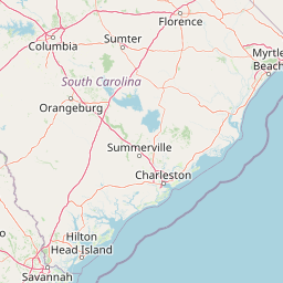
Map view of Ashepoo Combahee Edisto Basin National Estuarine Research Reserve

Use this park location map to pinpoint Ashepoo Combahee Edisto Basin National Estuarine Research Reserve in United States of America, understand its exact geographic position, and read its mapped placement within the surrounding landscape more clearly.

Pigeon | © OpenStreetMap contributors

Location context for Ashepoo Combahee Edisto Basin National Estuarine Research Reserve

South Carolina

Visualizing the tidal marshes, blackwater rivers, and protected coastal landscapes of the South Carolina lowcountry

Ashepoo Combahee Edisto Basin National Estuarine Research Reserve Photos and Scenery

Examinations of Ashepoo Combahee Edisto Basin National Estuarine Research Reserve photography reveal extensive tidal salt marshes, cypress-lined riverways, and remote barrier islands. Visual records document the intricate intersection of protected estuarine habitats and traditional working waterways along the Atlantic seaboard.

An aerial view of Otter Island showing a sandy shoreline and complex network of winding tidal creeks flowing into the dark blue water.

Park atlas

Compare surrounding coastal landscapes and regional nature reserves

Explore Protected Areas and Parks Near Ashepoo Combahee Edisto Basin National Estuarine Research Reserve

Continue geographic discovery by browsing protected areas and national parks located near Ashepoo Combahee Edisto Basin National Estuarine Research Reserve. Comparing adjacent estuarine reserves and coastal habitats provides a deeper understanding of the wider Atlantic coastal plain.
Marine protected areaGeorgia
About 124 km away#1 closest

South

Gray's Reef National Marine Sanctuary: Continental Shelf Geography and Reef Mapping

Submerged sandstone ridges and Atlantic marine habitat

Gray's Reef National Marine Sanctuary protects one of the largest near-shore live-bottom reefs in the southeastern United States. This submerged landscape consists of sandstone ledges rising above the sandy seafloor, fostering a unique three-dimensional habitat that supports a diverse range of marine invertebrates and fish species across its 22-square-mile protected boundary.

Area
57 km²
Established
1981
IUCN
IV
Relief
Lowland
National parkSouth Carolina
About 141 km away#2 closest

North

Congaree National Park: A Protected National Park in South Carolina's Geographic Landscape

Explore mapped boundaries and regional park geography.

Congaree National Park represents a vital protected national park entity within South Carolina, offering rich opportunities for geographic discovery and landscape exploration. Its designation as a National Park underscores its importance in mapping protected areas and understanding regional terrain. This entry provides essential context for exploring the park's specific geographic features and its position within the broader atlas of conservation landscapes.

Area
108.021 km²
Established
2003
IUCN
Ib
Visitors
287.8K annual
A soft watercolor painting of a coastal scene with sandy dunes, pine trees, and palmetto bushes against a pale, warm-toned sky.
Protected areaGeorgia
About 190 km away#3 closest

Southwest

Cumberland Island National Seashore: Protected Barrier Island Geography and Mapping

A wild coastal landscape on the southeastern Georgia shoreline

Cumberland Island National Seashore stands as a significant protected area on the Atlantic coast, defined by its lack of paved roads and vehicle-free status. The geography spans a complex array of habitats, including maritime forests, tidal creeks, and salt marshes, anchored by historic estates. This protected landscape represents an essential case study in coastal barrier island ecology and preserved historic environments.

Area
147.368 km²
Established
1972
IUCN
II
Visitors
60.3K annual
Protected landscapeSouth Carolina
About 193 km away#4 closest

Northwest

Sumter National Forest: Mapping Protected Landscapes and Terrain in South Carolina

Bridging Piedmont forests and Appalachian mountain foothills

Sumter National Forest offers a study in geographic contrast, as its three districts span the transition from South Carolina Piedmont ridges to the rugged spurs of the Blue Ridge Mountains. This protected area features the Chattooga Wild and Scenic River corridor, expansive hardwood-conifer mosaics, and complex mountain watersheds. The forest provides a window into regional land restoration, where reclaimed farmland and mountain ridges now form a continuous network of protected natural terrain.

Area
1,500.98 km²
Established
1936
Relief
Mixed relief
Climate
Temperate
A watercolor painting showing a soft, stylized landscape with rolling green hills, a small river or stream, and a hazy sky at sunrise or sunset.
Protected landscapeFlorida
About 280 km away#5 closest

Southwest

Osceola National Forest: Mapping the Protected Landscapes and Geography of Northeast Florida

Pine flatwoods, cypress swamps, and historic wilderness terrain

Osceola National Forest serves as a protected landscape in northeast Florida, defined by its extensive pine flatwoods and cypress-hardwood swamp mosaics. The forest provides vital habitat for wildlife like the Florida black bear and red-cockaded woodpecker, while preserving significant historical narratives. Its geography, marked by low elevations and slow-moving water, creates an expansive natural environment for ecological observation and regional exploration.

Area
772.67 km²
Established
1931
Relief
Lowland
Climate
Subtropical
Nature reserveFlorida
About 290 km away#6 closest

South

Guana Tolomato Matanzas National Estuarine Research Reserve: Florida Nature Reserve Atlas

Protected estuarine geography and coastal river convergence

Discover the geographic complexity of this research-driven protected area, where freshwater and saltwater environments converge along the Florida coastline. The reserve features an intricate network of tidal creeks, pine flatwoods, and coastal dunes, providing a unique look into the regional ecology of the Carolinian marine bioregion and its significant role in maritime conservation science.

Area
296.46 km²
Established
1999
IUCN
IV
Relief
Lowland
A horizontal watercolor illustration depicting a grassy shoreline with a single tree and distant rolling hills against a soft pale sky.
Nature reserveNorth Carolina
About 302 km away#7 closest

Northeast

North Carolina National Estuarine Research Reserve: Mapped Protected Coastal Terrain

Coastal habitat and biogeographic research corridor

Spanning from Currituck Banks to Zeke's Island, the North Carolina National Estuarine Research Reserve preserves a diverse coastal mosaic. This protected area supports essential estuarine functions and provides critical habitat for numerous aquatic species, defining the complex intersection of land and sea in the southeastern United States.

Area
42.76 km²
Established
1985
Relief
Lowland
Climate
Subtropical
A horizontal watercolor painting depicting a soft-toned, light-filled forest landscape with a calm body of water in the foreground and rolling treed hills in the background.
Protected landscapeFlorida
About 355 km away#8 closest

South

Ocala National Forest: A Comprehensive Look at Florida's Largest National Forest Landscape

Protected scrub ecosystems and hydric river networks

Explore the geographic expanse of Ocala National Forest, the oldest national forest east of the Mississippi. This protected area features the vast Big Scrub, a unique sand pine ecosystem that anchors a diverse terrain of longleaf pine, blackwater rivers, and crystal-clear springs across multiple Florida counties.

Area
1,741.96 km²
Established
1908
Relief
Lowland
Climate
Subtropical

Common questions about visiting, size, designation, and location context for Ashepoo Combahee Edisto Basin National Estuarine Research Reserve

Ashepoo Combahee Edisto Basin National Estuarine Research Reserve FAQs for park facts, access, geography, and protected area context

Find quick answers about Ashepoo Combahee Edisto Basin National Estuarine Research Reserve, including protected-area facts, park geography, trail and visitor context, and how the park fits into its surrounding country and regional landscape.
MoriAtlas Explorer

Continue Your Protected Areas Search Across the Global Atlas

Deepen your exploration by continuing the structured search for national parks and protected areas worldwide. Utilize the comprehensive filtering capabilities to compare different conservation landscapes and refine your understanding of global park geography. Discover more about the distribution and characteristics of protected natural areas.

Global natural geography