
Why North Carolina National Estuarine Research Reserve stands out
The reserve is best known for protecting and representing the full ecological gradient of North Carolina's estuarine coastline. Because the state sits at the meeting point of the Virginian and Carolinian biogeographic provinces near Cape Hatteras, the reserve captures biological transitions that are unusual along the U.S. Atlantic seaboard, including shifts in fish, invertebrate, and plant communities between cooler northern waters and warmer southern waters. It is also recognized for its contribution to the state's seafood economy. Estuaries preserved and studied within the reserve support the juvenile stages of commercially important fishery species, including shrimp, crabs, oysters, and a variety of finfish. The reserve's research and monitoring programs therefore serve both conservation and fisheries management purposes, linking habitat protection with sustainable use of coastal resources.
North Carolina National Estuarine Research Reserve history and protected-area timeline
The North Carolina National Estuarine Research Reserve was formally established in 1985 as part of the national system of estuarine reserves coordinated by the National Oceanic and Atmospheric Administration. Its creation reflected growing awareness of the ecological and economic importance of estuaries and a desire to preserve representative examples of these habitats in each participating coastal state.
From the outset, the reserve was designed as a multi-component system to reflect North Carolina's unusual geographic position. The state sits astride a major biogeographic transition near Cape Hatteras, where northern Virginian marine ecosystems give way to southern Carolinian ones. Rather than selecting a single site, planners assembled four distinct sites stretching from the Outer Banks in the north to the southern coast. Over time, individual components such as Rachel Carson Reserve near Beaufort and Masonboro Island became well-known units in their own right, expanding public familiarity with the broader reserve system.
The reserve is administered cooperatively, with NOAA providing national program coordination and the North Carolina Department of Environmental Quality managing the sites on the ground. This partnership arrangement has shaped decades of research, monitoring, and education work centered on coastal water quality, habitat change, fisheries habitat, and shoreline dynamics.
North Carolina National Estuarine Research Reserve landscape and geographic character
The reserve's landscape is defined by the dynamic interface between land and sea along the North Carolina coast. Its four sites collectively encompass barrier islands, sand flats, beach ridges, salt marshes, mud flats, shallow estuarine creeks, and submerged open water, all shaped by tides, storms, and long-term sea level change. Barrier island components such as Masonboro Island and Zeke's Island exhibit classic profile features including ocean-facing beaches, dunes, and broad back-barrier marsh platforms laced with sinuous tidal channels.
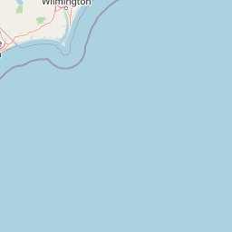
Currituck Banks represents the northernmost portion of the reserve, with relatively pristine shorelines along the Currituck Sound side of the Outer Banks and a mix of dune, scrub, and marsh habitats. Moving south, Rachel Carson Reserve includes salt marsh islands and estuarine waters near Beaufort, where the Intracoastal Waterway and surrounding sounds create sheltered environments characteristic of central North Carolina's coastal plain. Masonboro Island provides one of the most undisturbed barrier island landscapes in the region, with shifting sand, marine grassland, and expansive tidal flats. Zeke's Island preserves similar features further south near the Cape Fear area, where warmer climate conditions begin to dominate.
Throughout the system the terrain is low-lying and sculpted by water. Elevation changes are subtle, yet the relief created by tides, channels, dune ridges, and marsh hummocks gives the landscape strong visual character. The interplay of open water, marsh edge, woodland patches, and open beach produces a varied, layered scenery that defines the visitor experience across all four sites.
North Carolina National Estuarine Research Reserve ecosystems, habitats, and plant life
The reserve protects an unusually complete spectrum of estuarine ecosystems for the U.S. Atlantic coast. Its habitats range from salt marsh and tidal creek networks to brackish sound environments, barrier island maritime forests, dune thickets, and open ocean-facing beach. Each component supports the characteristic vegetation of its region: saltmarsh cordgrass dominates the regularly flooded marsh platform, while upper marsh zones support black needlerush, saltwort, and glasswort; dune environments feature sea oats, beach grass, and scattered shrubs; and sheltered interior portions of barrier islands support stunted live oak and loblolly pine woodland.
Because the reserve spans two biogeographic provinces, plant communities differ measurably from north to south. Northern sites such as Currituck Banks carry a cooler-temperate flavor, while southern sites around Zeke's Island reflect the warmer Carolinian flora. These transitions allow ecologists to study how vegetation responds to gradual climatic gradients within a single state-managed reserve network.
Wetland and estuarine habitats also play a central ecological role by filtering nutrients, buffering storm energy, and exporting organic material that fuels coastal food webs. The reserve's combination of marsh, open water, and upland island environments creates the kind of habitat mosaic that supports fish nurseries, shellfish beds, wading bird foraging areas, and nesting grounds for coastal bird species.
North Carolina National Estuarine Research Reserve wildlife and species highlights
The estuarine habitats protected by the reserve serve as essential nursery grounds and foraging areas for a wide range of fish, shellfish, birds, and other wildlife. Shrimp, blue crabs, oysters, clams, menhaden, flounder, and various drum species all spend part of their life cycles within reserve waters, making the system a critical contributor to the broader life cycle of North Carolina's commercial fisheries.
Coastal birds are particularly conspicuous throughout the reserve. Barrier island and marsh habitats support nesting and migratory species such as terns, skimmers, plovers, oystercatchers, herons, egrets, and ibises. Rachel Carson Reserve is well known for its use by nesting colonial waterbirds, while Masonboro Island and Zeke's Island provide less disturbed nesting habitat than nearby developed beaches. The Outer Banks component at Currituck Banks lies along a major migratory flyway and hosts seasonal concentrations of waterfowl and shorebirds drawn to the Currituck Sound.
Other wildlife typical of southeastern estuarine environments also occurs in the reserve, including diamondback terrapins that inhabit salt marshes, various species of crabs and shrimp that move between marsh and open water, and occasional marine mammals such as dolphins that use the sounds and inlets as travel corridors. The combination of wild barrier islands, productive marshes, and clean tidal waters produces a diverse and seasonally dynamic wildlife community across all four sites.
North Carolina National Estuarine Research Reserve conservation status and protection priorities
The reserve exists to protect representative estuarine ecosystems and to ensure that these habitats continue to support the ecological and economic functions on which North Carolina depends. Estuaries are among the most productive natural systems on Earth, but they are also among the most threatened by coastal development, pollution, erosion, sea level rise, and shoreline hardening. Preserving intact examples of these systems, as the reserve does, provides a baseline against which change elsewhere can be measured and a reservoir of habitat that can persist under future stress.
Within the federal National Estuarine Research Reserve System, the reserve also serves as a long-term monitoring platform. Standardized water quality, weather, and biological monitoring programs operating across the four sites generate datasets used by researchers and managers throughout the region. These data help track trends such as nutrient loading, salinity change, marsh die-off, and shifts in species distribution connected to climate and land use. Because the reserve spans two biogeographic regions, its monitoring record is particularly valuable for understanding how coastal ecosystems respond along environmental gradients.
The reserve's conservation role also extends outward through partnerships with state agencies, universities, and local communities. Research conducted within its sites informs coastal policy, supports fisheries management, and contributes to broader discussions about resilience, restoration, and sustainable use of coastal resources in the face of rising seas and expanding human pressure.
North Carolina National Estuarine Research Reserve cultural meaning and human context
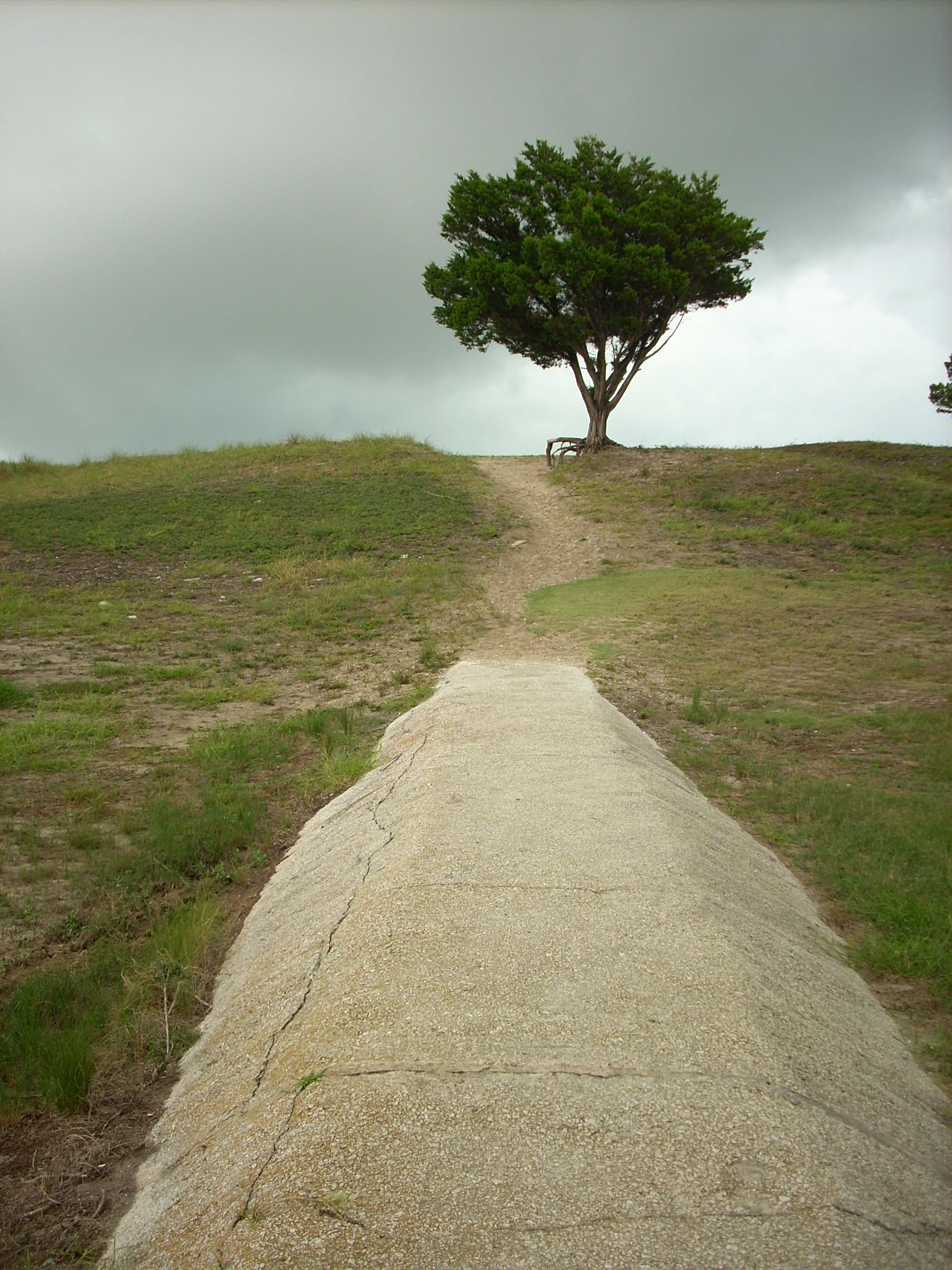
The North Carolina coast has a long and layered human history that overlaps with the reserve's natural areas. Barrier islands and sounds have supported fishing communities, lighthouse keepers, lifesaving station crews, and military installations historically, and several reserve sites contain reminders of that heritage. Zeke's Island, for example, includes the Buchanan Battery, a remnant of the area's coastal defense history, while other reserve components preserve structures associated with lifesaving stations and early twentieth century maritime communities.
Traditional use of these waters, including small-scale commercial fishing, crabbing, oystering, and recreational clamming, continues alongside the reserve's protected status. Indigenous peoples of the coastal plain also have deep historical connections to estuarine environments of the region, having relied on shellfish, fish, and waterfowl resources for thousands of years. Contemporary reserve programming often engages with these layered histories through interpretive and educational efforts alongside ecological research and habitat protection.
Top sights and standout views in North Carolina National Estuarine Research Reserve
Four geographically distinct sites stretching across North Carolina's coast, from Currituck Banks in the north to Zeke's Island in the south.
The only major estuarine reserve in the national system that explicitly straddles both the Virginian and Carolinian biogeographic provinces.
Home to over forty-four thousand acres of protected tidal marsh, open water, barrier island, and estuarine habitats of major economic importance.
A long-term research platform supporting coastal monitoring, fisheries habitat science, and estuarine ecology studies throughout the region.
Best time to visit North Carolina National Estuarine Research Reserve
The reserve's varied habitats offer different experiences across the seasons. Spring and fall are generally the most comfortable times for outdoor exploration, with milder temperatures, fewer insects than summer, and active migration periods that bring concentrations of shorebirds and waterfowl, especially around Rachel Carson Reserve, Zeke's Island, and the Currituck Sound side of Currituck Banks.
Summer brings the warmest water temperatures and the highest biological activity in the estuaries, but it is also the season of greatest heat, humidity, and biting insects across the marsh and barrier island sites; visitors commonly arrive in early morning or late afternoon. Winter can be rewarding for birdwatching and for experiencing the stark, quiet character of the barrier islands, though weather windows may be limited. Access to specific sites varies by management rules and tidal conditions, and visitors benefit from planning around low to mid tide when marsh and tidal flat exploration is most rewarding.