
Mori Atlas logo
Protected landscapeCape Lookout National Seashore

A dynamic coastal landscape defined by shifting sand dunes, wild beaches, and remote maritime ecosystems.

Cape Lookout National Seashore: Mapping the Protected Barrier Islands of North Carolina

Cape Lookout National Seashore encompasses a 56-mile stretch of undeveloped Atlantic shoreline across North Core Banks, South Core Banks, and Shackleford Banks. This protected landscape preserves a rare, roadless environment where shifting beach sands, salt marshes, and maritime grasslands provide critical habitat. The geography serves as a primary study of barrier island systems, shaped by constant wind and tidal influence along the North Carolina coast.

Outer Banksbarrier islandscoastal scenerylighthousewild horsesshorebird nesting
Vector-style illustration of the Cape Lookout Lighthouse with its signature black and white diamond pattern, surrounded by sand dunes and pine trees under a sunset sky.

Cape Lookout National Seashore

Protected landscape

Park overview

Structured park overview, official facts, and landscape profile for Cape Lookout National Seashore

Cape Lookout National Seashore park facts, protected area profile, and essential visitor context

Review the core facts for Cape Lookout National Seashore, including designation, size, terrain, visitor scale, habitats, and operating context in one park-focused overview.

About Cape Lookout National Seashore

Cape Lookout National Seashore is one of the most extensive stretches of protected barrier island in the eastern United States. Running along North Carolina's Crystal Coast from Ocracoke Inlet in the northeast to Beaufort Inlet in the southwest, the seashore captures the essential geography of the Southern Outer Banks: long, narrow sand islands, shifting inlets, and broad shallow sounds that stand between the open Atlantic and the mainland.

The seashore is made up of three core islands - North Core Banks, South Core Banks, and Shackleford Banks - each with its own character. North and South Core Banks together form a long, largely empty crescent of sand inhabited mainly by nesting shorebirds, sea turtles, and the occasional ranger station. Shackleford Banks, to the south, is the home of the famous herd of banker horses, a feral population that has lived on the island for centuries and is among its strongest symbols. Together, these islands preserve a working example of how Atlantic barrier systems naturally migrate, accrete, and erode over time.

Human history is woven through the landscape in subtle but important ways. Core Banks still carries traces of the once-thriving village of Portsmouth, a nineteenth-century port community now largely abandoned but preserved as part of the seashore's historic districts. The Cape Lookout Lighthouse, with its unmistakable black-and-white diamond daymark, has guided mariners along this stretch of coast since the nineteenth century and remains the seashore's most visible landmark. The Park Service has worked to rehabilitate the light station and stabilize the historic structures as part of its broader stewardship of the area.

From an ecological standpoint, Cape Lookout is remarkable for the simplicity and resilience of its habitats. Narrow beach and dune zones give way to salt marshes, sound flats, and maritime shrub thickets. The islands serve as nesting habitat for terns, skimmers, oystercatchers, and brown pelicans, while the surrounding waters support whelks, crabs, sharks, and a rich variety of fish. Because much of the seashore is roadless and lightly visited, large sections retain the open, windswept quality that has characterized the Outer Banks for generations.

Quick facts and research context for Cape Lookout National Seashore

Cape Lookout National Seashore lies in Carteret County, North Carolina, within the Southern Outer Banks and the broader Crystal Coast region. The protected area covers about 28,243 acres of barrier island and estuarine habitat, managed by the National Park Service and established on March 10, 1966.

It encompasses three principal barrier islands - North Core Banks, South Core Banks, and Shackleford Banks - along with the surrounding waters, inlets, and sound-side marshes. The seashore is internationally recognized as part of the Carolinian-South Atlantic Biosphere Reserve and is also designated as a North Carolina Natural Heritage Area.

Protection and recognition

Explore documented conservation scope and 1986 designation timelines for this coastal landscape.

Cape Lookout National Seashore Protection Status And Designation History

Examine the recorded protection status and designation history established for Cape Lookout National Seashore since 1986. Review structured conservation metrics and management parameters associated with this coastal protected area.

Protection details

Protection scope
Mixed
Designated year
1986
Transboundary protection
No
Park context

Deeper park guide and search-rich context for Cape Lookout National Seashore

Cape Lookout National Seashore history, landscape, wildlife, and travel context

Explore Cape Lookout National Seashore through its history, landscape character, ecosystems, wildlife, conservation priorities, cultural context, and seasonal travel timing in a structured park guide built for atlas discovery and search intent.

Why Cape Lookout National Seashore stands out

Cape Lookout is best known for the trio of undeveloped barrier islands that form its core, anchored by the iconic black-and-white diamond-patterned Cape Lookout Lighthouse. The seashore is equally famous for the wild banker horses of Shackleford Banks, one of the most photographed feral horse herds in the United States. Equally central to its identity is the sense of remote, roadless beach wilderness. Most of the islands are only accessible by ferry or private boat, and many visitors come specifically for that feeling of an undeveloped Atlantic shoreline where dunes, surf, and sea-blown grasslands stretch uninterrupted toward the horizon.
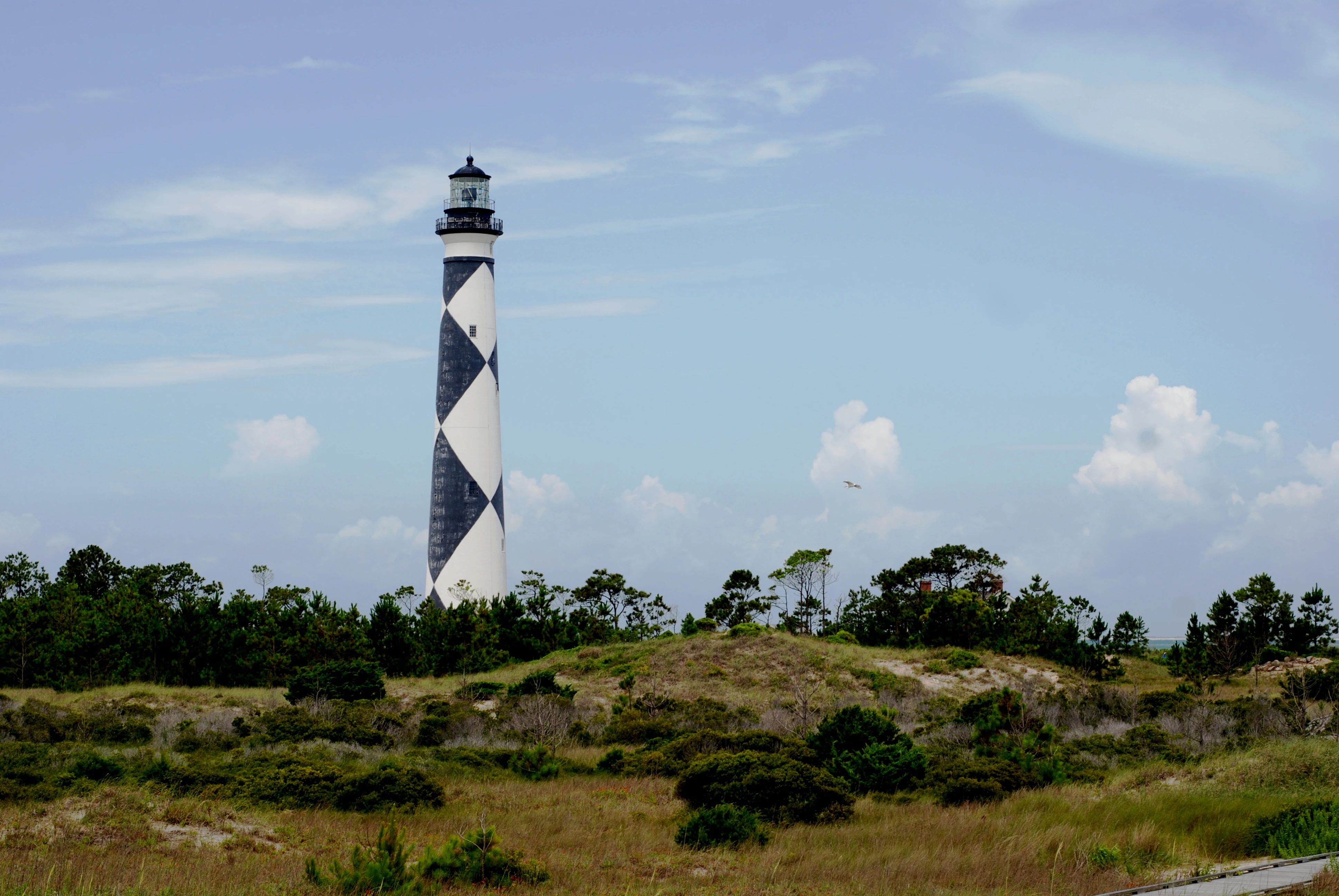
A tall, slender lighthouse with a distinctive black and white diamond pattern stands surrounded by green coastal shrubs and grasses under a partly cloudy blue sky.
The iconic diamond patterned Cape Lookout Lighthouse rises above the coastal vegetation.

Cape Lookout National Seashore history and protected-area timeline

Cape Lookout National Seashore was authorized on March 10, 1966, as part of the broader American movement to protect outstanding examples of the nation's coastline before they were lost to development. Its creation reflected growing recognition of the ecological fragility of barrier islands and the need to keep representative stretches of the Atlantic shore in public ownership.

In the years that followed, the seashore gained additional recognition for its natural value. On May 23, 1986, it was named a North Carolina Natural Heritage Area, and shortly afterward, on June 16, 1986, it was designated as part of the Carolinian-South Atlantic Biosphere Reserve, linking it into an international network of sites representing key ecosystems.

The history of the islands themselves runs far deeper than the establishment of the national seashore. The Cape Lookout Lighthouse has marked this stretch of coast for mariners since the nineteenth century, and its diamond pattern has become a navigational icon of the Outer Banks. South Core Banks also preserves the remains of Portsmouth Village, once a busy maritime community that served as a customs port before its gradual decline in the early twentieth century. The buildings and streetscapes there are now part of the park's historic districts, where the National Park Service has undertaken preservation and stabilization work, including efforts tied to its 2016 Centennial Initiative.

The seashore's modern history has also been shaped by repeated encounters with Atlantic storms. Tropical Storm Gabrielle made landfall at Cape Lookout in 2007, Hurricane Irene struck nearby in 2011 as a Category 1 storm, and Hurricane Arthur made landfall near the cape as a Category 2 hurricane. Each event has left its mark on the islands' shifting shoreline and has reinforced the importance of long-term monitoring and barrier island stewardship.

Cape Lookout National Seashore landscape and geographic character

The landscape of Cape Lookout National Seashore is the landscape of a working barrier island system. The three islands that form the heart of the seashore - North Core Banks, South Core Banks, and Shackleford Banks - are narrow, low, and shaped by wind, tide, and storm. Their oceanfront faces are broad, open sandy beaches, often broken by low dune ridges built from the same sands that shift with every major storm.

Behind the beach, the islands typically grade into dune fields, scattered sea oats and beach grasses, and the occasional shrub thicket of hardy coastal vegetation. On the sound side, the islands slope gently into expansive tidal flats, salt marshes, and oyster shoals along Core Sound and the larger Pamlico Sound system. These quieter back-island environments harbor most of the invertebrate life of the seashore and provide the rich foraging grounds that support migratory and resident birds.

Cape Lookout itself, at the southern tip of South Core Banks, gives the seashore its name and its most recognizable silhouette: the lighthouse rising above gently rolling dunes with the open Atlantic on one side and the broad sweep of Core Sound on the other. The horizon here feels unusually wide, because the islands rarely rise more than a few meters above sea level and there are virtually no large structures to interrupt the view. That combination of openness, constant wind, and shifting light is one of the seashore's defining visual qualities.
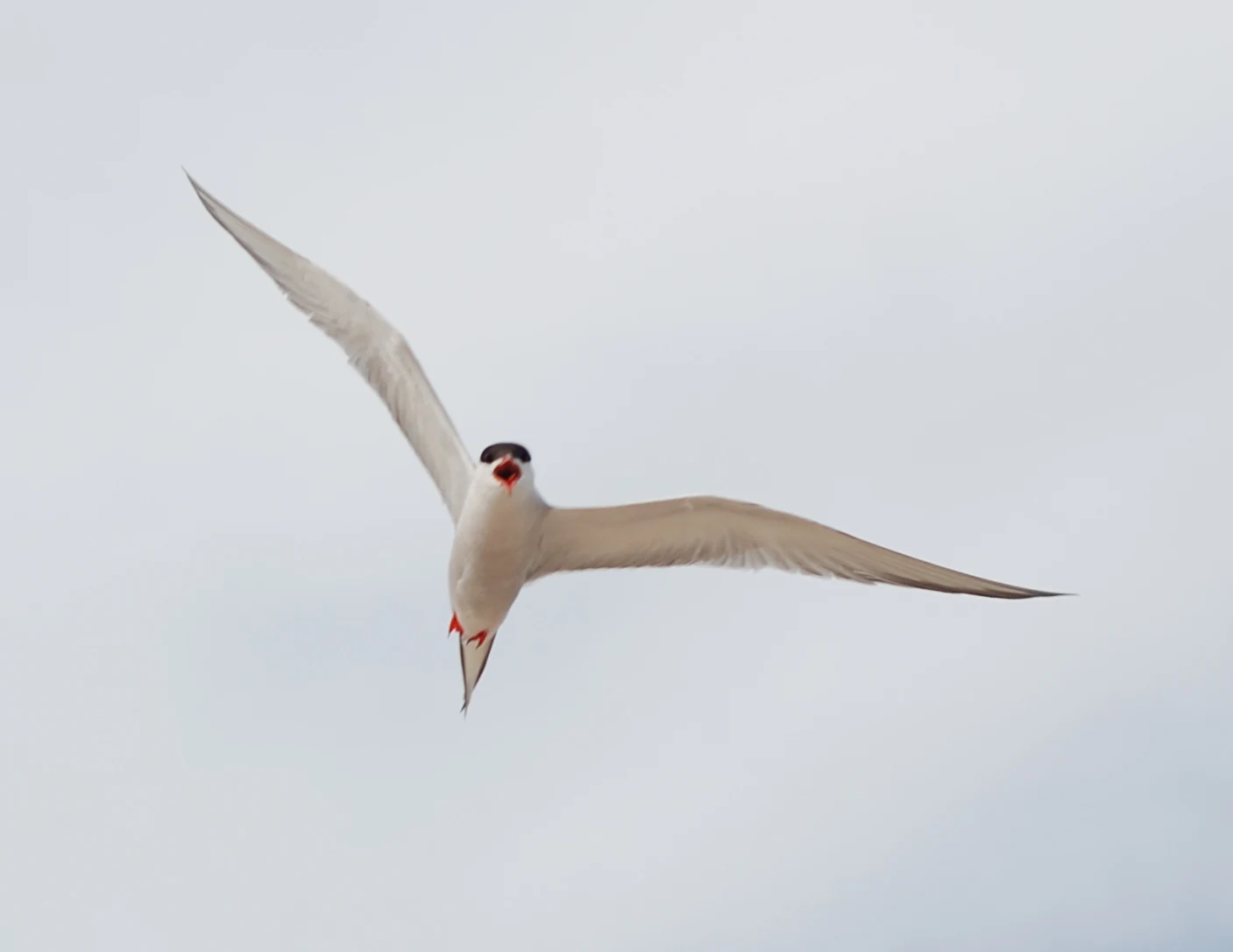
A white tern with a black cap flying with its wings spread against a bright, overcast sky.
A common tern in flight above Core Banks at Cape Lookout National Seashore.

Cape Lookout National Seashore ecosystems, habitats, and plant life

Ecologically, Cape Lookout National Seashore is a textbook example of the Carolinian coastal zone. The seashore's vegetation is dominated by communities typical of mid-Atlantic and Southeast barrier islands: rolling mats of sea oats and other dune-building grasses on the oceanfront, low shrubs and wind-pruned coastal forest patches in more protected interior swales, and extensive salt marshes and cordgrass flats along the sound-side margins.

Coastal processes are central to the seashore's nature, not just its scenery. The islands are in constant slow motion, accreting sand on one face while losing it on another, with inlets migrating and reshaping themselves over decades. This dynamic geography means that habitats here are always in flux, and the park's protected status helps ensure that those natural processes can continue without the interference of heavy development or shoreline hardening.
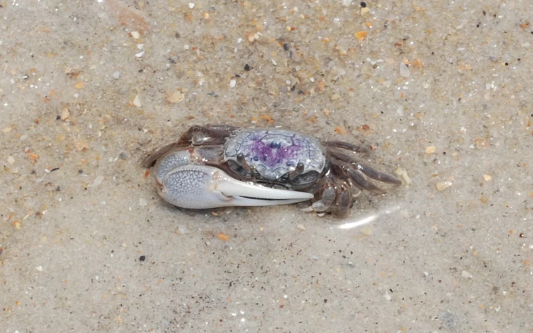
A small fiddler crab with a large white claw and a purple-patterned shell resting on wet sand.
A fiddler crab on the sandy beach of Core Banks, Cape Lookout National Seashore.

Cape Lookout National Seashore wildlife and species highlights

Wildlife at Cape Lookout is shaped by the rhythm of the seasons and the exchange between ocean and sound. The islands are especially important for colonial-nesting shorebirds and seabirds. Common terns nest in dense colonies on Core Banks, often defending their nest sites with dramatic aerial dives, while black skimmers, American oystercatchers, laughing gulls, brown pelicans, and great egrets are characteristic sights along the beaches and shallow flats.

The ocean and sound waters add a second layer of wildlife interest. Small sharks patrol the surf line, while the tidal flats and shallows are home to lightning whelks, knobbed whelks, shark eye snails, fiddler crabs, and hermit crabs. Sea turtles nest on the beaches during the warmer months, though hurricanes and tropical storms regularly reshape their nesting habitat.

Above all, the seashore is associated with the wild horses of Shackleford Banks. These so-called banker horses have lived on the island for generations and continue to roam freely, grazing on dune grasses and moving between beach and interior as conditions change. They are both a conservation focus and one of the park's most recognizable wildlife symbols.
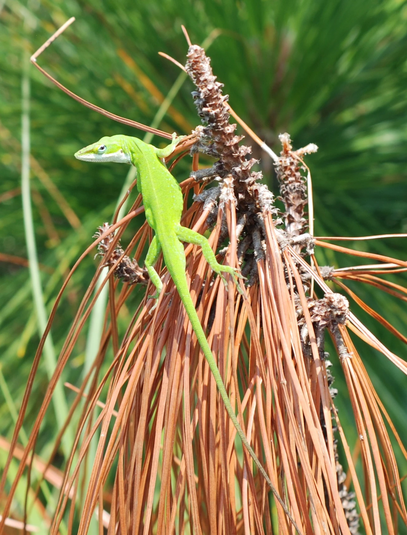
A bright green lizard perched on a bunch of brown pine needles, shown from above.
A green anole rests on a pine branch within Cape Lookout National Seashore.

Cape Lookout National Seashore conservation status and protection priorities

Conservation at Cape Lookout is organized around the idea of letting a barrier island system function as naturally as possible on a heavily developed coastline. The seashore's protected status has kept long stretches of the Outer Banks free of roads, large structures, and bulkheading, which in turn has preserved natural overwash, dune migration, and inlet dynamics that are increasingly rare elsewhere along the U.S. Atlantic coast.

Recognizing these values, the seashore was designated a North Carolina Natural Heritage Area in 1986 and was added to the international network of biosphere reserves as part of the Carolinian-South Atlantic Biosphere Reserve the same year. It is also tracked as a dark-sky site for the quality of its night skies, reflecting the low levels of light pollution over the islands.

The seashore also plays an important role in the conservation of the Shackleford horse herd. Because the population is small and isolated, its long-term genetic viability has been a recurring concern, and proposals such as the Corolla Wild Horses Protection Act have explored adding horses from other Outer Banks herds to maintain genetic diversity. Conservation work is further shaped by the recurring impact of tropical storms and hurricanes, which has made long-term shoreline monitoring, habitat mapping, and storm-response planning central to the park's management approach.

Cape Lookout National Seashore cultural meaning and human context

Cape Lookout's cultural landscape is small but distinctive. The Cape Lookout Lighthouse has long stood as a working navigational aid and a visual shorthand for the Outer Banks, while the historic village of Portsmouth on North Core Banks preserves the brick streets, foundations, and wooden structures of a nineteenth-century port community that slowly emptied as Silas Luca's neighboring deeper-water anchorages drew shipping and residents away.

The wild horses of Shackleford Banks also carry strong cultural meaning, living as a living link between the islands' early domestic stock and the present-day landscape. Together, these elements give the seashore a cultural identity rooted in maritime work, isolated island communities, and the long human tradition of life on the edge of the Atlantic.
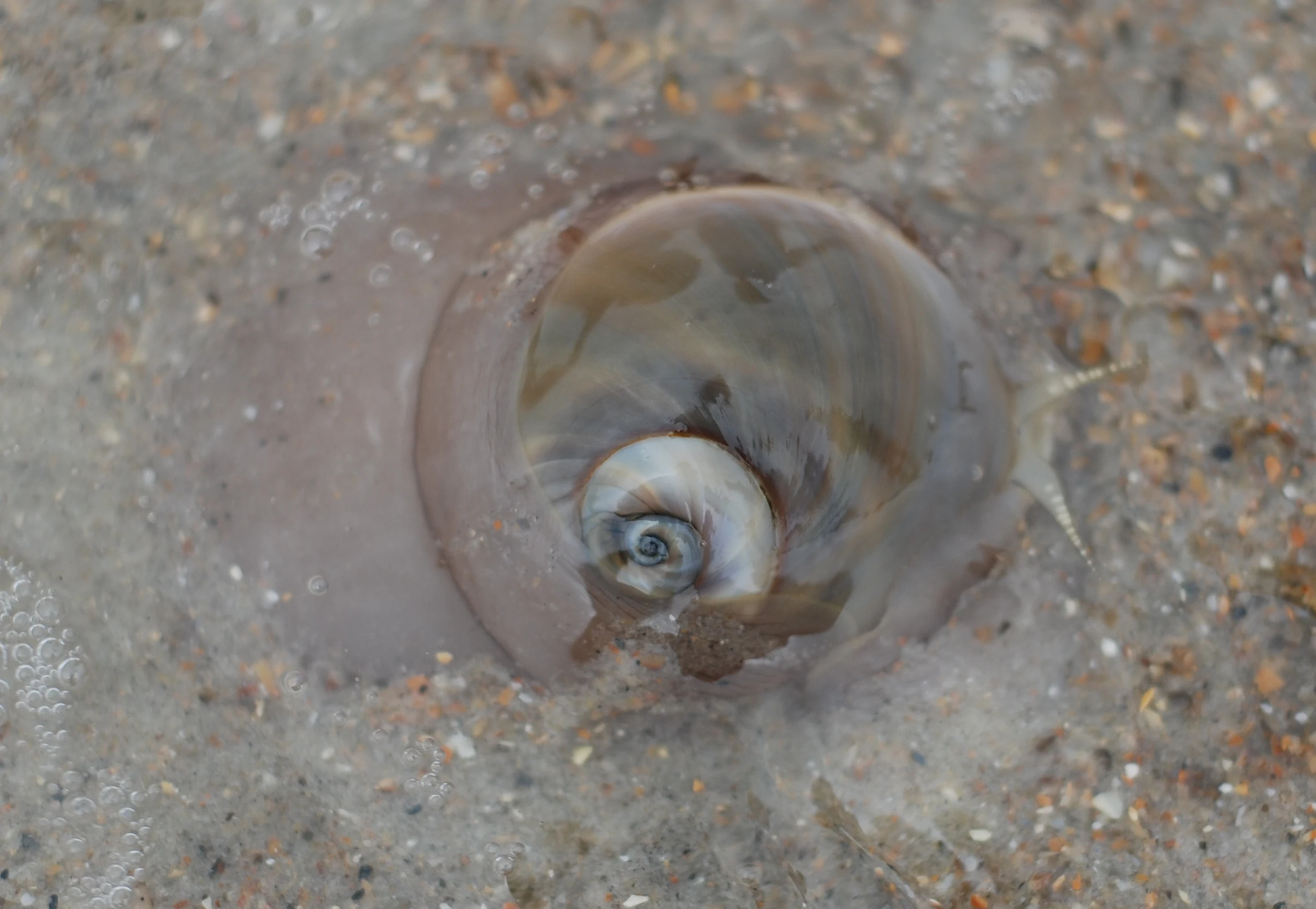
A close up view of a shark eye moon snail, showing its smooth, light-colored, globular shell and fleshy mantle resting in shallow, sandy water.
A shark eye moon snail partially submerged in the wet sand of a barrier island beach.

Top sights and standout views in Cape Lookout National Seashore

Cape Lookout stands out for the combination of three very different island experiences within a single national seashore: the long, roadless beaches and nesting bird colonies of the Core Banks; the historic Portsmouth Village district; and the wild horse country of Shackleford Banks. The diamond-patterned Cape Lookout Lighthouse ties these places together visually and historically.

The seashore is also notable for what it does not have - there are almost no roads, boardwalks, or large developments within its boundaries - and that absence of modern coastal infrastructure is itself one of its strongest attractions, making it a rare place where visitors can still experience the Outer Banks as an essentially moving, open, and wild shoreline.
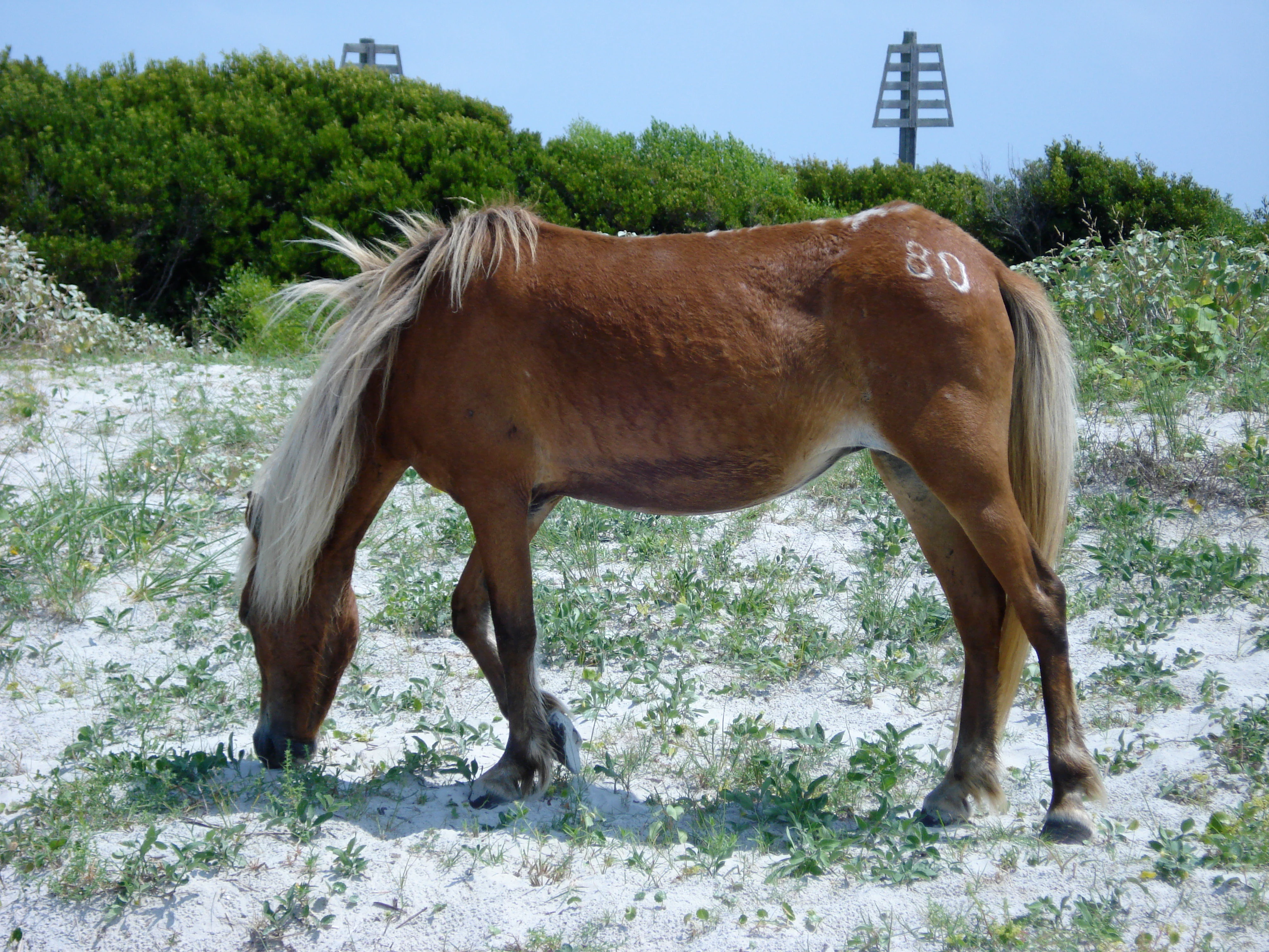
A brown horse with a light mane grazes on sandy ground with sparse vegetation. The horse has the number 80 painted or branded on its hindquarters. In the background, there are green shrubs and two wooden sign markers.
A branded Banker horse grazing on the sandy dunes of Shackleford Banks.

Best time to visit Cape Lookout National Seashore

Cape Lookout has a humid subtropical climate marked by hot, humid summers, mild winters, and year-round precipitation, with the dominant natural rhythm shaped by the Atlantic hurricane season and winter nor'easters. Late spring through early fall is generally the most rewarding window for exploring the seashore, when warm ocean water, sea breezes, and active nesting and feeding birdlife give the islands their most vibrant character.

Summer brings reliable sea breezes that take the edge off the heat, although it is also the period of greatest hurricane risk, with activity peaking from late August through September. Spring and fall tend to be quieter, cooler, and excellent for visitors focused on bird migration and the calmer atmosphere of the off-season. Winter visits are possible but cooler and windier, with strong nor'easters most common in February; whatever the season, visitors should expect conditions to be more exposed and changeable than they would be onshore.
Monthly climate preview

Long term temperature averages and monthly precipitation records for coastal North Carolina

Cape Lookout National Seashore Climate Normals and Annual Weather Patterns

Representative coordinate data records measured monthly temperature fluctuations alongside daily precipitation amounts across the year. Evaluating twelve month climate normals provides complete insight into long term environmental rhythms.
Annual mean20 °C
14 °C27 °C
Jan14°
Feb14°
Mar16°
Apr19°
May22°
Jun25°
Jul27°
Aug27°
Sep26°
Oct22°
Nov18°
Dec16°
Warmest month
July

27.2 °C

Coolest month
January

13.6 °C

Wettest month
September

6.5 mm/day

Driest month
April

3.1 mm/day

Park location guide

Geography guide, regional context, and park location map for Cape Lookout National Seashore

Cape Lookout National Seashore park geography, regions, and map view in United States of America

Understand where Cape Lookout National Seashore sits in United States of America through a broader geographic reading of the surrounding landscape, nearby location context, and its mapped position within the national park landscape.

How Cape Lookout National Seashore fits into United States of America

The United States of America is a federal presidential republic and one of the world's largest countries by area and population. It consists of 50 states across a vast territory spanning multiple time zones, with its capital in Washington, D.C. and largest city in New York City. The nation has a diverse economy, influential political system, and significant cultural and military presence globally.

Wider geography shaping Cape Lookout National Seashore in United States of America

The United States occupies a vast territory in North America, bordered by Canada to the north and Mexico to the south. The 48 contiguous states stretch from the Atlantic to the Pacific Ocean, while Alaska occupies the northwestern region and Hawaii is an archipelago in the Pacific. The country encompasses diverse terrain including the Rocky Mountains, Appalachian Mountains, Great Plains, and extensive river systems.

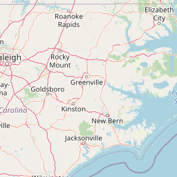
Map view of Cape Lookout National Seashore

Use this park location map to pinpoint Cape Lookout National Seashore in United States of America, understand its exact geographic position, and read its mapped placement within the surrounding landscape more clearly.

Pigeon | © OpenStreetMap contributors

Location context for Cape Lookout National Seashore

North Carolina
Recorded earthquake history

Explore the Cape Lookout National Seashore Recorded Earthquake History

Examine the historical record of seismic activity documented near the barrier islands of Cape Lookout National Seashore. This catalogue provides organized data on event timing, magnitude, and epicentre locations to support geographic exploration of the region.

Cape Lookout National Seashore Earthquake History

Catalogued events

1 event

Strongest magnitude

Magnitude 3.6

Most recent event

Aug 6, 1994

This history includes earthquakes recorded inside the park or within 50 km of its borders

Visual reference of remote Atlantic beaches, maritime grasslands, and protected island habitats.

Cape Lookout National Seashore Photos: Scenery, Barrier Islands, and Coastal Landscapes

Examine professional national park photography capturing the shifting sand dunes, tidal marshes, and barrier island terrain of Cape Lookout National Seashore. Visual records reveal the distinct coastal environment, native wildlife habitats, and wild horse ranges shaping the protected southern Outer Banks.

A tall, slender lighthouse with a distinctive black and white diamond pattern stands surrounded by green coastal shrubs and grasses under a partly cloudy blue sky.

A laughing gull flying against a clear sky with its wings spread.

A white tern with a black cap flying with its wings spread against a bright, overcast sky.

A small fiddler crab with a large white claw and a purple-patterned shell resting on wet sand.

A bright green lizard perched on a bunch of brown pine needles, shown from above.

A close up view of a live lightning whelk shell lying on the tan sand of a beach.

A close up view of a shark eye moon snail, showing its smooth, light-colored, globular shell and fleshy mantle resting in shallow, sandy water.

A brown horse with a light mane grazes on sandy ground with sparse vegetation. The horse has the number 80 painted or branded on its hindquarters. In the background, there are green shrubs and two wooden sign markers.

A small black and white bird, identified as an American oystercatcher, flying low over the breaking waves of an ocean beach.

A group of black skimmers with black and white plumage and orange bills standing on a wide, sandy beach with shallow water and ocean surf in the background.

A brown pelican with outstretched wings soaring through a clear blue sky.

A close-up shot of a small hermit crab with its body partially emerging from a dark brown, spiky whelk shell, held in a person's hand.

A white great egret stands amidst green coastal shrubs and grasses with a flat, distant horizon under a pale, overcast sky.

Park atlas

Compare nearby protected areas and related coastal landscapes across the regional network

Explore Other Parks Near Cape Lookout National Seashore and Surrounding Coastal Reserves

Browse nearby national parks and protected areas sharing similar barrier island terrain and coastal habitats. Comparing adjacent reserves helps trace broader regional conservation patterns and coastal geography.
A soft watercolor illustration of a coastal marsh landscape with greenery, low hills, and a calm water channel.
Protected landscapeNorth Carolina
2.3 km away#1 closest

Northeast

Cape Hatteras National Seashore: Geographic Overview and Protected Coastal Landscape

Mapping the barrier island geography of North Carolina.

Cape Hatteras National Seashore encompasses an uninterrupted stretch of sandy beaches and shrub thickets along the Atlantic coast. This protected area serves as a primary case study for barrier island dynamics, featuring iconic lighthouses, extensive estuarine shorelines, and critical habitats within the North Carolina Outer Banks.

Area
122.83 km²
Established
1953
IUCN
V
Visitors
2.9M annual
Marine protected areaNorth Carolina
About 57 km away#2 closest

Northeast

Monitor National Marine Sanctuary: Map and Protected Area Geographic Context

Underwater heritage site in North Carolina Atlantic waters

Monitor National Marine Sanctuary stands as a landmark of marine conservation, designated specifically to preserve the remains of the USS Monitor ironclad warship. Located off Cape Hatteras, the sanctuary provides a defined underwater landscape where historical research, archaeology, and natural reef formation converge. Discover the spatial context of this significant Atlantic protected area and its enduring legacy in American naval history.

Area
2.69 km²
Established
1975
Relief
Lowland
Climate
Subtropical
A horizontal watercolor illustration depicting a grassy shoreline with a single tree and distant rolling hills against a soft pale sky.
Nature reserveNorth Carolina
About 126 km away#3 closest

Southwest

North Carolina National Estuarine Research Reserve: Mapped Protected Coastal Terrain

Coastal habitat and biogeographic research corridor

Spanning from Currituck Banks to Zeke's Island, the North Carolina National Estuarine Research Reserve preserves a diverse coastal mosaic. This protected area supports essential estuarine functions and provides critical habitat for numerous aquatic species, defining the complex intersection of land and sea in the southeastern United States.

Area
42.76 km²
Established
1985
Relief
Lowland
Climate
Subtropical
Nature reserveVirginia
About 268 km away#4 closest

North

Chesapeake Bay National Estuarine Research Reserve, Virginia: Coastal and Estuarine Atlas

Mapped protected landscapes of the York River estuary.

Spanning the critical salinity gradient of the York River, this nature reserve integrates diverse tidal habitats including expansive marshes, quiet creeks, and coastal islands. As a center for scientific monitoring, the reserve offers a layered view of Mid-Atlantic estuarine geography, protecting essential buffers and water channels that define the lower Chesapeake Bay region.

Established
1991
Relief
Lowland
Climate
Temperate
Access
Access unknown
A minimalist watercolor painting depicting a soft green and pastel landscape with rolling hills and a central pond or marshy area on a white background.
Protected landscapeMaryland
315 km away#5 closest

North

Assateague Island National Seashore: Geographic Atlas and Protected Landscape Overview

Dynamic barrier island terrain in the Maryland region

Assateague Island National Seashore preserves one of the most naturally functioning barrier island ecosystems in the Mid-Atlantic. This protected stretch of coastline showcases the interaction between sediment movement, storm-driven overwash, and salt marsh development, offering a clear view of how barrier systems respond to environmental forces.

Area
167.2 km²
Established
1965
IUCN
V
Visitors
2.3M annual
National parkSouth Carolina
378 km away#6 closest

West

Congaree National Park: A Protected National Park in South Carolina's Geographic Landscape

Explore mapped boundaries and regional park geography.

Congaree National Park represents a vital protected national park entity within South Carolina, offering rich opportunities for geographic discovery and landscape exploration. Its designation as a National Park underscores its importance in mapping protected areas and understanding regional terrain. This entry provides essential context for exploring the park's specific geographic features and its position within the broader atlas of conservation landscapes.

Area
108.021 km²
Established
2003
IUCN
Ib
Visitors
287.8K annual
A watercolor painting showing a soft, stylized view of rolling green hills, trees, and a river flowing through a valley.
Marine protected areaCharles County
384 km away#7 closest

North

Mallows Bay, Potomac River National Marine Sanctuary: Mapping the Potomac River Ghost Fleet

A historic marine protected area in Charles County, Maryland.

The Mallows Bay, Potomac River National Marine Sanctuary preserves a significant maritime archaeology site within the Chesapeake Bay watershed. The protected area features the Ghost Fleet of World War I era steamships that have been reclaimed by river ecology. This region offers a distinct look at the intersection of cultural history and tidal freshwater habitats in Southern Maryland.

Area
47 km²
Established
2019
IUCN
V
Relief
Lowland
Wildlife reserveNelson County
403 km away#8 closest

Northwest

Priest Wilderness: A Deep Dive Into Appalachian Mountain Geography and Protected Forest Boundaries

High elevation ridge terrain in Nelson County, Virginia.

Priest Wilderness stands as a signature protected area in the Blue Ridge Mountains, defined by a dramatic 3,000 foot vertical gain and dense, mature hardwood forests. This documentation maps the rugged ridge and hollow topography that characterizes one of the most significant wilderness sections along the central Appalachian trail corridor.

Area
23.17 km²
Established
2000
IUCN
Ib
Relief
Mountain

Common questions about visiting, size, designation, and location context for Cape Lookout National Seashore

Cape Lookout National Seashore FAQs for park facts, access, geography, and protected area context

Find quick answers about Cape Lookout National Seashore, including protected-area facts, park geography, trail and visitor context, and how the park fits into its surrounding country and regional landscape.
MoriAtlas Explorer

Continue Your Protected Areas Search Across the Global Atlas

Deepen your exploration by continuing the structured search for national parks and protected areas worldwide. Utilize the comprehensive filtering capabilities to compare different conservation landscapes and refine your understanding of global park geography. Discover more about the distribution and characteristics of protected natural areas.

Global natural geography