

Mori Atlas logo
Protected areaDallol Maouri

A climatically diverse landscape corridor linking Sahel and Sudan zones through the Dosso Region

Dallol Maouri Protected Area: Mapping the Ancient Fossil Valleys of Southwestern Niger

Dallol Maouri represents a significant ecological corridor within the Iullemmeden Basin, functioning as a fossilized drainage network that bridges the Sahelian and Sudanian climate zones. This protected area supports a distinctive landscape of seasonal ponds, palm-lined floodplains, and complex tributary ravines. By examining the valley's hydrogeography and regional flood patterns, one can understand how this seasonal wetland maintains its vital ecological role across southwestern Niger.

dry valleyseasonal wetlandRamsar siteSahel-Sudan transitionpalm grovesfloodplain

Dallol Maouri

Protected area

Park overview

Structured park overview, official facts, and landscape profile for Dallol Maouri

Dallol Maouri park facts, protected area profile, and essential visitor context

Review the core facts for Dallol Maouri, including designation, size, terrain, visitor scale, habitats, and operating context in one park-focused overview.

About Dallol Maouri

Dallol Maouri is a long seasonal valley in west and southwest Niger, one of three parallel fossil drainages that shape the Iullemmeden Basin. The name combines the Fulfulde word dallol, meaning valley, with a reference to the Maouri people, whose communities once formed the political core of the historic Aréoua landscape through which the valley flows. The upper section of the Dallol Maouri is essentially the continuation of the Tadiss dry valley, which descends from the Tahoua Region south of Soucoucoutane, where the system formally takes the Dallol Maouri name.

The valley's physical setting is defined by old, sandy alluvial sediments laid down when the system carried a more substantial flow toward the Niger River. Today, the channel is broad and shallow, with coarse, sometimes clayey sands, gently sloping valley walls, scattered low dunes, and sandy rises that rise only slightly above the floor. During the rainy months between May and September the valley fills intermittently, fed by a network of small tributaries known locally as koris. As the dry season sets in, the flow retreats and leaves behind string of ponds called mares, which are central to both the wetland's ecology and to rural livelihoods along the corridor.

Settlement is unusually dense for Niger along the Dallol Maouri. The valley passes through the regional center of Dogondoutchi and links a chain of villages including Matankari, Kiéché, Tibiri, Fadama, Guéchémé, Dioundiou, and Yélou before it merges with the Dallol Foga near Bana. This tight ribbon of villages and farmland gives the valley a distinctly inhabited, working-landscape feel that sets it apart from many other protected natural areas in the Sahel. The cultural mix of the corridor reflects the linguistic roots of the valley's name, with Maouri communities who speak either Hausa or Zarma alongside other groups.

Ecologically, the Dallol Maouri stands out for the way vegetation, hydrology, and human use overlap in a single landscape. The floodplain has long hosted irrigation agriculture and palm-based forestry, while the surrounding sandy soils still support scattered woodland and savanna species. The inclusion of the wider Dallol Maouri wetland in the Ramsar Convention in 2004 recognized not just its hydrological importance but also the broader ecological and socioeconomic value of the valley to southwestern Niger.

Quick facts and research context for Dallol Maouri

Dallol Maouri is a roughly 250 kilometer dry valley in western Niger, draining a catchment of about 8,100 square kilometers. It runs through the Dosso Region between the towns and villages of Soucoucoutane, Matankari, Dogondoutchi, Kiéché, Tibiri, Fadama, Guéchémé, Dioundiou, Yélou, and Bana, before joining the Dallol Foga system that ultimately reaches the Niger River. Its surface geology is loose, often clay-rich alluvial sand over old floodplain deposits, and the climate grades from Sahelian in the north to Sudanian in the south across the length of the valley. The valley's wetland complex has been recognized internationally as a Ramsar site since 26 April 2004.

Protection and recognition

Documented terrestrial protection history and Ramsar wetland designation records

Dallol Maouri Protection Status and International Recognition Data

Dallol Maouri maintains official terrestrial protection status established in the year 2004 alongside documented international Ramsar wetland recognition sources. Records compile recorded management scope and formal designation markers to support detailed conservation analysis.

International recognition

Protection details

Protection scope
Terrestrial
Designated year
2004
Transboundary protection
No
Park context

Deeper park guide and search-rich context for Dallol Maouri

Dallol Maouri history, landscape, wildlife, and travel context

Explore Dallol Maouri through its history, landscape character, ecosystems, wildlife, conservation priorities, cultural context, and seasonal travel timing in a structured park guide built for atlas discovery and search intent.

Why Dallol Maouri stands out

Dallol Maouri is best known as one of the three great fossil valleys of the Iullemmeden Basin, alongside the Dallol Bosso and the Dallol Foga, and as a Ramsar-listed wetland of southwestern Niger. It is also widely recognized for the dense palm groves that line its floodplain and for the seasonal ponds, or mares, that support a rich bird and fish fauna after the rains. The valley's geographical role, linking Sahel and Sudan climate zones along a single north to south corridor, gives it a distinctive ecological character that it shares with very few other landscapes in the Sahel.

Dallol Maouri history and protected-area timeline

The Dallol Maouri is best understood historically as a legacy valley of the Iullemmeden Basin, a paleodrainage that once channelled large tributaries into the Niger River before climate shifts gradually reduced it to an intermittent seasonal system. Its name preserves the memory of the Maouri people, the historical state-bearing community of the Aréoua landscape that straddled the valley. Although the valley itself is ancient in geological terms, modern scholarly attention to the Dallol Maouri developed strongly from the late twentieth century onward, when researchers began intensively studying its alluvial aquifer and floodplain soils as a basis for irrigated agriculture in the Sahel.

In the lower valley, near Yélou and toward Bana, traditional salt extraction has been documented since at least the nineteenth century, making the Dallol Maouri one of the older documented sites of mineral exploitation in southwestern Niger. The wetland gained formal international recognition on 26 April 2004, when its floodplain and associated seasonal marshes were designated as a Ramsar site of international importance, covering the entire Département de Dioundiou and the eastern part of the Département de Gaya.

Dallol Maouri landscape and geographic character

Geologically, the Dallol Maouri is a broad, shallow incision cut into the sandy floor of the Iullemmeden Basin. Its substrate is dominated by coarse, at times clayey, alluvial sands laid down by the river system in earlier, wetter climatic phases, and these old floodplain sediments remain the foundation of both the modern valley and its aquifer.

The terrain along the valley floor is comparatively gentle: a wide central channel bordered by low sandy ridges, occasional clay-rich deposits, and small dunes that flank but rarely cross the floodplain. Where tributaries enter the main valley, the small seasonal ravines known locally as koris cut sharply back into the surrounding land, and these coris determine much of the valley's flood behavior. The southern terminus near Bana is where the broad valley of Dallol Maouri blends into the equally broad Dallol Foga valley, and from there the combined system runs south toward the Niger River.

Climate and vegetation shift noticeably along the valley's length. The upper section, in the Aréoua landscape, lies at the transition between the Sahel to the north and the Sudan zone to the south and receives roughly 650 millimeters of rainfall a year. The lower section, in the Dendi landscape, is firmly Sudanian, with annual rainfall around 850 millimeters concentrated between May and September. This climatic gradient is one of the defining features of the Dallol Maouri landscape and supports a corresponding shift in woody vegetation, soil moisture, and land use as one moves down the valley.

Dallol Maouri ecosystems, habitats, and plant life

Ecologically, Dallol Maouri is a transitional and mosaic landscape. The valley floor and the rarely flooded rises support a mix of palmyra palms, gum acacias, Bauhinia species, figs, and dogtooth grass, while the surrounding sandy hills and small dunes carry a drier suite of woody plants including shea trees, Diospyros mespiliformis, and Crateva religiosa.

The hydrology is the single most important ecological driver of the valley. During the May to September rainy season, water from the main channel and from dozens of small koris flows across the floodplain, replenishing the alluvial aquifer. After the rains, this water recedes into a chain of seasonal ponds, the mares, which retain moisture into the dry season and act as refuges for fish, waterbirds, amphibians, and aquatic invertebrates. The unpredictability of tributary flows, and the seasonality of the mares, is also a defining ecological feature of the system, repeatedly reshaping both habitats and human access to water.

For these reasons the valley is treated as a single integrated wetland ecosystem rather than as a series of separate habitats. The floodplain, the palm groves, the surrounding sandy woodland, and the seasonal ponds operate as one interconnected system, which is the basis for its designation under the Ramsar Convention.

Dallol Maouri wildlife and species highlights

The Dallol Maouri supports a varied birdlife that reflects its position on the Sahelian to Sudanian boundary. Herons and egrets are particularly prominent, with species such as the Squacco Heron, Cattle Egret, Little Egret, Grey Heron, Black-headed Heron, and Purple Heron regularly using the valley's ponds and flooded areas. Raptors and scavenging birds are also recorded, including the Western Marsh Harrier, Black Kite, and Hooded Vulture, while waterbirds such as the Spur-winged Lapwing, Black-winged Stilt, Egyptian Plover, African Pied Kingfisher, and African Jacana are characteristic species along the wetland margins.

Migratory and nomadic waterfowl add a strong seasonal signal to the birdlife. The valley hosts species such as the White-faced Whistling Duck, Knob-billed Duck, Wattled Starling, and Abdim's Stork, while the dry-season ponds attract a wide range of waders including Common Moorhen, Green Sandpiper, and other shorebirds. The fish fauna of the mares adds a second important wildlife dimension, with Nile Tilapia, Zille's Cichlid, the Five-spot Cichlid, the African Catfish, Schilbe mystus, Marcusenius senegalensis, and the dark-bellied snakehead among the species documented in the valley's ponds.

Dallol Maouri conservation status and protection priorities

The Dallol Maouri wetland complex was listed as a Ramsar site of international importance on 26 April 2004, citing the ecological value of its seasonal floodplain, its importance for migratory and resident waterbirds, and its role as a refuge for native fish populations in the dry season. The protected designation covers the entire Département de Dioundiou and the eastern part of the Département de Gaya, an area of about 317,520 hectares, and is one of the larger Ramsar listings in Niger.

Conservation interest in the valley is driven by its combination of ecological function and human dependence. The Ramsar listing reflects concerns over aquifer recharge, the maintenance of dry-season ponds, the survival of palm-dominated vegetation along the floodplain, and the connectivity between the valley's habitats and the surrounding Sahelian and Sudanian ecosystems. The designation also acknowledges that the Dallol Maouri floodplain is a working landscape, integrating protection with the irrigation agriculture, fisheries, and traditional salt production that local communities have practiced for generations.

Dallol Maouri cultural meaning and human context

The Dallol Maouri carries a layered cultural history. Its name itself encodes the identity of the Maouri people, who historically formed the ruling community of the Aréoua landscape through the valley and whose members today speak either Hausa or Zarma. Linguistically, dallol is a Fulfulde word meaning valley, which situates the name in a wider regional vocabulary shared with the Dallol Bosso and Dallol Foga.

Along its course, the valley links a chain of longstanding settlements that have grown around its groundwater, irrigable soils, and palm groves. The towns and villages of Soucoucoutane, Matankari, Dogondoutchi, Kiéché, Tibiri, Fadama, Guéchémé, Dioundiou, and Yélou are part of this cultural continuum, and each has historically depended on the valley's seasonal water. In the lower reaches, near Bana, traditional salt-making has been part of the local economy since at least the nineteenth century, while research on palm regeneration, irrigated cropping, and pastoral resources has framed much of the valley's modern scholarly identity.

Top sights and standout views in Dallol Maouri

Dallol Maouri stands out for the rare combination of three qualities in a single Nigerien landscape: a fossil Sahelian to Sudanian valley corridor, a Ramsar-listed seasonal wetland, and a densely inhabited working floodplain. The valley's chain of dry-season ponds, its palm-dominated floodplain vegetation, and its role as one of the three great dallols of the Iullemmeden Basin together give it a layered identity that is recognized in both ecological and cultural terms. Its importance as a refuge for waterbirds, native fish, and palmyra palms reinforces why it remains a reference site for wetland conservation in southwestern Niger.

Best time to visit Dallol Maouri

The Dallol Maouri's character shifts strongly with the West African rainy season. Between May and September, water flows intermittently down the main valley and its tributary koris, replenishing ponds and creating temporary flooded areas that attract large numbers of waterbirds. The post-rainy-season window, after the main rains but before the intense heat of April and May, is generally regarded as favorable for both irrigation agriculture and for observing the valley at its most biologically productive. Travel during this period offers the best combination of fresh vegetation, active birdlife, and accessible surface water, while the deep dry season exposes more of the sandy floodplain and the residual ponds known locally as mares.

Monthly climate preview

Long-term representative monthly averages for temperature and rainfall patterns

Dallol Maouri Climate Normals, Annual Temperature and Precipitation Rhythm

Representative coordinates record measured monthly temperature swings from 23.92 to 33.28 degrees Celsius alongside shifting daily precipitation averages. Detailed monthly climate normals provide deeper reference data for the annual meteorological rhythm across the protected landscape.
Annual mean28 °C
24 °C33 °C
Jan24°
Feb28°
Mar31°
Apr33°
May32°
Jun30°
Jul28°
Aug26°
Sep27°
Oct27°
Nov26°
Dec24°
Warmest month
April

33.3 °C

Coolest month
December

23.9 °C

Wettest month
August

7.1 mm/day

Driest month
January

0 mm/day

Park location guide

Geography guide, regional context, and park location map for Dallol Maouri

Dallol Maouri park geography, regions, and map view in Niger

Understand where Dallol Maouri sits in Niger through a broader geographic reading of the surrounding landscape, nearby location context, and its mapped position within the national park landscape.

How Dallol Maouri fits into Niger

Niger is a landlocked West African country spanning approximately 1.27 million km², making it the largest landlocked country in the region and the second-largest landlocked nation in Africa. Over 80% of its territory lies in the Sahara Desert, with the population concentrated in clusters in the southern and western regions. The country gained independence from France in 1960 and has experienced multiple coups, most recently in 2023.

Wider geography shaping Dallol Maouri in Niger

Niger is located in West Africa and is landlocked, bordered by Libya (northeast), Chad (east), Nigeria (south), Benin and Burkina Faso (southwest), Mali (west), and Algeria (northwest). Over 80% of the country's land area lies in the Sahara Desert. The terrain is predominantly flat desert plains and sand dunes, with the Niger River flowing through the southwest corner near the capital Niamey.

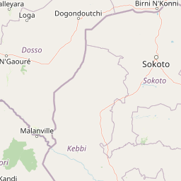
Map view of Dallol Maouri

Use this park location map to pinpoint Dallol Maouri in Niger, understand its exact geographic position, and read its mapped placement within the surrounding landscape more clearly.

Pigeon | © OpenStreetMap contributors

Location context for Dallol Maouri

Dosso Region
Park atlas

Compare regional park geography, seasonal wetlands, and connected dry valley landscapes

Other Parks Near Dallol Maouri and Protected Areas in the Surrounding Region

Browsing other parks near Dallol Maouri reveals broader patterns across the paleodrainage networks and seasonal wetlands of southwestern Niger. Examining adjacent protected areas provides essential regional context for understanding the climate transition and floodplain habitats of the Iullemmeden Basin.
Wildlife reserveDosso Region
Park boundaries overlap#1 closest

South

Feuchtgebiet am mittleren Niger II: Wetland Geography and Wildlife Reserve Boundaries

A seasonal floodplain corridor in the Dosso Region of Niger.

Feuchtgebiet am mittleren Niger II offers a clear view into the flood-pulse ecology of the middle Niger River. The reserve comprises a complex network of channels, ponds, and riverine woodlands that shift with the annual rains. This protected site in the Dosso Region acts as a crucial transboundary conservation area, showcasing the unique interaction between riparian forests, baobab groves, and seasonal aquatic terrain.

Area
385.55 km²
Established
2004
Relief
Lowland
Scope
Terrestrial
Protected areaDosso
13 km away#2 closest

West

Feuchtgebiet am mittleren Niger: Protected Wetland Geography and River Floodplain Atlas

Geographic overview of floodplain terrain in Dosso, Niger

Feuchtgebiet am mittleren Niger preserves a vital mosaic of riverine channels, temporary ponds, and floodplain flats. This protected area stands as a distinctive aquatic corridor within the Sahel, characterized by diverse water-based habitats and seasonal vegetation shifts that define the regional geography of Dosso.

Area
521.8 km²
Established
2001
Relief
Lowland
Scope
Terrestrial
Wildlife reserveNiger
19 km away#3 closest

Northwest

Dallol Bosso Wildlife Reserve: Geographic Atlas and Protected Landscape Context in Niger

A 350-kilometer seasonal wetland corridor and regional hydrologic system

Dallol Bosso stands as a major seasonal drainage corridor in western Niger. This wildlife reserve spans from the Malian border to the Niger River, offering a distinct study in Sahelian hydrology. Its alluvial soils and wetland characteristics support specific agricultural patterns, making it a focal point for understanding the human and natural geography of the Boboye region.

Area
8,921.22 km²
Established
2004
Relief
Lowland
Climate
Subtropical
National parkNiger
65 km away#4 closest

Northwest

W National Park: Niger National Park, UNESCO World Heritage Site & Ramsar Wetland

Transborder savanna ecosystem and dramatic Niger River landscape.

W National Park in Niger offers a unique atlas view of a vast protected landscape defined by the Niger River's iconic W-shaped bend. As a UNESCO World Heritage Site and Ramsar Wetland, it protects crucial savanna plains, extensive floodplains, and rocky outcrops. This transborder conservation area is a vital habitat for West African wildlife, providing a rich context for geographic discovery and landscape exploration.

Area
10,000 km²
Established
1954
IUCN
II
Relief
Mixed relief
National parkNiger
About 76 km away#5 closest

Northwest

W of the Niger National Park: National Park Protected Landscape and Geographic Atlas

Explore the mapped boundaries and regional geography of this protected area.

W of the Niger National Park is a designated national park offering detailed atlas-level context for its protected landscape. Users can investigate its mapped boundaries, understand its regional geographic setting, and gain insight into its unique natural terrain. This entry provides a focused view of the park's identity within the broader atlas for protected-area exploration.

Area
10,000 km²
Established
1954
Relief
Mixed relief
Climate
Tropical
Protected areaAlibori
About 81 km away#6 closest

South

Forêt classée de la Sota: Exploring Protected Woodlands in the Alibori Department

A historic Sudano-Sahelian savanna and riverine ecosystem

Forêt classée de la Sota stands as a critical protected woodland in northeastern Benin. This expansive 53,000 hectare reserve protects unique Sudano-Sahelian terrain defined by the Sota River basin, supporting a diverse range of savanna wildlife and complex riparian habitats across the Alibori region.

Area
530 km²
Established
1947
Relief
Lowland
Climate
Tropical
Nature reserveBenin
About 129 km away#7 closest

South

Forêt classée des Trois Rivières: Geographic Context and Protected Landscape Map

Nature reserve protecting vital northern Benin river catchments.

Spanning over 2,595 square kilometers in northern Benin, Forêt classée des Trois Rivières functions as a critical watershed protector for the Sota, Tassiné, and Bouli rivers. The reserve sustains a fragile Sudano-Sahelian ecosystem where open tree savanna and gallery forests provide refuge for elephants and other wildlife. Its mapped boundaries offer a look at the historical and ecological struggle to maintain intact forest fragments within a landscape defined by agricultural expansion and river basin management.

Area
2,595 km²
Established
1949
IUCN
II
Protected areaBenin
About 135 km away#8 closest

Southwest

Complexe W-Arly-Pendjari: Regional Geography and Transboundary Protected Landscapes

Sudano-Sahelian savanna and riverine conservation corridors.

As a massive transboundary conservation area, the Complexe W-Arly-Pendjari protects nearly 1.5 million hectares of savanna, woodland, and rocky terrain. The complex links national parks across three countries to maintain a continuous habitat for West African megafauna. Its distinctive landscape transitions from lush gallery forests along river systems to open, dry plains, representing an essential geographic gradient for regional biodiversity.

Area
14,948.3 km²
Established
1996
Water
Major water bodies

Common questions about visiting, size, designation, and location context for Dallol Maouri

Dallol Maouri FAQs for park facts, access, geography, and protected area context

Find quick answers about Dallol Maouri, including protected-area facts, park geography, trail and visitor context, and how the park fits into its surrounding country and regional landscape.
MoriAtlas Explorer

Continue Your Protected Areas Search Across the Global Atlas

Deepen your exploration by continuing the structured search for national parks and protected areas worldwide. Utilize the comprehensive filtering capabilities to compare different conservation landscapes and refine your understanding of global park geography. Discover more about the distribution and characteristics of protected natural areas.

Global natural geography