Mori Atlas logo
Nature reserveDavis Scrub Nature Reserve

Understanding the mapped boundaries and basaltic-soil terrain of the historic Big Scrub ecosystem remnant.

Davis Scrub Nature Reserve: A Protected Sub-Tropical Rainforest Fragment in Northern New South Wales

Davis Scrub Nature Reserve preserves a vital 13-hectare segment of the sub-tropical lowland rainforest that once defined the Big Scrub region of north-eastern New South Wales. Situated on an undulating plain at approximately 170 metres above sea level, the reserve provides a critical botanical reference for the original rainforest character shaped by ancient volcanic flows from Mount Warning. This protected landscape offers essential insights into the structure and species composition of the primary lowland rainforests that were historically prevalent across this coastal region.

sub-tropical rainforestBig Scrub remnantlowland rainforestprotected nature reserveNorthern RiversNew South Wales

Davis Scrub Nature Reserve

Nature reserve

Park overview

Structured park overview, official facts, and landscape profile for Davis Scrub Nature Reserve

Davis Scrub Nature Reserve park facts, protected area profile, and essential visitor context

Review the core facts for Davis Scrub Nature Reserve, including designation, size, terrain, visitor scale, habitats, and operating context in one park-focused overview.

About Davis Scrub Nature Reserve

Davis Scrub Nature Reserve protects one of the remaining fragments of the Big Scrub, a vast sub-tropical lowland rainforest that once stretched across much of the Northern Rivers region of New South Wales. The reserve lies near Alstonville, on an undulating high-rainfall plain at roughly 170 metres above sea level, and covers about 13 hectares. Although the area is small, it preserves a representative cross-section of the rainforest type that historically dominated the surrounding volcanic lowlands.

The reserve's soils are red-brown and derived from basaltic flows that originated from Mount Warning, the remains of a large eroded shield volcano that forms the central landmark of the Tweed caldera. This volcanic geology produces fertile, well-structured soils that historically supported exceptionally diverse and tall sub-tropical rainforest, and Davis Scrub retains a canopy and understory structure characteristic of that original ecosystem.

Davis Scrub was established in May 1980 and is managed by the NSW National Parks and Wildlife Service as a protected nature reserve under IUCN Category IV. Its IUCN designation reflects a focus on managing and preserving specific habitats and species rather than allowing broad ecosystem processes. As one of the surviving fragments of a much larger ecosystem that has been reduced to roughly one percent of its original extent, the reserve has an importance to regional conservation that goes well beyond its modest footprint.

The site is also significant as a reference point for understanding the Big Scrub. Where most of the surrounding landscape has been converted to agricultural uses, particularly horticulture and dairy farming, Davis Scrub offers a window into the structure, species composition, and ecological character of the original lowland rainforests. Together with other small remnants scattered through the region, it forms part of an important network of protected rainforest fragments that help maintain plant diversity and ecological memory in a heavily modified landscape.

Quick facts and research context for Davis Scrub Nature Reserve

Davis Scrub Nature Reserve is a 13-hectare sub-tropical rainforest reserve in the Northern Rivers region of New South Wales, near Alstonville. It was established in May 1980 and is managed by the NSW National Parks and Wildlife Service under IUCN Category IV, recognising its role as a habitat and species management area. The reserve lies on red-brown basaltic soils originating from Mount Warning, on an undulating high-rainfall plain at around 170 metres in elevation. It is regarded as an important remnant of the historical Big Scrub lowland rainforest.

Protection and recognition

Review documented terrestrial protection measures and international recognition records

Davis Scrub Nature Reserve Protection Status and Designated Conservation Scope

Davis Scrub Nature Reserve maintains a documented terrestrial protection scope within the global conservation framework. Review available designation records, management parameters, and international recognition details for this protected area.

Protection details

Protection scope
Terrestrial
Transboundary protection
No
Park context

Deeper park guide and search-rich context for Davis Scrub Nature Reserve

Davis Scrub Nature Reserve history, landscape, wildlife, and travel context

Explore Davis Scrub Nature Reserve through its history, landscape character, ecosystems, wildlife, conservation priorities, cultural context, and seasonal travel timing in a structured park guide built for atlas discovery and search intent.

Why Davis Scrub Nature Reserve stands out

Davis Scrub is best known as a surviving sub-tropical rainforest remnant of the once extensive Big Scrub, the historic lowland rainforest ecosystem of north-eastern New South Wales. The reserve stands out for its compact but characteristic mix of sub-tropical rainforest tree species and its position on basaltic soils derived from the Mount Warning volcanic system. A large Moreton Bay fig dominating the canopy is among its most visually distinctive features. As one of the small fragments of the original Big Scrub that has been protected, the reserve has strong botanical and historical-ecological significance despite its modest size.
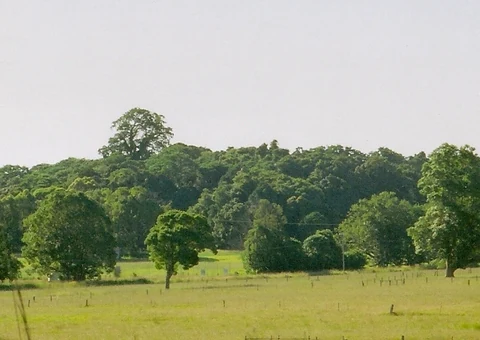
A wide view of a dense patch of green trees and forest remnants bordering a grassy field under a bright, overcast sky.
A remnant subtropical rainforest stand at Davis Scrub Nature Reserve.

Davis Scrub Nature Reserve history and protected-area timeline

Davis Scrub Nature Reserve was formally gazetted in May 1980, establishing legal protection for a small sub-tropical rainforest remnant at a time when the broader Big Scrub ecosystem was already highly reduced. The Big Scrub, once one of the largest expanses of lowland sub-tropical rainforest in southern Australia, had been progressively cleared since the late nineteenth century for agriculture, particularly dairy farming and horticulture, leaving only isolated fragments scattered across the Northern Rivers landscape.

The establishment of Davis Scrub as a nature reserve reflects a growing awareness during the twentieth century of the ecological loss represented by the disappearance of the Big Scrub. By the time the reserve was created, only a tiny percentage of the original rainforest remained, and protecting these surviving patches became a priority for conservation authorities in New South Wales. The reserve has been managed since then by the NSW National Parks and Wildlife Service.

Over time, Davis Scrub has come to be valued not only as a stand-alone protected area but also as part of the wider set of remnants that connect the modern Northern Rivers landscape to its original rainforest identity. It stands alongside such well-known sites as the nearby Nightcap Range reserves as evidence of the once continuous rainforest canopy that wrapped around the base of the Mount Warning shield volcano.

Davis Scrub Nature Reserve landscape and geographic character

The landscape of Davis Scrub Nature Reserve is shaped by its position on an undulating plain within the volcanic foothills of north-eastern New South Wales. The reserve sits at around 170 metres above sea level, part of a high-rainfall lowland setting that was once blanketed by tall sub-tropical rainforest. The topography is gently rolling rather than rugged, but subtle changes in elevation and drainage create a varied microtopography within the small area of the reserve.

The soils are red-brown and were formed from basaltic lava flows that originated at Mount Warning, a deeply eroded volcanic peak that marks the core of the Tweed caldera. These volcanic soils are nutrient-rich and able to hold moisture well, which historically supported the exceptionally tall and diverse rainforests of the Big Scrub. The same soil chemistry continues to shape the ecological character of Davis Scrub today.

Although the reserve itself is small, the surrounding region is dominated by the visual legacy of the same volcanic processes. Rich red farmland, scattered pockets of regrowth, and distant forested ranges all reflect the interplay of basaltic geology, high rainfall, and a long history of both natural rainforest and agricultural land use. Within Davis Scrub, the rainforest structure forms a tall, layered canopy with emergent Moreton Bay figs rising above a dense main canopy, recalling the original form of the Big Scrub that once covered these plains.

Davis Scrub Nature Reserve ecosystems, habitats, and plant life

Davis Scrub Nature Reserve preserves a characteristic example of sub-tropical lowland rainforest, a vegetation type that was once widespread across the Northern Rivers region but has been almost entirely replaced by cleared land. The reserve's ecosystem is shaped by high rainfall, fertile basaltic soils, and the moderating influence of the nearby coast, allowing the growth of lush, structurally complex rainforest in a lowland setting.

The vegetation is multi-layered, with a tall main canopy, a mid-tier of smaller trees and shrubs, and a shaded understory. Climbers and epiphytes use the trunks and branches of mature trees, while the forest floor is blanketed with leaf litter and decaying wood that recycles nutrients back into the rich volcanic soils. This layered structure is typical of southern sub-tropical Australian rainforests and is one of the defining features preserved at Davis Scrub.

Because the reserve is a fragment embedded in a heavily agricultural landscape, its ecology also reflects edge effects and isolation. Light penetrating the margins supports some pioneer and edge species, while the interior retains a more closed, humid, mossy rainforest character. Despite its small size, Davis Scrub provides a relatively intact example of the way Big Scrub rainforests once functioned as continuous forest across this part of New South Wales, and it plays an important role in maintaining habitat continuity and plant genetic resources in the broader region.

Davis Scrub Nature Reserve wildlife and species highlights

Davis Scrub Nature Reserve is small and botanically focused, but as a fragment of sub-tropical rainforest it supports the animal life typically associated with remnant lowland rainforest in the Northern Rivers. The dense canopy, layered vegetation, and humid understory provide shelter and foraging habitat for a range of birds, insects, and small mammals that depend on rainforest conditions for survival in an otherwise heavily cleared agricultural landscape.

Rainforest birds typical of the Big Scrub remnants, including fruit-eating pigeons, honeyeaters, and various parrot and lorikeet species, are likely to use the reserve, particularly where flowering and fruiting trees such as the Moreton Bay fig provide seasonal food resources. The fig also attracts a wide range of insects and, in turn, insectivorous birds that patrol the canopy and mid-storey.

The reserve's moist conditions and rotting logs support diverse invertebrate communities, including beetles, moths, spiders, and other arthropods characteristic of sub-tropical rainforest floors. These invertebrates are an important part of nutrient cycling within the reserve and form the base of many food chains. Small mammals, reptiles, and frogs adapted to humid, sheltered habitats can also be present, although the reserve's isolation and small size place natural limits on its capacity to support large or wide-ranging species. Davis Scrub therefore plays a valuable role as a refuge patch for rainforest-dependent fauna within a fragmented landscape.

Davis Scrub Nature Reserve conservation status and protection priorities

Davis Scrub Nature Reserve is primarily valued from a conservation perspective as one of the surviving remnants of the Big Scrub, the extensive sub-tropical lowland rainforest ecosystem that historically blanketed the Northern Rivers region. The Big Scrub has been reduced to a small fraction of its original extent, and protecting its remaining fragments is a key conservation priority in New South Wales. In this broader context, even a 13-hectare reserve like Davis Scrub carries substantial regional significance.

The reserve's IUCN Category IV designation recognises it specifically as a habitat and species management area, a category used for protected places where active management of particular habitats or species is a central objective. For Davis Scrub, this means conserving the sub-tropical rainforest community, protecting key canopy species such as the Moreton Bay fig, black bean, white booyong, red bean, and purple cherry, and maintaining the conditions that allow the rainforest structure to persist.

Because much of the surrounding land has been converted to agriculture, particularly horticulture and dairy farming, the reserve also functions as a small biodiversity island in a mostly cleared landscape. It contributes to the broader network of Big Scrub remnants that together maintain plant species, support pollination and dispersal processes, and preserve a living reference to the original rainforest identity of the region. The reserve is therefore an important component of efforts to retain what remains of one of Australia's most historically extensive lowland rainforests.

Davis Scrub Nature Reserve cultural meaning and human context

Davis Scrub Nature Reserve sits within a region with a deep cultural and historical connection to land use change in northern New South Wales. The surrounding Northern Rivers landscape was traditionally home to Aboriginal peoples whose lives were interwoven with the forests, rivers, and rich volcanic soils, and the broader landscape of the Big Scrub carries long-standing significance for the Bundjalung and neighbouring Country of the region.

With European settlement from the nineteenth century onward, the Big Scrub became one of the most dramatically altered rainforest landscapes in Australia. Vast tracts were cleared for dairy farming, timber, and later horticulture, including the avocado and macadamia industries that remain characteristic of the area around Alstonville today. Davis Scrub takes its place in that history as a small public memory of the original forest, protected at a time when the region's identity was shifting from rainforest to farmland.

Today, the reserve also forms part of the cultural fabric of the Northern Rivers community, where awareness of the Big Scrub, local conservation efforts, and the broader rainforest restoration movement are central themes. Davis Scrub is recognised locally as both a natural and a cultural landmark, a tangible link between the cleared farming landscape of the present and the towering rainforests of the past.

Top sights and standout views in Davis Scrub Nature Reserve

Davis Scrub Nature Reserve stands out for its combination of compact size and strong ecological identity. Despite covering only about 13 hectares, it preserves a representative slice of the sub-tropical lowland rainforest that once formed the Big Scrub of north-eastern New South Wales. Its position on basaltic soils from Mount Warning, its altitude of around 170 metres on a high-rainfall plain near Alstonville, and its characteristic canopy species all give it a clear and recognisable ecological profile.

A large Moreton Bay fig dominates the canopy and is one of the reserve's most visually striking features, while species such as black bean, white booyong, red bean, and purple cherry illustrate the botanical richness of the Big Scrub fragments. Established in 1980 and managed under IUCN Category IV, the reserve functions as both a protected habitat and a living reference point for the regional rainforest that has otherwise been almost entirely cleared.

Best time to visit Davis Scrub Nature Reserve

Davis Scrub Nature Reserve is appealing year-round thanks to its humid sub-tropical setting, but the cooler and drier months from late autumn through early spring generally offer the most comfortable conditions for a visit. Temperatures are milder, rain is less frequent than during the summer wet season, and walking through the rainforest is more pleasant without the high humidity and heat of peak summer.

Spring and early summer bring flowering and fruiting across many rainforest trees, including the Moreton Bay fig, which can attract a wide range of birds and insects to the canopy. This makes the reserve especially rewarding for visitors interested in spotting rainforest wildlife and observing seasonal changes in the forest. Whenever visiting, the cool, shaded interior of the rainforest offers a refreshing contrast to the often warm and sunny surrounding farmland of the Alstonville area.

Monthly climate preview

Long-term temperature ranges and monthly precipitation averages for New South Wales

Davis Scrub Nature Reserve Climate Normals and Annual Weather Patterns

Representative coordinate measurements reveal the annual rhythm of average temperatures and daily precipitation at Davis Scrub Nature Reserve from 1991 to 2020. Examining the complete twelve-month record provides deeper insight into measured baseline climate conditions across the protected area.
Annual mean20 °C
14 °C25 °C
Jan25°
Feb24°
Mar23°
Apr20°
May17°
Jun15°
Jul14°
Aug15°
Sep18°
Oct21°
Nov23°
Dec24°
Warmest month
January

25 °C

Coolest month
July

14 °C

Wettest month
February

5.8 mm/day

Driest month
September

1.3 mm/day

Park location guide

Geography guide, regional context, and park location map for Davis Scrub Nature Reserve

Davis Scrub Nature Reserve park geography, regions, and map view in Australia

Understand where Davis Scrub Nature Reserve sits in Australia through a broader geographic reading of the surrounding landscape, nearby location context, and its mapped position within the national park landscape.

How Davis Scrub Nature Reserve fits into Australia

Australia is a constitutional monarchy and federal parliamentary democracy comprising six states and ten territories. With a population of nearly 28 million, it is one of the world's most urbanised countries, with most people concentrated on the eastern seaboard. The country has a high Human Development Index and is known for its cultural diversity, ancient Aboriginal heritage, and unique wildlife.

Wider geography shaping Davis Scrub Nature Reserve in Australia

Australia occupies the entire Australian continent, the island of Tasmania, and numerous smaller islands. It is the world's flattest and driest inhabited continent, featuring vast deserts in the interior (the Outback), tropical rainforests along the eastern coast, and a coastline bordering the Indian and Pacific Oceans.

Map view of Davis Scrub Nature Reserve

Use this park location map to pinpoint Davis Scrub Nature Reserve in Australia, understand its exact geographic position, and read its mapped placement within the surrounding landscape more clearly.

Pigeon | © OpenStreetMap contributors

Location context for Davis Scrub Nature Reserve

New South Wales

Visual reference guide to the sub-tropical rainforest canopy, terrain, and habitats.

Davis Scrub Nature Reserve Photos, Scenery, and Protected Landscape Views

Visual documentation of Davis Scrub Nature Reserve reveals the dense layering of the surviving Big Scrub rainforest fragment. Photographic records capture the dominant Moreton Bay fig canopy and basaltic terrain that define this protected New South Wales habitat.

A wide view of a dense patch of green trees and forest remnants bordering a grassy field under a bright, overcast sky.

Park atlas

Discover related lowland rainforest reserves and regional conservation landscapes in New South Wales.

Explore Protected Areas and Parks Near Davis Scrub Nature Reserve

Browse other protected areas and national parks near Davis Scrub Nature Reserve to examine connected rainforest fragments across the Northern Rivers region. Comparing surrounding volcanic terrain and botanical remnants provides deeper geographical context for the broader regional ecosystem.
National parkNew South Wales
About 16 km away#1 closest

South

Broadwater National Park: Protected Coastal Wilderness and Geographic Atlas Entry

Coastal rainforest, wetlands, migratory bird habitats, and unique geology.

Broadwater National Park presents a rich protected-area identity within New South Wales, Australia, characterized by its diverse mosaic of coastal rainforests, freshwater swamps, and eucalyptus woodlands. This national park is notable for its unique Coffee Rocks geological formation and its crucial role as a refuge for migratory birds, offering a compelling focus for geographic exploration and atlas-based understanding. Discover the mapped extent and ecological significance of this significant protected landscape.

Area
421 km²
Established
1974
IUCN
II
Relief
Lowland
Nature reserveNew South Wales
About 19 km away#2 closest

North

Andrew Johnston Big Scrub Nature Reserve: Mapped Protected Landscapes in New South Wales

Botanical significance within the Northern Rivers volcanic terrain

Andrew Johnston Big Scrub Nature Reserve serves as a primary example of remnant subtropical lowland rainforest in Australia. This protected area offers insight into the region's volcanic geography and high-rainfall forest ecosystems, providing a critical refuge for biodiversity on fertile basaltic soils within the broader New South Wales landscape.

Area
0.21 km²
Established
1993
IUCN
IV
Relief
Upland
National parkNew South Wales
About 25 km away#3 closest

North

Nightcap National Park: New South Wales Protected Landscape and Geographic Atlas

Mapping the protected area boundaries and natural terrain.

Nightcap National Park is a key protected landscape within New South Wales, Australia, offering distinct opportunities for geographic exploration. This entry provides critical details about its mapped boundaries, surrounding regional terrain, and its role as a national park. Understand the park's specific environmental context and its contribution to the broader atlas of protected lands in the region, ideal for detailed map-based discovery.

Area
81 km²
Established
1983
IUCN
II
Relief
Mountain
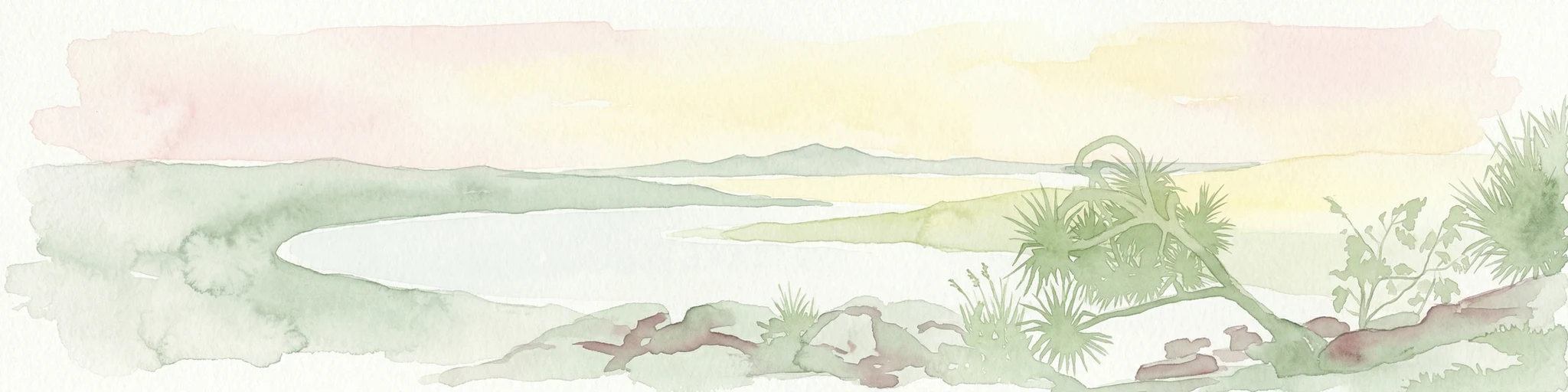
Watercolor painting showing a coastal landscape with a body of water, trees, and distant hills under a soft pastel sky
National parkNew South Wales
About 25 km away#4 closest

South

Bundjalung National Park: New South Wales Protected Landscape Atlas Entry

Explore its unique coffee rock formations and Bundjalung heritage.

Bundjalung National Park is a significant protected area on the coast of New South Wales, Australia, renowned for its distinctive coffee rock formations and coastal heathland ecosystems. This park offers a rich landscape for atlas exploration, showcasing unique geological features along its beaches and headlands. Understanding its geography and protected boundaries provides crucial context for appreciating its natural and cultural significance within the broader regional landscape.

Area
210 km²
Established
1980
IUCN
II
Relief
Lowland
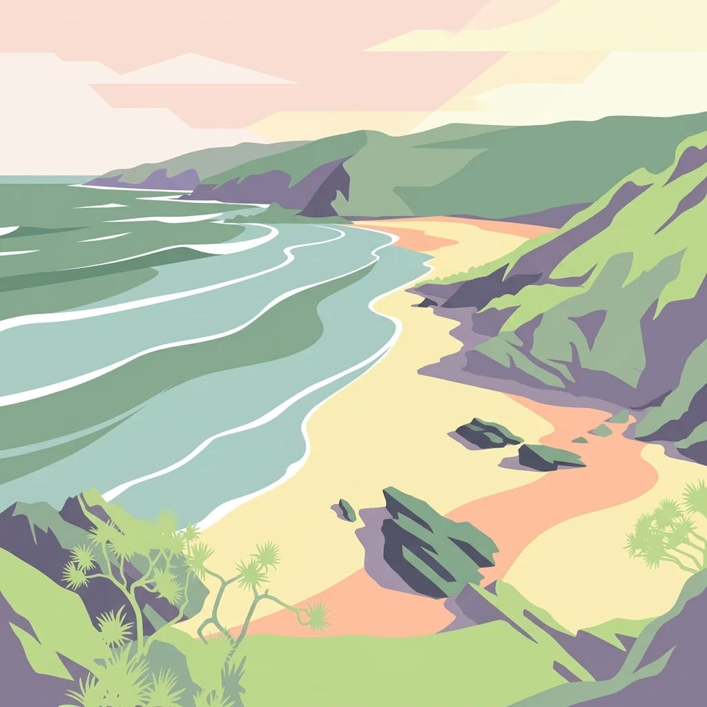
A stylized illustration showing a sandy beach meeting the ocean, flanked by grassy green hills and cliffs under a soft-colored sky.
Nature reserveNew South Wales
About 26 km away#5 closest

Northeast

Broken Head Nature Reserve: Littoral Rainforest and Coastal Geography of New South Wales

Coastal terrain and protected headland mapped landscapes

Located in the Northern Rivers region of New South Wales, Broken Head Nature Reserve offers a concentrated view of coastal ecological zones. The protected area features a unique combination of littoral rainforest, sandstone formations, and beach ecosystems. This geography provides insight into regional conservation and the historical landscape of the far north coast of Australia.

Area
0.98 km²
IUCN
Ia
Relief
Lowland
Climate
Subtropical
Nature reserveNew South Wales
About 28 km away#6 closest

Northeast

Hayters Hill Nature Reserve: A Significant Big Scrub Rainforest Remnant in New South Wales

Protected subtropical forest in the Northern Rivers hinterland

Hayters Hill Nature Reserve represents a critical protected fragment of the original Big Scrub subtropical rainforests. Situated on elevated ground near Byron Bay, this nature reserve offers insight into the regional topography and the conservation of lowland forest ecosystems in the Northern Rivers area of New South Wales.

Area
0.08 km²
Established
1989
IUCN
IV
Relief
Upland
National parkNew South Wales
About 28 km away#7 closest

Southwest

Bungawalbin National Park: Explore New South Wales National Park Protected Area and Geography

New South Wales National Park Landscape Exploration

Bungawalbin National Park is a national park situated in New South Wales, Australia, offering users a point of reference for understanding protected landscapes. The MoriAtlas platform facilitates exploration of this park's geographic identity, its mapped boundaries, and its role within the regional context of New South Wales. This detailed view is essential for anyone interested in the structured discovery of Australia's protected areas and their natural terrain.

Area
37 km²
Established
1999
IUCN
II
Relief
Lowland
National parkNew South Wales
About 29 km away#8 closest

Northeast

Arakwal National Park: National Park Protected Landscape in New South Wales

Explore mapped boundaries and regional geography.

Arakwal National Park stands as a protected national park, offering insights into its distinct landscape and geographic setting within New South Wales. This resource provides detailed information focused on the park's mapped boundaries and its role as a conservation landscape. Users can explore the regional geography and understand the specific protected-area context that defines Arakwal National Park, contributing to a broader atlas understanding.

Area
1.99 km²
Established
2001
IUCN
II
Relief
Lowland

Common questions about visiting, size, designation, and location context for Davis Scrub Nature Reserve

Davis Scrub Nature Reserve FAQs for park facts, access, geography, and protected area context

Find quick answers about Davis Scrub Nature Reserve, including protected-area facts, park geography, trail and visitor context, and how the park fits into its surrounding country and regional landscape.
MoriAtlas Explorer

Continue Your Protected Areas Search Across the Global Atlas

Deepen your exploration by continuing the structured search for national parks and protected areas worldwide. Utilize the comprehensive filtering capabilities to compare different conservation landscapes and refine your understanding of global park geography. Discover more about the distribution and characteristics of protected natural areas.

Global natural geography