

Mori Atlas logo
National parkBungawalbin National Park

Explore the mapped boundaries and regional landscape of this New South Wales national park.

Bungawalbin National Park: New South Wales National Park Protected Area & Geographic Context

Bungawalbin National Park represents a key protected area within the diverse geography of New South Wales, Australia. As a designated national park, its mapped boundaries offer a distinct natural landscape for atlas-driven discovery. Users can explore its geographic context and understand its significance as a protected land within the regional framework of New South Wales, contributing to a broader understanding of Australia's natural areas.

Australian national parksWetland protected areasSubtropical rainforestsNew South Wales nature reservesFloodplain ecosystemsClarence River basin

Bungawalbin National Park

National park

Park overview

Structured park overview, official facts, and landscape profile for Bungawalbin National Park

Bungawalbin National Park park facts, protected area profile, and essential visitor context
Review the core facts for Bungawalbin National Park, including designation, size, terrain, visitor scale, habitats, and operating context in one park-focused overview.

About Bungawalbin National Park

Bungawalbin National Park is located in the northern rivers region of New South Wales, occupying a strategic position within the Clarence River floodplain system. The park's establishment in 1999 marked a significant achievement in regional conservation, transitioning from its earlier status as Bungawalbin Nature Reserve to full national park protection. This change reflected growing recognition of the park's ecological importance, particularly its role in preserving subtropical rainforest communities that are characteristic of lowland floodplain environments in this part of Australia. The park's boundary and management regime were designed to operate in conjunction with adjacent protected areas, creating a contiguous conservation network that protects hydrological connectivity across the wetland system. The surrounding landscape has been extensively modified for agriculture, making Bungawalbin's intact natural areas increasingly valuable as refuges for native species and as functional components of the broader catchment ecosystem.

Quick facts and research context for Bungawalbin National Park

Bungawalbin National Park covers an area of 37 square kilometres and is managed by the NSW National Parks and Wildlife Service. The park is located in the Clarence River region, positioned on fertile floodplain terrain that supports unique ecological communities. It was formally designated as a national park in 1999 after decades as a nature reserve. The park is part of a contiguous wetland system that includes adjacent protected areas, creating a coherent conservation landscape across the floodplain.

Park context

Deeper park guide and search-rich context for Bungawalbin National Park

Bungawalbin National Park history, landscape, wildlife, and travel context
Explore Bungawalbin National Park through its history, landscape character, ecosystems, wildlife, conservation priorities, cultural context, and seasonal travel timing in a structured park guide built for atlas discovery and search intent.

Why Bungawalbin National Park stands out

Bungawalbin National Park is best known for its exceptional representation of subtropical rainforest on floodplain terrain, a habitat type that has been greatly diminished across coastal New South Wales. The park protects one of the few remaining intact wetland complexes in the Clarence River basin, supporting diverse ecological communities that depend on seasonal flooding and the unique hydrological conditions of the floodplain. The interconnection of rainforest, swamp, and wetland habitats creates a distinctive conservation value that distinguishes this park from surrounding agricultural landscapes.

Bungawalbin National Park history and protected-area timeline

The area now comprising Bungawalbin National Park was originally protected as Bungawalbin Nature Reserve before receiving national park status in 1999. This elevation in protection status reflected accumulating scientific understanding of the area's ecological significance, particularly regarding the subtropical rainforest communities and the wetland system's function within the broader Clarence River catchment. The transition from nature reserve to national park also aligned with broader NSW government policy during the 1990s to upgrade representative natural areas to higher conservation categories. Management of the park falls to the NSW National Parks and Wildlife Service, which administers it as part of the northern rivers district network.

Bungawalbin National Park landscape and geographic character

The landscape of Bungawalbin National Park is defined by its floodplain setting within the Clarence River basin, characterised by low-relief terrain and seasonal waterlogging. The park sits on alluvial soils deposited by the Clarence River system over geological time, creating a flat to gently undulating landscape that experiences periodic flooding. The floodplain environment supports a mosaic of vegetation communities, with subtropical rainforest occupying the better-drained rises and more open wetland vegetation in the lower-lying areas. The park's position at relatively low elevation within the landscape means it receives abundant moisture from both rainfall and flood waters, maintaining the hydrological conditions that sustain the rainforest and wetland communities.

Bungawalbin National Park ecosystems, habitats, and plant life

The nature of Bungawalbin National Park is distinguished by its floodplain subtropical rainforest, a vegetation type that once covered extensive areas of the Clarence River lowlands but now survives in highly fragmented remnants. The park protects these communities in a relatively intact condition, maintaining the ecological processes that depend on seasonal flooding and the nutrient dynamics of the floodplain system. The wetland component of the park supports characteristic species adapted to seasonal water fluctuations, while the rainforest areas contain tree species typical of the Subtropical Rainforest ecological community that is listed as significant under NSW legislation. The combination of these habitats within a single protected area creates ecological diversity that is rare in the regional context.

Bungawalbin National Park wildlife and species highlights

Bungawalbin National Park provides habitat for wildlife species adapted to the complex of rainforest, swamp, and floodplain environments found within its boundaries. The subtropical rainforest component supports arboreal species that depend on tree canopy structure and the continuity of forest cover, while the wetland areas offer foraging and breeding habitat for waterbird species and amphibians that require seasonal wetland conditions. The park's position within a connected conservation network, including adjacent protected areas, supports wildlife movement and population connectivity across the broader landscape.

Bungawalbin National Park conservation status and protection priorities

Bungawalbin National Park contributes significantly to conservation in the Clarence River region by protecting one of the few remaining examples of floodplain subtropical rainforest in northern New South Wales. This habitat type has been severely reduced by historical clearing for agriculture, with the park representing a critical refugium for associated species and ecological communities. The wetland system also provides important ecosystem services including water filtration, flood buffering, and carbon storage, values that extend beyond the park's boundaries to benefit the broader catchment. Management of the park focuses on maintaining the integrity of these ecological communities and the hydrological processes upon which they depend.

Bungawalbin National Park cultural meaning and human context

The Bungawalbin area is situated within the traditional lands of Aboriginal people, with the park name deriving from a word in a local Aboriginal language. The floodplain and wetland environments of the Clarence River region have been significant to Aboriginal communities historically, providing resources and cultural connections that extend back over many thousands of years. The wetland system would have supported traditional food gathering, tool-making materials, and spiritual associations. While specific details of Indigenous management of this particular area are not extensively documented in available sources, the broader context suggests the landscape has been shaped by Aboriginal land use over very long timeframes.

Top sights and standout views in Bungawalbin National Park

The standout feature of Bungawalbin National Park is its subtropical rainforest growing on floodplain terrain, a combination that is botanically distinctive and increasingly rare in coastal eastern Australia. The park's integration with the adjacent Yarringully wetland system creates a larger conservation area that protects hydrological connectivity and supports ecological processes at a landscape scale. The relative intactness of the park's natural communities, set against a heavily modified surrounding agricultural landscape, enhances its conservation significance and its role as a reference site for understanding the pre-clearing ecology of the Clarence River lowlands.

Best time to visit Bungawalbin National Park

The park can be visited throughout the year, with different seasons offering varying conditions for experiencing its natural values. The subtropical climate of the northern rivers region means summers are warm and wet, while winters are milder and drier. The wet season typically brings higher water levels in the floodplain areas, which can affect accessibility but also creates the aquatic conditions that sustain the wetland ecosystem. The drier winter months may offer easier access to walking areas and clearer visibility through the rainforest, though the distinctive character of the park is evident across all seasons.

Park location guide

Geography guide, regional context, and park location map for Bungawalbin National Park

Bungawalbin National Park park geography, regions, and map view in Australia
Understand where Bungawalbin National Park sits in Australia through a broader geographic reading of the surrounding landscape, nearby location context, and its mapped position within the national park landscape.

How Bungawalbin National Park fits into Australia

Australia is a constitutional monarchy and federal parliamentary democracy comprising six states and ten territories. With a population of nearly 28 million, it is one of the world's most urbanised countries, with most people concentrated on the eastern seaboard. The country has a high Human Development Index and is known for its cultural diversity, ancient Aboriginal heritage, and unique wildlife.

Wider geography shaping Bungawalbin National Park in Australia

Australia occupies the entire Australian continent, the island of Tasmania, and numerous smaller islands. It is the world's flattest and driest inhabited continent, featuring vast deserts in the interior (the Outback), tropical rainforests along the eastern coast, and a coastline bordering the Indian and Pacific Oceans.

Map view of Bungawalbin National Park

Use this park location map to pinpoint Bungawalbin National Park in Australia, understand its exact geographic position, and read its mapped placement within the surrounding landscape more clearly.

Pigeon | © OpenStreetMap contributors

Location context for Bungawalbin National Park

New South Wales
Park atlas

Trace regional park geography, compare floodplain ecosystems, and discover protected landscapes in New South Wales.

Explore Other National Parks and Protected Areas Near Bungawalbin National Park in New South Wales
After exploring Bungawalbin National Park, discover additional national parks and protected areas across northern New South Wales, mapping the regional spread of unique floodplain ecosystems and subtropical rainforests. Trace the geographic context of the Clarence River basin, comparing distinct wetland systems and other conservation landscapes that contribute to the region's diverse natural heritage.
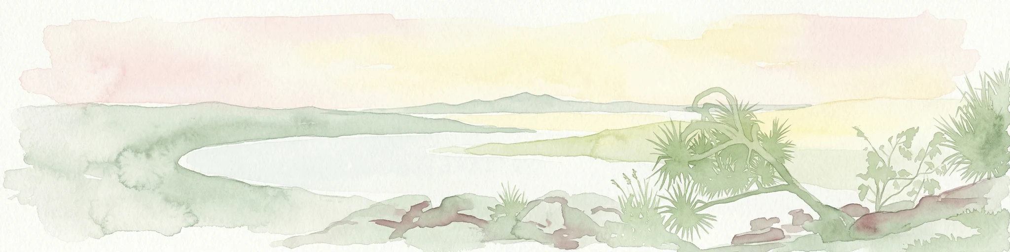
Watercolor painting showing a coastal landscape with a body of water, trees, and distant hills under a soft pastel sky
National parkNew South Wales

Bundjalung National Park: New South Wales Protected Landscape Atlas Entry

Explore its unique coffee rock formations and Bundjalung heritage.

Bundjalung National Park is a significant protected area on the coast of New South Wales, Australia, renowned for its distinctive coffee rock formations and coastal heathland ecosystems. This park offers a rich landscape for atlas exploration, showcasing unique geological features along its beaches and headlands. Understanding its geography and protected boundaries provides crucial context for appreciating its natural and cultural significance within the broader regional landscape.

Area
210 km²
Established
1980
IUCN
II
Relief
Lowland
National parkNew South Wales

Broadwater National Park: Protected Coastal Wilderness and Geographic Atlas Entry

Coastal rainforest, wetlands, migratory bird habitats, and unique geology.

Broadwater National Park presents a rich protected-area identity within New South Wales, Australia, characterized by its diverse mosaic of coastal rainforests, freshwater swamps, and eucalyptus woodlands. This national park is notable for its unique Coffee Rocks geological formation and its crucial role as a refuge for migratory birds, offering a compelling focus for geographic exploration and atlas-based understanding. Discover the mapped extent and ecological significance of this significant protected landscape.

Area
421 km²
Established
1974
IUCN
II
Relief
Lowland
National parkAustralia

Mallanganee National Park: Australia's Protected Landscape and Geographic Context

Mapped boundaries and regional park geography.

Mallanganee National Park stands as a significant protected area, offering a unique perspective on Australia's natural landscapes. This page provides detailed geographic information, focusing on its mapped boundaries and regional context within the national park system. It's designed for explorers seeking to understand the park's protected status and its place in the broader atlas of natural areas.

Area
11.44 km²
Established
1999
IUCN
Ia
Relief
Lowland
National parkNew South Wales

Mount Pikapene National Park: Protected Area with Tall Moist Rainforests in New South Wales

Explore the mapped terrain and regional geography of this national park.

Mount Pikapene National Park is a key protected area in New South Wales, recognized for its distinctive tall moist rainforests, a rare ecological community within the Northern Tablelands. The park's landscape features hilly terrain, with Big Sugarloaf marking its highest point at 525 meters. As a national park managed by the National Parks and Wildlife Service, it safeguards significant forest ecosystems and offers valuable insights into the protected geography of eastern Australia's natural heritage.

Area
26.3 km²
Established
1999
IUCN
II
Relief
Mountain
National parkNew South Wales

Fortis Creek National Park: A Protected Valley Landscape in Northern New South Wales

Mapped protected area boundaries and regional geographic context.

Fortis Creek National Park preserves a significant valley and creek environment in northern New South Wales, Australia. Established in 1997, it serves as a protected area safeguarding representative riparian and valley ecosystems. The park's landscape, characterized by draining creek corridors toward the Clarence River basin, offers a glimpse into the natural terrain of eastern Australia, distinct from more commonly known coastal or alpine regions.

Area
78 km²
Established
1997
IUCN
II
Scope
Terrestrial
National parkNew South Wales

Goonengerry National Park: New South Wales Protected Landscape and Geography

Discover mapped boundaries and regional context.

Goonengerry National Park is a designated national park in New South Wales, Australia, offering valuable insights for geographic exploration. This entry provides a structured view of its protected area status, focusing on its mapped boundaries and landscape context. Users can explore how Goonengerry National Park fits into the regional geography of New South Wales, enhancing understanding of protected lands within the Australian atlas.

Area
4 km²
Established
1999
IUCN
II
Relief
Upland
National parkNew South Wales

Nightcap National Park: New South Wales Protected Landscape and Geographic Atlas

Mapping the protected area boundaries and natural terrain.

Nightcap National Park is a key protected landscape within New South Wales, Australia, offering distinct opportunities for geographic exploration. This entry provides critical details about its mapped boundaries, surrounding regional terrain, and its role as a national park. Understand the park's specific environmental context and its contribution to the broader atlas of protected lands in the region, ideal for detailed map-based discovery.

Area
81 km²
Established
1983
IUCN
II
Relief
Mountain
National parkNew South Wales

Arakwal National Park: National Park Protected Landscape in New South Wales

Explore mapped boundaries and regional geography.

Arakwal National Park stands as a protected national park, offering insights into its distinct landscape and geographic setting within New South Wales. This resource provides detailed information focused on the park's mapped boundaries and its role as a conservation landscape. Users can explore the regional geography and understand the specific protected-area context that defines Arakwal National Park, contributing to a broader atlas understanding.

Area
1.99 km²
Established
2001
IUCN
II
Relief
Lowland

Common questions about visiting, size, designation, and location context for Bungawalbin National Park

Bungawalbin National Park FAQs for park facts, access, geography, and protected area context
Find quick answers about Bungawalbin National Park, including protected-area facts, park geography, trail and visitor context, and how the park fits into its surrounding country and regional landscape.
MoriAtlas Explorer

Continue Your Protected Areas Search Across the Global Atlas

Deepen your exploration by continuing the structured search for national parks and protected areas worldwide. Utilize the comprehensive filtering capabilities to compare different conservation landscapes and refine your understanding of global park geography. Discover more about the distribution and characteristics of protected natural areas.

Global natural geography