Mori Atlas logo
Wildlife reserveDeh Akro-II Desert Wetland Complex

Mapping the transitional geography of interdunal valleys and inland water systems in Pakistan

Deh Akro-II Desert Wetland Complex: An Atlas of Sindh's Unique Desert and Wetland Landscapes

(Deh Akro-II Wildlife Sanctuary)

Deh Akro-II Desert Wetland Complex represents a rare ecological mosaic where sandy desert dunes merge with freshwater and brackish lakes. Located in the Sindh province, this protected wildlife reserve functions as a critical transitional zone between arid desert terrain and vital irrigation-fed wetland habitats. Our mapping provides a clear view of the park boundaries, landscape patterns, and geographical features that define this significant Indus system sanctuary.

inland wetlandsdesert wetland mosaicRamsar sitewildlife sanctuaryImportant Bird Areamugger crocodile habitat

Deh Akro-II Desert Wetland Complex

Wildlife reserve

Park overview

Structured park overview, official facts, and landscape profile for Deh Akro-II Desert Wetland Complex

Deh Akro-II Desert Wetland Complex park facts, protected area profile, and essential visitor context

Review the core facts for Deh Akro-II Desert Wetland Complex, including designation, size, terrain, visitor scale, habitats, and operating context in one park-focused overview.

About Deh Akro-II Desert Wetland Complex

Deh Akro-II Desert Wetland Complex is one of the most distinctive protected landscapes in Sindh, defined by the close proximity of arid dunes and functioning inland wetlands. Lying in central Sindh in Shaheed Benazirabad District, the complex forms part of an ecological gradient between the Indus-fed plains and the Nara Desert, a subdivision of the greater Thar Desert. Within the protected boundary, sand formations rise between five and ten meters, with interdunal valleys cutting through them to expose shallow lakes fed by irrigation systems.

The complex derives much of its identity from water. Most of its waterbodies are linked to the Nara Canal, which carries Indus River water into the surrounding agricultural lands, supplemented by seasonal rainfall. Of the dozens of lakes within Deh Akro-II, only a few are freshwater, while the majority are brackish due to dissolved salts accumulated over time. Originally the site contained forty-five lakes in 1988, but persistent water stress and broader climate-driven changes have reduced that number substantially, with only thirty-two lakes reported as of 2021.

This convergence of habitats defines the sanctuary's ecological character. Marshy wetlands, agricultural land, sandy desert, and open water coexist across roughly twenty thousand hectares, providing niches for fish, reptiles, mammals, and birds. The presence of human settlements within and around the complex, including villages such as Kunjwaro, Nathantal, Lalantar, Drigadaro, Pokhal-wari, and Husayfakir, shows how closely local livelihoods are tied to the same landscape and water systems.

Deh Akro-II's protected status has evolved across multiple layers. The site was first declared a wildlife sanctuary in 1988, prompting more structured conservation planning. With support from WWF-Pakistan, criteria for international wetland recognition were met, and in 2002 the site was designated under the Ramsar Convention. Two years later, in 2004, BirdLife International listed the area as an Important Bird and Biodiversity Area, reinforcing its profile as a habitat of regional and global significance. Today the sanctuary is administered by the Sindh Wildlife Department, and its layered recognition reflects its exceptional combination of desert and wetland values.

Quick facts and research context for Deh Akro-II Desert Wetland Complex

Deh Akro-II is a wildlife sanctuary in Shaheed Benazirabad District, Sindh, Pakistan, lying roughly 330 kilometers northeast of Karachi. It was declared a wildlife sanctuary in 1988, designated a Ramsar Wetland of International Importance in 2002, and recognized as an Important Bird and Biodiversity Area in 2004.

The complex combines sandy desert, marshy areas, agricultural land, and wetlands within a single protected boundary, with thirty or more lakes embedded between sand dunes. The wetlands supporting these lakes depend on water from the Nara Canal, itself fed by the Indus River, together with rainfall, making the site both hydrologically and ecologically significant.

Protection and recognition

Documented terrestrial protection history and Ramsar designation metrics

Deh Akro-II Desert Wetland Complex Protection Status and International Recognition

Deh Akro-II Desert Wetland Complex holds documented terrestrial protection status established in 2002 alongside official Ramsar site recognition. Structured records summarize the designation timeline and international recognition sources associated with the protected area.

International recognition

Protection details

Protection scope
Terrestrial
Designated year
2002
Transboundary protection
No
Park context

Deeper park guide and search-rich context for Deh Akro-II Desert Wetland Complex

Deh Akro-II Desert Wetland Complex history, landscape, wildlife, and travel context

Explore Deh Akro-II Desert Wetland Complex through its history, landscape character, ecosystems, wildlife, conservation priorities, cultural context, and seasonal travel timing in a structured park guide built for atlas discovery and search intent.

Why Deh Akro-II Desert Wetland Complex stands out

Deh Akro-II is best known for its unusual combination of desert and wetland ecosystems within a single protected area. The site's interdunal valleys hold freshwater and brackish lakes amid sandy terrain, creating habitat conditions that support species often absent from arid landscapes. The complex is also recognized for its role in sustaining globally significant biodiversity, including over twenty thousand waterbirds, the endangered mugger crocodile, and the Indian hog deer. Its triple designation as a wildlife sanctuary, Ramsar site, and Important Bird and Biodiversity Area underlines its standing as one of the most ecologically important wetland complexes in Sindh.

Deh Akro-II Desert Wetland Complex history and protected-area timeline

Deh Akro-II has a relatively compact but layered protection history that reflects growing recognition of its environmental importance. Until the late twentieth century, the site functioned largely as an undifferentiated section of the central Sindh landscape, where arid terrain, irrigation-fed lakes, and local villages coexisted without a formal conservation identity.

In 1988, the area was officially declared a wildlife sanctuary, marking the first formal acknowledgment of its ecological value and placing it under the management of the Sindh Wildlife Department. This designation laid the groundwork for more systematic conservation interventions, although broader international recognition came only later.

A decisive step came in 2000, when WWF-Pakistan supported efforts to assess the site's suitability under international wetland criteria. By 2002, the complex had met Ramsar criteria 1 through 6 and criterion 8, leading to its designation as a Ramsar Wetland of International Importance. Two years afterward, in 2004, BirdLife International assessed the area as meeting IBA criteria A1 and A4iii, adding it to the global network of Important Bird and Biodiversity Areas.

Alongside these formal milestones, the sanctuary's hydrological history has been one of gradual contraction. The number of lakes within the complex declined from 45 in 1988 to 36 in 2003 and reportedly to 32 by 2021, a trajectory that has shaped ongoing conservation attention and reshaped how the surviving wetlands are valued.

Deh Akro-II Desert Wetland Complex landscape and geographic character

The landscape of Deh Akro-II is defined by the striking coexistence of sand and water. Sandy terrain shaped into dunes and broader desert patches dominates the visual geography, with average dune heights in the range of five to ten meters. These dry formations are interrupted by flat interdunal valleys, which act as natural collection points for water and wetland habitat.

Within these valleys, lakes form an irregular network of shallow waterbodies, combining freshwater and brackish systems. The freshwater lakes are limited in number, while most of the remaining lakes carry elevated salt levels from sustained evaporation and irrigation-driven mineral accumulation. Beyond their hydrochemical character, the lakes vary in size and permanence, with some contracting visibly across decades due to declining water inflows.

The broader landscape also incorporates substantial agricultural land and marshy areas, blending natural and human-shaped environments. Settlements within and around the complex, including Kunjwaro, Nathantal, Lalantar, Drigadaro, Pokhal-wari, and Husayfakir, are part of the geographical setting. To the northeast, the complex borders the Nara Desert, linking this protected wetland system to the wider Thar Desert landscape of Sindh. The terrain sits at a relatively low elevation of about fifty meters, reinforcing its character as a flat, arid-to-wetland transitional zone rather than a highland environment.

Deh Akro-II Desert Wetland Complex ecosystems, habitats, and plant life

Ecologically, Deh Akro-II functions as a transition zone where harsh, sandy desert conditions meet freshwater and brackish wetland systems. The juxtaposition of four distinct habitat types: marshlands, agricultural land, sandy desert, and open wetlands, defines the site's ecological identity. This variety allows species from very different environments to find refuge within the same protected boundary.

The wetlands are the ecological heart of the complex, supporting fish communities, aquatic reptiles, amphibians, and a remarkably dense waterbird population. The surrounding agricultural land adds feeding and roosting opportunities, while the dunes host reptiles and small mammals adapted to arid conditions. Together, these ecological layers produce one of the more biodiverse protected landscapes in Sindh despite the region's overall aridity.

The wetland ecosystem is fundamentally dependent on external water inputs from the Nara Canal and from rainfall, making the system sensitive to changes in irrigation flows and precipitation patterns. The long-term decline in the number of lakes, from forty-five in 1988 to thirty-two by 2021, reflects how tightly ecological integrity is tied to water availability in this environment.

Deh Akro-II Desert Wetland Complex wildlife and species highlights

Deh Akro-II supports a wide animal community shaped by the unusual overlap of desert and wetland habitats. The sanctuary hosts fourteen recorded fish species, sixteen reptilian species, eighteen mammalian species, and 101 avian species, with peak waterbird counts exceeding twenty thousand individuals. This rich fauna reflects the site's importance as both a refuge and a seasonal gathering point for wildlife.

Among the most ecologically significant animals is the mugger crocodile, Pakistan's national reptile, which inhabits the lakes, marshes, and swamps of the complex. Although historically a defining species of the area, the mugger population has suffered severe decline, with conservation assessments documenting roughly a ninety percent reduction over recent decades due to poaching, habitat loss, and water shortages. Smooth-coated otters also occupy the wetland margins, alongside waterfowl that use the lakes as feeding and breeding grounds.

Birds are arguably the most visible wildlife asset of the sanctuary. Notable species include the oriental darter, garganey, and black ibis, alongside recognized endangered visitors such as the ferruginous duck. Mammalian fauna ranges from desert specialists like the Balochistan gerbil, Indian desert jird, and desert wildcat to more habitat-flexible species such as the golden jackal, jungle cat, Indian hog deer, Indian hare, and Eurasian wild pig. Reptile diversity mirrors the dual desert-wetland nature of the site, combining desert lizards such as the Persian long-tailed desert lizard with aquatic reptiles like the spotted pond turtle and mugger crocodile.

Deh Akro-II Desert Wetland Complex conservation status and protection priorities

Conservation at Deh Akro-II operates across multiple overlapping designations that together reflect the site's ecological importance. Its 1988 declaration as a wildlife sanctuary provided the first formal protection framework, while its 2002 Ramsar designation brought international recognition of its wetland values, and its 2004 inclusion as an Important Bird and Biodiversity Area highlighted its ornithological significance. Managed by the Sindh Wildlife Department, the site benefits from this layered institutional backing.

The sanctuary's most pressing conservation concern is water availability. With lakes reduced from forty-five in 1988 to thirty-two by 2021, the ecological foundations of the site are increasingly vulnerable. The mugger crocodile has experienced one of the steepest declines, highlighting how species dependent on stable wetlands suffer first under hydrological stress.

Conservation significance at Deh Akro-II also extends to its rare and endangered species, including the Indian hog deer, ferruginous duck, and several waterbirds of global conservation concern. The site demonstrates how a single protected area can preserve both desert-adapted and wetland-dependent biodiversity, making it a valuable reference point for wetland conservation policy in arid regions of South Asia.

Deh Akro-II Desert Wetland Complex cultural meaning and human context

Deh Akro-II is closely integrated with the human geography of central Sindh. Several villages, including Kunjwaro, Nathantal, Lalantar, Drigadaro, Pokhal-wari, and Husayfakir, lie within or near the complex, with local communities historically tied to the same water systems that sustain the wetlands. The Nara Canal, a major Indus-fed irrigation artery, supports both agriculture and the sanctuary's lakes, binding local livelihoods and ecological processes together.

This shared hydrological foundation gives the site cultural as well as ecological meaning, embedding the wetland complex into the agricultural and rural identity of Shaheed Benazirabad District.

Top sights and standout views in Deh Akro-II Desert Wetland Complex

The Deh Akro-II Desert Wetland Complex stands out for the rarity of a Ramsar site that simultaneously protects desert dunes and functioning inland lakes. Within a single protected boundary, the site preserves marshes, agricultural land, sandy desert, and wetland lakes that collectively host more than twenty thousand waterbirds, eighteen mammal species, sixteen reptile species, and fourteen fish species.

Its triple recognition as a wildlife sanctuary, Ramsar site, and Important Bird and Biodiversity Area gives it international resonance, while the dramatic decline of the mugger crocodile within the complex has made it a symbol of the conservation challenges facing arid wetlands in South Asia. The integration of villages and irrigation-fed lakes also makes Deh Akro-II a notable example of a wetland shaped by both natural and human hydrological systems.

Best time to visit Deh Akro-II Desert Wetland Complex

The character of Deh Akro-II shifts notably with the seasons because the wetlands depend on rainfall and Indus-fed irrigation inflows. Cooler, drier months tend to offer more comfortable conditions for exploring the arid dunes and observing wildlife around the lakes, when water levels are more stable and visibility is better.

The post-monsoon period is often associated with fuller lakes and higher waterbird activity, as migrants and resident species concentrate around the remaining waterbodies. Extreme summer heat can make the desert sections harder to access comfortably, while unusually dry periods may expose reduced lake extents, affecting the overall landscape experience.
Monthly climate preview

Long-term representative point measurements tracking monthly temperature and precipitation variation

Deh Akro-II Desert Wetland Complex Climate Normals and Annual Temperature Rhythm

Deh Akro-II Desert Wetland Complex records sustained high mean temperatures and low daily precipitation across historical NASA Power coordinate climatology between 1991 and 2020. Reviewing the complete monthly data profile provides detailed insight into long-term temperature ranges and precipitation patterns across the protected landscape.
Annual mean29 °C
16 °C39 °C
Jan16°
Feb20°
Mar26°
Apr32°
May37°
Jun39°
Jul38°
Aug36°
Sep34°
Oct30°
Nov24°
Dec18°
Warmest month
June

38.6 °C

Coolest month
January

16.4 °C

Wettest month
August

0.9 mm/day

Driest month
October

0.1 mm/day

Park location guide

Geography guide, regional context, and park location map for Deh Akro-II Desert Wetland Complex

Deh Akro-II Desert Wetland Complex park geography, regions, and map view in Pakistan

Understand where Deh Akro-II Desert Wetland Complex sits in Pakistan through a broader geographic reading of the surrounding landscape, nearby location context, and its mapped position within the national park landscape.

How Deh Akro-II Desert Wetland Complex fits into Pakistan

Pakistan, officially the Islamic Republic of Pakistan, is a federal parliamentary Islamic republic in South Asia. It is the fifth-most populous country and the 33rd-largest by area. The country gained independence from British India in 1947 and has a diverse history spanning ancient civilizations including Mehrgarh and the Indus Valley Civilisation. Pakistan shares maritime borders with Oman and is bounded by the Arabian Sea, Gulf of Oman, and several neighboring countries.

Wider geography shaping Deh Akro-II Desert Wetland Complex in Pakistan

Pakistan is located in South Asia, bordered by the Arabian Sea to the south, the Gulf of Oman to the southwest, and shares land borders with India to the east, Afghanistan to the west, Iran to the southwest, and China to the northeast. The country also shares a maritime border with Oman in the Gulf of Oman. The Wakhan Corridor in Afghanistan separates Pakistan from Tajikistan in the northwest.

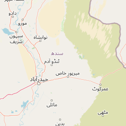
Map view of Deh Akro-II Desert Wetland Complex

Use this park location map to pinpoint Deh Akro-II Desert Wetland Complex in Pakistan, understand its exact geographic position, and read its mapped placement within the surrounding landscape more clearly.

Pigeon | © OpenStreetMap contributors

Location context for Deh Akro-II Desert Wetland Complex

Sindh
Park atlas

Compare adjacent wetland reserves, desert ecosystems, and regional conservation landscapes

Exploring Other Parks Near Deh Akro-II Desert Wetland Complex and Surrounding Protected Areas

Browsing other parks near Deh Akro-II Desert Wetland Complex reveals adjacent desert wetland mosaics and regional protected landscapes across central Sindh. Comparing these connected sanctuaries provides deeper geographic context into arid hydrological basins and wildlife habitats.
Nature reserveSindh
About 82 km away#1 closest

South

Pai Forest Nature Reserve: Geography and Protected Landscape Context in Sindh

An Indus floodplain reserve featuring arid and riverine flora

Pai Forest in Sindh offers a distinctive study of protected landscapes where canal irrigation sustains both riverine and arid plant communities. This reserve functions as a vital ecological island amidst agricultural plains, providing a rich case for exploring the interaction between water management and natural terrain within the Indus valley geography.

Relief
Lowland
Climate
Arid
Scope
Terrestrial
Water
Major water bodies
Wildlife reserveSindh
About 91 km away#2 closest

Northwest

Drigh Lake Wildlife Reserve: Protected Wetland Geography in Sindh, Pakistan

Mapped freshwater habitat in the Indus river basin

Drigh Lake is a designated wildlife sanctuary and Ramsar site in the Qambar Shahdadkot District of Sindh. This protected area features shallow, reed-fringed freshwater environments that serve as an essential waterbird haven. Analyze the park boundaries and the surrounding alluvial plains that characterize this significant regional wetland geography.

Area
1.64 km²
Established
1972
Scope
Terrestrial
Water
Water-dominated
Wildlife reserveKhairpur District
About 95 km away#3 closest

North

Mehrano Wildlife Sanctuary: Protected Forest Landscapes and Geography in Khairpur District

A historic wildlife reserve along the Indus riverine corridor.

Mehrano Wildlife Sanctuary represents a unique intersection of private historical stewardship and modern conservation. This riverine forest in Khairpur District provides a critical habitat for large game and migratory bird populations, functioning as a lush ecological refuge at the edge of the Cholistan desert. The terrain offers a distinct study in Indus floodplain geography and long-standing protected land management.

Area
2.8 km²
Established
1790
Relief
Lowland
Scope
Terrestrial
National parkPakistan
About 146 km away#4 closest

Southwest

Kirthar National Park: Discover Pakistan's Arid Mountain Protected Landscape

Explore the mapped geography and unique terrain of this vital national park.

Kirthar National Park represents a critical expanse of protected semi-arid mountainous terrain in southern Pakistan, covering over 3,000 square kilometers. It is recognized for its significant populations of Sindh ibex, urial, and chinkara gazelles, alongside a diverse array of raptors, including migratory vulture and eagle species. The park's unique landscape, characterized by parallel ridges and deep, dry valleys, provides crucial habitat in a region facing considerable development pressures, offering a distinct geographical context for protected area exploration.

Area
3,087 km²
Established
1974
IUCN
II
Relief
Mountain
Watercolor painting of a calm lake with grassy foreground, small islands, and distant hills under a soft light.
Wildlife reserveSindh
About 211 km away#5 closest

South

Keenjhar Lake Wildlife Reserve: Sindh Province Protected Wetland and Geographic Atlas

Mapped freshwater wetland and regional wildlife sanctuary

Keenjhar Lake is a prominent freshwater wetland and wildlife reserve in the Thatta District of Sindh. This expansive basin serves as a key ecological anchor for migratory waterbirds and a central feature of the regional landscape. The area combines significant hydrological value with distinct cultural history, providing a unique look into the protected geography of southeastern Pakistan.

Area
134.68 km²
Relief
Lowland
Scope
Terrestrial
Water
Water-dominated
A wide watercolor painting showing a body of water in the foreground, green trees and shrubs in the middle ground, and rolling hills in the background under a pale sky.
Protected areaThatta District
About 231 km away#6 closest

South

Haleji Lake Protected Area: Mapping Wetlands and Freshwater Ecosystems in Thatta District

A significant freshwater reservoir and Ramsar site in southern Sindh, Pakistan.

Situated in the low-lying plains of Thatta District, Haleji Lake functions as an essential freshwater sanctuary for migratory bird species. The site features a distinct mosaic of managed reservoirs, fringing marshes, and brackish lagoons, offering a unique look at the interaction between water engineering and natural wetland conservation in the Indus basin.

Area
6.58 km²
Established
1943
Relief
Lowland
Scope
Terrestrial
National parkRajasthan
About 235 km away#7 closest

Southeast

Desert National Park: A Sprawling National Park in Rajasthan's Thar Desert

Explore unique desert geography, mapped terrain, and fossil discoveries.

Desert National Park offers an expansive atlas view of the Thar Desert's unique aeolian sand deposits and arid terrain. Covering over 3,100 square kilometers across Rajasthan's Jaisalmer and Barmer districts, this national park is a critical landscape for desert conservation. Its features include iconic sand dunes, rocky formations, and ancient fossil beds, providing a profound geographic context for understanding desert ecosystems and prehistoric life.

Area
3,162 km²
Established
1981
IUCN
II
Relief
Lowland
National parkBalochistan
About 250 km away#8 closest

Southwest

Hingol National Park: Pakistan's Unique Protected Landscape and Geological Atlas

Discover dramatic rock formations and coastal geography.

Hingol National Park stands as a monumental protected landscape within Balochistan, Pakistan, offering an unparalleled atlas view of geological diversity. Renowned for its hoodoos like the Princess of Hope and the Balochistan Sphinx, the park also features active mud volcanoes and striking coastal semi-desert terrain. The confluence of the Hingol River with the Arabian Sea creates important wetland habitats. This national park provides a rich context for exploring unique natural formations and regional geography, making it a significant point of discovery within Pakistan's protected areas.

Area
6,100 km²
Established
1988
IUCN
II
Relief
Mixed relief

Common questions about visiting, size, designation, and location context for Deh Akro-II Desert Wetland Complex

Deh Akro-II Desert Wetland Complex FAQs for park facts, access, geography, and protected area context

Find quick answers about Deh Akro-II Desert Wetland Complex, including protected-area facts, park geography, trail and visitor context, and how the park fits into its surrounding country and regional landscape.
MoriAtlas Explorer

Continue Your Protected Areas Search Across the Global Atlas

Deepen your exploration by continuing the structured search for national parks and protected areas worldwide. Utilize the comprehensive filtering capabilities to compare different conservation landscapes and refine your understanding of global park geography. Discover more about the distribution and characteristics of protected natural areas.

Global natural geography