
Mori Atlas logo
Nature reserveDiabelskie Pustacie Nature Reserve

Examining the ecological boundaries and sandy outwash formations of this West Pomeranian protected area.

Diabelskie Pustacie Nature Reserve: A Detailed Atlas of Glacial Landscapes and Heathland Terrain

(Rezerwat przyrody Diabelskie Pustacie)

Diabelskie Pustacie Nature Reserve encompasses the core of the Kłomińskie Heathlands, serving as one of the most significant inland heath complexes in Europe. This protected territory in the West Pomeranian Voivodeship features a distinctive mosaic of glacial sandr plains, meltwater depressions, and residual hills shaped by historical military use and ongoing conservation efforts. The area provides a rare look at exposed lowland heath habitats in northern Poland.

nature reserveheathlandinland heathfloristic reserveNatura 2000post-military landscape
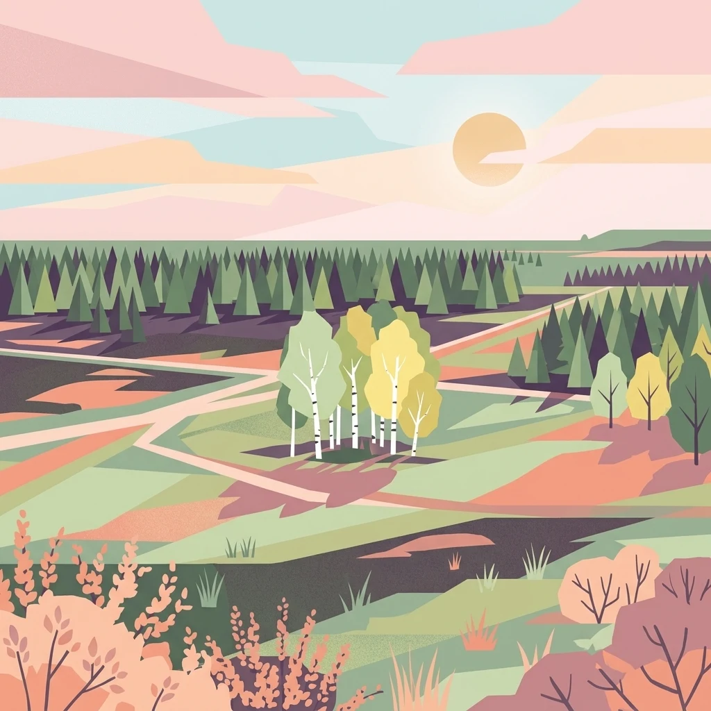
A minimalist, flat-design illustration showing a sweeping landscape with heath, patches of pine and birch forest, and winding trails under a sunset sky.

Diabelskie Pustacie Nature Reserve

Nature reserve

Park overview

Structured park overview, official facts, and landscape profile for Diabelskie Pustacie Nature Reserve

Diabelskie Pustacie Nature Reserve park facts, protected area profile, and essential visitor context

Review the core facts for Diabelskie Pustacie Nature Reserve, including designation, size, terrain, visitor scale, habitats, and operating context in one park-focused overview.

About Diabelskie Pustacie Nature Reserve

Diabelskie Pustacie Nature Reserve is a substantial protected area in north-western Poland that safeguards a representative slice of one of the country's most important inland heathland landscapes. Situated within the broader Kłomińskie Heathlands, an expanse of open heath on sandy glacial terrain, the reserve functions as a conservation anchor for this habitat type in the West Pomeranian region.

Geographically, the reserve lies within the Szczecineckie Lake District, a young glacial landscape shaped by Pleistocene ice sheets and their meltwaters. The area sits on a former military training ground, a detail that has shaped the contemporary character of the site: long-term military use limited intensive forestry and agricultural conversion, leaving much of the sandy soil bare or only lightly vegetated and allowing heathland communities to dominate. Following the end of active military activity, the site has increasingly been managed with explicit conservation goals in mind.

Ecologically, Diabelskie Pustacie belongs to the dry and wet heathland spectrum characteristic of lowland northern and central Europe. The open heath vegetation, patches of boggy terrain, and sandy outwash plains combine to create a habitat mosaic that supports specialized plant communities adapted to nutrient-poor, acidic substrates. The site also sits inside the Natura 2000 habitat area PLH320048, which underscores its importance within the European Union's ecological network.

For visitors, the reserve offers both ecological value and a sense of open, semi-wilderness space unusual in the Polish lowlands. Marked trails and educational paths cross the area, and a wooden observation tower on the highest hill provides views across the heath. Together, the reserve's scale, ecological identity, and protected status make it one of the most significant heathland reserves in Poland and a key reference site for studies of inland heath conservation in Central Europe.

Quick facts and research context for Diabelskie Pustacie Nature Reserve

Diabelskie Pustacie is a Polish floristic nature reserve of about 932.53 hectares, established on 26 November 2008 by order of the Governor of West Pomerania. It lies in the Szczecineckie Lake District, in Gmina Borne Sulinowo, Szczecinecki County, West Pomeranian Voivodeship, roughly two kilometres north of Kłomino and about eight kilometres south-south-east of Borne Sulinowo.

The reserve protects a portion of the Kłomińskie Heathlands, a heathland system located on a former military training ground and recognized as one of the largest inland heaths in Europe. It is a Natura 2000 habitat site with the code PLH320048 and is managed under active protection. The area lies within the forest districts of Borne Sulinowo and Czarnobór and includes marked hiking trails and educational paths.

Protection and recognition

Review documented terrestrial protection scope and official designation records

Diabelskie Pustacie Nature Reserve Protection Status and Governance Data

Diabelskie Pustacie Nature Reserve maintains a documented terrestrial protection scope within regional conservation frameworks. Official records organize management details and international recognition parameters without supplementary designations.

Protection details

Protection scope
Terrestrial
Transboundary protection
No
Park context

Deeper park guide and search-rich context for Diabelskie Pustacie Nature Reserve

Diabelskie Pustacie Nature Reserve history, landscape, wildlife, and travel context

Explore Diabelskie Pustacie Nature Reserve through its history, landscape character, ecosystems, wildlife, conservation priorities, cultural context, and seasonal travel timing in a structured park guide built for atlas discovery and search intent.

Why Diabelskie Pustacie Nature Reserve stands out

The reserve is best known for hosting part of the Kłomińskie Heathlands, the largest inland heath complex in Poland and one of the largest in Europe, set on an open post-military landscape where natural processes have reshaped sandy glacial terrain. Its defining character is the combination of two glacial sandr outwash plains, meltwater depressions, and residual erosional hills, producing a patchwork of dry heaths, wet basins, and exposed sandy ridges that is unusual on this scale in lowland Poland. The reserve is also notable as a Natura 2000 habitat site, giving it formal recognition within the European network of protected natural areas.
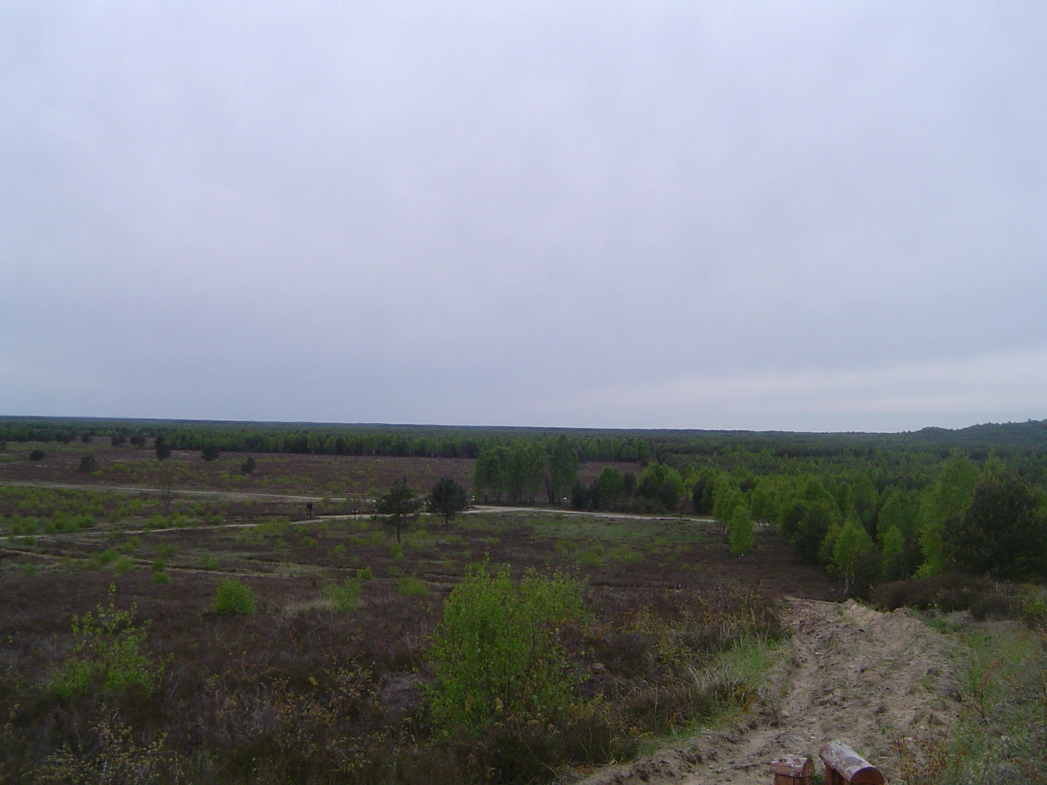
A wide view of a flat, open heathland landscape featuring low vegetation, sparse trees, and a sandy path under an overcast sky.
A wide view of the heathlands and forest landscape in Diabelskie Pustacie Nature Reserve, Poland.

Diabelskie Pustacie Nature Reserve history and protected-area timeline

The land that today forms Diabelskie Pustacie Nature Reserve was historically part of an extensive military training ground associated with the Borne Sulinowo area. Long-term military use prevented the conversion of the sandy soils into dense forest or farmland, leaving the landscape unusually open.

The reserve was formally established on 26 November 2008 through Regulation No. 45/2008 of the Governor of West Pomerania, with a stated area of about 932.53 hectares. The protection goal recorded at the time of designation was the preservation of natural and semi-natural biocenotic systems and the landscape of glacial sandr plains, together with the associated meltwater depressions and residual erosional hills.

In 2013, a formal protection plan for the reserve was adopted, introducing active conservation management for the area. This plan, with later amendments, brought the reserve within the framework of active Natura 2000 habitat protection, with the site designated as the Special Area of Conservation Diabelskie Pustacie PLH320048. Today, the reserve is administered in cooperation with the forest districts of Borne Sulinowo and Czarnobór, which manage the surrounding forested landscape.

Diabelskie Pustacie Nature Reserve landscape and geographic character

The landscape of Diabelskie Pustacie is dominated by glacial sandr outwash plains, which form broad, gently undulating sandy surfaces with relatively poor soils. These plains belong to two distinct sandr systems: the younger sandr and the older Plitnica sandr, whose overlapping outwash patterns define much of the reserve's terrain.

Scattered through this sandy matrix are meltwater depressions, low-lying hollows left behind by the retreat of ice and the action of meltwater, which collect moisture and often hold richer, wetter vegetation than the surrounding dry heaths. The reserve also includes residual erosional hills, isolated elevations of more resistant glacial material that rise above the sandr surface and provide both microhabitat variation and elevated viewpoints across the open heath.

The highest point within the reserve reaches about 175 metres above sea level and is marked by a wooden observation tower. Because much of the area was kept open by historical military use, the present-day landscape reads as a wide, exposed expanse of low heathland rather than the dense forest typical of much of north-western Poland. The combination of plains, hollows, and low hills gives the reserve a noticeably varied relief for an inland lowland site.

Diabelskie Pustacie Nature Reserve ecosystems, habitats, and plant life

Ecologically, Diabelskie Pustacie is defined by its heathland habitats and associated sandy-substrate communities, set within a glacial post-glacial landscape. The dominant vegetation types belong to the dry heath complex found across nutrient-poor sandy soils in the southern Baltic region, with characteristic heaths dominated by low shrubs, ericaceous plants, and drought-adapted herbaceous species.

Where the topography dips into meltwater depressions, the habitat shifts toward wetter communities, including marshy and boggy vegetation supported by slower drainage and water-retaining substrate. These wet patches are an essential counterpoint to the dry heaths, increasing habitat diversity and supporting specialized plant and animal communities.

The reserve also includes areas of more developed forest and woodland edge along its margins, managed by the Borne Sulinowo and Czarnobór forest districts. This mosaic of dry heath, wet hollows, forest edges, and sandy open ground gives the site its ecological character and explains its formal inclusion in the European Natura 2000 network as a habitat site of recognized significance.

Diabelskie Pustacie Nature Reserve wildlife and species highlights

The wildlife profile of Diabelskie Pustacie is shaped by its open heathland character and the mixture of dry sandy terrain with wet depressions. Open heaths of this kind typically support bird communities associated with low shrub vegetation and bare ground, alongside insect and pollinator groups that depend on flowering heath plants.

The wetter habitats within the reserve's meltwater depressions add an extra dimension, providing conditions suitable for amphibians, dragonflies, and wetland-adapted invertebrates. The transition zones between dry heath, wet hollows, and adjacent woodland further diversify the faunal communities that the reserve supports.

While detailed wildlife inventories vary across the wider heathland complex, the combination of habitat structure and protected status means that the reserve functions as a significant refuge for heathland-associated species in the West Pomeranian landscape. Its inclusion in the Natura 2000 network also reflects its value for threatened habitat types rather than any single flagship species.

Diabelskie Pustacie Nature Reserve conservation status and protection priorities

From a conservation perspective, Diabelskie Pustacie is significant primarily because it protects a large and largely intact example of inland heath, a habitat type that has declined sharply across much of Europe due to afforestation, agricultural conversion, and land-use change. By preserving more than 900 hectares of this habitat, the reserve contributes to the long-term survival of heath communities in the Polish lowlands.

The reserve's formal protection status includes its designation as a Polish floristic nature reserve, established in 2008, and its location within the Natura 2000 habitat site Diabelskie Pustacie PLH320048. This links the reserve into the European Union's broader ecological network and gives it a recognized role in transnational habitat conservation.

Active conservation management, introduced under the 2013 protection plan and its later amendments, is another key element of the reserve's conservation profile. Rather than being left entirely to passive protection, the site is subject to active measures intended to maintain or restore heathland character, including the management of vegetation succession. The cooperation of the Borne Sulinowo and Czarnobór forest districts in administering the wider forested context adds further stability to the reserve's ecological surroundings.

Diabelskie Pustacie Nature Reserve cultural meaning and human context

The cultural context of Diabelskie Pustacie is closely tied to the military history of the Borne Sulinowo region. For decades, much of this terrain functioned as a military training ground, an unusual land use that inadvertently preserved the open heathland character of the sandy outwash soils.

The name Diabelskie Pustacie, often translated as "Devil's Wastelands" or similar, evokes the sense of an exposed, otherworldly landscape and reflects how local communities historically perceived this stark, open terrain. The reserve's landscape, with its wide horizons and low vegetation, continues to carry a sense of remoteness that contrasts with much of the surrounding countryside.

In modern terms, the site also has an educational role, with marked educational paths such as the Ladybug Loop and the Bee Loop introducing visitors to the heathland environment. This growing emphasis on interpretation and public engagement reflects the transition of the area from a restricted military landscape into a publicly accessible protected natural site.

Top sights and standout views in Diabelskie Pustacie Nature Reserve

Diabelskie Pustacie is distinguished above all by the sheer scale of its protected heathland, which forms part of the largest inland heath complex in Poland. The reserve's terrain combines glacial sandr plains, meltwater depressions, and residual hills into a habitat mosaic rarely matched at this size in the Polish lowlands.

Other notable highlights include the reserve's formal connection to Natura 2000 through the Diabelskie Pustacie PLH320048 habitat site, its active conservation management since 2013, and the presence of visitor infrastructure such as educational trails and a wooden observation tower on the highest hill. Together, these features make the reserve both a meaningful conservation site and one of the most representative heathland landscapes in the country.

Best time to visit Diabelskie Pustacie Nature Reserve

The reserve's open heathland character gives it a relatively wide seasonal window for visits. Late spring and early summer tend to be a rewarding period, when heath plants flower and bird activity across the open landscape is at its peak. Summer visits offer the warmest conditions, though exposed sandy areas can become hot and dry.

Autumn brings a shift in the colour and texture of the heath vegetation, while winter allows visitors to walk the marked educational paths on cross-country skis, as the reserve explicitly permits winter use of its trails. In general, the open terrain, presence of marked paths, and elevated viewpoint from the observation tower make the reserve pleasant to visit whenever the weather is favorable, with each season offering a slightly different reading of the heathland landscape.


Monthly climate preview

Long-term temperature ranges and monthly precipitation averages at a representative coordinate

Diabelskie Pustacie Nature Reserve Climate Normals and Annual Weather Patterns

Representative coordinate measurements reveal marked shifts in monthly temperature and precipitation rhythm across Diabelskie Pustacie Nature Reserve from winter lows to summer highs. Detailed twelve-month data series and comparative metrics provide a complete statistical profile of long-term climatic behavior.
Annual mean8 °C
-3 °C19 °C
Jan-3°
Feb-1°
Mar
Apr
May13°
Jun16°
Jul19°
Aug19°
Sep14°
Oct
Nov
Dec-1°
Warmest month
July

18.8 °C

Coolest month
January

-2.6 °C

Wettest month
July

2.7 mm/day

Driest month
April

1.2 mm/day

Park location guide

Geography guide, regional context, and park location map for Diabelskie Pustacie Nature Reserve

Diabelskie Pustacie Nature Reserve park geography, regions, and map view in Poland

Understand where Diabelskie Pustacie Nature Reserve sits in Poland through a broader geographic reading of the surrounding landscape, nearby location context, and its mapped position within the national park landscape.

How Diabelskie Pustacie Nature Reserve fits into Poland

Poland, officially the Republic of Poland, is a Central European country spanning from the Baltic Sea in the north to the Carpathian Mountains in the south. It borders Germany, Czech Republic, Slovakia, Ukraine, Belarus, Lithuania, and Kaliningrad Oblast. The country has a temperate climate, diverse landscapes, and is known for its rich history, cultural heritage, and strong economic position within the EU.

Wider geography shaping Diabelskie Pustacie Nature Reserve in Poland

Poland occupies 312,696 km2 in Central Europe, extending from the Baltic Sea coast in the north to the Sudetes and Carpathian Mountains in the south. It borders Germany to the west, Czech Republic and Slovakia to the south, Ukraine and Belarus to the east, and Lithuania and Kaliningrad Oblast to the northeast. The landscape includes lowland plains, uplands, and mountain ranges.

Map view of Diabelskie Pustacie Nature Reserve

Use this park location map to pinpoint Diabelskie Pustacie Nature Reserve in Poland, understand its exact geographic position, and read its mapped placement within the surrounding landscape more clearly.

Pigeon | © OpenStreetMap contributors

Location context for Diabelskie Pustacie Nature Reserve

West Pomeranian Voivodeship

Visual exploration of outwash sand plains, inland heaths, and glacial terrain

Diabelskie Pustacie Nature Reserve Photos and Landscape Scenery

Visual documentation of Diabelskie Pustacie Nature Reserve reveals the expansive scale of its protected inland heathlands and glacial outwash terrain. Examining these field photographs provides a clearer understanding of the open sand plains, wet depressions, and distinct habitat mosaic defining the region.

A wide view of a flat, open heathland landscape featuring low vegetation, sparse trees, and a sandy path under an overcast sky.

Park atlas

Compare regional lowland landscapes and connected habitats across north-western Poland.

Exploring Parks Near Diabelskie Pustacie Nature Reserve and Surrounding Protected Areas

Visitors can browse other protected areas sharing similar glacial sandr terrain and heathland habitats across the surrounding region. Comparing adjacent lowland reserves provides broader context for the unique post-military ecosystems found throughout West Pomerania.
A watercolor painting of a serene landscape with soft green hills and distant mountains.
Nature reserveGreater Poland Voivodeship
About 13 km away#1 closest

South

Rezerwat przyrody Diabli Skok: Protected Forest and Glacial Ravine Geography

A sheltered microclimate and moraine reserve in Greater Poland.

Rezerwat przyrody Diabli Skok protects a sharp, deeply incised gorge that contrasts with the surrounding flat glacial plains. This site is defined by its old-growth beech woodland and numerous groundwater springs, providing a critical habitat for diverse plant species and montane moss communities within the regional geography of the Greater Poland Voivodeship.

Area
0.21 km²
Established
1961
Relief
Upland
Climate
Temperate
Nature reserveZachodniopomorskie
About 23 km away#2 closest

South

Rezerwat przyrody Dolina Rurzycy: Mapped Geography and Protected Area Data

A glacial river valley reserve in the West Pomeranian landscape

Trace the ecological profile of Rezerwat przyrody Dolina Rurzycy. This entry provides map-based context for its deeply incised river valley, interconnected glacial lake chain, and rare calcareous spring communities within the Wałcz Forests region.

Area
5.547 km²
Established
2005
Relief
Upland
Climate
Temperate
Nature reservePomeranian Voivodeship
About 25 km away#3 closest

East

Rezerwat przyrody Dolina Gwdy: Exploring Protected River Meanders and Forested Geography

Nature reserve in Pomeranian Voivodeship

This nature reserve serves as a critical protected landscape, encompassing 425 hectares of riverine corridors along the Gwda and Czernica rivers. The area is defined by its pronounced meanders, floodplain terraces, and extensive alder swamp forests, providing a documented look at the natural terrain and hydrological evolution within the Pomeranian lake district of northern Poland.

Area
4.246 km²
Established
1998
Relief
Upland
Scope
Terrestrial
Watercolor painting of a tranquil lake scene with lush trees and foliage in shades of green and autumnal tones, set against a soft white background.
Nature reservePoland
About 29 km away#4 closest

Northwest

Jezioro Prosino Nature Reserve: Protected Wetland and Lake Landscape in Poland

Ecological mapping of the Drawsko Lake District

Jezioro Prosino Nature Reserve is a targeted faunistic sanctuary in the West Pomeranian Voivodeship of Poland. This protected landscape focuses on the conservation of waterbird breeding sites and delicate lakeshore vegetation zones. By integrating with the Natura 2000 network and the surrounding Drawsko Landscape Park, the reserve serves as a prime example of postglacial ecosystem management and aquatic habitat preservation.

Area
0.86 km²
Established
1988
Relief
Lowland
Climate
Temperate
A horizontal watercolor painting showing a winding river flowing through a lush green valley with distant hills under a soft light.
Nature reserveZachodniopomorskie
About 35 km away#5 closest

Northwest

Dolina Pięciu Jezior Nature Reserve: Geographic Atlas and Protected Area Map

A glacial valley and lake system in the Drawsko Lakeland

Located in the heart of the Drawsko Lakeland, Dolina Pięciu Jezior represents a protected nature reserve centered on a narrow valley system. The area showcases a distinctive post-glacial terrain with five linked lakes and mature beech forests. This geographic corridor serves as a vital protected area, preserving the headwaters of the Drawa River and its surrounding ecosystem within the Zachodniopomorskie region.

Area
2.288 km²
Established
1987
Relief
Upland
Climate
Temperate
Nature reservePomeranian Voivodeship
About 41 km away#6 closest

East

Rezerwat przyrody Miłachowo: Protected Xerothermic Grassland and Nature Reserve Atlas

Mapping relict steppe communities in the Pomeranian Voivodeship

Located in the Krajeńskie Lakeland, Rezerwat przyrody Miłachowo preserves rare dry-grassland and shrub ecosystems. This nature reserve protects thermophilic vegetation on glacial valley slopes, providing vital ecological continuity for species adapted to sun-exposed, dry terrain far from their primary European strongholds.

Area
0.038 km²
Established
1976
Relief
Upland
Climate
Temperate
Nature reserveGreater Poland Voivodeship
About 42 km away#7 closest

East

Uroczyska Kujańskie Nature Reserve: A Geographic Overview of the Krajeńskie Lakeland

Mapped protected landscapes, glacial lakes, and old-growth oak forests.

Uroczyska Kujańskie provides a rare study in post-glacial landscape architecture. Situated in the Greater Poland Voivodeship, this site links dystrophic lakes, travertine-forming spring fens, and extensive acid oak forests. Use our atlas data to understand the complex ecological boundaries and hydrological features that define this protected Natura 2000 habitat.

Area
10.182 km²
Relief
Lowland
Scope
Terrestrial
Water
Major water bodies
Nature reserveZachodniopomorskie Voivodeship
About 44 km away#8 closest

South

Rezerwat przyrody Mokradła koło Leśniczówki Łowiska: Protected Landscapes and Map Geography

A nature reserve located in the West Pomeranian Voivodeship

Located in the heart of the Wałeckie Lake District, this nature reserve is a concentration of transitional bogs and dystrophic lakes. The site remains a critical node in the Drawa River basin, serving as a protected landscape for rare bog mosses and peat forming processes framed by mature pine stands. Explore the mapped boundaries and natural terrain of this unique ecological refuge.

Area
1.018 km²
Established
2011
Relief
Lowland
Climate
Temperate

Common questions about visiting, size, designation, and location context for Diabelskie Pustacie Nature Reserve

Diabelskie Pustacie Nature Reserve FAQs for park facts, access, geography, and protected area context

Find quick answers about Diabelskie Pustacie Nature Reserve, including protected-area facts, park geography, trail and visitor context, and how the park fits into its surrounding country and regional landscape.
MoriAtlas Explorer

Continue Your Protected Areas Search Across the Global Atlas

Deepen your exploration by continuing the structured search for national parks and protected areas worldwide. Utilize the comprehensive filtering capabilities to compare different conservation landscapes and refine your understanding of global park geography. Discover more about the distribution and characteristics of protected natural areas.

Global natural geography