
Mori Atlas logo
Nature reserveDolina Eliaszówki Nature Reserve

Tracing the limestone karst terrain and forest mosaic within the Kraków-Częstochowa Upland

Dolina Eliaszówki Nature Reserve: Mapped Protected Landscapes and Karst Valley Geography in Southern Poland

(Rezerwat przyrody Dolina Eliaszówki)

Dolina Eliaszówki Nature Reserve stands as a significant protected area in the Lesser Poland Voivodeship, carved into the limestone bedrock of the Olkusz Upland. The valley preserves a distinct ecological gradient, ranging from alluvial alder-ash floodplain forests along the Krzeszówka stream to mature oak-hornbeam and beech stands on the valley slopes. This area serves as a primary geographic reference for the karst processes defining the broader Jurassic Upland landscape.

dolinki krakowskiejurassic uplandlimestone valleyold-growth forestbeech forestoak-hornbeam forest
A digital illustration of a forested valley with a small stream flowing over rocky terrain toward a waterfall, flanked by steep limestone cliff formations under a soft sun.

Dolina Eliaszówki Nature Reserve

Nature reserve

Park overview

Structured park overview, official facts, and landscape profile for Dolina Eliaszówki Nature Reserve

Dolina Eliaszówki Nature Reserve park facts, protected area profile, and essential visitor context

Review the core facts for Dolina Eliaszówki Nature Reserve, including designation, size, terrain, visitor scale, habitats, and operating context in one park-focused overview.

About Dolina Eliaszówki Nature Reserve

Dolina Eliaszówki Nature Reserve sits in a relatively narrow but ecologically rich corner of the Olkusz Upland, a mesoregion that belongs to the larger Kraków-Częstochowa Upland, often referred to in tourism and scientific literature as the Jura Krakowsko-Częstochowska. The elevation, the limestone bedrock, and the area's long exposure to natural processes have produced a landscape that blends forested valley slopes, exposed rock faces, karst springs, and small cave systems within a compact spatial footprint.

At the heart of the reserve is the lower portion of the Eliaszówka Valley, named after the local stream historically called Eliaszówka and now formally known as the Krzeszówka. The valley bottom carries an alder-ash floodplain forest that thrives in the moist conditions along the watercourse, where the karst-fed springs of the Prophet Elijah and Prophet Elisha emerge. Higher up, the slopes support a layered mosaic of old-growth dry-site forest communities: oak-hornbeam grąd on the more mesic positions, Carpathian beech forest in shaded areas, and a more thermophilic beech forest variant on warmer, sun-exposed slopes. The diverse substrate and microclimate create striking transitions between forest types within short distances.

Beyond its ecological significance, the reserve carries strong cultural weight. The Carmelite monastery complex in Czerna rises above the valley and is surrounded by the reserve on all sides, creating an intimate relationship between protected forest landscape and centuries of monastic tradition. The ruins of the Devil's Bridge (Diabelski Most) are another distinct cultural element integrated into the same valley system, together with small religious caves such as the Grotto of Saint Hilarion and the Grotto of Saint Onuphrius. The reserve thus functions simultaneously as a forest sanctuary, a geological learning ground, and a place where the natural and human history of the region visibly intersect.

Administratively and ecologically, the reserve belongs to the Dolinki Krakowskie Landscape Park and overlaps two Natura 2000 habitat designations, which underscores its recognized contribution to preserving the broader natural character of the small valleys network typical of the Kraków Upland. While relatively modest in size compared with Poland's large national parks, Dolina Eliaszówki delivers an unusually complete example of how karst geology, forest dynamics, hydrology, and cultural heritage converge in a single protected valley system.

Quick facts and research context for Dolina Eliaszówki Nature Reserve

Dolina Eliaszówki Nature Reserve was established in 1989 under Polish legal gazette M.P. of 1989, No. 9, item 77, and operates under partial protection ("ochrona częściowa"). It covers roughly 109.57 ha within the Dolinki Krakowskie Landscape Park, and is part of the Natura 2000 sites "Czerna" (PLH120034) and "Dolinki Jurajskie" (PLH120005). The reserve sits on the Olkusz Upland, a mesoregion of the Kraków-Częstochowa Upland, and is administered under the Małopolskie Voivodeship, Kraków County, and Krzeszowice municipality.

Protection and recognition

Examine terrestrial protection status and formal conservation recognition records

Dolina Eliaszówki Nature Reserve Protection Status and Governance Data

Dolina Eliaszówki Nature Reserve maintains a documented terrestrial protection scope without international recognition listings. Review official designation records and management parameters for this protected natural area.

Protection details

Protection scope
Terrestrial
Transboundary protection
No
Park context

Deeper park guide and search-rich context for Dolina Eliaszówki Nature Reserve

Dolina Eliaszówki Nature Reserve history, landscape, wildlife, and travel context

Explore Dolina Eliaszówki Nature Reserve through its history, landscape character, ecosystems, wildlife, conservation priorities, cultural context, and seasonal travel timing in a structured park guide built for atlas discovery and search intent.

Why Dolina Eliaszówki Nature Reserve stands out

The reserve is best known for a particularly rich mosaic of forest communities growing on a limestone substrate in a deep karst valley. Old-growth stands of oak-hornbeam grąd, Carpathian beech forest, and warm-loving beech forest crown the slopes, while a distinct alder-ash floodplain forest grows in the valley bottom along the Krzeszówka stream. This combination of varied forest types on a small geographic scale makes the reserve an important reference site for understanding the ecological gradients of the Kraków-Częstochowa Upland. The valley is also celebrated for its karst features, including limestone outcrops, several named caves and rock shelters, the deep-cut Kulenda gorge, and the karst springs known as the Spring of Prophet Elijah and the Spring of Prophet Elisha. These geological and hydrological features, together with the surrounding monastic heritage of Czerna, give the reserve a strong cultural-natural identity unmatched by many other small Polish forest reserves.
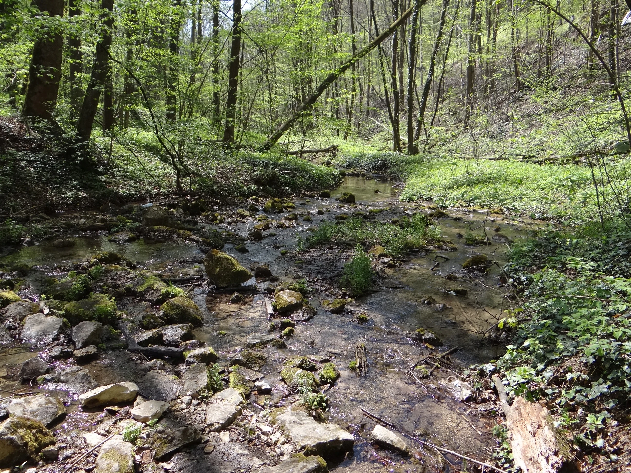
A shallow stream with mossy stones flows through a lush, green deciduous forest.
A shaded stream winding through the forest in Dolina Eliaszówki Nature Reserve.

Dolina Eliaszówki Nature Reserve history and protected-area timeline

The Dolina Eliaszówki Nature Reserve was formally established in 1989, based on the Polish legal gazette Monitor Polski of that year (M.P. z 1989 r. Nr 9, poz. 77), with its founding rooted in the recognition of the valley's exceptional forest and karst features.

Its creation came as part of a broader movement during the late twentieth century to formally safeguard the most ecologically valuable valleys of the Kraków-Częstochowa Upland, often referred to as the small "dolinki" of the Jura region. The valley's old-growth forest communities and karst hydrology were considered strong enough reasons to place its lower section under partial protection ("ochrona częściowa"), a category that allows for regulated use while maintaining core natural values.

Following its establishment, the reserve became further embedded in the wider landscape protection framework of the region through its location within the Dolinki Krakowskie Landscape Park and its later overlap with European Natura 2000 habitat sites. These designations reinforced the reserve's role as a reference area for old-growth deciduous forest, karst springs, and cave habitats, and continue to shape its conservation management into the present day.

Dolina Eliaszówki Nature Reserve landscape and geographic character

The landscape of Dolina Eliaszówki Nature Reserve is a textbook example of the small, deeply incised valleys that characterize the Olkusz Upland, the western mesoregion of the broader Kraków-Częstochowska Jura. The valley itself is carved into limestone bedrock, which produces the structural conditions for karst processes: rock outcrops, narrow gorges such as the Kulenda ravine, caves, rock shelters, and a series of springs that feed the local stream.

The terrain transitions smoothly from the moist valley floor, dominated by alluvial deposits and a meandering watercourse, to steeper and sometimes rocky slopes, and eventually to the surrounding plateau-surface of the upland. Forest cover dominates nearly the entire reserve, with the lower elevations defined by an alder-ash floodplain forest along the stream and the higher slopes transitioning gradually through oak-hornbeam grąd into the Carpathian and thermophilic beech forest types that occupy mid- to upper-slope positions. This topographic and ecological layering gives the valley a strong sense of enclosed, corridor-like scenery typical of the regional "dolinki."

Limestone outcrops punctuate the slope forest, adding visual texture to the landscape and creating microhabitats for specialized plant communities. The spring complexes at the head of the reserve, including the Prophet Elijah and Prophet Elisha springs, add a notable hydrological element. Above the canopy, the Carmelite monastery complex and the remains of the Devil's Bridge provide prominent cultural landmarks that visually anchor the landscape, while the cave systems such as the Grotto of Saint Hilarion and the Jaskinia za Siedmioma Progami enrich the area's geomorphological character.
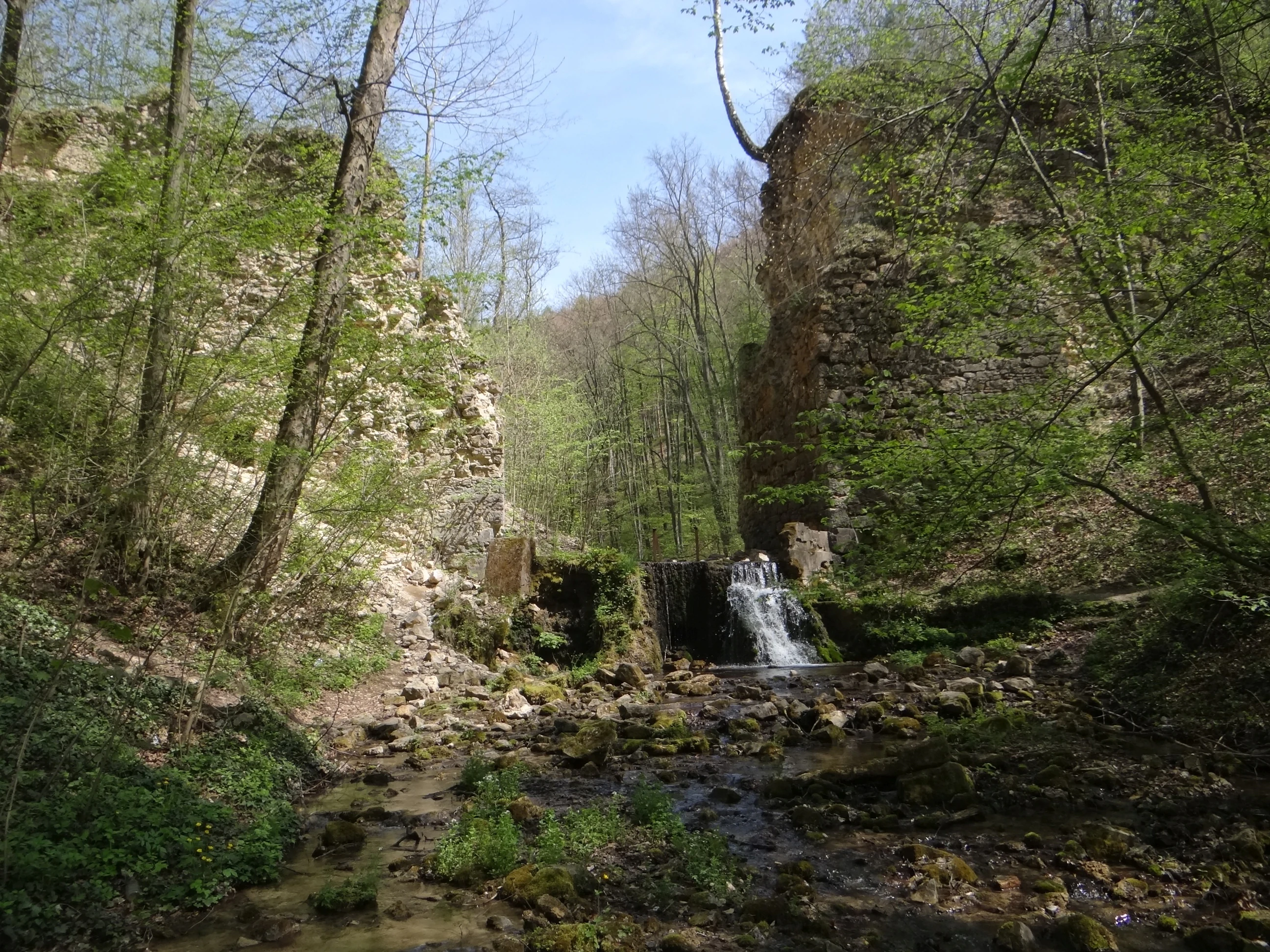
Ancient stone arch ruins situated over a small stream in a dense forest, with a small waterfall flowing between the stone pillars.
The remains of the historic Devils Bridge within the Dolina Eliaszówki Nature Reserve.

Dolina Eliaszówki Nature Reserve ecosystems, habitats, and plant life

Ecologically, Dolina Eliaszówki Nature Reserve is a compact but exceptionally layered forest ecosystem, shaped by limestone bedrock, a deep valley profile, and a stream fed by karst springs. This combination yields a strong gradient of moisture and soil conditions over a small horizontal distance, allowing several distinct natural forest communities to coexist within reserve boundaries.

The bottom of the valley supports an alder-ash floodplain forest ("las łęgowy olszowo-jesionowy"), a community adapted to periodic flooding and groundwater-rich soils. Slightly higher and drier positions on the slopes carry an oak-hornbeam grąd, while still higher and on warmer aspects, the vegetation shifts into a thermophilic beech forest ("buczyna ciepłolubna"). In shaded, cooler parts of the valley, a Carpathian beech forest ("żyzna buczyna karpacka") occupies the most mesic habitats. Together, these forest types form a representative cross-section of the deciduous forest communities typical of the Kraków-Częstochowska Upland.

The herb layer in spring is exceptionally rich, with carpets of species such as Dentaria glandulosa, yellow star-of-Bethlehem, wood anemone, sweet woodruff, perennial mercury, and white butterbur. Among ferns and other characteristic woodland plants, the reserve hosts male fern, mountain speedwell, spiny shield fern, Moldavian monkshood, yellow archangel, and nine-leaved toothwort. These species, together with the limestone substrate and the shaded microclimate, give the reserve a particularly strong springtime floral display and a reputation as a refuge for typical Jurassic-Upland woodland flora.

The reserve's nature value is further formalized through its inclusion in two Natura 2000 habitat sites, "Czerna" (PLH120034) and "Dolinki Jurajskie" (PLH120005), recognizing the habitat types found here as part of the European ecological network.
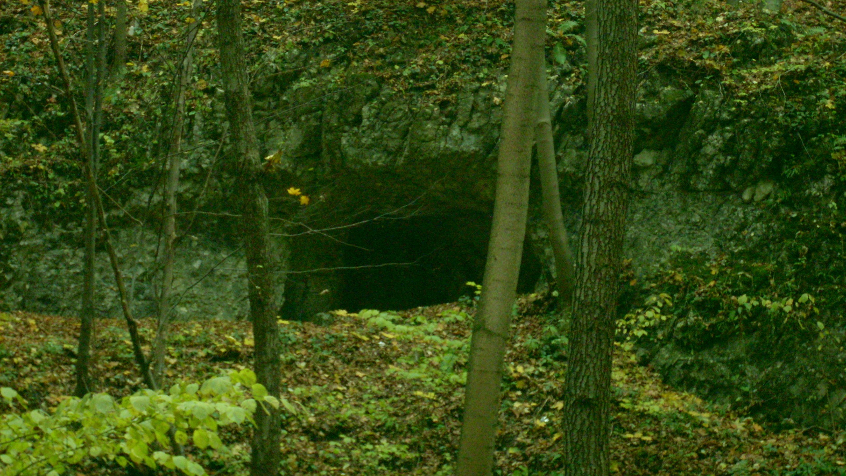
The dark entrance of Hieronim Cave situated in a forested limestone valley, surrounded by deciduous trees and leaf litter.
A view of the entrance to Hieronim Cave within the Dolina Eliaszówki Nature Reserve.

Dolina Eliaszówki Nature Reserve wildlife and species highlights

While the source material emphasizes plant communities and karst features over detailed species lists, the reserve's mosaic of old-growth deciduous forests, karst springs, and cave habitats provides important conditions for a wide range of woodland and subterranean fauna typical of the Kraków-Częstochowska Upland.

The alder-ash floodplain forest along the Krzeszówka stream offers habitat for amphibians, river-associated invertebrates, and bird species dependent on moist deciduous woodland. The surrounding beech and oak-hornbeam forests support typical central-European woodland bird communities, mammals such as forest-dwelling small carnivores and ungulates common to southern Polish uplands, and a rich community of forest-floor invertebrates sustained by deep leaf litter and deadwood.

The cave systems and rock shelters within the reserve, including the Grota Świętego Hilariona, the Jaskinia pod Bukami, and others, also serve as important bat and cave-fauna habitat. Combined with the broader Natura 2000 designations covering the area, the reserve contributes to the regional network of protected habitats that maintain functional populations of woodland species in a landscape otherwise shaped by agriculture and settlement.
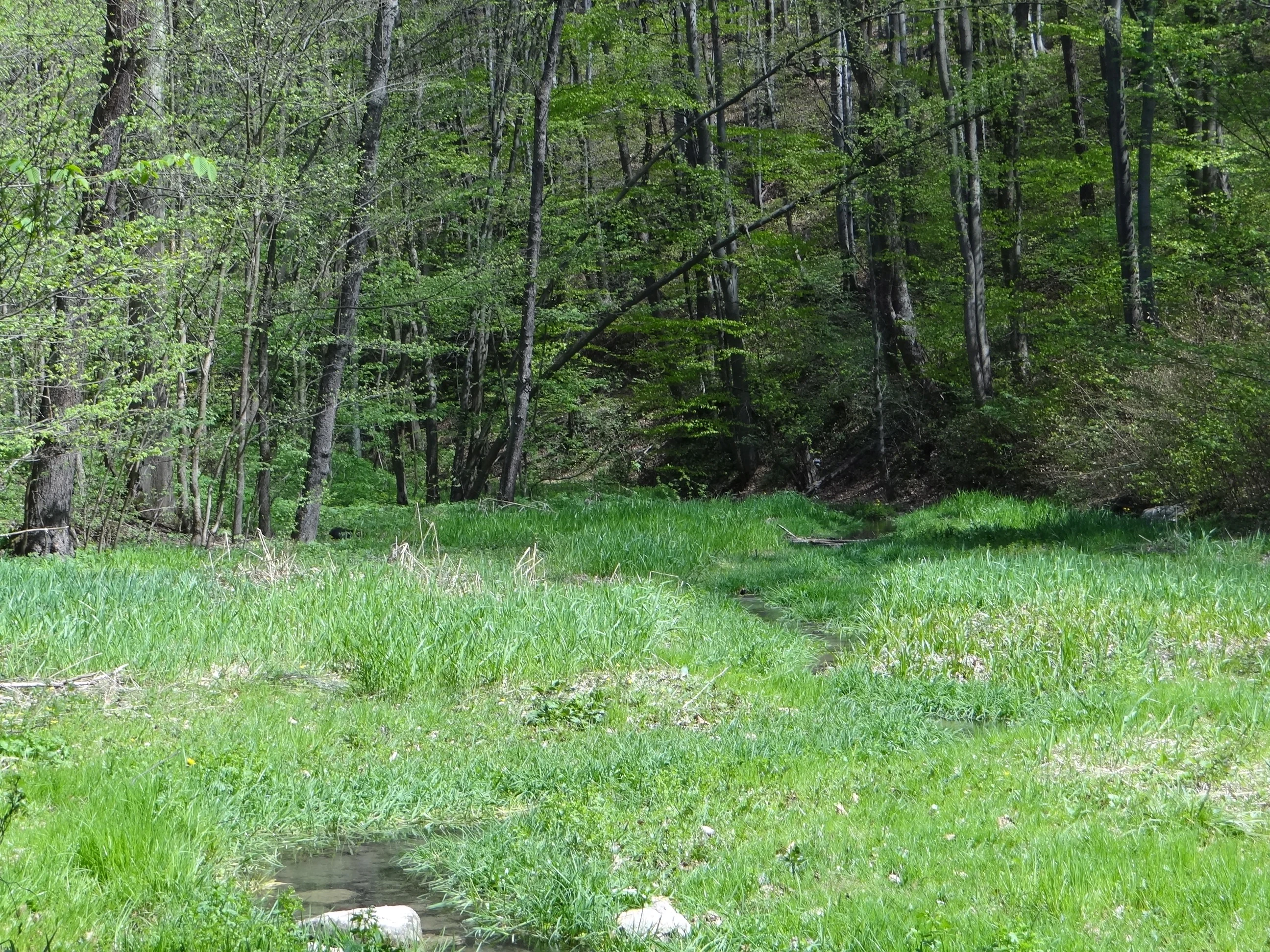
A view of a lush green meadow with a small stream flowing through, backed by a dense forest of tall deciduous trees in early spring.
The forested valley of the Eliaszówka stream.

Dolina Eliaszówki Nature Reserve conservation status and protection priorities

Dolina Eliaszówki Nature Reserve plays a significant conservation role as a representative example of the small Jurassic-Upland valleys with their characteristic karst geology and old-growth deciduous forest cover. By safeguarding a coherent cross-section of forest communities, from floodplain alder-ash woodland to thermophilic beech forest, the reserve maintains a reference dataset for understanding natural forest dynamics on limestone substrate in the Kraków-Częstochowa region.

The conservation value of the reserve is reinforced by its placement within the Dolinki Krakowskie Landscape Park, a regional-level protection framework, and by its overlap with two Natura 2000 habitat sites: "Czerna" (PLH120034) and "Dolinki Jurajskie" (PLH120005). These overlapping designations reflect the recognized importance of the valley's forests, karst habitats, and cave systems within the European ecological network and provide a stronger legal and management basis for long-term habitat preservation.

The partial protection regime ("ochrona częściowa") applied to the reserve balances habitat preservation with regulated human use, allowing traditional low-impact activities such as the established hiking and cycling routes while keeping the most sensitive forest, spring, and cave features shielded from more intensive use. This layered protection approach helps maintain both ecological integrity and the area's character as a connecting landscape element between the surrounding monastery grounds and the wider Dolinki Krakowskie system.

Dolina Eliaszówki Nature Reserve cultural meaning and human context

The reserve carries an unusually strong cultural layer for a small forest protected area. The Carmelite monastery complex in Czerna, a place of pilgrimage and religious life dating back several centuries, sits directly above the valley and is encircled by the reserve on all sides, creating a long historical continuum between human spiritual activity and the surrounding protected landscape.

Several named springs within the valley, including the Spring of Prophet Elijah and the Spring of Prophet Elisha, bear biblical and monastic associations. Small religious caves and shelters within the reserve, such as the Grota Świętego Hilariona and the Grota Świętego Onufrego, are tied to local hermit traditions and the contemplative culture of the surrounding monastic institutions. The ruins of the Devil's Bridge near Czerna add another chapter of local folk and religious heritage to the site's identity.

Together with the established hiking and cycling routes that link the valley to Olkusz, Krzeszowice, and the Dolina Racławki reserve, these cultural elements frame the reserve as both a natural and a historical landscape, where forest, karst, monastery, and regional trail network converge into a coherent place-based identity.

Top sights and standout views in Dolina Eliaszówki Nature Reserve

The standout features of Dolina Eliaszówki Nature Reserve include its compact but highly representative mosaic of Jurassic-Upland forest types, from alder-ash floodplain woodland through oak-hornbeam grąd to thermophilic and Carpathian beech forest. Karst landforms provide a second layer of distinction: limestone outcrops, the Kulenda gorge, multiple named caves and rock shelters, and the karst springs of Prophet Elijah and Prophet Elisha.

A third defining element is the deep integration with cultural heritage, framed by the Carmelite monastery at Czerna, the ruins of the Devil's Bridge, and small religious caves. Combined with the reserve's formal status within the Dolinki Krakowskie Landscape Park and its overlap with two Natura 2000 sites, these features make the reserve unusually rich for its size.

Best time to visit Dolina Eliaszówki Nature Reserve

Spring is widely regarded as the most rewarding season to experience the valley, when the woodland herb layer of the reserve produces an exceptionally rich floral display across the slopes and valley floor. Cool, often damp conditions suit both the limestone-dependent plant species and the active bird and amphibian life associated with the stream and floodplain forest.

Late spring and early summer also offer comfortable conditions for following the yellow hiking trail from Olkusz through the reserve and onward toward Paczółtowice, as well as the cycling route connecting Krzeszowice, Bartlowa Góra, Dębnik, and Siedlec. Autumn brings rich forest color across the beech and hornbeam stands, while winter offers a quieter experience focused on karst landforms, springs, and the surrounding monastic landscape. Visitors should be aware that the reserve operates under partial protection, so low-impact behaviour is important in all seasons.

Monthly climate preview

Track monthly temperature ranges and precipitation averages at a representative coordinate

Dolina Eliaszówki Nature Reserve Climate Normals and Annual Weather Patterns

Long-term data records reveal a measured annual cycle of shifting thermal extremes and precipitation rates across twelve distinct intervals at the sampled coordinate. Detailed monthly records offer comprehensive analytical depth for examining historical temperature variations and precipitation distributions across the protected area.
Annual mean8 °C
-4 °C19 °C
Jan-4°
Feb-2°
Mar
Apr
May13°
Jun17°
Jul19°
Aug19°
Sep14°
Oct
Nov
Dec-2°
Warmest month
July

19.2 °C

Coolest month
January

-3.5 °C

Wettest month
July

3.5 mm/day

Driest month
December

1.5 mm/day

Park location guide

Geography guide, regional context, and park location map for Dolina Eliaszówki Nature Reserve

Dolina Eliaszówki Nature Reserve park geography, regions, and map view in Poland

Understand where Dolina Eliaszówki Nature Reserve sits in Poland through a broader geographic reading of the surrounding landscape, nearby location context, and its mapped position within the national park landscape.

How Dolina Eliaszówki Nature Reserve fits into Poland

Poland, officially the Republic of Poland, is a Central European country spanning from the Baltic Sea in the north to the Carpathian Mountains in the south. It borders Germany, Czech Republic, Slovakia, Ukraine, Belarus, Lithuania, and Kaliningrad Oblast. The country has a temperate climate, diverse landscapes, and is known for its rich history, cultural heritage, and strong economic position within the EU.

Wider geography shaping Dolina Eliaszówki Nature Reserve in Poland

Poland occupies 312,696 km2 in Central Europe, extending from the Baltic Sea coast in the north to the Sudetes and Carpathian Mountains in the south. It borders Germany to the west, Czech Republic and Slovakia to the south, Ukraine and Belarus to the east, and Lithuania and Kaliningrad Oblast to the northeast. The landscape includes lowland plains, uplands, and mountain ranges.

Map view of Dolina Eliaszówki Nature Reserve

Use this park location map to pinpoint Dolina Eliaszówki Nature Reserve in Poland, understand its exact geographic position, and read its mapped placement within the surrounding landscape more clearly.

Pigeon | © OpenStreetMap contributors

Location context for Dolina Eliaszówki Nature Reserve

Lesser Poland Voivodeship

Examine the limestone valley terrain, old-growth beech forests, and karst topography.

Visual Explorer and Landscape Photography of Dolina Eliaszówki Nature Reserve

Visual records capture the deep karst terrain, limestone outcrops, and old-growth beech forests that define Dolina Eliaszówki Nature Reserve. Photographic documentation reveals the ecological gradients of the valley, helping researchers examine its protected habitats and geomorphology.

A shallow stream with mossy stones flows through a lush, green deciduous forest.

A stone-walled spring enclosure set into a hillside in a forest, featuring a small stone shrine to the side and information signs in the background.

Ancient stone arch ruins situated over a small stream in a dense forest, with a small waterfall flowing between the stone pillars.

The dark entrance of Hieronim Cave situated in a forested limestone valley, surrounded by deciduous trees and leaf litter.

A view of a lush green meadow with a small stream flowing through, backed by a dense forest of tall deciduous trees in early spring.

Park atlas

Compare adjacent limestone valleys and regional conservation landscapes in southern Poland

Parks Near Dolina Eliaszówki Nature Reserve and Surrounding Protected Areas

Visitors exploring Dolina Eliaszówki Nature Reserve can discover other protected areas across the surrounding region, comparing similar karst topography and forest ecosystems. Continuing into neighboring park geography reveals broader regional biodiversity patterns and connected natural habitats throughout the upland.
Watercolor painting of a valley landscape with rolling hills, limestone rock formations on the right, and soft green vegetation.
Nature reserveLesser Poland Voivodeship
About 3.2 km away#1 closest

East

Rezerwat przyrody Dolina Racławki: Protected Limestone Valley and Karst Geography

Explore the forest mosaic and geological cliff features in Lesser Poland

The Rezerwat przyrody Dolina Racławki landscape reserve is a significant protected area in the Olkuska Upland. Spanning a long limestone valley, the reserve features a network of caves, rock shelters, and steep cliffs built from Carboniferous and Jurassic bedrock. Its combination of layered forest communities and protected orchid populations marks it as a vital site for understanding the natural heritage and regional geography of southern Poland.

Area
4.739 km²
Established
1962
Relief
Upland
Climate
Temperate
Watercolor painting of a rolling landscape featuring a line of evergreen trees and soft hills under a light, warm sky.
Nature reserveLesser Poland Voivodeship
About 6.5 km away#2 closest

East

Dolina Szklarki Nature Reserve: Atlas Map and Protected Landscape Geography

Exploring forest communities and limestone rock formations in Lesser Poland.

Analyze the protected geography of Dolina Szklarki Nature Reserve, a key nature reserve in the Kraków-Częstochowa Upland. The area features a dense concentration of limestone cliffs, distinct forest ecosystems, and karst valley terrain within Lesser Poland Voivodeship.

Area
0.467 km²
Established
1989
Relief
Upland
Climate
Temperate
Protected landscapeLesser Poland Voivodeship
About 8.1 km away#3 closest

South

Tenczyński Park Krajobrazowy: Protected Landscape and Karst Geography in Lesser Poland

Mapped limestone ridges and forest corridors near Kraków

Discover Tenczyński Park Krajobrazowy, a protected landscape park located in Lesser Poland Voivodeship. This geographic study covers the Garb Tenczyński ridge, where karst limestone formations, small caves, and volcanic outcrops shape a diverse terrain spanning from marshy lowlands to upland forest ridges.

Area
136.581 km²
Established
1981
Relief
Upland
Climate
Temperate
Watercolor illustration showing green hills, scattered trees, and a light sky background
National parkLesser Poland Voivodeship
About 11 km away#4 closest

East

Ojców National Park: Karst Geography and Protected Landscape Atlas Entry

Explore the mapped terrain and unique geology of this national park.

Ojców National Park, situated in Lesser Poland Voivodeship, offers a concentrated display of dramatic karst topography. This protected national park is renowned for its towering limestone cliffs, intricate ravines, and over 400 caves, showcasing a unique Jurassic geology. As a vital protected area, its mapped boundaries encompass distinctive rock formations like Hercules' Club and the historic Trail of the Eagles' Nests, providing rich context for landscape discovery and atlas exploration.

Area
21.46 km²
Established
1956
IUCN
II
Relief
Upland
Watercolor painting of limestone rock formations surrounded by trees and green hills, rendered in a soft, panoramic landscape style.
National parkLesser Poland Voivodeship
About 11 km away#5 closest

East

Ojcowski Park Narodowy: A Geographic Guide to Poland's Compact Protected Landscape

Jurassic limestone formations and karst valleys in Lesser Poland

Ojcowski Park Narodowy occupies a unique place in the national park system of Poland, defined by its small footprint and high concentration of Jurassic geological features. The terrain includes vertical cliffs, ancient river valleys, and significant cave systems that provide critical habitats for bat populations. Use this mapping resource to understand the park's structural complexity, from its dry ravines to the historic cultural sites integrated into the limestone bedrock.

Area
21.46 km²
Established
1956
Visitors
400K annual
Relief
Upland
A soft watercolor painting of a winding stream flowing through a green valley with light trees, under a pale pink and yellow sky.
Nature reservePoland
About 12 km away#6 closest

South

Rezerwat przyrody Dolina Potoku Rudno: Nature Reserve and Protected Landscape Atlas

Geographic map and protected forest terrain in Lesser Poland

Situated in the Rudno Stream valley, this nature reserve offers a detailed look at preserved alder floodplain ecosystems and rocky gorge formations. The area provides a critical protected woodland link within the Kraków-Częstochowa Upland. Use the atlas data to examine the reserve boundaries, geological exposures, and regional landscape connections in Poland.

Area
0.959 km²
Established
2001
Relief
Upland
Climate
Temperate
A horizontal watercolor illustration showing a peaceful river flowing through a lush green valley with distant rolling hills and wild grasses in the foreground.
Nature reserveLesser Poland Voivodeship
About 13 km away#7 closest

Southeast

Rezerwat przyrody Dolina Mnikowska: A Karst Landscape Reserve in Lesser Poland

Mapped limestone gorge and forest protected area geography

Rezerwat przyrody Dolina Mnikowska features a striking limestone gorge and forest ecosystem within the Lesser Poland Voivodeship. This protected area offers a deep look into the karst topography, river-carved cliffs, and diverse habitat zones of the Garb Tenczyński upland region.

Area
0.209 km²
Established
1963
Relief
Upland
Climate
Temperate
A flat-style vector illustration showing a winding river flowing through a lush green valley towards a large mountain with a waterfall, surrounded by trees and stylized clouds.
Nature reserveLesser Poland Voivodeship
About 13 km away#8 closest

East

Rezerwat przyrody Dolina Kluczwody: Karst Valley and Protected Nature Reserve Geography

Exploring the limestone cliffs of Lesser Poland Voivodeship

Dolina Kluczwody represents a quintessential limestone valley landscape in southern Poland, featuring a blend of forest cover and exposed rock swards. As a protected nature reserve, it forms a crucial habitat within the Dolinki Krakowskie complex, preserving unique karst terrain and stream-fed ecosystems for scientific and environmental monitoring.

Area
0.352 km²
Established
1989
Relief
Upland
Climate
Temperate

Common questions about visiting, size, designation, and location context for Dolina Eliaszówki Nature Reserve

Dolina Eliaszówki Nature Reserve FAQs for park facts, access, geography, and protected area context

Find quick answers about Dolina Eliaszówki Nature Reserve, including protected-area facts, park geography, trail and visitor context, and how the park fits into its surrounding country and regional landscape.
MoriAtlas Explorer

Continue Your Protected Areas Search Across the Global Atlas

Deepen your exploration by continuing the structured search for national parks and protected areas worldwide. Utilize the comprehensive filtering capabilities to compare different conservation landscapes and refine your understanding of global park geography. Discover more about the distribution and characteristics of protected natural areas.

Global natural geography