
Mori Atlas logo
Wildlife reserveDomeland Wilderness

A remote high-country wilderness featuring granite spires and the Wild and Scenic South Fork Kern River

Domeland Wilderness: Mapping the Granite Domes and Kern Plateau Protected Landscape in California

Domeland Wilderness stands as a significant protected area within the southern Sierra Nevada, covering 130,081 acres of dramatic granite domes, cliffs, and sweeping alpine meadows. This remote wildlife reserve spans the southern Kern Plateau, where elevations climb from arid canyons to near 10,000 feet, showcasing a distinct transition from desert-influenced terrain to mixed conifer forests. The South Fork Kern River carves a path through this wilderness, defining both the riparian habitat and the rugged geological structure of the region.

sierra nevadawilderness areagranite domeskern plateausouth fork kern rivermixed conifer forest
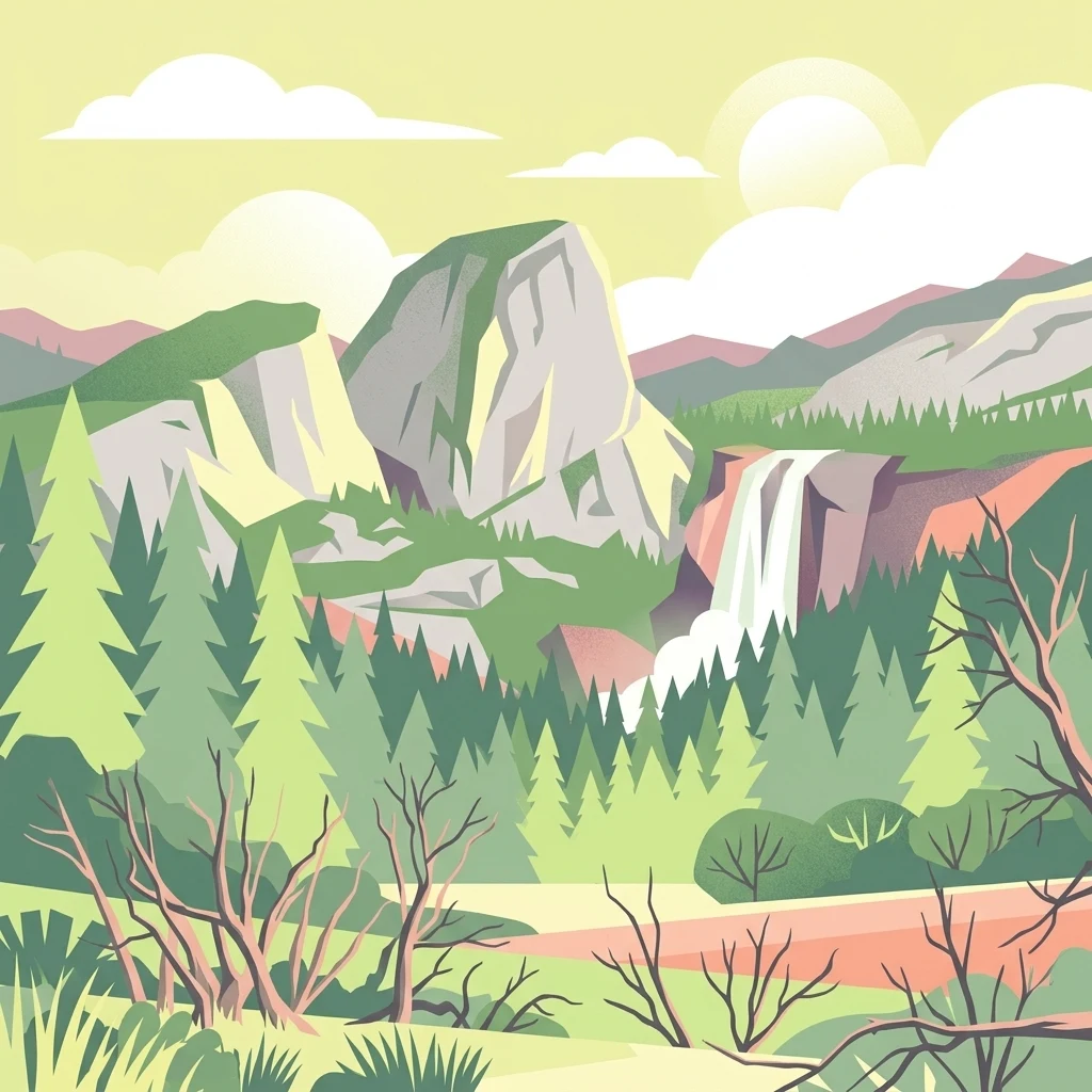
A flat-style digital illustration of a mountain landscape featuring a large granite dome, a cascading waterfall, and a pine forest under a soft sky.

Domeland Wilderness

Wildlife reserve

Park overview

Structured park overview, official facts, and landscape profile for Domeland Wilderness

Domeland Wilderness park facts, protected area profile, and essential visitor context

Review the core facts for Domeland Wilderness, including designation, size, terrain, visitor scale, habitats, and operating context in one park-focused overview.

About Domeland Wilderness

Domeland Wilderness is one of the more remote and least-visited designated wilderness areas in the southern Sierra Nevada. Located about 55 miles northeast of Bakersfield, it spans portions of Tulare and Kern counties and lies almost entirely within the Sequoia National Forest, with smaller tracts of Bureau of Land Management land completing the protected mosaic. The U.S. Forest Service and the Bureau of Land Management share management responsibility for the wilderness, which covers roughly 130,081 acres and ranges from about 2,800 feet up to 9,977 feet in elevation.

The defining geographic feature of the wilderness is the southern Kern Plateau, a high, broad upland shaped by ancient granite. Across this plateau, bedrock is exposed in dramatic cliffs, rounded domes, and isolated spires, with Church Dome standing out as one of the most remarkable rock formations. A broken granite ridge marks the western boundary, while a second ridge divides the northern edge of the wilderness. Between these rocky highlands lie large open meadows and forest stands that give the area a layered, varied character.

The Wild and Scenic South Fork Kern River flows through the center of the wilderness from north to south, providing both a scenic backbone and a focal point for the area's wildlife. Mixed conifer forests fill the slopes and benches, ranging from white fir and Jeffrey pine in the mid-elevations to limber pine and foxtail pine near the highest summits. This combination of river, meadows, forest, and bare-rock summits makes Domeland a textbook example of the high-country transition zone between the Mojave Desert influence to the east and the deeper Sierra Nevada to the north.

Despite its dramatic scenery, Domeland sees far less foot traffic than many other Sierra wildernesses. The combination of remote trailheads, summer heat, scarce water, and challenging river crossings keeps visitation modest, especially during the hotter months. The result is a wilderness with a distinctly unsettled, primitive atmosphere, where rock formations, river canyons, and forested ridges remain largely undisturbed.

Quick facts and research context for Domeland Wilderness

Domeland Wilderness straddles Tulare and Kern counties in California, with Porterville to the northwest and Ridgecrest to the southeast as the nearest cities. Most of the area lies within the Sequoia National Forest, and the wilderness is jointly administered by the U.S. Forest Service and the Bureau of Land Management. It is classified as an IUCN Category Ib wilderness area, roughly 130,081 acres in size, with elevations ranging from around 2,800 feet at lower canyons to nearly 9,977 feet on the highest plateau summits.

Protection and recognition

Documented terrestrial conservation scope and historical establishment timeline

Domeland Wilderness Protection Status and Official Designation Records

Domeland Wilderness maintains a terrestrial protection scope established through official designation records from 1994. Verified administrative facts outline the documented management framework without relying on external recognition sources.

Protection details

Protection scope
Terrestrial
Designated year
1994
Transboundary protection
No
Park context

Deeper park guide and search-rich context for Domeland Wilderness

Domeland Wilderness history, landscape, wildlife, and travel context

Explore Domeland Wilderness through its history, landscape character, ecosystems, wildlife, conservation priorities, cultural context, and seasonal travel timing in a structured park guide built for atlas discovery and search intent.

Why Domeland Wilderness stands out

Domeland Wilderness is best known for the granite domes, spires, and exposed bedrock that give the area its name, most notably Church Dome and other prominent rock formations clustered on the central Kern Plateau. It is also recognized for the Wild and Scenic South Fork Kern River bisecting the wilderness and for its large, high-country meadows that serve as important summer range for deer. The wilderness combines dramatic alpine rock scenery with mixed conifer forests of white fir, Jeffrey pine, limber pine, and foxtail pine, producing the kind of varied, lightly travelled terrain that defines the southern Sierra Nevada.
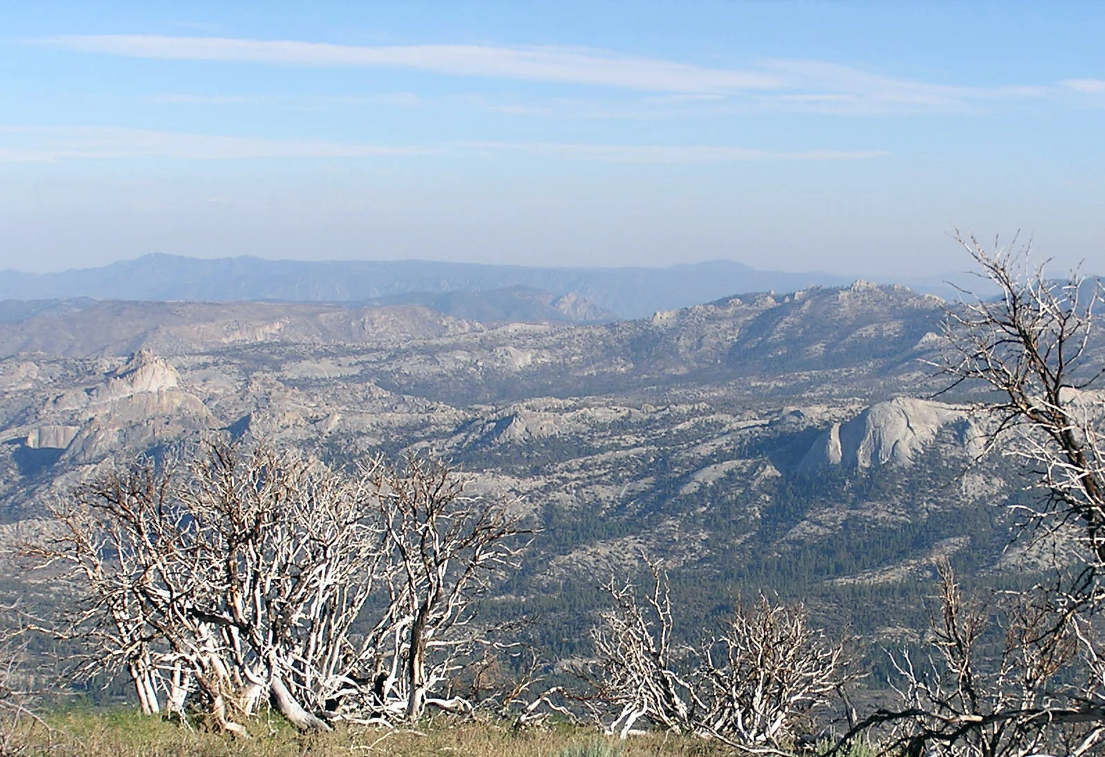
A high-angle, wide-angle view of mountainous, rocky terrain featuring multiple granite domes and sparse, dry, dead trees in the foreground, with distant hazy blue ridges.
A wide, hazy view of the granite domes and rugged terrain within the Domeland Wilderness.

Domeland Wilderness history and protected-area timeline

Domeland Wilderness was designated as part of the original federal Wilderness Act of 1964, placing it among the earliest wilderness protections established under that landmark legislation. In 1994, the California Desert Protection Act added roughly 36,000 acres of Bureau of Land Management land to the wilderness, expanding its footprint and bringing additional terrain under a single protective designation.

The area has a notable history of wildfire activity. In July 2000, the Manter Fire burned more than 74,000 acres across the wilderness, dramatically reshaping large sections of forest and meadow. More recently, the Trout and Long Fires of 2024 also affected parts of the wilderness, continuing a long pattern of large blazes moving through the southern Sierra's dry forests and brush zones.

Domeland Wilderness landscape and geographic character

The landscape of Domeland Wilderness is dominated by the southern end of the Kern Plateau, a high expanse of ancient granite that has been sculpted into a series of domes, spires, and exposed cliffs. These rock features are concentrated near the center of the wilderness and are the source of the area's name. Church Dome is the most iconic of these formations, rising as a signature landmark above the surrounding plateau.

Elevations span roughly 2,800 feet in the lower canyons to almost 9,977 feet on the highest summits, producing sharp transitions from arid, desert-influenced lowlands to true alpine-style terrain. A broken granite ridge defines the western edge of the wilderness, while another ridge runs along the northern boundary, framing the plateau between two natural walls. Large meadows spread across flatter sections of the plateau, opening up the dense forest and offering wide, sweeping views.

Domeland Wilderness ecosystems, habitats, and plant life

Ecologically, Domeland Wilderness captures a wide gradient of southern Sierra habitats within a relatively compact area. Mixed conifer forests cover much of the slope and plateau country, with white fir and Jeffrey pine common through mid-elevations and limber pine and foxtail pine appearing in the harshest, highest sites.

The wilderness's meadows and river corridor add a second major habitat layer. The South Fork Kern River and its tributaries create riparian zones supporting willows, sedges, and other wet-meadow vegetation, while the broad upland meadows provide open grassland habitat. Together, these forest, meadow, and riparian systems host deer, predators, trout-bearing streams, and dense populations of reptiles, making the wilderness a finely textured mosaic of southern Sierra ecosystems.

Domeland Wilderness wildlife and species highlights

Domeland Wilderness supports a meaningful population of large mammals, anchored by the Kern River deer herd and the Monarche herd, both of which use the wilderness's expansive meadows as critical summer range. Mountain lions, bobcats, and American black bears are also present, taking advantage of the mix of forest cover and open ground.

Reptiles are a notable feature of the area; a large population of rattlesnakes inhabits the wilderness, particularly along the South Fork Kern River, where warm rocks and riverbanks provide favored habitat. The rivers and creeks also host strong fisheries, with brown trout and rainbow trout common in the main river corridor and golden trout present in the upper reaches of tributary creeks such as Fish Creek, Manter Creek, Taylor Creek, and Trout Creek.

Domeland Wilderness conservation status and protection priorities

Domeland Wilderness plays an important conservation role in protecting the southern Kern Plateau, one of the key high-country transitions in the southern Sierra Nevada. By shielding over 130,000 acres from road-building, logging, and most forms of development, the wilderness preserves a connected block of conifer forest, granite uplands, and meadow systems that function together as a single ecological unit.

The Wild and Scenic designation of the South Fork Kern River reinforces the wilderness's conservation value by safeguarding the river corridor that anchors the area's hydrology and wildlife movement. Although the wilderness has been repeatedly shaped by large wildfires, including the Manter Fire in 2000 and the Trout and Long Fires in 2024, fire is recognized as part of the natural ecological process of this dry, southern Sierra landscape, and long-term protection under the Wilderness Act allows these cycles to continue with minimal human interference.

Top sights and standout views in Domeland Wilderness

Among Domeland Wilderness's standout features are the granite domes, cliffs, and spires that give the area its name, with Church Dome serving as the most recognizable single landmark. The Wild and Scenic South Fork Kern River bisects the entire wilderness from north to south, creating a defining spine of river, riparian habitat, and trout fishing opportunity.

Equally important are the large upland meadows that serve as summer range for the Kern River deer herd and the Monarche herd, and the mixed conifer forests that climb from white fir and Jeffrey pine at mid-elevations up to limber pine and foxtail pine near the highest summits. Together, these elements combine to create a remote, lightly visited high-country wilderness in the southern Sierra Nevada.

Best time to visit Domeland Wilderness

Domeland Wilderness is generally best experienced outside of the peak summer months, when extreme heat and scarce water make conditions difficult and visitation drops sharply. Autumn, winter, and spring tend to offer more comfortable temperatures and better opportunities for activities like day hiking, backpacking, fishing, rock climbing, cross-country skiing, and snowshoeing.

Winter transforms the area into a quiet, snow-covered landscape suitable for ski touring and snowshoeing, while spring and fall provide milder conditions for tackling the rougher interior routes, such as the Domeland Trail, and for accessing higher elevations that may require fords across the South Fork Kern River during warmer months.

Monthly climate preview

Track representative monthly temperature ranges and precipitation rhythm across the park coordinate

Domeland Wilderness Climate Normals and Long-Term Temperature Patterns

Long-term records reveal measured shifts in average monthly temperatures alongside recorded daily precipitation rates across the representative sample coordinate. Reviewing the complete twelve-month sequence details broader annual climate rhythms and multi-year meteorological baselines.
Annual mean10 °C
1 °C22 °C
Jan
Feb
Mar
Apr
May12°
Jun18°
Jul22°
Aug21°
Sep18°
Oct11°
Nov
Dec
Warmest month
July

22.2 °C

Coolest month
December

1.3 °C

Wettest month
January

2.1 mm/day

Driest month
June

0.2 mm/day

Park location guide

Geography guide, regional context, and park location map for Domeland Wilderness

Domeland Wilderness park geography, regions, and map view in United States of America

Understand where Domeland Wilderness sits in United States of America through a broader geographic reading of the surrounding landscape, nearby location context, and its mapped position within the national park landscape.

How Domeland Wilderness fits into United States of America

The United States of America is a federal presidential republic and one of the world's largest countries by area and population. It consists of 50 states across a vast territory spanning multiple time zones, with its capital in Washington, D.C. and largest city in New York City. The nation has a diverse economy, influential political system, and significant cultural and military presence globally.

Wider geography shaping Domeland Wilderness in United States of America

The United States occupies a vast territory in North America, bordered by Canada to the north and Mexico to the south. The 48 contiguous states stretch from the Atlantic to the Pacific Ocean, while Alaska occupies the northwestern region and Hawaii is an archipelago in the Pacific. The country encompasses diverse terrain including the Rocky Mountains, Appalachian Mountains, Great Plains, and extensive river systems.

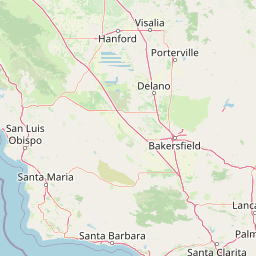
Map view of Domeland Wilderness

Use this park location map to pinpoint Domeland Wilderness in United States of America, understand its exact geographic position, and read its mapped placement within the surrounding landscape more clearly.

Pigeon | © OpenStreetMap contributors

Location context for Domeland Wilderness

California
Recorded earthquake history

Examine the Recorded Earthquake History for Domeland Wilderness

Use this structured MoriAtlas catalogue to review historical seismic activity recorded near the Domeland Wilderness. Filter through past event magnitudes and epicentre distances to build a clear understanding of the region's recorded seismic history.

Domeland Wilderness Earthquake History

Catalogued events

2,067 events

Strongest magnitude

Magnitude 7.1

Most recent event

Aug 23, 2026

This history includes earthquakes recorded inside the park or within 50 km of its borders

Visual reference for the granite domes, high plateaus, and river corridors of the southern Sierra Nevada.

Domeland Wilderness Photos, Scenery, and Protected Landscape Views

Visual documentation reveals the rugged granite domes, exposed bedrock, and expansive high-country meadows defining Domeland Wilderness. Examining these protected landscapes provides clear insight into the alpine terrain, conifer forests, and river corridors shaping the regional ecosystem.

A high-angle, wide-angle view of mountainous, rocky terrain featuring multiple granite domes and sparse, dry, dead trees in the foreground, with distant hazy blue ridges.

A Parry's beargrass plant with tall, cylindrical yellow flower stalks rising from a base of pointed, green leaves in a sandy desert landscape.

Park atlas

Compare adjacent Sierra Nevada landscapes and regional park geography

Other Parks Near Domeland Wilderness and Surrounding Protected Areas

Browsing parks near Domeland Wilderness reveals connected granite terrain and high plateau environments across the southern Sierra Nevada. Expanding the geographic scope allows travelers to evaluate related protected landscapes and regional wilderness reserves.
Watercolor painting of a panoramic mountain landscape with stylized pine trees and soft green meadows.
Protected landscapeCalifornia
Park boundaries overlap#1 closest

Northwest

Sequoia National Forest: Protected Sierra Nevada Geography and Mountain Terrain

A vast protected landscape spanning 1.1 million acres in California

Spanning Tulare, Kern, and Fresno counties, Sequoia National Forest preserves iconic giant sequoia groves across multiple river watersheds. The terrain features vertical relief exceeding 11,000 feet, showcasing a range of ecosystems from chaparral slopes and coniferous forests to glacial cirques and granite spires located within the southern Sierra Nevada range.

Area
4,829.17 km²
Established
1908
Relief
Mountain
Climate
Mediterranean
Wildlife reserveKern County
0.7 km away#2 closest

South

Kiavah Wilderness: Geographic Overview of the Scodie Mountains Plateau

Protected desert wilderness in Kern County, California

Kiavah Wilderness provides a vital protected landscape in Kern County, defined by the Scodie Mountains and a dramatic escarpment above the Mojave Desert floor. Known for its rare pinyon-juniper woodlands and seasonal springs, this wilderness area preserves the complex geography linking the southern Sierra Nevada to the broader Mojave basin.

Area
357.3 km²
Established
1994
IUCN
Ib
Relief
Mountain
A horizontal watercolor painting depicting a mountain range in the background with rolling hills and a winding river or stream in the foreground.
Protected landscapeCalifornia
1.6 km away#3 closest

North

Inyo National Forest: An Atlas of Protected Landscapes and Sierra Nevada Geography

High altitude wilderness and volcanic terrain in Eastern California

Spanning from the arid Owens Valley floor to the 14,000 foot crest of the Sierra Nevada, Inyo National Forest remains a cornerstone of the American West. This protected landscape contains the Ancient Bristlecone Pine Forest, Mount Whitney, and the Mono Inyo volcanic chain, providing a dense geographic record of glacial, tectonic, and ecological diversity across a vast managed corridor.

Area
7,702.71 km²
Established
1907
IUCN
Ib
Relief
Mountain
Watercolor painting of a mountain landscape with trees in the midground and a simple river or valley floor in the foreground, executed in a soft, light-toned palette.
Protected areaUnited States of America
About 20 km away#4 closest

Northeast

Inyo Mountains Wilderness: Protected Landscapes and Geographic Features in California

A study of fault block terrain and desert mountain ecosystems.

The Inyo Mountains Wilderness serves as a dramatic ecological bridge between the Owens Valley and Saline Valley. This expansive protected area offers a look into late Proterozoic to Cambrian geology and distinct vertical plant zonation. Mapping the range reveals a network of canyons, ridges, and slopes that sustain endemic biodiversity and ancient bristlecone pine stands within the Great Basin periphery.

Area
806.17 km²
Relief
Mountain
Climate
Arid
Access
Remote access
A watercolor illustration showing a soft-focused desert landscape with gentle rolling hills, sparse desert vegetation, and muted earthy tones.
Wildlife reserveKern County
29 km away#5 closest

Southeast

El Paso Mountains Wilderness: Geological Atlas and Protected Landscape Overview

Mojave Desert geography within Kern County, California

Explore the volcanic structure of El Paso Mountains Wilderness, a desert landscape dominated by Black Mountain, red buttes, and narrow canyons. This atlas entry details the protected boundary and geological features of this Mojave Desert wildlife reserve, highlighting the intersection of volcanic badlands and ancient archaeological sites.

Area
96.2 km²
Established
1994
IUCN
Ib
Relief
Mountain
National parkCalifornia
36 km away#6 closest

Northwest

Sequoia National Park National Park: Geographic Identity and Protected Landscape Atlas

Explore mapped boundaries and the terrain of this California protected area.

Gain a structured understanding of Sequoia National Park as a protected landscape, focusing on its mapped geographic boundaries and its context within California. This entry provides foundational data for exploring the park's natural terrain and its role in a broader atlas of conservation lands, ideal for users seeking detailed geographic information.

Area
1,635.19 km²
Established
1890
IUCN
II
Visitors
1.2M annual
A watercolor painting showing a panoramic view of mountain ranges, a treeline, and a calm body of water in the foreground.
Wildlife reserveCalifornia
48 km away#7 closest

Northwest

John Muir Wilderness: Sierra Nevada Protected Landscape and High Mountain Geography

California wilderness area with glacial basins and granite peaks

John Muir Wilderness represents one of the largest protected high-elevation areas in the contiguous United States. Spanning the Sierra Nevada crest, its granite terrain is sculpted by Pleistocene glaciation into sharp arêtes, deep canyons, and hundreds of alpine lakes. This wilderness serves as a vital geographic anchor for mountain ecosystems, offering an extensive look at the high-country landscape of eastern California.

Area
2,641.76 km²
Established
1964
IUCN
Ib
Relief
Mountain
National parkCalifornia
59 km away#8 closest

Northeast

Death Valley National Park: Exploring California's Mapped Protected Landscape

View the geographic boundaries and desert terrain.

Access a detailed atlas perspective of Death Valley National Park, a protected national park situated in California. Understand the park's distinct mapped boundaries and its role within the regional geography. This resource highlights the unique desert landscape, offering focused insights into its protected-area identity and natural terrain for geographic discovery.

Area
13,848.4 km²
Established
1994
IUCN
II
Visitors
1.1M annual

Common questions about visiting, size, designation, and location context for Domeland Wilderness

Domeland Wilderness FAQs for park facts, access, geography, and protected area context

Find quick answers about Domeland Wilderness, including protected-area facts, park geography, trail and visitor context, and how the park fits into its surrounding country and regional landscape.
MoriAtlas Explorer

Continue Your Protected Areas Search Across the Global Atlas

Deepen your exploration by continuing the structured search for national parks and protected areas worldwide. Utilize the comprehensive filtering capabilities to compare different conservation landscapes and refine your understanding of global park geography. Discover more about the distribution and characteristics of protected natural areas.

Global natural geography