
Mori Atlas logo
Nature reserveDrachenfels

Mapping the geological terrain, protected forest boundaries, and summit topography of this German peak

Drachenfels Nature Reserve and Sandstone Mountain Landscapes in the Middle Palatinate Forest

(Drachenfels (Naturschutzgebiet im Mittleren Pfälzerwald))

Drachenfels stands as a prominent sandstone summit within the Middle Palatinate Forest of Rheinland-Pfalz, rising to 571 meters above the surrounding valleys. This nature reserve protects a vital ecological footprint defined by weathered rock chambers, deep cliff-side ravines, and extensive deciduous forest cover. The massif represents a core geographic feature of the region, offering a clear connection between its distinct Bunter sandstone geology and long-standing cultural history.

sandstone summitPalatinate Forestnature reservepanorama viewpointNibelungen legendRoman fortification site
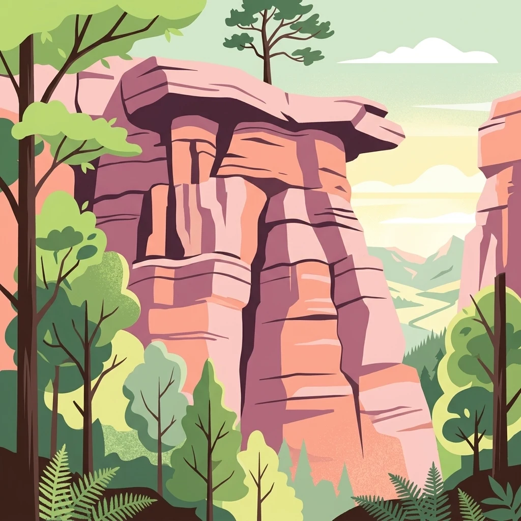
An illustration showing a prominent, layered pink sandstone cliff face surrounded by green forest canopy, ferns, and a distant valley, rendered in a flat, graphic art style.

Drachenfels

Nature reserve

Park overview

Structured park overview, official facts, and landscape profile for Drachenfels

Drachenfels park facts, protected area profile, and essential visitor context

Review the core facts for Drachenfels, including designation, size, terrain, visitor scale, habitats, and operating context in one park-focused overview.

About Drachenfels

Drachenfels is a sandstone mountain in the heart of the Middle Palatinate Forest, set on the forest land of the district town of Bad Dürkheim in Rhineland-Palatinate, Germany. Reaching 570.8 meters above sea level at its northeastern edge of the plateau, it is the highest peak in the Palatinate Forest north of the line traced by the Hochspeyerbach and Speyerbach streams, making it a natural landmark above the vine-clad edge of the Upper Rhine Plain.

The mountain belongs to the layered cuesta landscape of the Pfälzisch-Saarländisches Muschelkalkgebiet, where Lower and Middle Bunter sandstone forms long, blocky ridges and weather-resistant cliffs. The summit plateau covers about 13 hectares and falls gradually toward its edges to roughly 540 meters. The northeastern West Rock is the main lookout, with views over the Donnersberg to the north, the Hunsrück ridges to the northwest, and the city of Kaiserslautern to the west, while to the east the rock face plunges toward the Isenach valley.

The protected status of the mountain is central to its identity. Since 1972, a 12.53-hectare area covering the summit and part of the southwestern slope has been a designated nature reserve (Naturschutzgebiet 7332-003). The protection covers old sandstone outcrops, rock cavities, and species-rich deciduous forest that has been allowed to develop with minimal interference. Because of this status, the mountain is only accessible on foot; riding, mountain biking, and other wheeled traffic are not permitted.

Culturally, Drachenfels is a literary landscape as much as a physical one. The mountain takes its name from the dragon of the Nibelungen saga, and the nearby Siegfriedsbrunnen spring echoes the same mythology. Two rock hollows beneath the prominent south cliff, the small Dragon Chamber and the larger Dragon Cave, reinforce this story in the rock itself. Layered on top of this older legend is a more recent historical footprint: the remains of a late Roman double-ring fortification from the third century still trace the southwestern edge of the plateau, evidence that this commanding viewpoint was strategically valued long before it became a hiking destination.

Quick facts and research context for Drachenfels

Drachenfels is a 570.8 meter summit in the Middle Palatinate Forest, on the wooded district land of Bad Dürkheim in Rhineland-Palatinate. It is the highest point of the Palatinate Forest north of the Hochspeyerbach–Speyerbach line and is composed of Lower and Middle Bunter sandstone dating from roughly 251 to 243 million years ago.

A 12.53-hectare area covering the summit plateau and part of the southwest flank has been a designated nature reserve since 1972. The mountain carries remains of a late Roman fortification from the third century and is associated with motifs from the Nibelungen saga, including the Siegfriedsbrunnen spring. Access is exclusively on foot; the mountain is maintained by the Drachenfels-Club, founded in 1873.

Protection and recognition

Terrestrial protected area designation established in 1972

Drachenfels Protection Status and Documented Conservation History

Drachenfels maintains a documented terrestrial protection status established in 1972 without transboundary status or imported international recognition sources. Official designation records outline the management scope and historical framework governing this protected area.

Protection details

Protection scope
Terrestrial
Designated year
1972
Transboundary protection
No
Park context

Deeper park guide and search-rich context for Drachenfels

Drachenfels history, landscape, wildlife, and travel context

Explore Drachenfels through its history, landscape character, ecosystems, wildlife, conservation priorities, cultural context, and seasonal travel timing in a structured park guide built for atlas discovery and search intent.

Why Drachenfels stands out

Drachenfels is best known as a striking red sandstone summit that rises above the Upper Rhine edge of the Palatinate Forest and offers a clear panorama toward the Donnersberg, the Hunsrück, and Kaiserslautern from its West Rock viewpoint. The mountain is also known for its link to the Nibelungen saga, with rock hollows called the Dragon Chamber and Dragon Cave near the southern cliffs and a spring named after Siegfried. Its sandstone geology defines the character of the place: weathered cliffs, narrow ravines, and rock chambers cut into a roughly 13-hectar summit plateau that has been protected as a nature reserve since 1972. The combination of open views, dark sandstone walls, and old forest gives the mountain a distinctive, almost legendary atmosphere that matches its name.
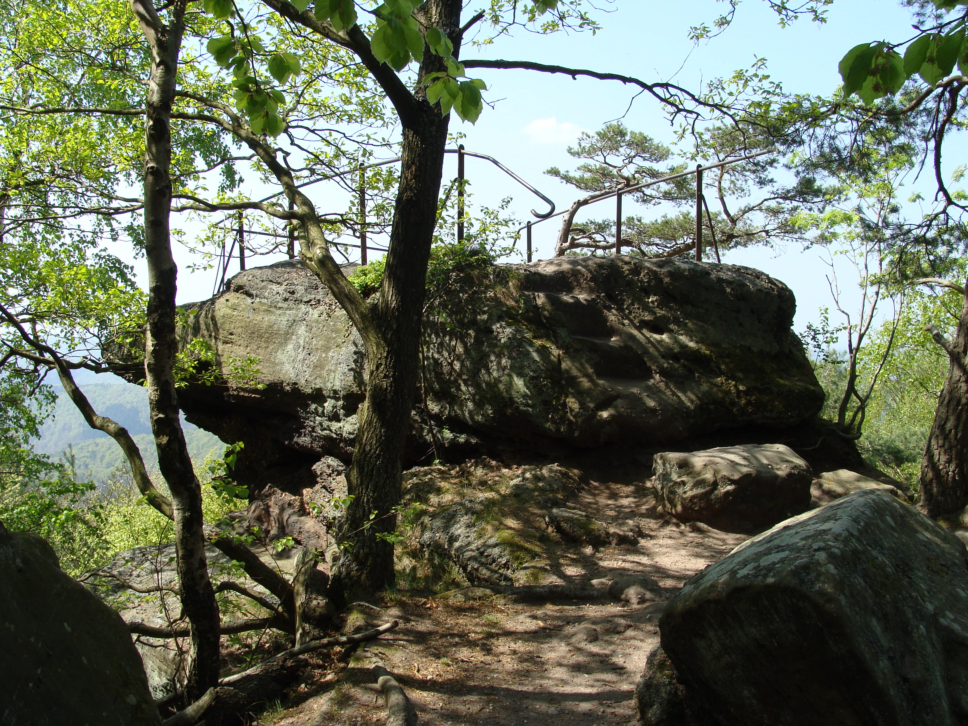
A large, weathered sandstone rock formation topped with a safety railing, surrounded by deciduous trees, serving as a viewpoint in the Palatinate Forest.
The sandstone rock formation at the western lookout point of Drachenfels in the Palatinate Forest.

Drachenfels history and protected-area timeline

Drachenfels carries two distinct layers of human history. The oldest visible traces belong to a late Roman military presence in the third century, when a defensive fortification was constructed on the southwestern corner of the summit plateau. The installation was a double ringwall (Doppelwall), built to exploit the natural defensibility of the sandstone cliffs. Today it is only faintly visible beneath the forest cover, but the fortified plateau itself is still the surviving structural element of the site. A second, possibly older wall on the same flank suggests that the location drew defensive interest over a longer period.

The mountain's modern history begins in the nineteenth century. In the 1840s, the forester Karl Kummerer of the Forsthaus Jägerthal and his colleague Karl Nahm from the neighboring district tapped a spring at the foot of the ascent and created the Kummererbrunnen, dedicating it with the initials KK and KN. Around the same time, a spring on the south slope of the mountain, originally named after a Count of Leiningen, was renamed Siegfriedsbrunnen by the Drachenfels-Club.

A new chapter for the mountain opened in 1873 with the founding of the Drachenfels-Club. The association, dedicated to preserving the cultural monuments around Bad Dürkheim, opened up the Drachenfels plateau in the very year of its foundation, marking the start of organized hiking access to the summit. Throughout the late nineteenth and twentieth centuries, the club maintained the trails and scenic features of the area, including the rock chambers and lookout points.

In 1972 the summit area and part of the western slope were placed under nature protection (Naturschutzgebiet 7332-003), formalizing the ecological importance of the sandstone cliffs, caves, and old-growth forest. With this designation, the mountain took its present form as a protected natural area maintained for both conservation and quiet low-impact hiking, with stricter rules on access reflecting its status.

Drachenfels landscape and geographic character

Drachenfels is a classic blocky sandstone summit of the Palatinate Forest, characterized by weathered cliffs, rock chambers, and a broad, gently sloping plateau above deeply incised valleys. The summit plateau covers about 13 hectares and crests to about 571 meters in the northeast before dipping to roughly 540 meters along its edges. The West Rock at the northeast, the dominant lookout, drops sharply to the north, while the south cliff juts out conspicuously toward the Isenach valley and is one of the most visually striking features of the mountain.

The geology belongs to the Lower and Middle Bunter sandstone sequence, deposited roughly 251 to 243 million years ago. These reddish sandstones have been shaped over millions of years into the smooth, blocky outcrops typical of the Palatinate cuesta landscape. The mountain is part of the broader Pfälzisch-Saarländisches Schichtstufenland, structurally linked to the great rift escarpment of the Upper Rhine Plain, and is framed by the Großer Pfaffenkopf to the west and the Hohekopf to the southwest.

The hydrography adds to the mountain's character. The Glashüttentalbach, fed by the Siegfriedsbrunnen, runs along the western base; the longer Dreibrunnentalbach wraps around the eastern side before joining the Isenach near the Forsthaus Saupferch and Jägerthal. These two valleys give Drachenfels an isolated, stand-alone silhouette when seen from the Rhine Plain, with the eye drawn to the bare sandstone cliffs at the summit that contrast with the dark forest below.
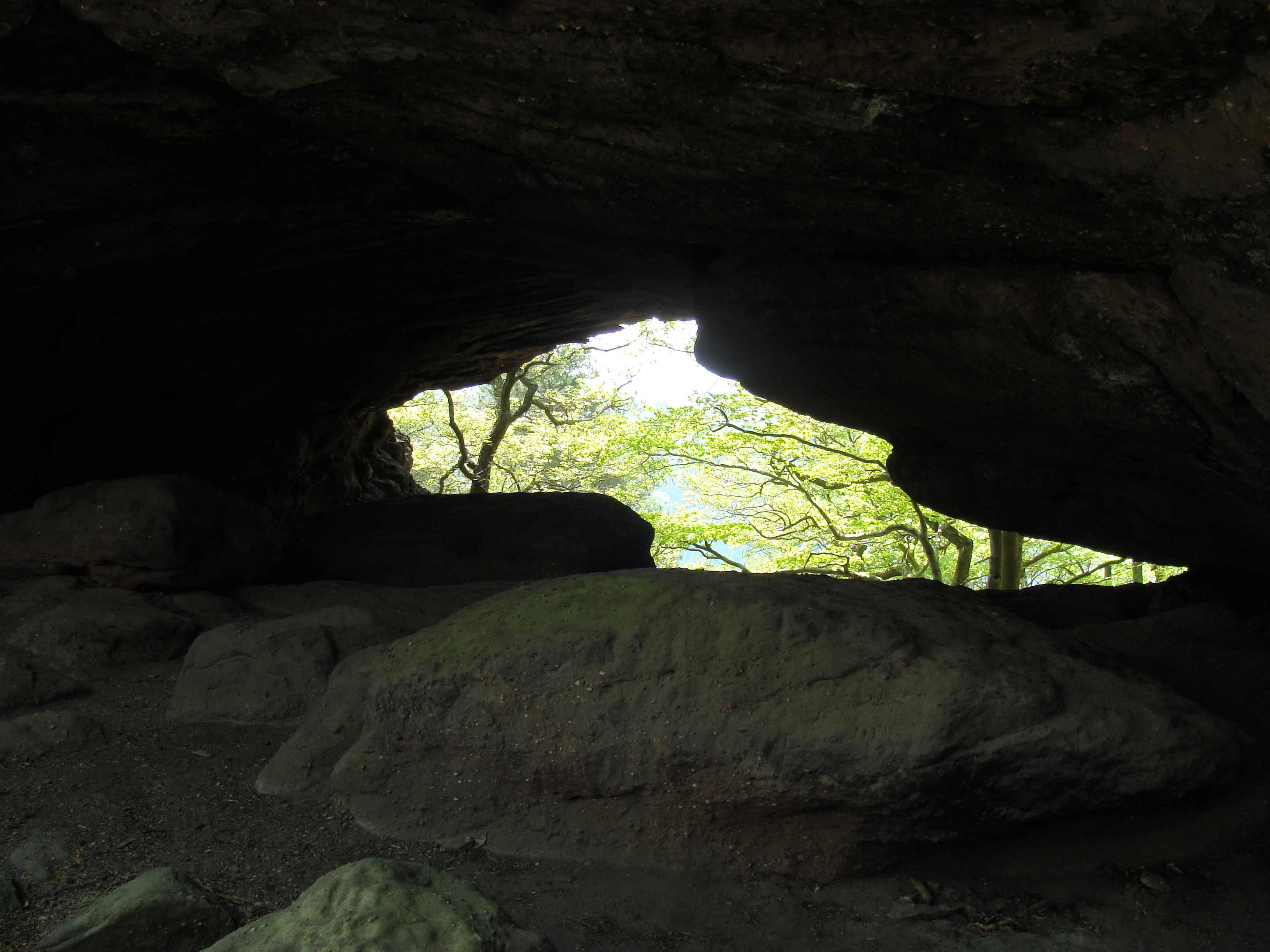
A view from inside a dark, shadowed sandstone rock chamber, looking out through an opening to a bright forest of green trees.
The Durchblickkammer, a natural viewing chamber carved into the sandstone cliffs at Drachenfels.

Drachenfels ecosystems, habitats, and plant life

The protected ecology of Drachenfels centers on the sandstone summit plateau and an adjoining section of the southwestern slope. Since 1972, this 12.53-hectare area has been formally protected as a nature reserve. Its status guards a specific combination of open sandstone outcrops, rock crevices and small caves, and older mixed deciduous forest that has been left largely to its own dynamics.

The sandstone itself shapes the ecology. Weathered outcrops and shallow soils support specialized dry-site plant communities, while shaded crevices and the deeper Dragon Cave provide cooler microhabitats. The transition from open rock to closed forest is unusually compressed here, creating habitat diversity within a small surface area. Deciduous woodland dominated by beech and oak, typical of the Middle Palatinate Forest, surrounds the reservation, linking it to the larger forested mosaic of the region.

The tight combination of cliff, cave, and forest has historically supported raptors that nest on isolated rock ledges. Until 1920, a pair of short-toed snake eagles (Schlangenadler) is recorded as having bred in the cliff face, evidence of the cliffs' value for cliff-nesting birds. Today the area continues to host forest and rock-associated species typical of the Palatinate sandstone highlands, though specific inventories remain limited.
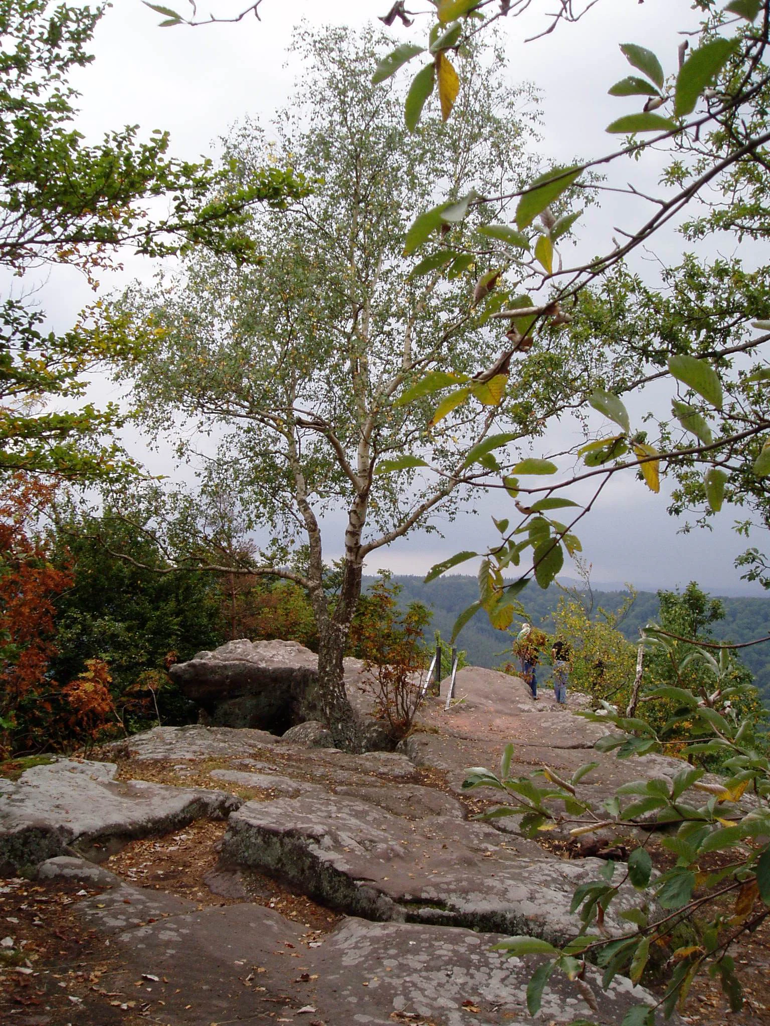
A dirt hiking trail winding across a flat sandstone rock formation with a slender birch tree in the center and hikers walking in the distance.
A hiking path leading across the exposed sandstone plateau of Drachenfels in the Palatinate Forest.

Drachenfels wildlife and species highlights

The wildlife significance of Drachenfels is closely tied to its sandstone cliffs, small rock chambers, and old deciduous forest. Records show that the south cliff historically hosted breeding short-toed snake eagles; the pair nested on the rock face until 1920, after which the site apparently ceased to be used for breeding. This historical record makes the mountain one of the documented breeding sites for this raptor in the Middle Palatinate Forest.

Beyond this specific historical record, the protected zone functions as refuge habitat for forest and rock-associated species typical of the Palatinate sandstone highlands. The cliffs provide ledges and cavities used by birds and small mammals, while the surrounding older beech-oak forest offers habitat for typical woodland fauna of the Middle Palatinate Forest. The small area of the reserve, combined with strict access rules, helps maintain a low-disturbance habitat for sensitive species.
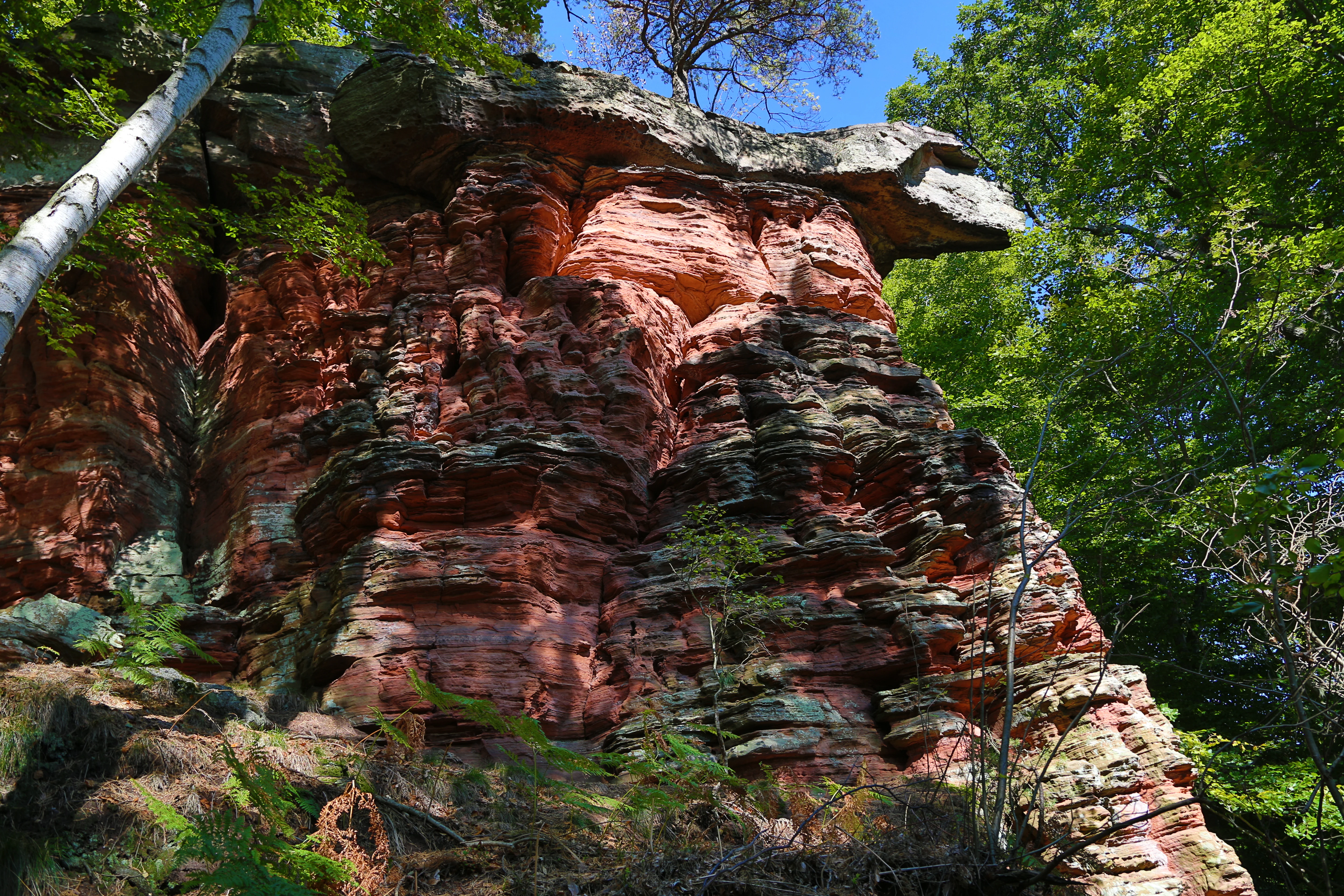
A close view of a tall, weathered red sandstone cliff face surrounded by dense green forest foliage under a clear blue sky.
The distinctive red sandstone rock formation at Drachenfels in the Palatinate Forest.

Drachenfels conservation status and protection priorities

Drachenfels has carried formal nature protection since 1972, when the summit plateau and part of the southwestern flank were designated as Naturschutzgebiet 7332-003 with a total area of roughly 12.53 hectares. The reserve is part of the wider network of protected sandstone habitats in the Bad Dürkheim district and contributes to the conservation of the Palatinate Forest's cuesta landscape.

The site's conservation value lies in the rarity of undisturbed sandstone cliff-and-forest mosaics of this quality. Bunter sandstone outcrops, the Dragon Chamber and Dragon Cave rock hollows, and adjacent older deciduous forest are preserved together within the reserve boundaries. The cliffs host specialized plants of dry sandstone communities, while the caves and rock crevices provide microhabitats for invertebrates and roosting or nesting vertebrates.

The protected status also governs public access. Because the area lies entirely within the reserve, no cycling, horseback riding, or motorized traffic is permitted; visitors reach the summit only on foot. This low-impact regime, combined with the continuing maintenance of trails and rock features by the Drachenfels-Club, keeps disturbance well below the level seen on many comparable Palatinate summits.

Drachenfels cultural meaning and human context

Drachenfels is anchored in two distinct strands of cultural memory. The older one is rooted in the Nibelungen saga, the medieval Germanic epic whose dragon-slaying hero Siegfried is one of the central figures. The mountain's name, the nearby Siegfriedsbrunnen spring, and the rock hollows called the Dragon Chamber and Dragon Cave all carry elements of this legend into the landscape itself. Even before the saga was written down, local folk tradition linked the menacing sandstone cliffs to dragons, and the place-name reflects that older oral memory as much as the literary Nibelungen tradition.

The second strand is more recent and tied directly to the cultural identity of Bad Dürkheim. Founded in 1873, the Drachenfels-Club has spent more than a century maintaining the mountain's paths, springs, and lookout points, including today-listed cultural monuments such as the Kummererbrunnen and Siegfriedsbrunnen. The club's work links the natural site to a wider circle of regional monuments around Bad Dürkheim, including Forsthaus Jägerthal, Schloss Kehrdichannichts, the Lambertskreuz, and the Forsthaus Saupferch, all of which lie within walking distance of the summit.
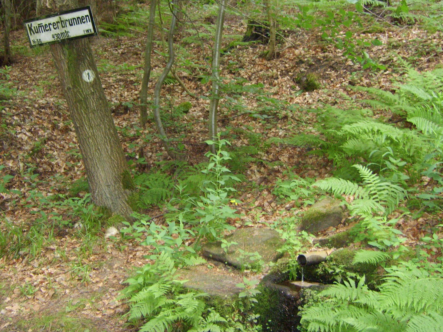
A small forest spring named Kummererbrunnen, with a wooden sign attached to a tree trunk and water flowing from a pipe into a small basin.
The Kummererbrunnen spring, marked by a trail sign at an elevation of 430 meters in the Palatinate Forest.

Top sights and standout views in Drachenfels

Drachenfels stands out for the unusual density of cultural and natural features packed into a small sandstone summit. The visible fragment of a late Roman double-ring fort, the dragon-themed rock chambers, and the Nibelungen-linked Siegfriedsbrunnen spring are layered on top of a protected sandstone cliff-and-forest ecosystem, all within a 12.5-hectar nature reserve.

Key highlights include the West Rock lookout with its long view over the Donnersberg, Hunsrück, and Kaiserslautern; the Dragon Chamber and Dragon Cave beneath the south cliff; the historically significant Kummererbrunnen and Siegfriedsbrunnen springs at the base of the ascent; and the surrounding Palatinate Forest hiking routes, including the long-distance Staudernheim–Soultz-sous-Forêts trail and segments marked with the regional yellow-bar symbology. The combination of protected nature reserve, regional cultural monument status, and a 150-year tradition of organized hiking sets the mountain apart from many other summits in the range.
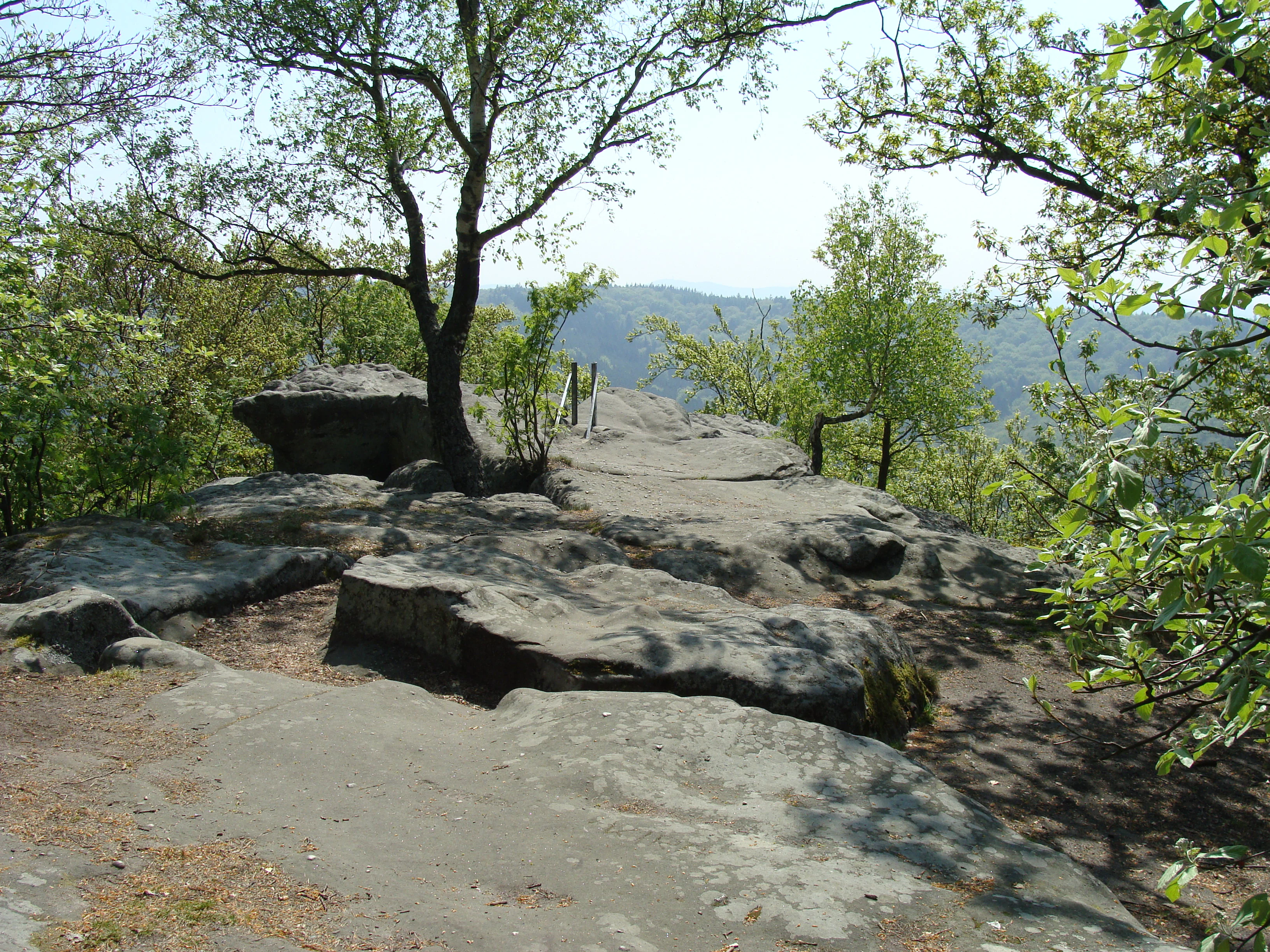
A sandstone plateau formation with trees on the edge, overlooking a forested valley in the distance.
The southern rock plateau at Drachenfels in the Palatinate Forest.

Best time to visit Drachenfels

The mountain has a strongly seasonal character. Spring brings fresh green foliage to the surrounding beech and oak forest and active birdlife on the cliffs and around the springs at the base of the ascent. Summer offers the clearest long-distance views from the West Rock, when the Rhine Plain and the high points of the Hunsrück and Donnersberg are most visible and the forest is fully shaded.

In autumn the sandstone cliffs warm in low sun and the surrounding woodland turns color, enhancing the contrast between bare red rock and forest; this is widely considered one of the most atmospheric times on the mountain, though views to the Rhine Plain can become hazier. Winter, after the first cold spells, often shows the West Rock dusted with snow, which makes the sandstone architecture of the summit particularly prominent from below. The narrow, steep paths can be slick in winter and rocky after heavy rain, so drier shoulder seasons tend to make the ascent easier.


Monthly climate preview

Track representative temperature ranges and precipitation patterns across the year

Drachenfels Climate Normals and Long-Term Monthly Weather Profiles

Long-term data records for Drachenfels trace a measured annual cycle from sub-zero winter lows to warm summer maximums alongside steady daily precipitation rates. Reviewing the complete twelve-month climate profile provides granular monthly averages for detailed environmental analysis.
Annual mean10 °C
0 °C20 °C
Jan
Feb
Mar
Apr
May14°
Jun18°
Jul20°
Aug20°
Sep15°
Oct10°
Nov
Dec
Warmest month
July

20.4 °C

Coolest month
January

0.3 °C

Wettest month
July

2.2 mm/day

Driest month
April

1.4 mm/day

Park location guide

Geography guide, regional context, and park location map for Drachenfels

Drachenfels park geography, regions, and map view in Germany

Understand where Drachenfels sits in Germany through a broader geographic reading of the surrounding landscape, nearby location context, and its mapped position within the national park landscape.

How Drachenfels fits into Germany

Germany is a federal republic in Western and Central Europe with a population of over 83 million across sixteen constituent states. It is Europe's largest economy by nominal GDP and a major global exporter and importer. The capital is Berlin, and the country borders Denmark, Poland, Czech Republic, Austria, Switzerland, France, Luxembourg, Belgium, and the Netherlands.

Wider geography shaping Drachenfels in Germany

Germany is located in Western and Central Europe, spanning 357,022 km². It borders Denmark to the north, Poland and the Czech Republic to the east, Austria and Switzerland to the south, and France, Luxembourg, Belgium, and the Netherlands to the west. The country has coastlines on the Baltic Sea and North Sea to the north, with the Alps located in the southern region.

Map view of Drachenfels

Use this park location map to pinpoint Drachenfels in Germany, understand its exact geographic position, and read its mapped placement within the surrounding landscape more clearly.

Pigeon | © OpenStreetMap contributors

Location context for Drachenfels

Rheinland-Pfalz

Explore protected sandstone cliffs, forest habitats, and terrain views across the mountain.

Drachenfels Photos and Landscape Scenery: Visualizing the Palatinate Forest Summit

Visual records capture the distinctive red sandstone cliffs, weathered rock chambers, and dense deciduous canopy defining the Drachenfels summit. Examining these protected area photographs reveals the rugged topography, isolated forest valleys, and geological character of the region.

A large, weathered sandstone rock formation topped with a safety railing, surrounded by deciduous trees, serving as a viewpoint in the Palatinate Forest.

A tall sandstone rock formation rises behind lush green deciduous trees in a forest, with a sunlit path and fallen logs in the foreground.

A view from inside a dark, shadowed sandstone rock chamber, looking out through an opening to a bright forest of green trees.

A dirt hiking trail winding across a flat sandstone rock formation with a slender birch tree in the center and hikers walking in the distance.

A close view of a tall, weathered red sandstone cliff face surrounded by dense green forest foliage under a clear blue sky.

A winter scene at a rocky viewpoint featuring large sandstone boulders and bare trees dusted with snow under an overcast sky.

A small forest spring named Kummererbrunnen, with a wooden sign attached to a tree trunk and water flowing from a pipe into a small basin.

A sandstone plateau formation with trees on the edge, overlooking a forested valley in the distance.

Park atlas

Compare adjacent sandstone summits, forest reserves, and regional protected landscapes

Explore Parks Near Drachenfels and Protected Areas Across the Surrounding Region

Visitors exploring Drachenfels can continue browsing nearby national parks and protected areas to examine connected regional terrain. Comparing adjacent forest reserves and sandstone formations provides broader geographic context across the surrounding landscape.
A soft, light watercolor painting of a rolling rural landscape featuring rows of vineyards in the foreground and tree-covered hills in the distance.
Nature reserveRheinland-Pfalz
About 4.2 km away#1 closest

East

Haardtrand Nature Reserve: Geographic Overview and Protected Landscape Mapping

Bird protection area within the Rheinland-Pfalz region.

Spanning roughly 14,700 hectares, Haardtrand serves as a critical link between the Palatinate Forest and the Rhine valley. This nature reserve is composed of a distinctive mosaic of habitat types, including mature broadleaf woodlands, traditional orchard meadows, and sandy terraces, which together create a highly structured environment for diverse raptors and forest-dwelling bird species.

Area
147.28 km²
Established
2004
Nature reserveRheinland-Pfalz
About 8.2 km away#2 closest

Southeast

Naturschutzgebiet Am Wolfsberg: Protected Nature Reserve and Botanical Landscape Atlas

Ecological terrain and geological layers in the Palatinate Forest

Naturschutzgebiet Am Wolfsberg is a specialized nature reserve in Rheinland-Pfalz, characterized by its steep, sun-exposed sandstone slopes and rare dry grassland vegetation. This protected area serves as an essential site for studying submediterranean flora and the interplay between historical quarry workings and forest ecosystems. The reserve provides a distinct glimpse into the climatic and geological variety of the Haardt massif.

Area
0.03 km²
Established
1984
Relief
Mountain
Climate
Temperate
A horizontal watercolor painting showing a soft, abstract landscape with patches of green forest, yellow meadows, and pale pink marshland against a light background.
Nature reserveRheinland-Pfalz
About 10 km away#3 closest

East

Forster Bruch Nature Reserve: Geography and Protected Habitat Mapping in Rhineland-Palatinate

Ecological transition zone between forest slopes and agricultural loess plains.

Forster Bruch represents a rare surviving patch of Feuchtgrünland, providing a essential refuge for meadow-dwelling birdlife within the highly cultivated landscape of the Palatinate. This protected area highlights the intersection of historic rail infrastructure and natural wetland restoration, serving as a distinct geographic landmark that contrasts sharply with the surrounding vineyards and forested Haardtrand slopes.

Area
0.49 km²
Established
2008
IUCN
IV
Relief
Lowland
A minimalist watercolor illustration featuring a soft, light-toned marsh landscape with green trees, reeds, and rolling hills in the background.
Nature reserveLandkreis Bad Dürkheim
About 12 km away#4 closest

Northeast

Dürkheimer Bruch: An Ecological Mosaic in the Palatinate Landscape of Germany

A protected Natura 2000 wetland and salt meadow reserve

Dürkheimer Bruch features a finely textured lowland mosaic of wet meadows, streams, and shrubs. This nature reserve, located within the broader geography of Landkreis Bad Dürkheim, is notable for its rare inland salt meadows and its critical role in supporting protected bird species and wetland fauna.

Area
6.98 km²
Established
2005
IUCN
IV
Relief
Lowland
A watercolor painting showing a soft, panoramic landscape of rolling hills, scattered trees, and grassland on a white background.
Nature reserveRhineland-Palatinate
About 12 km away#5 closest

Northeast

Felsenberg-Berntal Nature Reserve: Mapped Protected Landscapes in Rhineland-Palatinate

Geographic analysis of dry grasslands and forest transition zones.

Felsenberg-Berntal is a distinguished nature reserve that defines the transition from forested uplands to open vine country. This site preserves unique limestone and tertiary rock formations that host steppe-like vegetation and diverse insect populations, serving as a landmark example of ecological restoration in the Haardtrand region of western Germany.

Area
3 km²
Established
2000
IUCN
IV
Relief
Upland
A horizontal watercolor illustration depicting a calm lake with grassy foreground reeds and distant soft purple hills under a clear sky.
Nature reserveRhineland-Palatinate
About 13 km away#6 closest

Southeast

Mußbacher Baggerweiher Nature Reserve in the Rhineland-Palatinate Protected Landscape Atlas

Wetland habitat mosaic and post-industrial geography

Mußbacher Baggerweiher stands as a textbook example of industrial recovery, where a former extraction site for motorway construction transformed into a thriving protected wetland. Situated in the eastern reaches of Neustadt an der Weinstraße, the reserve offers a dense mosaic of shoreline habitats, sheltered water, and small islands that contribute significantly to regional conservation in the Upper Rhine Plain.

Area
0.205 km²
Established
1989
Watercolor painting of a heathland landscape with rolling hills, purple heather, and scattered pine trees.
Nature reserveRhineland-Palatinate
About 15 km away#7 closest

Northwest

Mehlinger Heide Nature Reserve: Geography and Protected Heathland Atlas of Rhineland-Palatinate

A rare mosaic of inland sandy heath and dry grassland habitats

Spanning over 400 hectares in Rhineland-Palatinate, Mehlinger Heide offers a distinctive protected area featuring inland dunes and dwarf-shrub heath. This nature reserve presents an unusual ecological environment within Germany, supporting specialised insect and bird populations through its open pioneer habitats and remnants of historic military training grounds. Explore the mapped terrain and natural boundaries of this significant conservation site.

Area
3.99 km²
Established
2001
IUCN
IV
Relief
Upland
A horizontal watercolor painting showing a stylized, soft-focus forest landscape with green trees against a pale, warm-toned ground.
Protected areaRhineland-Palatinate
About 19 km away#8 closest

Southeast

Speyerer Wald: Protected Alluvial Forest and Inland Sand Dune Landscape

Regional geography and protected area context in Rhineland-Palatinate.

Speyerer Wald offers a look into the formation of Rhine Plain alluvial fans and the survival of forest ecosystems on poor, sandy soils. This protected expanse showcases the intersection of inland dunes, dry sand grasslands, and riparian stream corridors. It serves as a key case study in regional landscape evolution, highlighting how ice age deposits continue to dictate current habitat distribution and nature conservation priorities.

Established
1981
Relief
Lowland
Climate
Temperate
Access
Easy access

Common questions about visiting, size, designation, and location context for Drachenfels

Drachenfels FAQs for park facts, access, geography, and protected area context

Find quick answers about Drachenfels, including protected-area facts, park geography, trail and visitor context, and how the park fits into its surrounding country and regional landscape.
MoriAtlas Explorer

Continue Your Protected Areas Search Across the Global Atlas

Deepen your exploration by continuing the structured search for national parks and protected areas worldwide. Utilize the comprehensive filtering capabilities to compare different conservation landscapes and refine your understanding of global park geography. Discover more about the distribution and characteristics of protected natural areas.

Global natural geography