
Mori Atlas logo
Nature reserveDreiherrenstein-Eschenberg-Kreutzerberg

A vital protected landscape node within the Hessian Green Belt and transboundary biotope network

Dreiherrenstein-Eschenberg-Kreutzerberg Protected Nature Reserve and Limestone Escarpment Geography

(Naturschutzgebiet Dreiherrenstein-Eschenberg-Kreutzerberg)

Dreiherrenstein-Eschenberg-Kreutzerberg occupies a dramatic limestone ridge in the Werra-Meißner-Kreis, serving as a significant site for calcareous beech forest conservation. This protected nature reserve spans steep slopes and rock-strewn terrain, bridging the border between Hesse and Thuringia as part of the National Natural Monument Green Belt. The area contains unique orchid-rich grasslands and complex geological features that support diverse cliff-dwelling species and bat habitats.

limestone beech forestnature reserveFFH siteGreen BeltMuschelkalk cliffsorchid-rich grassland
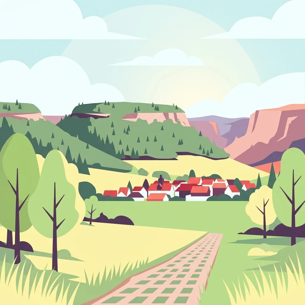
Vector illustration showing a small village with red roofs nestled between rolling green, forested hills under a soft, light-filled sky, with a cobblestone path leading through a meadow in the foreground.

Dreiherrenstein-Eschenberg-Kreutzerberg

Nature reserve

Park overview

Structured park overview, official facts, and landscape profile for Dreiherrenstein-Eschenberg-Kreutzerberg Nature Reserve

Dreiherrenstein-Eschenberg-Kreutzerberg Nature Reserve park facts, protected area profile, and essential visitor context

Review the core facts for Dreiherrenstein-Eschenberg-Kreutzerberg Nature Reserve, including designation, size, terrain, visitor scale, habitats, and operating context in one park-focused overview.

About Dreiherrenstein-Eschenberg-Kreutzerberg Nature Reserve

Dreiherrenstein-Eschenberg-Kreutzerberg is a compact yet ecologically rich nature reserve in the Werra-Meißner-Kreis, occupying the northern slope of the Ringgau, a relict Muschelkalk (shell-limestone) plateau west of the Thuringian Basin. The Werra river once severed the Ringgau from its parent rock body, leaving behind a cuesta-like mass whose steep northern edge forms the dramatic backbone of the reserve. The protected area stretches from the Dreiherrenstein in the north, down through the Schöddel valley, westward to the Kreutzerberg and the slopes of the Stückberg, with peaks that briefly rise above 450 meters before plunging toward the Werratal.

What sets the reserve apart ecologically is the unusual concentration of calcareous beech forest types, Sesleria-rich grasslands, rocky block fields and damp meadows within a relatively small area. Decades of low-intensity, near-natural forestry have allowed the beech forests to develop multi-layered age structures, with ash, sycamore maple, and notably yew forming a mosaic across the limestone cliffs. The combination of base-rich soils, warm microclimates on south-facing rocks and cool shaded ravines produces an unusually high diversity of orchids, including several Cephalanthera, Epipactis and Orchis species, along with relicts such as liverleaf, Turk's-cap lily and fringed gentians.

The reserve carries a layered protection status that reflects its national and European importance. Beyond its 1998 designation as a Hessian nature reserve, it forms part of the EU Natura 2000 network through the FFH site "Kalkberge bei Röhrda und Weißenborn," which documents twelve habitat types of community interest and includes several Annex II species such as the greater mouse-eared bat, lesser horseshoe bat and the lady's slipper orchid. Since January 2023, the entire reserve has also been incorporated as Zone I of the National Natural Monument "Grünes Band Hessen," securing a strict natural-process regime for the future.

Culturally, the landscape lies at one of Germany's most historic crossroads: the Dreiherrenstein marks where the territories of the Electorate of Hessen, the Kingdom of Prussia and the Grand Duchy of Saxe-Weimar-Eisenach once met. The same ridge served as part of the inner-German border between 1949 and 1990, with a patrol road and clear-cut strip still partly visible today. Together with the Thuringian Heldrastein reserve across the border, the area forms a key link in the Green Belt, connecting protected habitats along the former Iron Curtain.

Quick facts and research context for Dreiherrenstein-Eschenberg-Kreutzerberg Nature Reserve

Dreiherrenstein-Eschenberg-Kreutzerberg is a nature reserve (Naturschutzgebiet) in the Werra-Meißner district of northern Hesse, Germany, along the state border with Thuringia. The protected landscape encompasses a ridge of limestone hills ranging from about 320 meters to 478 meters in elevation, dominated by the peaks of Dreiherrenstein (478 m), Eichenberg (450 m), Eschenberg (450 m, summit in Thuringia), Sauberg (422 m) and Kreutzerberg (450 m). It was formally designated as a nature reserve in spring 1998 and covers roughly 206 hectares. The area is also part of the larger EU Fauna-Flora-Habitat site "Kalkberge bei Röhrda und Weißenborn" (about 634 hectares) and, since 2023, lies entirely within Zone I of the National Natural Monument "Grünes Band Hessen." Classified under IUCN Category IV, it is nationally important for the conservation of calcareous beech forest species, including rare orchids, bats, cliff-nesting birds and old-growth beech woodland communities.

Protection and recognition

Examine the official designation history, management scope, and terrestrial protection data.

Dreiherrenstein-Eschenberg-Kreutzerberg Protection Status and Protected Area Designation

Documented protection records outline the formal designation history and terrestrial conservation framework established for Dreiherrenstein-Eschenberg-Kreutzerberg. Structured reference entries provide verifiable conservation data and official protected area attributes for analysis.

Protection details

Protection scope
Terrestrial
Designated year
2008
Transboundary protection
No
WDPA ID
318304
Park context

Deeper park guide and search-rich context for Dreiherrenstein-Eschenberg-Kreutzerberg Nature Reserve

Dreiherrenstein-Eschenberg-Kreutzerberg Nature Reserve history, landscape, wildlife, and travel context

Explore Dreiherrenstein-Eschenberg-Kreutzerberg Nature Reserve through its history, landscape character, ecosystems, wildlife, conservation priorities, cultural context, and seasonal travel timing in a structured park guide built for atlas discovery and search intent.

Why Dreiherrenstein-Eschenberg-Kreutzerberg Nature Reserve stands out

The reserve is especially known for its calcareous beech forests (Kalkbuchenwälder), which together with their rocky outcrops host an unusually rich flora of orchids, submediterranean and continental relicts, and a notable concentration of rare bat, bird and butterfly species. Three Sesleria grasslands on the steep upper slopes of the Eschenberg and Dreiherrenstein are considered unique in Hesse and harbor a mixture of submediterranean, subcontinental and pre-Alpine plant species reflective of post-glacial climatic history. The reserve is also known for its dramatic limestone cliffs, block fields and old landslide scars, as well as its cultural-historical setting on the former inner-German border, symbolized by the historic three-lord boundary stone at the Dreiherrenstein. Equally distinctive is its inclusion in the Green Belt biotope network, which ties these protected habitats to the larger Cold War-era border landscape.
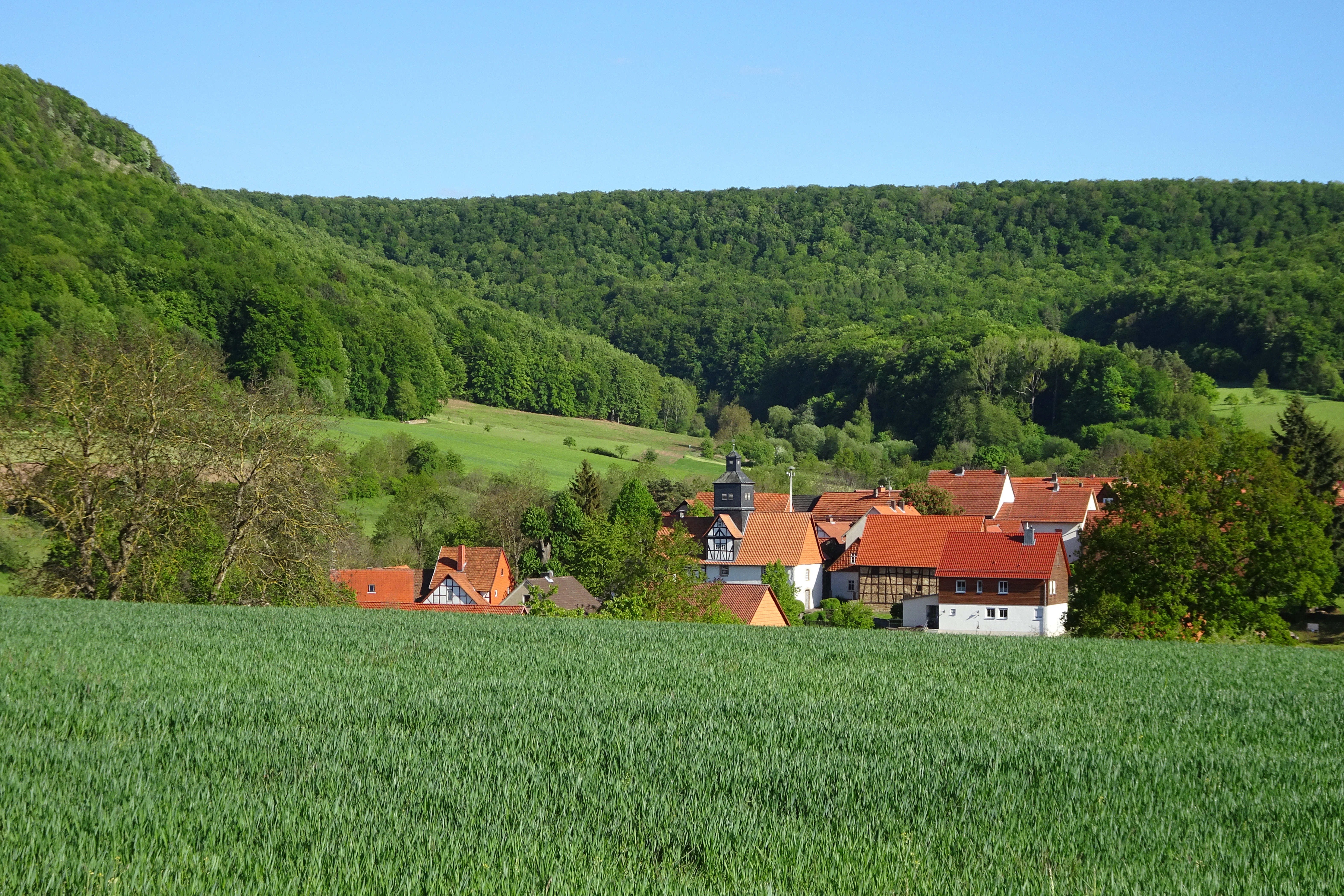
A green field in the foreground leading to a small village with terracotta-roofed houses nestled at the foot of a heavily forested hill under a clear blue sky.
A view of the Kreutzerberg hill and nearby village within the Dreiherrenstein-Eschenberg-Kreutzerberg Nature Reserve.

Dreiherrenstein-Eschenberg-Kreutzerberg Nature Reserve history and protected-area timeline

The hills of the Dreiherrenstein, Eschenberg, Sauberg and Kreutzerberg have long functioned as a borderland. The prominent dolomite-like rock spur known as the Dreiherrenstein (Three Lords' Stone) takes its name from a still-surviving boundary stone carved with the initials and coats of arms of three former German states whose territories once converged there: Hesse, Prussia and Saxe-Weimar-Eisenach. The same stone today also bears a memorial for the inner-German border that divided this very ridge between 1949 and 1990, with remnants of the patrol road and a roughly one-hundred-meter-wide clear-cut strip still visible in the landscape.

In the medieval and early modern period, a sandstone outcrop northeast of Rambach was quarried as a source of scouring sand, sold regionally as household cleaning material for wooden floors. Extraction ceased once modern chemical cleaners made the labor unprofitable, and the former quarry was later integrated into the nature reserve, where today it serves as a winter roost for the lesser horseshoe bat.

The modern protected status of the area began on 9 February 1998, when the upper nature conservation authority at the Regierungspräsidium Kassel issued the ordinance designating the forests around Dreiherrenstein, Eschenberg, Kreutzerberg and Stückberg as the Naturschutzgebiet Dreiherrenstein-Eschenberg-Kreutzerberg. The reserve's goal was to preserve a typical, locally near-natural forest community and to safeguard rare, often warmth-loving plant communities found on its calcareous soils; adjoining orchards and grasslands were included because they too shelter rare flora and fauna.

In 2008, the area was formally anchored in the European Natura 2000 network via the Hessian Natura 2000 Ordinance, which set the conservation objectives for the larger FFH site "Kalkberge bei Röhrda und Weißenborn." Twelve habitats of community interest were documented, including three considered "priority" habitats, alongside species such as the greater mouse-eared bat, lesser horseshoe bat and the lady's slipper orchid. In January 2023, the Hessian parliament adopted the law establishing the National Natural Monument "Grünes Band Hessen," placing the entire reserve within Zone I of that monument and assigning it a strict, near-natural conservation regime.

Dreiherrenstein-Eschenberg-Kreutzerberg Nature Reserve landscape and geographic character

The reserve occupies the bold northern escarpment of the Ringgau, the westernmost outlying Muschelkalk plateau of the Thuringian Basin. Roughly 200 million years ago, the underlying limestone, formed from the deposits of a shallow tropical to subtropical sea, laid down thick-bedded sequences of the Upper and Lower Wellenkalk. These bedded limestones rest on clay-rich Upper Buntsandstein layers in which gypsum lenses occur; in wet years, water seeping through the jointed limestone lubricates the underlying clays, setting up rock slides that have periodically reshaped the cliffs.

Within the reserve, this geology expresses itself as a narrow chain of sharply defined peaks and steep slopes. The Dreiherrenstein rises to about 478 meters as the north-facing continuation of the Heldrastein spur; from there the protected ridge runs south and west across the Schöddel valley to the Eichenberg, the Eschenberg (whose summit lies just over the border in Thuringia), the Sauberg and the Kreutzerberg at around 450 meters, finally opening onto the slopes of the Stückberg to the west. Long, prominent rock faces and large block fields of limestone debris mark the line where whole sections of the Muschelkalk slab have broken loose and slid downward over the centuries.

Geomorphologically, the reserve sits at the meeting point of three natural-region units: the Treffurt-Wanfried Werratal of the Lower Werra hill country, the Schlierbachswald of the Fulda-Werra hill country, and the Northern Ringgau, part of the northwestern margin of the Thuringian Basin. The dramatic relief, combined with deeply incised valleys and abrupt cliff transitions from forest to rock to meadow, gives the landscape a perceived scale far larger than its 206 hectares.

Layered onto this geology is a distinct cultural imprint. A former patrol road and clear-cut Strip from the inner-German border still cut across parts of the ridge, while long-standing forestry traditions have shaped the woodlands into near-natural beech forests managed selectively since at least the early 20th century. The combination of active slope processes, geological exposures and historical boundary features makes the reserve a striking morphological and cultural landmark in the Werra hill country.
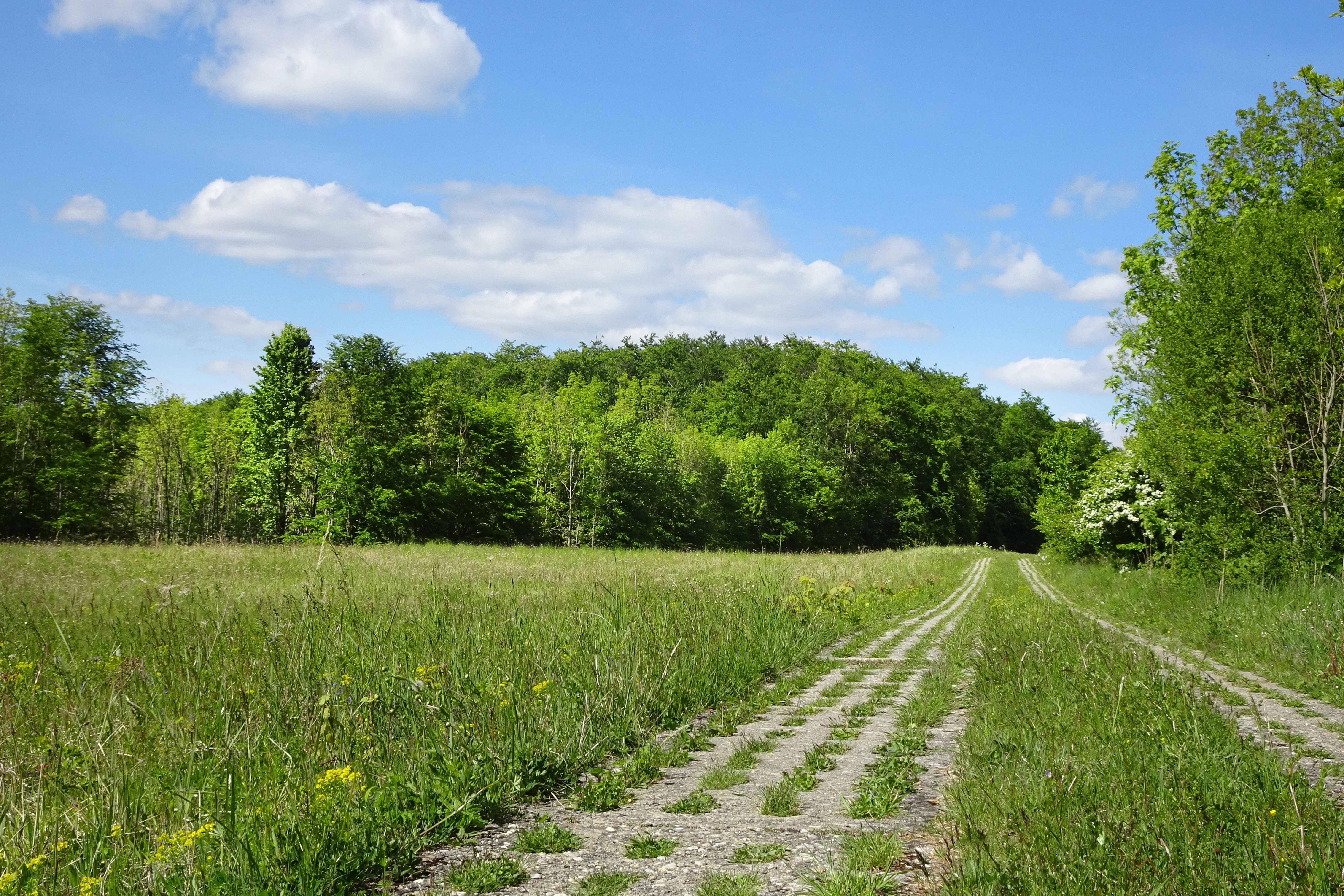
A green meadow with a historic concrete border patrol track running through it, leading toward a dense deciduous forest under a blue sky.
A former border patrol path through the Green Belt, leading towards the wooded Eschenberg.

Dreiherrenstein-Eschenberg-Kreutzerberg Nature Reserve ecosystems, habitats, and plant life

Ecologically, Dreiherrenstein-Eschenberg-Kreutzerberg is dominated by calcareous beech forests managed in a near-natural way for generations. European beech (Rotbuche) forms the core of the canopy, regularly accompanied by ash (Gemeine Esche) and sycamore maple (Bergahorn), with scattered pedunculate oak, wild cherry, summer linden, wych elm, Norway maple and field maple. The presence of large numbers of wild service trees (Elsbeere) in former coppice sections and, more strikingly, the area-wide occurrence of European yew (Eibe) on the limestone cliffs are considered special features of the reserve's forest composition. Older stands tend to be two- or multi-layered rather than uniform hall-like beech high forest, and the management aims to convert these forests into a close-to-permanent, mixed-age deciduous mosaic.

A botanical highlight is the occurrence of three Sesleria (Blaugras) grasslands on the steep upper slopes of the Eschenberg and Dreiherrenstein. These naturally established communities, often described as "steppe heaths," are exceptionally old and original, mixing submediterranean, subcontinental and pre-Alpine species. Many of the pre-Alpine plants are believed to have arrived during the ice ages, while the more thermophilic species spread during warm phases of the late glacial and post-glacial periods. According to current knowledge, such communities in Hesse occur only in the Werra region, where several species reach their northern or northwestern natural range limits.

The base-rich soils of the calcareous grasslands and beech forests sustain an unusually rich orchid flora, including white and red helleborines, spotted and broad-leaved marsh orchids, several Epipactis species (broad-leaved, narrow-leaved, small, marsh and violet helleborines), the mosquito orchid, bird's-nest orchid, fly orchid, several Dactylorhiza species and both white and greenish woodland hyacinths. Additional rare plants include large wood anemone, grape hyacinth, spiked star-of-Bethlehem, yellow and bird's-foot sedges, yellow gentian, common centaury, field larkspur, hawksbeard, eyebright, fringed gentian, German gentian, liverleaf, willow-leaved elecampane, Turk's-cap lily and tassel hyacinth, each contributing to a flora of high biogeographical interest.
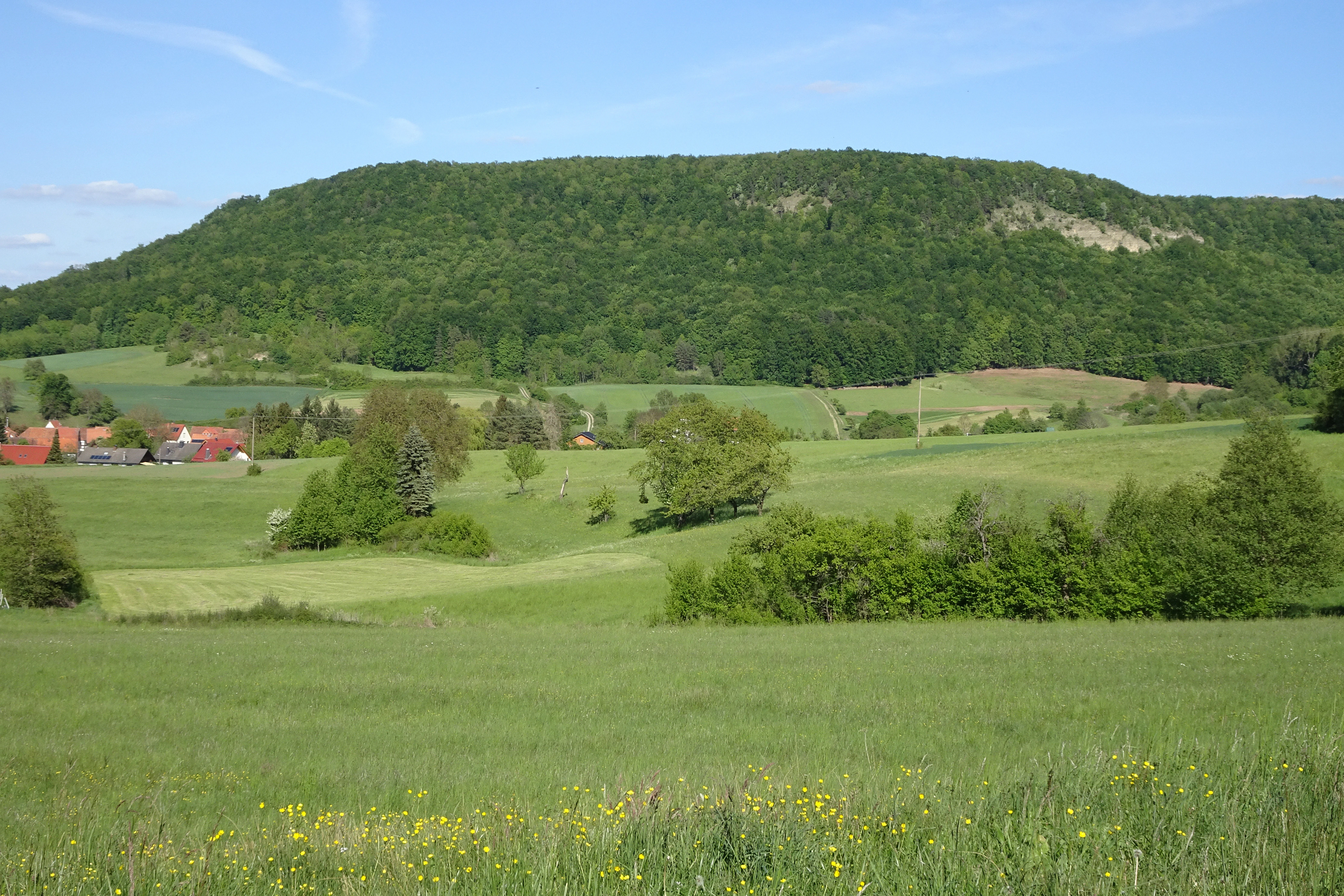
A green forested hill rises behind a rural landscape with meadows, small trees, and a few buildings in the distance under a blue sky.
A view of the Eschenberg hill within the Dreiherrenstein-Eschenberg-Kreutzerberg nature reserve in Hesse, Germany.

Dreiherrenstein-Eschenberg-Kreutzerberg Nature Reserve wildlife and species highlights

The cliffs, mature beech forests, orchards adjoining the woodlands and the abandoned Rambach sand quarry together support a notably diverse fauna. The most prominent group is the breeding bird community of the rocky cliffs and open habitats, many of which are listed in Annex I of the EU Birds Directive and require special conservation measures: eagle owl (Uhu), Tengmalm's owl (Raufußkauz), middle, black and grey woodpeckers, red-backed shrike (Neuntöter) and tawny pipit (Brachpieper). The reserve also harbors a wider suite of characteristic forest, field and edge species, including common linnet, stock dove, turtle dove, common wood pigeon, common raven, jackdaw, great grey shrike, northern wheatear, Eurasian woodcock, common whitethroat, common blackbird, song thrush, fieldfare and mistle thrush.

Bats are an equally important component. The greater mouse-eared bat (Großes Mausohr) and lesser horseshoe bat (Kleine Hufeisennase) are Annex II species of the Habitats Directive and are strictly protected; the lesser horseshoe population has used an artificial gallery in the former Rambach sand quarry as a winter roost for many years. Noctule (Abendsegler), brown long-eared bat (Braunes Langohr) and Daubenton's bat (Wasserfledermaus) are also recorded as threatened resident species.

Among invertebrates, around twenty species of butterflies have been documented, several of which are considered strongly endangered or in significant decline on Hesse's Red List, including the swallowtail, silver-washed fritillary, large tortoiseshell, lesser purple emperor, mourning cloak, woodland ringlet and wall brown. Old and dead-wood rich beech stands, in particular, provide habitat for saproxylic beetles and other invertebrates tied to veteran trees, snags and bracket fungi, reinforcing the value of the reserve's habitat-tree network.
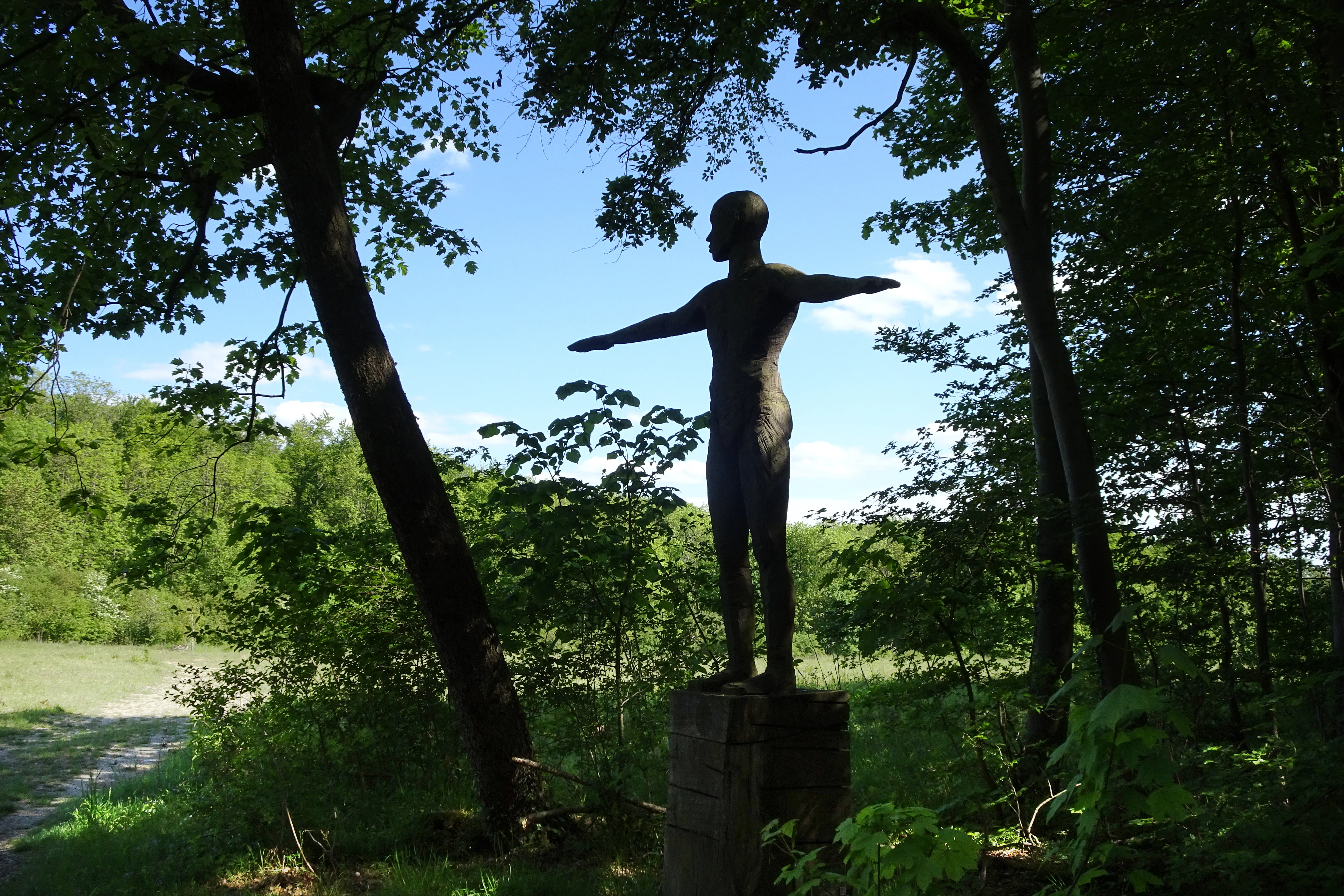
A dark human-shaped sculpture standing with arms outstretched on a pedestal in a sunlit forest clearing.
A human figure sculpture situated within the forest landscape of the Dreiherrenstein-Eschenberg-Kreutzerberg nature reserve.

Dreiherrenstein-Eschenberg-Kreutzerberg Nature Reserve conservation status and protection priorities

Dreiherrenstein-Eschenberg-Kreutzerberg sits at the intersection of national and European conservation frameworks. Designated as a Hessian Naturschutzgebiet in March 1998 under IUCN Category IV (Habitat/Species Management Area), it protects roughly 206 hectares of near-natural beech forest, calcareous grasslands, rock faces, wet meadows and orchard margins. Through its integration into the FFH site "Kalkberge bei Röhrda und Weißenborn" in 2008, the area contributes directly to the EU Natura 2000 network, with twelve habitat types of community interest, including three "priority" habitat types of particular conservation responsibility.

Several species recorded in the reserve carry strict protection obligations under Annex II of the Habitats Directive: the greater mouse-eared bat, the lesser horseshoe bat and the lady's slipper orchid. The breeding bird community adds further weight, with multiple Annex I species such as eagle owl, Tengmalm's owl and several woodpecker species. The protection ordinance therefore obligates private, communal and state forest owners (about half of the area is state forest of Hesse) to maintain near-natural forestry practices that favor multi-aged deciduous stands, retain habitat trees and conserve dead wood.

Since January 2023, the entire reserve lies within Zone I of the National Natural Monument "Grünes Band Hessen," placing it under a strict natural-process regime that aims to preserve the uninfluenced dynamics of ecosystems, including their breakdown and pioneer phases. In connection with the Thuringian "Mertelstal - Heldrastein" reserve on the opposite side of the former border, the site forms one of the keystone segments of the Green Belt biotope network, demonstrating how Cold War-era military barriers have been repurposed as long, continuous corridors of conservation value for forest, cliff and grassland habitats.

Dreiherrenstein-Eschenberg-Kreutzerberg Nature Reserve cultural meaning and human context

Culturally, the ridge has long functioned as a meeting point of territories. The name-giving Dreiherrenstein preserves the memory of a now-historic three-party boundary: between Hesse, Prussia and Saxe-Weimar-Eisenach, marked on the rock by a stone inscribed with their initials and heraldic animals. This centuries-old role as a frontier was dramatically extended in 1949 when the same ridge became part of the inner-German border, sealed by fences, a patrol road and a one-hundred-meter-wide clear-cut strip. A memorial on the Dreiherrenstein today commemorates this history, while landscape traces such as the patrol road and the cleared corridor remain legible to visitors.

In everyday rural life, the landscape supported traditional land uses that survive as cultural heritage features within the reserve: extensive meadows, orchard meadows (Streuobstwiesen) on the forest edge, and the historic sandstone quarry northeast of Rambach that supplied scouring sand across the region before industrial cleaners made it obsolete. Today these same elements are valued as cultural landscape features that complement the reserve's ecological profile. The ridge also lies within the Geo-Naturpark Frau-Holle-Land, and several long-distance hiking trails pass across the protected area, including the Hessenweg 8 / Barbarossaweg, the Weg der deutschen Einheit and the Ars Natura art trail, weaving contemporary cultural use back into this historically boundary-marked landscape.

Top sights and standout views in Dreiherrenstein-Eschenberg-Kreutzerberg Nature Reserve

Standout features of Dreiherrenstein-Eschenberg-Kreutzerberg include its near-natural, multi-aged calcareous beech forests with rare yew, wild service tree and old-growth character; three Sesleria-rich "steppe heath" grasslands on the Eschenberg and Dreiherrenstein that are unique in Hesse; a striking suite of orchids and cliff-breeding birds; and large limestone rock faces with active landslide scars that document the ongoing geomorphological evolution of the Ringgau escarpment. The Dreiherrenstein itself is a singular cultural-ecological landmark where a 19th-century three-state boundary stone and a Cold War-era border memorial share the same outcrop.

Equally notable is the reserve's layered protection profile: as a Hessian nature reserve, an EU FFH site within Natura 2000, and since 2023 as Zone I of the National Natural Monument "Grünes Band Hessen." Together, these designations mark it as one of the most intensively protected forest-cliff reserves in the Werra-Meißner region and a key node in the transboundary Green Belt biotope network that bridges Hesse and Thuringia.

Best time to visit Dreiherrenstein-Eschenberg-Kreutzerberg Nature Reserve

Spring and early summer are arguably the most rewarding seasons for a visit, when the calcareous grasslands and forest floor host their richest display of orchids, gentians, wood anemones and other geophytes, while cliff-nesting eagle owls and Tengmalm's owls can still be active around the rock faces. Late spring through midsummer also suits botanical viewing of the Sesleria grasslands and rocky flora. Autumn brings sharp visibility across the ridge and the wooded slopes of the Werra valley, with dramatic light on the limestone cliffs and migrating or overwintering bats settling into the gallery in the former Rambach quarry.

In winter, the open structure of the deciduous forest, the frozen block fields and the visible traces of the former border strip give the landscape a stark, spacious character, and the clear-cut layout of the old Kolonnenweg can be followed more easily through the woods. Heavy snow or prolonged rain can make some of the steep, rocky stretches slippery, so drier, frost-free days tend to be the most comfortable for exploring the ridge, the Dreiherrenstein viewpoint and the trails toward the Heldrastein.

Monthly climate preview

Long-term representative temperature and precipitation patterns across the elevation

Dreiherrenstein-Eschenberg-Kreutzerberg Climate Normals and Weather by Month

Representative coordinate sampling records measured monthly temperature variations and precipitation rates for Dreiherrenstein-Eschenberg-Kreutzerberg from 1991 to 2020. Examining the complete twelve-month climatology profile reveals detailed seasonal shifts in regional temperature extremes.
Annual mean8 °C
-1 °C18 °C
Jan-1°
Feb
Mar
Apr
May12°
Jun16°
Jul18°
Aug18°
Sep14°
Oct
Nov
Dec
Warmest month
July

18.3 °C

Coolest month
January

-1.1 °C

Wettest month
July

2.6 mm/day

Driest month
April

1.4 mm/day

Park location guide

Geography guide, regional context, and park location map for Dreiherrenstein-Eschenberg-Kreutzerberg Nature Reserve

Dreiherrenstein-Eschenberg-Kreutzerberg Nature Reserve park geography, regions, and map view in Germany

Understand where Dreiherrenstein-Eschenberg-Kreutzerberg Nature Reserve sits in Germany through a broader geographic reading of the surrounding landscape, nearby location context, and its mapped position within the national park landscape.

How Dreiherrenstein-Eschenberg-Kreutzerberg Nature Reserve fits into Germany

Germany is a federal republic in Western and Central Europe with a population of over 83 million across sixteen constituent states. It is Europe's largest economy by nominal GDP and a major global exporter and importer. The capital is Berlin, and the country borders Denmark, Poland, Czech Republic, Austria, Switzerland, France, Luxembourg, Belgium, and the Netherlands.

Wider geography shaping Dreiherrenstein-Eschenberg-Kreutzerberg Nature Reserve in Germany

Germany is located in Western and Central Europe, spanning 357,022 km². It borders Denmark to the north, Poland and the Czech Republic to the east, Austria and Switzerland to the south, and France, Luxembourg, Belgium, and the Netherlands to the west. The country has coastlines on the Baltic Sea and North Sea to the north, with the Alps located in the southern region.

Map view of Dreiherrenstein-Eschenberg-Kreutzerberg Nature Reserve

Use this park location map to pinpoint Dreiherrenstein-Eschenberg-Kreutzerberg Nature Reserve in Germany, understand its exact geographic position, and read its mapped placement within the surrounding landscape more clearly.

Pigeon | © OpenStreetMap contributors

Location context for Dreiherrenstein-Eschenberg-Kreutzerberg Nature Reserve

Werra-Meißner-Kreis

Visual exploration of limestone cliffs, beech forests, and reserve habitats

Dreiherrenstein-Eschenberg-Kreutzerberg Photos and Protected Landscape Scenery

Photographic collections reveal the steep limestone cliffs, block fields, and ancient beech forests defining the terrain of Dreiherrenstein-Eschenberg-Kreutzerberg. Visual documentation clarifies the varied topography, geological formations, and protected habitats spanning the ridge.

A green field in the foreground leading to a small village with terracotta-roofed houses nestled at the foot of a heavily forested hill under a clear blue sky.

A dense forest scene featuring a large, weathered, fallen tree trunk in the foreground and tall, lush green beech trees in the background.

A green meadow with a historic concrete border patrol track running through it, leading toward a dense deciduous forest under a blue sky.

A green forested hill rises behind a rural landscape with meadows, small trees, and a few buildings in the distance under a blue sky.

A dark human-shaped sculpture standing with arms outstretched on a pedestal in a sunlit forest clearing.

Park atlas

Compare adjacent limestone reserves and regional biotope networks across northern Hesse

Other Parks Near Dreiherrenstein-Eschenberg-Kreutzerberg and Surrounding Protected Landscapes

Browsing other parks near Dreiherrenstein-Eschenberg-Kreutzerberg reveals connected limestone escarpments and protected beech forest reserves along the regional state border. Expanding the geographic comparison highlights broader conservation corridors and similar protected landscapes throughout the surrounding hill country.
Watercolor painting of a rolling green landscape with a winding trail leading toward purple mountains under a soft light.
Nature reserveWartburgkreis
About 1.6 km away#1 closest

Southwest

Mertelstal - Heldrastein: Protected Nature Reserve and Forested Limestone Geography in Wartburgkreis

Mapping the natural relief and ecological boundaries of a central German nature reserve.

Mertelstal - Heldrastein stands as a protected natural landmark in the Wartburgkreis district, defined by its dramatic limestone cliffs and ancient beech forest canopy. The reserve features a unique vertical relief above the Werra river valley, housing rare orchid communities and specialized bryophytes. This entry maps the structural geography and conservation value of the site, highlighting its dual identity as both a Natura 2000 protected habitat and a place of deep historical resonance across the former inner-German border landscape.

Area
2.525 km²
Established
1997
IUCN
IV
Relief
Mountain
A watercolor painting depicting a soft, green meadow landscape with gentle rolling hills in the background and scattered trees.
Nature reserveGermany
About 2.5 km away#2 closest

Southwest

Feuchtwiesen bei Lüderbach Nature Reserve: Regional Geography and Protected Landscape Atlas

A diverse wetland and grassland reserve in northern Hesse, Germany

Spanning 40 hectares in the Werra-Meißner-Kreis district, Feuchtwiesen bei Lüderbach protects a complex mosaic of reedbeds, eutrophic ponds, and floodplain forests. This nature reserve serves as an important ecological link in the Netra-Ifta valley, bridging valley-bottom wetlands with the limestone-rich slopes of the Weinberg hill to create a distinct and valuable natural terrain in the German landscape.

Area
0.41 km²
Established
1995
Relief
Upland
Climate
Temperate
Watercolor illustration showing a wide landscape with green trees, rolling hills, and distant mountains under a pale sky.
Nature reserveHessen
About 3 km away#3 closest

Northwest

Graburg Nature Reserve and Protected Shell-Limestone Massif in Northern Hessen

Mapped protected areas and botanical landscape geography

Graburg is a compact shell-limestone plateau located in the Ringgau range of northern Hessen. This nature reserve is characterized by its high conservation value, featuring ancient calcareous beech forests, dramatic rock faces, and extensive historic landslide zones that support one of the most botanically diverse habitats in central Germany.

Area
3.41 km²
Established
1965
IUCN
IV
Watercolor illustration showing a wide landscape with green rolling hills in the background, a line of trees in the midground, and a pinkish meadow with grasses in the foreground
Nature reserveHesse
About 4.6 km away#4 closest

Northeast

Frankenloch bei Heldra Nature Reserve: Mapped Protected Landscapes in Hesse, Germany

A rare, near-natural Werra river oxbow and wetland floodplain sanctuary.

Discover the geographic layout of Frankenloch bei Heldra, a protected nature reserve located along the River Werra. This site offers insight into floodplain dynamics, reed-bed ecology, and the restoration of natural river channels within the Werra-Meissner-Kreis district of Hesse, Germany.

Area
0.089 km²
Established
1995
Relief
Lowland
Climate
Temperate
Nature reserveThuringia
About 4.9 km away#5 closest

East

Werra bis Treffurt mit Zuflüssen: Protected River and Floodplain Network in Thuringia

Mapping an extensive 191 kilometer Natura 2000 river corridor.

The Werra bis Treffurt mit Zuflüssen protected area serves as a vital ecological corridor in Thuringia. This site encompasses a complex mosaic of fast-flowing highland brooks, expansive floodplain meadows, inland salt sites, and rare dissolution lakes. Its geography bridges high-altitude source regions with lower river valleys, creating a distinctive landscape transect that supports essential freshwater habitats and rare aquatic species across the state.

Area
22.6 km²
Established
2008
IUCN
IV
Relief
Mixed relief
Nature reserveWartburgkreis
About 5.2 km away#6 closest

Northeast

Werraaue Treffurt Nature Reserve: Geographic Overview and Protected Floodplain Map

Wartburgkreis wetland refuge and Green Belt stepping stone

Werraaue Treffurt comprises a complex riverine landscape where sediment-rich floodplain soils and restored gravel-pit lakes create a diverse sanctuary. Located near the Thuringia-Hessia state border, this nature reserve integrates into the broader Green Belt, offering significant habitat continuity for species dependent on transition zones. Its position in the Werra valley floor highlights the intersection of hydrological change, historical land-use exclusion, and modern ecological protection in Germany.

Area
0.685 km²
Established
1995
IUCN
IV
Relief
Lowland
A horizontal watercolor painting depicting a soft-toned, layered landscape of rolling hills and forests in shades of green and pale yellow.
Nature reserveThuringia
About 5.6 km away#7 closest

Northeast

Adolfsburg, Bornberg, Sülzenberg: A Protected Muschelkalk Landscape in Thuringia

Geographic map and protected-area atlas context

This nature reserve stands as a prominent geological feature in the Werrabergland region, where steep Muschelkalk hills and plateaus meet the Werra valley. The site protects a rare assembly of habitats including juniper heathland, scree slopes, and old-growth orchards, offering a dense case study for regional botanical diversity and limestone-terrain mapping in central Germany.

A minimalist watercolor illustration depicting a soft, rolling landscape with gentle hills, a winding path, and sparse trees in light green, yellow, and muted tones.
Nature reserveHesse
About 6.8 km away#8 closest

South

Iberg bei Markershausen: Nature Reserve and Geological Landmark in Hesse, Germany

Calcareous forests and limestone cliff landscapes within the Ringgau plateau

Iberg bei Markershausen is a protected nature reserve in northern Hesse recognized for its complex Muschelkalk terrain. The reserve encompasses a 180-meter limestone cliff, rare relict yew populations, and a dense forest floor featuring spring geophytes and diverse orchid species. This site serves as a vital anchor for regional biodiversity, linking steep rockfall remnants with open dry grassland habitats.

Area
0.32 km²
Established
1988
IUCN
IV
Relief
Upland

Common questions about visiting, size, designation, and location context for Dreiherrenstein-Eschenberg-Kreutzerberg Nature Reserve

Dreiherrenstein-Eschenberg-Kreutzerberg Nature Reserve FAQs for park facts, access, geography, and protected area context

Find quick answers about Dreiherrenstein-Eschenberg-Kreutzerberg Nature Reserve, including protected-area facts, park geography, trail and visitor context, and how the park fits into its surrounding country and regional landscape.
MoriAtlas Explorer

Continue Your Protected Areas Search Across the Global Atlas

Deepen your exploration by continuing the structured search for national parks and protected areas worldwide. Utilize the comprehensive filtering capabilities to compare different conservation landscapes and refine your understanding of global park geography. Discover more about the distribution and characteristics of protected natural areas.

Global natural geography