Mori Atlas logo
Wildlife reserveDrift Creek Wilderness

Understanding the geography, steep coastal terrain, and forest boundaries of this protected wildlife reserve.

Drift Creek Wilderness: A Mapped Exploration of Oregon's Protected Old Growth Forest Landscapes

Drift Creek Wilderness sits within the rugged Coast Range of Oregon, preserving a dense and exceptionally lush expanse of old growth Sitka spruce, western hemlock, and western red cedar. This protected wildlife reserve encompasses deep stream corridors that serve as critical salmon habitat, framed by sharp slopes and moss-covered forest floors. The area remains a primary example of Pacific Northwest temperate rainforest geography, where complex topography and high-rainfall ecosystems define the natural boundaries.

wilderness areaOregon Coast Rangeold-growth forestSitka spruce forestwestern hemlock forestcoastal temperate rainforest

Drift Creek Wilderness

Wildlife reserve

Park overview

Structured park overview, official facts, and landscape profile for Drift Creek Wilderness

Drift Creek Wilderness park facts, protected area profile, and essential visitor context

Review the core facts for Drift Creek Wilderness, including designation, size, terrain, visitor scale, habitats, and operating context in one park-focused overview.

About Drift Creek Wilderness

Drift Creek Wilderness occupies a compact slice of the Oregon Coast Range just inland from the central Oregon coastline. Although small in size, it captures many of the defining features of the range: steep, dissected slopes, persistent rainfall, dense conifer forests, and streams that connect directly to larger coastal river systems. The wilderness sits within the Siuslaw National Forest and is managed under the stricter standards of the National Wilderness Preservation System, meaning its natural conditions, solitude, and undeveloped character are given priority over infrastructure and convenience.

The vegetation profile of the area is strongly shaped by climate. Annual rainfall in the wilderness approaches 120 inches, producing the mossy, fern-laden understory typical of the wettest parts of the Pacific Northwest. Beneath the canopy of Sitka spruce, western hemlock, western red cedar, and Douglas fir, a varied understory of salmonberry, huckleberry, sword fern, salal, trillium, and licorice fern thrives. The presence of old-growth trees, some likely centuries old, gives the wilderness an atmosphere distinct from nearby logged or second-growth lands.

Wildlife is closely tied to this forested and aquatic setting. Roosevelt elk, black-tailed deer, and black bear use the dense cover, while salmon and trout populations move through Drift Creek and its tributaries to spawn in autumn. The area is also significant for the northern spotted owl, a species of conservation concern in Oregon's coastal forests, and for bald eagles that nest and forage along the larger river corridors nearby. The combination of intact forest, clean water, and relatively undisturbed habitat makes Drift Creek a meaningful refuge despite its modest acreage.

Quick facts and research context for Drift Creek Wilderness

Drift Creek Wilderness is a Congressionally designated wilderness area of roughly 5,798 acres within the Siuslaw National Forest, in Lincoln County on Oregon's central coast. It was established in 1984 alongside two other small Siuslaw wildernesses, Cummins Creek and Rock Creek, and is administered by the United States Forest Service.

The wilderness lies in a high-rainfall portion of the Coast Range, with elevations ranging from roughly 150 to 1,500 feet, and is characterized by long, steep slopes and broken terrain. Its defining ecological features include old-growth Sitka spruce and western hemlock stands, salmon and trout-bearing streams, and habitat for Roosevelt elk, black bear, and several sensitive species, including the northern spotted owl and bald eagle.

Protection and recognition

Documented management scope and formal protected area designation facts

Drift Creek Wilderness Protection Status and Terrestrial Conservation Data

Drift Creek Wilderness maintains a terrestrial protection scope governed by established conservation frameworks and official land records. National park data compiles verified designation parameters and administrative records for accurate geographical reference.

Protection details

Protection scope
Terrestrial
Transboundary protection
No
Park context

Deeper park guide and search-rich context for Drift Creek Wilderness

Drift Creek Wilderness history, landscape, wildlife, and travel context

Explore Drift Creek Wilderness through its history, landscape character, ecosystems, wildlife, conservation priorities, cultural context, and seasonal travel timing in a structured park guide built for atlas discovery and search intent.

Why Drift Creek Wilderness stands out

Drift Creek Wilderness is best known for protecting one of the most substantial old-growth forest stands remaining in the Oregon Coast Range. Its combination of extremely high rainfall, classic Sitka spruce and western hemlock forests, salmon-bearing creeks, and steep Coast Range topography gives it an intensely lush, Pacific Northwest character. It is also recognized as important habitat for Roosevelt elk, the endangered northern spotted owl, and bald eagle, and as a refuge for wild salmon and trout populations that still run in Drift Creek, a tributary of the Alsea River. The presence of relic homestead artifacts in a wilderness setting adds an unusual cultural layer to its natural identity.
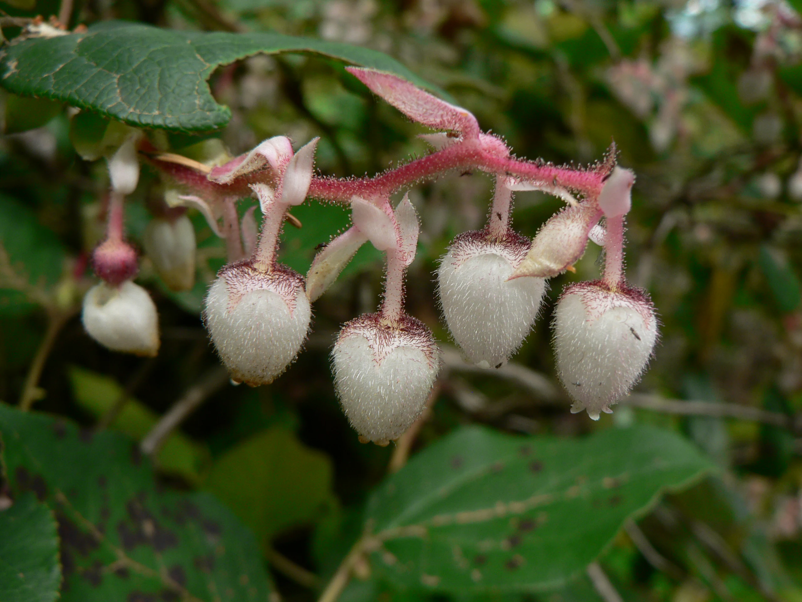
A close-up view of a cluster of fuzzy, bell-shaped, white-to-pinkish Salal flowers hanging from reddish stems among green foliage.
Clusters of nodding, bell-shaped Salal (Gaultheria shallon) flowers in the Drift Creek Wilderness.

Drift Creek Wilderness history and protected-area timeline

The human history of Drift Creek Wilderness stretches from the era of Oregon's indigenous peoples through early Twentieth-century homesteading and into the modern conservation period. The Alsea tribe historically used the lands around Drift Creek for hunting and for gathering berries, integrating the area into a broader pattern of seasonal use across the central Oregon Coast.

In the early 1900s, American settlers entered the rugged country around the creek and attempted to establish homesteads, despite the difficult terrain and heavy rainfall. Among them was Fred Purath, who operated a subsistence farm and ran a small cattle herd on the land. Following his death in the early 1940s, his property was purchased by Earl Harris. The Harris Ranch homestead did not survive for long, and its only remaining trace is a moss-covered stove and stove parts along the Harris Ranch Trail, now quietly absorbed back into the forest.

In 1984, Drift Creek was designated as a federal wilderness area, alongside Cummins Creek Wilderness and Rock Creek Wilderness, two other small coastal wildernesses in the Siuslaw National Forest. The designation protected the area from logging, roadbuilding, and other development, locking in the conditions that today make it one of the larger surviving old-growth forest remnants in the Coast Range.

Drift Creek Wilderness landscape and geographic character

Drift Creek Wilderness lies in a steep section of Oregon's Coast Range, where terrain rises from roughly 150 feet near the creek to about 1,500 feet on surrounding ridges. The topography is highly dissected, marked by long, sharp slopes and uneven, broken ground that makes travel off-trail slow and strenuous. Drainages cut deeply into the uplands, and the small creek valleys are narrow and shaded, often carpeted in moss and ferns.

The Coast Range context gives the wilderness a strong sense of enclosure. Ridges and forested slopes surround the creek basin on multiple sides, and views are generally limited to the immediate forest rather than distant horizons. The creek itself lends the area its name: Drift Creek, a tributary of the Alsea River, was historically notable for the accumulations of driftwood along its banks, an enduring feature of stream corridors in this wet coastal forest.
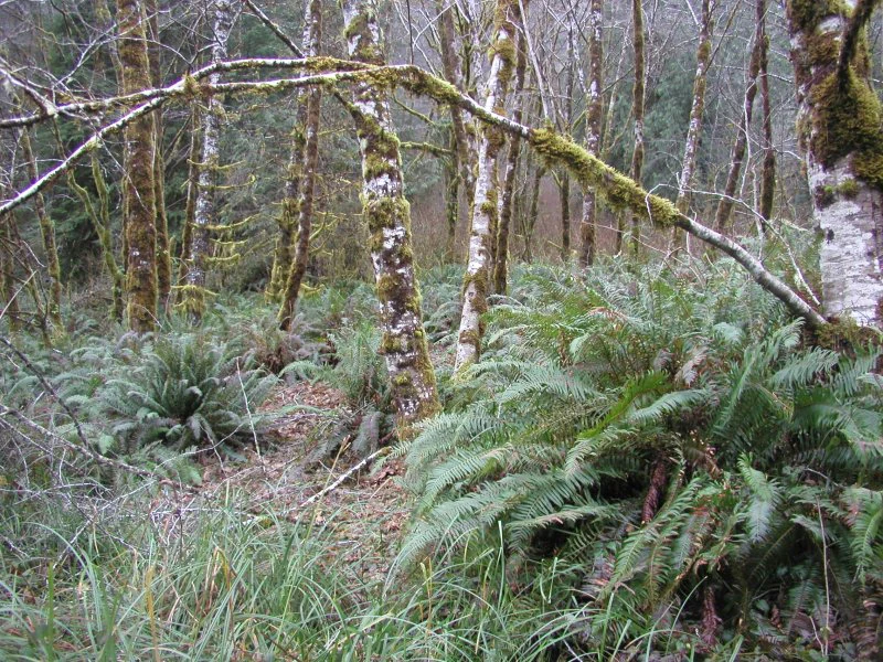
A dense forest understory in the Pacific Northwest, with vibrant green sword ferns carpeting the ground around moss-covered red alder tree trunks.
Lush old growth understory featuring sword ferns and moss-covered trees in the Drift Creek Wilderness.

Drift Creek Wilderness ecosystems, habitats, and plant life

The ecological character of Drift Creek Wilderness is defined by its extremely wet climate and the resulting richness of its plant communities. Annual precipitation around 120 inches supports a deeply layered forest ecosystem, in which old-growth conifers rise above a continuous understory of broadleaf shrubs, ferns, mosses, and herbaceous plants.

Dominant tree species include Sitka spruce, especially near the coast and along streams, along with western hemlock, western red cedar, and Douglas fir. Bigleaf maple and red alder appear in moister or more disturbed pockets. Below the canopy, the underbrush is unusually diverse, with licorice fern, oxalis, salmonberry, thimbleberry, huckleberry, foxglove, trillium, sword fern, and salal all contributing to the dense, green ground layer that characterizes the wilderness.

Freshwater systems are an integral part of the park's nature profile. Drift Creek and its tributaries support native salmonids and connect the wilderness to the larger Alsea River watershed, linking forest, stream, and estuary along Oregon's central coast.
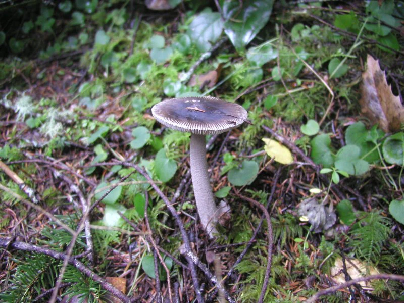
A close up view of a small greyish brown mushroom growing from damp, mossy ground covered in twigs and leaves.
A single mushroom growing on the forest floor of the Drift Creek Wilderness.

Drift Creek Wilderness wildlife and species highlights

Wildlife in Drift Creek Wilderness reflects the broader fauna of Oregon's coastal forests, with large ungulates and predators sharing the landscape with rarer, more sensitive species. Roosevelt elk are one of the most significant mammals in the area, finding food and cover in the dense old-growth stands and steep valley bottoms. Black-tailed deer are also common, and American black bear range through the wilderness, taking advantage of berries and other seasonal foods.

Two endangered or threatened Oregon species are particularly important to the area's wildlife profile: the northern spotted owl, which depends on large blocks of older forest for nesting and roosting, and the bald eagle, which uses the broader Coast Range river corridors for nesting and foraging. The presence of both species underlines the conservation value of keeping the wilderness in an undisturbed, mature-forest condition.

Drift Creek itself is also a wildlife habitat in its own right. Chinook salmon, coho salmon, steelhead, and coastal cutthroat trout all use the creek and its tributaries to spawn in autumn, linking the freshwater wilderness to the marine environment just a short distance to the west.

Drift Creek Wilderness conservation status and protection priorities

Conservation significance at Drift Creek Wilderness is rooted in the size and quality of its old-growth forest, which makes up one of the larger remaining stands in Oregon's Coast Range. Protecting this forest maintains habitat continuity for species that depend on late-successional conifer stands, particularly the northern spotted owl, and preserves the watershed functions of streams flowing into the Alsea River.

The wilderness designation itself places a high level of legal protection on the area. Logging, road construction, and most forms of development are prohibited, and recreational use is kept deliberately low-impact, with horseback riding banned because the soil is considered too fragile to withstand it. Fishing is restricted to native fish, further aligning management with the goal of preserving ecological processes rather than maximizing harvest.

By combining climatic moisture, intact old-growth stands, salmon-bearing streams, and habitat for sensitive species such as spotted owls and bald eagles, Drift Creek Wilderness provides conservation value considerably greater than its modest acreage would suggest.

Drift Creek Wilderness cultural meaning and human context

The cultural context of Drift Creek Wilderness reflects two distinct periods of human presence. The Alsea tribe historically used the area as part of a broader territory along the central Oregon coast, hunting in the forests and gathering berries from the dense understory plants. Their use was integrated with the landscape itself, leaving no large infrastructure but shaping the way the land was understood and named.

The early Twentieth century brought a different kind of presence, as American settlers attempted to carve homesteads from this steep, wet terrain. The experiences of settlers like Fred Purath and Earl Harris, who ran a small subsistence farm and cattle operation on what would later become wilderness, illustrate the difficulty of agriculture in the Coast Range. The Harris Ranch Trail now passes the moss-covered remains of a stove, a quiet reminder that this now-undeveloped landscape was once the site of human effort and abandonment before it was protected.

Top sights and standout views in Drift Creek Wilderness

Among the standout features of Drift Creek Wilderness are its exceptionally old Sitka spruce, western hemlock, and western red cedar stands, set within one of the most intact old-growth blocks left in Oregon's Coast Range. The wilderness also includes some of the wettest forest habitat in the state, with an understory so dense that it can feel more like a green tunnel than an open woodland.

The creek system adds another major highlight: a native salmon and trout stream corridor that still supports Chinook, coho, steelhead, and coastal cutthroat trout, all spawning within a designated wilderness. Combined with wildlife such as Roosevelt elk, black bear, and the northern spotted owl, and the evocative leftover artifacts of the Harris Ranch homestead, Drift Creek offers a layered experience of coastal Oregon wilderness in unusually compact form.

Best time to visit Drift Creek Wilderness

The character of Drift Creek Wilderness shifts noticeably with the seasons, largely because of its very high rainfall. Late spring through early fall tends to bring drier footing, longer daylight hours, and more comfortable conditions for hiking the roughly 8.5 miles of trail. Summer is also when berries ripen across the dense understory, and elk and deer are often more visible in cooler morning and evening hours.

Autumn is a particularly meaningful season ecologically, because Chinook and coho salmon, along with steelhead and coastal cutthroat trout, return to Drift Creek and its tributaries to spawn, drawing wildlife watchers to the streams. Winter and early spring, while beautiful in their own intensely green way, are also when the area receives the bulk of its approximately 120 inches of annual rainfall, making trails wet, slippery, and more challenging. Visitors in any season should be prepared for the dense, shaded, mossy character of this Oregon Coast Range forest rather than expansive vistas.
Monthly climate preview

Track long-term average temperature and precipitation rhythms across the protected landscape

Drift Creek Wilderness Climate Normals and Representative Weather by Month

Representative coordinates record measured monthly temperature swings and precipitation rates across a standard thirty-year climatology baseline. Examining the complete twelve-month record clarifies long-term thermal and moisture patterns across the protected terrain.
Annual mean10 °C
5 °C16 °C
Jan
Feb
Mar
Apr
May11°
Jun14°
Jul16°
Aug16°
Sep14°
Oct11°
Nov
Dec
Warmest month
August

15.7 °C

Coolest month
December

5.3 °C

Wettest month
December

8.8 mm/day

Driest month
July

0.4 mm/day

Park location guide

Geography guide, regional context, and park location map for Drift Creek Wilderness

Drift Creek Wilderness park geography, regions, and map view in United States of America

Understand where Drift Creek Wilderness sits in United States of America through a broader geographic reading of the surrounding landscape, nearby location context, and its mapped position within the national park landscape.

How Drift Creek Wilderness fits into United States of America

The United States of America is a federal presidential republic and one of the world's largest countries by area and population. It consists of 50 states across a vast territory spanning multiple time zones, with its capital in Washington, D.C. and largest city in New York City. The nation has a diverse economy, influential political system, and significant cultural and military presence globally.

Wider geography shaping Drift Creek Wilderness in United States of America

The United States occupies a vast territory in North America, bordered by Canada to the north and Mexico to the south. The 48 contiguous states stretch from the Atlantic to the Pacific Ocean, while Alaska occupies the northwestern region and Hawaii is an archipelago in the Pacific. The country encompasses diverse terrain including the Rocky Mountains, Appalachian Mountains, Great Plains, and extensive river systems.

Map view of Drift Creek Wilderness

Use this park location map to pinpoint Drift Creek Wilderness in United States of America, understand its exact geographic position, and read its mapped placement within the surrounding landscape more clearly.

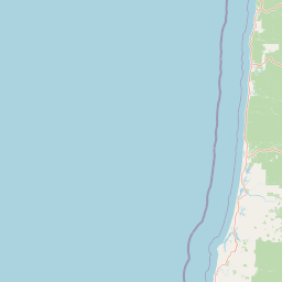
Pigeon | © OpenStreetMap contributors

Location context for Drift Creek Wilderness

Oregon

Visual reference for old-growth conifer stands, steep terrain, and coastal temperate rainforest habitats.

Drift Creek Wilderness Landscape Photos and Protected Forest Scenery

Examine detailed photography capturing the dense Sitka spruce canopies, moss-covered stream corridors, and rugged topography defining Drift Creek Wilderness. Visual records reveal the complex structure of preserved old-growth habitats and the distinct enclosed character of the Oregon Coast Range.

A close-up view of a cluster of fuzzy, bell-shaped, white-to-pinkish Salal flowers hanging from reddish stems among green foliage.

A view of a fast-moving, misty river flowing through a lush, green forest with mossy rocks and coniferous trees.

A dense forest understory in the Pacific Northwest, with vibrant green sword ferns carpeting the ground around moss-covered red alder tree trunks.

A close up view of a small greyish brown mushroom growing from damp, mossy ground covered in twigs and leaves.

Park atlas

Compare surrounding regional forests and coastal temperate wilderness zones

Explore Protected Areas and Parks Near Drift Creek Wilderness

Discover other protected areas and parks near Drift Creek Wilderness within the rugged Oregon Coast Range. Expanding regional comparison helps connect isolated old growth reserves with broader temperate rainforest geography.
Watercolor painting of a coastal landscape with sandy dunes, beach grasses in the foreground, and a dense treeline in the background.
Protected landscapeOregon
Mapped location lies within the park boundary#1 closest

South

Siuslaw National Forest: Oregon Coast Range and Protected Landscape Geography

Coastal dunes, temperate rainforests, and river networks

Explore the mapped boundaries and natural geography of Siuslaw National Forest. This protected landscape highlights the ecological transition from Pacific shorelines to the high-elevation forests of the Oregon Coast Range, encompassing sand dune systems, salmon-supporting streams, and significant wilderness refuges.

Area
2,566.54 km²
Established
1908
Visitors
1M annual
Climate
Temperate
Wildlife reserveOregon
About 33 km away#2 closest

South

Rock Creek Wilderness: Coastal Forest Geography and Protected Terrain

Oregon wilderness with undisturbed temperate rainforest watersheds

Discover the geographic identity of Rock Creek Wilderness, a congressionally designated area on the Oregon Coast. This protected block of temperate rainforest is characterized by its trail-free, road-free interior and its role as a sanctuary for old growth Douglas-fir and rare butterfly habitat. The watershed terrain, centered around Rock and Big Creeks, preserves a continuous ecological gradient stretching from inland ridges to the Pacific maritime climate.

Area
30.29 km²
Established
1984
IUCN
Ib
Relief
Upland
A soft watercolor painting of a coastal landscape with pale sandy dunes, patches of green grasses, and distant hills under a white background.
Protected landscapeOregon
About 52 km away#3 closest

South

Oregon Dunes National Recreation Area: Mapped Geography and Coastal Landscape Atlas

Protected temperate sand dunes along the Pacific coast

Examine the expansive dune fields and aquatic habitats within the Oregon Dunes National Recreation Area. This atlas provides a detailed look at the geographic distribution of wetlands, coastal forests, and massive sand formations that shape this unique protected landscape in Oregon.

Area
127.74 km²
Established
1972
Visitors
1.5M annual
Relief
Lowland
Protected landscapeOregon
About 108 km away#4 closest

East

Willamette National Forest: Geography and Protected Landscapes of the Central Oregon Cascades

Mapped terrain, old-growth forests, and protected wilderness boundaries.

Explore the expansive territory of Willamette National Forest, a primary protected area extending over 100 miles along Oregon's Cascade Range. This region features volcanic peaks exceeding 10,000 feet, extensive old-growth Douglas-fir stands, and a dense network of Wild and Scenic rivers, providing a detailed look at the geographic character and ecological heritage of the Pacific Northwest.

Area
6,790.75 km²
Established
1933
Visitors
1.7M annual
Relief
Mountain
Watercolor painting of a rolling mountain landscape with coniferous trees in the foreground and a hazy range of hills in the background.
Wildlife reserveOregon
About 129 km away#5 closest

East

Menagerie Wilderness Wildlife Reserve: Oregon Cascade Range Geography and Rock Pinnacles

Protected Cascade mountain terrain and unique crag clusters

Situated in the central Cascade Range of Oregon, Menagerie Wilderness provides a compact, highly defined landscape of rising rock pinnacles and lush coniferous forest. This resource traces the unique topography and protected boundaries of this specialized wilderness area, offering insight into the geological features and forest ecosystems that distinguish it from surrounding mountainous terrain.

Area
20.37 km²
Established
1984
IUCN
Ib
Relief
Mountain
Wildlife reserveOregon
About 132 km away#6 closest

East

Middle Santiam Wilderness: Geographic Atlas and Protected Landscape Overview of the Oregon Cascades

Old-growth forest basins and volcanic landmarks in the Willamette National Forest.

Middle Santiam Wilderness represents a distinct segment of the central Oregon Cascades. The area is defined by its substantial old-growth coniferous forests, including 450-year-old Douglas-fir and western hemlock stands, alongside the striking 4,965-foot volcanic plug known as Chimney Peak. This map-focused record traces the river-cut valleys and high-ridge topography that shape this protected habitat.

Area
34.57 km²
Established
1984
IUCN
Ib
Relief
Mountain
A watercolor painting showing a snowy mountain peak in the background rising above rolling green hills and pine forests in the foreground.
Protected landscapeOregon
About 141 km away#7 closest

Northeast

Mount Hood National Forest: Atlas of Protected Landscapes and Volcanic Geography

Exploring the Cascade Range terrain and wilderness boundaries in Oregon.

Mount Hood National Forest encompasses a vast, rugged expanse of the Oregon Cascades, anchored by the iconic, glacier-clad Mount Hood. This protected landscape contains extensive old-growth forests, high-alpine lakes, and deep river canyons. Discover the geographic extent of these wilderness areas and mountain terrain within the MoriAtlas database of protected lands.

Area
4,318.17 km²
Established
1908
Visitors
4.4M annual
Relief
Mountain
A horizontal watercolor illustration showing a landscape with soft rolling mountains in the distance, a line of pine trees in the midground, and a grassy shoreline in the foreground.
Wildlife reserveOregon
About 155 km away#8 closest

East

Mount Washington Wilderness: Volcanic Geology and Forested Cascade Terrain

A mapped overview of Oregon protected volcanic landscapes.

Mount Washington Wilderness offers a stark and compelling geological study of Oregon's central Cascades. From the shield volcano's basaltic remnants to the fragmented cinder cones of Belknap Crater, the area provides a window into explosive and effusive volcanic activity. Our geographic data maps the transition of conifer forests and subalpine zones across its rocky, lake-dotted interior, highlighting the unique character of this quiet protected preserve.

Area
219.66 km²
Established
1964
IUCN
Ib
Relief
Mountain

Common questions about visiting, size, designation, and location context for Drift Creek Wilderness

Drift Creek Wilderness FAQs for park facts, access, geography, and protected area context

Find quick answers about Drift Creek Wilderness, including protected-area facts, park geography, trail and visitor context, and how the park fits into its surrounding country and regional landscape.
MoriAtlas Explorer

Continue Your Protected Areas Search Across the Global Atlas

Deepen your exploration by continuing the structured search for national parks and protected areas worldwide. Utilize the comprehensive filtering capabilities to compare different conservation landscapes and refine your understanding of global park geography. Discover more about the distribution and characteristics of protected natural areas.

Global natural geography