Mori Atlas logo
Protected landscapeDuu Guusd Heritage Site/Conservancy

Tracing the marine and terrestrial boundaries of this expansive Haida Gwaii wilderness area

Duu Guusd Heritage Site/Conservancy: A Mapped Exploration of Coastal Protected Landscapes

Duu Guusd Heritage Site/Conservancy encompasses a vast expanse of northwestern Graham Island, anchoring the northern reaches of the Haida Gwaii archipelago in British Columbia. This protected landscape integrates remote coastal rainforests, exposed Pacific shorelines, and critical marine environments into a singular conservation mosaic. Map-based data reveals how these lands and waters connect with regional ecological networks, preserving cultural heritage and natural habitat across this rugged maritime frontier.

Haida GwaiiBritish Columbiacoastal rainforestmarine conservancyisland landscapesPacific coast

Duu Guusd Heritage Site/Conservancy

Protected landscape

Park overview

Structured park overview, official facts, and landscape profile for Duu Guusd Heritage Site/Conservancy

Duu Guusd Heritage Site/Conservancy park facts, protected area profile, and essential visitor context

Review the core facts for Duu Guusd Heritage Site/Conservancy, including designation, size, terrain, visitor scale, habitats, and operating context in one park-focused overview.

About Duu Guusd Heritage Site/Conservancy

Duu Guusd Heritage Site/Conservancy is one of the largest and most expansive protected areas in the Haida Gwaii archipelago, occupying an enormous swath of the northwestern Graham Island landscape and its surrounding coastal waters. It was established on March 23, 2008 under the British Columbia provincial park system as a Conservancy, a designation that aims to balance ecological protection with ongoing cultural and resource values. With its combined terrestrial and marine extent, the site functions less as a single concentrated park and more as a sweeping regional reserve that frames much of northern Haida Gwaii in conservation terms.

The terrestrial component covers a vast area stretching from the western side of Naden Harbour across to the open Pacific Ocean, and from Langara Island at the strategic Dixon Entrance waterway in the north down to the northern end of Rennell Sound in the south. This geography places Duu Guusd at the very edge of the archipelago, where island forests meet open ocean conditions and where weather, tides, and remote coastlines define the character of the land. The marine and foreshore portion adds an equally significant offshore dimension, including the waters, shoals, and intertidal zones that connect these shorelines to the wider North Pacific.

A defining feature of the conservancy's layout is that it almost entirely surrounds the Vladimir J. Krajina Ecological Reserve, which protects most of Port Chanal. This creates a remarkable nested pattern of protection in which a small, ecologically focused reserve is embedded within a much larger heritage landscape, reinforcing the conservation importance of the entire region. Together with Gwaii Haanas National Park Reserve and Haida Heritage Site, the related Gwaii Haanas National Marine Conservation Area Reserve, and seventeen other provincially protected areas across the islands, Duu Guusd forms a key component of an archipelago-wide system designed to maintain ecological integrity and cultural continuity across Haida Gwaii.

Quick facts and research context for Duu Guusd Heritage Site/Conservancy

Duu Guusd Heritage Site/Conservancy is situated on Graham Island in the Haida Gwaii archipelago of British Columbia, extending from Naden Harbour on the west to the Pacific Ocean and from Langara Island at Dixon Entrance south toward Rennell Sound. Established on March 23, 2008 and managed by BC Parks as a Conservancy under IUCN Category II, the protected area encompasses a total area of roughly 227,712 hectares, divided between a substantial terrestrial zone and a large marine and foreshore zone.

The heritage site/conservancy contains Mesozoic-era fossil beds and surrounds the Vladimir J. Krajina Ecological Reserve, which protects most of Port Chanal. It also encompasses 88 recorded archaeological sites with at least 491 known cultural artifacts, reflecting deep and continuing Haida connections to the land and sea.

Protection and recognition

Documented protection scope and international recognition records for Duu Guusd Heritage Site/Conservancy

Duu Guusd Heritage Site/Conservancy Protection Status and Recognition

Examine the documented protection status and mixed management scope assigned to Duu Guusd Heritage Site/Conservancy within the global park registry. Review official conservation designations and recognized international status metrics compiled for this protected area.

Protection details

Protection scope
Mixed
Transboundary protection
No
Park context

Deeper park guide and search-rich context for Duu Guusd Heritage Site/Conservancy

Duu Guusd Heritage Site/Conservancy history, landscape, wildlife, and travel context

Explore Duu Guusd Heritage Site/Conservancy through its history, landscape character, ecosystems, wildlife, conservation priorities, cultural context, and seasonal travel timing in a structured park guide built for atlas discovery and search intent.

Why Duu Guusd Heritage Site/Conservancy stands out

Duu Guusd is best known for combining an exceptionally large terrestrial conservancy with a major marine and foreshore component, creating a unified land-and-sea protected area on the remote northwestern tip of Haida Gwaii. The site is recognized for preserving extensive coastal rainforest landscapes, rugged Pacific shoreline, offshore islands such as Langara Island, and the marine waters of Dixon Entrance. Equally distinctive is the cultural depth of the area. Duu Guusd hosts a remarkable concentration of Haida archaeological sites and continues to support traditional Haida land and sea uses, including bark harvesting, medicinal plant gathering, fishing, hunting, and totem-related practices. This blend of natural and cultural heritage is central to what makes the conservancy significant within the broader Haida Gwaii protected-area network.

Duu Guusd Heritage Site/Conservancy history and protected-area timeline

Duu Guusd Heritage Site/Conservancy was formally established on March 23, 2008 through a British Columbia provincial designation process that recognized both the ecological importance of the region and its deep cultural significance to the Haida people. The creation of the site was part of a broader movement to expand the network of protected areas across the Haida Gwaii archipelago, complementing the existing federal Gwaii Haanas National Park Reserve and Haida Heritage Site further south on Moresby Island and its associated national marine conservation area reserve.

The design of Duu Guusd also reflects a longer history of conservation planning in northern Graham Island, where smaller ecological reserves, such as the Vladimir J. Krajina Ecological Reserve protecting Port Chanal, had already been set aside within what would later become the larger conservancy. By placing these smaller reserves inside a much broader heritage landscape, the provincial framework effectively built a layered system of protection in the northwest of the archipelago.

Beyond formal designations, the cultural history embedded in the land predates modern park creation by thousands of years. The 88 recorded archaeological sites and at least 491 known cultural artifacts within the conservancy indicate sustained human presence and use across generations of Haida communities, who continue to rely on the area for traditional practices. The establishment of Duu Guusd was therefore as much an acknowledgment of an enduring cultural landscape as it was a conservation measure for natural systems.

Duu Guusd Heritage Site/Conservancy landscape and geographic character

The landscape of Duu Guusd Heritage Site/Conservancy is defined by the meeting of land and sea at the northwestern edge of Haida Gwaii. On the terrestrial side, the area encompasses forested terrain typical of coastal British Columbia, with western shorelines along Naden Harbour, the remote outer coast facing the open Pacific, and a long sweep of land from Langara Island at Dixon Entrance southward to the upper reaches of Rennell Sound. The result is a vast, largely undeveloped expanse of remote island scenery shaped by ocean exposure, rain, and dense vegetation.

Offshore, the marine and foreshore component adds an additional layer of landscape character, including sheltered inlets, exposed coastlines, intertidal areas, and the open waters of Dixon Entrance, one of the Pacific's most important maritime passages. Together, these elements give the conservancy a strongly coastal and oceanic identity, in which forested land, sea channels, islands, and tidal margins combine into a single large-scale protected setting. Embedded within this terrain is Port Chanal, protected as the Vladimir J. Krajina Ecological Reserve and almost entirely ringed by Duu Guusd.

Duu Guusd Heritage Site/Conservancy ecosystems, habitats, and plant life

Duu Guusd protects an extensive representative portion of northern Haida Gwaii's ecosystems, encompassing coastal temperate rainforest, bog and wetland systems typical of Graham Island, rugged shoreline habitats, and a large marine environment. The transitional character of the landscape, where dense forest meets tidal flats, rocky shores, and open ocean, supports a wide range of ecological niches and contributes to the overall biodiversity of the archipelago.

In addition to its living ecosystems, the conservancy preserves important geological heritage in the form of Mesozoic-era fossil beds. These fossil-bearing formations add a deep-time dimension to the area's natural significance, providing insight into ancient life and into the longer geological history of the North Pacific margin. While the terrestrial ecosystems dominate the land area, the marine and foreshore zones sustain a productive coastal environment shaped by nutrient-rich Pacific waters moving through Dixon Entrance and along the outer coast.

Duu Guusd Heritage Site/Conservancy wildlife and species highlights

The combination of large terrestrial habitat and an extensive marine component makes Duu Guusd an important area for wildlife across northern Haida Gwaii. The coastal forests, bogs, and river systems of northern Graham Island support populations of land mammals and birdlife typical of the archipelago, while the surrounding ocean and shoreline habitats sustain seabirds, marine mammals, and migratory species drawn to the rich waters of Dixon Entrance.

Although the heritage site/conservancy's remote and lightly developed character keeps wildlife relatively undisturbed, the area's ecological value is enhanced by its sheer size and by the inclusion of a wide gradient of habitats, from sheltered inlets to open coast. This continuity of natural habitat is a key reason why Duu Guusd is viewed as ecologically complementary to other protected areas in the archipelago and contributes meaningfully to the broader wildlife security of Haida Gwaii.

Duu Guusd Heritage Site/Conservancy conservation status and protection priorities

Duu Guusd Heritage Site/Conservancy is a major element of the conservation architecture of Haida Gwaii, applying an IUCN Category II national park-level framework at a provincial scale through BC Parks. By protecting around 227,712 hectares across both land and sea, it safeguards a substantial proportion of northern Graham Island from development pressures and helps maintain ecological processes across the region.

The conservancy's conservation significance is amplified by its relationship with surrounding protected areas. It almost entirely encloses the Vladimir J. Krajina Ecological Reserve around Port Chanal, reinforcing protection for that smaller reserve, and it forms part of a wider archipelago-wide network that includes Gwaii Haanas National Park Reserve and Haida Heritage Site, the related national marine conservation area reserve, and seventeen additional provincial designations. This layered approach ensures that ecological values, cultural heritage, and landscape connectivity are addressed across multiple jurisdictions rather than being confined to any single site.

The protection of Mesozoic fossil beds within the area adds a further dimension of conservation interest, helping preserve geological heritage alongside ecological and cultural values. Taken together, these elements give Duu Guusd considerable weight as a long-term conservation asset within British Columbia's protected-area system.

Duu Guusd Heritage Site/Conservancy cultural meaning and human context

Duu Guusd Heritage Site/Conservancy is deeply embedded in the cultural landscape of the Haida people, whose sustained relationship with the land and sea of Haida Gwaii spans thousands of years. The designation explicitly recognizes the importance of traditional Haida practices, and the area continues to support activities such as tree bark harvesting, medicinal plant cultivation, fishing, hunting, and totem-related cultural work.

The presence of 88 recorded archaeological sites and at least 491 known cultural artifacts demonstrates the depth of this heritage, with researchers expecting that many more sites and materials remain to be documented. This combination of living cultural practice and rich archaeological record makes the conservancy an important site not only for environmental protection but also for the preservation and continuity of Haida identity within the broader cultural geography of the Pacific Northwest coast.

Top sights and standout views in Duu Guusd Heritage Site/Conservancy

Duu Guusd stands out for the sheer scale of its combined terrestrial and marine protected area, covering more than 227,000 hectares across northwestern Graham Island and the surrounding Pacific waters. Its geographic position, from Langara Island at Dixon Entrance down to Rennell Sound, gives it a frontier-coast character shaped by remote shorelines, dense coastal forest, and expansive ocean.

A second defining highlight is the cultural depth of the site, reflected in its 88 archaeological sites, hundreds of artifacts, and ongoing Haida traditional land and sea uses. The presence of Mesozoic fossil beds and the almost-complete enclosure of the Vladimir J. Krajina Ecological Reserve around Port Chanal further distinguish Duu Guusd as both a natural and cultural cornerstone of the Haida Gwaii protected-area network.

Best time to visit Duu Guusd Heritage Site/Conservancy

Visiting Duu Guusd Heritage Site/Conservancy is shaped significantly by the maritime climate of northern Haida Gwaii, which tends to be wet, mild, and often cloudy throughout much of the year. Summer months generally offer the most favorable conditions for outdoor activity, with longer daylight hours, generally drier weather, and calmer seas that make it easier to reach remote coastal areas, islands, and shoreline features. The lush green character of the coastal rainforest is also at its most vivid during this warmer, brighter season.

Autumn and winter bring heavier rainfall, stronger Pacific storms, and rougher seas, which can make travel in the area more challenging. Shoulder seasons can still offer rewarding experiences for travelers prepared for variable weather, including dramatic storm-driven coastlines and rich conditions for observing coastal ecology. Because the area is remote and largely undeveloped, visitors considering Duu Guusd should generally plan around the more settled summer season while remaining attentive to the unpredictable conditions of the open Pacific coast.

Monthly climate preview

Long-term temperature ranges and monthly precipitation recorded at representative coordinates

Duu Guusd Heritage Site/Conservancy Climate Normals and Annual Weather Patterns

Historical climate data for Duu Guusd Heritage Site/Conservancy outlines measured temperature fluctuations and monthly precipitation averages across the representative coordinate. Reviewing the complete twelve-month profile provides deeper insight into long-term meteorological trends across the protected landscape.
Annual mean8 °C
5 °C14 °C
Jan
Feb
Mar
Apr
May
Jun11°
Jul13°
Aug14°
Sep13°
Oct10°
Nov
Dec
Warmest month
August

13.8 °C

Coolest month
February

4.6 °C

Wettest month
October

6.6 mm/day

Driest month
May

2.7 mm/day

Park location guide

Geography guide, regional context, and park location map for Duu Guusd Heritage Site/Conservancy

Duu Guusd Heritage Site/Conservancy park geography, regions, and map view in Canada

Understand where Duu Guusd Heritage Site/Conservancy sits in Canada through a broader geographic reading of the surrounding landscape, nearby location context, and its mapped position within the national park landscape.

How Duu Guusd Heritage Site/Conservancy fits into Canada

Canada is a federal parliamentary constitutional monarchy spanning North America from the Atlantic to the Pacific and Arctic Oceans. With a population of over 41 million, it is officially bilingual in English and French at the federal level. The country gained independence from the United Kingdom through a gradual process culminating in 1982.

Wider geography shaping Duu Guusd Heritage Site/Conservancy in Canada

Canada occupies the northern portion of North America, sharing its longest international border with the United States. The country extends from the Atlantic Ocean to the Pacific Ocean and northward into the Arctic Ocean, giving it the longest coastline of any nation.

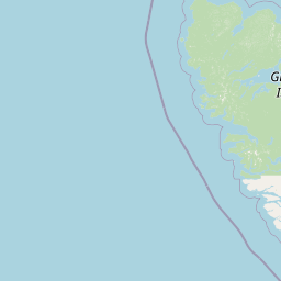
Map view of Duu Guusd Heritage Site/Conservancy

Use this park location map to pinpoint Duu Guusd Heritage Site/Conservancy in Canada, understand its exact geographic position, and read its mapped placement within the surrounding landscape more clearly.

Pigeon | © OpenStreetMap contributors

Location context for Duu Guusd Heritage Site/Conservancy

British Columbia
Recorded earthquake history

Explore Recorded Seismic History at Duu Guusd Heritage Site/Conservancy

Review the chronological record of seismic events documented near the terrestrial and marine boundaries of Duu Guusd Heritage Site/Conservancy. This dataset offers an essential look at the historical seismic patterns across the Haida Gwaii region as recorded by scientific monitoring networks.

Duu Guusd Heritage Site/Conservancy Earthquake History

Catalogued events

31 events

Strongest magnitude

Magnitude 6.2

Most recent event

Aug 7, 2026

This history includes earthquakes recorded inside the park or within 50 km of its borders

Park atlas

Compare surrounding regional geography and connected coastal conservation areas across the archipelago.

Parks Near Duu Guusd Heritage Site/Conservancy and Related Protected Landscapes

Browse other protected areas near Duu Guusd Heritage Site/Conservancy to examine connected coastal rainforests and marine reserves across the wider Haida Gwaii region. Expanding the geographic scope helps place remote island ecosystems and regional conservation networks into a broader perspective.
Wildlife reserveAlaska
About 64 km away#1 closest

North

Forrester Island Wilderness: Mapped Protected Landscapes and Wildlife Reserve Geography

Isolated island terrain in the Alaska Maritime National Wildlife Refuge

This remote wilderness area in Alaska features a mountainous, forested profile and sheer coastal cliffs that drop directly into the Pacific Ocean. Its protected boundaries are vital for maintaining undisturbed marine mammal habitat and temperate coastal forest ecosystems, offering a distinct example of isolated island geography within the United States.

Area
10.29 km²
Established
1912
Relief
Upland
Climate
Temperate
National parkHaida Gwaii
76 km away#2 closest

Southeast

Gwaii Haanas National Park Reserve and Haida Heritage Site: National Park Protected Area

Explore the mapped geography and landscape context of Haida Gwaii.

Gwaii Haanas National Park Reserve and Haida Heritage Site offers a clear view of a protected national park's landscape and geographic positioning. This page provides detailed information on its specific boundaries and its location within the Haida Gwaii region, serving as a key point for understanding protected land distribution and regional geography through an atlas lens.

Area
1,470 km²
Established
1988
IUCN
II
Relief
Mountain
Watercolor painting of a coastal scene with green islands, coniferous trees, and soft, hazy mountains in the background, set against a white background.
Marine protected areaBritish Columbia
About 144 km away#3 closest

East

Kitson Island Marine Provincial Park Map and Coastal Protected Area Atlas

Protected island and estuarine landscape in British Columbia

Kitson Island Marine Provincial Park encompasses a vital coastal island and the adjacent Flora Bank at the mouth of the Skeena River. This protected marine environment provides a rare example of accessible sandy beach terrain on the North Coast. Use this atlas resource to understand the park boundaries, island geography, and estuarine interface within the broader Inside Passage conservation network.

Area
0.45 km²
Established
1993
IUCN
II
Relief
Lowland
A watercolor painting showing a lake, a forested shoreline, and distant mountains in a soft palette.
State or regional parkBritish Columbia
About 154 km away#4 closest

East

Diana Lake Provincial Park: Mapping Coastal Rainforest and Wetland Geography in British Columbia

An examination of North Coast forest and freshwater ecosystems

Diana Lake Provincial Park represents a significant protected area in British Columbia, showcasing the diverse ecological character of the North Coast. The park boundary encompasses a mosaic of old-growth rainforest, open blanket bogs, and freshwater aquatic systems. By protecting these varied terrains, the region maintains vital habitats for Pacific salmon species while providing a structured landscape for understanding the wet maritime environment of the Pacific Northwest.

Area
2.33 km²
Established
1980
IUCN
II
Relief
Upland
A soft watercolor painting of a winding river flowing through a lush, green landscape with forested hills in the background.
Nature reserveBritish Columbia
About 163 km away#5 closest

East

Gamble Creek Ecological Reserve: Protected Nature Reserve Geography and Forest Map

British Columbia North Coast forest and peatland research landscape.

Situated on the North Coast of British Columbia, Gamble Creek Ecological Reserve is a designated nature reserve comprising forest and bog ecosystems. The protected area serves as an important site for studying plant communities, including sphagnum moss and coastal bog species, within a unique altitudinal transition between coastal hemlock and subalpine zones.

Area
10.26 km²
Established
1991
IUCN
Ia
Relief
Mixed relief
State or regional parkBritish Columbia
About 188 km away#6 closest

Northeast

Khutzeymateen Provincial Park: Protected Wilderness and Coastal Forest Geography

North Coast British Columbia protected area and estuary map.

Khutzeymateen Provincial Park represents a pivotal conservation achievement on the British Columbia North Coast. This wilderness sanctuary protects a critical estuarine complex where rugged mountain ranges meet a sheltered Pacific inlet. Beyond its designation as a grizzly bear stronghold, the park holds globally significant old-growth Sitka spruce forests, providing a rare look at an intact temperate rainforest landscape.

Area
450.52 km²
Established
1994
IUCN
Ib
Relief
Mountain
A horizontal watercolor painting showing a calm inlet surrounded by forested hills and distant mountains.
State or regional parkBritish Columbia
About 189 km away#7 closest

East

Klewnuggit Inlet Marine Provincial Park: Regional Geography and Protected Area Mapping

Coastal inlet, freshwater lakes, and northern forest ecosystems.

Klewnuggit Inlet Marine Provincial Park showcases the dramatic meeting of mountain, forest, and sea. Spanning from the sheltered waters of the Grenville Channel to inland freshwater systems, the park offers a detailed study of northern coastal geography, fjord-like marine channels, and diverse bird and marine wildlife habitats.

Area
18 km²
Established
1993
IUCN
II
Relief
Mixed relief
A soft watercolor illustration depicting a calm river scene with evergreen trees, a grassy riverbank, and distant rolling hills in pale green and pink tones.
State or regional parkBritish Columbia
About 212 km away#8 closest

East

Exchamsiks River Provincial Park: Protected Old-Growth Forest Geography in British Columbia

A rare maritime Sitka spruce landscape in the Skeena River estuary

Situated at the meeting of the Exchamsiks and Skeena rivers, this provincial park protects a significant stand of unlogged old-growth coastal rainforest. The terrain provides a compact, ecologically essential example of the temperate habitat characteristic of British Columbia's north coast, featuring moisture-loving spruce and salmonberry understory landscapes.

Area
0.182 km²
Established
1956
Relief
Lowland
Climate
Temperate

Common questions about visiting, size, designation, and location context for Duu Guusd Heritage Site/Conservancy

Duu Guusd Heritage Site/Conservancy FAQs for park facts, access, geography, and protected area context

Find quick answers about Duu Guusd Heritage Site/Conservancy, including protected-area facts, park geography, trail and visitor context, and how the park fits into its surrounding country and regional landscape.
MoriAtlas Explorer

Continue Your Protected Areas Search Across the Global Atlas

Deepen your exploration by continuing the structured search for national parks and protected areas worldwide. Utilize the comprehensive filtering capabilities to compare different conservation landscapes and refine your understanding of global park geography. Discover more about the distribution and characteristics of protected natural areas.

Global natural geography