
Mori Atlas logo
Nature reserveDyer Island Nature Reserve Complex

A vital cluster of rocky islets and coastal waters supporting diverse South African seabird and marine predator populations

Dyer Island Nature Reserve Complex: Mapping the Protected Marine Ecosystems of the Western Cape

(Dyer Island Provincial Nature Reserve and Geyser Island Provincial Nature Reserve)

The Dyer Island Nature Reserve Complex stands as a globally significant marine conservation site situated in the turbulent Atlantic waters off the coast of Gansbaai. Comprising the three distinct rocky outcrops of Dyer Island, Geyser Island, and Quoin Rock, the protected complex serves as a critical habitat for African penguins, Cape fur seals, and a variety of pelagic species. The narrow channels between these islands, renowned as Shark Alley, form an essential, high-energy marine funnel that anchors the regional biodiversity of the Western Cape coastline.

marine protected areacoastal islandsseabird colonyafrican penguin habitatcape fur seal colonygreat white shark habitat
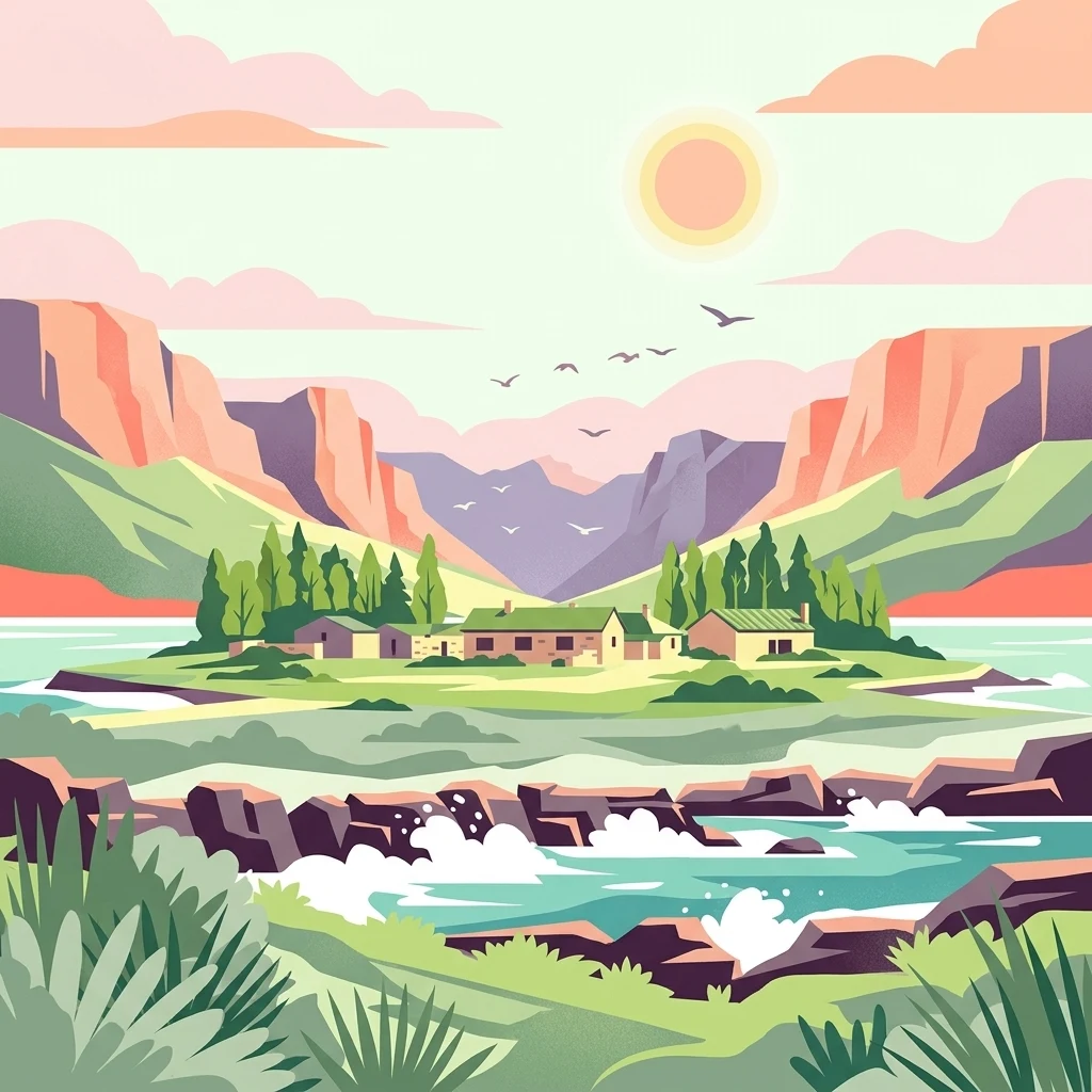
A digital illustration of a coastal landscape with a central island or coastline featuring small buildings, surrounded by rocky water, green fields, and framed by mountains under a sunlit sky.

Dyer Island Nature Reserve Complex

Nature reserve

Park overview

Structured park overview, official facts, and landscape profile for Dyer Island Nature Reserve Complex

Dyer Island Nature Reserve Complex park facts, protected area profile, and essential visitor context

Review the core facts for Dyer Island Nature Reserve Complex, including designation, size, terrain, visitor scale, habitats, and operating context in one park-focused overview.

About Dyer Island Nature Reserve Complex

The Dyer Island Nature Reserve Complex is one of the most distinctive marine protected area complexes along the South African coast. Located roughly eight kilometres offshore from Gansbaai and the historic Danger Point Lighthouse, the complex combines three small rocky islets whose individual characters together create a single, tightly integrated marine ecosystem. Dyer Island, the largest, is a flat-topped rock that has long served as a seabird refuge. Geyser Island, only a short distance away, hosts one of the densest Cape fur seal colonies in southern Africa. A third component, Quoin Rock, lies considerably further south near the Quoin Point coastline and falls within the same administrative protection framework.

Although the islands are small, their ecological significance is far greater than their footprint suggests. They sit within the Benguela-influenced transition zone where cold Atlantic water meets the warmer Agulhas current, creating exceptionally productive marine conditions. This productivity feeds a rich food web, beginning with plankton and small pelagic fish and extending upward to seabirds, seals, sharks, and cetaceans. The result is a compact system in which energy flows rapidly from the open ocean into coastal colonies, making the islands disproportionately important for regional biodiversity.

The complex's profile has been shaped significantly by its accessibility to marine researchers and ecotourism operators operating from Gansbaai. Shark cage diving, boat-based penguin viewing, and seal watching all take place around the islands, although the reserve itself is closed to the general public. Despite its protection, the complex faces ongoing threats from overfishing in adjacent waters, oil spills along the shipping lanes that run nearby, climate-driven shifts in prey availability, and disease outbreaks among both penguins and seals. Its designation as a Ramsar wetland in 2019 underlined the international recognition of its conservation value at a moment when that value is under growing pressure.

Quick facts and research context for Dyer Island Nature Reserve Complex

Dyer Island Nature Reserve Complex consists of three islets off the Western Cape coast of South Africa, near the fishing town of Gansbaai. The complex is managed by CapeNature and was first proclaimed as provincial nature reserves in 1988, while the two main islands were jointly designated a Ramsar site in 2019.

The protected area is dominated by seabird colonies on Dyer Island and one of the largest Cape fur seal colonies in the region on Geyser Island. The waters around the islands are renowned for great white shark activity, turning the channel between the islands into one of South Africa's most iconic marine predator viewing areas.

Protection and recognition

Documented international Ramsar wetland designations and conservation recognition for Dyer Island Nature Reserve Complex.

Dyer Island Nature Reserve Complex Protection Status and Ramsar Recognition

Examine the verified international Ramsar wetland recognition and documented protection designations associated with Dyer Island Nature Reserve Complex. Official records outline the formal conservation status and administrative framework governing this protected wetland habitat.
Park context

Deeper park guide and search-rich context for Dyer Island Nature Reserve Complex

Dyer Island Nature Reserve Complex history, landscape, wildlife, and travel context

Explore Dyer Island Nature Reserve Complex through its history, landscape character, ecosystems, wildlife, conservation priorities, cultural context, and seasonal travel timing in a structured park guide built for atlas discovery and search intent.

Why Dyer Island Nature Reserve Complex stands out

Dyer Island Nature Reserve Complex is most famous for the dramatic proximity between Cape fur seals and great white sharks, which use the narrow channel between Dyer Island and Geyser Island as a hunting ground. This stretch of water, nicknamed Shark Alley, has played a central role in global research and public awareness of great white shark behaviour. Equally significant is the role the islands play in conserving African penguins, a species in steep decline along the South African coastline. Dyer Island supports one of the remaining breeding colonies, while Geyser Island's dense fur seal colony and the surrounding kelp-rich waters sustain an unusual concentration of large marine predators in a very small geographic area.
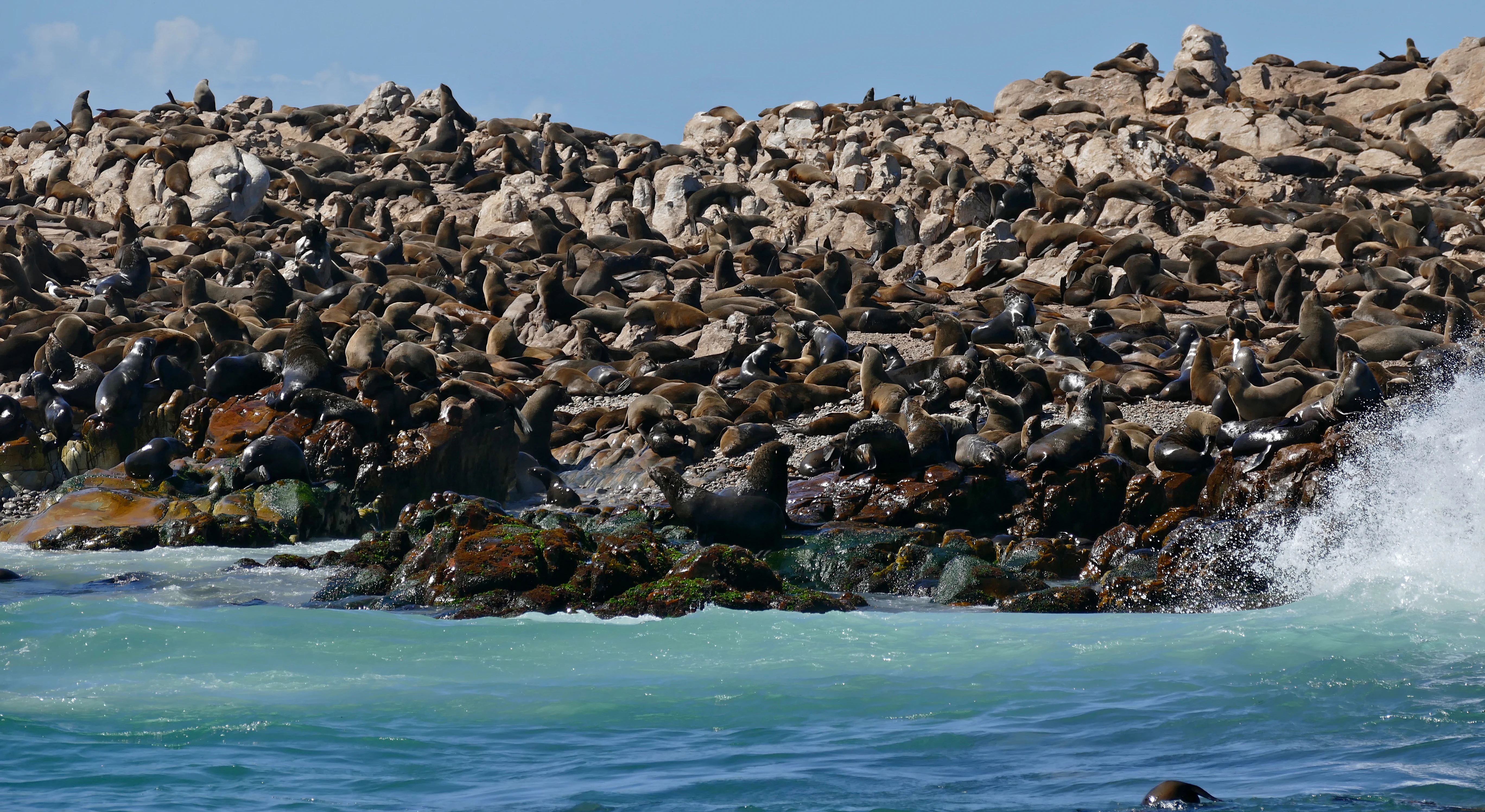
A dense colony of South African fur seals rests on a jagged, rocky island shore with ocean waves crashing in the foreground.
A large colony of South African fur seals congregates on the rocky shores of Geyser Island.

Dyer Island Nature Reserve Complex history and protected-area timeline

The islands have a layered human history that begins well before any formal conservation protection. Portuguese seafarers in the fifteenth century called the largest island Ilha da Fera, meaning Island of Wild Creatures, in recognition of the abundant wildlife they observed from their ships. The current English name, Dyer Island, comes from Samson Dyer, an American emigrant who settled in the Cape Colony in 1806 and lived on the island collecting guano, which he sold to mainland farmers as fertilizer.

Formal protection came much later. On 9 March 1988, Dyer Island and Geyser Island were each proclaimed as separate Provincial Nature Reserves, placing them under the management of what is today CapeNature. For decades the islands operated under these individual designations, with their conservation importance steadily rising as scientific understanding of seabird declines and shark ecology expanded.

In 2019, the two islands were jointly designated as a Ramsar site, formally recognising them as a wetland of international importance under the Ramsar Convention. This designation highlighted the role of guano deposits, intertidal zones, and surrounding marine productivity as an integrated ecological system, and brought the complex into a global network of significant wetlands. The combination of individual reserve status and Ramsar recognition defines the present-day identity of the Dyer Island Nature Reserve Complex.

Dyer Island Nature Reserve Complex landscape and geographic character

The landscape of the Dyer Island Nature Reserve Complex is defined by exposure, not scale. The three islets are low, rocky outcrops jutting from a turbulent stretch of the South Atlantic, shaped by relentless wind, salt spray, and wave action. There are no trees, no freshwater streams, and no broad beaches; instead the terrain consists of bare rock platforms, guano-stained surfaces, boulder fields, and narrow intertidal shelves.

Dyer Island, the largest at roughly several hundred metres across, has a relatively flat upper surface that supports dense seabird colonies and accumulates guano over decades. Its rocky edges drop steeply into the sea, with submerged reefs extending outward into the channel. Geyser Island is smaller, more rugged, and surrounded by fast-moving water that channels currents between the two islands. Quoin Rock, separated from the others by roughly 25 kilometres of open coast, resembles a sea stack more than an island, standing as a vertical reef feature near Quoin Point.

The waters between and around the islands are as much a part of the landscape as the rock itself. Submerged reef structures, kelp forests near the shallower margins, and shifting sand channels create a dynamic seafloor. The narrow stretch between Dyer Island and Geyser Island forms a natural funnel, concentrating marine life and giving the channel its well-known character as Shark Alley.
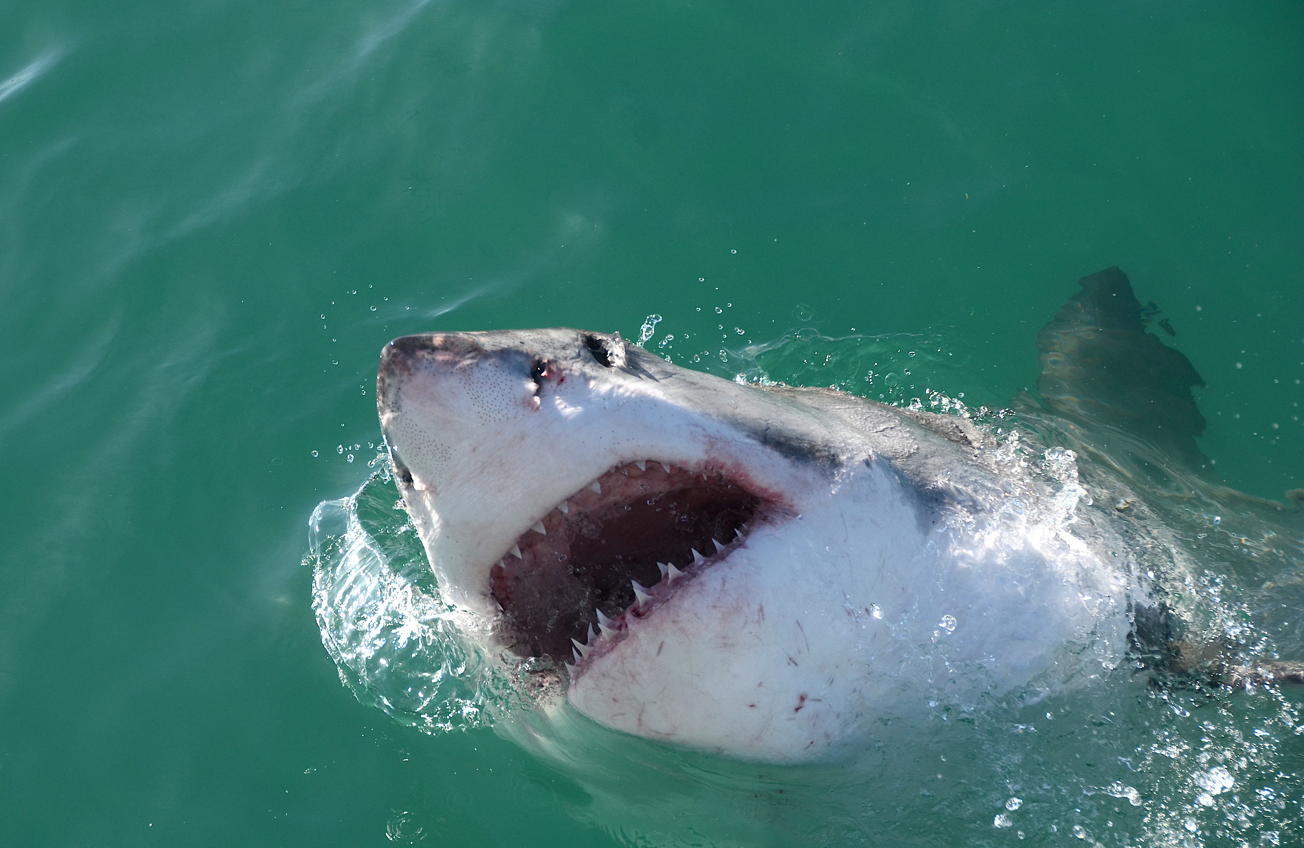
A great white shark with its mouth partially open surfaces in turquoise ocean water.
A great white shark surfacing in the waters near Dyer Island.

Dyer Island Nature Reserve Complex ecosystems, habitats, and plant life

The ecological character of the Dyer Island Nature Reserve Complex is unusual because such a small area supports an exceptionally high concentration of different habitat types. The rocky islands themselves are essentially seabird and pinniped habitat, while the surrounding ocean functions as a productive pelagic and reef ecosystem. Guano from penguin and cormorant colonies enriches both the rock surfaces and the adjacent waters, fuelling localised productivity that reinforces the food web.

The marine environment around the islands sits within a region of strong upwelling and high biological productivity, supporting dense populations of small pelagic fish. These fish, in turn, attract larger predators such as gamefish, sharks, and marine mammals. Kelp beds along portions of the shoreline provide nursery habitat for a range of species, while deeper offshore waters offer habitat for migratory cetaceans and oceanic sharks.

On land, the islands support at least 48 bird species, of which 21 are recorded as breeding on the islands. Vegetation is sparse and limited to hardy, salt-tolerant species that manage to survive among the rocks. The interplay between marine and terrestrial habitats, mediated by guano and the movements of seals and birds, gives the complex a tightly woven ecological fabric.
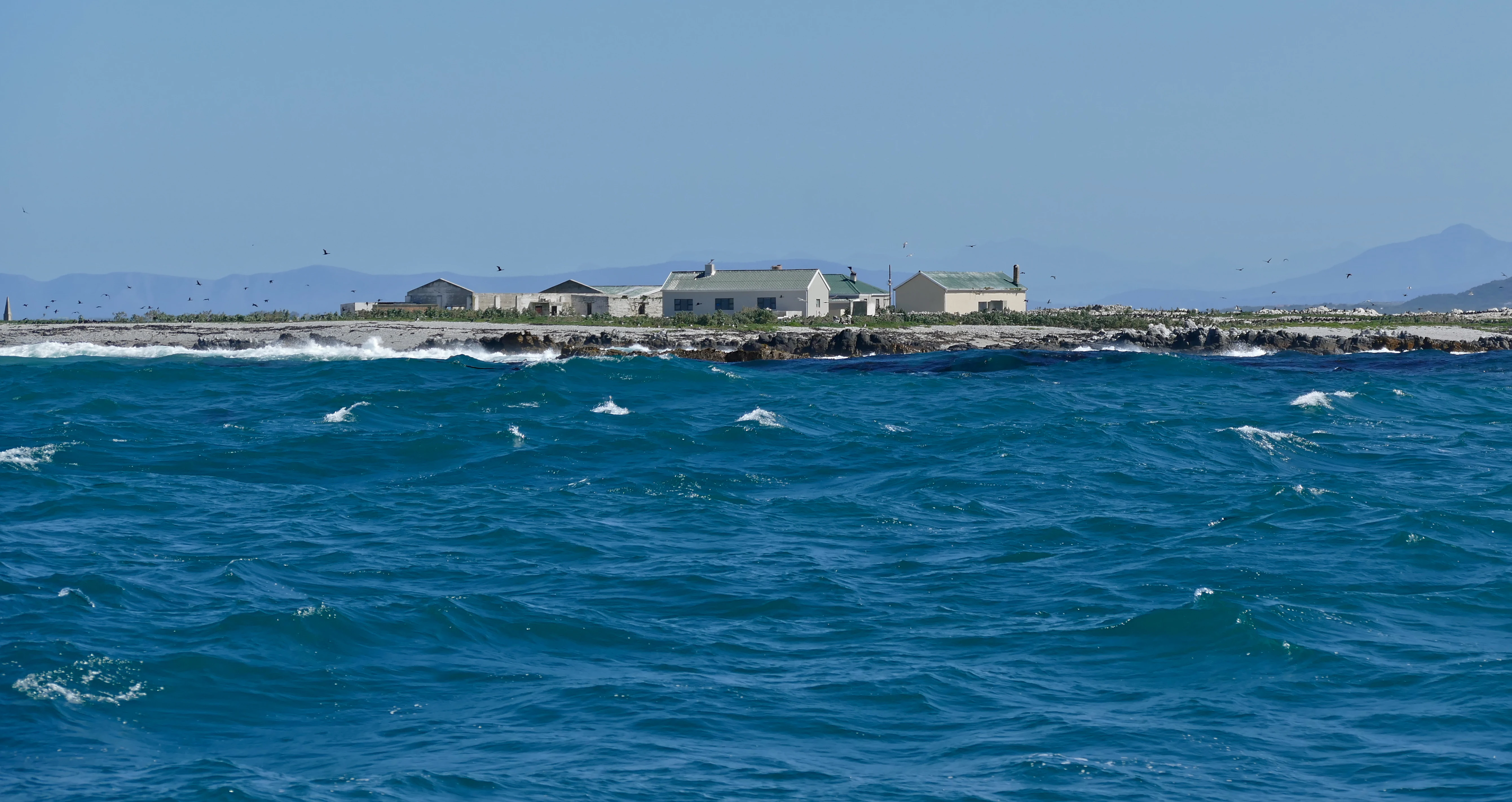
A low-lying island surrounded by blue sea, with small light-colored buildings situated on the rocky shore.
A view of Dyer Island from the surrounding waters, showing the low-lying coastal terrain and station buildings.

Dyer Island Nature Reserve Complex wildlife and species highlights

Wildlife is the defining feature of the Dyer Island Nature Reserve Complex, and the area is best understood through the relationships between its key species. The African penguin colony on Dyer Island is one of the most ecologically important features of the entire complex. Although the population has been in decline for years, the island still hosts thousands of breeding penguins and remains a vital stronghold for the species on the southern African coast.

Geyser Island sustains an enormous Cape fur seal colony of roughly 60,000 animals. The sheer biomass of seals is a major ecological driver of the area, attracting predators and influencing nutrient cycling through the surrounding waters. The interaction between this colony and visiting great white sharks has made the channel between the islands internationally famous, both for research and for ecotourism.

Birds are abundant and diverse. Beyond penguins, breeding populations include species such as the African oystercatcher, several cormorant species including the bank cormorant and crowned cormorant, and various tern species ranging from Antarctic and Arctic terns to roseate and Caspian terns. White-breasted cormorants and Hartlaub's gulls are also regular features of the islands.

In the surrounding ocean, fish diversity includes species such as the endangered galjoen, while the presence of Indo-Pacific bottlenose dolphins has been documented in the area. Great white sharks are the most iconic of the large marine visitors, drawn to the channel by the abundance of seals.

Dyer Island Nature Reserve Complex conservation status and protection priorities

The Dyer Island Nature Reserve Complex occupies an important place in South African marine conservation. The islands were individually proclaimed as Provincial Nature Reserves in 1988, and their joint designation as a Ramsar site in 2019 reflected international recognition of the wetlands that include guano-coated rock platforms, intertidal zones, and the highly productive waters surrounding them.

Conservation concern at the complex is intense. African penguin numbers at Dyer Island have fallen sharply in recent decades, driven by shifts in prey availability, historical competition with commercial fisheries, and the wider effects of climate change on the Benguela ecosystem. Cape fur seals on Geyser Island, while still numerous, also face periodic pressures, including disease outbreaks and competition with fisheries.

The presence of great white sharks has transformed the region into one of the most studied shark habitats in the world. Research and ecotourism activities focused on the channel between the islands have produced a substantial body of work on shark population dynamics, behaviour, and the role of apex predators in the marine food web. Protection from direct public access to the islands themselves helps limit disturbance to breeding birds and seals, while management under CapeNature aims to balance scientific research, tourism, and the long-term ecological requirements of the system.

Dyer Island Nature Reserve Complex cultural meaning and human context

The cultural identity of the Dyer Island Nature Reserve Complex is inseparable from the maritime heritage of Gansbaai and the broader Western Cape coast. The name Ilha da Fera, given by Portuguese explorers in the fifteenth century, reflects the early European recognition of these islands as places where wildlife was unusually concentrated along an otherwise windswept coastline. That early awareness of the islands as a wildlife landmark long predates the modern conservation movement.

The later naming after Samson Dyer, an American emigrant who made a livelihood from guano collection on the island in the early nineteenth century, illustrates a more extractive phase of human interaction, when the islands were valued for their resources rather than for their ecological role. That pattern shifted over time as commercial pressures, ecological awareness, and conservation legislation together redefined how the islands should be protected.

In the contemporary context, the islands have become iconic within South Africa's marine ecotourism culture. Gansbaai is closely associated worldwide with shark cage diving and marine wildlife experiences, and the islands form the visual and ecological centerpiece of that identity. The recognition of the islands as a Ramsar site reinforced this connection between local identity, global conservation values, and the long human history of encounters at this rocky outpost.

Top sights and standout views in Dyer Island Nature Reserve Complex

Three core features shape the identity of the Dyer Island Nature Reserve Complex. First, the African penguin colony on Dyer Island, which remains one of the remaining breeding strongholds for the species along the Western Cape. Second, the enormous Cape fur seal colony on Geyser Island, which forms the energetic basis for the area's marine food web. Third, the world-famous channel between the two islands, where great white sharks regularly congregate in search of seals.

Beyond these icons, the complex carries broader value as a Ramsar-recognised wetland, a provincial nature reserve cluster under CapeNature management, and a research-rich marine site whose islands cannot be accessed by the general public. Together these qualities make the complex a compact but disproportionately important node of South African marine and coastal conservation.

Best time to visit Dyer Island Nature Reserve Complex

The Dyer Island Nature Reserve Complex itself is not open to the general public, so any visit experience is necessarily boat-based and viewed from the water. South Africa's Western Cape coastal waters are most calm and accessible during the warmer, drier months from late spring through early autumn, roughly November to April, when boat-based wildlife viewing tends to be at its most reliable.

That said, the marine wildlife of the area follows ecological rather than purely seasonal patterns. Penguin breeding cycles, seal colony dynamics, and seasonal shifts in shark and cetacean activity occur throughout the year, and the area has become a year-round destination for marine ecotourism around Gansbaai. Daylength, sea state, and weather windows matter more than specific calendar months, and conditions can vary considerably between mild and stormy periods even within the more favourable seasons.
Monthly climate preview

Track long term average temperatures and precipitation patterns across the year

Dyer Island Nature Reserve Complex Climate Normals and Weather by Month

Representative coordinate sampling records annual temperature swings alongside monthly precipitation rates for Dyer Island Nature Reserve Complex. Analyzing the complete twelve month profile provides deeper insight into measured long term climate norms.
Annual mean17 °C
13 °C21 °C
Jan21°
Feb21°
Mar20°
Apr17°
May16°
Jun14°
Jul13°
Aug13°
Sep14°
Oct16°
Nov18°
Dec20°
Warmest month
February

20.9 °C

Coolest month
July

12.9 °C

Wettest month
July

2 mm/day

Driest month
February

0.8 mm/day

Park location guide

Geography guide, regional context, and park location map for Dyer Island Nature Reserve Complex

Dyer Island Nature Reserve Complex park geography, regions, and map view in South Africa

Understand where Dyer Island Nature Reserve Complex sits in South Africa through a broader geographic reading of the surrounding landscape, nearby location context, and its mapped position within the national park landscape.

How Dyer Island Nature Reserve Complex fits into South Africa

South Africa is the southernmost country in Africa, spanning 1.22 million km² with a population of over 63 million. The country operates with three capital cities, Pretoria (executive), Cape Town (legislative), and Bloemfontein (judicial), and is renowned for its biodiversity, national parks, and multicultural society.

Wider geography shaping Dyer Island Nature Reserve Complex in South Africa

South Africa occupies the southernmost region of Africa, with coastline along both the Atlantic Ocean to the west and the Indian Ocean to the east. The interior features elevated plateaus including the Highveld, with the Drakensberg escarpment marking the eastern highlands. The country shares borders with Namibia, Botswana, Zimbabwe, Mozambique, Eswatini, and Lesotho.

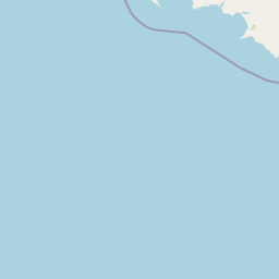
Map view of Dyer Island Nature Reserve Complex

Use this park location map to pinpoint Dyer Island Nature Reserve Complex in South Africa, understand its exact geographic position, and read its mapped placement within the surrounding landscape more clearly.

Pigeon | © OpenStreetMap contributors

Location context for Dyer Island Nature Reserve Complex

Western Cape

Visualizing the rocky islets, marine habitats, and coastal environment

Dyer Island Nature Reserve Complex Photos and Protected Landscape Scenery

Examinations of park photography reveal the rugged terrain and exposed rock platforms that define the remote island cluster. Visual records document the marine habitats and coastal environments supporting vulnerable seabird populations in the South Atlantic.

A dense colony of South African fur seals rests on a jagged, rocky island shore with ocean waves crashing in the foreground.

Two dolphins swimming in turquoise ocean water near a rocky outcrop with seals visible in the background.

A great white shark with its mouth partially open surfaces in turquoise ocean water.

A low-lying island surrounded by blue sea, with small light-colored buildings situated on the rocky shore.

Park atlas

Discover related coastal reserves, marine habitats, and protected landscapes across the Western Cape

Explore Protected Areas Near Dyer Island Nature Reserve Complex and Surrounding Regional Parks

Browsing other protected areas near Dyer Island Nature Reserve Complex allows visitors to examine connected marine ecosystems and coastal reserves across the region. Extending the geographic comparison reveals broader conservation patterns and related wildlife habitats along the southern African coast.
National parkWestern Cape
14 km away#1 closest

East

Agulhas National Park: National Park Protected Landscape and Geographic Atlas

Mapped boundaries and regional geography in Western Cape.

Agulhas National Park is a protected national park in South Africa's Western Cape, vital for understanding regional geography and mapped landscape features. This entry focuses on its identity as a conservation area, detailing its protected landscape context and geographic setting within the broader atlas of Southern Africa. Explore the specific park boundaries and the unique terrain that defines this significant natural area.

Area
209.59 km²
Established
1998
IUCN
II
Relief
Lowland
Nature reserveWestern Cape
About 34 km away#2 closest

Northeast

Salmonsdam Nature Reserve: Atlas of Protected Landscapes in the Western Cape Overberg

Mountain fynbos, river gorges, and forest catchment geography.

Salmonsdam Nature Reserve is a compact protected expanse in the Overberg mountains of the Western Cape. The reserve encompasses the full Paardensberg River catchment, featuring complex terrain that ranges from high rocky ridges to the wet valley floor of Die Weivlakte. Its geography supports a high concentration of Afromontane forest patches and mountain fynbos habitats within a small, accessible area.

Area
8.34 km²
Established
1962
Relief
Mountain
Climate
Mediterranean
A watercolor illustration of a wide landscape featuring a calm body of water in the foreground, rolling green hills, and purple-toned mountains in the background.
Nature reserveWestern Cape
About 63 km away#3 closest

Northwest

Kogelberg Nature Reserve: Protected Mountain Geography in the Western Cape, South Africa

Coastal mountain fynbos and protected river ecosystems

Situated in the Western Cape of South Africa, Kogelberg Nature Reserve protects an exceptional concentration of fynbos vegetation and rugged sandstone terrain. The area spans coastal mountain ridges, riparian corridors, and forest-filled ravines, serving as a landmark for botanical diversity and protected-landscape mapping in the region.

Area
30 km²
Relief
Mountain
Scope
Terrestrial
Water
Major water bodies
Watercolor painting of a mountain landscape with green foreground hills and soft purple mountain ranges in the background.
Nature reserveWestern Cape
About 90 km away#4 closest

Northwest

Jonkershoek Nature Reserve: A Detailed Atlas of Mountain Catchment and Fynbos Ecology

Protected mountain geography near Stellenbosch, Western Cape

Jonkershoek Nature Reserve serves as a primary water source for the surrounding Western Cape landscape. This profile outlines the reserve's role in the Cape Floral Region, detailing its complex mountain topography, river headwaters, and significant fynbos plant communities that characterize the terrain.

Area
110 km²
Relief
Mountain
Climate
Mediterranean
Access
Easy access
National parkWestern Cape
91 km away#5 closest

Northwest

Table Mountain National Park: Mapped Protected Landscape and Geographic Context in Western Cape

National Park details focused on atlas exploration and regional geography.

Table Mountain National Park is a designated national park within the Western Cape region, offering a distinct geographic profile for atlas exploration. This entity provides detailed mapped boundaries and landscape context, crucial for understanding its role as a protected area in South Africa. Users can explore the specific geography that defines this park and its place within the broader regional context, making it a key point of interest for structured geographic discovery and map-based research.

Area
221 km²
Established
1998
Relief
Mountain
Climate
Mediterranean
Biosphere reserveWestern Cape
About 110 km away#6 closest

North

Cape Winelands Biosphere Reserve: Geographic Overview and Protected Area Mapping

Western Cape mountain terrain and sustainable landscape integration

The Cape Winelands Biosphere Reserve serves as a model for integrated landscape management in South Africa. Situated along the Cape Fold Belt, this reserve protects crucial water catchments and endemic floral habitats while encompassing a globally recognized wine-producing region. Access detailed mapping of its core, buffer, and transition zones to see how conservation persists within a working agricultural environment.

Area
1,243.4 km²
Established
2007
Relief
Mountain
Climate
Mediterranean
Watercolor painting of a soft, hazy mountain landscape with rolling green hills and pink-toned foreground vegetation, presented in a wide panoramic aspect.
Biosphere reserveWestern Cape
About 111 km away#7 closest

Northwest

Cape Floristic Region: A Detailed Geographic Atlas of the Western Cape Biodiversity Hotspot

Mapped protected biosphere reserve and fynbos landscapes

Explore the Cape Floristic Region, an expansive protected landscape within South Africa. This atlas provides a detailed look at the region's Mediterranean shrublands, sandstone-derived soil terrain, and its status as a singular floral kingdom. Understand the geography of the Western Cape through its mountain ranges and diverse ecological zones.

Area
78,555 km²
Established
2004
National parkWestern Cape
112 km away#8 closest

Northeast

Bontebok National Park: A Unique Protected Landscape in South Africa's Western Cape

Mapping the endemic bontebok's habitat and diverse fynbos.

Bontebok National Park represents a singular achievement in conservation, dedicated to protecting the rare bontebok antelope and showcasing the extraordinary biodiversity of the Cape Floristic Region. Located in the Western Cape, this smallest of South Africa's national parks features a landscape of fynbos-covered foothills beneath the Langeberg Mountains, with the Breede River defining its southern edge. Explore its mapped boundaries and unique ecosystems, offering a concentrated natural discovery experience within a UNESCO World Heritage Site.

Area
27.86 km²
Established
1931
IUCN
II
Relief
Mixed relief

Common questions about visiting, size, designation, and location context for Dyer Island Nature Reserve Complex

Dyer Island Nature Reserve Complex FAQs for park facts, access, geography, and protected area context

Find quick answers about Dyer Island Nature Reserve Complex, including protected-area facts, park geography, trail and visitor context, and how the park fits into its surrounding country and regional landscape.
MoriAtlas Explorer

Continue Your Protected Areas Search Across the Global Atlas

Deepen your exploration by continuing the structured search for national parks and protected areas worldwide. Utilize the comprehensive filtering capabilities to compare different conservation landscapes and refine your understanding of global park geography. Discover more about the distribution and characteristics of protected natural areas.

Global natural geography