
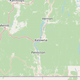
Streams
Park geography
Regional landscape analysis covering terrain, water features, and ecosystem zones.
Structured Geographic Profile and Mapped Boundaries for E. C. Manning Provincial Park
This geographic profile tracks the spatial characteristics of E. C. Manning Provincial Park, encompassing 836.71 square kilometers of diverse terrain in British Columbia. Examine internal features such as Lightning Lake and Blackwall Peak alongside regional landscape classifications including temperate coniferous forests and alpine meadows.
A Cascade Range park of alpine meadows, glacial rivers, and one of British Columbia's most-visited mountain landscapes.
E. C. Manning Provincial Park
E. C. Manning Provincial Park is a large Class A provincial park in southern British Columbia, Canada, straddling the Cascade Mountains between the communities of Hope and Princeton along the Canada–United States border. It protects a sweeping section of the Hozameen Range, a sub-range of the Canadian Cascades, where wet coastal rainforest on the western slopes gives way to jagged snow-capped peaks, subalpine meadows of wildflowers, and broad glacial river valleys further east. The park is crossed by British Columbia Highway 3, the Hope–Princeton highway, which links the park's deeply different ecological zones and gives road-access visitors an unusually varied mountain experience. Manning Park is also a destination for outdoor recreation, with the resort area at its heart, well-developed hiking networks, and the Canadian northern terminus of the famous Pacific Crest Trail. Defined in 1941 and now one of British Columbia's most-visited provincial parks, Manning combines ecological diversity, high-elevation scenery, and a strong recreation infrastructure that includes campgrounds, ski terrain, and the well-known Lightning Lake area. Its position along the cross-Cascade highway has shaped both its identity and its visitor patterns since the mid-twentieth century.
- Location
- Canada
- Park type
- State or regional park
- Established
- 1941
- Area
- 836.7 km²
Location overview
Recorded country and regional administrative memberships for protected area tracking
Geographic Setting and Regional Context for E. C. Manning Provincial Park
E. C. Manning Provincial Park is situated within Canada and the province of British Columbia. Regional location memberships establish the primary administrative and geographic framework for this protected area.
- Countries
- Canada
- Regions
- British Columbia
- Primary location
- British Columbia
- Geographic setting
- Inland
Boundary and coordinates
An 836.71 km² outline with geographic measurements
E. C. Manning Provincial Park mapped boundary and land area
E; C; Manning Provincial Park has boundary geometry that lets the map depict its broad shape across the landscape. Its 836.71 km² is all land, while perimeter is unavailable and the polygon serves geographic orientation rather than legal survey use.
- Boundary area
- 841.8 km²
- Boundary perimeter
- 209.9 km
- Northernmost point
- 49.3525° N
- Southernmost point
- 49.0001° N
- Easternmost point
- 120.5979° W
- Westernmost point
- 121.1983° W
- Geographic centre
- 49.1419° N, 120.866° W
- North–south span
- 39.2 km
- East–west span
- 43.8 km
Terrain and natural features
Explore recorded mountain terrain classifications and internal natural features
E. C. Manning Provincial Park Terrain and Named Natural Features
Protected terrain classifications document the mountain park environment across regional boundaries. Linked feature cards supply recorded names, types, and spatial relationships for interior lakes, peaks, and streams.
Selected named natural features
Peaks
Porcupine Peak
2,022 m
Lakes
Flash Lake
Wetlands
Dry Lake
Lakes
Grant Lake
Streams
Coates Creek
Environmental setting
Temperate mountain relief, coniferous forest cover, and major aquatic systems
E. C. Manning Provincial Park Environmental Setting and Landscape Classification
Recorded classifications group mountainous terrain, forest cover, and aquatic systems into complementary ways to read the physical setting. Associated atlas links connect each stored category to broader regional geography and protected areas.
- Relief
- Mountain
- Climate
- Temperate
- Water
- Major water bodies
- Forest cover
- Partial forest
- Seasonality
- Year-round
Landscape features
Mountains · Forest · Valleys · Lakes · Rivers
Habitat types
Temperate coniferous forest · Montane forest · Alpine meadow · Riverine habitat · Lacustrine habitat
Park atlas
Compare adjacent mountain terrain, alpine meadows, and connected regional reserves
Exploring Parks Near E. C. Manning Provincial Park and Surrounding Protected Landscapes
Visitors exploring E. C. Manning Provincial Park can continue browsing nearby protected areas across the Canadian Cascades. Comparing adjacent mountain terrain and regional river valleys provides broader context on southern British Columbia wilderness.

Protected landscapeWashington
Park boundaries overlap#1 closest
Southeast

Okanogan, Wenatchee National Forest: A Comprehensive Look at Washington's Protected Mountain Landscapes
Mapping ecological gradients and wilderness boundaries across the eastern Cascade Range
Spanning from the moist coniferous forests of the western Cascades to the arid plateaus of the Okanogan, this massive national forest protects an unmatched diversity of terrain. Explore the intricate geography of river-carved valleys, glacial cirques, and remote wilderness areas that characterize this critical environmental corridor in the Pacific Northwest.
- Area
- 6,066.33 km²
- Established
- 1911
- Visitors
- 397K annual
- Relief
- Mountain

Protected landscapeWashington
Park boundaries overlap#2 closest
Southwest
Ross Lake National Recreation Area: A Glacial Reservoir Landscape in Washington
Mapping the Skagit River and North Cascades alpine corridor
Located in the heart of Washington, Ross Lake National Recreation Area preserves a unique landscape of connected reservoirs and deep, glacier-cut valleys. This protected area acts as a vital geographic link within the North Cascades, offering access to high-altitude peaks, riverine forests, and the distinct turquoise waters of Diablo Lake.
- Area
- 475.81 km²
- Established
- 1968
- IUCN
- V
- Visitors
- 998K annual
National parkWashington
6.9 km away#3 closest
Southwest
North Cascades National Park: US National Park Protected Landscape and Geographic Context
Explore mapped boundaries and regional Washington geography.
Gain insight into North Cascades National Park, a vital US National Park located in Washington. This entry focuses on its protected land status, mapped geographic extent, and its role within the regional atlas. Users seeking to understand the park's landscape character, natural terrain, and its specific location in Washington will find this an essential point for detailed park geography exploration and protected area discovery.
- Area
- 2,042.26 km²
- Established
- 1968
- IUCN
- II
- Visitors
- 16.5K annual
State or regional parkBritish Columbia
17 km away#4 closest
Northwest

Coquihalla Canyon Provincial Park: A Deeply Eroded Granite Gorge in British Columbia
Mapping historic railway tunnels and river canyon landscapes
Trace the winding Coquihalla River as it cuts through ancient volcanic and metamorphic bedrock. This park preserves a unique intersection of industrial heritage and river morphology, showcasing four iconic tunnels bored through solid granite that define this section of the British Columbia interior landscape.
- Area
- 1.59 km²
- Established
- 1986
- IUCN
- III
- Relief
- Upland
Protected landscapeBritish Columbia
About 29 km away#5 closest
North
Coquihalla Summit Recreation Area: A Protected Landscape in the British Columbia Mountains
Mapping ecological transition zones and mountain terrain
Covering 5,750 hectares of rugged slopes and high-elevation ridges, Coquihalla Summit Recreation Area anchors a vital ecological transition between the coastal and interior climates of British Columbia. This mapped protected area offers a deep look into the granite peaks of the North Cascades and the historic remnants of transportation corridors spanning over a century.
- Area
- 57.5 km²
- Established
- 1987
- Relief
- Mountain
- Scope
- Terrestrial
State or regional parkBritish Columbia
32 km away#6 closest
Northwest
Emory Creek Provincial Park: Protected River Valley Landscapes in British Columbia
Historical boomtown site within the Fraser Canyon corridor
Located on the western bank of the Fraser River, Emory Creek Provincial Park preserves a landscape shaped by nineteenth century gold rushes and Canadian Pacific Railway construction. This protected area offers insight into the forested riverside terrain and historical geography that define one of the most storied corridors in southern British Columbia.
- Established
- 1956
- IUCN
- II
- Water
- Major water bodies

Protected landscapeWashington
36 km away#7 closest
South
Mount Baker, Snoqualmie National Forest: Mapped Geography and Protected Landscape Analysis
Exploratory atlas of Washington's primary Cascade Range wilderness
Delve into the structural geography of Mount Baker, Snoqualmie National Forest. This protected area corridor serves as a major ecological transition zone between the Puget Sound lowlands and the interior Cascades, characterized by extensive glaciers, wild river systems, and iconic stratovolcanoes that define the regional landscape of Washington state.
- Area
- 6,978 km²
- Established
- 1974
- Relief
- Mountain
- Climate
- Alpine

Wildlife reserveWashington
36 km away#8 closest
West
Mount Baker Wilderness: Mapped Volcanic Peaks and Glacial Geography in Washington State
Protected wilderness boundaries in the Northern Cascades
Mount Baker Wilderness encompasses a vast mountain landscape characterized by an active stratovolcano and significant permanent snowfields. The terrain features a vertical gradient from dense west side conifer forests to exposed alpine summits, creating a distinct ecological corridor connected to neighboring protected areas in the Pacific Northwest.
- Area
- 485.58 km²
- Established
- 1984
- IUCN
- Ib
- Relief
- Mountain
MoriAtlas Explorer
Explore the Geographic Boundaries of E. C. Manning Provincial Park
Trace the diverse terrain of this essential British Columbia protected area through MoriAtlas. Examine how mountain passes, alpine meadows, and river headwaters define the unique geography and ecological profile of E. C. Manning Provincial Park.
Browse next
Global natural geography
Explore related park routes
Explore MoriAtlas Global ParksBrowse All MoriAtlas ParksGlobal Park Map DiscoveryMoriAtlas: Browse All CountriesBrowse All MoriAtlas ContinentsNational Park Environment AtlasGrand Canyon National Park AtlasYellowstone National Park AtlasYosemite National Park Atlas and GeographySerengeti National Park AtlasGalápagos National Park Protected LandscapeBanff National Park Geography and AtlasKruger National Park Atlas EntryUluṟu-Kata Tjuṯa National Park AtlasExplore Uluru-Kata Tjuta National Park GeographyPlitvice Lakes National Park AtlasFiordland National Park Protected LandscapeGreat Smoky Mountains National Park AtlasAfghanistan National Parks and Protected AreasAlbania National Parks and Protected AreasAlgeria National Parks and Protected AreasAmerican Samoa National Parks and Protected AreasAndorra National Parks and Protected AreasAngola National Parks and Protected AreasAntarctica National Parks and Protected AreasAntigua and Barbuda Park List